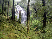
The process of karst management (lesson 2)
On this page
Learning objectives
This lesson will introduce you to the management objectives of the Karst Management Handbook, and the process of identifying karst terrain in the field. By working through this lesson you will be able to:
- Recognize key karst management objectives
- Describe the purpose and general process of karst inventories
- Distinguish between the four different vulnerability ratings for karst.
Introduction
Lesson 1 introduced you to general information about how karst develops and various karst values. You were made aware that karst and productive timber sites often coexist.
A key aspect of effective karst management is conducting karst inventories and assessing the vulnerability of the karst. Lesson 2 focuses on helping you understand karst inventories and vulnerability assessments. You will use this information in the remaining lessons of this course.
The information in this lesson is only an introduction to karst inventories and vulnerability assessments. For complete information, go to Karst Inventory Standards and Vulnerability Assessment Procedures for British Columbia (PDF, 11MB).
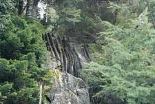
Below: Karst feature in a forest - Click for larger image
Understanding karst management objectives
What is the main purpose of the Karst Management Handbook?
To integrate the protection of karst systems and individual karst features with sustainable forest practices. The primary focus is to manage surface and subsurface karst resources by applying appropriate forest management practices on the surface karst environment.
What are the challenges of karst management?
The complex and three-dimensional nature of karst presents unique challenges to land management. A specific challenge is to manage the potential for karst hydrological systems to transport water, nutrients, soil, and pollutants into and through underground environments.
What are the management objectives of the Karst Management Handbook?
To promote sustainable forest practices on karst landscapes and achieve the following objectives, while minimizing impacts to timber supply and operational costs:
- Maintain the ability of karst landscapes to regenerate healthy and productive forests after harvesting
- Maintain the surface and subsurface habitats of karst ecosystems to ensure biodiversity
- Maintain the natural flows and water quality of karst hydrologic systems
- Maintain the natural rates of air exchange between the surface and subsurface
- Protect significant surface karst features (for example, sinkholes, sinking streams, springs, cave entrances) and subsurface karst resources (for example, caves, underground streams, subterranean fauna)
- Provide recreational opportunities where appropriate.
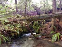
Below: Karst water feature - Click for larger image
Karst inventories
There are three levels of karst inventories in B.C. Each level has increasing requirements for data collection and evaluation. They are:
Reconnaissance
Reconnaissance-level karst inventories are used to identify areas of potential karst development. These inventories have been completed for the entire province of B.C.
Reconnaissance-level inventory maps should be checked prior to any forest development on potential karst terrain. Reconnaissance-level inventory assists with strategic planning; helps determine whether more detailed inventories are needed; and, helps guide planning-level inventories and karst field assessments.
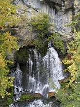
Below: Karst spring - Click for larger image
Planning
Planning inventories (1:20 000 or 1:50,000 scale) are used to delineate karst unit boundaries, and determine the distribution and variation of karst development over a landscape or watershed. They are also used to identify the extent of karst and non-karst catchment areas.
A planning-level inventory could be triggered under the following circumstances:
- Reconnaissance-level maps indicate potential karst in the area
- There is prior knowledge of karst in or around the area
- Karst features have been identified in or around the area.
Planning-level inventory data are used to stratify a karst unit into polygons of differing vulnerability potential which provide a preliminary indication as to the scope and intensity of karst development in the polygon. Areas mapped as moderate, high or very high vulnerability potential should have karst field assessments completed before any forestry activities commence to accurately delineate the specific characteristics of the karst.
Planning-level inventories are used for landscape-level forest development planning and are a guide to the location and scope of karst field assessments.
Karst field assessments
Karst field assessments (1:5000 or 1:10 000 scale) focus on evaluating the karst attributes of a relatively small karst area of interest (for example, cutblock or road). It is recommended that karst field assessments be done prior to any road construction or forest harvesting on karst terrain. Typically they should be done prior to or during site-level planning.
A karst field assessment can be triggered under the following circumstances:
- An area is underlain by carbonate bedrock.
- A development is proposed on non-carbonate lands located within the contributing drainage basin of known or suspected carbonate units. (In this case, the karst field assessment would be carried out on the known or suspected karst units located downstream of the proposed cutblock)
- Reconnaissance-level maps indicate that an area may be underlain by karst.
- A planning-level inventory has identified karst polygons with moderate, high or very high vulnerability potential ratings in or around the area.
- There is prior knowledge of karst in or around the area.
- Karst features have been identified in the area.
- Forestry activities, such as windthrow salvage, spacing, pruning or commercial thinning are planned on an area known or suspected to be underlain by carbonate bedrock.
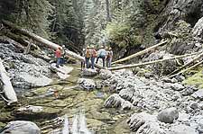
Below: Karst field assessments - Click for larger image
Karst field assessments primarily evaluate surface features, but can also include subsurface evaluations if caves are encountered. Karst field assessments examine such things as:
- The location, classification and significance of surface karst features
- Epikarst development and soil thickness
- Density of surface karst features
- Karst roughness
- Characteristics of streams
- The inspection and mapping of caves
- Subsurface karst potential
- Unique or unusual flora/fauna/habitats
- Geomorphic hazards.
The data collected during a karst field assessment are used to stratify the karst area of interest into polygons of similar karst attributes and vulnerability.
Karst vulnerability is determined during a karst field assessment using a systematic procedure that evaluates three major criteria: epikarst sensitivity, surface karst sensitivity, and subsurface karst potential. Other factors considered for assessing vulnerability include soil texture, overall karst roughness, and unique or unusual flora/fauna or habitats. Using this procedure, vulnerability ratings can be determined for each karst polygon – low, moderate, high, or very high. These ratings are used to guide appropriate forest management practices for the karst within each polygon, based on the assessed level of vulnerability (see Lesson 5).
The data from a karst field assessment also identifies “significant” surface karst features where specific protective measures (for example, reserves) are recommended for forest operations (see Lesson 3).
Karst field assessments also identify sinking and losing streams/sinking watercourses where special riparian management considerations are recommended (see Lesson 4).
Self check questions
Answer either True or False to check your understanding:
- The main purpose of the Karst Management Handbook is to integrate the protection of karst systems and individual karst features with sustainable forest practices
- Karst field assessments should be done during road construction or timber harvesting
- Karst field assessments include evaluation of the subsurface
Self check answers
- True
- False
- True

