Climate-based seed transfer interim policy measures 2010
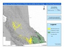
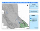
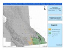
The following maps show the tested parent tree seed planning zones (SPZs) associated with the new seed deployment areas identified for the assisted range and population expansion of western larch beyond its contemporary (current) range as provided in the June 2010 amendments to the Chief Forester's Standards.
LW range and population expansion has been identified for climatically suitable areas projected to the year 2030.
LW range and population expansion beyond its contemporary range projected for the year 2030 (denoted as areas highlighted in yellow) is represented in three maps for three distinct seed sources:
The LW zones are aligned with the following B.C. seed sources/orchards:
- LW1 with EK High
- LW2 with Nelson Low
- LW3 with EK Low (and NE High)
Spatial data for LW1, LW2, and LW3 zones to support operational planning, including relevant metadata.
Note: LW1, LW2 and LW3 may geographically overlap with each other in some regions/areas of the province.


