Employment opportunities

As the steward of geoscience and mineral resource information in the province, the British Columbia Geological Survey stimulates mineral exploration, attracts investment, and informs societal decisions by providing research based on more than 125 years of corporate memory. Current research programs continue to define the geological evolution and natural resources of the province, generating knowledge and data to support land use and resource management decisions that balance the economy, the environment, and community interests.
The Survey links government, the minerals industry, First Nations, public safety agencies, other research organizations, and the general public to the province’s geology and mineral resources.
Join the British Columbia Geological Survey and help contribute to a better understanding of the geology and mineral resources of the province.
Limited Term positions
Mineral Deposit Geological Assistant: Critical Minerals Geoscience Data projects (closes Feb 25, 2025)
Term position
Starting in April, 2025 (externally funded for 2 years; no possibility of extension).
Tasks
• Assist with execution of laboratory activities involving machinery and procedures such as rock saw, crushers, pulverizers, heavy liquids, magnetic separators, and portable X-ray fluorescence analyzer.
• Assist with processing and analyzing samples, and interpreting mineralogical and geochemical data.
• Assist with queries and statistical analysis of geochemical datasets to support preparing geological and/or mineral maps and reports.
• Possible field work in challenging and remote terrain.
• Additional responsibilities may be added depending upon knowledge and experience.
Education, training, and experience
• Master of Science in geology or related field (B.Sc. with 4 years of workplace equivalency may be considered).
• A valid WHMIS certification.
• A valid Class 5 BC Driver’s license or equivalent.
• Experience using a broad range of computer software (MS Office, GIS, graphics, and statistical analysis).
• Experience in the compilation, evaluation, synthesis, and interpretation of geological, geochemical, and/or geochronological data.
Knowledge, skills and abilities
• Knowledge of the fundamentals of geology and mineral systems.
• Ability to work safely in laboratory setting
• Ability to conduct laboratory and field work.
• Demonstrated excellent written and oral communication skills.
Contact for questions and application:
Alexei Rukhlov, Ph.D., P.Geo.
Provincial Geochemist, BCGS, Ministry of Mining and Critical Minerals, Victoria, BC.
Alexei.Rukhlov@gov.bc.ca
Seasonal field positions
The British Columbia Geological Survey generates new geoscience knowledge through regional and detailed mapping programs. As part of these programs, we generally require several field assistants. Positions for geoscience students at all levels are available. To submit a resume, see below for instructions.
Field experience is an essential part of any geoscience education. Being part of a British Columbia Geological Survey field mapping program will help you gain and develop skills that you will use throughout your career. The experience gained will provide an excellent foundation for undergraduate and graduate research or serve as a stepping stone to work in industry.
“Working as a student for the BCGS is great because it allows you to apply the skills you’ve learned in the classroom to projects that generate important, new geoscience knowledge. It’s a great way to hone your geological skills and be mentored by senior geologists.” former Senior Geoscience Assistant
About the fieldwork
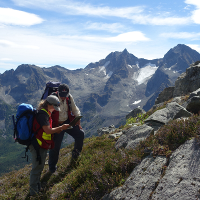
• Generally, up to two months of mapping. Work is commonly based out of 2-person remote tent fly camps that are moved by helicopter, with up to 4 weeks out in the bush at a time. Depending on remoteness, parts or all of the field area may be accessed by truck, ATV, or boat.
• Fieldwork is physically demanding and commonly carried out under isolated, primitive conditions.

Junior Field Assistant position (4 months, May to early Sept)
• Several weeks of office work in Victoria, including safety training
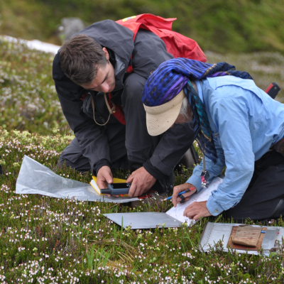
• Field duties include traversing on foot, describing rocks, taking notes, collecting samples, helping with camp set-up, cooking, camp maintenance, and logistics.
• May include other office duties and lab work (e.g., sample preparation).

Senior Field Assistant position (4-8 months, May to Sept or May to Jan)
• The Senior Assistant will generally be expected to work independently, commonly in a fly-camp, and be fully responsible for mapping, sampling, collating data, supervising junior assistants, ensuring safe practices, and establishing logistics.
• Following the field season, the Senior Assistant will return to the Victoria office to collaborate with the Project Geologist on final deliverables (e.g., reports, maps, and presentations).
Interested?
• Please send a cover letter and resume to Geological.Survey@gov.bc.ca. For full consideration, applications should be received by mid-March. Positions will remain open until filled
• As part of the application, please indicate if you have a valid firearms Possession and Acquisition Licence (PAL), a valid first aid certificate, a valid driver’s licence. Preference may be given to candidates who hold these licences.
• Previous field experience is an asset for the junior position and a requirement for the senior position.
• Candidates for the junior position are expected to have a general knowledge of computer programs such as Word, Excel, Access, and GIS (Manifold, MapInfo or ArcGIS). Senior hires are expected to be well versed in using these programs.
• Please indicate in your cover letter if you are interested in pursuing an Honours thesis project, listing your main geological interests and identifying a potential university supervisor.
