Papers 1999-1980
The Paper series is reserved for reviews and final thematic or regional works. Geological Fieldwork, our annual review of field activities and current research, is released as the first Paper of each year.
Jump to:
2018-2000 | 1999 | 1998 | 1997 | 1996 | 1995 | 1994 | 1993 | 1992 | 1991 | 1990 | 1989 | 1988 | 1987 | 1986 | 1985 | 1984 | 1983 | 1982 | 1981 | 1980 | 1979-1975
1999
MacIntyre, D.G., Struik, L.C., 1999. Nechako NATMAP Project, Central British Columbia - 1998 Overview. In: Geological Fieldwork 1998, British Columbia Ministry of Energy and Mines, British Columbia Geological Survey Paper 1999-01, pp. 1-14.
Levson, V.M., Mate, D.J., Stuart, A.J., Levson, V.M., Mate, D.J., Stuart, A.J., 1999. Quaternary Geology and Drift Prospecting Studies in the North Central Nechako Plateau. In: Geological Fieldwork 1998, British Columbia Ministry of Energy and Mines, British Columbia Geological Survey Paper 1999-01, pp. 15-24.
Mate, D.J., Levson, V.M., 1999. Quaternary Geology of the Marilla Map Sheet. In: Geological Fieldwork 1998, British Columbia Ministry of Energy and Mines, British Columbia Geological Survey Paper 1999-01, pp. 25-32.
Schiarizza, P.A., MacIntyre, D.G., 1999. Geology of the Babine Lake - Takla Lake Area, Central British Columbia. In: Geological Fieldwork 1998, British Columbia Ministry of Energy and Mines, British Columbia Geological Survey Paper 1999-01, pp. 33-68.
Ferri, F., Höy, T., Friedman, R.M., 1999. Description, U-Pb age and tectonic setting of the Quesnel Lake gneiss, east-central British Columbia. In: Geological Fieldwork 1998, British Columbia Ministry of Energy and Mines, British Columbia Geological Survey Paper 1999-01, pp. 69-80.
Nelson, J.L., Gabites, J.E., Paradis, S., 1999. New Galena Lead Isotopic Data from Carbonate Rocks in Northeastern B.C. - Implications for Regional MVT Fluid Migration. In: Geological Fieldwork 1998, British Columbia Ministry of Energy and Mines, British Columbia Geological Survey Paper 1999-01, pp. 81-88.
Nelson, J.L., Paradis, S., Zantvoort, W., 1999. The Robb Lake Carbonate-hosted Lead-Zinc Deposit, Northeastern British Columbia: A Cordilleran MVT Deposit. In: Geological Fieldwork 1998, British Columbia Ministry of Energy and Mines, British Columbia Geological Survey Paper 1999-01, pp. 89-102.
Rogers, C., Houle, J., 1999. Geological setting of the Kemess South Au-Cu porphyry deposit and local geology between Kemess Creek and Bicknell Lake. In: Geological Fieldwork 1998, British Columbia Ministry of Energy and Mines, British Columbia Geological Survey Paper 1999-01, pp. 103-114.
Legun, A.S., 1999. Geology of the Mount McCusker Area, Northeastern British Columbia. In: Geological Fieldwork 1998, British Columbia Ministry of Energy and Mines, British Columbia Geological Survey Paper 1999-01, pp. 115-126.
Mihalynuk, M.G., Erdmer, P., Ghent, E.D., Archibald, D., Friedman, R.M., Cordey, F., Johannson, G.G., Beanish, J., 1999. Age Constraints for Emplacement of the Northern Cache Creek Terrane and Implications of Blueschist Metamorphism. In: Geological Fieldwork 1998, British Columbia Ministry of Energy and Mines, British Columbia Geological Survey Paper 1999-01, pp. 127-142.
Nelson, J.L., 1999. Devono-Mississippian VMS Project: Continuing Studies in the Dorsey Terrane, Northern British Columbia. In: Geological Fieldwork 1998, British Columbia Ministry of Energy and Mines, British Columbia Geological Survey Paper 1999-01, pp. 143-156.
Webster, I.C.L., Desjardins, P.J., Kilby, W.E., 1999. The Digital Terrain Map Library: An Explorationist's Resource. In: Geological Fieldwork 1998, British Columbia Ministry of Energy and Mines, British Columbia Geological Survey Paper 1999-01, pp. 157-164.
Lefebure, D.V., Brown, D.A., Ray, G.E., 1999. The British Columbia Sediment-Hosted Gold Project. In: Geological Fieldwork 1998, British Columbia Ministry of Energy and Mines, British Columbia Geological Survey Paper 1999-01, pp. 165-178.
Brown, D.A., Cameron, R., 1999. Sediment-Hosted, Disseminated Gold Deposits Related to Alkalic Intrusions in the Howell Creek Structure, Southeastern British Columbia. In: Geological Fieldwork 1998, British Columbia Ministry of Energy and Mines, British Columbia Geological Survey Paper 1999-01, pp. 179-192.
Church, B.N., Jones, L.D., 1999. Metallogeny of the Beaton - Camborne mining camp, Lardeau District (NTS 82K 12 and 13). In: Geological Fieldwork 1998, British Columbia Ministry of Energy and Mines, British Columbia Geological Survey Paper 1999-01, pp. 193-222.
Höy, T., 1999. Massive Sulphide Deposits of the Eagle Bay Assemblage, Adams Plateau, south central British Columbia (NTS 82M3,4). In: Geological Fieldwork 1998, British Columbia Ministry of Energy and Mines, British Columbia Geological Survey Paper 1999-01, pp. 223-246.
Ryan, B., Leeder, R., Price, J.T., Gransden, J.F., 1999. The Effect of Coal Preparation on the Quality of Clean Coal and Coke. In: Geological Fieldwork 1998, British Columbia Ministry of Energy and Mines, British Columbia Geological Survey Paper 1999-01, pp. 247-278.
Bobrowsky, P.T., Matheson, A.H., Paulen, R., Massey, N.W.D., 1999. Aggregate Potential Project for the Nanaimo Area, Vancouver Island (NTS 92B, C, F and G). In: Geological Fieldwork 1998, British Columbia Ministry of Energy and Mines, British Columbia Geological Survey Paper 1999-01, pp. 279-284.
Simandl, G.J., Paradis, S., Diakow, L.J., Wojdak, P.J., Hartley, A.J., 1999. Precious Opal in the Whitesail Range, West-central British Columbia, Canada (NTS 93E/10W and 93E/11E). In: Geological Fieldwork 1998, British Columbia Ministry of Energy and Mines, British Columbia Geological Survey Paper 1999-01, pp. 285-296.
Lett, R.E., Jackaman, W., Yeow, A., 1999. Detailed geochemical exploration techniques for base and precious metals in the Kootenay Terrane (NTS 82L13, 82L/14, 82M/4, 82M/5, 92P/1). In: Geological Fieldwork 1998, British Columbia Ministry of Energy and Mines, British Columbia Geological Survey Paper 1999-01, pp. 297-306.
Paulen, R.C., Bobrowsky, P.T., Lett, R.E., Bichler, A.J., Wingerter, C., 1999. Till Geochemistry in the Kootenay, Slide Mountain and Quesnel Terranes. In: Geological Fieldwork 1998, British Columbia Ministry of Energy and Mines, British Columbia Geological Survey Paper 1999-01, pp. 307-319.
1998
MacIntyre, D.G., Struik, L.C., 1998. Nechako NATMAP Project, 1997 Overview. In: Geological Fieldwork 1997, British Columbia Ministry of Employment and Investment, British Columbia Geological Survey Paper 1998-01, pp. 1-1 - 1-8.
MacIntyre, D.G., 1998. Babine Porphyry Belt: Bedrock Geology of the Nakinilerak Lake Map Sheet (NTS 93M/8), British Columbia. In: Geological Fieldwork 1997, British Columbia Ministry of Employment and Investment, British Columbia Geological Survey Paper 1998-01, pp. 2-1 - 2-18.
MacIntyre, D.G., Schiarizza, P.A., Struik, L.C., 1998. Preliminary Bedrock Geology of the Tochcha Lake Map Area (NTS 93K/13), British Columbia. In: Geological Fieldwork 1997, British Columbia Ministry of Employment and Investment, British Columbia Geological Survey Paper 1998-01, pp. 3-1 - 3-14.
Schiarizza, P.A., Massey, N.W.D., MacIntyre, D.G., 1998. Geology of the Sitlika Assemblage in the Takla Lake Area. In: Geological Fieldwork 1997, British Columbia Ministry of Employment and Investment, British Columbia Geological Survey Paper 1998-01, pp. 4-1 - 4-20.
Levson, V.M., Stumpf, A.J., Stuart, A.J., 1998. Quaternary Geology and Ice-Flow Studies in the Smithers and Hazelton Map Areas (NTS 93L and M): Implications for Exploration. In: Geological Fieldwork 1997, British Columbia Ministry of Employment and Investment, British Columbia Geological Survey Paper 1998-01, pp. 5-1 - 5-8.
Mihalynuk, M.G., Nelson, J.L., Friedman, R.M., 1998. Regional Geology and Mineralization of the Big Salmon Complex. In: Geological Fieldwork 1997, British Columbia Ministry of Employment and Investment, British Columbia Geological Survey Paper 1998-01, pp. 6-1 - 6-19.
Nelson, J.L., Harms, T., Mortensen, J., 1998. Extensions and Affiliates of the Yukon-Tanana Terrane in Northern British Columbia. In: Geological Fieldwork 1997, British Columbia Ministry of Employment and Investment, British Columbia Geological Survey Paper 1998-01, pp. 7-1 - 7-12.
Diakow, L.J., Rogers, C., 1998. Toodoggone - McConnell Project: Geology of the McConnell Range - Serrated Peak to Jensen Creek. In: Geological Fieldwork 1997, British Columbia Ministry of Employment and Investment, British Columbia Geological Survey Paper 1998-01, pp. 8a-1 - 8a-14.
Legun, A.S., 1998. Toodoggone - McConnell Project: Geology of the McConnell Range - Jensen Creek to Johanson Creek. In: Geological Fieldwork 1997, British Columbia Ministry of Employment and Investment, British Columbia Geological Survey Paper 1998-01, pp. 8b-1 - 8b-10.
Brown, D.A., Woodfill, R.D., 1998. The Moyie Industrial Partnership Project: Geology and Mineralization of the Yahk-Moyie Lake Area, Southeastern British Columbia. In: Geological Fieldwork 1997, British Columbia Ministry of Employment and Investment, British Columbia Geological Survey Paper 1998-01, pp. 9-1 - 9-22.
Brown, D.A., Termuende, T., 1998. The Findlay Industrial Partnership Project: Geology and Mineral Occurrences of the Findlay - Doctor Creek Areas, Southeastern British Columbia. In: Geological Fieldwork 1997, British Columbia Ministry of Employment and Investment, British Columbia Geological Survey Paper 1998-01, pp. 10-1 - 10-10.
Smith, M., Brown, D.A., 1998. Preliminary Report on a Proterozoic (?) Stock in the Purcell Supergroup and Comparison to the Cretaceous White Creek Batholith, Southeastern British Columbia. In: Geological Fieldwork 1997, British Columbia Ministry of Employment and Investment, British Columbia Geological Survey Paper 1998-01, pp. 11-1 - 11-8.
Woodfill, R., 1998. Purcell Gravity Anomaly - Implications for Mineral Exploration. In: Geological Fieldwork 1997, British Columbia Ministry of Employment and Investment, British Columbia Geological Survey Paper 1998-01, pp. 12-1 - 12-4.
Höy, T., Ferri, F., 1998. Stratabound Base Metal Deposits of the Barkerville Subterrane, Central British Columbia. In: Geological Fieldwork 1997, British Columbia Ministry of Employment and Investment, British Columbia Geological Survey Paper 1998-01, pp. 13-1 - 13-12.
Höy, T., Ferri, F., 1998. Zn-Pb Deposits in the Cariboo Subterrane, Central British Columbia. In: Geological Fieldwork 1997, British Columbia Ministry of Employment and Investment, British Columbia Geological Survey Paper 1998-01, pp. 14-1 - 14-10.
Lett, R.E., Bobrowsky, P., Cathro, M.S., Yeow, A., 1998. Geochemical Pathfinders For Massive Sulphide Deposits in the Southern Kootenay Terrane. In: Geological Fieldwork 1997, British Columbia Ministry of Employment and Investment, British Columbia Geological Survey Paper 1998-01, pp. 15-1 - 15-10.
Paulen, R.C., Bobrowsky, P.T., Little, E.C., Prebble, A.C., Ledwon, A., 1998. Surficial Deposits in the Louis Creek and Chu Chua Creek Area. In: Geological Fieldwork 1997, British Columbia Ministry of Employment and Investment, British Columbia Geological Survey Paper 1998-01, pp. 16-1 - 16-12.
Plint, H., McMillan, W.J., Nelson, J.L., Panteleyev, A., 1998. The Nizi Property: A Classic (Eocene?) Epithermal Gold System in Far Northern British Columbia. In: Geological Fieldwork 1997, British Columbia Ministry of Employment and Investment, British Columbia Geological Survey Paper 1998-01, pp. 17-1 - 17-14.
Nixon, G.T., 1998. Ni-Cu Sulphide Mineralization in the Turnagain Alaskan-Type Complex: A Unique Magmatic Environment. In: Geological Fieldwork 1997, British Columbia Ministry of Employment and Investment, British Columbia Geological Survey Paper 1998-01, pp. 18-1 - 18-12.
Lefebure, D.V., 1998. Epithermal Gold Deposits of the Queen Charlotte Islands. In: Geological Fieldwork 1997, British Columbia Ministry of Employment and Investment, British Columbia Geological Survey Paper 1998-01, pp. 19-1 - 19-14.
Ray, G.E., Brown, J.A., Friedman, R.M., 1998. Geology of the Nifty Zn-Ba-Ag Prospect Bella Coola District, British Columbia. In: Geological Fieldwork 1997, British Columbia Ministry of Employment and Investment, British Columbia Geological Survey Paper 1998-01, pp. 20-1 - 20-28.
Cathro, M.S., Dürfeld, R.M., Ray, G.E., 1998. Epithermal Mineralization on the Watson Bar Property (92/01E), Clinton Mining Division, Southern B.C.. In: Geological Fieldwork 1997, British Columbia Ministry of Employment and Investment, British Columbia Geological Survey Paper 1998-01, pp. 21-1 - 21-14.
Church, B.N., 1998. Metallogeny of the Slocan City Mining Camp. In: Geological Fieldwork 1997, British Columbia Ministry of Employment and Investment, British Columbia Geological Survey Paper 1998-01, pp. 22-1 - 22-14.
Church, B.N., Klein, G.H., 1998. The Allin Property and Equity-type Mineralization, Central British Columbia. In: Geological Fieldwork 1997, British Columbia Ministry of Employment and Investment, British Columbia Geological Survey Paper 1998-01, pp. 23-1 - 23-10.
Lefebure, D.V., 1998. British Columbia Mineral Deposit Profiles. In: Geological Fieldwork 1997, British Columbia Ministry of Employment and Investment, British Columbia Geological Survey Paper 1998-01, pp. 24a-1 - 24a-2.
Trueman, E.A.G., 1998. Carbonate-Hosted Cu+Pb+Zn. In: Geological Fieldwork 1997, British Columbia Ministry of Employment and Investment, British Columbia Geological Survey Paper 1998-01, pp. 24b-1 - 24b-4.
Hora, Z.D., 1998. Bentonite. In: Geological Fieldwork 1997, British Columbia Ministry of Employment and Investment, British Columbia Geological Survey Paper 1998-01, pp. 24c-1 - 24c-4.
Hora, Z.D., 1998. Sedimentary Kaolin. In: Geological Fieldwork 1997, British Columbia Ministry of Employment and Investment, British Columbia Geological Survey Paper 1998-01, pp. 24d-1 - 24d-4.
Simandl, G.J., Hancock, K.D., 1998. Sparry Magnesite. In: Geological Fieldwork 1997, British Columbia Ministry of Employment and Investment, British Columbia Geological Survey Paper 1998-01, pp. 24e-1 - 24e-4.
Paradis, S., Simandl, G.J., MacIntyre, D.G., Orris, G.J., 1998. Sedimentary-Hosted, Stratiform Barite. In: Geological Fieldwork 1997, British Columbia Ministry of Employment and Investment, British Columbia Geological Survey Paper 1998-01, pp. 24f-1 - 24f-4.
McMillan, R.H., 1998. Unconformity-Associated U. In: Geological Fieldwork 1997, British Columbia Ministry of Employment and Investment, British Columbia Geological Survey Paper 1998-01, pp. 24g-1 - 24g-4.
Ray, G.E., 1998. Au Skarns. In: Geological Fieldwork 1997, British Columbia Ministry of Employment and Investment, British Columbia Geological Survey Paper 1998-01, pp. 24h-1 - 24h-4.
Ray, G.E., 1998. Garnet Skarns. In: Geological Fieldwork 1997, British Columbia Ministry of Employment and Investment, British Columbia Geological Survey Paper 1998-01, pp. 24i-1 - 24i-2.
Gross, G.A., Gower, C.F., Lefebure, D.V., 1998. Magmatic Ti-Fe+V Oxide Deposits. In: Geological Fieldwork 1997, British Columbia Ministry of Employment and Investment, British Columbia Geological Survey Paper 1998-01, pp. 24j-1 - 24j-4.
Hora, Z.D., 1998. Ultramafic-Hosted Chrysotile Asbestos. In: Geological Fieldwork 1997, British Columbia Ministry of Employment and Investment, British Columbia Geological Survey Paper 1998-01, pp. 24k-1 - 24k-4.
Pell, J., 1998. Kimberlite-Hosted Diamonds. In: Geological Fieldwork 1997, British Columbia Ministry of Employment and Investment, British Columbia Geological Survey Paper 1998-01, pp. 24l-1 - 24l-4.
Pell, J., 1998. Lamproite-Hosted Diamonds. In: Geological Fieldwork 1997, British Columbia Ministry of Employment and Investment, British Columbia Geological Survey Paper 1998-01, pp. 24m-1 - 24m-4.
Hora, Z.D., 1998. Andalusite Hornfels. In: Geological Fieldwork 1997, British Columbia Ministry of Employment and Investment, British Columbia Geological Survey Paper 1998-01, pp. 24n-1 - 24n-4.
Simandl, G.J., Kenan, W.M., 1998. Microcrystalline Graphite. In: Geological Fieldwork 1997, British Columbia Ministry of Employment and Investment, British Columbia Geological Survey Paper 1998-01, pp. 24o-1 - 24o-4.
Simandl, G.J., Kenan, W.M., 1998. Crystalline Flake Graphite. In: Geological Fieldwork 1997, British Columbia Ministry of Employment and Investment, British Columbia Geological Survey Paper 1998-01, pp. 24p-1 - 24p-4.
Simandl, G.J., Kenan, W.M., 1998. Vein Graphite in Metamorphic Terrains. In: Geological Fieldwork 1997, British Columbia Ministry of Employment and Investment, British Columbia Geological Survey Paper 1998-01, pp. 24q-1 - 24q-4.
Simandl, G.J., Payie, G.J., Wilson, B., 1998. Blue Beryl/ Aquamarine Occurrences in the Horseranch Range, North Central British Columbia. In: Geological Fieldwork 1997, British Columbia Ministry of Employment and Investment, British Columbia Geological Survey Paper 1998-01, pp. 25-1 - 25-10.
Simandl, G.J., Jones, P., Osborne, J.W., Payie, G.J., McLeod, J., 1998. Use of Heavy Minerals in Exploration for Sapphires, Empress Cu-Au-Mo Deposit, British Columbia. In: Geological Fieldwork 1997, British Columbia Ministry of Employment and Investment, British Columbia Geological Survey Paper 1998-01, pp. 26-1 - 26-12.
Ryan, B., Gransden, J., Price, J., 1998. Fluidity of Western Canadian Coals and its Relationship to Other Coal and Coke Properties. In: Geological Fieldwork 1997, British Columbia Ministry of Employment and Investment, British Columbia Geological Survey Paper 1998-01, pp. 27-1 - 27-17.
Ryan, B., Khan, M., 1998. Maceral Affinity of Phosphorus in Coals from the Elk Valley Coalfield, British Columbia. In: Geological Fieldwork 1997, British Columbia Ministry of Employment and Investment, British Columbia Geological Survey Paper 1998-01, pp. 28-1 - 28-20.
Ryan, B., Ledda, A., 1998. A Review of Sulphur in Coal: With Specific Reference to the Telkwa Deposit, North-Western British Columbia. In: Geological Fieldwork 1997, British Columbia Ministry of Employment and Investment, British Columbia Geological Survey Paper 1998-01, pp. 29-1 - 29-22.
Matheson, A., Paulen, R., Bobrowsky, P.T., Massey, N.W.D., 1998. Okanagan Aggregate Potential Project. In: Geological Fieldwork 1997, British Columbia Ministry of Employment and Investment, British Columbia Geological Survey Paper 1998-01, pp. 29a-1 - 29a-2.
Jackaman, W., Cook. S.J., Lett, R.E., 1998. Regional Geochemical Survey Program: Review of 1997 Activities. In: Geological Fieldwork 1997, British Columbia Ministry of Employment and Investment, British Columbia Geological Survey Paper 1998-01, pp. 30-1 - 30-4.
Deyell, C.L., Thompson, J.F.H., Groat, L.A., Mortensen, J.K., Friedman, R.M., Tompson, W.D., 1998. The Style and Origin of Alternation on the Limonite Creek Property, Central British Columbia. In: Geological Fieldwork 1997, British Columbia Ministry of Employment and Investment, British Columbia Geological Survey Paper 1998-01, pp. 31-1 - 31-8.
Lepitre, M.E., Mortensen, J.K., Friedman, R.M., 1998. Geology and U-Pb Geochronology of Intrusive Rocks Associated with Mineralization in the Northern Tahtsa Lake District, West-Central British Columbia. In: Geological Fieldwork 1997, British Columbia Ministry of Employment and Investment, British Columbia Geological Survey Paper 1998-01, pp. 32-1 - 32-10.
Whiteaker, R.J., Mortensen, J.K., Friedman, R.M., 1998. U-Pb Geochronology, Pb Isotopic Signatures and Geochemistry of an Early Jurassic Alkalic Porphyry System near Lac La Hache. In: Geological Fieldwork 1997, British Columbia Ministry of Employment and Investment, British Columbia Geological Survey Paper 1998-01, pp. 33-1 - 33-14.
1997
Brown, D.A., Lowe, C., Shives, R.B.K., Best, M.E., 1997. East Kootenay Geophysical Survey, Southeastern British Columbia (NTS 82F, G, K): Sullivan - North Star Area. In: Geological Fieldwork 1996, British Columbia Ministry of Employment and Investment, British Columbia Geological Survey Paper 1997-01, pp. 3-16.
Logan, J.M., 1997. U-Pb Ages from the Selkirk Allochthon, Seymour Arm Map Area, Southeast British Columbia. In: Geological Fieldwork 1996, British Columbia Ministry of Employment and Investment, British Columbia Geological Survey Paper 1997-01, pp. 17-24.
Logan, J.M., Rees, C.J., 1997. Northern Selkirk Project - Geology of the Laforme Creek Area. In: Geological Fieldwork 1996, British Columbia Ministry of Employment and Investment, British Columbia Geological Survey Paper 1997-01, pp. 25-38.
MacIntyre, D.G., Struik, L.C., 1997. Nechako NATMAP Project - 1996 Overview. In: Geological Fieldwork 1996, British Columbia Ministry of Employment and Investment, British Columbia Geological Survey Paper 1997-01, pp. 39-46.
MacIntyre, D.G., Webster, I.C.L., Villeneuve, M., 1997. Babine Porphyry Belt Project: Bedrock Geology of the Old Fort Mountain Area (NTS 92M/1), British Columbia. In: Geological Fieldwork 1996, British Columbia Ministry of Employment and Investment, British Columbia Geological Survey Paper 1997-01, pp. 47-68.
Childe, F.C., Schiarizza, P.A., 1997. U-Pb Geochronology, Geochemistry and ND Isotopic Systematics of the Sitlika Assemblage, Central British Columbia. In: Geological Fieldwork 1996, British Columbia Ministry of Employment and Investment, British Columbia Geological Survey Paper 1997-01, pp. 69-78.
Schiarizza, P.A., Payie, G.J., 1997. Geology of the Sitlika Assemblage in the Kenny Creek - Mount Olson Area (NTS 92N/12, 13), Central British Columbia. In: Geological Fieldwork 1996, British Columbia Ministry of Employment and Investment, British Columbia Geological Survey Paper 1997-01, pp. 79-100.
Diakow, L.J., Metcalfe, P., 1997. Geology of the Swannell Ranges in the Vicinity of the Kemess Copper-Gold Porphyry Deposit, Attycelley Creek (NTS 94E/2), Toodoggone River Map Area. In: Geological Fieldwork 1996, British Columbia Ministry of Employment and Investment, British Columbia Geological Survey Paper 1997-01, pp. 101-116.
Childe, F.C., Friedman, R.M., Mortensen, J.K., Thompson, J.F.H., 1997. Evidence for Early Triassic Felsic Magmatism in the Ashcroft (NTS 92I) Map Area, British Columbia. In: Geological Fieldwork 1996, British Columbia Ministry of Employment and Investment, British Columbia Geological Survey Paper 1997-01, pp. 117-124.
Ferri, F., Rees, C., Nelson, J.L., Legun, A.S., 1997. Geology of the Northern Kechika Trough. In: Geological Fieldwork 1996, British Columbia Ministry of Employment and Investment, British Columbia Geological Survey Paper 1997-01, pp. 125-144.
Nelson, J.L., 1997. Last Seen Heading South: Extensions of the Yukon-Tanana Terrane into Northern British Columbia. In: Geological Fieldwork 1996, British Columbia Ministry of Employment and Investment, British Columbia Geological Survey Paper 1997-01, pp. 145-156.
Mihalynuk, M.G., Cordey, F., 1997. Potential for Kutcho Creek Volcanogenic Massive Sulphide Mineralization in the Northern Cache Creek Terrane: A Progress Report. In: Geological Fieldwork 1996, British Columbia Ministry of Employment and Investment, British Columbia Geological Survey Paper 1997-01, pp. 157-170.
Mihalynuk, M.G., Gabites, J.E., Orchard, M.J., Tozer, E.T., 1997. Age of the Willison Bay Pluton and Overlying Sediments: Implications for the Carnian Stage Boundary. In: Geological Fieldwork 1996, British Columbia Ministry of Employment and Investment, British Columbia Geological Survey Paper 1997-01, pp. 171-182.
Nelson, J.L., Sibbick, S.J., Höy, T., Bobrowsky, P., Cathro, M., 1997. The Paleozoic Massive Sulphide Project: An Investigation of Yukon-Tanana Correlatives in British Columbia. In: Geological Fieldwork 1996, British Columbia Ministry of Employment and Investment, British Columbia Geological Survey Paper 1997-01, pp. 183-186.
Legun, A.S., 1997. Sub-Basin Recognition in the Purcell Anticlinorium. In: Geological Fieldwork 1996, British Columbia Ministry of Employment and Investment, British Columbia Geological Survey Paper 1997-01, pp. 187-198.
Höy, T., 1997. Harper Creek: A Volcanogenic Sulphide Deposit within the Eagle Bay Assemblage, Kootenay Terrane, Southern British Columbia. In: Geological Fieldwork 1996, British Columbia Ministry of Employment and Investment, British Columbia Geological Survey Paper 1997-01, pp. 199-210.
Church, B.N., 1997. Age of Mineralization, City of Paris Veins, Greenwood Area. In: Geological Fieldwork 1996, British Columbia Ministry of Employment and Investment, British Columbia Geological Survey Paper 1997-01, pp. 211-214.
Church, B.N., Dostal, J., Gale, V., 1997. Age of a Basalt Dike, Sustut Copper Deposit. In: Geological Fieldwork 1996, British Columbia Ministry of Employment and Investment, British Columbia Geological Survey Paper 1997-01, pp. 215-218.
Friedman, R.M., Jordan, S., 1997. U-Pb Ages for Intrusive Rocks at the Huckleberry Porphyry Copper Deposit, Tahtsa Lake District, Whitesail Lake Map Area, West-Central British Columbia. In: Geological Fieldwork 1996, British Columbia Ministry of Employment and Investment, British Columbia Geological Survey Paper 1997-01, pp. 219-226.
Friedman, R.M., Panteleyev, A., 1997. U-Pb Age of Mineralized Feldspar Porphyry Sills at the Louise Lake Cu-Mo-Au-As Deposit, Smithers Map Area, West-Central British Columbia. In: Geological Fieldwork 1996, British Columbia Ministry of Employment and Investment, British Columbia Geological Survey Paper 1997-01, pp. 227-232.
Ray, G.E., Webster, I.C.L., Ballantyne, S.B., Kilby, C.E., Cornelius, S.B., 1997. Geology and Mineral Chemistry of Tin-Bearing Skarns Related to the Surprise Lake Batholith, Atlin, Northern British Columbia. In: Geological Fieldwork 1996, British Columbia Ministry of Employment and Investment, British Columbia Geological Survey Paper 1997-01, pp. 233-254.
Panteleyev, A., Broughton, D., Lefebure, D.V., 1997. The Taurus Project, A Bulk Tonnage Gold Prospect near Cassiar, British Columbia. In: Geological Fieldwork 1996, British Columbia Ministry of Employment and Investment, British Columbia Geological Survey Paper 1997-01, pp. 255-266.
Grunsky, E.C., 1997. Mineral Resource Estimation: The Mineral Potential Project: An Evaluation of Estimator Responses for Selected Mineral Deposit Types for the Province. In: Geological Fieldwork 1996, British Columbia Ministry of Employment and Investment, British Columbia Geological Survey Paper 1997-01, pp. 267-282.
Ash, C.H., MacDonald, R.W.J., Friedman, R.M., 1997. Stratigraphy of the Tatogga Lake Area, Northwestern British Columbia. In: Geological Fieldwork 1996, British Columbia Ministry of Employment and Investment, British Columbia Geological Survey Paper 1997-01, pp. 283-290.
Friedman, R.M., Ash, C.H., 1997. U-Pb Age of Intrusions Related to Porphyry Cu-Au Mineralization in the Tatogga Lake Area, Northwestern British Columbia. In: Geological Fieldwork 1996, British Columbia Ministry of Employment and Investment, British Columbia Geological Survey Paper 1997-01, pp. 291-300.
Hora, Z.D., Hancock, K.D., 1997. Some New Dimension Stone Properties in British Columbia, Part III. In: Geological Fieldwork 1996, British Columbia Ministry of Employment and Investment, British Columbia Geological Survey Paper 1997-01, pp. 301-306.
Symons, D.T.A., Lewchuk, M.T., Simandl, G.J., Sangster, D.F., 1997. Paleomagnetism of the Mount Brussilof Magnesite Deposit and its Cambrian Host Rocks, Southeastern British Columbia. In: Geological Fieldwork 1996, British Columbia Ministry of Employment and Investment, British Columbia Geological Survey Paper 1997-01, pp. 307-316.
Hora, Z.D., Hancock, K.D., 1997. A New Sodalite Occurrence: Mount Mather Creek, British Columbia. In: Geological Fieldwork 1996, British Columbia Ministry of Employment and Investment, British Columbia Geological Survey Paper 1997-01, pp. 317-320.
Simandl, G.J., Hancock, K.D., Callaghan, B., Paradis, S., Yorke-Hardy, R., 1997. Klinker Precious Opal Deposit, South Central British Columbia, Canada - Field Observations and Potential Deposit-Scale Controls. In: Geological Fieldwork 1996, British Columbia Ministry of Employment and Investment, British Columbia Geological Survey Paper 1997-01, pp. 321-328.
Church, B.N., Hora, Z.D., 1997. New Splitstone and Opal Occurrences, Nipple Mountain, Beaverdell Area. In: Geological Fieldwork 1996, British Columbia Ministry of Employment and Investment, British Columbia Geological Survey Paper 1997-01, pp. 329-332.
Legun, A.S., 1997. Amber in British Columbia. In: Geological Fieldwork 1996, British Columbia Ministry of Employment and Investment, British Columbia Geological Survey Paper 1997-01, pp. 333-338.
Simandl, G.J., Hancock, K.D., Lambert, E., Hudon, P., Martignole, J., Osborne, W.W., 1997. The Empress Cu-Au-Mo Deposit - Gemstone and Industrial Minerals Potential. In: Geological Fieldwork 1996, British Columbia Ministry of Employment and Investment, British Columbia Geological Survey Paper 1997-01, pp. 339-346.
Matheson, A., MacDougall, D., Bobrowsky, P.T., 1997. Okanagan Aggregate Potential Project. In: Geological Fieldwork 1996, British Columbia Ministry of Employment and Investment, British Columbia Geological Survey Paper 1997-01, pp. 347-352.
Ryan, B.D., 1997. Coalbed Methane in the Comox Formation Tsable River Area, Vancouver Island. In: Geological Fieldwork 1996, British Columbia Ministry of Employment and Investment, British Columbia Geological Survey Paper 1997-01, pp. 353-364.
Ryan, B.D., 1997. Coal Rank Variations in the Cabinet Creek Area, Telkwa Coalfield, Central British Columbia. In: Geological Fieldwork 1996, British Columbia Ministry of Employment and Investment, British Columbia Geological Survey Paper 1997-01, pp. 365-372.
Ryan, B.D., 1997. Coal Quality Variations in the Gething Formation Northeast British Columbia. In: Geological Fieldwork 1996, British Columbia Ministry of Employment and Investment, British Columbia Geological Survey Paper 1997-01, pp. 373-400.
Cook. S.J., Jackaman, W., Lett, R.E., Sibbick, S.J., 1997. Regional Geochemical Survey Program: Review of 1996 Activities. In: Geological Fieldwork 1996, British Columbia Ministry of Employment and Investment, British Columbia Geological Survey Paper 1997-01, pp. 401-404.
Dixon-Warren, A.B., Bobrowsky, P.T., Leboe, E.R., Ledwon, A., 1997. Eagle Bay Project: Surficial Geology of the Adams Plateau (NTS 82M/4) and North Barriere Lake (NTS 92M/5) Map Areas. In: Geological Fieldwork 1996, British Columbia Ministry of Employment and Investment, British Columbia Geological Survey Paper 1997-01, pp. 405-412.
Bobrowsky, P.T., Leboe, E.R., Dixon-Warren, A.B., Ledwon, A., 1997. Eagle Bay Project: Till Geochemistry of the Adams Plateau (NTS 82M/4) and North Barriere Lake (NTS 92M/5) Map Areas. In: Geological Fieldwork 1996, British Columbia Ministry of Employment and Investment, British Columbia Geological Survey Paper 1997-01, pp. 413-422.
Sibbick, S.J., Runnells, J.L., Lett, R.E., 1997. Eagle Bay Project: Regional Hydrogeochemical Survey and Geochemical Orientation Studies. In: Geological Fieldwork 1996, British Columbia Ministry of Employment and Investment, British Columbia Geological Survey Paper 1997-01, pp. 423-426.
Levson, V.M., Stumpf, A.J., Meldrum, D.G., O'Brien, E.K., Broster, B.E., 1997. Quaternary Geology and Ice Flow History of the Babine Copper Porphyry Belt, British Columbia. In: Geological Fieldwork 1996, British Columbia Ministry of Employment and Investment, British Columbia Geological Survey Paper 1997-01, pp. 427-438.
Stumpf, A.J., Broster, B.E., Levson, V.M., 1997. Evaluating the Use of Till Geochemistry to Define Buried Mineral Targets: A Case Study from the Bell Mine Property (NTS 93L/16, 93M/1), West-Central British Columbia. In: Geological Fieldwork 1996, British Columbia Ministry of Employment and Investment, British Columbia Geological Survey Paper 1997-01, pp. 439-456.
Levson, V.M., Meldrum, D.G., Cook, S.J., Stumpf, A.L., O'Brien, E.K., Churchill, C., Coneys, A.M., Broster, B.E., 1997. Till Geochemical Studies in the Babine Porphyry Belt: Regional Surveys and Deposit-Scale Studies. In: Geological Fieldwork 1996, British Columbia Ministry of Employment and Investment, British Columbia Geological Survey Paper 1997-01, pp. 457-466.
Monahan, P.A., Levson, V.M., 1997. Earthquake Hazard Assessment in Greater Victoria, British Columbia: Development of a Shear-Wave Velocity Model for the Quaternary Deposits. In: Geological Fieldwork 1996, British Columbia Ministry of Employment and Investment, British Columbia Geological Survey Paper 1997-01, pp. 467-480.
edited by L.J. Diakow, P. Metcalfe and J. Newell
Also available as GSC Open File 3448
This volume contains 12 reports which summarize results from a variety of geological studies conducted in selected localities of the vast Interior Plateau region that lies south of the Nechako Reservoir, west of the Fraser River and east of the Coast Mountains in central British Columbia. The Interior Plateau Project was initiated in 1992, conducted under the auspices of the Mineral Development Agreement (1991-1995), and involved geoscientists from the British Columbia Geological Survey and Geological Survey of Canada.
The project included mineral deposit studies, bedrock and surficial mapping, till and lake sediment geochemistry, biogeochemistry, airborne magnetic, gamma-ray spectrometric and electromagnetic surveys. They were designed to improve understanding of the geology and mineral deposits, test and develop exploration techniques suited for drift covered terrain, and provide an up to date assessment of the mineral potential of the Interior Plateau region.
L.J. Diakow, P. Van der Heyden and P. Metcalfe; Introduction, pp. 1-6.
L.J. Diakow, I.C.L. Webster, T.A. Richards and H.W. Tipper;Geology of the Fawnie and Nechako Ranges, Southern Nechako Plateau, Central British Columbia (93F/2,3,6,7), pp. 7-30.
P. Metcalfe, T.A. Richards, M.E. Villeneuve, J.M. White and C.J. Hickson; Physical and Chemical Volcanology of the Eocene Mount Clisbako Volcano, Central British Columbia (93B/12,13; 93C/9,16), pp. 31-61.
P. Schiarizza; Geology of the Tatlayoko Lake - Beece Creek Area (92N/8,9,10; 92O/5,6,12), pp. 63-101.
P.S. Mustard and P. van der Heyden; Geology of the Tatla Lake and the East Half of Bussel Creek Map Areas (092N/15, 092N/14), pp. 103-118.
V.M. Levson and T.R. Giles; Quaternary Geology and Till Geochemistry Studies in the Nechako and Fraser Plateaus, Central British Columbia (93C/1,8,9,10; 93F/2,3,7; 93L/16; 93M/1), pp. 121-147.
A. Plouffe; Reconnaissance Till Geochemistry on the Chilcotin Plateau (92O/5 and O/12), pp. 147-157.
D.E. Kerr and V.M. Levson; Drift Prospecting Activites in British Columbia: An Overview with Emphasis on the Interior Plateau, pp. 159-172.
S.J. Cook; Regional and Property-scale Application of Lake Sediment Geochemistry in the Search for Buried Mineral Deposits in the Southern Nechako Plateau Area, British Columbia (93C,E,F,K,L), pp. 175-203.
C.E. Dunn; Biogeochemical Surveys in the Interior Plateau of British Columbia, pp. 205-218.
D. Teskey, P. Stone, P. Mustard and P. Metcalfe; High-Resolution Aeromagnetic Survey - Interior Plateau, British Columbia, pp. 221-224.
M.E. Best, V.M. Levson and L.J. Diakow; Electromagnetic Mapping in Drift Covered Regions of the Nechako Plateau, British Columbia (93F/2, 3, 6, 7), pp. 225-234.
R.A. Lane and T.G. Schroeter; A Review of Metallic Mineralization in the Interior Plateau, Central British Columbia (parts of 93B,C,F), pp. 237-256.
1996
McMillan, W.J., Struick, L.C., 1996. Natmap: Nechako Project, Central British Columbia. In: Geological Fieldwork 1995, British Columbia Ministry of Energy, Mines and Petroleum Resources, British Columbia Geological Survey Paper 1996-01, pp. 3-10.
MacIntyre, D.G., Webster, I.C.L., Bellefontaine, K.A., 1996. Babine Porphyry Belt Project: Bedrock Geology of the Fulton Lake Map Area, British Columbia. In: Geological Fieldwork 1995, British Columbia Ministry of Energy, Mines and Petroleum Resources, British Columbia Geological Survey Paper 1996-01, pp. 11-36.
Stumpf, A.J., Huntley, D.H., Broster, B.E., Levson, V.M., 1996. Babine Porphyry Belt Project: Detailed Drift Exploration Studies in the Old Fort Mountain and Fulton Lake Map Areas, British Columbia. In: Geological Fieldwork 1995, British Columbia Ministry of Energy, Mines and Petroleum Resources, British Columbia Geological Survey Paper 1996-01, pp. 36-44.
Huntley, D.H., Stumpf, A.J., Levson, V.M., Broster, B.E., 1996. Babine Porphyry Belt Project: Quaternary Geology and Regional Till Geochemistry Sampling in the Old Fort Mountain (NTS 93M/1) and Fulton Lake (NTS 93L/16) Map Areas, British Columbia. In: Geological Fieldwork 1995, British Columbia Ministry of Energy, Mines and Petroleum Resources, British Columbia Geological Survey Paper 1996-01, pp. 45-56.
Panteleyev, A., Bobrowsky, P.T., Nixon, G.T., Sibbick, S.J., 1996. Northern Vancouver Island Integrated Project. In: Geological Fieldwork 1995, British Columbia Ministry of Energy, Mines and Petroleum Resources, British Columbia Geological Survey Paper 1996-01, pp. 57-60.
Panteleyev, A., Sibbick, S.J., Koyanagi, V.M., 1996. Natural Acid Rock-Drainage in Northern Vancouver Island - Its Place in Geoenvironmental Ore Deposits Models. In: Geological Fieldwork 1995, British Columbia Ministry of Energy, Mines and Petroleum Resources, British Columbia Geological Survey Paper 1996-01, pp. 61-68.
Diakow, L.J., Cook, S.J., Lane, R.A., Levson, V.M., Schroeter, T.G., 1996. Summary of the Interior Plateau Program: Activities by the British Columbia Geological Survey in the Southern Nechako Plateau. In: Geological Fieldwork 1995, British Columbia Ministry of Energy, Mines and Petroleum Resources, British Columbia Geological Survey Paper 1996-01, pp. 69-76.
Schiarizza, P.A., 1996. Tatlayoko Project Update. In: Geological Fieldwork 1995, British Columbia Ministry of Energy, Mines and Petroleum Resources, British Columbia Geological Survey Paper 1996-01, pp. 77-94.
Leitch, C.H.B., 1996. Preliminary Petrographic, Geochemical and Fluid Inclusion Studies of the Fors Deposit, Southeastern British Columbia. In: Geological Fieldwork 1995, British Columbia Ministry of Energy, Mines and Petroleum Resources, British Columbia Geological Survey Paper 1996-01, pp. 95-106.
Logan, J.M., Colpron, M., Johnson, B.J., 1996. Northern Selkirk Project - Geology of the Downie Creek Map Area. In: Geological Fieldwork 1995, British Columbia Ministry of Energy, Mines and Petroleum Resources, British Columbia Geological Survey Paper 1996-01, pp. 107-126.
Stanley, G.D., Nelson, J.L., 1996. New Investigations on Eaglenest Mountain, Northern Quesnel Terrane: An Upper Triassic Reef Facies in the Takla Group, Central B.C.. In: Geological Fieldwork 1995, British Columbia Ministry of Energy, Mines and Petroleum Resources, British Columbia Geological Survey Paper 1996-01, pp. 127-136.
Ferri, F., Rees, C.J., Nelson, J.L., 1996. Geology and Mineralization of the Gataga River Area, Northern Rocky Mountains. In: Geological Fieldwork 1995, British Columbia Ministry of Energy, Mines and Petroleum Resources, British Columbia Geological Survey Paper 1996-01, pp. 137-154.
Ash, C.H., Stinson, P.K., MacDonald, R.W.J., 1996. Geology of the Todagin Plateau and Kinaskan Lake Area, Northwestern British Columbia. In: Geological Fieldwork 1995, British Columbia Ministry of Energy, Mines and Petroleum Resources, British Columbia Geological Survey Paper 1996-01, pp. 155-174.
Mihalynuk, M.G., McMillan, W.J., Mortenson, J.K., Childe, F.C., Orchard, M.J., 1996. Age of Host Strata Versus Mineralization at Ericksen-Ashby : A Skarn Deposit. In: Geological Fieldwork 1995, British Columbia Ministry of Energy, Mines and Petroleum Resources, British Columbia Geological Survey Paper 1996-01, pp. 175-180.
Jackaman, W., Cook, S.J., Lett, R.E., Sibbick, S.J., Matysek, P.F., 1996. 1995 Regional Geochemical Survey Program: Review of Activities. In: Geological Fieldwork 1995, British Columbia Ministry of Energy, Mines and Petroleum Resources, British Columbia Geological Survey Paper 1996-01, pp. 181-184.
Matysek, P., Jackaman, W., 1996. B.C. Regional Geochemical Survey Anomaly Recognition, An Example Using Catchment Analysis. In: Geological Fieldwork 1995, British Columbia Ministry of Energy, Mines and Petroleum Resources, British Columbia Geological Survey Paper 1996-01, pp. 185-190.
Levson, V.M., Monahan, P.A., Meldrum, D.G., Matysek, P.F., Gerath, R.F., Watts, B.D., Sy, A., Yan, L., 1996. Surficial Geology and Earthquake Hazard Mapping, Chilliwack, British Columbia. In: Geological Fieldwork 1995, British Columbia Ministry of Energy, Mines and Petroleum Resources, British Columbia Geological Survey Paper 1996-01, pp. 191-206.
Read, P.B., 1996. Industrial Mineral Potential of the Tertiary Rocks, Vernon and Adjacent Map Areas. In: Geological Fieldwork 1995, British Columbia Ministry of Energy, Mines and Petroleum Resources, British Columbia Geological Survey Paper 1996-01, pp. 207-218.
Simandl, G.J., Church, B.N., 1996. Clearcut Pyroxmangite/Rhodonite Occurrence, Greenwood Area, Southern British Columbia. In: Geological Fieldwork 1995, British Columbia Ministry of Energy, Mines and Petroleum Resources, British Columbia Geological Survey Paper 1996-01, pp. 219-222.
Simandl, G.J., Church, B.N., Hodgson, W., 1996. Perlite from Terrace Mountain, Vernon Area: Possible Industrial Applications. In: Geological Fieldwork 1995, British Columbia Ministry of Energy, Mines and Petroleum Resources, British Columbia Geological Survey Paper 1996-01, pp. 223-226.
Ray, G.E., Kilby, C.E., 1996. The Geology and Geochemistry of the Mineral Hill-Wormy Lake Wollastonite Skarns, Southern British Columbia. In: Geological Fieldwork 1995, British Columbia Ministry of Energy, Mines and Petroleum Resources, British Columbia Geological Survey Paper 1996-01, pp. 227-242.
Jaworski, B.J., Dipple, G.M., 1996. Zippa Mountain Wollastonite Skarns, Iskut River Map Area. In: Geological Fieldwork 1995, British Columbia Ministry of Energy, Mines and Petroleum Resources, British Columbia Geological Survey Paper 1996-01, pp. 243-250.
Hancock, K.D., Simandl, G.J., 1996. Kyanite at Prince Rupert and Kitimat. In: Geological Fieldwork 1995, British Columbia Ministry of Energy, Mines and Petroleum Resources, British Columbia Geological Survey Paper 1996-01, pp. 251-258.
Ryan, B.D., 1996. Controls on Coal Washing Difficulty. In: Geological Fieldwork 1995, British Columbia Ministry of Energy, Mines and Petroleum Resources, British Columbia Geological Survey Paper 1996-01, pp. 259-270.
Ryan, B.D., 1996. Lignite Occurrences on the Coal River, Northern British Columbia. In: Geological Fieldwork 1995, British Columbia Ministry of Energy, Mines and Petroleum Resources, British Columbia Geological Survey Paper 1996-01, pp. 271-276.
Ryan, B.D., Grieve, D.A., 1996. Source and Distribution of Phosphorus in British Columbia Coal Seams. In: Geological Fieldwork 1995, British Columbia Ministry of Energy, Mines and Petroleum Resources, British Columbia Geological Survey Paper 1996-01, pp. 277-294.
Bobrowsky, P.T., Massey, N.W.D., Matheson, A.H., Matysek, P.F., 1996. British Columbia Aggregate Inventory Project. In: Geological Fieldwork 1995, British Columbia Ministry of Energy, Mines and Petroleum Resources, British Columbia Geological Survey Paper 1996-01, pp. 295-300.
Kilby, W.E., 1996. Mineral Potential Assessment Projects - An Update. In: Geological Fieldwork 1995, British Columbia Ministry of Energy, Mines and Petroleum Resources, British Columbia Geological Survey Paper 1996-01, pp. 301-308.
Grunsky, E.C., Kilby, W.E., 1996. Mineral Resource Estimation: An Evaluation of Responses from Northeast British Columbia. In: Geological Fieldwork 1995, British Columbia Ministry of Energy, Mines and Petroleum Resources, British Columbia Geological Survey Paper 1996-01, pp. 309-320.
1995
Smyth, W.R., 1995. Geological Fieldwork 1994: A Summary in Field Activities and Current Research. In: Geological Fieldwork 1994, British Columbia Ministry of Energy, Mines and Petroleum Resources, British Columbia Geological Survey Paper 1995-01, pp. 3-8.
Nixon, G.T., Hammack, J.L., Payie, G.J., Snyder, L.D., Archibald, D.A., Barron, D.J., 1995. Quatsino - San Josef Map Area, Northern Vancouver Island: Geological Overview. In: Geological Fieldwork 1994, British Columbia Ministry of Energy, Mines and Petroleum Resources, British Columbia Geological Survey Paper 1995-01, pp. 9-22.
Bobrowsky, P.T., Best, M., Dunn, C.E., Huntley, D.H., Lowe, C., Roberts, M.C., Seemann, D.A., Sibbick, S.J., 1995. Integrated Drift Exploration Studies on Northern Vancouver Island. In: Geological Fieldwork 1994, British Columbia Ministry of Energy, Mines and Petroleum Resources, British Columbia Geological Survey Paper 1995-01, pp. 23-34.
Huntley, D.H., Bobrowsky, P.T., 1995. Surficial Geology and Drift Exploration: Mahatta Creek Map Area. In: Geological Fieldwork 1994, British Columbia Ministry of Energy, Mines and Petroleum Resources, British Columbia Geological Survey Paper 1995-01, pp. 35-48.
Archibald, D.A., Nixon, G.T., 1995. 40Ar/39 Geochronometry of Igneous Rocks in the Quatsino-Port McNeill Map Area, Northern Vancouver Island. In: Geological Fieldwork 1994, British Columbia Ministry of Energy, Mines and Petroleum Resources, British Columbia Geological Survey Paper 1995-01, pp. 49-60.
Panteleyev, A., Reynolds, P.H., Koyanagi, V.M., 1995. 40Ar/39 Ages of Hydrothermal Minerals in Acid Sulphate-Altered Bonanza Volcanics, Northern Vancouver Island. In: Geological Fieldwork 1994, British Columbia Ministry of Energy, Mines and Petroleum Resources, British Columbia Geological Survey Paper 1995-01, pp. 61-66.
Sibbick, S.J., Laurus, K.A., 1995. Investigation of a Natural Acid Rock Drainage and an Anomalous Mercury-Bearing Stream, Northern Vancouver Island. In: Geological Fieldwork 1994, British Columbia Ministry of Energy, Mines and Petroleum Resources, British Columbia Geological Survey Paper 1995-01, pp. 67-72.
Höy, T., Pighin, D.L., Ransom, P.W., 1995. Volcanism in the Middle Aldridge Formation, Purcell Supergroup, Southeastern British Columbia. In: Geological Fieldwork 1994, British Columbia Ministry of Energy, Mines and Petroleum Resources, British Columbia Geological Survey Paper 1995-01, pp. 73-84.
Höy, T., Pighin, D.L., 1995. Vine-A Middle Proterozoic Massive Sulphide Vein, Purcell Supergroup, Southeastern British Columbia. In: Geological Fieldwork 1994, British Columbia Ministry of Energy, Mines and Petroleum Resources, British Columbia Geological Survey Paper 1995-01, pp. 85-98.
Britton, J.M., Pighin, D.L., 1995. Fors - A Proterozoic Sedimentary Exhalative Base Metal Deposit, Purcell Supergroup, Southeastern British Columbia. In: Geological Fieldwork 1994, British Columbia Ministry of Energy, Mines and Petroleum Resources, British Columbia Geological Survey Paper 1995-01, pp. 99-110.
Brown, D.A., Stinson, P., 1995. Geological Mapping of the Yahk Map Area, Southeastern British Columbia: An Update. In: Geological Fieldwork 1994, British Columbia Ministry of Energy, Mines and Petroleum Resources, British Columbia Geological Survey Paper 1995-01, pp. 111-126.
Stinson, P., Brown, D.A., 1995. Iron Range Deposits, Southeastern British Columbia. In: Geological Fieldwork 1994, British Columbia Ministry of Energy, Mines and Petroleum Resources, British Columbia Geological Survey Paper 1995-01, pp. 127-134.
Brown, D.A., Doughty, T.P., Stinson, P., 1995. Preliminary Geology of the Creston Map Area, Southeastern British Columbia. In: Geological Fieldwork 1994, British Columbia Ministry of Energy, Mines and Petroleum Resources, British Columbia Geological Survey Paper 1995-01, pp. 135-156.
Brown, D.A., Klewchuk, P., 1995. The Wilds Creek (Leg) Zinc-Lead-Barite Deposit, Southeastern British Columbia. In: Geological Fieldwork 1994, British Columbia Ministry of Energy, Mines and Petroleum Resources, British Columbia Geological Survey Paper 1995-01, pp. 157-166.
Brown, D.A., Cook, S.J., Diakow, L.J., Giles, T.R., Jackaman, W., Lane, R.A., Levson, V.M., Matysek, P.F., Schroeter, T.G., 1995. Geoscience Studies in the Interior Plateau Region: British Columbia Geological Survey 1994-95 Activities. In: Geological Fieldwork 1994, British Columbia Ministry of Energy, Mines and Petroleum Resources, British Columbia Geological Survey Paper 1995-01, pp. 167-170.
Diakow, L.J., Webster, I.C.L., Whittles, J.A., Richards, T.A., 1995. Stratigraphic Highlights of Bedrock Mapping in the Southern Nechako Plateau, Northern Interior Plateau Region. In: Geological Fieldwork 1994, British Columbia Ministry of Energy, Mines and Petroleum Resources, British Columbia Geological Survey Paper 1995-01, pp. 171-176.
Lane, R.A., Schroeter, T.G., 1995. Mineral Occurrence Investigations and Exploration Monitoring in the Nechako Plateau. In: Geological Fieldwork 1994, British Columbia Ministry of Energy, Mines and Petroleum Resources, British Columbia Geological Survey Paper 1995-01, pp. 177-192.
Cook, S.J., Luscombe, M.E., 1995. Update on 1994 Lake Sediment Geochemistry Studies in the Northern Interior Plateau, Central British Columbia. In: Geological Fieldwork 1994, British Columbia Ministry of Energy, Mines and Petroleum Resources, British Columbia Geological Survey Paper 1995-01, pp. 193-198.
Giles, T.R., Levson, V.M., Weary, G.F., 1995. Surficial Geology and Drift Exploration Studies in the Tsacha Lake and Chedakuz Creek Areas, Central British Columbia. In: Geological Fieldwork 1994, British Columbia Ministry of Energy, Mines and Petroleum Resources, British Columbia Geological Survey Paper 1995-01, pp. 199-206.
O'Brien, E.K., Broster, B.E., Giles, T.R., Levson, V.M., 1995. Till Geochemical Sampling: CH, Blackwater-Davidson and Uduk Lake Properties, British Columbia: Report of Activities. In: Geological Fieldwork 1994, British Columbia Ministry of Energy, Mines and Petroleum Resources, British Columbia Geological Survey Paper 1995-01, pp. 207-214.
Logan, J.M., Colpron, M., 1995. Northern Selkirk Project - Geology of the Goldstream River Map Area. In: Geological Fieldwork 1994, British Columbia Ministry of Energy, Mines and Petroleum Resources, British Columbia Geological Survey Paper 1995-01, pp. 215-242.
Ryan, B.D., 1995. Calcite in Coal from the Quinsam Mine, British Columbia, Canada; Its Origin, Distribution and Effects on Coal Utilization. In: Geological Fieldwork 1994, British Columbia Ministry of Energy, Mines and Petroleum Resources, British Columbia Geological Survey Paper 1995-01, pp. 243-260.
Nelson, J.L., Paradis, S., Farmer, R., 1995. Geology of the Driftpile Stratiform, Sediment-Hosted Ba-Zn-Pb Deposit, Northern British Columbia. In: Geological Fieldwork 1994, British Columbia Ministry of Energy, Mines and Petroleum Resources, British Columbia Geological Survey Paper 1995-01, pp. 261-268.
Lett, R.E., Jackaman, W., 1995. Application of Spring-Water Chemistry to Exploration in the Driftpile Creek Area, North-eastern B.C.. In: Geological Fieldwork 1994, British Columbia Ministry of Energy, Mines and Petroleum Resources, British Columbia Geological Survey Paper 1995-01, pp. 269-276.
Ferri, F., Nelson, J.L., Rees, C.J., 1995. Geology and Mineralization of the Gataga River Area, Northern Rocky Mountains. In: Geological Fieldwork 1994, British Columbia Ministry of Energy, Mines and Petroleum Resources, British Columbia Geological Survey Paper 1995-01, pp. 277-296.
Schiarizza, P.A., Melville, D.M., Riddell, J.M., Jennings, B.K., Umhoefer, P.J., Robinson, M.J., 1995. Geology and Mineral Occurrences of the Tatlayoko Lake Map Area, British Columbia. In: Geological Fieldwork 1994, British Columbia Ministry of Energy, Mines and Petroleum Resources, British Columbia Geological Survey Paper 1995-01, pp. 297-320.
Mihalynuk, M.G., Meldrum, D.G., Sears, S., Johannson, G., 1995. Geology and Mineralization of the Stuhini Creek Area. In: Geological Fieldwork 1994, British Columbia Ministry of Energy, Mines and Petroleum Resources, British Columbia Geological Survey Paper 1995-01, pp. 321-342.
Ash, C.H., Fraser, T.M., Blanchflower, J.D., Thurston, B.G., 1995. Tatogga Lake Project, Northwestern British Columbia. In: Geological Fieldwork 1994, British Columbia Ministry of Energy, Mines and Petroleum Resources, British Columbia Geological Survey Paper 1995-01, pp. 343-360.
Bobrowsky, P.T., Kilby, C.E., Manson, G., Matysek, P.F., 1995. British Columbia Aggregate Inventory Project. In: Geological Fieldwork 1994, British Columbia Ministry of Energy, Mines and Petroleum Resources, British Columbia Geological Survey Paper 1995-01, pp. 361-364.
Hora, Z.D., Hancock, K.D., 1995. Some New Dimension Stone Properties in British Columbia II. In: Geological Fieldwork 1994, British Columbia Ministry of Energy, Mines and Petroleum Resources, British Columbia Geological Survey Paper 1995-01, pp. 365-370.
Ray, G.E., Webster, I.C.L., 1995. The Geochemistry of Mineralized Skarns in British Columbia. In: Geological Fieldwork 1994, British Columbia Ministry of Energy, Mines and Petroleum Resources, British Columbia Geological Survey Paper 1995-01, pp. 371-384.
Simandl, G.J., Hancock, K.D., Church, B.N., Woodsworth, G.J., 1995. Andalusite in British Columbia - New Exploration Targets. In: Geological Fieldwork 1994, British Columbia Ministry of Energy, Mines and Petroleum Resources, British Columbia Geological Survey Paper 1995-01, pp. 385-394.
Hora, Z.D., Hancock, K.D., 1995. Quesnel Area - Industrial Minerals Assessment. In: Geological Fieldwork 1994, British Columbia Ministry of Energy, Mines and Petroleum Resources, British Columbia Geological Survey Paper 1995-01, pp. 395-404.
Kilby, W.E., 1995. Mineral Potential Project - Overview. In: Geological Fieldwork 1994, British Columbia Ministry of Energy, Mines and Petroleum Resources, British Columbia Geological Survey Paper 1995-01, pp. 411-416.
Grunsky, E.C., 1995. Grade and Tonnage for British Columbia Mineral Deposit Models. In: Geological Fieldwork 1994, British Columbia Ministry of Energy, Mines and Petroleum Resources, British Columbia Geological Survey Paper 1995-01, pp. 417-424.
Church, B.N., 1995. Mineral Potential of the Okanagan-Similkameen-Boundary Area. In: Geological Fieldwork 1994, British Columbia Ministry of Energy, Mines and Petroleum Resources, British Columbia Geological Survey Paper 1995-01, pp. 425-434.
Massey, N.W.D., 1995. The Vancouver Island and Mineral Potential Project. In: Geological Fieldwork 1994, British Columbia Ministry of Energy, Mines and Petroleum Resources, British Columbia Geological Survey Paper 1995-01, pp. 435-448.
Bellefontaine, K.A., Alldrick, D.J., 1995. Highlights of the Mid-Coast Mineral Potential Project. In: Geological Fieldwork 1994, British Columbia Ministry of Energy, Mines and Petroleum Resources, British Columbia Geological Survey Paper 1995-01, pp. 449-458.
MacIntyre, D.G., Ash, C.H., Britton, J.B., Kilby, W.E., Grunsky, E., 1995. Mineral Potential Assessment of the Skeena-Nass Area. In: Geological Fieldwork 1994, British Columbia Ministry of Energy, Mines and Petroleum Resources, British Columbia Geological Survey Paper 1995-01, pp. 459-468.
Lefebure, D.V., Alldrick, D.J., Simandl, G.J., Ray, G.E., 1995. British Columbia Deposit Profiles for British Columbia. In: Geological Fieldwork 1994, British Columbia Ministry of Energy, Mines and Petroleum Resources, British Columbia Geological Survey Paper 1995-01, pp. 469-490.
Lefebure, D.V., 1995. Two Intriguing Mineral Deposit Profiles for British Columbia. In: Geological Fieldwork 1994, British Columbia Ministry of Energy, Mines and Petroleum Resources, British Columbia Geological Survey Paper 1995-01, pp. 491-502.
McKinley, S.D., Thompson, J.F.H., Barrett, T.J., 1995. Volcanic Stratigraphy and Lithogeochemistry of the Seneca Prospect, Southwestern British Columbia. In: Geological Fieldwork 1994, British Columbia Ministry of Energy, Mines and Petroleum Resources, British Columbia Geological Survey Paper 1995-01, pp. 503-512.
MacDonald, R.W.J., Barrett, T.J., Sherlock, R.L., 1995. Geological Investigations of the Hidden Creek Deposit, Anyox, West-Central British Columbia. In: Geological Fieldwork 1994, British Columbia Ministry of Energy, Mines and Petroleum Resources, British Columbia Geological Survey Paper 1995-01, pp. 513-520.
Childe, F., Mihalynuk, M.G., 1995. U-Pb Geochronology of the Mount Stapler Quartz Monzonite: Evidence for Early Jurassic Magmatism in the Tulsequah Glacier Area, Northwest British Columbia. In: Geological Fieldwork 1994, British Columbia Ministry of Energy, Mines and Petroleum Resources, British Columbia Geological Survey Paper 1995-01, pp. 521-528.
Sebert, C.F.B., Curtis, K.M., Barrett, T.J., Sherlock, R.L., 1995. Geology of the Tulsequah Chief Volcanogenic Massive Sulphide Deposit, Northwestern British Columbia. In: Geological Fieldwork 1994, British Columbia Ministry of Energy, Mines and Petroleum Resources, British Columbia Geological Survey Paper 1995-01, pp. 529-540.
Carmichael, R.G., Sherlock, R.L., Barrett, T.J., 1995. The Geology of the Big Bull Polymetallic Volcanogenic Massive Sulphide Deposit, Northwestern British Columbia. In: Geological Fieldwork 1994, British Columbia Ministry of Energy, Mines and Petroleum Resources, British Columbia Geological Survey Paper 1995-01, pp. 541-552.
edited by P.T. Bobrowsky, S.J.N. Sibbick, J.M. Newell and P.F. Matysek
B.N. Church
Paper 1995-3 discusses the geology and mineral deposits of the Bridge River Mining camp (NTS 092/J, O). The area is located 185 kilometres north of Vancouver at Gold Bridge, and the accompanying map covers an area of 1500 square kilometres of mountainous terrain bounded by the Coast Range on the west and southwest, and the Shulaps Range on the northeast. The camp has more than 50 mineral localities including the Bralorne-Pioneer mining complex which retains the status as the foremost gold producer in British Columbia and the sixth largest producer in Canada. This study re-evaluates the geology of the camp, fits the numerous mineral occurrences to modern geological interpretations, and provides a synthesis of mineral potential and a framework for further exploration.
The rocks of the Bridge River mining camp comprise a variety of Paleozoic, Mesozoic and Tertiary volcanic and sedimentary strata and igneous intrusions. The Bralorne intrusions and Pioneer volcanic rocks are the most consistently mineralized rocks in the area and the granitic rocks of the Coast Plutonic Complex appear to have been the principal source of mineralizing solutions.
The geology of the camp records repeated cycles of deformation. The oldest rocks are strongly fragmented and intricately folded; spilitic greenschist metamorphism is common. Numerous slices and wedges of Cadwallader and Bridge River metamorphic rocks are found throughout the area testifying to a complicated tectonic history. The youngest units are weakly metamorphosed and block faulted.
It is believed that the imbrication of rocks from Cadwallader (Stikinia) and Bridge River (Cache Creek) terranes occurred at the time of plate collision. Faults and folds disrupt all the units and the general lack of stratigraphic markers makes it difficult to fully evaluate the structures. Although current studies allow tentative restoration of the ancient terranes the details remain controversial. The present map pattern mainly reflects Cretaceous and Tertiary tectonic activity. A relatively young 'slice fabric' dominates the region. This consists of panels of diverse rocks (including ramped blocks of older rocks) bounded by major northwest and north-trending faults of the Cadwallader and Yalakom fault systems, which mark the boundaries of the principal structural domains that have persisted through the emplacement of the late Cretaceous to Early Tertiary granitic plutons.
That parts of the Cadwallader and Bridge River suites were deposited penecontemporaneously in adjacent terranes is suggested by similar fossil assemblages and similar geochemical signatures of the volcanic rocks. These volcanic rocks are MORB-like tholeiites generated from rising mantle diapirs, possibly in a back-arc setting.
The Bralorne intrusions are small gabbro and diorite stocks mostly aligned along the Cadwallader break. Zircon from a coarse-grained phase near Gold Bridge yields a U-Pb date of 293±13 Ma, indicating that the intrusions are among the oldest rocks in the area. These rocks have silica contents in the range 45 to 55% (averaging 50.8%), similar to the Pioneer volcanics, but relatively high in magnesia and low in titania and iron oxides. The geochemistry is similar to that of rocks of ophiolitic affinity in the Thetford area of Quebec and in a general way to that of magmas of oceanic arc tholeiite association.
The Bridge River mining camp is known principally for mesothermal gold-quartz vein mineralization. An intricate system of fractures is thought to have controlled the movement of the ore-solutions; the most profound crustal breaks being the main solution channelways.
Mineralizing solutions in the Bridge River camp were originally considered to be magmatic, the result of differentiation of Bralorne gabbro and diorite that produced the soda granite (plagiogranite). However, it is now known that the Bralorne intrusions and associated ophiolite complex are Paleozoic and much older than the ore veins. Indeed, the age of mineralization at the Bralorne mine, determined by K-Ar dating of wallrock alteration, is 85.1 Ma. This is similar to the age of the nearby Gwyneth Lake satellitic stock, dated 85.9 Ma, and within the 69.5 to 98.4 Ma-zircon-dating age range of the adjacent Bendor pluton.
It is speculated that the stresses caused by intrusion of these granitic plutons resulted in shearing and the development of fissure veins. It is believed that an important part of this movement is manifest in reactivation of the Cadwallader fault zone, a pre-existing major break. The evidence suggests that emplacement of the Coast Plutonic Complex provided both the structural controls and the necessary thermal engine to drive the mineralizing solutions, which were of mixed connate and juvenile origin.
1994
Smyth, W.R., 1994. Geological Fieldwork 1993: A Summary in Field Activities and Current Research. In: Geological Fieldwork 1993, British Columbia Ministry of Energy, Mines and Petroleum Resources, British Columbia Geological Survey Paper 1994-01, pp. 3-8.
Matysek, P.F., Heyden, P., 1994. 1993-94 Update: Interior Plateau Program. In: Geological Fieldwork 1993, British Columbia Ministry of Energy, Mines and Petroleum Resources, British Columbia Geological Survey Paper 1994-01, pp. 9-14.
Diakow, L.J., Webster, I.C.L., 1994. Geology of the Fawnie Creek Map Area. In: Geological Fieldwork 1993, British Columbia Ministry of Energy, Mines and Petroleum Resources, British Columbia Geological Survey Paper 1994-01, pp. 15-26.
Giles, T.R., Levson, V.M., 1994. Surficial Geology and Drift Exploration Studies in the Fawnie Creek Area. In: Geological Fieldwork 1993, British Columbia Ministry of Energy, Mines and Petroleum Resources, British Columbia Geological Survey Paper 1994-01, pp. 27-38.
Cook, S.J., Jackaman, W., 1994. Regional Lake Sediment and Water Geochemistry Surveys in the Northern Interior Plateau, B.C.. In: Geological Fieldwork 1993, British Columbia Ministry of Energy, Mines and Petroleum Resources, British Columbia Geological Survey Paper 1994-01, pp. 39-44.
Schroeter, T.G., Lane, R.A., 1994. Mineral Resources: Interior Plateau Project. In: Geological Fieldwork 1993, British Columbia Ministry of Energy, Mines and Petroleum Resources, British Columbia Geological Survey Paper 1994-01, pp. 45-58.
Panteleyev, A., Bobrowsky, P.T., Nixon, G.T., Sibbick, S.J., 1994. Northern Vancouver Island Integrated Project. In: Geological Fieldwork 1993, British Columbia Ministry of Energy, Mines and Petroleum Resources, British Columbia Geological Survey Paper 1994-01, pp. 59-62.
Nixon, G.T., Hammack, J.L., Koyanagi, V.M., Payie, G.J., Panteleyev, A., Massey, N.W.D., Hamilton, J.V., Haggart, J.W., 1994. Preliminary Geology of the Quatsino-Port McNeill Map Areas, Northern Vancouver Island. In: Geological Fieldwork 1993, British Columbia Ministry of Energy, Mines and Petroleum Resources, British Columbia Geological Survey Paper 1994-01, pp. 63-86.
Bobrowsky, P.T., Meldrum, D.G., 1994. Preliminary Drift Exploration Studies, Northern Vancouver Island. In: Geological Fieldwork 1993, British Columbia Ministry of Energy, Mines and Petroleum Resources, British Columbia Geological Survey Paper 1994-01, pp. 87-100.
Panteleyev, A., Koyanagi, V.M., 1994. Advanced Argillic Alteration in Bonanza Volcanic Rocks, Northern Vancouver Island - Lithologic and Permeability Controls. In: Geological Fieldwork 1993, British Columbia Ministry of Energy, Mines and Petroleum Resources, British Columbia Geological Survey Paper 1994-01, pp. 101-110.
Sibbick, S.J., 1994. Preliminary Report on the Application of Catchment Basin Analysis to Regional Geochemical Survey Data, Northern Vancouver Island. In: Geological Fieldwork 1993, British Columbia Ministry of Energy, Mines and Petroleum Resources, British Columbia Geological Survey Paper 1994-01, pp. 111-118.
Koyanagi, V.M., Panteleyev, A., 1994. Natural Acid Rock-Drainage in the Red Dog - Hushamu-Pemberton Hills Area, Northern Vancouver Island. In: Geological Fieldwork 1993, British Columbia Ministry of Energy, Mines and Petroleum Resources, British Columbia Geological Survey Paper 1994-01, pp. 119-128.
Brown, D.A., Bradford, J.A., Melville, D.M., Legun, A.S., Anderson, D., 1994. Geology and Mineral Deposits of Purcell Supergroup in Yahk Map Area, Southeastern British Columbia. In: Geological Fieldwork 1993, British Columbia Ministry of Energy, Mines and Petroleum Resources, British Columbia Geological Survey Paper 1994-01, pp. 129-152.
Logan, J.M., Drobe, J.R., 1994. Summary of Activities, North Selkirk Project Goldstream River and Downie Creek Map Areas. In: Geological Fieldwork 1993, British Columbia Ministry of Energy, Mines and Petroleum Resources, British Columbia Geological Survey Paper 1994-01, pp. 153-170.
Mihalynuk, M.G., Smith, M.T., Hancock, K.D., Dudka, S.F., 1994. Regional and Economic Geology of the Tulsequah River and Glacier Areas. In: Geological Fieldwork 1993, British Columbia Ministry of Energy, Mines and Petroleum Resources, British Columbia Geological Survey Paper 1994-01, pp. 171-200.
Jackaman, W., 1994. B.C. Regional Geochemical Survey Program: Highlights from the 1993 Release. In: Geological Fieldwork 1993, British Columbia Ministry of Energy, Mines and Petroleum Resources, British Columbia Geological Survey Paper 1994-01, pp. 201-206.
Bhagwanani, B., Lett, R.E., 1994. The Sequential Extraction of Copper, Silver, Molybdenum, Iron and Manganese from Geochemical Standards and Selected Samples. In: Geological Fieldwork 1993, British Columbia Ministry of Energy, Mines and Petroleum Resources, British Columbia Geological Survey Paper 1994-01, pp. 207-214.
Ryan, B.D., Dawson, M.F., 1994. Coalbed Methane Desorption Results from the Quinsam Coal Mine and Coalbed Methane Resource of the Quinsam Coalfield, British Columbia. In: Geological Fieldwork 1993, British Columbia Ministry of Energy, Mines and Petroleum Resources, British Columbia Geological Survey Paper 1994-01, pp. 215-224.
Ryan, B.D., Dawson, M.F., 1994. Potential Coal and Coalbed Methane Resource of the Telkwa Coalfield, Central British Columbia. In: Geological Fieldwork 1993, British Columbia Ministry of Energy, Mines and Petroleum Resources, British Columbia Geological Survey Paper 1994-01, pp. 225-244.
Ryan, B.D., Dawson, M.F., 1994. Coalbed Methane Canister Desorption Techniques. In: Geological Fieldwork 1993, British Columbia Ministry of Energy, Mines and Petroleum Resources, British Columbia Geological Survey Paper 1994-01, pp. 245-258.
Fraser, T.M., 1994. Hydrothermal Breccias and Associated Alternation of the Mount Polley Copper-Gold Deposit. In: Geological Fieldwork 1993, British Columbia Ministry of Energy, Mines and Petroleum Resources, British Columbia Geological Survey Paper 1994-01, pp. 259-268.
Stanley, C.R., Lang, J.R., Snyder, L.D., 1994. Geology and Mineralization in the Northern Part of the Iron Mask Batholith, Kamloops, British Columbia. In: Geological Fieldwork 1993, British Columbia Ministry of Energy, Mines and Petroleum Resources, British Columbia Geological Survey Paper 1994-01, pp. 269-274.
Stanley, C.R., 1994. Geology of the Pothook Alkalic Copper-Gold Porphyry Deposit, Afton Mining Camp, British Columbia. In: Geological Fieldwork 1993, British Columbia Ministry of Energy, Mines and Petroleum Resources, British Columbia Geological Survey Paper 1994-01, pp. 275-284.
Lang, J.R., 1994. Geology of the Crescent Alkalic Porphyry Copper-Gold Deposit, Afton Mining Camp, British Columbia. In: Geological Fieldwork 1993, British Columbia Ministry of Energy, Mines and Petroleum Resources, British Columbia Geological Survey Paper 1994-01, pp. 285-296.
Snyder, L.D., Russell, J.K., 1994. Petrology and Stratigraphic Setting of the Kamloops Lake Picritic Basalts, Quesnellia Terrane, South Central B.C.. In: Geological Fieldwork 1993, British Columbia Ministry of Energy, Mines and Petroleum Resources, British Columbia Geological Survey Paper 1994-01, pp. 297-310.
Lueck, B.A., Russell, J.K., 1994. Silica-Undersaturated, Zoned, Alkaline Intrusions within the British Columbia Cordillera. In: Geological Fieldwork 1993, British Columbia Ministry of Energy, Mines and Petroleum Resources, British Columbia Geological Survey Paper 1994-01, pp. 311-318.
Robinson, M., Godwin, C.I., Juras, S.J., 1994. Major Lithologies of the Battle Zone, Buttle Lake Camp, Central Vancouver Island. In: Geological Fieldwork 1993, British Columbia Ministry of Energy, Mines and Petroleum Resources, British Columbia Geological Survey Paper 1994-01, pp. 319-338.
Barrett, T.J., Sherlock, R.L., Juras, S.J., Wilson, G.C., Allen, R., 1994. Geological Investigations of the H-W Deposit, Buttle Lake Camp, Central Vancouver Island. In: Geological Fieldwork 1993, British Columbia Ministry of Energy, Mines and Petroleum Resources, British Columbia Geological Survey Paper 1994-01, pp. 339-344.
McKinley, S., Thompson, J.F.H., Barrett, T.J., Sherlock, R.L., Allen, A., Burge, C., 1994. Geology of the Seneca Property Southwestern British Columbia. In: Geological Fieldwork 1993, British Columbia Ministry of Energy, Mines and Petroleum Resources, British Columbia Geological Survey Paper 1994-01, pp. 345-350.
MacDonald, R.W.J., Barrett, T.J., Sherlock, R.L., Chase, R.L., Lewis, P., Alldrick, D.J., 1994. Geological Investigations of the Hidden Creek Deposit, Anyox, Northwestern British Columbia. In: Geological Fieldwork 1993, British Columbia Ministry of Energy, Mines and Petroleum Resources, British Columbia Geological Survey Paper 1994-01, pp. 351-356.
Sherlock, R.L., Barrett, T.J., Roth, T., Childe, F., Thompson, J.F.H., Kuran, D., Marsden, H., Allen, R., 1994. Geological Investigations of the 21B Deposit, Eskay Creek, Northwestern British Columbia. In: Geological Fieldwork 1993, British Columbia Ministry of Energy, Mines and Petroleum Resources, British Columbia Geological Survey Paper 1994-01, pp. 357-364.
Kaip, A.W., Gaunt, D., 1994. Geology and Alteration Zonation of the Hank Property, Northwestern British Columbia. In: Geological Fieldwork 1993, British Columbia Ministry of Energy, Mines and Petroleum Resources, British Columbia Geological Survey Paper 1994-01, pp. 365-372.
Sherlock, R.L., Childe, F., Barrett, T.J., Mortenson, J.K., Lewis, P.D., Chandler, T., McGuigan, P., Dawson, G.L., Allen, R., 1994. Geological Investigations of the Tulsequah Chief Massive Sulphide Deposit, Northwestern British Columbia. In: Geological Fieldwork 1993, British Columbia Ministry of Energy, Mines and Petroleum Resources, British Columbia Geological Survey Paper 1994-01, pp. 373-382.
M.E. Holuszko
This paper summarizes the washability study conducted under the Coal Quality project. The aim of the study was to investigate and interpret washability characteristics of British Columbia coals, in order to provide a geological basis of washability and to gain practical information which will be useful in the processing and utilization of these coals. Washability characteristics of many coal seams from various British Columbia coal fields were examined.
A. Matheson, D.A. Grieve, F. Goodarzi and M.E. Holuszko
This paper contains a general historical background of coal in British Columbia, followed by studies of the Comox Coalfield, Telkwa Coalfield, Bowron River Coalfield, Merritt Coal Deposits, Sampling and Analysis, Coal Quality and Conclusions. There are five photos, 13 tables and 24 figures in this 52-page report.
1993
Smyth, W.R., 1993. Geological Fieldwork 1992: A Summary of Field Activities and Current Research. In: Geological Fieldwork 1992, British Columbia Ministry of Energy, Mines and Petroleum Resources, British Columbia Geological Survey Paper 1993-01, pp. 3-8.
Warren, M.J., Price, R.A., 1993. Tectonic Significance of Stratigraphic and Structural Contrasts Between the Purcell Anticlinorium and the Kootenay Arc, East of Duncan Lake. In: Geological Fieldwork 1992, British Columbia Ministry of Energy, Mines and Petroleum Resources, British Columbia Geological Survey Paper 1993-01, pp. 9-16.
Nixon, G.T., Hammack, J.L., Hamilton, J.V., Jennings, H., 1993. Preliminary Geology of the Mahatta Creek Area, Northern Vancouver Island. In: Geological Fieldwork 1992, British Columbia Ministry of Energy, Mines and Petroleum Resources, British Columbia Geological Survey Paper 1993-01, pp. 17-36.
Riddell, J.M., Schiarizza, P.A., Gaba, R.G., Caira, N.M., 1993. Geology and Mineral Occurrences of the Mount Tatlow Map Area. In: Geological Fieldwork 1992, British Columbia Ministry of Energy, Mines and Petroleum Resources, British Columbia Geological Survey Paper 1993-01, pp. 37-52.
Diakow, L.J., Van Der Heyden, P., 1993. An Overview of the Interior Plateau Program. In: Geological Fieldwork 1992, British Columbia Ministry of Energy, Mines and Petroleum Resources, British Columbia Geological Survey Paper 1993-01, pp. 53-56.
Green, K.C., Diakow, L.J., 1993. The Fawnie Range Project - Geology of the Natalkuz Lake Map Area. In: Geological Fieldwork 1992, British Columbia Ministry of Energy, Mines and Petroleum Resources, British Columbia Geological Survey Paper 1993-01, pp. 57-68.
Ash, C.H., MacDonald, R.W.J., 1993. Geology, Mineralization and Lithogeochemistry of the Stuart Lake Area, Central British Columbia. In: Geological Fieldwork 1992, British Columbia Ministry of Energy, Mines and Petroleum Resources, British Columbia Geological Survey Paper 1993-01, pp. 69-86.
Nelson, J.L., Bellefontaine, K.A., Maclean, M.E., Mountjoy, K.J., 1993. Geology of the Klawli Lake, Kwanika Creek and Discovery Creek Map Areas, Northern Quesnel Terrane, British Columbia. In: Geological Fieldwork 1992, British Columbia Ministry of Energy, Mines and Petroleum Resources, British Columbia Geological Survey Paper 1993-01, pp. 87-108.
Ferri, F., Dudka, S.F., Rees, C.J., Meldrum, D.G., 1993. Geology of the Aiken Lake and Osilinka River Areas, Northern Quesnel Trough. In: Geological Fieldwork 1992, British Columbia Ministry of Energy, Mines and Petroleum Resources, British Columbia Geological Survey Paper 1993-01, pp. 109-134.
Logan, J.M., Drobe, J.R., 1993. Geology and Mineral Occurrences of the Mess Lake Area. In: Geological Fieldwork 1992, British Columbia Ministry of Energy, Mines and Petroleum Resources, British Columbia Geological Survey Paper 1993-01, pp. 135-148.
Neill, I., Russell, J.K., 1993. Mineralogy and Chemistry of the Rugged Mountain Pluton: A Melanite-Bearing Alkaline Intrusion. In: Geological Fieldwork 1992, British Columbia Ministry of Energy, Mines and Petroleum Resources, British Columbia Geological Survey Paper 1993-01, pp. 149-158.
Bradford, J.A., Brown, D.A., 1993. Geology of the Bearskin Lake and Southern Tatsamenie Lake Map Areas, Northwestern British Columbia. In: Geological Fieldwork 1992, British Columbia Ministry of Energy, Mines and Petroleum Resources, British Columbia Geological Survey Paper 1993-01, pp. 159-176.
Oliver, J.L., Gabites, J.E., 1993. Geochronology of Rocks and Polyphase Deformation, Bearskin (Muddy) and Tatsamenie Lakes District, Northwestern British Columbia. In: Geological Fieldwork 1992, British Columbia Ministry of Energy, Mines and Petroleum Resources, British Columbia Geological Survey Paper 1993-01, pp. 177-188.
Mihalynuk, M.G., Smith, M.T., MacIntyre, D.G., Deschenes, M., 1993. Tatshenshini Project, Northwestern British Columbia. In: Geological Fieldwork 1992, British Columbia Ministry of Energy, Mines and Petroleum Resources, British Columbia Geological Survey Paper 1993-01, pp. 189-232.
Cathro, M.S., Dunne, K.P.E., Naciuk, T.M., 1993. Katie - An Alkaline Porphyry Copper-gold Deposit in the Rossland Group, Southeastern British Columbia. In: Geological Fieldwork 1992, British Columbia Ministry of Energy, Mines and Petroleum Resources, British Columbia Geological Survey Paper 1993-01, pp. 233-248.
Stinson, P., Pattison, D.R.M., 1993. Petrology of the Evening Star Claim, Rossland, B.C.. In: Geological Fieldwork 1992, British Columbia Ministry of Energy, Mines and Petroleum Resources, British Columbia Geological Survey Paper 1993-01, pp. 249-254.
Bartholomew, P.R., 1993. Mineral Chemistry of Some Metamorphosed Shuswap-Area Mineral Deposits. In: Geological Fieldwork 1992, British Columbia Ministry of Energy, Mines and Petroleum Resources, British Columbia Geological Survey Paper 1993-01, pp. 255-258.
Stanley, C.R., Lang, J.R., 1993. Geology, Geochemistry, Hydrothermal Alteration and Mineralization in the Virginia Zone, Copper Mountain Copper-Gold Camp, Princeton, British Columbia. In: Geological Fieldwork 1992, British Columbia Ministry of Energy, Mines and Petroleum Resources, British Columbia Geological Survey Paper 1993-01, pp. 259-268.
Ray, G.E., Dawson, G.L., Ettlinger, A.D., 1993. A Geological Overview of the Hedley Gold Skarn District Southern British Columbia. In: Geological Fieldwork 1992, British Columbia Ministry of Energy, Mines and Petroleum Resources, British Columbia Geological Survey Paper 1993-01, pp. 269-280.
Snyder, L.D., Russell, J.K., 1993. Field Constraints on Diverse Igneous Processes in the Iron Mask Batholith. In: Geological Fieldwork 1992, British Columbia Ministry of Energy, Mines and Petroleum Resources, British Columbia Geological Survey Paper 1993-01, pp. 281-286.
Panteleyev, A., Koyanagi, V.M., 1993. Advanced Argillic Alteration in Bonanza Volcanic Rocks, Northern Vancouver Island - Transitions Between Porphyry Copper and Epithermal Environments. In: Geological Fieldwork 1992, British Columbia Ministry of Energy, Mines and Petroleum Resources, British Columbia Geological Survey Paper 1993-01, pp. 287-294.
Fraser, T.M., Godwin, C.I., Thompson, J.F.H., Stanley, C.R., 1993. Geology and Alteration of the Mount Polley Alkalic Porphyry Copper-Gold Deposit, British Columbia. In: Geological Fieldwork 1992, British Columbia Ministry of Energy, Mines and Petroleum Resources, British Columbia Geological Survey Paper 1993-01, pp. 295-300.
Halleran, A.A.D., Russell, J.K., 1993. Rare-Earth Element Bearing Pegmatites in the Wolverine Metamorphic Complex: A New Exploration Target. In: Geological Fieldwork 1992, British Columbia Ministry of Energy, Mines and Petroleum Resources, British Columbia Geological Survey Paper 1993-01, pp. 301-306.
MacDonald, A.J., Lewis, P.D., Ettlinger, A.D., Bartsch, R.D., 1993. Basaltic Rocks of the Middle Jurassic Salmon River Formation, Northwestern British Columbia. In: Geological Fieldwork 1992, British Columbia Ministry of Energy, Mines and Petroleum Resources, British Columbia Geological Survey Paper 1993-01, pp. 307-314.
MacDonald, A.J., 1993. Lithostratigraphy and Geochronometry, Brucejack Lake, Northwestern British Columbia. In: Geological Fieldwork 1992, British Columbia Ministry of Energy, Mines and Petroleum Resources, British Columbia Geological Survey Paper 1993-01, pp. 315-324.
Roth, T., 1993. Surface Geology of the 21A Zone, Eskay Creek, British Columbia. In: Geological Fieldwork 1992, British Columbia Ministry of Energy, Mines and Petroleum Resources, British Columbia Geological Survey Paper 1993-01, pp. 325-330.
Bartsch, R.D., 1993. A Rhyolite Flow Dome in the Upper Hazelton Group, Eskay Creek Area. In: Geological Fieldwork 1992, British Columbia Ministry of Energy, Mines and Petroleum Resources, British Columbia Geological Survey Paper 1993-01, pp. 331-334.
Metcalfe, P., Moors, J.G., 1993. Refinement and Local Correlation of the Upper Snippaker Ridge Section, Iskut River Area, B.C.. In: Geological Fieldwork 1992, British Columbia Ministry of Energy, Mines and Petroleum Resources, British Columbia Geological Survey Paper 1993-01, pp. 335-340.
Rhys, D.A., Lewis, P.D., 1993. Geology of the Inel Deposit, Iskut River Area, Northwestern British Columbia. In: Geological Fieldwork 1992, British Columbia Ministry of Energy, Mines and Petroleum Resources, British Columbia Geological Survey Paper 1993-01, pp. 341-348.
Kaip, A.W., McPherson, M.D., 1993. Preliminary Geology of the Hank Property, Northwestern British Columbia. In: Geological Fieldwork 1992, British Columbia Ministry of Energy, Mines and Petroleum Resources, British Columbia Geological Survey Paper 1993-01, pp. 349-360.
Benvenuto, G., 1993. Geology of Several Talc Occurrences in Middle Cambrian Dolomites, Southern Rocky Mountains, British Columbia. In: Geological Fieldwork 1992, British Columbia Ministry of Energy, Mines and Petroleum Resources, British Columbia Geological Survey Paper 1993-01, pp. 361-380.
Hancock, K.D., Simandl, G.J., 1993. Geology of the Anzac Magnesite Deposit. In: Geological Fieldwork 1992, British Columbia Ministry of Energy, Mines and Petroleum Resources, British Columbia Geological Survey Paper 1993-01, pp. 381-388.
Marchildon, N., Simandl, G.J., Hancock, K.D., 1993. The AA Graphite Deposit, Bella Coola Area, British Columbia: Exploration Implications for the Coast Plutonic Complex. In: Geological Fieldwork 1992, British Columbia Ministry of Energy, Mines and Petroleum Resources, British Columbia Geological Survey Paper 1993-01, pp. 389-400.
Jackaman, W., 1993. 1992 Regional Geochemical Survey Program: Review of Activities. In: Geological Fieldwork 1992, British Columbia Ministry of Energy, Mines and Petroleum Resources, British Columbia Geological Survey Paper 1993-01, pp. 401-406.
Blyth, H.E., Rutter, N.W., 1993. Quaternary Geology of Southeastern Vancouver Island and Gulf Islands. In: Geological Fieldwork 1992, British Columbia Ministry of Energy, Mines and Petroleum Resources, British Columbia Geological Survey Paper 1993-01, pp. 407-414.
Levson, V.M., 1993. Applied Surficial Geology Program: Aggregate Potential Mapping, Squamish Area. In: Geological Fieldwork 1992, British Columbia Ministry of Energy, Mines and Petroleum Resources, British Columbia Geological Survey Paper 1993-01, pp. 415-426.
Bobrowsky, P.T., Kerr, D.E., Sibbick, S.J., Newman, K., 1993. Drift Exploration Studies, Valley Copper Pit, Highland Valley Copper Mine, British Columbia: Stratigraphy and Sedimentology. In: Geological Fieldwork 1992, British Columbia Ministry of Energy, Mines and Petroleum Resources, British Columbia Geological Survey Paper 1993-01, pp. 427-438.
Kerr, D.E., Sibbick, S.J., Belik, G.D., 1993. Preliminary Results of Glacial Dispersion Studies on the Galaxy Property, Kamloops, B.C.. In: Geological Fieldwork 1992, British Columbia Ministry of Energy, Mines and Petroleum Resources, British Columbia Geological Survey Paper 1993-01, pp. 439-444.
Koyanagi, V.M., Panteleyev, A., 1993. Natural Acid-Drainage in the Mount McIntosh/Pemberton Hills Area, Northern Vancouver Island. In: Geological Fieldwork 1992, British Columbia Ministry of Energy, Mines and Petroleum Resources, British Columbia Geological Survey Paper 1993-01, pp. 445-450.
Sibbick, S.J., Delaney, T.A., 1993. Investigation of Anomalous RGS Stream Sediment Sites in Central British Columbia. In: Geological Fieldwork 1992, British Columbia Ministry of Energy, Mines and Petroleum Resources, British Columbia Geological Survey Paper 1993-01, pp. 451-462.
Levson, V.M., Clarkson, R., Douma, M., 1993. Evaluating Buried Placer Deposits in the Cariboo Region of Central British Columbia. In: Geological Fieldwork 1992, British Columbia Ministry of Energy, Mines and Petroleum Resources, British Columbia Geological Survey Paper 1993-01, pp. 463-474.
Cook, S.J., 1993. Preliminary Report on Lake Sediment Studies in the Northern Interior Plateau, Central British Columbia. In: Geological Fieldwork 1992, British Columbia Ministry of Energy, Mines and Petroleum Resources, British Columbia Geological Survey Paper 1993-01, pp. 475-482.
Giles, T.R., Kerr, D.E., 1993. Surficial Geology in the Chilanko Forks and Chezacut Areas. In: Geological Fieldwork 1992, British Columbia Ministry of Energy, Mines and Petroleum Resources, British Columbia Geological Survey Paper 1993-01, pp. 483-490.
Proudfoot, D.N., 1993. Drift Exploration and Surficial Geology of the Clusko River and Toil Mountain Map Sheets. In: Geological Fieldwork 1992, British Columbia Ministry of Energy, Mines and Petroleum Resources, British Columbia Geological Survey Paper 1993-01, pp. 491-498.
Sinclair, A.J., Delaney, T.A., 1993. Preliminary Evaluation of Multielement Regional Stream-Sediment Data, Iskut River Area. In: Geological Fieldwork 1992, British Columbia Ministry of Energy, Mines and Petroleum Resources, British Columbia Geological Survey Paper 1993-01, pp. 499-506.
Ryan, B.D., Price, J.T., 1993. The Predicted Coke Strength After Reaction Values of British Columbia Coals, With Comparisons to International Coals. In: Geological Fieldwork 1992, British Columbia Ministry of Energy, Mines and Petroleum Resources, British Columbia Geological Survey Paper 1993-01, pp. 507-516.
Holuszko, M.E., 1993. Washability of Lithotypes from a Selected Seam in the East Kootenay Coalfield, Southeast British Columbia. In: Geological Fieldwork 1992, British Columbia Ministry of Energy, Mines and Petroleum Resources, British Columbia Geological Survey Paper 1993-01, pp. 517-526.
Holuszko, M.E., Matheson, A.H., Grieve, D.A., 1993. Pyrite Occurrences in Telkwa and Quinsam Coal Seams. In: Geological Fieldwork 1992, British Columbia Ministry of Energy, Mines and Petroleum Resources, British Columbia Geological Survey Paper 1993-01, pp. 527-536.
Cunningham, J.M., Sprecher, B.W., 1993. Peace River Coalfield Digital Mapping Project 1992 Fieldwork. In: Geological Fieldwork 1992, British Columbia Ministry of Energy, Mines and Petroleum Resources, British Columbia Geological Survey Paper 1993-01, pp. 537-548.
1992
Grant, B., Newell, J.M., editors, 1992. Geological Fieldwork 1991: A summary of Field Activities and Current Research. In: Geological Fieldwork 1991, British Columbia Ministry of Energy, Mines and Petroleum Resources, British Columbia Geological Survey Paper 1992-01, pp. 3-8.
Dunne, K.P.E., Höy, T., 1992. Petrology of Pre to Syntectonic Early and Middle Jurassic Intrusions in the Rossland Group, Southeastern British Columbia. In: Geological Fieldwork 1991, British Columbia Ministry of Energy, Mines and Petroleum Resources, British Columbia Geological Survey Paper 1992-01, pp. 9-20.
Welbon, A.I., Price, R.A., 1992. Stratigraphic Dating of Fault Systems of the Central Hughes Range, Southeast British Columbia. In: Geological Fieldwork 1991, British Columbia Ministry of Energy, Mines and Petroleum Resources, British Columbia Geological Survey Paper 1992-01, pp. 21-26.
Warren, M.J., Price, R.A., 1992. Tectonic Significance of Stratigraphic and Structural Contrasts Between the Purcell Anticlinorium and the Kootenay Arc, East of Duncan Lake: Preliminary Results. In: Geological Fieldwork 1991, British Columbia Ministry of Energy, Mines and Petroleum Resources, British Columbia Geological Survey Paper 1992-01, pp. 27-36.
Ijewliw, O.J., 1992. Petrology of the Golden Cluster Lamprophyres in Southeastern British Columbia. In: Geological Fieldwork 1991, British Columbia Ministry of Energy, Mines and Petroleum Resources, British Columbia Geological Survey Paper 1992-01, pp. 37-46.
Schmitt, H.R., Koyanagi, V.M., 1992. Cascade Recreation Area, Preliminary Geology and Mineral Potential. In: Geological Fieldwork 1991, British Columbia Ministry of Energy, Mines and Petroleum Resources, British Columbia Geological Survey Paper 1992-01, pp. 47-64.
Pell, J., Hammack, J.L., Fletcher, B.A., Harris, W.D., 1992. Kakwa Recreation Area: Northeastern British Columbia Geology and Resource Potential. In: Geological Fieldwork 1991, British Columbia Ministry of Energy, Mines and Petroleum Resources, British Columbia Geological Survey Paper 1992-01, pp. 65-82.
Pell, J., Hammack, J.L., 1992. Triassic Fossil Fish from the Sulphur Mountain Formation, Kakwa Recreation Area, Northeastern British Columbia. In: Geological Fieldwork 1991, British Columbia Ministry of Energy, Mines and Petroleum Resources, British Columbia Geological Survey Paper 1992-01, pp. 83-92.
Gaba, R.G., Desjardins, P.J., MacIntyre, D.G., 1992. Mineral Potential Investigations in the Babine Mountains Recreation Area. In: Geological Fieldwork 1991, British Columbia Ministry of Energy, Mines and Petroleum Resources, British Columbia Geological Survey Paper 1992-01, pp. 93-102.
Nelson, J.L., Bellefontaine, K.A., Rees, C.J., Maclean, M.E., 1992. Regional Geological Mapping in the Nation Lakes Area. In: Geological Fieldwork 1991, British Columbia Ministry of Energy, Mines and Petroleum Resources, British Columbia Geological Survey Paper 1992-01, pp. 103-118.
Wynne, P.J., Irving, E., Ferri, F., 1992. Paleomagnetism of the Middle Cretaceous Germansen Batholith, British Columbia. In: Geological Fieldwork 1991, British Columbia Ministry of Energy, Mines and Petroleum Resources, British Columbia Geological Survey Paper 1992-01, pp. 119-126.
Ferri, F., Dudka, S.F., Rees, C.J., 1992. Geology of the Uslika Lake Area, Northern Quesnel Trough. In: Geological Fieldwork 1991, British Columbia Ministry of Energy, Mines and Petroleum Resources, British Columbia Geological Survey Paper 1992-01, pp. 127-146.
Zhang, G., Hynes, A., 1992. Structures Along Finlay-Ingenika Fault, McConnell Creek Area, North-Central British Columbia. In: Geological Fieldwork 1991, British Columbia Ministry of Energy, Mines and Petroleum Resources, British Columbia Geological Survey Paper 1992-01, pp. 147-154.
Palmer, H.C., MacDonald, W.D., 1992. Paleomagnetism and Anisotropy of Magnetic Susceptibility of the Toodoggone Formation, British Columbia. In: Geological Fieldwork 1991, British Columbia Ministry of Energy, Mines and Petroleum Resources, British Columbia Geological Survey Paper 1992-01, pp. 155-160.
Logan, J.M., Drobe, J.R., Elsby, D.C., 1992. Geology of the More Creek Area, Northwestern British Columbia. In: Geological Fieldwork 1991, British Columbia Ministry of Energy, Mines and Petroleum Resources, British Columbia Geological Survey Paper 1992-01, pp. 161-178.
Brown, D.A., Harvey-Kelly, F.E.L., Neill, I., Timmerman, J., 1992. Geology of the Chutine River - Tahltan Lake Area, Northwestern British Columbia. In: Geological Fieldwork 1991, British Columbia Ministry of Energy, Mines and Petroleum Resources, British Columbia Geological Survey Paper 1992-01, pp. 179-196.
Elsby, D.C., 1992. Structure, Ductile Thrusting and Mineralization within the Paleozoic Stikine Assemblage, South Forrest Kerr Area, Northwestern British Columbia. In: Geological Fieldwork 1991, British Columbia Ministry of Energy, Mines and Petroleum Resources, British Columbia Geological Survey Paper 1992-01, pp. 197-206.
McClelland, W.C., 1992. Paleozoic Stikine Assemblage in the Iskut River and Chutine River Regions, Northwestern British Columbia. In: Geological Fieldwork 1991, British Columbia Ministry of Energy, Mines and Petroleum Resources, British Columbia Geological Survey Paper 1992-01, pp. 207-212.
Vandall, T.A., Brown, D.A., Wheadon, P.A., 1992. Paleomagnetism of Toarcian Hazelton Group Volcanic Rocks in the Yehinkio Lake Area, A Preliminary Report. In: Geological Fieldwork 1991, British Columbia Ministry of Energy, Mines and Petroleum Resources, British Columbia Geological Survey Paper 1992-01, pp. 213-220.
Mihalynuk, M.G., Smith, M.T., 1992. Highlights of 1991 Mapping in the Atlin-West Map Area. In: Geological Fieldwork 1991, British Columbia Ministry of Energy, Mines and Petroleum Resources, British Columbia Geological Survey Paper 1992-01, pp. 221-228.
Panteleyev, A., 1992. Copper-Gold-Silver Deposits Transitional Between Subvolcanic Porphyry and Epithermal Environments. In: Geological Fieldwork 1991, British Columbia Ministry of Energy, Mines and Petroleum Resources, British Columbia Geological Survey Paper 1992-01, pp. 229-234.
Webster, I.C.L., Ray, G.E., Pettipas, A.R., 1992. An Investigation of Selected Mineralized Skarns in British Columbia. In: Geological Fieldwork 1991, British Columbia Ministry of Energy, Mines and Petroleum Resources, British Columbia Geological Survey Paper 1992-01, pp. 235-252.
Ash, C.H., MacDonald, R.W.J., Arksey, R.L., 1992. Towards a Deposit Model for Ophiolite Related Mesothermal Gold in British Columbia. In: Geological Fieldwork 1991, British Columbia Ministry of Energy, Mines and Petroleum Resources, British Columbia Geological Survey Paper 1992-01, pp. 253-260.
Höy, T., Dunne, K.P.E., Wehrle, D., 1992. Tectonic and Stratigraphic Controls of Gold-Copper Mineralization in the Rossland Camp, Southeastern British Columbia. In: Geological Fieldwork 1991, British Columbia Ministry of Energy, Mines and Petroleum Resources, British Columbia Geological Survey Paper 1992-01, pp. 261-272.
Schandl, E.S., Gorton, M.P., 1992. Rare-Earth Element Geochemistry of Selected Samples from the Sullivan Pb-Zn Sedex Deposit: the Role of Allanite in Mobilizing Rare-Earth Elements in the Chlorite-Rich Footwall. In: Geological Fieldwork 1991, British Columbia Ministry of Energy, Mines and Petroleum Resources, British Columbia Geological Survey Paper 1992-01, pp. 273-280.
Hood, C.T.S., Sinclair, A.J., Leitch, C.H.B., 1992. Silver-Bearing Minerals of the Silver Queen (Nadina) Mine, Owen Lake, West-Central British Columbia. In: Geological Fieldwork 1991, British Columbia Ministry of Energy, Mines and Petroleum Resources, British Columbia Geological Survey Paper 1992-01, pp. 281-286.
Thomson, M.L., Sinclair, A.J., 1992. Fluid Inclusion Study of Vein Minerals from the Silver Queen Mine, Central British Columbia. In: Geological Fieldwork 1991, British Columbia Ministry of Energy, Mines and Petroleum Resources, British Columbia Geological Survey Paper 1992-01, pp. 287-294.
Church, B.N., 1992. The Lexington Porphyry, Greenwood Mining Camp, Southern British Columbia: Geochronology. In: Geological Fieldwork 1991, British Columbia Ministry of Energy, Mines and Petroleum Resources, British Columbia Geological Survey Paper 1992-01, pp. 295-300.
Page, J.W., 1992. Stream-Sediment Petrography Using the Coarse Fraction of Stream Sediments. In: Geological Fieldwork 1991, British Columbia Ministry of Energy, Mines and Petroleum Resources, British Columbia Geological Survey Paper 1992-01, pp. 301-306.
Jackaman, W., Matysek, P.F., Cook, S.J., 1992. The Regional Geochemical Survey Program: Summary of Activities. In: Geological Fieldwork 1991, British Columbia Ministry of Energy, Mines and Petroleum Resources, British Columbia Geological Survey Paper 1992-01, pp. 307-318.
Hou, Z., Fletcher, W.K., 1992. Distribution and Morphological Characteristics of Visible Gold in Harris Creek. In: Geological Fieldwork 1991, British Columbia Ministry of Energy, Mines and Petroleum Resources, British Columbia Geological Survey Paper 1992-01, pp. 319-324.
Bobrowsky, P.T., Clague, J.J., 1992. Neotectonic Investigations on Vancouver Island. In: Geological Fieldwork 1991, British Columbia Ministry of Energy, Mines and Petroleum Resources, British Columbia Geological Survey Paper 1992-01, pp. 325-330.
Goff, J.R., Hicock, S.R., 1992. An Evaluation of the Potential Aggregate Resources for Sooke Land District, B.C.. In: Geological Fieldwork 1991, British Columbia Ministry of Energy, Mines and Petroleum Resources, British Columbia Geological Survey Paper 1992-01, pp. 331-340.
Kerr, D.E., Sibbick, S.J., 1992. Preliminary Results of Drift Exploration Studies in the Quatsino and the Mount Milligan Areas. In: Geological Fieldwork 1991, British Columbia Ministry of Energy, Mines and Petroleum Resources, British Columbia Geological Survey Paper 1992-01, pp. 341-348.
Sibbick, S.J., Rebagliati, C.M., Lett, R.E., 1992. Soil Geochemistry of the Kemess South Porphyry Gold-Copper Deposit. In: Geological Fieldwork 1991, British Columbia Ministry of Energy, Mines and Petroleum Resources, British Columbia Geological Survey Paper 1992-01, pp. 349-362.
Bobrowsky, P.T., Smith, C.P., 1992. Quaternary Studies in the Peace River District, 1990: Stratigraphy, Mass Movements and Glaciation Limits. In: Geological Fieldwork 1991, British Columbia Ministry of Energy, Mines and Petroleum Resources, British Columbia Geological Survey Paper 1992-01, pp. 363-374.
Levson, V.M., 1992. Quaternary Geology of the Atlin Area. In: Geological Fieldwork 1991, British Columbia Ministry of Energy, Mines and Petroleum Resources, British Columbia Geological Survey Paper 1992-01, pp. 375-392.
Ryan, B.D., 1992. An Equation for Estimation of Maximum Coalbed-Methane Resource Potential. In: Geological Fieldwork 1991, British Columbia Ministry of Energy, Mines and Petroleum Resources, British Columbia Geological Survey Paper 1992-01, pp. 393-396.
Grieve, D.A., 1992. Relationships between Coal Quality Parameters in British Columbia Coals. In: Geological Fieldwork 1991, British Columbia Ministry of Energy, Mines and Petroleum Resources, British Columbia Geological Survey Paper 1992-01, pp. 397-404.
Holuszko, M.E., 1992. Washability of Peace River and East Kootenay Coals. In: Geological Fieldwork 1991, British Columbia Ministry of Energy, Mines and Petroleum Resources, British Columbia Geological Survey Paper 1992-01, pp. 405-418.
Cathyl-Bickford, C.G., 1992. Geology and Energy Resource Potential of the Tsable River and Denman Island. In: Geological Fieldwork 1991, British Columbia Ministry of Energy, Mines and Petroleum Resources, British Columbia Geological Survey Paper 1992-01, pp. 419-426.
Matheson, A.H., 1992. Subsurface Thermal Coal Sampling Survey, Merritt Coal Deposits, South-Central British Columbia. In: Geological Fieldwork 1991, British Columbia Ministry of Energy, Mines and Petroleum Resources, British Columbia Geological Survey Paper 1992-01, pp. 427-432.
Jahans, P.C., 1992. Pine Valley Mapping and Compilation Project. In: Geological Fieldwork 1991, British Columbia Ministry of Energy, Mines and Petroleum Resources, British Columbia Geological Survey Paper 1992-01, pp. 433-440.
Cunningham, J.M., Sprecher, B.W., 1992. Peace River Coalfield Digital Mapping Program. In: Geological Fieldwork 1991, British Columbia Ministry of Energy, Mines and Petroleum Resources, British Columbia Geological Survey Paper 1992-01, pp. 441-450.
Ryan, B.D., 1992. Coal Rank Variations in the Telkwa Coalfield, Central British Columbia. In: Geological Fieldwork 1991, British Columbia Ministry of Energy, Mines and Petroleum Resources, British Columbia Geological Survey Paper 1992-01, pp. 451-460.
Simandl, G.J., Hancock, K.D., 1992. Geology of Dolomite-Hosted Magnesite Deposits of the Brisco and Driftwood Creek Areas, British Columbia. In: Geological Fieldwork 1991, British Columbia Ministry of Energy, Mines and Petroleum Resources, British Columbia Geological Survey Paper 1992-01, pp. 461-480.
Kliparchuk, K., Von Gaza, P., 1992. Detection and Mapping of Regional-Scale Lineaments Using NOAA AVHRR Satellite Imagery. In: Geological Fieldwork 1991, British Columbia Ministry of Energy, Mines and Petroleum Resources, British Columbia Geological Survey Paper 1992-01, pp. 481-488.
Grunsky, E.C., MacIntyre, D.G., Richards, T.A., 1992. Resource Assessment using a Geographical Information System: A Pilot Study in the Smithers Area. In: Geological Fieldwork 1991, British Columbia Ministry of Energy, Mines and Petroleum Resources, British Columbia Geological Survey Paper 1992-01, pp. 489-494.
MacDonald, A.J., Van Der Heyden, P., Lefebure, D.V., Alldrick, D.J., 1992. Geochronology of the Iskut River Area - An Update. In: Geological Fieldwork 1991, British Columbia Ministry of Energy, Mines and Petroleum Resources, British Columbia Geological Survey Paper 1992-01, pp. 495-502.
Roach, S., MacDonald, A.J., 1992. Silver-Gold Vein Mineralization, West Zone, Brucejack Lake, Northwestern British Columbia. In: Geological Fieldwork 1991, British Columbia Ministry of Energy, Mines and Petroleum Resources, British Columbia Geological Survey Paper 1992-01, pp. 503-512.
Bridge, D.J., Godwin, C.I., 1992. Preliminary Geology of the Kerr Copper-(Gold) Deposit, Northwestern British Columbia. In: Geological Fieldwork 1991, British Columbia Ministry of Energy, Mines and Petroleum Resources, British Columbia Geological Survey Paper 1992-01, pp. 513-516.
Bartsch, R.D., 1992. Eskay Creek Area, Stratigraphy Update. In: Geological Fieldwork 1991, British Columbia Ministry of Energy, Mines and Petroleum Resources, British Columbia Geological Survey Paper 1992-01, pp. 517-520.
Lewis, P.D., 1992. Structural Geology of the Prout Plateau Region, Iskut River Map Area, British Columbia. In: Geological Fieldwork 1991, British Columbia Ministry of Energy, Mines and Petroleum Resources, British Columbia Geological Survey Paper 1992-01, pp. 521-528.
Roth, T., Godwin, C.I., 1992. Preliminary Geology of the 21A Zone, Eskay Creek, British Columbia. In: Geological Fieldwork 1991, British Columbia Ministry of Energy, Mines and Petroleum Resources, British Columbia Geological Survey Paper 1992-01, pp. 529-534.
Ettlinger, A.D., 1992. Hydrothermal Alteration and Brecciation Underlying the Eskay Creek Polymetallic Massive Sulphide Deposit. In: Geological Fieldwork 1991, British Columbia Ministry of Energy, Mines and Petroleum Resources, British Columbia Geological Survey Paper 1992-01, pp. 535-542.
Thompson, J.F.H., Lewis, P.D., 1992. Advanced Argillic Alteration at Treaty Glacier, Northwestern British Columbia. In: Geological Fieldwork 1991, British Columbia Ministry of Energy, Mines and Petroleum Resources, British Columbia Geological Survey Paper 1992-01, pp. 543-548.
Rhys, D.A., Godwin, C.I., 1992. Preliminary Structural Interpretation of the Snip Mine. In: Geological Fieldwork 1991, British Columbia Ministry of Energy, Mines and Petroleum Resources, British Columbia Geological Survey Paper 1992-01, pp. 459-556.
N.W.D. Massey
Includes Geoscience Map 1991-01
Paper 1992-02 covers the geology and mineral potential of the Alberni - Nanaimo Lakes map area, which is located on Vancouver island, to the east of Alberni Inlet and to the southeast of Port Alberni in southwestern British Columbia. The area lies at the southeastern end of the Vancouver Island Ranges and is characterized by fairly rugged topography with fault-line scarps and fault-controlled valleys that were accentuated by glaciation. The area covers the northwestern end of the Cowichan uplift, one of a series of major geanticlinal structures constituting the structural fabric of the Wrangellia terrane of Vancouver Island.
The oldest rocks in the Alberni - Nanaimo Lakes area belong to the Paleozoic Sicker and Buttle Lake groups which contain volcanic and sedimentary units ranging from Middle Devonian to Early Permian age. The Devonian Sicker Group is a thick package of lower greenschist metavolcanic and volcaniclastic rocks that formed in an oceanic island-arc environment. The lowest unit is the Duck Lake Formation which comprises a suite of grey to maroon and green pillowed basalts and basaltic breccias with chert, jasper and cherty tuff interbeds near the top of the sequence. Well-bedded felsic tuffs and lapilli tuffs are associated with the cherts and jaspers. Massive dacite-rhyolite dikes and sills intrude the pillowed basalts. The pillowed basalts can be divided into two subunits on the basis of geochemistry. The apparently lowermost flows are tholeiitic with an affinity to enriched-type mid-ocean ridge basalts and probably represent the oceanic substrate upon which the Sicker arc developed. The uppermost lavas, and dacite intrusions, are of high-potassium calcalkaline chemistry and mark the initiation of arc construction. These two suites were not recognized nor distinguished in the field.
Overlying the Duck Lake Formation is the Nitinat Formation characterized by pyroxene-feldspar-porphyritic basalts and basaltic andesites. These typically occur as agglomerates, breccias. lapilli tuffs and crystal tuffs that formed as pyroclastic flows, debris flows and lahars. Pyroxene-phyric, amygdaloidal, pillowed and massive flows are also developed.
The Nitinat Formation passes upwards transitionally (over a thickness of about 150 metres ) into the McLaughlin Ridge Formation, a sequence of volcaniclastic sediments dominated by thickly bedded, massive tuffites and lithic tuffites, interbedded with thinly bedded tuffites and laminated tuffaceous sandstone, siltstone and argillite. The beds tend to form fining-upward cycles from tuffite to argillite, but overall the sequence becomes coarser towards the top with more frequent development of lithic tuffite and coarse pyroclastic horizons. The sequence probably formed as a volcaniclastic apron around a volcanic island and grades eastwards into more proximal volcanic-dominated facies in the Duncan area. The Nitinat and McLaughlin Ridge formations form a coherent suite of sodium-potassium calcalkaline chemistry typical of island arcs.
The Buttle Lake Group is made up of a dominantly epiclastic and bioclastic limestone sedimentary sequence ranging from Mississippian to Early Permian in age. This sedimentary package is apparently conformable on the underlying volcanics along the northeastern limb of the Cowichan uplift, for example, in the upper Cameron River valley and St Mary's Lake area, but is unconformable along the southwestern limb and in the Fourth Lake area.
The Fourth Lake Formation comprises mostly thin-bedded often cherty sediments. These vary from green and red ribbon cherts, black cherty argillites, green and white cherty tuffs, grey and green siltstones and argillites, to thicker bedded green volcanic sandstones. The upper part of the formation is characterized by thinly bedded, turbiditic sandstone-siltstone-argillite intercalations, with some thicker beds of volcanic sandstone. These pass upwards into argillite-calcarenite interbeds at the top of the sequence.
The Mount Mark Formation conformably overlies and laterally interfingers with the Fourth Lake Formation. It consists of well-bedded bioclastic calcarenite and calcirudite with minor argillite and chert interbeds. The overlying St Mary's Lake Formation is sporadically preserved beneath the Triassic unconformity. It comprises clastic sediments varying from polymictic conglomerates to volcanic sandstones and argillites.
Rocks of the Upper Triassic Vancouver Group are exposed throughout the map area, flanking the Paleozoic core of the Cowichan uplift. The group is subdivided into a thick lower basaltic volcanic package (Karmutsen Formation) and a thin upper sedimentary package (Quatsino and Parson Bay formations). The lower Karmutsen Formation basalts rest unconformably on the underlying Paleozoic rocks. The basalts form pillowed flows, pillow breccias and hyaloclastite breccias interbedded with massive flows and sills. There is a tendency for the massive flows to dominate the sequence towards the top and the pillowed flows the lower parts. The Karmutsen Formation basalts show amydgule infillings and alteration assemblages typical of the prehnite-pumpellyite facies. The mafic bodies of the Mount Hall gabbro, intrusive into the Paleozoic rocks, are coeval and consanguineous with the Karmutsen Formation basalts. The basalts formed from an iron-titanium enriched tholeiitic magma, similar to continental tholeiite or enriched mid-ocean ridge basalt, probably in an oceanic flood-basalt province. Succeeding limestones, argillites and tuffaceous sediments of the Quatsino and Parson Bay formations are poorly developed in the map area.
All of the Paleozoic and Triassic sequences have been intruded by granodioritic stocks of the Early to Middle Jurassic Island Plutonic Suite. These bodies are usually elongate in shape, although the Fourth Lake stock is roughly circular. The intrusions are dominantly equigranular quartz diorite to granodiorite but show considerable lithological variation. The Corrigan pluton in particular is heterogeneous and composite, comprising a mix of diorite, quartz diorite, granodiorite and monzogranite phases with abundant minor intrusive dikes. Most of the large intrusive bodies are rich in inclusions, especially in marginal agmatitic intrusive breccias. Contact metamorphic aureoles are developed around the intrusions causing hornfelsing and skarning in Paleozoic rocks. A variety of dikes and small irregular intrusions that are probably coeval with the Island Plutonic Suite occur throughout the area. Lithologically they include intermediate feldspar porphyry, hornblende feldspar porphyry and minor diabase. The Jurassic intrusions form a metaluminous, medium to high-potassium calcalkaline suite typical of a convergent-margin environment.
Clastic sediments of the Upper Cretaceous Nanaimo Group lie unconformably on the older rocks. They are most thickly developed in the Alberni Valley, though only exposed around the margins due to Quaternary cover. The lower Benson Formation comprises basal conglomerates and overlying medium to coarse-grained sandstones. These are succeeded by the black argillites and siltstones of the Haslam Formation. Younger formations of the Nanaimo Group are absent.
Tertiary dacite porphyries of the Mount Washington Intrusive Suite occur throughout the area. Where the magma has penetrated the Nanaimo Group sediments, it has spread out laterally to form thick sills.
Southern Vancouver Island has a complex structural history with frequent rejuvenation of previous structures. All Paleozoic rocks are affected by a series of southeast-trending, upright to overturned, southwest-verging folds. Associated schistosity and lineation are absent from most of the area, only occurring to the west of the Mineral Creek fault. Regional-scale warping of Vancouver Island occurred during the Early to Middle Jurassic, facilitating the emplacement of the Island Plutonic Suite intrusions and producing the geanticlinal Cowichan uplift. The present map pattern is dominated by the northwesterly trending contractional faults of the Tertiary Cowichan fold and thrust system.
These are high angle reverse faults that become listric at mid-crustal levels. They generally place older rocks over younger.
The deformation probably took place during the crustal shortening accompanying the formation and emplacement of the Pacific Rim and Crescent terranes out-board of Wrangellia. The north-trending Mineral Creek fault and associated northwest-trending faults, such as the Stokes fault, are subvertical with small, apparently sinistral offsets.
They may have formed during minor extension accompanying late-stage post-contractional relaxation.
The Alberni - Nanaimo Lakes area has had a long history of mineral exploration and production, starting with small-scale placer-gold mining on China Creek in 1862. The localization of metal deposits in the area is controlled by the interplay of stratigraphy and spatial association with later intrusions and structures. Three major metallogenic epochs are recognized. Syngenetic mineralization occurred during the building of the Sicker arc. Oxide facies exhalites, such as the 900 zone of the Mineral Creek area, are found in the uppermost Duck Lake Formation. Sulphide facies equivalents are also found, although less commonly. Thin syngenetic manganese oxide beds and sulphidic argillites occur within the radiolarian cherts of the basal Fourth Lake Formation in the upper Shaw Creek area.
The Early to Middle Jurassic arc was characterized by epigenetic mineralization of various types and styles, spatially related to the Island Plutonic Suite intrusions. Copper-molybdenum veins and stockworks occur within intrusions and volcanic country rock. Production has been minor from these deposits but came from the Havilah and WWW mines.
Rhodonite forms by contact metamorphism of manganiferous chert. Iron-copper-gold skarns are developed in calcareous tuffs and limestones of the Karmutsen and Quatsino formations, though are rare in Mount Mark lithologies. A stratiform auriferous hematite cap has developed on the top of the skarn on the Villalta property, probably formed by residual weathering during the middle Cretaceous.
Mesothermal gold-bearing quartz-carbonate veins are located along Tertiary structures and have been one of the main exploration targets in the area. Historic production has ensued from the Victoria, Thistle and Black Panther mines. Tertiary epigenetic quartz-arsenic-(antimony) veins are variably developed in dacite porphyry sills and Haslam Formation argillites on the Coal and Grizzly properties.
N.W.D. Massey
Includes Geoscience Map 1991-02
The Cowichan Lake map area is centred on north-northwest trending Cowichan Lake, 27 kilometres west of Duncan, on Vancouver Island, British Columbia. The area lies at the southeastern end of the Vancouver Island Ranges and is characterized by fairly rugged topography with fault-line scarps and fault-controlled valleys, accentuated by glaciation.
The area is divided into two regions of differing structural style by a major thrust fault running along the north side of Cowichan Lake. The northern region is underlain by Paleozoic rocks forming the southwest limb of the Cowichan uplift, one of a series of major geanticlinal structures constituting the structural fabric of the Wrangellia terrane of Vancouver Island. South of Cowichan Lake, Mesozoic sequences form a syncline-anticline pair that parallels the Cowichan uplift and plunges to the northwest.
The oldest rocks in the Cowichan Lake area belong to the Paleozoic Sicker and Buttle Lake groups which contain volcanic and sedimentary units ranging from Middle Devonian to Lower Permian age. The Devonian Sicker Group is a thick package of lower greenschist facies, metavolcanic and volcaniclastic rocks that formed in an oceanic island-arc environment. The lowest unit is the Duck Lake Formation which, in the Alberni -Nanaimo Lakes area, comprises a suite of grey to maroon and green pillowed basalts and basaltic breccias with chert, jasper and cherty tuff interbeds near the top of the sequence. This unit has not been positively identified in the Cowichan Lake area, although a narrow band of green-grey pillowed basalt, about 1 kilometre southwest of Heather Lake, is tentatively assigned to the Duck Lake Formation.
Overlying the Duck Lake Formation is the Nitinat Formation, characterized by pyroxene-feldspar-porphyritic basalts and basaltic andesites. These typically occur as agglomerates, breccias, lapilli tuffs and crystal tuffs that formed as pyroclastic flows, debris flows and lahars. Pyroxene-phyric, amygdaloidal, pillowed and massive flows are also developed.
South of the Chemainus River fault in the Cowichan Lake map area, the Nitinat Formation is overlain by a sequence of interbedded volcaniclastic sediments and pyroclastic rocks of the McLaughlin Ridge Formation. A variety of lithologies are developed including thickly bedded, massive tuffite and lithic tuffite; interbedded, laminated sandstones, siltstones and argillites; heterolithic volcanic breccias and lapilli tuffs, commonly mafic to intermediate in composition; and feldspar crystal tuffs and lapilli tuffs. The sequence probably formed in the transition between the proximal volcanic-dominated facies and the distal volcaniclastic apron facies around a volcanic island. North of the Chemainus River fault, the mafic to felsic volcanics of the proximal volcanic facies dominate the McLaughlin Ridge Formation. The volcanics are predominantly intermediate pyroclastics, commonly feldspar crystal-lapilli tuffs, heterolithic lapilli tuffs and breccias, and minor pyroxene-phyric lapilli tuffs. Felsic crystal and dust-tuffs interfinger with andesitic lapilli tuffs and breccias at the eastern edge of the map. The felsic rocks appear to be stratigraphically high within the formation.
A distinctive maroon, schistose heterolithic breccia and lapilli tuff with minor jasper is the uppermost unit and is overlain conformably by thinly bedded cherty sediments of the Fourth Lake Formation of the Buttle Lake Group. A suite of greenstone dikes, informally called the "older dikes", intrudes the felsic volcanics and maroon breccia. The age of these dikes is unknown, but may be contemporaneous with minor volcanics in the lower Fourth Lake Formation. The Nitinat and McLaughlin Ridge formations form a coherent suite of medium-potassium calcalkaline chemistry typical of island arcs. In contrast, the older dikes are high iron-titanium tholeiites with an affinity to transitional or enriched ocean-floor basalts.
The Buttle Lake Group is made up of a dominantly epiclastic and bioclastic limestone sedimentary sequence ranging from Mississippian to Early Permian in age. Within the Cowichan Lake area, the Buttle Lake Group is either in fault contact with, or rests unconformably on the Sicker Group. The Fourth Lake Formation comprises mostly thin-bedded, often cherty sediments.
South of the Chemainus River, the base of the formation is marked by a sequence of radiolarian ribbon cherts and cherty siltstones 100 to 200 metres thick, informally called the Shaw Creek member. This passes upwards into monotonous thinly bedded, sometimes cherty, turbiditic sandstone-siltstone-argillite intercalations. Thicker beds of sandstone, granule sandstone, breccia and conglomerate are exposed to the south of the Chemainus River. The ribbon cherts of the Shaw Creek member are absent north of the river, where thinly bedded turbiditic clastic sediments conformably overlie the McLaughlin Ridge volcanics and dominate the sequence. Minor volcanism was synchronous with early Fourth Lake Formation sedimentation in the Mount Whymper - Rheinhart Creek area. This ‘Mount Whymper suite’ consists of aphyric amygdaloidal basalt flows, interbedded with cherts and cherty sediments and olive-green, amygdaloidal, aphyric dacitic flows interbedded with maroon and green chert, jasper, magnetite-jasper and cherty sediments. The basalts are undersaturated and enriched in both compatible and incompatible trace elements, with a within-plate petrotectonic affinity.
The Mount Mark Formation conformably overlies the Fourth Lake Formation, although outcrops of the formation are not common in the Cowichan Lake area. It consists of well-bedded bioclastic calcarenite with porcellaneous micrite and tuffaceous limestone interbeds and thinly bedded black cherts.
Rocks of the Upper Triassic Vancouver Group outcrop both north and south of Cowichan Lake. They form the core of the Seymour Range anticline in the south and Karmutsen Formation basalts unconformably overlie the Paleozoic sequences north of Cowichan Lake. The group is subdivided into a thick lower basaltic volcanic package (Karmutsen Formation) and a thin upper sedimentary package (Quatsino and Parson flay formations). The lower Karmutsen Formation basalts rest unconformably on the underlying Paleozoic rocks. The basalts form pillowed flows, pillow breccias and hyaloclastite breccias interbedded with massive flows and sills. There is a tendency for the massive flows to dominate the sequence towards the top and the pillowed flows in the lower parts. Lithologically, the flows are dark grey, variably feldspar phyric basalts. Glomeroporphyritic flows and hyaloclastite breccia are commonly seen at the top of the pile. The Karmutsen basalts show amygdule infillings and alteration assemblages typical of the prehnite-pumpellyite facies. The mafic bodies of the Mount Hall gabbro, intrusive into the Paleozoic rocks, are coeval and consanguineous with the Karmutsen basalts. The basalts formed from an iron-titanium enriched tholeiitic magma, similar to continental tholeiite or enriched mid-ocean ridge basalt, probably in an oceanic flood-basalt province.
The Quatsino Formation is characterized by massive, thickly bedded, black micritic limestone, essentially. Unfossiliferous, though bioclastic micrite, oolitic limestone, calcirudite and calcarenite may occur locally. The formation is conformably overlain by thinly bedded sediments and tuffs, provisionally correlated with the Parson Bay Formation. This sequence comprises tuff and tuffaceous sandstone overlain by flaggy limestones and black limy argillites, which grade vertically into thinly bedded argillites with minor fossiliferous limestone interbeds. Flaggy, sandy limestone and bio thermal limestone ascribed to the Sutton limestone member of the Parson Bay Formation outcrop on the south shore of Cowichan Lake.
The Bonanza Group overlies the Vancouver Group sediments with a slight angular unconformity, only readily detectable from the regional distribution of rock units. The unconformity cuts down section and may result in thinning or elimination of the Parson Bay Formation. The bulk of the Bonanza Group consists of maroon to green-grey, feldspar-phyric basalt and andesite flows, lapilli and crystal tuffs, feldspar-hornblende andesite flows, dacite and felsic lapilli tuff, and various minor basalt, andesite and dacite dikes. Tuffaceous and epiclastic sediments are found interbedded with lapilli and crystal tuffs, within the basal part of the sequence. The Bonanza Group evolved in a convergent-margin setting as an arc on the Paleozoic and Triassic transitional crust.
All of the Paleozoic and Triassic sequences have been intruded by granodioritic stocks of the Early to Middle Jurassic Island Plutonic Suite. Stocks north of Cowichan Lake have an elongate outcrop pattern, often with different stratigraphic units on either side, as with the Mount Buttle-Meade Creek stock. Stocks intruded into the Mesozoic sequences south of Cowichan Lake are more rounded in outcrop shape. The intrusions are dominantly equigranular quartz diorite to granodiorite but show considerable lithological variation. Most of the large intrusive bodies are rich in mafic inclusions, especially in marginal agmatitic intrusive breccias. Contact metamorphic aureoles are developed around the intrusions, causing hornfelsing and skarning in Paleozoic rocks. A variety of dikes and small irregular intrusions, that are probably coeval with the Island Plutonic Suite, occur throughout the area. Lithologically they include intermediate feldspar porphyry, feldspar pyroxene porphyry, hornblende feldspar porphyry and minor diabase. The Jurassic intrusions are coeval with the Bonanza volcanics and form a metaluminous, medium to high-potassium calcalkaline suite typical of a convergent-margin environment.
Clastic sediments of the Upper Cretaceous Nanaimo Group lie unconformably on the older rocks. They outcrop mainly around the shores of Cowichan Lake, but are also preserved in fault-controlled valleys to the north of the lake. The lower Benson Formation comprises basal cobble and boulder conglomerates and overlying medium to coarse-grained sandstones. These are succeeded by black argillites and siltstones of the Haslam Formation. Younger formations of the Nanaimo Group are absent.
Southern Vancouver Island has a complex structural history with frequent rejuvenation of pre-existing structures. All Paleozoic rocks are affected by a series of southeast trending, upright to overturned, southwestverging folds. Penetrative axial planar foliation is absent throughout most of the area, except to the west of Mount Whymper and north of the Chemainus River fault, where foliation (schistosity in volcanics and cleavage in sediments) is well developed, trending north-northwest with generally steep northeasterly dips. Lineations plunge gently, up to 15 degrees, and may be to the west-northwest or east-southeast. Regional-scale warping of Vancouver Island occurred during the Early to Middle Jurassic, facilitating emplacement of the Island Plutonic Suite intrusions and producing the geanticlinal Cowichan uplift. North of Cowichan Lake, the present map pattern is dominated by the northwesterly trending contractional faults of the Tertiary Cowichan fold and thrust system. These are high-angle reverse faults, which become listric at mid-crustal levels. They generally place older rocks over younger. A footwall syncline is developed in the thicker Nanaimo Group section beneath the Cowichan fault at the east end of Cowichan Lake. The deformation probably took place during the crustal shortening accompanying formation and emplacement of the Pacific Rim and Crescent terranes outboard of Wrangellia.
The Cowichan Lake area has had a somewhat intermittent history of mineral exploration since about 1900. Production has been limited to small quantities of copper from the Blue Grouse mine and manganese and rhodonite from Hill 60. The localization of metal deposits in the area is controlled by the interplay of stratigraphy and spatial association with later intrusions and structures. Three major metallogenic epochs are recognized. Syngenetic mineralization occurred during the building of the Sicker arc. Oxide facies exhalites, such as the ‘900 zone’ of the Mineral Creek area, are found in the uppermost Duck Lake Formation in the adjacent Alberni – Nanaimo Lakes area. Sulphide facies equivalents are also found, though less commonly. Thin syngenetic manganese oxide beds and sulphidic argillites occur within the radiolarian cherts of the basal Fourth Lake Formation in the upper Shaw Creek area.
The Early to Middle Jurassic arc was characterized by epigenetic mineralization of various types and styles, spatially related to the Island Plutonic Suite intrusions. Copper-molybdenum veins and stockworks occur within intrusions and volcanic country rocks. Rhodonite forms by contact metamorphism of manganiferous chert. Iron-copper-gold skarns are developed in calcareous tuffs and limestones of the Karmutsen and Quatsino formations, though are rare in Mount Mark lithologies.
Mesothermal gold-bearing quartz-carbonate veins are located along Tertiary structures and have been one of the main exploration targets in the area.
N.W.D. Massey
Includes Geoscience Map 1991-03
The Duncan map area lies about 50 kilometres northwest of Victoria on southern Vancouver Island and includes parts of the Gulf Islands. The area lies at the southeastern end of the Vancouver Island Ranges and is characterized by fairly rugged topography with fault-line scarps and fault-controlled valleys, accentuated by glaciation. The area straddles the eastern end of the Cowichan uplift, one of a series of major geanticlinal structures constituting the structural fabric of Vancouver Island.
The oldest rocks in the Duncan area belong to the Paleozoic Sicker and Buttle Lake groups which contain volcanic and sedimentary units ranging from Middle Devonian to Early Permian age. The Devonian Sicker Group is a thick package of lower greenschist facies, metavolcanic and volcaniclastic rocks that formed in an oceanic island-arc environment. The lowest unit is the Duck Lake Formation which, in the Alberni - Nanaimo Lakes, area comprises a suite of grey to maroon and green pillowed basalts and basaltic breccias with chert, jasper and cherty tuff interbeds near the top of the sequence.
In the Duncan map area, this unit is only found in the Bear Creek area, south of the Cowichan River.
Overlying the Duck Lake Formation is the Nitinat Formation, characterized by pyroxene-feldspar-porphyritic basalts and basaltic andesites. These typically occur as agglomerates, breccias, lapilli tufts and crystal tuffs that formed as pyroclastic flows, debris flows and lahars. Pyroxene-phyric, amygdaloidal, pillowed and massive flows are also developed.
The Nitinat Formation is overlain, apparently conformably, by a heterogeneous sequence of mafic to felsic volcanics and volcaniclastic sediments of the McLaughlin Ridge Formation. The volcanics are predominantly intermediate pyroclastics, commonly feldspar crystal-lapilli tufts, heterolithic lapilli tufts and breccias and minor pyroxene-phyric lapilli tuffs. A thick package of felsic quartz-crystal, quartz-feldspar-crystal and fine dust-tuffs is developed in the Chapman Creek-Mount Sicker-Mount Richards area. It thins to the west, where it interfingers with andesitic lapilli tufts and breccias. The uppermost unit is a distinctive maroon schistose heterolithic breccia and lapilli tuff with minor jasper, exposed in the Chapman Creek area.
Coeval, and probably consanguineous, with the felsic volcanics in the McLaughlin Ridge Formation is a suite of granodiorite stocks and quartz porphyry dikes collectively known as the Saltspring Intrusive Suite. The Sicker Group volcanic rocks and associated intrusions form a coherent suite of medium-potassium calcalkaline chemistry typical of an island-arc.
The Buttle Lake Group is made up of a dominantly epiclastic and bioclastic limestone sedimentary sequence ranging from Mississippian to Early Permian in age. Within the Duncan area, the Buttle Lake Group is most often found in fault contact with the lower volcanic units of the Sicker Group. However, it is conformable on the McLaughlin Ridge Formation south of Sansum Point and in the Chapman Creek area and on the southwest limb of the Cowichan uplift, is unconformable on the lower volcanics.
The Fourth Lake Formation comprises mostly thin-bedded, often cherty sediments. South of the Chemainus River, the base of the formation is marked by a sequence of radiolarian ribbon cherts and cherty siltstones 100 to 200 metres thick, informally called the Shaw Creek member. This passes upwards into monotonous thinly bedded, sometimes cherty, turbiditic sandstone-siltstone-argillite intercalations. The ribbon cherts of the Shaw Creek member are absent north of the Chemainus River, where thinly bedded turbiditic clastic sediments conformably overlie the McLaughlin Ridge volcanics and dominate the sequence. Minor volcanism was synchronous with early Fourth Lake Formation sedimentation in the Coronation Mountain area. This 'Coronation Mountain suite' consists of hornfelsed, amygdaloidal diabasic flows, which are generally massive but occasionally pillowed, and interbedded cherty tufts and sediments. The basalts are slightly undersaturated olivine tholeiites or transitional basalts, with somewhat enriched incompatible trace-element contents akin to ocean-island tholeiite or enriched ocean-floor basalt.
The Mount Mark Formation conformably overlies the Fourth Lake Formation, although outcrops of the formation are restricted to the Fairservice Mountain -Bear Creek area, south of the Cowichan River. It comprises massive and laminated crinoidal calcarenites with chert and argillite interbeds.
Basalts of the Karmutsen Formation are only exposed in the extreme southwest corner of the map area, on the west side of the Chanlog fault. They are comagmatic with the extensive mafic bodies of the Mount Hall gabbro, intrusive into the Paleozoic rocks. These intrusions are medium to coarse-grained diabase, gabbro and leucogabbro with minor diorite, commonly porphyritic with feldspar phenocrysts often forming glomeroporphyritic clusters. Thick gabbro bodies under Mount Hall and Coronation Mountain show layering of porphyritic and nonporphyritic lithologies. The basalts, diabases and gabbros formed from an iron-titanium enriched tholeiitic magma, similar to continental tholeiite or enriched midocean ridge basalt, probably in an oceanic flood-basalt province.
The Paleozoic and Triassic rocks have been intruded by granodioritic bodies of the Early to Middle Jurassic Island Plutonic Suite. With the exception of the large Ladysmith pluton, these granodiorite intrusions are elongate in surface outcrop shape, paralleling the overall structural grain of the area. The dominant lithology is a medium to coarse-gained, equigranular granodiorite to quartz diorite with a characteristic 'salt-and-pepper' texture. Most of the large intrusive bodies are rich in mafic inclusions, especially in marginal agmatitic intrusive breccias. Contact metamorphic aureoles are developed around the intrusions causing hornfelsing and skarning in Paleozoic rocks. A variety of dikes and small irregular intrusions, that are probably coeval with the Island Plutonic Suite, occur throughout the area. Lithologically they include intermediate feldspar porphyry, hornblende feldspar porphyry and minor diabase. The Jurassic intrusions are coeval with the Bonanza volcanics, which outcrop in the Cowichan Lake area to the west. They form a metaluminous, medium to high-potassium calcalkaline suite typical of a convergent-margin environment.
Clastic sediments of the Upper Cretaceous Nanaimo Group lie unconformably on the older rocks. They are most thickly developed in the Maple Bay to Mount Prevost area, the Cowichan and Chemainus River valleys and the shoreline from Crofton to Ladysmith. The lower Benson Formation comprises basal cobble and boulder conglomerates and overlying medium to coarse-grained sandstones. These are succeeded by the black argillites and siltstones of the Haslam Formation.
Pebble and cobble conglomerates of the Extension Formation conformably overlie Haslam Formation argillites on top of Mount Prevost and along the Chemainus River. Grey, medium to coarse-grained sandstones are interbedded with and overlie the conglomerates. Argillites of the Fender Formation, overlying the Extension Formation, are exposed in the incised gorge along the Chemainus River just below its confluence with Chipman Creek. Younger formations of the Nanaimo Group are absent.
Southern Vancouver Island has a complex structural history with frequent rejuvenation of previous structures. All Paleozoic rocks are affected by a series of southeast trending, upright to overturned, southwest-verging folds. Penetrative axial planar foliation is absent throughout most of the area, except north of the Fulford fault, where foliation (schistosity in volcanics and cleavage in sediments) is well developed and trends north-northwest with generally steep northeasterly dips. Lineations plunge gently, up to 15 degrees, to the west-northwest or east-southeast. Regional scale warping of Vancouver Island occurred during the Early to Middle Jurassic, facilitating the emplacement of the Island Plutonic Suite intrusions and producing the geanticlinal Cowichan uplift. The present map pattern is dominated by the northwesterly trending contractional faults of the Tertiary Cowichan fold and thrust system. These are high-angle reverse faults that become listric at mid-crustal levels.
They generally place older rocks over younger. Mesoscale footwall folds and minor imbricate faults are developed along most of the thrusts, particularly where thicker sections of Nanaimo sediments occur in the footwall, as in the Mount Prevost area where a deformational zone up to 1.5 kilometres wide occurs beneath the Fulford fault. The deformation probably took place during the crustal shortening accompanying the formation and emplacement of the Rim and Crescent terranes outboard of Wrangellia.
The Duncan area has had a somewhat intermittent history of mineral exploration since the late nineteenth century. 'Three mines on Mount Sicker (Lenora, Tyee and Richard III) formed the foci for one of the largest townsites in the area at the turn of the century. However, only sporadic production has ensued since then. The localization of metal deposits in the area is controlled by the interplay of stratigraphy and spatial association with later intrusions and structures. Three major metallogenic epochs are recognized. Syngenetic mineralization occurred during the building of the Sicker arc. Kuroko-style massive sulphides are associated with felsic volcanics in the upper part of the McLaughlin Ridge Formation.
They occur in a belt extending from Saltspring Island to Rheinhart Creek, bounded to the south by the Fulford fault and appear to have formed close to the volcanic centre located in the Duncan - Saltspring Island area. Jasper and oxide-rich cherts occur within the volcanics of the Nitinat and McLaughlin Ridge formations but appear to have negligible economic mineralization. Thin syngenetic manganese oxide beds and sulphidic argillites occur within the radiolarian cherts of the basal Fourth Lake Formation.
The Early to Middle Jurassic arc was characterized by epigenetic mineralization of various types and styles, spatially related to the Island Plutonic Suite intrusions. Copper-molybdenum veins and stockworks occur within intrusions and volcanic country rock. Rhodonite forms by contact metamorphism of manganiferous chert.
Mesothermal gold-bearing quartz-carbonate veins are located along Tertiary structures and have been one of the main exploration targets in the area.
R.G. Gaba
Paper 1992-05 describes the geology and mineral potential of the Babine Mountains Recreation Area in west central British Columbia, which is a candidate for Class A park status. At the request of the Ministry of Environment, Lands and Parks, in accordance with the requirements of Section 19 of the Mineral Tenure Act, the Ministry of Energy, Mines and Petroleum Resources conducted a mineral resource potential study, the results of which are presented herein.
There is concern that potentially economic resources may be included if the area is reclassified from a recreation area to a park without provision to test this possibility by allowing mineral exploration first. The present recreation area boundary encompasses a metal resource-rich region:
- there are twenty-three mineral prospects of which seven are past-producing mines
- prospects contain identified resources in the ground,
- three of the prospects were found during the course of this study, which demonstrates favourable mineral potential for the area.
The early history of mineral exploration in the region is essentially coincident with the population influx of the post fir-trade era. Many of the pioneering explorers, prospectors and miners have lent their names to the mountain peaks, rivers, creeks and trails within the area. Many of the prospects date to the turn of the century. Not surprisingly, the vast majority of the mineral claims predate the establishment of the recreation area.
The Babine Mountains Recreation Area is 15 kilometres northeast of Smithers and covers much of the southern part of the Babine Range. The region is underlain by volcanic and sedimentary rocks 65 to 200 million years old; granitic rocks are the youngest rocks and are generally less than 65 million years old. The rocks accumulated in subaerial to submarine environments, which are analogous to a modern volcanic island-arc, such as the Aleutian volcanic mountain chain of Alaska. The nature and distribution of metallic mineral deposits in the recreation area is a reflection of processes that were active during and after deposition of the hostrocks: these include intrusion of granitic rocks with circulation of metal-rich hydrothermal fluids, and development of faults and fracture zones along which metal-rich hydrothermal fluids were focused.
Three types of metallic mineral deposits occur within the Babine Mountains Recreation Area: porphyry copper-molybdenum deposits associated with granitic rocks (such as the Big Onion deposit), silver-rich polymetallic veins associated generally with volcanic and sedimentary rocks (such as the Cronin deposit) and copper-silver veins contained in volcanic rocks (as at the Drift prospect).
Historical production of metal has been from silver-rich polymetallic veins and basalt-hosted copper-silver veins: past-producers were mostly small-scale operations because of the small size of the deposits. By comparison, the Big Onion porphyry copper-molybdenum deposit dwarfs other mineral deposits in the area.
The evaluation of the mineral resource potential of the recreation area required the integration of all available geological, geochemical and mineral occurrence information. Mineral potential estimates rate the probability that an area contains mineral deposits of a particular type, based on the presence of favourable criteria. Favourable criteria include: the presence of favourable geology (as determined by geological mapping); anomalous concentrations of characteristic base or precious metals in rock or stream-sediment samples; and the nature of known mineral occurrences (such as mineral showings, prospects, developed prospects with identified resources, and past-producers). Areas where favourable criteria overlap (for a particular mineral deposit type) indicate a greater degree of confidence, or an increased likelihood for a mineral deposit to occur: these areas are therefore assigned a higher mineral potential.
Three domains of high to extreme mineral potential were outlined during this study. Domain A has very high potential for silver-rich polymetallic veins, and includes identified metal resources at the Cronin mine, four other past-producers and eight prospects (including three found during this study). The region is centred about a volcanic complex at Mount Cronin, which is thought to be an important source of metals for these deposits. Consequently, there is potential for silver-rich polymetallic veins across the central part of the recreation area. Much historical interest in silver-rich polymetallic veins has been focused at the metal resources that remain underground at the Cronin mine. At this time, however, there is little exploration or development of silver-rich polymetallic veins.
Domain B has high to very high potential for basalt-hosted copper-silver veins, and includes two past producers and three prospects: the domain generally outlines the distribution of the favourable hostrocks to these veins.
S.J. Cook and W.K. Fletcher
Geochemical exploration for chromitite-associated platinum deposits is hampered by a poor understanding of the distribution and behaviour of platinum in the surficial environment. This study investigates platinum content, residence sites and mineralogy of soils developed on till and colluvium above the Tulameen Ultramafic Complex in southern British Columbia.
1991
Smyth, W.R., 1991. Geological Fieldwork 1990: A Summary of Field Activities and Current Research. In: Geological Fieldwork 1990, British Columbia Ministry of Energy, Mines and Petroleum Resources, British Columbia Geological Survey Paper 1991-01, pp. 3-8.
Andrew, K.P.E., Höy, T., 1991. Geology of the Rossland Group in the Erie Lake Area, with Emphasis on Stratigraphy and Structure of the Hall Formation, Southeastern British Columbia. In: Geological Fieldwork 1990, British Columbia Ministry of Energy, Mines and Petroleum Resources, British Columbia Geological Survey Paper 1991-01, pp. 9-20.
Höy, T., Andrew, K.P.E., 1991. Geology of the Rossland Area, Southeastern British Columbia. In: Geological Fieldwork 1990, British Columbia Ministry of Energy, Mines and Petroleum Resources, British Columbia Geological Survey Paper 1991-01, pp. 21-32.
De Rosen-Spence, A., Sinclair, A.J., 1991. Metchosin Volcanics: A Low-Titanium Emergent Seamount at the Base of the Crescent Terrane. In: Geological Fieldwork 1990, British Columbia Ministry of Energy, Mines and Petroleum Resources, British Columbia Geological Survey Paper 1991-01, pp. 33-40.
Ray, G.E., 1991. The Geochemistry of Early Cretaceous Volcanic Rocks on the West Side of Harrison Lake, Southern British Columbia. In: Geological Fieldwork 1990, British Columbia Ministry of Energy, Mines and Petroleum Resources, British Columbia Geological Survey Paper 1991-01, pp. 41-46.
Schmitt, H.R., Stewart, G.G., 1991. Preliminary Geology and Mineral Potential of the Cascade Recreation Area. In: Geological Fieldwork 1990, British Columbia Ministry of Energy, Mines and Petroleum Resources, British Columbia Geological Survey Paper 1991-01, pp. 47-56.
Riddell, J.M., 1991. Stratigraphy of Mesozoic Rocks East of Pemberton, British Columbia, and the Setting of Mineral Showings. In: Geological Fieldwork 1990, British Columbia Ministry of Energy, Mines and Petroleum Resources, British Columbia Geological Survey Paper 1991-01, pp. 57-64.
Garver, J.I., 1991. Kinematic Analysis and Timing of Structures in the Bridge River Complex and Overlying Cretaceous Sedimentary Rocks, Cinnabar Creek Area, Southwestern British Columbia. In: Geological Fieldwork 1990, British Columbia Ministry of Energy, Mines and Petroleum Resources, British Columbia Geological Survey Paper 1991-01, pp. 65-74.
Archibald, D.A., Schiarizza, P.A., Garver, J.I., 1991. 40Ar/39Ar Evidence for the Age of Igneous and Metamorphic Events in the Bridge River and Shulaps Complexes, Southwestern British Columbia. In: Geological Fieldwork 1990, British Columbia Ministry of Energy, Mines and Petroleum Resources, British Columbia Geological Survey Paper 1991-01, pp. 75-84.
Massey, N.W.D., Melville, D.M., 1991. Quatsino Sound Project. In: Geological Fieldwork 1990, British Columbia Ministry of Energy, Mines and Petroleum Resources, British Columbia Geological Survey Paper 1991-01, pp. 85-88.
Nelson, J.L., Bellefontaine, K.A., Green, K.C., Maclean, M.E., 1991. Regional Geological Mapping near the Mount Milligan Copper-Gold Deposit. In: Geological Fieldwork 1990, British Columbia Ministry of Energy, Mines and Petroleum Resources, British Columbia Geological Survey Paper 1991-01, pp. 89-110.
Desjardins, P.J., Arksey, R.L., MacIntyre, D.G., 1991. Geology of the Lamprey Creek Map Sheet. In: Geological Fieldwork 1990, British Columbia Ministry of Energy, Mines and Petroleum Resources, British Columbia Geological Survey Paper 1991-01, pp. 111-120.
Zhang, G., Hynes, A., 1991. Structure of the Takla Group East of the Finlay-Ingenika Fault, McConnell Creek Area, North Central B.C.. In: Geological Fieldwork 1990, British Columbia Ministry of Energy, Mines and Petroleum Resources, British Columbia Geological Survey Paper 1991-01, pp. 121-130.
Britton, J.M., 1991. Stratigraphic Notes from the Iskut-Sulphurets Project Area. In: Geological Fieldwork 1990, British Columbia Ministry of Energy, Mines and Petroleum Resources, British Columbia Geological Survey Paper 1991-01, pp. 131-138.
Donelick, R.A., Dickie, J.R., 1991. Low-Temperature Thermal History of the Coast Plutonic Complex and Intermontane Belt, Northwest British Columbia. In: Geological Fieldwork 1990, British Columbia Ministry of Energy, Mines and Petroleum Resources, British Columbia Geological Survey Paper 1991-01, pp. 139-144.
Mihalynuk, M.G., Mountjoy, K.J., McMillan, W.J., Ash, C.H., 1991. Highlights of 1990 Fieldwork in the Atlin Area. In: Geological Fieldwork 1990, British Columbia Ministry of Energy, Mines and Petroleum Resources, British Columbia Geological Survey Paper 1991-01, pp. 145-152.
Jackson, J.L., Patchett, P.J., Gehrels, G.E., 1991. Preliminary Nd and Sr Isotopic Analysis from the Nisling Assemblage, Northern Stikine and Northern Cache Creek Terranes, Northwestern British Columbia and Adjacent Yukon. In: Geological Fieldwork 1990, British Columbia Ministry of Energy, Mines and Petroleum Resources, British Columbia Geological Survey Paper 1991-01, pp. 153-162.
Church, B.N., Jessop, A.M., Bell, R., Pettipas, A.R., 1991. Tertiary Outlier Studies: Recent Investigations in the Summerland Basin, South Okanagan Area, B.C.. In: Geological Fieldwork 1990, British Columbia Ministry of Energy, Mines and Petroleum Resources, British Columbia Geological Survey Paper 1991-01, pp. 163-170.
Beaudoin, G., Sangster, D.F., 1991. The Use of Production Data as an Exploration Guideline for Ag-Pb-An-Au Vein and Replacement Deposits, Northern Kokanee Range. In: Geological Fieldwork 1990, British Columbia Ministry of Energy, Mines and Petroleum Resources, British Columbia Geological Survey Paper 1991-01, pp. 171-178.
Cheng, X., Sinclair, A.J., Thomson, M.L., Zhang, Y., 1991. Hydrothermal Alteration Associated with the Silver Queen Polymetallic Veins at Owen Lake, Central B.C.. In: Geological Fieldwork 1990, British Columbia Ministry of Energy, Mines and Petroleum Resources, British Columbia Geological Survey Paper 1991-01, pp. 179-184.
Hood, C.T.S., Leitch, C.H.B., Sinclair, A.J., 1991. Mineralogic Variation Observed at the Silver Queen Mine, Owen Lake, Central British Columbia. In: Geological Fieldwork 1990, British Columbia Ministry of Energy, Mines and Petroleum Resources, British Columbia Geological Survey Paper 1991-01, pp. 185-190.
Thomson, M.L., Sinclair, A.J., 1991. Syn-Hydrothermal Development of Fractures in the Silver Queen Mine Area, Owen Lake, Central British Columbia. In: Geological Fieldwork 1990, British Columbia Ministry of Energy, Mines and Petroleum Resources, British Columbia Geological Survey Paper 1991-01, pp. 191-198.
Delong, R.C., Godwin, C.I., Harris, M.W., Caira, N.M., 1991. Geology and Alteration of the Mount Milligan Gold-Copper Porphyry Deposit, Central British Columbia. In: Geological Fieldwork 1990, British Columbia Ministry of Energy, Mines and Petroleum Resources, British Columbia Geological Survey Paper 1991-01, pp. 199-206.
Clark, J.R., Williams-Jones, A.E., 1991. 40Ar/39Ar Ages of Epithermal Alteration and Volcanic Rocks in the Toodoggone Au-Ag District, North Central British Columbia. In: Geological Fieldwork 1990, British Columbia Ministry of Energy, Mines and Petroleum Resources, British Columbia Geological Survey Paper 1991-01, pp. 207-216.
Hammack, J.L., Nixon, G.T., Paterson, W.P.E., Nuttall, C., 1991. Geology and Noble-Metal Geochemistry of the Lunar Creek Alaskan-Type Complex, North Central British Columbia. In: Geological Fieldwork 1990, British Columbia Ministry of Energy, Mines and Petroleum Resources, British Columbia Geological Survey Paper 1991-01, pp. 217-234.
Godwin, C.I., Pickering, A.D.R., Gabites, J.E., Alldrick, D.J., 1991. Interpretation of Galena Lead Isotopes from the Stewart-Iskut Area. In: Geological Fieldwork 1990, British Columbia Ministry of Energy, Mines and Petroleum Resources, British Columbia Geological Survey Paper 1991-01, pp. 235-244.
Webster, I.C.L., Ray, G.E., 1991. Skarns in the Iskut River - Scud River Region, Northwest British Columbia. In: Geological Fieldwork 1990, British Columbia Ministry of Energy, Mines and Petroleum Resources, British Columbia Geological Survey Paper 1991-01, pp. 245-254.
Ray, G.E., Jarmillo, V.A., Ettlinger, A.D., 1991. The McLymont Northwest Zone, Northwest British Columbia: A Gold-Rich Retrograde Skarn?. In: Geological Fieldwork 1990, British Columbia Ministry of Energy, Mines and Petroleum Resources, British Columbia Geological Survey Paper 1991-01, pp. 255-264.
Morin, L., Lamothe, J.M., 1991. Testing on Perlite and Vermiculite Samples from British Columbia. In: Geological Fieldwork 1990, British Columbia Ministry of Energy, Mines and Petroleum Resources, British Columbia Geological Survey Paper 1991-01, pp. 265-268.
Simandl, G.J., Hancock, K.D., 1991. Geology of the Mount Brussilof Magnesite Deposit, Southeastern British Columbia. In: Geological Fieldwork 1990, British Columbia Ministry of Energy, Mines and Petroleum Resources, British Columbia Geological Survey Paper 1991-01, pp. 269-278.
Renaut, R.W., Stead, D., 1991. Recent Magnesite-Hydromagnesite Sedimentation in Playa Basins of the Cariboo Plateau, British Columbia. In: Geological Fieldwork 1990, British Columbia Ministry of Energy, Mines and Petroleum Resources, British Columbia Geological Survey Paper 1991-01, pp. 279-290.
Matysek, P.F., Jackaman, W., Feulgen, S., 1991. 1991 Regional Geochemical Survey Release, Southeastern British Columbia: Delivering a New Generation of Geochemical Data. In: Geological Fieldwork 1990, British Columbia Ministry of Energy, Mines and Petroleum Resources, British Columbia Geological Survey Paper 1991-01, pp. 291-300.
Ryder, J.M., Fletcher, W.K., 1991. Exploration Geochemistry - Sediment Supply to Harris Creek. In: Geological Fieldwork 1990, British Columbia Ministry of Energy, Mines and Petroleum Resources, British Columbia Geological Survey Paper 1991-01, pp. 301-306.
Bobrowsky, P.T., Clague, J.J., 1991. Neotectonic Investigations on Western Vancouver Island, British Columbia. In: Geological Fieldwork 1990, British Columbia Ministry of Energy, Mines and Petroleum Resources, British Columbia Geological Survey Paper 1991-01, pp. 307-314.
Bartier, P.M., Keller, C.P., 1991. Integrating Bedrock Geology with Stream-Sediment Geochemistry in a Geographic Information System (GIS): Case Study (NTS 92H). In: Geological Fieldwork 1990, British Columbia Ministry of Energy, Mines and Petroleum Resources, British Columbia Geological Survey Paper 1991-01, pp. 315-322.
Gravel, J.L., Sibbick, S.J., Kerr, D.E., 1991. Geochemical Research, 1990: Coast Range-Chilcotin Orientation and Mount Milligan Drift Prospecting Studies. In: Geological Fieldwork 1990, British Columbia Ministry of Energy, Mines and Petroleum Resources, British Columbia Geological Survey Paper 1991-01, pp. 323-330.
Levson, V.M., Giles, T.R., 1991. Stratigraphy and Geologic Settings of Gold Placers in the Cariboo Mining District. In: Geological Fieldwork 1990, British Columbia Ministry of Energy, Mines and Petroleum Resources, British Columbia Geological Survey Paper 1991-01, pp. 331-344.
Bobrowsky, P.T., Catto, N., Levson, V.M., 1991. Reconnaissance Quaternary Geological Investigations in the Peace River District, British Columbia. In: Geological Fieldwork 1990, British Columbia Ministry of Energy, Mines and Petroleum Resources, British Columbia Geological Survey Paper 1991-01, pp. 345-360.
Grieve, D.A., Holuszko, M.E., 1991. Trace Elements, Mineral Matter and Phosphorus in British Columbia Coals. In: Geological Fieldwork 1990, British Columbia Ministry of Energy, Mines and Petroleum Resources, British Columbia Geological Survey Paper 1991-01, pp. 361-370.
Holuszko, M.E., Grieve, D.A., 1991. Washability Characteristics of British Columbia Coals. In: Geological Fieldwork 1990, British Columbia Ministry of Energy, Mines and Petroleum Resources, British Columbia Geological Survey Paper 1991-01, pp. 371-380.
Cathyl-Bickford, C.G., Hoffman, G.L., 1991. Geology and Coal Resources of the Nanaimo Group in the Alberni, Ash River, Cowie Creek and Parksville Areas, Vancouver Island. In: Geological Fieldwork 1990, British Columbia Ministry of Energy, Mines and Petroleum Resources, British Columbia Geological Survey Paper 1991-01, pp. 381-386.
Kenyon, C.E., 1991. The Suquash Coalfield, Vancouver Island. In: Geological Fieldwork 1990, British Columbia Ministry of Energy, Mines and Petroleum Resources, British Columbia Geological Survey Paper 1991-01, pp. 387-390.
Matheson, A.H., Sadre, M., 1991. Subsurface Coal Sampling Survey, Bowron River Coal Deposits, Central British Columbia. In: Geological Fieldwork 1990, British Columbia Ministry of Energy, Mines and Petroleum Resources, British Columbia Geological Survey Paper 1991-01, pp. 391-398.
Ryan, B.D., 1991. Density of Coals from the Telkwa Coal Property, Northwestern British Columbia. In: Geological Fieldwork 1990, British Columbia Ministry of Energy, Mines and Petroleum Resources, British Columbia Geological Survey Paper 1991-01, pp. 399-406.
Hunter, D.J., Cunningham, J.M., 1991. Burnt River Mapping and Compilation Project. In: Geological Fieldwork 1990, British Columbia Ministry of Energy, Mines and Petroleum Resources, British Columbia Geological Survey Paper 1991-01, pp. 407-414.
Cookenboo, H.O., Bustin, R.M., 1991. Coal-Bearing Facies in the Northern Bowser Basin. In: Geological Fieldwork 1990, British Columbia Ministry of Energy, Mines and Petroleum Resources, British Columbia Geological Survey Paper 1991-01, pp. 415-418.
Ryan, B.D., 1991. Geology and Potential Coal and Coalbed Methane Resource of the Tuya River Coal Basin. In: Geological Fieldwork 1990, British Columbia Ministry of Energy, Mines and Petroleum Resources, British Columbia Geological Survey Paper 1991-01, pp. 419-432.
R.J. Palsgrove and R.M. Bustin
C. Kenyon, C.G. Cathyl-Bickford and G. Hoffman
Paper 1991-03 covers part of an ongoing project that was begun in 1987 to bring knowledge of the Vancouver Island coal deposits up to date. The aim of these resource evaluation studies is to provide sufficient data and analysis to assist industry and government in assessing the potential of the Island coals for utilization in both traditional and new applications, such as coalbed demethanation. This paper presents the results of work in the Quinsam coalfield, which is part of the Comox sub-basin. There are two coal deposits of interest in the coalfield, Quinsam to the north and Chute Creek to the south.
The Quinsam and Chute Creek coal deposits occur in the Comox Formation, at the base of the Upper Cretaceous Nanaimo Group. The stratigraphy of the Comox Formation resembles that in adjoining areas, and three members are distinguished: in ascending order, Benson, Cumberland and Dunsmuir. Patterns of sedimentation, and hence of coal distribution, were controlled by the irregular topography of the pre-Cretaceous basement. Coal measures are generally only gently deformed by block faulting and tilting, with regional dips from 8 to 12 degrees to the northeast. Three sets of faults have been mapped in the study area.
Potentially mineable coal beds at Quinsam and Chute Creek lie at different positions in the stratigraphic section. In the Quinsam area these coals are close to basement, and occur in the Cumberland member. They are older than coals of the Chute Creek area, which lie near the top of the Comox Formation in the Dunsmuir member. Coal measures of the Cumberland member were probably deposited in back-swamps, while the Dunsmuir coals were formed in back-barrier lagoons.
The Quinsam coal can be correlated, with varying assurance, with coals in other parts of the Comox sub-basin. Given available data, the Chute Creek coals cannot be correlated with coal from outside the study area.
The Quinsam and Chute Creek coals straddle the boundary between high-volatile ‘A’ and ‘B’ bituminous rank. Mean-maximum vitrinite reflectance (Rmax) values range from 0.52 to 0.85 per cent. Averaged proximate analysis (air-dried, raw coals) range as follows: residual moisture, 1.8 to 4.0 per cent; ash, 7 to 38 per cent; volatile matter, 27 to 40 per cent; fixed carbon, 34 to 54 per cent; and sulphur, 0.5 to 4.2 per cent.
The Brinco Coal Corporation is currently conducting both open-pit and underground mining operations at the Quinsam mine-site. These coals average 26.5 megajoules per kilogram (11 400 British thermal units per pound), 0.8 per cent sulphur, 36 per cent volatiles and 48 per cent fixed carbon. Ash content ranges from 9 per cent in open-pit operations to 17 per cent in underground operations.
The current total coal resource estimate for the Quinsam property is 23.3 million tonnes of open pit reserves and 19.9 million tonnes of underground reserves, for a total of 43.2 million tonnes, of which 23.04 million tonnes are proven. The total in-situ coal resource within the Chute Creek ‘A’, ‘B’, ‘C’ and ’D’ coal beds, is 5.26 million tonnes; of this, 3.35 million tonnes are considered to be potentially mineable.
Preliminary calculations suggest a potential coalbed methane resource of 30.1 billion cubic metres or 0.09 trillion cubic feet in the Quinsam sub-basin. This deserves consideration both as a possible on-site energy source and as a potential safety hazard in underground mi n ing operations.
Much of the study area has been intensively drilled, and therefore is unlikely to contain undiscovered coal resources. The country lying east of Iron River and north of Woodhus Creek may contain additional resources in the Chute Creek coal zone and in the No.3 coal bed. The northern limit of mineable coal in the No.1 bed, down dip from Quinsam colliery, is unknown owing to lack of sufficiently deep drilling.
W.J. McMillan, T. Höy, D.G. MacIntyre, J.L. Nelson, G.T. Nixon, J.L. Hammack, A. Panteleyev, G.E. Ray and I.C.L. Webster
W.J. McMillan: Tectonic Evolution and Setting of Mineral Deposits in the Canadian Cordillera
A. Panteleyev: Chapter 1: Introduction: Toward a Metallogeny
W.J. McMillan: Chapter 2: Overview of the Tectonic Evolution and Setting of Mineral Deposits in the Canadian Cordillera
- Definitions and Concepts; The Canadian Cordillera; North American Rocks; Accreted Rocks; Summary; Plate Tectonics and Mineral Deposit Settings; Deposits in Oceanic and Island-arc Settings; Volcanogenic Massive Sulphides; Magmatic Deposits; Porphyry Copper Deposits; Skarn Deposits; Gold in Island-arc and Back-arc Settings; Mesothermal Deposits; Epithermal Deposits; Transitional Deposits; Deposits in Oceanic Rocks; Summary; Deposits in North American Rocks; Deposits in Accreted Rocks
D.G. MacIntyre: Chapter 3: SEDEX - Sedimentary Exhalative Deposits
- Deposit Characteristics; Distribution in Time and Space; Canadian Cordillera Deposits s:; Middle Proterozoic; Sullivan District; Other Deposits; Wernecke Supergroup; Muskwa Assemblage; Mackenzie Mountains Supergroup; Late Proterozoic; Cambrian to Middle Devonian; Early Cambrian; Kootenay Arc Deposits; Shuswap Deposits; Adams Plateau; Selkirk Mountains; Anvil Camp; Other Cambrian Deposits; Middle Ordovician (Road River); Gataga District; Early Silurian; Howard’s Pass District; Maxi; Gataga District; Early-Middle Devonian; Middle Devonian-Mississippian; MacMillan Pass District; Other Selwyn Basin Deposits; Gataga District; Red Dog; Cassiar and Kootenay Terrane Deposits; Genetic Models; Modern Submarine Exhalative Systems; Environment of Deposition; Nature of Mineralizing Fluids; Source of Metals; Source of Sulphur; Temperature and Composition of the Fluids; Tectonic Controls; Deposit Morphology; Discussion; Exploration Guidelines
J.L. Nelson: Chapter 4: Carbonate-hosted Lead-Zinc (±Silver, Gold) Deposits
- The Models; Kootenay Arc-type Deposits; Mississippi Valley-type Deposits; Manto-type Deposits; Lead Isotopic Signatures of Carbonate-hosted Deposits
T. Höy: Chapter 5: Volcanic Massive Sulphide (VMS) Deposits in British Columbia
- Tectonic Setting; Deposit Morphology; Alteration Zones; Genesis; Distribution; Classification; Cu-Zn Deposits - Cyprus-type; Cu-Zn Deposits - Besshi-type; Zn-Pb-Cu Deposits - Kuroko-type; VMS Deposits in British Columbia; Classification; Cu-Zn: CvDrus-tvoe :; Chu Chua; Anyox; Cu-Zn: Besshi-type ; Goldstream; Windy Craggy; Zn-Pb-Cu: Kuroko-type; Buttle Lake Camp; Rea; Homestake; Kutcho Creek; Eskay Creek
G.T. Nixon and J.L. Hammack: Chapter 6: Metallogeny of Ultramafic-Mafic Rocks in British Columbia with Emphasis on Platinum-Group Elements
- Terms and Definitions; Tectonic Setting; Nomenclature of Ultramafic-Mafic Rocks; Alaskan-type Complexes; Ophiolites; Mineral Deposit Types; Chromite; Chromite Deposit Model; Chromite Occurrences; Nickel; Nickel Deposit Model; Nickel Occurrences; Platinum-Group Elements; PGE Deposit Models; Alaskan-type Complexes; PGE Occurrences; PGE Abundances; PGE as an Exploration Tool; Platinum-group Minerals (PGM) as an; Exploration Tool: Lode versus Placer; Deposits - the Chromitite Connection; Implications of PGM Speciation and PGE; Abundances for Exploration; Gold; Listwanite Model; Listwanite Occurrences
A. Panteleyev: Chapter 7: Gold in the Canadian Cordillera – a Focus on Epithermal and Deeper Environments
- Gold Production; Deposit Classification; Deposit Distribution; Age of Gold Mineralization; Hydrothermal Fluid Sources and Gold; Solubility; Hydrothermal Fluid Sources; Gold Solubility and Deposition; Solubility; Mineral Deposition; Summary; Cordilleran Mesothermal Gold Deposits; Geodynamic Setting and Genetic Models; Timing and Sequence of Mineralizing; Events; Major British Columbia Mesothermal Deposits; Summary; Mesothermal to Epithermal Transitional Deposits; Epithermal Deposits; Deposit Types and Mineralogy; Geological Setting and Hydrothermal Fluid; Hydrodynamics in Epithermal Environments; Volcanic Environments and Depth-Zoning; Relationships of Epithermal and Related Deposits; Major B.C. Epithermal Deposits
G.E. Ray and I.C.L. Webster: Chapter 8: An Overview of Skarn Deposits
- Classification; Evolutionary Model of Skam Formation; Distribution, Age and Tectonic Setting; General Characteristics; Mineralogy; Associated Intrusions; Morphology of Skarns; Skarn Deposits; Iron Skarns; Copper Skarns; Tungsten Skarns; Molybdenum Skarns; Zinc-lead Skarns; Tin Skarns; Gold Skarns (including PME Skarns); Distribution of Gold and PME Skarns; Characteristics of Gold Skarns; Problems in Classifying Gold and PME Skarns; Exploration Criteria for Gold and PME Skarns; Skarns in British Columbia; Distribution of Occurrences and Deposits; Metal Production from Skarns
W.J. McMillan: Chapter 9: Porphyry Deposits in the Canadian Cordillera
- Definition of the Term Porphyry Deposit; Worldwide Distribution of Porphyry Deposits; Ages of Intrusion and Mineralization; Depth of Emplacement; Characteristics of Associated Intrusive Rocks; Alteration in Porphyry Systems; Hydrogene Mineralization and Metal Patterns; Classification of Cordilleran Porphyry Deposits; Classification Based on Morphology, Rock Exploration Methods Associations and Depth; Chemical Classification: Calkalkalic and Alkalic Classes; Classification by Metal Content; Gold-rich Porphyries; Cordilleran Alkalic Cu-Au Porphyries; Supergene Alteration in the Cordillera; Hydrothermal Systems, Transport and Sources of Metals
1990
Smyth, W.R., 1990. Geological Fieldwork 1989: A Summary of Field Activities and Current Research. In: Geological Fieldwork 1989, British Columbia Ministry of Energy, Mines and Petroleum Resources, British Columbia Geological Survey Paper 1990-01, pp. 3-10.
Höy, T., Andrew, K.P.E., 1990. Structure and Tectonic Setting of the Rossland Group, Mount Kelly-Hellroaring Creek Area, Southeastern B.C.. In: Geological Fieldwork 1989, British Columbia Ministry of Energy, Mines and Petroleum Resources, British Columbia Geological Survey Paper 1990-01, pp. 11-18.
Andrew, K.P.E., Höy, T., Drobe, J.R., 1990. Stratigraphy and Tectonic Setting of the Archibald and Elise Formations, Rossland Group. In: Geological Fieldwork 1989, British Columbia Ministry of Energy, Mines and Petroleum Resources, British Columbia Geological Survey Paper 1990-01, pp. 19-28.
McLaren, G.P., Stewart, G.G., Lane, R.A., 1990. Geology and Mineral Potential of the Purcell Wilderness Conservancy. In: Geological Fieldwork 1989, British Columbia Ministry of Energy, Mines and Petroleum Resources, British Columbia Geological Survey Paper 1990-01, pp. 29-38.
Riddell, J.M., 1990. Preliminary Report on the Lillooet Lake Mapping Project, Southwestern British Columbia. In: Geological Fieldwork 1989, British Columbia Ministry of Energy, Mines and Petroleum Resources, British Columbia Geological Survey Paper 1990-01, pp. 39-44.
Archibald, D.A., Schiarizza, P.A., Garver, J.I., 1990. 40Ar/39Ar Dating and the Timing of Deformation and Metamorphism in the Bridge River Terrane, Southwestern British Columbia. In: Geological Fieldwork 1989, British Columbia Ministry of Energy, Mines and Petroleum Resources, British Columbia Geological Survey Paper 1990-01, pp. 45-52.
Schiarizza, P.A., Gaba, R.G., Coleman, M., Garver, J.I., 1990. Geology and Mineral Occurrences of the Yalakom River Area. In: Geological Fieldwork 1989, British Columbia Ministry of Energy, Mines and Petroleum Resources, British Columbia Geological Survey Paper 1990-01, pp. 53-72.
Moore, J.M., Pettipas, A.R., 1990. Geology of the Swakum Mountain Area, Southern Intermontane Belt. In: Geological Fieldwork 1989, British Columbia Ministry of Energy, Mines and Petroleum Resources, British Columbia Geological Survey Paper 1990-01, pp. 73-78.
Bailey, D.G, Archibald, D.A., 1990. Age of the Bootjack Stock, Quesnel Terrane, South-Central British Columbia. In: Geological Fieldwork 1989, British Columbia Ministry of Energy, Mines and Petroleum Resources, British Columbia Geological Survey Paper 1990-01, pp. 79-82.
Diakow, L.J., 1990. Geology of the Nanika Lake Map Area. In: Geological Fieldwork 1989, British Columbia Ministry of Energy, Mines and Petroleum Resources, British Columbia Geological Survey Paper 1990-01, pp. 83-90.
Desjardins, P.J., MacIntyre, D.G., Hunt, J., Lyons, L., 1990. Geology of the Thautil River Map Area. In: Geological Fieldwork 1989, British Columbia Ministry of Energy, Mines and Petroleum Resources, British Columbia Geological Survey Paper 1990-01, pp. 91-100.
Ferri, F., Melville, D.M., 1990. Geology between Nina Lake and Osilinka River, North-Central British Columbia (NTS 93N/15, North Half and 94C/2, South Half). In: Geological Fieldwork 1989, British Columbia Ministry of Energy, Mines and Petroleum Resources, British Columbia Geological Survey Paper 1990-01, pp. 101-114.
Britton, J.M., Fletcher, B.A., Alldrick, D.J., 1990. Snippaker Map Area. In: Geological Fieldwork 1989, British Columbia Ministry of Energy, Mines and Petroleum Resources, British Columbia Geological Survey Paper 1990-01, pp. 115-126.
Logan, J.M., Koyanagi, V.M., Drobe, J.R., 1990. Geology of the Forrest Kerr Creek Area, Northwestern British Columbia. In: Geological Fieldwork 1989, British Columbia Ministry of Energy, Mines and Petroleum Resources, British Columbia Geological Survey Paper 1990-01, pp. 127-140.
Brown, D.A., Greig, C.J., 1990. Geology of the Stikine River - Yehiniko Lake Area, Northwestern British Columbia. In: Geological Fieldwork 1989, British Columbia Ministry of Energy, Mines and Petroleum Resources, British Columbia Geological Survey Paper 1990-01, pp. 141-152.
Gunning, M.H., 1990. Stratigraphy of the Stikine Assemblage, Scud River Area, Northwest British Columbia. In: Geological Fieldwork 1989, British Columbia Ministry of Energy, Mines and Petroleum Resources, British Columbia Geological Survey Paper 1990-01, pp. 153-162.
Oliver, J.L., Hodgson, C.J., 1990. Geology and Mineralization, Tatsamenie Lake District, Northwestern British Columbia. In: Geological Fieldwork 1989, British Columbia Ministry of Energy, Mines and Petroleum Resources, British Columbia Geological Survey Paper 1990-01, pp. 163-174.
Jackson, J.L., Gehrels, G.E., Patchett, P.J., 1990. Geologic and Isotopic Analysis of the Nisling - Northern Stikine Terrane Boundary near Atlin, British Columbia. In: Geological Fieldwork 1989, British Columbia Ministry of Energy, Mines and Petroleum Resources, British Columbia Geological Survey Paper 1990-01, pp. 175-180.
Mihalynuk, M.G., Mountjoy, K.J., 1990. Geology of the Tagish Lake Area. In: Geological Fieldwork 1989, British Columbia Ministry of Energy, Mines and Petroleum Resources, British Columbia Geological Survey Paper 1990-01, pp. 181-196.
Currie, L.D., 1990. Metamorphic Rocks in the Florence Range, Coast Mountains, Northwestern British Columbia. In: Geological Fieldwork 1989, British Columbia Ministry of Energy, Mines and Petroleum Resources, British Columbia Geological Survey Paper 1990-01, pp. 197-204.
Bloodgood, M.A., Bellefontaine, K.A., 1990. The Geology of the Atlin Area (Dixie Lake and Teresa Island). In: Geological Fieldwork 1989, British Columbia Ministry of Energy, Mines and Petroleum Resources, British Columbia Geological Survey Paper 1990-01, pp. 205-216.
Nelson, J.L., 1990. The Blue Dome Fault: the Evolution of a Transform Structure into a Thrust Fault in the Sylvester Allochthon, Cassiar Mountains, British Columbia. In: Geological Fieldwork 1989, British Columbia Ministry of Energy, Mines and Petroleum Resources, British Columbia Geological Survey Paper 1990-01, pp. 217-222.
O'Hanley, D.S., 1990. The Structural Geology of the Mount McDame Area, North-Central British Columbia. In: Geological Fieldwork 1989, British Columbia Ministry of Energy, Mines and Petroleum Resources, British Columbia Geological Survey Paper 1990-01, pp. 223-228.
Nelson, J.L., 1990. Evidence for a Cryptic Intrusion Beneath the Erickson - Taurus Gold-Quartz Vein System, near Cassiar, B.C.. In: Geological Fieldwork 1989, British Columbia Ministry of Energy, Mines and Petroleum Resources, British Columbia Geological Survey Paper 1990-01, pp. 229-236.
Ray, G.E., Ettlinger, A.D., Meinert, L.D., 1990. Gold Skarns: Their Distribution, Characteristics and Problems in Classification. In: Geological Fieldwork 1989, British Columbia Ministry of Energy, Mines and Petroleum Resources, British Columbia Geological Survey Paper 1990-01, pp. 237-246.
Hardy, R., 1990. Preliminary Report of Research in the Sheep Creek Camp, Salmo, British Columbia. In: Geological Fieldwork 1989, British Columbia Ministry of Energy, Mines and Petroleum Resources, British Columbia Geological Survey Paper 1990-01, pp. 247-250.
Beaudoin, G., Sangster, D.F., 1990. Preliminary Report on the Silvana Mine and Other AG-PB-ZN Vein Deposits, Northern Kokanee Range. In: Geological Fieldwork 1989, British Columbia Ministry of Energy, Mines and Petroleum Resources, British Columbia Geological Survey Paper 1990-01, pp. 251-256.
Webster, I.C.L., Ray, G.E., 1990. Geology and Mineral Deposits of Northern Texada Island. In: Geological Fieldwork 1989, British Columbia Ministry of Energy, Mines and Petroleum Resources, British Columbia Geological Survey Paper 1990-01, pp. 257-266.
Godwin, C.I., Pickering, A.D.R., Bradford, J.A., Ray, G.E., 1990. Interpretation of Galena Lead Isotopes from Texada Island. In: Geological Fieldwork 1989, British Columbia Ministry of Energy, Mines and Petroleum Resources, British Columbia Geological Survey Paper 1990-01, pp. 267-270.
Dawson, G.L., Godwin, C.I., Ray, G.E., Hammack, J.L., 1990. Geology of the Good Hope - French Mine Area, South-Central British Columbia. In: Geological Fieldwork 1989, British Columbia Ministry of Energy, Mines and Petroleum Resources, British Columbia Geological Survey Paper 1990-01, pp. 271-278.
Gaba, R.G., 1990. Stockwork Molybdenite in the Mission Ridge Pluton: A New Exploration Target in the Bridge River Mining Camp. In: Geological Fieldwork 1989, British Columbia Ministry of Energy, Mines and Petroleum Resources, British Columbia Geological Survey Paper 1990-01, pp. 279-286.
Leitch, C.H.B., Hood, C.T.S., Cheng, X., Sinclair, A.J., 1990. Geology of the Silver Queen Mine Area, Owen Lake, Central British Columbia. In: Geological Fieldwork 1989, British Columbia Ministry of Energy, Mines and Petroleum Resources, British Columbia Geological Survey Paper 1990-01, pp. 287-296.
Halleran, A.A.D., Russell, J.K., 1990. Geology and Descriptive Petrology of the Mount Bisson Alkaline Complex, Munroe Creek, British Columbia. In: Geological Fieldwork 1989, British Columbia Ministry of Energy, Mines and Petroleum Resources, British Columbia Geological Survey Paper 1990-01, pp. 297-304.
Marsden, H., Moore, J.M., 1990. Stratigraphic and Structural Setting of the Shasta AG-AU Deposit. In: Geological Fieldwork 1989, British Columbia Ministry of Energy, Mines and Petroleum Resources, British Columbia Geological Survey Paper 1990-01, pp. 305-314.
Thiersch, P., Williams-Jones, A.E., 1990. Paragenesis and Ore Controls of the Shasta Ag-Au Deposit, Toodoggone River Area, British Columbia. In: Geological Fieldwork 1989, British Columbia Ministry of Energy, Mines and Petroleum Resources, British Columbia Geological Survey Paper 1990-01, pp. 315-322.
McDonald, D., 1990. Temperature and Composition of Fluids in the Base Metal Rich Silbak Premier Ag-Au Deposit, Stewart B.C.. In: Geological Fieldwork 1989, British Columbia Ministry of Energy, Mines and Petroleum Resources, British Columbia Geological Survey Paper 1990-01, pp. 323-336.
Hancock, K.D., 1990. Geology of Nickel Mountain and the E&L Nickel-Copper Project. In: Geological Fieldwork 1989, British Columbia Ministry of Energy, Mines and Petroleum Resources, British Columbia Geological Survey Paper 1990-01, pp. 337-342.
MacLean, M.E., 1990. Geology of the Colagh Prospect, Unuk Map Area. In: Geological Fieldwork 1989, British Columbia Ministry of Energy, Mines and Petroleum Resources, British Columbia Geological Survey Paper 1990-01, pp. 343-346.
Nelson, J.L., Hora, Z.D., Harvey-Kelly, F.E.L., 1990. A New Rhodonite Occurrence in the Cassiar Area, Northern British Columbia. In: Geological Fieldwork 1989, British Columbia Ministry of Energy, Mines and Petroleum Resources, British Columbia Geological Survey Paper 1990-01, pp. 347-352.
Nixon, G.T., 1990. Geology and Precious Metal Potential of Mafic-Ultramafic Rocks in British Columbia. In: Geological Fieldwork 1989, British Columbia Ministry of Energy, Mines and Petroleum Resources, British Columbia Geological Survey Paper 1990-01, pp. 353-358.
Ash, C.H., Arksey, R.L., 1990. The Listwanite - Lode Gold Association in British Columbia. In: Geological Fieldwork 1989, British Columbia Ministry of Energy, Mines and Petroleum Resources, British Columbia Geological Survey Paper 1990-01, pp. 359-364.
Ash, C.H., Arksey, R.L., 1990. The Atlin Ultramafic Allochthon: Ophiolitic Basement Within the Cache Creek Terrane; Tectonic and Metallogenic Significance. In: Geological Fieldwork 1989, British Columbia Ministry of Energy, Mines and Petroleum Resources, British Columbia Geological Survey Paper 1990-01, pp. 365-374.
Calon, T.J., Malpas, J.G., MacDonald, R., 1990. The Anatomy of the Shulaps Ophiolite. In: Geological Fieldwork 1989, British Columbia Ministry of Energy, Mines and Petroleum Resources, British Columbia Geological Survey Paper 1990-01, pp. 375-386.
Nixon, G.T., Hammack, J.L., Connelly, J.N., Case, G., 1990. Geology and Noble Metal Geochemistry of the Polaris Ultramafic Complex, North-Central British Columbia. In: Geological Fieldwork 1989, British Columbia Ministry of Energy, Mines and Petroleum Resources, British Columbia Geological Survey Paper 1990-01, pp. 387-404.
Hammack, J.L., Nixon, G.T., Wong, R.H., Paterson, W.P.E., 1990. Geology and Noble Metal Geochemistry of the Wrede Creek Ultramafic Complex, North-Central British Columbia. In: Geological Fieldwork 1989, British Columbia Ministry of Energy, Mines and Petroleum Resources, British Columbia Geological Survey Paper 1990-01, pp. 405-416.
Nixon, G.T., Hammack, J.L., Paterson, W.P.E., 1990. Geology and Noble Metal Geochemistry of the Johanson Lake Mafic-Ultramafic Complex, North-Central British Columbia. In: Geological Fieldwork 1989, British Columbia Ministry of Energy, Mines and Petroleum Resources, British Columbia Geological Survey Paper 1990-01, pp. 417-426.
Van Den Bussche, B.G., Grieve, D.A., 1990. Phosphorus in British Columbia Coking Coals. In: Geological Fieldwork 1989, British Columbia Ministry of Energy, Mines and Petroleum Resources, British Columbia Geological Survey Paper 1990-01, pp. 427-430.
Cathyl-Bickford, C.G., Hoffman, G.L., Kenyon, C.E., 1990. Geological Investigations in the Coal Measures of the Oyster River, Mount Washington and Cumberland Area, Vancouver Island. In: Geological Fieldwork 1989, British Columbia Ministry of Energy, Mines and Petroleum Resources, British Columbia Geological Survey Paper 1990-01, pp. 431-438.
Matheson, A.H., 1990. Subsurface Coal Sampling Survey, Quinsam Area, Vancouver Island, British Columbia. In: Geological Fieldwork 1989, British Columbia Ministry of Energy, Mines and Petroleum Resources, British Columbia Geological Survey Paper 1990-01, pp. 439-444.
Matheson, A.H., Van Den Bussche, B.G., 1990. Subsurface Coal Sampling Survey, Telkwa Area, Central British Columbia. In: Geological Fieldwork 1989, British Columbia Ministry of Energy, Mines and Petroleum Resources, British Columbia Geological Survey Paper 1990-01, pp. 445-448.
Palsgrove, R.J., Bustin, R.M., 1990. Stratigraphy and Sedimentology of the Lower Skeena Group, Telkwa Coalfield, Central British Columbia. In: Geological Fieldwork 1989, British Columbia Ministry of Energy, Mines and Petroleum Resources, British Columbia Geological Survey Paper 1990-01, pp. 449-454.
Kilby, W.E., Hunter, D.J., 1990. Tumbler Ridge, Northeast British Columbia. In: Geological Fieldwork 1989, British Columbia Ministry of Energy, Mines and Petroleum Resources, British Columbia Geological Survey Paper 1990-01, pp. 455-460.
Lamberson, M.N., Bustin, R.M., Kalkreuth, W., Pratt, K.C., 1990. Lithotype Characteristics and Variation in Selected Coal Seams of the Gates Formation, Northeastern British Columbia. In: Geological Fieldwork 1989, British Columbia Ministry of Energy, Mines and Petroleum Resources, British Columbia Geological Survey Paper 1990-01, pp. 461-468.
Ryan, B.D., 1990. Preliminary Survey of the Coal Resources of Upper Cretaceous Rocks, Northeastern British Columbia. In: Geological Fieldwork 1989, British Columbia Ministry of Energy, Mines and Petroleum Resources, British Columbia Geological Survey Paper 1990-01, pp. 469-472.
Cookenboo, H.O., Bustin, R.M., 1990. Stratigraphy of Coal Occurrences in the Bowser Basin. In: Geological Fieldwork 1989, British Columbia Ministry of Energy, Mines and Petroleum Resources, British Columbia Geological Survey Paper 1990-01, pp. 473-480.
White, G.V., 1990. Perlite and Vermiculite Occurrences in British Columbia. In: Geological Fieldwork 1989, British Columbia Ministry of Energy, Mines and Petroleum Resources, British Columbia Geological Survey Paper 1990-01, pp. 481-488.
Marcille-Kerslake, V., 1990. Sedimentary Phosphates in the Fernie Basin: Development of New Technology for Direct Application to Soils. In: Geological Fieldwork 1989, British Columbia Ministry of Energy, Mines and Petroleum Resources, British Columbia Geological Survey Paper 1990-01, pp. 489-492.
Malott, M.L., 1990. Four Marl Deposits Within the Skeena River Drainage. In: Geological Fieldwork 1989, British Columbia Ministry of Energy, Mines and Petroleum Resources, British Columbia Geological Survey Paper 1990-01, pp. 493-502.
Gravel, J.L., Jackaman, W., Matysek, P.F., 1990. 1989 Regional Geochemical Survey, Southern Vancouver Island and Lower Mainland (NTS 92B, 92C, 92F and 92G). In: Geological Fieldwork 1989, British Columbia Ministry of Energy, Mines and Petroleum Resources, British Columbia Geological Survey Paper 1990-01, pp. 503-510.
Cook, S.J., Fletcher, W.K., 1990. Preliminary Report on the Distribution and Dispersion of Platinum in the Soils of the Tulameen Ultramafic Complex, Southern British Columbia. In: Geological Fieldwork 1989, British Columbia Ministry of Energy, Mines and Petroleum Resources, British Columbia Geological Survey Paper 1990-01, pp. 511-518.
Levson, V.M., Giles, T.R., Bobrowsky, P.T., Matysek, P.F., 1990. Geology of Placer Deposits in the Cariboo Mining District, British Columbia; Implications for Exploration. In: Geological Fieldwork 1989, British Columbia Ministry of Energy, Mines and Petroleum Resources, British Columbia Geological Survey Paper 1990-01, pp. 519-530.
Rouse, G.E., Lesack, K.A., Hughes, B.L., 1990. Palynological Dating of Sediments Associated with Placer Gold Deposits in the Barkerville-Quesnel, Prince George Region, South-Central British Columbia. In: Geological Fieldwork 1989, British Columbia Ministry of Energy, Mines and Petroleum Resources, British Columbia Geological Survey Paper 1990-01, pp. 531-532.
B.N. Church and J.J. Barakso
Paper 1990-2 describes the geology and mineral deposits of the Buck Creek area, which is approximately 3000 square kilometres of mostly rolling subalpine terrain in the Nechako Plateau region of central British Columbia. The area is underlain by a diverse suite of Mesozoic and Tertiary volcanic rocks and small igneous intrusions.
The main stratigraphic divisions comprise a basement sequence of metamorphosed strata of Jurassic and possibly Early Cretaceous age, and cover rocks of Late Cretaceous and Tertiary age. The basement rocks are commonly poorly exposed and little is known about their thickness and regional structure. The cover rocks, referred to here as the Francois Lake group have been mapped in detail and are divided into four volcanic formations and one sedimentary formation.
The intrusions are acid, intermediate and basic alkaline types. Most are clearly younger than the basement strata and some are volcanic necks and feeder dikes to the overlying Cretaceous and Tertiary volcanic rocks.
The subcircular distribution of rhyolite beds at the base of the Francois Lake group outlines a broad volcano-tectonic basin, with a central resurgent uplifted area near the Equity mine, and Lower Tertiary volcanic rocks within a peripheral moat. Along a prominent lineament, 30 kilometres in length and radial to the resurgent centre, the Equity and Silver Queen mines are connected by a series of feeder intrusions to the Francois Lake group volcanic rocks.
Porphyry copper and molybdenum mineralization is associated with Late Cretaceous-Early Tertiary granitoid intrusions and rhyolites on the rim and in the central area of the basin. Somewhat younger copper-lead-zinc veins, such as at the Silver Queen mine, and silver-copper-rich fracture fillings, disseminations and replacements, as at the Equity mine, are related to the Goosly syenomonzonite intrusions.
At the Equity mine erosion has exposed the upper part of the Goosly stock and subvolcanic structures. A thickened zone of disseminated and massive sulphides rich in pyrite, chalcopyrite and tetrahedrite, with some pyrrhotite, minor sphalerite and magnetite, is mostly adjacent to the stock. Aluminous alteration, characterized by andalusite, scorzalite, pyrophyllite and corundum, accompanies much of this mineralization. A narrow tail-like appendage to the ore zone strikes south and away from the main orebody.
The Silver Queen deposit is a system of mesothermal and epithermal polymetallic veins. These are mostly pyrite and sphalerite rich with accessory chalcopyrite, galena and tennantite within a quartz, rhodochrosite and barite-rich gangue.
The veins are enveloped by argillic rocks within a broader aureole of propylitic alteration. Dikes related to the Goosly intrusions are contemporaneous with vein emplacement.
It appears that the Silver Queen and Equity deposits are genetically related, and together represent a full spectrum in a hydrothermal plumbing system driven by the Goosly intrusions.
A lithogeochemical study of the Buck Creek basin confirms the subcircular form of this structure and highlights the many known mineral showings and ore deposits. The dispersion of elements about certain igneous intrusions, such as the Goosly stock at the Equity mine, supports the theory that correlates intrusive events with mineralization.
The lithogeochemical data table, available as an Excel file, represents analysis for 1791 rock samples.
M.A. Bloodgood
Paper 1990-03 covers the geology and mineral deposit types of the Eureka Peak and Spanish Lake areas. The area is within the Quesnel Terrane of the Intermontane Belt, adjacent to the Omineca Belt - Intermontane Belt tectonic boundary. It represents a convergent zone between the arc related Quesnel Terrane and parautochthonous Barkerville Terrane. The boundary is defined by the Eureka thrust.
Underlying the area are Middle Triassic to Early Jurassic sedimentary and volcanic rocks represented by the Quesnel River Group and the Nicola Group, respectively. Petrologic and geochemical studies suggest protoliths of island arc and marginal basin affinities (Bloodgood, 1987a). The Quesnel Terrane structurally overlies the Barkerville Terrane, represented by Hadrynian to early Paleozoic metasediments of the Snowshoe Group and the Late Devonian to Middle Mississippian Quesnel Lake gneiss. The base of the Quesnel Terrane is marked by mylonitized mafic and ultramafic rocks of the Crooked amphibolite.
Correlation of features across the boundary has established the structural continuity in the region and recognition of structural features common to both terranes that developed in response to plate convergence. The deformational history involves two phases of coaxial folding, accompanied by extensive pressure solution, and later overprinting by northeast trending fractures. Synchronous with first phase deformation, thrust faults and detachment surfaces developed, primarily along stratigraphic contacts due to contrasting rheologies of the adjacent lithologies. Second phase deformation established the regional map pattern, folding both the fault surfaces and the tectonic boundary.
Synchronous to the deformation, regional metamorphism is evidenced by the growth of minerals characteristic of amphibolite facies in the Barkerville Terrane and greenschist facies in the Quesnel Terrane. Cleavage surfaces have acted as a locus along which pressure solution occurred, providing a pathway for the migration of fluids generated during regional metamorphism.
Mineral exploration within the Triassic black phyllites has been ongoing since the Barkerville gold rush. Three mineral deposit types have been recognized within the area, all of which have important structural and stratigraphic controls. Remobilization of gold and sulphide minerals during regional metamorphism is characteristic of syngenetic lode gold mineralization. Porphyry copper mineralization occurs in association with alkalic stocks within the metavolcanic Nicola succession. And, vein mineralization associated with zones of intense listwanite and carbonate-silica alteration has also been recognized. In each case, fracture formation and cleavage development accompanying regional metamorphism and deformation have provided the pathway for the migration of hydrothermal and mineralizing fluids.
1989
Smyth, W.R., 1989. Geological Fieldwork 1988: A Summary of Field Activities and Current Research. In: Geological Fieldwork 1988, British Columbia Ministry of Energy, Mines and Petroleum Resources, British Columbia Geological Survey Paper 1989-01, pp. 3-10.
Fyles, J.T., 1989. Geology of the Pre-Tertiary Rocks in the Rock Creek - Greenwood Area (NTS 82E/2). In: Geological Fieldwork 1988, British Columbia Ministry of Energy, Mines and Petroleum Resources, British Columbia Geological Survey Paper 1989-01, pp. 11-18.
Mader, U.K., Lewis, P.D., Russell, J.K., 1989. Geology and Structure of the Kobau Group Between Oliver and Cawston, British Columbia: with Notes on Some Auriferous Quartz Veins. In: Geological Fieldwork 1988, British Columbia Ministry of Energy, Mines and Petroleum Resources, British Columbia Geological Survey Paper 1989-01, pp. 19-26.
Keep, M., Russell, J.K., 1989. The Geology of the Averill Plutonic Complex, Grand Forks, British Columbia. In: Geological Fieldwork 1988, British Columbia Ministry of Energy, Mines and Petroleum Resources, British Columbia Geological Survey Paper 1989-01, pp. 27-32.
Höy, T., Andrew, K.P.E., 1989. The Rossland Group, Nelson Map Area, Southeastern British Columbia. In: Geological Fieldwork 1988, British Columbia Ministry of Energy, Mines and Petroleum Resources, British Columbia Geological Survey Paper 1989-01, pp. 33-44.
Burwash, R.A., Wagner, P.A., 1989. Sm/Nd Geochronology of the Moyie Intrusions, Moyie Lake Map Area, British Columbia. In: Geological Fieldwork 1988, British Columbia Ministry of Energy, Mines and Petroleum Resources, British Columbia Geological Survey Paper 1989-01, pp. 45-48.
Johnson, B.J., 1989. Geology of the West Margin of the Shuswap Terrane near Digamous: Implications for Tertiary Extensional Tectonics. In: Geological Fieldwork 1988, British Columbia Ministry of Energy, Mines and Petroleum Resources, British Columbia Geological Survey Paper 1989-01, pp. 49-54.
Scammell, R.J., Dixon, J.M., 1989. Stratigraphy Along the North Flank of Frenchman Cap Dome, South Omineca Belt, British Columbia. In: Geological Fieldwork 1988, British Columbia Ministry of Energy, Mines and Petroleum Resources, British Columbia Geological Survey Paper 1989-01, pp. 55-60.
Massey, N.W.D., Friday, S.J., 1989. Geology of the Alberni - Nanaimo Lakes Area, Vancouver Island. In: Geological Fieldwork 1988, British Columbia Ministry of Energy, Mines and Petroleum Resources, British Columbia Geological Survey Paper 1989-01, pp. 61-74.
Andrew, A., Godwin, C.I., 1989. Galena Lead Isotope Model for Vancouver Island. In: Geological Fieldwork 1988, British Columbia Ministry of Energy, Mines and Petroleum Resources, British Columbia Geological Survey Paper 1989-01, pp. 75-80.
Muller, J.E., 1989. Tertiary Low-Angle Faulting and Related Gold and Copper Mineralization on Mount Washington. In: Geological Fieldwork 1988, British Columbia Ministry of Energy, Mines and Petroleum Resources, British Columbia Geological Survey Paper 1989-01, pp. 81-92.
Moore, J.M., 1989. Geology Along the Lithoprobe Transect Between the Guichon Creek Batholith and Okanagan. In: Geological Fieldwork 1988, British Columbia Ministry of Energy, Mines and Petroleum Resources, British Columbia Geological Survey Paper 1989-01, pp. 93-98.
Coleman, M., 1989. Geology of the Mission Ridge, near Lillooet, British Columbia. In: Geological Fieldwork 1988, British Columbia Ministry of Energy, Mines and Petroleum Resources, British Columbia Geological Survey Paper 1989-01, pp. 99-104.
Church, B.N., Pettipas, A.R., 1989. Research and Exploration in the Bridge River Mining Camp. In: Geological Fieldwork 1988, British Columbia Ministry of Energy, Mines and Petroleum Resources, British Columbia Geological Survey Paper 1989-01, pp. 105-114.
Schiarizza, P.A., Gaba, R.G., Glover, J.K., Garver, J.I., 1989. Geology and Mineral Occurrences of the Tyaughton Creek Area. In: Geological Fieldwork 1988, British Columbia Ministry of Energy, Mines and Petroleum Resources, British Columbia Geological Survey Paper 1989-01, pp. 115-130.
Garver, J.I., Schiarizza, P.A., Gaba, R.G., 1989. Stratigraphy and Structure of the Eldorado Mountain Area, Chilcotin Ranges, Southwestern British Columbia. In: Geological Fieldwork 1988, British Columbia Ministry of Energy, Mines and Petroleum Resources, British Columbia Geological Survey Paper 1989-01, pp. 131-144.
Archibald, D.A., Glover, J.K., Schiarizza, P.A., 1989. Preliminary Report on 40Ar/39Ar Geochronology of the Warner Pass, Noaxe Creek an Bridge River. In: Geological Fieldwork 1988, British Columbia Ministry of Energy, Mines and Petroleum Resources, British Columbia Geological Survey Paper 1989-01, pp. 145-152.
McLaren, G.P., Rouse, J.N., 1989. Geology and Mineral Occurrences in the Vicinity of Taseko Lakes. In: Geological Fieldwork 1988, British Columbia Ministry of Energy, Mines and Petroleum Resources, British Columbia Geological Survey Paper 1989-01, pp. 153-158.
Panteleyev, A., Hancock, K.D., 1989. Quesnel Mineral Belt: Summary of the Geology of the Beaver Creek - Horsefly River Map Area. In: Geological Fieldwork 1988, British Columbia Ministry of Energy, Mines and Petroleum Resources, British Columbia Geological Survey Paper 1989-01, pp. 159-166.
Bailey, D.G., 1989. Geology of the Central Quesnel Belt, Swift River, South-Central British Columbia. In: Geological Fieldwork 1988, British Columbia Ministry of Energy, Mines and Petroleum Resources, British Columbia Geological Survey Paper 1989-01, pp. 167-172.
Lu, J., 1989. Geology of the Cantin Creek Area, Quesnel River. In: Geological Fieldwork 1988, British Columbia Ministry of Energy, Mines and Petroleum Resources, British Columbia Geological Survey Paper 1989-01, pp. 173-182.
Diakow, L.J., Drobe, J.R., 1989. Geology and Mineral Occurrences in North Newcombe Lake Map Sheet. In: Geological Fieldwork 1988, British Columbia Ministry of Energy, Mines and Petroleum Resources, British Columbia Geological Survey Paper 1989-01, pp. 183-188.
Rouse, G.E., Mathews, W.H., 1989. Palynology of Subsurface Cenozoic Sediments and Pyroclastic Rocks Southwest of Vanderhoof. In: Geological Fieldwork 1988, British Columbia Ministry of Energy, Mines and Petroleum Resources, British Columbia Geological Survey Paper 1989-01, pp. 189-194.
MacIntyre, D.G., Desjardins, P.J., Tercier, P.E., 1989. Jurassic Stratigraphic Relationships in the Babine and Telkwa Ranges. In: Geological Fieldwork 1988, British Columbia Ministry of Energy, Mines and Petroleum Resources, British Columbia Geological Survey Paper 1989-01, pp. 195-208.
Ferri, F., Melville, D.M., 1989. Geology of the Germansen Landing Area, British Columbia. In: Geological Fieldwork 1988, British Columbia Ministry of Energy, Mines and Petroleum Resources, British Columbia Geological Survey Paper 1989-01, pp. 209-220.
Bellefontaine, K.A., 1989. Tectonic Evolution of Upper Proterozoic Ingenika Group, North-Central British Columbia. In: Geological Fieldwork 1988, British Columbia Ministry of Energy, Mines and Petroleum Resources, British Columbia Geological Survey Paper 1989-01, pp. 221-226.
Minehan, K., 1989. Takla Group Volcano-Sedimentary Rocks, North-Central British Columbia: A Summary of Fieldwork. In: Geological Fieldwork 1988, British Columbia Ministry of Energy, Mines and Petroleum Resources, British Columbia Geological Survey Paper 1989-01, pp. 227-232.
Alldrick, D.J., 1989. Volcanic Centres in the Stewart Complex. In: Geological Fieldwork 1988, British Columbia Ministry of Energy, Mines and Petroleum Resources, British Columbia Geological Survey Paper 1989-01, pp. 233-240.
Britton, J.M., Webster, I.C.L., Alldrick, D.J., 1989. Unuk Map Area. In: Geological Fieldwork 1988, British Columbia Ministry of Energy, Mines and Petroleum Resources, British Columbia Geological Survey Paper 1989-01, pp. 241-250.
Brown, D.A., Gunning, M.H., 1989. Geology of the Scud River Area, Northwestern British Columbia. In: Geological Fieldwork 1988, British Columbia Ministry of Energy, Mines and Petroleum Resources, British Columbia Geological Survey Paper 1989-01, pp. 251-268.
Logan, J.M., Koyanagi, V.M., 1989. Geology and Mineral Deposits of the Galore Creek Area, Northwestern B.C.. In: Geological Fieldwork 1988, British Columbia Ministry of Energy, Mines and Petroleum Resources, British Columbia Geological Survey Paper 1989-01, pp. 269-284.
Fillipone, J.A., Ross, J.V., 1989. Stratigraphy and Structure in the Twin Glacier - Hoodoo Mountain Area, Northwestern British Columbia. In: Geological Fieldwork 1988, British Columbia Ministry of Energy, Mines and Petroleum Resources, British Columbia Geological Survey Paper 1989-01, pp. 285-292.
Mihalynuk, M.G., Currie, L.D., Arksey, R.L., 1989. The Geology of the Tagish Lake Area (Fantail Lake and Warm Creek). In: Geological Fieldwork 1988, British Columbia Ministry of Energy, Mines and Petroleum Resources, British Columbia Geological Survey Paper 1989-01, pp. 293-310.
Bloodgood, M.A., Rees, C.J., Lefebure, D.V., 1989. Geology and Mineralization of the Atlin Area, Northwestern British Columbia. In: Geological Fieldwork 1988, British Columbia Ministry of Energy, Mines and Petroleum Resources, British Columbia Geological Survey Paper 1989-01, pp. 311-322.
Nelson, J.L., Bradford, J.A., 1989. Geology and Mineral Deposits of the Cassiar and McDame Map Areas, British Columbia. In: Geological Fieldwork 1988, British Columbia Ministry of Energy, Mines and Petroleum Resources, British Columbia Geological Survey Paper 1989-01, pp. 323-338.
Harms, T.A., 1989. Geology of the Northeast Needlepoint Mountain and Erickson Mine Areas, Northern British Columbia. In: Geological Fieldwork 1988, British Columbia Ministry of Energy, Mines and Petroleum Resources, British Columbia Geological Survey Paper 1989-01, pp. 339-346.
Plint, H.E., Erdmer, P., 1989. Structure and Metamorphism in the Horseranch Range, North-Central British Columbia. In: Geological Fieldwork 1988, British Columbia Ministry of Energy, Mines and Petroleum Resources, British Columbia Geological Survey Paper 1989-01, pp. 347-354.
Meyers, R.E., Taylor, W.A., 1989. Metallogenic Studies of Lode Gold-Silver Occurrences in South-Central British Columbia: a Progress Report. In: Geological Fieldwork 1988, British Columbia Ministry of Energy, Mines and Petroleum Resources, British Columbia Geological Survey Paper 1989-01, pp. 355-364.
Leitch, C.H.B., Godwin, C.I., Brown, T.H., Taylor, B.E., 1989. Characteristics of Mineralizing Fluids in the Bralorne - Pioneer Mesothermal Gold Vein Deposit. In: Geological Fieldwork 1988, British Columbia Ministry of Energy, Mines and Petroleum Resources, British Columbia Geological Survey Paper 1989-01, pp. 365-376.
Eyles, N., Kocsis, S.P., 1989. Sedimentological Controls on Gold Distribution in Pleistocene Placer Deposits of the Cariboo Mining District, British Columbia. In: Geological Fieldwork 1988, British Columbia Ministry of Energy, Mines and Petroleum Resources, British Columbia Geological Survey Paper 1989-01, pp. 377-386.
Knight, J., McTaggart, K.C., 1989. Composition of Gold from Southwestern British Columbia: A Progress Report. In: Geological Fieldwork 1988, British Columbia Ministry of Energy, Mines and Petroleum Resources, British Columbia Geological Survey Paper 1989-01, pp. 387-394.
Marsden, H., Moore, J.M., 1989. Stratigraphic and Structural Setting of the Shasta Silver-Gold Deposit, North-Central British Columbia. In: Geological Fieldwork 1988, British Columbia Ministry of Energy, Mines and Petroleum Resources, British Columbia Geological Survey Paper 1989-01, pp. 395-408.
Clark, J.R., Williams-Jones, A.E., 1989. New K-Ar Isotopic Ages of Epithermal Alteration from the Toodoggone River Area, British Columbia. In: Geological Fieldwork 1988, British Columbia Ministry of Energy, Mines and Petroleum Resources, British Columbia Geological Survey Paper 1989-01, pp. 409-412.
Pell, J., Culbert, R., Fox, M., 1989. The Kechika Yttrium and Rare-Earth Prospect. In: Geological Fieldwork 1988, British Columbia Ministry of Energy, Mines and Petroleum Resources, British Columbia Geological Survey Paper 1989-01, pp. 417-422.
Christie, A.B., 1989. Cinola Gold Deposit, Queen Charlotte Islands. In: Geological Fieldwork 1988, British Columbia Ministry of Energy, Mines and Petroleum Resources, British Columbia Geological Survey Paper 1989-01, pp. 423-428.
Nixon, G.T., Ash, C.H., Connelly, J.N., Case, G., 1989. Alaskan-Type Mafic-Ultramafic Rocks in British Columbia: the Gnat Lakes, Hickman and Menard Creek Complexes. In: Geological Fieldwork 1988, British Columbia Ministry of Energy, Mines and Petroleum Resources, British Columbia Geological Survey Paper 1989-01, pp. 429-442.
Oliver, J.L., Hodgson, C.J., 1989. Geology and Mineralization, Bearskin (Muddy) and Tatsamenie Lake District (South Half), Northwestern British Columbia. In: Geological Fieldwork 1988, British Columbia Ministry of Energy, Mines and Petroleum Resources, British Columbia Geological Survey Paper 1989-01, pp. 443-454.
Peter, J.M., 1989. The Windy-Craggy Copper-Cobalt-Gold Massive Sulphide Deposit, Northwestern British Columbia. In: Geological Fieldwork 1988, British Columbia Ministry of Energy, Mines and Petroleum Resources, British Columbia Geological Survey Paper 1989-01, pp. 455-468.
Pell, J., Fontaine, J., 1989. Fluorspar in British Columbia. In: Geological Fieldwork 1988, British Columbia Ministry of Energy, Mines and Petroleum Resources, British Columbia Geological Survey Paper 1989-01, pp. 469-482.
White, G.V., 1989. Feldspar and Nepheline Syenite Potential in British Columbia. In: Geological Fieldwork 1988, British Columbia Ministry of Energy, Mines and Petroleum Resources, British Columbia Geological Survey Paper 1989-01, pp. 483-488.
White, G.V., 1989. Wollastonite Occurrences in British Columbia. In: Geological Fieldwork 1988, British Columbia Ministry of Energy, Mines and Petroleum Resources, British Columbia Geological Survey Paper 1989-01, pp. 489-496.
Butrenchuk, S.B., 1989. Gypsum in British Columbia. In: Geological Fieldwork 1988, British Columbia Ministry of Energy, Mines and Petroleum Resources, British Columbia Geological Survey Paper 1989-01, pp. 497-506.
MacLean, M.E., 1989. Mount Brussilof Magnesite Project, Southeastern British Columbia. In: Geological Fieldwork 1988, British Columbia Ministry of Energy, Mines and Petroleum Resources, British Columbia Geological Survey Paper 1989-01, pp. 507-510.
Marcille, V.V., 1989. Industrial Zeolites in the Princeton Basin. In: Geological Fieldwork 1988, British Columbia Ministry of Energy, Mines and Petroleum Resources, British Columbia Geological Survey Paper 1989-01, pp. 511-514.
Read, P.B., 1989. Miocene Stratigraphy and Industrial Minerals, Bonaparte to Deadman River Area, Southern B.C.. In: Geological Fieldwork 1988, British Columbia Ministry of Energy, Mines and Petroleum Resources, British Columbia Geological Survey Paper 1989-01, pp. 515-518.
Green, K.C., Trupia, S., 1989. Structure, Stratigraphy and Industrial Minerals in the Gang Ranch Area, Southern British Columbia. In: Geological Fieldwork 1988, British Columbia Ministry of Energy, Mines and Petroleum Resources, British Columbia Geological Survey Paper 1989-01, pp. 519-524.
Kilby, W.E., Van Der Flier-Keller, E., Bornhold, B.D., Barrie, J.V., 1989. Near Shore Morphology and Heavy Mineral Deposits, Juan de Fuca Strait, Sooke to Port Renfrew. In: Geological Fieldwork 1988, British Columbia Ministry of Energy, Mines and Petroleum Resources, British Columbia Geological Survey Paper 1989-01, pp. 525-528.
Thompson, B.J., 1989. Native Sulphur Occurrences in Devonian Evaporites, Northeastern British Columbia. In: Geological Fieldwork 1988, British Columbia Ministry of Energy, Mines and Petroleum Resources, British Columbia Geological Survey Paper 1989-01, pp. 529-534.
Grieve, D.A., 1989. Numerical Depositional Modelling of the Elk Valley Coalfield. In: Geological Fieldwork 1988, British Columbia Ministry of Energy, Mines and Petroleum Resources, British Columbia Geological Survey Paper 1989-01, pp. 535-542.
Kenyon, C.E., Cathyl-Bickford, C.G., 1989. Vitrinite Reflectance Study of Nanaimo Group Coals of Vancouver Island. In: Geological Fieldwork 1988, British Columbia Ministry of Energy, Mines and Petroleum Resources, British Columbia Geological Survey Paper 1989-01, pp. 543-552.
Cathyl-Bickford, C.G., 1989. Geology, Mining Conditions and Resource Potential of the Wellington Coal Bed, Georgia Basin. In: Geological Fieldwork 1988, British Columbia Ministry of Energy, Mines and Petroleum Resources, British Columbia Geological Survey Paper 1989-01, pp. 553-558.
Cathyl-Bickford, C.G., Hoffman, G.L., Kenyon, C.E., 1989. Coal Measures Geology of the Quinsam Area. In: Geological Fieldwork 1988, British Columbia Ministry of Energy, Mines and Petroleum Resources, British Columbia Geological Survey Paper 1989-01, pp. 559-564.
Kilby, W.E., 1989. Tectonically Altered Coal Rank, Boulder Creek Formation, Northeastern British Columbia. In: Geological Fieldwork 1988, British Columbia Ministry of Energy, Mines and Petroleum Resources, British Columbia Geological Survey Paper 1989-01, pp. 565-570.
Lamberson, M.N., Bustin, R.M., 1989. Petrology, Sedimentology and Geochemistry of Gates Formation Coals, Northeastern B.C.: Preliminary Results. In: Geological Fieldwork 1988, British Columbia Ministry of Energy, Mines and Petroleum Resources, British Columbia Geological Survey Paper 1989-01, pp. 571-578.
Matysek, P.F., Day, S.J., Gravel, J.L., 1989. Applied Geochemistry Subsection: Highlights of 1988 Activities. In: Geological Fieldwork 1988, British Columbia Ministry of Energy, Mines and Petroleum Resources, British Columbia Geological Survey Paper 1989-01, pp. 579-584.
Gravel, J.L., Matysek, P.F., 1989. 1988 Regional Geochemical Survey, Northern Vancouver Island and Adjacent Mainland. In: Geological Fieldwork 1988, British Columbia Ministry of Energy, Mines and Petroleum Resources, British Columbia Geological Survey Paper 1989-01, pp. 585-592.
Day, S.J., Matysek, P.F., 1989. Using the Regional Geochemical Survey Database: Examples from the 1988 Release. In: Geological Fieldwork 1988, British Columbia Ministry of Energy, Mines and Petroleum Resources, British Columbia Geological Survey Paper 1989-01, pp. 593-602.
Fletcher, W.K., Wenqin, Z., 1989. Size Distribution of Gold in Drainage Sediments: Mount Washington, Vancouver Island. In: Geological Fieldwork 1988, British Columbia Ministry of Energy, Mines and Petroleum Resources, British Columbia Geological Survey Paper 1989-01, pp. 603-606.
Fletcher, W.K., 1989. Preliminary Investigation of Platinum Content of Soils and Sediments, Southern British Columbia. In: Geological Fieldwork 1988, British Columbia Ministry of Energy, Mines and Petroleum Resources, British Columbia Geological Survey Paper 1989-01, pp. 607-612.
Jones, L.D., 1989. The Search-and-Report Power of MINFILE/pc. In: Geological Fieldwork 1988, British Columbia Ministry of Energy, Mines and Petroleum Resources, British Columbia Geological Survey Paper 1989-01, pp. 613-618.
Radlowski, Z.A., Sinclair, A.J., 1989. Lithochem - Geological Database System: Recent Developments. In: Geological Fieldwork 1988, British Columbia Ministry of Energy, Mines and Petroleum Resources, British Columbia Geological Survey Paper 1989-01, pp. 619-620.
Berman, R.G., Brown, T.H., Perkins, E.H., 1989. PTA System: A Software Package for Microcomputer Calculation and Display of Activity - Temperature - Pressure Phase Diagrams. In: Geological Fieldwork 1988, British Columbia Ministry of Energy, Mines and Petroleum Resources, British Columbia Geological Survey Paper 1989-01, pp. 621-626.
D.A. Grieve and N.C. Ollerenshaw
A.D. Ettlinger and G.E. Ray
Over 350 skarn occurrences are known to exist in British Columbia and at least 126 are enriched in precious metals. Of these, 49 precious-metal-enriched (PME) skarn deposits have produced a total of 342 tonnes of silver and 95 tonnes of gold, the latter representing approximately 10 per cent of the estimated total world gold production from skarns. Fifty-three per cent of the province's gold production from skarn deposits was won as a primary commodity, but virtually all of the silver was derived as a byproduct, largely from copper and iron mining operations.
The purpose of this paper is to present relevant data on the proven and potential PME skarns in British Columbia and outline their various characteristics, including distribution, mineralogy, geochemistry, geological controls and classification.
D.A. Grieve, W. Kilby
The objectives of paper 1989-04 are to summarize available geological and coal quality information within the Dominion Coal Block, and to present newly developed computer models of the geology of the Coal Block, along with resource calculations derived from the models.
The coal-bearing Mist Mountain Formation of the Jurassic-Cretaceous Kootenay Group crops out in three general areas within the Dominion Coal Block: i) the western half or Parcel 73 on the north end of Hosmer Ridge and the south end of Sparwood Ridge; ii) the southwestern edge of Parcel 82 on Flathead Ridge; iii) the northeastern part of Parcel 82 in the vicinity of Mount Taylor.
Potentially economic coal occurrences in Parcel 73 are in the hangingwall of the Lookout thrust fault. Rocks in this structural block are essentially monoclinal, with a mean bedding orientation of 182 degrees/13.5 degrees (dip-direction/dip). Seven seams are found within a stratigraphic section between 475 and 500 metres in thickness. The major seam, 9-seam or Lookout seam, is near the base of the section, and has a combined thickness of 19 metres in three separate benches. Coals are medium to high volatile bituminous in rank, and for a given stratigraphic position are somewhat lower in rank than those in the surrounding areas. The deposit contains in situ resources of 76 million tonnes at an overall waste-to-coal ratio of 4.7:1 bank cubic metres per tonne. Open pit mining of Parcel 73 appears to be feasible.
Coal occurrences on Flathead Ridge in Parcel 82 are on the west limb or the McEvoy syncline. The structure of the upper part of the Mist Mountain Formation, the only portion of the section modeled here, is monoclinal with an average bedding orientation of 040 degrees/20 degrees. Ten seams occur within a section approximately 400 metres in thickness. A and B-seams, at the top of the Mist Mountain Formation, were the focus of most exploration efforts and of our model. Coals on Flathead Ridge are medium and low-volatile bituminous in rank, and this area in general contains coals of higher rank for a given stratigraphic position than any other part of southeastern British Columbia. Both A and B-seams contain, for the most part, very high quality medium to low-volatile coking coal. Seams lower in the section are of lower quality, including some that have only thermal potential. The deposit, consisting of A and B-seams and their associated riders, contains 230 million tonnes of in situ coal, 17.5 million tonnes of which falls into the measured category. Underground mining is probably the only feasible approach to exploiting the bulk of this resource.
Coal occurrences on Mount Taylor in Parcel 82 are affected by complex structural geology, including north-trending folds and low-angle normal faults. The 400-metre thick stratigraphic section contains 10 coal seams, the thickness of the widest, the U2-seam, ranges from 5.5 to 11 metres. Coal rank varies from medium to high-volatile bituminous, with one small zone of low-volatile rank. The deposit model, which is based on the five thickest seams, predicts in situ coal resources of 613 million tonnes, but identifies no sites with significant open pit mine potential.
View Paper 1989-04 (PDF, 5.70 MB)
Download Paper 1989-04 (ZIP, 591 KB)
D.A. Brown and J.M. Logan
The results of this study documented the minerai potential data necessary to outline zones of high mineral potential. After this study was completed, the Minister of Parks and the Ministry of Energy, Mines and Petroleum
Resources announced in December 1988 that mining will not be allowed in Provincial Parks. For Kokanee Park the Government intends to acquire title to claims in the area within the old Park boundaries while allowing mineral exploration in the new Recreation Areas added under Section 19 of the Mineral Tenure Act. This report is being published to provide valuable data and interpretations to assist exploration in the new Recreation Area additions and other adjacent areas as part of government’s roll in mineral resource management.
1988
Smyth, W.R., 1988. Geological Fieldwork 1987: A Summary of Field Activities and Current Research. In: Geological Fieldwork 1987, British Columbia Ministry of Energy, Mines and Petroleum Resources, British Columbia Geological Survey Paper 1988-01, pp. 1-18.
Höy, T., Andrew, K.P.E., 1988. Preliminary Geology and Geochemistry of the Elise Formation, Rossland Group, Between Nelson and Ymir, Southeastern British Columbia. In: Geological Fieldwork 1987, British Columbia Ministry of Energy, Mines and Petroleum Resources, British Columbia Geological Survey Paper 1988-01, pp. 19-30.
Brown, D.A., Logan, J.M., 1988. Geology and Mineral Evaluation of Kokanee Glacier Provincial Park, Southeastern British Columbia. In: Geological Fieldwork 1987, British Columbia Ministry of Energy, Mines and Petroleum Resources, British Columbia Geological Survey Paper 1988-01, pp. 31-48.
Keep, M., Russell, J.K., 1988. Geology of the Averill Plutonic Complex, Franklin Mining Camp. In: Geological Fieldwork 1987, British Columbia Ministry of Energy, Mines and Petroleum Resources, British Columbia Geological Survey Paper 1988-01, pp. 49-54.
Johnson, B.J., 1988. Progress Report: Stratigraphy and Structure of the Shuswap Metamorphic Complex in the Hunters Range, Eastern Shuswap Highland. In: Geological Fieldwork 1987, British Columbia Ministry of Energy, Mines and Petroleum Resources, British Columbia Geological Survey Paper 1988-01, pp. 55-58.
Ray, G.E., Dawson, G.L., Simpson, R., 1988. Geology, Geochemistry and Metallogenic Zoning in the Hedley Gold-Skarn Camp. In: Geological Fieldwork 1987, British Columbia Ministry of Energy, Mines and Petroleum Resources, British Columbia Geological Survey Paper 1988-01, pp. 59-80.
Massey, N.W.D., Friday, S.J., 1988. Geology of the Chemainus River-Duncan Area, Vancouver Island. In: Geological Fieldwork 1987, British Columbia Ministry of Energy, Mines and Petroleum Resources, British Columbia Geological Survey Paper 1988-01, pp. 81-92.
Church, B.N., Gaba, R.G., Hanna, M.J., 1988. Geological Reconnaissance in the Bridge River Mining Camp. In: Geological Fieldwork 1987, British Columbia Ministry of Energy, Mines and Petroleum Resources, British Columbia Geological Survey Paper 1988-01, pp. 93-100.
Church, B.N., James, D.A.R., 1988. The Double Derivative Interpretation of Regional Magnetic Fields in the Bridge River Mining Camp. In: Geological Fieldwork 1987, British Columbia Ministry of Energy, Mines and Petroleum Resources, British Columbia Geological Survey Paper 1988-01, pp. 101-104.
Glover, J.K., Schiarizza, P.A., Garver, J.I., 1988. Geology of the Noaxe Creek Map Area. In: Geological Fieldwork 1987, British Columbia Ministry of Energy, Mines and Petroleum Resources, British Columbia Geological Survey Paper 1988-01, pp. 105-124.
Payne, D.F., Russell, J.K., 1988. Geology of the Mount Sheba Igneous Complex. In: Geological Fieldwork 1987, British Columbia Ministry of Energy, Mines and Petroleum Resources, British Columbia Geological Survey Paper 1988-01, pp. 125-130.
Panteleyev, A., 1988. Quesnel Mineral Belt: The Central Volcanic Axis between Horsefly and Quesnel Lakes. In: Geological Fieldwork 1987, British Columbia Ministry of Energy, Mines and Petroleum Resources, British Columbia Geological Survey Paper 1988-01, pp. 131-138.
Bloodgood, M.A., 1988. Geology of the Quesnel Terrane in the Spanish Lake Area, Central British Columbia. In: Geological Fieldwork 1987, British Columbia Ministry of Energy, Mines and Petroleum Resources, British Columbia Geological Survey Paper 1988-01, pp. 139-146.
Bailey, D.G., 1988. Geology of the Central Quesnel Belt, Hydraulic, South-Central British Columbia. In: Geological Fieldwork 1987, British Columbia Ministry of Energy, Mines and Petroleum Resources, British Columbia Geological Survey Paper 1988-01, pp. 147-154.
Diakow, L.J., Koyanagi, V.M., 1988. Stratigraphy and Mineral Occurrences of Chikamin Mountain and Whitesail Reach Map Areas. In: Geological Fieldwork 1987, British Columbia Ministry of Energy, Mines and Petroleum Resources, British Columbia Geological Survey Paper 1988-01, pp. 155-168.
Ferri, F., Melville, D.M., 1988. Manson Creek Mapping Project. In: Geological Fieldwork 1987, British Columbia Ministry of Energy, Mines and Petroleum Resources, British Columbia Geological Survey Paper 1988-01, pp. 169-180.
MacIntyre, D.G., Desjardins, P.J., 1988. Babine Project. In: Geological Fieldwork 1987, British Columbia Ministry of Energy, Mines and Petroleum Resources, British Columbia Geological Survey Paper 1988-01, pp. 181-194.
Bellefontaine, K.A., Minehan, K., 1988. Summary of Fieldwork in the Ingenika Range, North-Central British Columbia. In: Geological Fieldwork 1987, British Columbia Ministry of Energy, Mines and Petroleum Resources, British Columbia Geological Survey Paper 1988-01, pp. 195-198.
Britton, J.M., Alldrick, D.J., 1988. Sulphurets Map Area. In: Geological Fieldwork 1987, British Columbia Ministry of Energy, Mines and Petroleum Resources, British Columbia Geological Survey Paper 1988-01, pp. 199-210.
De Rosen-Spence, A., Sinclair, A.J., 1988. Lower Jurassic Volcanism of the Stikine Super-Terrane. In: Geological Fieldwork 1987, British Columbia Ministry of Energy, Mines and Petroleum Resources, British Columbia Geological Survey Paper 1988-01, pp. 211-216.
Mihalynuk, M.G., Rouse, J.N., 1988. Preliminary Geology of the Tutshi Lake Area, North-Western British Columbia. In: Geological Fieldwork 1987, British Columbia Ministry of Energy, Mines and Petroleum Resources, British Columbia Geological Survey Paper 1988-01, pp. 217-232.
Nelson, J.L., Bradford, J.A., Marsden, H., Green, K.C., 1988. Geology and Patterns of Mineralization, Blue Dome Map Area, Cassiar District. In: Geological Fieldwork 1987, British Columbia Ministry of Energy, Mines and Petroleum Resources, British Columbia Geological Survey Paper 1988-01, pp. 233-244.
Harms, T.A., Nelson, J.L., Bradford, J.A., 1988. Geological Transect across the Sylvester Allochthon North of the Blue River, Northern British Columbia. In: Geological Fieldwork 1987, British Columbia Ministry of Energy, Mines and Petroleum Resources, British Columbia Geological Survey Paper 1988-01, pp. 245-248.
Orchard, M.J., Irwin, S., 1988. Conodont Biostratigraphy, Midway Property, Northern British Columbia. In: Geological Fieldwork 1987, British Columbia Ministry of Energy, Mines and Petroleum Resources, British Columbia Geological Survey Paper 1988-01, pp. 249-254.
Plint, H.E., Erdmer, P., 1988. Geological Studies in the Horseranch Range, Northern British Columbia. In: Geological Fieldwork 1987, British Columbia Ministry of Energy, Mines and Petroleum Resources, British Columbia Geological Survey Paper 1988-01, pp. 254-262.
Ettlinger, A.D., Ray, G.E., 1988. Gold-Enriched Skarn Deposits of British Columbia. In: Geological Fieldwork 1987, British Columbia Ministry of Energy, Mines and Petroleum Resources, British Columbia Geological Survey Paper 1988-01, pp. 263-280.
Nixon, G.T., Rublee, V.J., 1988. Alaskan-Type Ultramafic Rocks in British Columbia: New Concepts of the Structure of the Tulameen Complex. In: Geological Fieldwork 1987, British Columbia Ministry of Energy, Mines and Petroleum Resources, British Columbia Geological Survey Paper 1988-01, pp. 281-294.
Reddy, D.G., Ross, J.V., Godwin, C.I., 1988. Geology of the Maggie Property, Indian River Area, Southwestern British Columbia. In: Geological Fieldwork 1987, British Columbia Ministry of Energy, Mines and Petroleum Resources, British Columbia Geological Survey Paper 1988-01, pp. 295-300.
Leitch, C.H.B., Godwin, C.I., 1988. Isotopic Ages, Wallrock Chemistry and Fluid Inclusion Data from the Bralorne Gold Vein Deposits. In: Geological Fieldwork 1987, British Columbia Ministry of Energy, Mines and Petroleum Resources, British Columbia Geological Survey Paper 1988-01, pp. 301-324.
Hanna, M.J., James, D.A.R., Church, B.N., 1988. The Reliance Gold Prospect, Bridge River Mining Camp. In: Geological Fieldwork 1987, British Columbia Ministry of Energy, Mines and Petroleum Resources, British Columbia Geological Survey Paper 1988-01, pp. 325-328.
Gaba, R.G., Hanna, M.J., Church, B.N., 1988. The Elizabeth-Yalakom Gold Prospect, Bridge River Mining Camp. In: Geological Fieldwork 1987, British Columbia Ministry of Energy, Mines and Petroleum Resources, British Columbia Geological Survey Paper 1988-01, pp. 329-334.
Melling, D.R., Watkinson, D.H., 1988. Alteration of Fragmental Basaltic Rocks: the Quesnel River Gold Deposit, Central British Columbia. In: Geological Fieldwork 1987, British Columbia Ministry of Energy, Mines and Petroleum Resources, British Columbia Geological Survey Paper 1988-01, pp. 335-348.
McDonald, D., 1988. Metallic Minerals in the Silbak Premier Silver-gold Deposit, Stewart. In: Geological Fieldwork 1987, British Columbia Ministry of Energy, Mines and Petroleum Resources, British Columbia Geological Survey Paper 1988-01, pp. 349-352.
Bradford, J.A., Godwin, C.I., 1988. Midway Silver-Lead-Zinc Manto Deposit, Northern British Columbia. In: Geological Fieldwork 1987, British Columbia Ministry of Energy, Mines and Petroleum Resources, British Columbia Geological Survey Paper 1988-01, pp. 353-362.
Helmstaedt, H.H., Mott, J.A., Hall, D.C., 1988. Stratigraphic and Structural Setting of Intrusive Breccia Diatremes in the White River-Bill River Area, Southeastern British Columbia. In: Geological Fieldwork 1987, British Columbia Ministry of Energy, Mines and Petroleum Resources, British Columbia Geological Survey Paper 1988-01, pp. 363-368.
Ijewliw, O.J., Schulze, D.J., 1988. The HP Pipe, A Preliminary Report. In: Geological Fieldwork 1987, British Columbia Ministry of Energy, Mines and Petroleum Resources, British Columbia Geological Survey Paper 1988-01, pp. 369-374.
Mader, U.K., Greenwood, H.J., 1988. Carbonatites and Related Rocks of the Prince and George Claims, Northern Rocky Mountains. In: Geological Fieldwork 1987, British Columbia Ministry of Energy, Mines and Petroleum Resources, British Columbia Geological Survey Paper 1988-01, pp. 375-380.
Hora, Z.D., White, G.V., 1988. The Evaluation of Olivine Sand Prepared from Tulameen Dunite. In: Geological Fieldwork 1987, British Columbia Ministry of Energy, Mines and Petroleum Resources, British Columbia Geological Survey Paper 1988-01, pp. 381-384.
White, G.V., 1988. Sandstone Quarries Along the Strait of Georgia. In: Geological Fieldwork 1987, British Columbia Ministry of Energy, Mines and Petroleum Resources, British Columbia Geological Survey Paper 1988-01, pp. 385-392.
White, G.V., 1988. Knight Inlet Granite Quarry. In: Geological Fieldwork 1987, British Columbia Ministry of Energy, Mines and Petroleum Resources, British Columbia Geological Survey Paper 1988-01, pp. 393-396.
Butrenchuk, S.B., 1988. Toodoggone River Area. In: Geological Fieldwork 1987, British Columbia Ministry of Energy, Mines and Petroleum Resources, British Columbia Geological Survey Paper 1988-01, pp. 397-410.
Read, P.B., 1988. Industrial Minerals in Tertiary Rocks, Lytton to Gang Ranch, Southern British Columbia. In: Geological Fieldwork 1987, British Columbia Ministry of Energy, Mines and Petroleum Resources, British Columbia Geological Survey Paper 1988-01, pp. 411-416.
Read, P.B., 1988. Industrial Minerals in the Tertiary of the Bonaparte to Deadman River Area, Southern British Columbia. In: Geological Fieldwork 1987, British Columbia Ministry of Energy, Mines and Petroleum Resources, British Columbia Geological Survey Paper 1988-01, pp. 417-420.
Pell, J., 1988. The Industrial Minerals in the Tertiary of the Bonaparte to Deadman River Area, Southern British Columbia. In: Geological Fieldwork 1987, British Columbia Ministry of Energy, Mines and Petroleum Resources, British Columbia Geological Survey Paper 1988-01, pp. 421-426.
Morris, R.J., Grieve, D.A., 1988. Elk Valley Coalfield, North Half. In: Geological Fieldwork 1987, British Columbia Ministry of Energy, Mines and Petroleum Resources, British Columbia Geological Survey Paper 1988-01, pp. 427-434.
Van der Flier-Keller, E., Dumais, S., 1988. Inorganic Matter Content and Specialized Element Potential of the Nanaimo and Comox Coalfields, Vancouver Island. In: Geological Fieldwork 1987, British Columbia Ministry of Energy, Mines and Petroleum Resources, British Columbia Geological Survey Paper 1988-01, pp. 435-440.
Cathyl-Bickford, C.G., Kenyon, C.E., 1988. Coalfield Geology of Eastern Vancouver Island. In: Geological Fieldwork 1987, British Columbia Ministry of Energy, Mines and Petroleum Resources, British Columbia Geological Survey Paper 1988-01, pp. 441-450.
Broatch, J.C., 1988. A Summary of the Results of a Palynological Investigation of British Columbia's Northeast Coalfield. In: Geological Fieldwork 1987, British Columbia Ministry of Energy, Mines and Petroleum Resources, British Columbia Geological Survey Paper 1988-01, pp. 451-458.
Legun, A.S., 1988. Coal Trends in the Gething Formation- An Update. In: Geological Fieldwork 1987, British Columbia Ministry of Energy, Mines and Petroleum Resources, British Columbia Geological Survey Paper 1988-01, pp. 459-462.
Kilby, W.E., Johnston, F.T., 1988. Kinuseo Mapping and Compilation Project. In: Geological Fieldwork 1987, British Columbia Ministry of Energy, Mines and Petroleum Resources, British Columbia Geological Survey Paper 1988-01, pp. 463-470.
Wrightson, C.B., 1988. Geology of Duke and Honeymoon Pit Areas, Monkman Coal Deposit, Northeast British Columbia. In: Geological Fieldwork 1987, British Columbia Ministry of Energy, Mines and Petroleum Resources, British Columbia Geological Survey Paper 1988-01, pp. 471-480.
Matysek, P.F., 1988. Applied Geochemistry Subsection, Overview of the First Two Years. In: Geological Fieldwork 1987, British Columbia Ministry of Energy, Mines and Petroleum Resources, British Columbia Geological Survey Paper 1988-01, pp. 481-488.
Gravel, J.L., Matysek, P.F., 1988. Regional Geochemical Surveys RGS 18 - Iskut River, RGS 19 - Sumdum and Telegraph Creek, RGS 20 - Tulsequah (NTS 104G). In: Geological Fieldwork 1987, British Columbia Ministry of Energy, Mines and Petroleum Resources, British Columbia Geological Survey Paper 1988-01, pp. 489-492.
Matysek, P.F., Day, S.J., 1988. Geochemical Orientation Surveys: Northern Vancouver Island Fieldwork and Preliminary Results. In: Geological Fieldwork 1987, British Columbia Ministry of Energy, Mines and Petroleum Resources, British Columbia Geological Survey Paper 1988-01, pp. 493-502.
Day, S.J., Matysek, P.F., Johnson, W.M., 1988. The Regional Geochemical Survey: Evaluation of an ICP-ES Package. In: Geological Fieldwork 1987, British Columbia Ministry of Energy, Mines and Petroleum Resources, British Columbia Geological Survey Paper 1988-01, pp. 503-508.
Fletcher, W.K., Day, S.J., 1988. Determination of Gold in Heavy-Mineral Concentrates: Fire Assay and Atomic Absorption Spectroscopy (FA-AAS) Versus Instrumental Neutron Activation Analysis (INAA). In: Geological Fieldwork 1987, British Columbia Ministry of Energy, Mines and Petroleum Resources, British Columbia Geological Survey Paper 1988-01, pp. 509-510.
Fletcher, W.K., Day, S.J., 1988. Seasonal Variation of Gold Content of Stream Sediments, Harris Creek, near Vernon. In: Geological Fieldwork 1987, British Columbia Ministry of Energy, Mines and Petroleum Resources, British Columbia Geological Survey Paper 1988-01, pp. 511-514.
Logan, J.M., Sinclair, A.J., 1988. Preliminary Lithogeochemical Study of Slocan Group. In: Geological Fieldwork 1987, British Columbia Ministry of Energy, Mines and Petroleum Resources, British Columbia Geological Survey Paper 1988-01, pp. 515-522.
Legun, A.S., 1988. Mineral Potential of the Wokkpash Recreation Area. In: Geological Fieldwork 1987, British Columbia Ministry of Energy, Mines and Petroleum Resources, British Columbia Geological Survey Paper 1988-01, pp. 523-524.
Nelson, J.L., Bradford, J.A., Marsden, H., 1988. Geochemical and Assay Results, Jennings River Map Area (Midway Area). In: Geological Fieldwork 1987, British Columbia Ministry of Energy, Mines and Petroleum Resources, British Columbia Geological Survey Paper 1988-01, pp. 525-528.
Godwin, C.I., Gabites, J.E., 1988. Galena Lead Isotope Research at the University of British Columbia. In: Geological Fieldwork 1987, British Columbia Ministry of Energy, Mines and Petroleum Resources, British Columbia Geological Survey Paper 1988-01, pp. 529-530.
Sabin, A.E., 1988. Geology and Geochemistry of Carbonate- Hosted Lead-Zinc Deposits of the Kootenay Arc. In: Geological Fieldwork 1987, British Columbia Ministry of Energy, Mines and Petroleum Resources, British Columbia Geological Survey Paper 1988-01, pp. 531-534.
Logan, J.M., Gabites, J.E., Brown, D.A., 1988. Galena Lead Isotope Characteristics of Mineralization in Kokanee G+B857lacier Provincial Park. In: Geological Fieldwork 1987, British Columbia Ministry of Energy, Mines and Petroleum Resources, British Columbia Geological Survey Paper 1988-01, pp. 535-542.
Nesbitt, B.E., 1988. Reconnaissance Study of 34S Values of Sulphides from Mesothermal Gold Deposits of the Eastern Canadian Cordillera. In: Geological Fieldwork 1987, British Columbia Ministry of Energy, Mines and Petroleum Resources, British Columbia Geological Survey Paper 1988-01, pp. 543-548.
Wilcox, A.F., 1988. New MINFILE - A Mainframe and Personal Computer Based Mineral Inventory Database. In: Geological Fieldwork 1987, British Columbia Ministry of Energy, Mines and Petroleum Resources, British Columbia Geological Survey Paper 1988-01, pp. 549-556.
A. Legun
Paper 1988-03 covers mapping in the Carbon Creek area and is part of a larger study of the Peace River Coalfield in the vicinity of Williston Lake. The study, initiated in 1983, is directed toward the publication of a 1:50 000 compilation map of the area together with reports on the stratigraphy, structural geology and sedimentology of Jurassic - Lower Cretaceous rocks with special reference to coal-bearing strata. The first product of the study was the publication of the Butler Ridge map sheet (094B/1) together with accompanying notes (Legun, 1985a). This map and report focuses on the Carbon Creek area and it also updates and draws upon the geology of the larger study area.
C.I. Godwin, J.E. Gabites and A. Andrew
The purpose of this paper is to make galena lead isotope data, and techniques for their interpretation, accessible to explorationists active or interested in the Canadian Cordillera. A concise introduction to theory, models and analytical procedures related to lead isotopes is presented. A collection of readily available data for deposits in the Canadian Cordillera is tabulated and documented. The data tables are available as an MS Access database.
The study of galena lead isotopes at the University of British Columbia goes back nearly thirty years. Early work, in the Geophysics Department, concentrated on measurement technology and global evolution models. Researchers of the current generation in the Department of Geological Sciences have concentrated on understanding models of lead isotope evolution within the major tectonic terranes of the Canadian Cordillera.
View Paper 1988-04 (PDF, 13.0 MB)
Download Paper 1988-04 (ZIP, 0.4 MB)
1987
Smyth, W.R., 1987. Geological Fieldwork 1986: A Summary of Field Activities and Current Research. In: Geological Fieldwork 1986, British Columbia Ministry of Energy, Mines and Petroleum Resources, British Columbia Geological Survey Paper 1987-01, pp. 1-14.
Schroeter, T.G., 1987. Brief Studies of Selected Gold Deposits in Southern British Columbia. In: Geological Fieldwork 1986, British Columbia Ministry of Energy, Mines and Petroleum Resources, British Columbia Geological Survey Paper 1987-01, pp. 15-22.
Church, B.N., 1987. Geology and Mineralization of the Bridge River Mining Camp. In: Geological Fieldwork 1986, British Columbia Ministry of Energy, Mines and Petroleum Resources, British Columbia Geological Survey Paper 1987-01, pp. 23-30.
Church, B.N., 1987. The Pacific Eastern Gold Prospect, Pioneer Extension Property, Lillooet Mining Division. In: Geological Fieldwork 1986, British Columbia Ministry of Energy, Mines and Petroleum Resources, British Columbia Geological Survey Paper 1987-01, pp. 31-34.
Leitch, C.H.B., Godwin, C.I., 1987. The Bralorne Gold Vein Deposit: An Update. In: Geological Fieldwork 1986, British Columbia Ministry of Energy, Mines and Petroleum Resources, British Columbia Geological Survey Paper 1987-01, pp. 35-38.
Church, B.N., 1987. The Bubble Hotspring Deposit, Black Dome Area. In: Geological Fieldwork 1986, British Columbia Ministry of Energy, Mines and Petroleum Resources, British Columbia Geological Survey Paper 1987-01, pp. 39-42.
Reddy, D.G., Ross, J.V., Godwin, C.I., 1987. Geology of the Hopkins Property, Indian River Area, Southwestern British Columbia. In: Geological Fieldwork 1986, British Columbia Ministry of Energy, Mines and Petroleum Resources, British Columbia Geological Survey Paper 1987-01, pp. 43-46.
Reddy, D.G., Godwin, C.I., 1987. Geology of the Bend Zinc-Lead-Silver Massive Sulphide Prospect, Southeastern British Columbia. In: Geological Fieldwork 1986, British Columbia Ministry of Energy, Mines and Petroleum Resources, British Columbia Geological Survey Paper 1987-01, pp. 47-52.
Andrew, K.P.E., Godwin, C.I., 1987. Capoose Precious and Base Metal Prospect, Central British Columbia. In: Geological Fieldwork 1986, British Columbia Ministry of Energy, Mines and Petroleum Resources, British Columbia Geological Survey Paper 1987-01, pp. 53-56.
Sketchley, D.A., Sinclair, A.J., 1987. Multielement Lithogeochemistry of Alteration Associated with Gold-Quartz Veins of the Erickson Mine, Cassiar District. In: Geological Fieldwork 1986, British Columbia Ministry of Energy, Mines and Petroleum Resources, British Columbia Geological Survey Paper 1987-01, pp. 57-64.
Ray, G.E., Dawson, G.L., Simpson, R., 1987. The Geology and Controls of Skarn Mineralization in the Hedley Gold Camp, Southern British Columbia. In: Geological Fieldwork 1986, British Columbia Ministry of Energy, Mines and Petroleum Resources, British Columbia Geological Survey Paper 1987-01, pp. 65-80.
Alldrick, D.J., Brown, D.A., Harakal, J.E., 1987. Geochronology of the Stewart Mining Camp. In: Geological Fieldwork 1986, British Columbia Ministry of Energy, Mines and Petroleum Resources, British Columbia Geological Survey Paper 1987-01, pp. 81-92.
Alldrick, D.J., Gabites, J.E., Godwin, C.I., 1987. Lead Isotope Data from the Stewart Mining Camp. In: Geological Fieldwork 1986, British Columbia Ministry of Energy, Mines and Petroleum Resources, British Columbia Geological Survey Paper 1987-01, pp. 93-102.
Schroeter, T.G., 1987. Golden Bear Project. In: Geological Fieldwork 1986, British Columbia Ministry of Energy, Mines and Petroleum Resources, British Columbia Geological Survey Paper 1987-01, pp. 103-110.
Schroeter, T.G., Lefebure, D.V., 1987. Toodoggone River Area. In: Geological Fieldwork 1986, British Columbia Ministry of Energy, Mines and Petroleum Resources, British Columbia Geological Survey Paper 1987-01, pp. 111-124.
Panteleyev, A., 1987. Quesnel Gold Belt - Alkalic Volcanic Terrane Between Horsefly and Quesnel Lakes. In: Geological Fieldwork 1986, British Columbia Ministry of Energy, Mines and Petroleum Resources, British Columbia Geological Survey Paper 1987-01, pp. 125-134.
Bloodgood, M.A., 1987. Crawford Bay. In: Geological Fieldwork 1986, British Columbia Ministry of Energy, Mines and Petroleum Resources, British Columbia Geological Survey Paper 1987-01, pp. 135-142.
Carter, G., Höy, T., 1987. Geology of Skookumchuck Map Area, Southeastern British Columbia. In: Geological Fieldwork 1986, British Columbia Ministry of Energy, Mines and Petroleum Resources, British Columbia Geological Survey Paper 1987-01, pp. 143-156.
Glover, J.K., Schiarizza, P.A., 1987. Geology and Mineral Potential of the Warner Pass Map Sheet. In: Geological Fieldwork 1986, British Columbia Ministry of Energy, Mines and Petroleum Resources, British Columbia Geological Survey Paper 1987-01, pp. 157-170.
Diakow, L.J., Mihalynuk, M.G., 1987. Geology of Whitesail Reach and Traits Lake Map Areas. In: Geological Fieldwork 1986, British Columbia Ministry of Energy, Mines and Petroleum Resources, British Columbia Geological Survey Paper 1987-01, pp. 171-180.
Nelson, J.L., Bradford, J.A., 1987. Geology of the Area Around the Midway Deposit, Northern British Columbia. In: Geological Fieldwork 1986, British Columbia Ministry of Energy, Mines and Petroleum Resources, British Columbia Geological Survey Paper 1987-01, pp. 181-192.
McClay, K.R., Insley, M.W., Way, N.A., 1987. Stratigraphy and Tectonics of the Gataga Area, Northeastern British Columbia. In: Geological Fieldwork 1986, British Columbia Ministry of Energy, Mines and Petroleum Resources, British Columbia Geological Survey Paper 1987-01, pp. 193-200.
MacIntyre, D.G., Brown, D.A., Desjardins, P.J., 1987. Babine Project. In: Geological Fieldwork 1986, British Columbia Ministry of Energy, Mines and Petroleum Resources, British Columbia Geological Survey Paper 1987-01, pp. 201-222.
Massey, N.W.D., Friday, S.J., 1987. Geology of the Cowichan Lake Area, Vancouver Island. In: Geological Fieldwork 1986, British Columbia Ministry of Energy, Mines and Petroleum Resources, British Columbia Geological Survey Paper 1987-01, pp. 223-230.
McLaren, G.P., 1987. Geology and Mineral Potential of the Chilko Lake Area. In: Geological Fieldwork 1986, British Columbia Ministry of Energy, Mines and Petroleum Resources, British Columbia Geological Survey Paper 1987-01, pp. 231-246.
Read, P.B., 1987. Industrial Minerals in Some Tertiary Basins, Southern British Columbia. In: Geological Fieldwork 1986, British Columbia Ministry of Energy, Mines and Petroleum Resources, British Columbia Geological Survey Paper 1987-01, pp. 247-254.
Pell, J., Hora, Z.D., 1987. Geology of the Rock Canyon Creek Fluorite/Rare Earth Element Showing Southern Rocky Mountains. In: Geological Fieldwork 1986, British Columbia Ministry of Energy, Mines and Petroleum Resources, British Columbia Geological Survey Paper 1987-01, pp. 255-258.
Pell, J., 1987. Alkalic Ultrabasic Diatremes in British Columbia: Petrology, Geochronology and Tectonic Significance. In: Geological Fieldwork 1986, British Columbia Ministry of Energy, Mines and Petroleum Resources, British Columbia Geological Survey Paper 1987-01, pp. 259-272.
Ijewliw, O.J., 1987. Comparative Mineralogy of Three Ultramafic Breccia Diatremes in Southeastern British Columbia. In: Geological Fieldwork 1986, British Columbia Ministry of Energy, Mines and Petroleum Resources, British Columbia Geological Survey Paper 1987-01, pp. 273-282.
Mader, U.K., 1987. The Aley Carbonatite Complex, Northern Rocky Mountains, British Columbia. In: Geological Fieldwork 1986, British Columbia Ministry of Energy, Mines and Petroleum Resources, British Columbia Geological Survey Paper 1987-01, pp. 283-288.
Butrenchuk, S.B., 1987. Phosphate Inventory (NTS 82G and J). In: Geological Fieldwork 1986, British Columbia Ministry of Energy, Mines and Petroleum Resources, British Columbia Geological Survey Paper 1987-01, pp. 289-302.
White, G.V., 1987. Olivine Potential in the Tulameen Ultramafic Complex Preliminary Report. In: Geological Fieldwork 1986, British Columbia Ministry of Energy, Mines and Petroleum Resources, British Columbia Geological Survey Paper 1987-01, pp. 303-308.
White, G.V., 1987. Dimension Stone Quarries in British Columbia. In: Geological Fieldwork 1986, British Columbia Ministry of Energy, Mines and Petroleum Resources, British Columbia Geological Survey Paper 1987-01, pp. 309-344.
Grieve, D.A., 1987. Weary Ridge and Bleasdell Creek Areas, Elk Valley Coalfield. In: Geological Fieldwork 1986, British Columbia Ministry of Energy, Mines and Petroleum Resources, British Columbia Geological Survey Paper 1987-01, pp. 345-350.
Grieve, D.A., 1987. Subsurface Coal Rank Profiles Ewin Pass to Bare Mountain, Elk Valley Coalfield, Southeastern British Columbia. In: Geological Fieldwork 1986, British Columbia Ministry of Energy, Mines and Petroleum Resources, British Columbia Geological Survey Paper 1987-01, pp. 351-360.
Grieve, D.A., 1987. Coal Rank Distribution, Flathead Coalfield, Southeastern British Columbia. In: Geological Fieldwork 1986, British Columbia Ministry of Energy, Mines and Petroleum Resources, British Columbia Geological Survey Paper 1987-01, pp. 361-364.
Legun, A.S., 1987. A Geological Update of the Carbon Creek and Butler Ridge Areas. In: Geological Fieldwork 1986, British Columbia Ministry of Energy, Mines and Petroleum Resources, British Columbia Geological Survey Paper 1987-01, pp. 365-368.
Legun, A.S., 1987. Relation of Gething Formation Coal Measures to Marine Paleoshorelines. In: Geological Fieldwork 1986, British Columbia Ministry of Energy, Mines and Petroleum Resources, British Columbia Geological Survey Paper 1987-01, pp. 369-372.
Kilby, W.E., Wrightson, C.B., 1987. Bullmoose Mapping and Compilation Project. In: Geological Fieldwork 1986, British Columbia Ministry of Energy, Mines and Petroleum Resources, British Columbia Geological Survey Paper 1987-01, pp. 373-378.
Broatch, J.C., 1987. Palynological Zonation and Correlation of the Peace River Coalfield, Northwestern British Columbia. In: Geological Fieldwork 1986, British Columbia Ministry of Energy, Mines and Petroleum Resources, British Columbia Geological Survey Paper 1987-01, pp. 379-384.
Faulkner, E.L., 1987. British Columbia Regional Geochemical Survey Release - An Assessment. In: Geological Fieldwork 1986, British Columbia Ministry of Energy, Mines and Petroleum Resources, British Columbia Geological Survey Paper 1987-01, pp. 385-386.
Matysek, P.F., 1987. A New Look for Regional Geochemical Survey Data. In: Geological Fieldwork 1986, British Columbia Ministry of Energy, Mines and Petroleum Resources, British Columbia Geological Survey Paper 1987-01, pp. 387-394.
Matysek, P.F., Saxby, D.W., 1987. Comparative Study of Reconnaissance Stream Sediment Sampling Techniques for Gold: Fieldwork. In: Geological Fieldwork 1986, British Columbia Ministry of Energy, Mines and Petroleum Resources, British Columbia Geological Survey Paper 1987-01, pp. 395-400.
Day, S.J., Fletcher, K., 1987. Seasonal Variation of Gold Content of Stream Sediments, Harris Creek, near Vernon. In: Geological Fieldwork 1986, British Columbia Ministry of Energy, Mines and Petroleum Resources, British Columbia Geological Survey Paper 1987-01, pp. 401-404.
Zastavnikovich, S., 1987. Geochemical Follow-up of RGS Data Orientation Report on the Field Sieved Stream Sediment Sampling Method, Blackwater Mountain Area. In: Geological Fieldwork 1986, British Columbia Ministry of Energy, Mines and Petroleum Resources, British Columbia Geological Survey Paper 1987-01, pp. 405-410.
Zastavnikovich, S., Johnson, W.M., 1987. Regional Geochemical Surveys RGS 16-Whitesail 93E and RGS 17-Smithers 93L, West-Central British Columbia. In: Geological Fieldwork 1986, British Columbia Ministry of Energy, Mines and Petroleum Resources, British Columbia Geological Survey Paper 1987-01, pp. 411-412.
Sketchley, D.A., Sinclair, A.J., 1987. Gains and Losses of Elements Resulting from Wallrock Alteration, a Quantitative Basis for Evaluation Lithogeochemical Samples. In: Geological Fieldwork 1986, British Columbia Ministry of Energy, Mines and Petroleum Resources, British Columbia Geological Survey Paper 1987-01, pp. 413-418.
De Rosen-Spence, A., Sinclair, A.J., 1987. Classification of the Cretaceous Volcanic Sequences of British Columbia and Yukon. In: Geological Fieldwork 1986, British Columbia Ministry of Energy, Mines and Petroleum Resources, British Columbia Geological Survey Paper 1987-01, pp. 419-430.
Kenyon, C.E., 1987. Coalfile. In: Geological Fieldwork 1986, British Columbia Ministry of Energy, Mines and Petroleum Resources, British Columbia Geological Survey Paper 1987-01, pp. 431-432.
Wilcox, A.F., Borsholm, C.B., 1987. MINFILE - Redesign and Progress Report. In: Geological Fieldwork 1986, British Columbia Ministry of Energy, Mines and Petroleum Resources, British Columbia Geological Survey Paper 1987-01, pp. 433-440.
Bentzen, A., 1987. Report on the Establishment of a Computer File of Radiometric Dates. In: Geological Fieldwork 1986, British Columbia Ministry of Energy, Mines and Petroleum Resources, British Columbia Geological Survey Paper 1987-01, pp. 441-442.
Godwin, C.I., Gabites, J.E., 1987. Galena Lead Isotope Research on Mineral Deposits at the University of British Columbia. In: Geological Fieldwork 1986, British Columbia Ministry of Energy, Mines and Petroleum Resources, British Columbia Geological Survey Paper 1987-01, pp. 443-446.
P. Schiarizza and V. Preto
Paper 1987-2 describes the geology and mineral deposits of the Adams Plateau - Clearwater - Vavenby map area, an area that covers 3500 square kilometres within the Shuswap Highland of south-central British Columbia. It is centred 80 kilometres north-northeast of Kamloops and is bounded by latitudes 5l degrees, 0 minutes and 51 degrees, 45 minutes north, and longitudes 119 degrees, 30 minutes and 120 degrees, 15 minutes west. The topography is dominated by the North Thompson River valley in the north and west, and the Adams Lake valley in the east.
The map area covers a belt of structurally complex low-grade metamorphic rocks that lies along the western margin of the Omineca Belt. It is flanked by high-grade metamorphic rocks of the Shuswap Complex to the east and by rocks of the Intermontane Belt to the west. The area is underlain mainly by Paleozoic metasedimentary and metavolcanic rocks of the Eagle Bay Assemblage and the Fennel Formation. Late Devonian granitic orthogneiss locally intrudes Eagle Bay rocks. The Paleozoic rocks are cut by mid Cretaceous granodiorite and quartz monzonite of the Raft and Baldy batholiths, and by Early Tertiary quartz feldspar porphyry, basalt and lamprophyre dykes. They are locally overlain by Eocene sedimentary and volcanic rocks of the Kamloops Group and by Miocene plateau lavas.
The Paleozoic rocks occur in four structural slices separated by southwesterly-directed thrust faults. The upper three fault slices contain only Eagle Bay rocks, while the lowest slice comprises Eagle Bay strata structurally overlain by the Fennell Formation.
Rocks assigned to the Eagle Bay Assemblage range in age from Early Cambrian to Late Mississippian. They are in part correlative with Paleozoic successions in the Kootenay Arc and in the Barkerville-Cariboo River area. The oldest Eagle Bay rocks comprise quartzites and quartzose schists overlain by a unit of predominantly mafic metavolcanic rocks and limestone which, at one locality, contains Lower Cambrian archaeocyathids. An undated package of grit, phyllite, carbonate and metavolcanic rocks overlies the Early Cambrian succession. It is locally overlain by calcareous phyllite and associated calc-silicate schist and skarn or by mafic metavolcanic rocks. The upper part of the Eagle Bay Assemblage comprises a Devono-Mississippian succession consisting of felsic metavolcanic rocks overlain by intermediate, locally alkalic, metavolcanics and fine to coarse-grained clastic metasediments. These Devono-Mississippian rocks may be separated from older portions of the Eagle Bay Assemblage by a significant unconformity. Late Devonian orthogneiss that intrudes Eagle Bay rocks is probably related to the felsic metavolcanics.
The Fennell Formation comprises imbricated oceanic rocks of Slide Mountain terrane that were tectonically emplaced onto Mississippian clastic rocks of the Eagle Bay Assemblage prior to synmetamorphic southwesterly directed folding and thrusting. The formation comprises two major divisions. The lower structural division is a heterogeneous assemblage of bedded chert, gabbro, diabase, pillowed basalt, sandstone, quartz-feldspar-porphyry rhyolite and intraformational conglomerate. Conodonts extracted from bedded chert range in age from Early Mississippian to Middle Permian, while zircons extracted from quartz feldspar porphyry yield a Devonian uranium-lead age. The distribution of dated units indicates that the lower division is segmented into at least three and locally four imbricate thrust slices. The upper division consists almost entirely of pillowed and massive basalt, together with minor amounts of bedded chert and gabbro. Conodonts from two separate chert lenses within the division are respectively Early (?) Pennsylvanian and Middle Permian in age. The two divisions are therefore the same age, at least in part, and are inferred to be separated by a thrust fault.
1986
Grieve, D.A., Elkins, P.R., 1986. Correlation and Comparison of Two Coal-Bearing Zones Between Ewin Pass and Bare Mountain, Elk Valley Coalfield, Southeastern British Columbia. In: Geological Fieldwork 1985, British Columbia Ministry of Energy, Mines and Petroleum Resources, British Columbia Geological Survey Paper 1986-01, pp. 17-24.
Grieve, D.A., Kilby, W.E., 1986. Flathead Ridge Coal Area, Southern Domino Coal Block (Parcel 82), Southern British Columbia. In: Geological Fieldwork 1985, British Columbia Ministry of Energy, Mines and Petroleum Resources, British Columbia Geological Survey Paper 1986-01, pp. 25-36.
Ray, G.E., McClintock, J., Roberts, W., 1986. A Comparison Between the Geochemistry of the Gold-Rich and Silver-Rich Skarns in the Tillicum Mountain Area. In: Geological Fieldwork 1985, British Columbia Ministry of Energy, Mines and Petroleum Resources, British Columbia Geological Survey Paper 1986-01, pp. 37-44.
Ray, G.E., Spence, A., 1986. The Potassium-Rich Volcanic Rocks at Tillicum Mountain- Their Geochemistry, Origin, and Regional Significance. In: Geological Fieldwork 1985, British Columbia Ministry of Energy, Mines and Petroleum Resources, British Columbia Geological Survey Paper 1986-01, pp. 45-50.
Hora, Z.D., Church, B.N., 1986. Zeolites in Eocene Rocks of the Penticton Group, Okanagan-Boundary Region, South-Central British Columbia. In: Geological Fieldwork 1985, British Columbia Ministry of Energy, Mines and Petroleum Resources, British Columbia Geological Survey Paper 1986-01, pp. 51-56.
Höy, T., 1986. The Rebar and Sherpa Lead-Zinc Occurrences, Shuswap Complex. In: Geological Fieldwork 1985, British Columbia Ministry of Energy, Mines and Petroleum Resources, British Columbia Geological Survey Paper 1986-01, pp. 57-58.
Höy, T., Goutier, F., 1986. Rea Gold (Hilton) and Homestake Volcanogenic Sulphide-Barite Deposits, Southeastern British Columbia. In: Geological Fieldwork 1985, British Columbia Ministry of Energy, Mines and Petroleum Resources, British Columbia Geological Survey Paper 1986-01, pp. 59-68.
Höy, T., Pell, J., 1986. Carbonatites and Associated Alkalic Rocks, Perry River and Mount Grace Areas, Shuswap Complex, Southeastern British Columbia. In: Geological Fieldwork 1985, British Columbia Ministry of Energy, Mines and Petroleum Resources, British Columbia Geological Survey Paper 1986-01, pp. 69-88.
Schiarizza, P.A., 1986. Geology Claims on the West Coast and in the Vicinity of Great Central Lake, Vancouver Island. In: Geological Fieldwork 1985, British Columbia Ministry of Energy, Mines and Petroleum Resources, British Columbia Geological Survey Paper 1986-01, pp. 89-94.
Ray, G.E., 1986. Gold Associated with a Regionally Developed Mid-Tertiary Plutonic Event in the Harrison Lake Area, Southwestern British Columbia. In: Geological Fieldwork 1985, British Columbia Ministry of Energy, Mines and Petroleum Resources, British Columbia Geological Survey Paper 1986-01, pp. 95-98.
Ray, G.E., Shearer, J.T., Niels, R.J.E., 1986. The Geology of the Carolin Mine Gold Deposit in Southwestern British Columbia and the Geochemistry of Its Replacement Sulphide-Albite-Quartz-Gold Mineralization. In: Geological Fieldwork 1985, British Columbia Ministry of Energy, Mines and Petroleum Resources, British Columbia Geological Survey Paper 1986-01, pp. 99-100.
Ray, G.E., Simpson, R., Wilkinson, W., 1986. Preliminary Report on the Hedley Mapping Project. In: Geological Fieldwork 1985, British Columbia Ministry of Energy, Mines and Petroleum Resources, British Columbia Geological Survey Paper 1986-01, pp. 101-106.
Faulkner, E.L., 1986. Blackdome Deposit. In: Geological Fieldwork 1985, British Columbia Ministry of Energy, Mines and Petroleum Resources, British Columbia Geological Survey Paper 1986-01, pp. 107-110.
Faulkner, E.L., 1986. British Columbia Regional Geochemical Survey (RGS) Release, Preliminary Results. In: Geological Fieldwork 1985, British Columbia Ministry of Energy, Mines and Petroleum Resources, British Columbia Geological Survey Paper 1986-01, pp. 111-112.
Boronowski, A.J., Johnson, W.M., 1986. Regional Geochemical Surveys RGS 13-Prince George and McBride; RGS 14 McLeod Lake. In: Geological Fieldwork 1985, British Columbia Ministry of Energy, Mines and Petroleum Resources, British Columbia Geological Survey Paper 1986-01, pp. 113-114.
Boronowski, A.J., 1986. 1985 Orientation Survey, A Follow Up of Two 1984 Regional Geochemical Survey, Geochemically Anomalous Drainages by Panned Stream Sediment and Silt Sampling, Blackwater Mountain a. In: Geological Fieldwork 1985, British Columbia Ministry of Energy, Mines and Petroleum Resources, British Columbia Geological Survey Paper 1986-01, pp. 115-120.
Church, B.N., 1986. The Bob Creek Gold-Silver Prospect. In: Geological Fieldwork 1985, British Columbia Ministry of Energy, Mines and Petroleum Resources, British Columbia Geological Survey Paper 1986-01, pp. 121-124.
Church, B.N., 1986. A Computer Program for the Determination of Molecular Norms for the Fine Grained and Altered Rocks of the Bob Creek Area. In: Geological Fieldwork 1985, British Columbia Ministry of Energy, Mines and Petroleum Resources, British Columbia Geological Survey Paper 1986-01, pp. 125-126.
Kilby, W.E., 1986. Biaxial Reflecting Coals in the Peace River Coalfield. In: Geological Fieldwork 1985, British Columbia Ministry of Energy, Mines and Petroleum Resources, British Columbia Geological Survey Paper 1986-01, pp. 127-138.
Kilby, W.E., 1986. Some Chemical and Mineralogical Characteristics of Tonsteins and Bentonites in Northeast B.C.. In: Geological Fieldwork 1985, British Columbia Ministry of Energy, Mines and Petroleum Resources, British Columbia Geological Survey Paper 1986-01, pp. 139-150.
Legun, A.S., Elkins, P.R., 1986. Wapiti Syncline Phosphate Potential. In: Geological Fieldwork 1985, British Columbia Ministry of Energy, Mines and Petroleum Resources, British Columbia Geological Survey Paper 1986-01, pp. 151-154.
Legun, A.S., 1986. Geology of the Carbon Creek Area. In: Geological Fieldwork 1985, British Columbia Ministry of Energy, Mines and Petroleum Resources, British Columbia Geological Survey Paper 1986-01, pp. 155-160.
Oppelt, H.P., 1986. Stratigraphy and Petrology of the Stewart Mining Camp. In: Geological Fieldwork 1985, British Columbia Ministry of Energy, Mines and Petroleum Resources, British Columbia Geological Survey Paper 1986-01, pp. 161-166.
Schroeter, T.G., Diakow, L.J., Panteleyev, A., 1986. Toodoggone River Area. In: Geological Fieldwork 1985, British Columbia Ministry of Energy, Mines and Petroleum Resources, British Columbia Geological Survey Paper 1986-01, pp. 167-174.
Schroeter, T.G., 1986. Muddy Lake Prospect. In: Geological Fieldwork 1985, British Columbia Ministry of Energy, Mines and Petroleum Resources, British Columbia Geological Survey Paper 1986-01, pp. 175-184.
Schroeter, T.G., 1986. Bennett Project. In: Geological Fieldwork 1985, British Columbia Ministry of Energy, Mines and Petroleum Resources, British Columbia Geological Survey Paper 1986-01, pp. 185-190.
Schroeter, T.G., MacIntyre, D.G., 1986. Tatshenshini Map Area. In: Geological Fieldwork 1985, British Columbia Ministry of Energy, Mines and Petroleum Resources, British Columbia Geological Survey Paper 1986-01, pp. 191-196.
MacIntyre, D.G., 1986. The Geochemistry of Basalts Hosting Massive Sulphide Deposits, Alexander Terrane, Northwest British Columbia. In: Geological Fieldwork 1985, British Columbia Ministry of Energy, Mines and Petroleum Resources, British Columbia Geological Survey Paper 1986-01, pp. 197-210.
Alldrick, D.J., 1986. Stratigraphy and Structure in the Anyox Area. In: Geological Fieldwork 1985, British Columbia Ministry of Energy, Mines and Petroleum Resources, British Columbia Geological Survey Paper 1986-01, pp. 211-216.
Alldrick, D.J., Mortensen, J.K., Armstrong, R.L., 1986. Uranium-Lead Age Determinations in the Stewart Area. In: Geological Fieldwork 1985, British Columbia Ministry of Energy, Mines and Petroleum Resources, British Columbia Geological Survey Paper 1986-01, pp. 217-218.
Dawson, G.L., Alldrick, D.J., 1986. Geology and Mineral Deposits of the Kitsault Valley. In: Geological Fieldwork 1985, British Columbia Ministry of Energy, Mines and Petroleum Resources, British Columbia Geological Survey Paper 1986-01, pp. 219-224.
Koo, J., 1986. Geology of the Klappan Coalfield in Northwestern British Columbia. In: Geological Fieldwork 1985, British Columbia Ministry of Energy, Mines and Petroleum Resources, British Columbia Geological Survey Paper 1986-01, pp. 225-230.
Wilcox, A.F., Borsholm, C.B., 1986. MINFILE. In: Geological Fieldwork 1985, British Columbia Ministry of Energy, Mines and Petroleum Resources, British Columbia Geological Survey Paper 1986-01, pp. 231-234.
Kenyon, C.E., 1986. Coalfile. In: Geological Fieldwork 1985, British Columbia Ministry of Energy, Mines and Petroleum Resources, British Columbia Geological Survey Paper 1986-01, pp. 235-236.
Thompson, B.J., 1986. Canada-British Columbia Coal Data Project. In: Geological Fieldwork 1985, British Columbia Ministry of Energy, Mines and Petroleum Resources, British Columbia Geological Survey Paper 1986-01, pp. 237-238.
Hora, Z.D., 1986. New Developments in Industrial Minerals. In: Geological Fieldwork 1985, British Columbia Ministry of Energy, Mines and Petroleum Resources, British Columbia Geological Survey Paper 1986-01, pp. 239-240.
Hora, Z.D., Kwong, Y.T.J., 1986. Anomalous Rare Earth Elements (REE) in the Deep Purple and Candy Claims. In: Geological Fieldwork 1985, British Columbia Ministry of Energy, Mines and Petroleum Resources, British Columbia Geological Survey Paper 1986-01, pp. 241-242.
Pell, J., 1986. Diatreme Breccias in British Columbia. In: Geological Fieldwork 1985, British Columbia Ministry of Energy, Mines and Petroleum Resources, British Columbia Geological Survey Paper 1986-01, pp. 243-254.
Pell, J., 1986. Nepheline Syenite Gneiss Complexes in British Columbia. In: Geological Fieldwork 1985, British Columbia Ministry of Energy, Mines and Petroleum Resources, British Columbia Geological Survey Paper 1986-01, pp. 255-260.
White, G.V., 1986. Preliminary Report, Lang Bay Germanium Prospect. In: Geological Fieldwork 1985, British Columbia Ministry of Energy, Mines and Petroleum Resources, British Columbia Geological Survey Paper 1986-01, pp. 261-264.
McLaren, G.P., 1986. Geology and Mineral Potential of the Chilko-Taseko Lakes Area. In: Geological Fieldwork 1985, British Columbia Ministry of Energy, Mines and Petroleum Resources, British Columbia Geological Survey Paper 1986-01, pp. 265-274.
Pell, J., 1986. Carbonatites in British Columbia: the Aley Property. In: Geological Fieldwork 1985, British Columbia Ministry of Energy, Mines and Petroleum Resources, British Columbia Geological Survey Paper 1986-01, pp. 275-278.
White, G.V., 1986. Preliminary Report, O'Connor River Gypsum Deposit. In: Geological Fieldwork 1985, British Columbia Ministry of Energy, Mines and Petroleum Resources, British Columbia Geological Survey Paper 1986-01, pp. 279-284.
Harrop, J.C., Sinclair, A.J., 1986. Lithochem: an Integrated Geological Database for Microcomputers. In: Geological Fieldwork 1985, British Columbia Ministry of Energy, Mines and Petroleum Resources, British Columbia Geological Survey Paper 1986-01, pp. 285-288.
Logan, J.M., 1986. Mineralogy and Metal Distribution, Hallmac Mine, Sandon. In: Geological Fieldwork 1985, British Columbia Ministry of Energy, Mines and Petroleum Resources, British Columbia Geological Survey Paper 1986-01, pp. 289-302.
Harrop, J.C., Sinclair, A.J., 1986. A Re-Evaluation of Production Data, Bridge River-Bralorne Camp. In: Geological Fieldwork 1985, British Columbia Ministry of Energy, Mines and Petroleum Resources, British Columbia Geological Survey Paper 1986-01, pp. 303-310.
Leitch, C.H.B., Godwin, C.I., 1986. Geology of the Bralorne-Pioneer Gold Camp. In: Geological Fieldwork 1985, British Columbia Ministry of Energy, Mines and Petroleum Resources, British Columbia Geological Survey Paper 1986-01, pp. 311-316.
Andrew, K.P.E., Godwin, C.I., Cann, R.M., 1986. Wolf Epithermal Precious Metal Vein Prospect, Central British Columbia. In: Geological Fieldwork 1985, British Columbia Ministry of Energy, Mines and Petroleum Resources, British Columbia Geological Survey Paper 1986-01, pp. 317-320.
Broatch, J.C., 1986. Palynological Zonation and Correlation of the Peace River Coalfield, Northwestern British Columbia. In: Geological Fieldwork 1985, British Columbia Ministry of Energy, Mines and Petroleum Resources, British Columbia Geological Survey Paper 1986-01, pp. 321-326.
Devlin, B.D., Godwin, C.I., 1986. Geology of the Dolly Varden Camp, Alice Arm Area. In: Geological Fieldwork 1985, British Columbia Ministry of Energy, Mines and Petroleum Resources, British Columbia Geological Survey Paper 1986-01, pp. 327-332.
Addie, G.G., 1986. Referendum Mine. In: Geological Fieldwork 1985, British Columbia Ministry of Energy, Mines and Petroleum Resources, British Columbia Geological Survey Paper 1986-01, pp. 333-336.
Addie, G.G., 1986. Hailstorm Mountain gold Prospect Reconnaissance Geology and Self-Potential Survey. In: Geological Fieldwork 1985, British Columbia Ministry of Energy, Mines and Petroleum Resources, British Columbia Geological Survey Paper 1986-01, pp. 337-342.
McClay, K.R., Insley, M.W., 1986. Structure and Mineralization of the Driftpile Creek Area, Northeastern British Columbia. In: Geological Fieldwork 1985, British Columbia Ministry of Energy, Mines and Petroleum Resources, British Columbia Geological Survey Paper 1986-01, pp. 343-350.
Addie, G.G., 1986. Structural Geology of the Millie Mack Mine and a Theoretical Ore Control. In: Geological Fieldwork 1985, British Columbia Ministry of Energy, Mines and Petroleum Resources, British Columbia Geological Survey Paper 1986-01, pp. 351-357.
B.N. Church
E.L. Faulkner (updated and reprinted in 1992)
Chapter 1 - Minerals
Chapter 2 - Mineral Identification
Chapter 3 - Identification of Rocks
Chapter 4 - Identification of Sedimentary and Metamorphic Rocks
Chapter 5 - Geology
Chapter 6 - Mineral Deposits
Chapter 7 - Mining
Chapter 8 - Fieldwork
Chapter 9 - Claim Staking and Legal Requirements
Chapter 10 - Geochemistry and Geophysics
Chapter 11 - Placer Deposits
Chapter 12 - Preparing Claims and Making a Deal
T.G. Schroeter, G.V. White and J. Koo
In coastal British Columbia coal was first discovered in 1835 at Suquash, on northwestern Vancouver Island, and shortly afterward at Nanaimo. Later that century coal from the Queen Charlottes was used for fuel for steamers servicing the west coast of North America. As railroads began to penetrate the northern interior of the province in the early 1900s, exploration for coal increased in anticipation of finding a commercial deposit close to the proposed rail route. It was, in fact, the period between 1900 and 1912 which saw the most concerted and successful exploration for new coal deposits in northwestern British Columbia. Coal exploration centered on the route of the Grand Trunk Pacific Railway being built from Prince Rupert to Prince George, which passes through the Bulkley River Coalfield, and in the Groundhog Coalfield in anticipation of a railroad being built from Stewart approximately 200 kilometres to the coalfield to rival the Grand Trunk Pacific Railway. The Grand Trunk railway, forerunner of the Canadian National Railway, which runs from Prince Rupert to Hazelton, was completed in 1913. The Bulkley River Coalfield was at that time accessible by road from Hazelton. In 1918 the railway began using coal from Telkwa in its locomotives. Between 1918 and 1984, the Telkwa deposits saw intermittent production and nearly 447 890 tonnes total was produced (Table 1) for domestic uses from seven small underground mines and two small open pits. No other production from northwestern British Columbia has been recorded, and only limited coal quality data exist for many of the coal occurrences.
Promises of a railroad from Telegraph Creek to the Dease Lake goldfields during the Klondike gold rush prompted exploration and led to the discovery of several small coal occurrences in that area. During the 1920s the demand for coal decreased because of the conversion of ships to fuel oil. This, however, was offset by a growing demand for domestic and industrial heating coal. By the late 1950s, railroads had converted completely to diesel, and domestic users to oil and natural gas; coal exploration in northwest British Columbia ceased. Thus most of the published inventories on coal in the northwest comes from information gathered prior to 1960.
Recent interest in the coalfields of northwestern British Columbia has resulted in successful exploration programs; significant new information on the Telkwa and Klappan coal deposits is now available. Crows Nest Resources Ltd. has outlined mineable reserves of 21 760 000 tonnes of high volatile A bituminous coal at Telkwa (Crows Nest Resources Ltd., 1985) and Gulf Canada Corp. has outlined inferred resources exceeding 1 billion tonnes of anthracite at Klappan (Gulf Canada Resources Inc., 1985).
Completion of the Ridley Island coal terminal at Prince Rupert in 1984, and the upgrading of the Canadian National Railway line between Prince George and Prince Rupert to transport coal from the northeast coal development have greatly enhanced transportation and handling services available in the northwest.
1985
Smyth, W.R., 1985. Geological Fieldwork 1984: A Summary of Field Activities and Current Research. In: Geological Fieldwork 1984, British Columbia Ministry of Energy, Mines and Petroleum Resources, British Columbia Geological Survey Paper 1985-01, pp. 1-16.
Church, B.N., 1985. Geology of the Mount Attwood-Phoenix Area, Greenwood. In: Geological Fieldwork 1984, British Columbia Ministry of Energy, Mines and Petroleum Resources, British Columbia Geological Survey Paper 1985-01, pp. 17-22.
Kwong, Y.T.J., 1985. The Tillicum Mountain Gold Prospect - A Petrologic Update. In: Geological Fieldwork 1984, British Columbia Ministry of Energy, Mines and Petroleum Resources, British Columbia Geological Survey Paper 1985-01, pp. 23-34.
Ray, G.E., McClintock, J., Roberts, W., 1985. Tillicum Mountain Gold-Silver Prospect. In: Geological Fieldwork 1984, British Columbia Ministry of Energy, Mines and Petroleum Resources, British Columbia Geological Survey Paper 1985-01, pp. 35-48.
Addie, G.G., 1985. Self-Potential Tests at the Silver Queen Prospect near Tillicum Mountain and the Hailstorm Mountain Gold Prospect. In: Geological Fieldwork 1984, British Columbia Ministry of Energy, Mines and Petroleum Resources, British Columbia Geological Survey Paper 1985-01, pp. 49-52.
Grieve, D.A., Kilby, W.E., 1985. Structural Modelling of Parts of the Northern Dominion Coal Block (Parcel 73), Southeastern British Columbia. In: Geological Fieldwork 1984, British Columbia Ministry of Energy, Mines and Petroleum Resources, British Columbia Geological Survey Paper 1985-01, pp. 53-66.
Goutier, F., Godwin, C.I., Höy, T., 1985. Mineral Deposits in the Birk Creek Area: An Introduction to a Metallogenic Study of the Adams Plateau-Clearwater Area. In: Geological Fieldwork 1984, British Columbia Ministry of Energy, Mines and Petroleum Resources, British Columbia Geological Survey Paper 1985-01, pp. 67-76.
White, G.P.E., 1985. Hilton Massive Sulphide Discovery (Rea Gold), Johnson Creek-Adams Lake Area. In: Geological Fieldwork 1984, British Columbia Ministry of Energy, Mines and Petroleum Resources, British Columbia Geological Survey Paper 1985-01, pp. 77-84.
Pell, J., 1985. Carbonatites and Related Rocks in British Columbia. In: Geological Fieldwork 1984, British Columbia Ministry of Energy, Mines and Petroleum Resources, British Columbia Geological Survey Paper 1985-01, pp. 85-94.
White, G.P.E., 1985. Further Notes on Carbonatites in Central British Columbia. In: Geological Fieldwork 1984, British Columbia Ministry of Energy, Mines and Petroleum Resources, British Columbia Geological Survey Paper 1985-01, pp. 95-100.
Höy, T., 1985. J&L, A Stratabound Gold-Arsenic Deposit, Southeastern British Columbia. In: Geological Fieldwork 1984, British Columbia Ministry of Energy, Mines and Petroleum Resources, British Columbia Geological Survey Paper 1985-01, pp. 101-104.
Gibson, G., Höy, T., 1985. Rift, a Zinc-Lead Massive Sulphide Deposit in Southeastern British Columbia. In: Geological Fieldwork 1984, British Columbia Ministry of Energy, Mines and Petroleum Resources, British Columbia Geological Survey Paper 1985-01, pp. 105-119.
Ray, G.E., Coombes, S., 1985. Harrison Lake Project. In: Geological Fieldwork 1984, British Columbia Ministry of Energy, Mines and Petroleum Resources, British Columbia Geological Survey Paper 1985-01, pp. 120-132.
Ray, G.E., Niels, R.J.E., 1985. Surface and Underground Geological Structures at Carolin Gold Mine. In: Geological Fieldwork 1984, British Columbia Ministry of Energy, Mines and Petroleum Resources, British Columbia Geological Survey Paper 1985-01, pp. 133-138.
Ray, G.E., Niels, R.J.E., 1985. Element Zoning Associated with Gold Mineralization at Carolin Mine. In: Geological Fieldwork 1984, British Columbia Ministry of Energy, Mines and Petroleum Resources, British Columbia Geological Survey Paper 1985-01, pp. 139-150.
Mihalynuk, M.G., White, G.P.E., 1985. Tertiary/Triassic Lithogeochemical Study, North Kamloops Lake Area. In: Geological Fieldwork 1984, British Columbia Ministry of Energy, Mines and Petroleum Resources, British Columbia Geological Survey Paper 1985-01, pp. 151-160.
Smyth, W.R., 1985. Geology of the Brooks Peninsula, Vancouver Island. In: Geological Fieldwork 1984, British Columbia Ministry of Energy, Mines and Petroleum Resources, British Columbia Geological Survey Paper 1985-01, pp. 161-170.
Schmitt, H.R., 1985. Regional Geochemical Survey 12: Prince George (East Half) and McBride (West Half). In: Geological Fieldwork 1984, British Columbia Ministry of Energy, Mines and Petroleum Resources, British Columbia Geological Survey Paper 1985-01, pp. 171-172.
Schroeter, T.G., 1985. Eagle Creek Opal Occurrence. In: Geological Fieldwork 1984, British Columbia Ministry of Energy, Mines and Petroleum Resources, British Columbia Geological Survey Paper 1985-01, pp. 173-174.
Church, B.N., 1985. Update on the Geology and Mineralization in the Buck Creek Area- the Equity Silver Mine Revisited. In: Geological Fieldwork 1984, British Columbia Ministry of Energy, Mines and Petroleum Resources, British Columbia Geological Survey Paper 1985-01, pp. 175-188.
Church, B.N., 1985. A Computer Program for the Estimation of Oxide Composition from Modal Analyses of Plutonic Rocks from the Buck Creek Area. In: Geological Fieldwork 1984, British Columbia Ministry of Energy, Mines and Petroleum Resources, British Columbia Geological Survey Paper 1985-01, pp. 189-192.
MacIntyre, D.G., 1985. Geology of the Dome Mountain Gold Camp. In: Geological Fieldwork 1984, British Columbia Ministry of Energy, Mines and Petroleum Resources, British Columbia Geological Survey Paper 1985-01, pp. 193-214.
White, G.V., 1985. The Seeley Lake Coal Prospect. In: Geological Fieldwork 1984, British Columbia Ministry of Energy, Mines and Petroleum Resources, British Columbia Geological Survey Paper 1985-01, pp. 215-218.
Schroeter, T.G., 1985. Pink Cadillac Silver Prospect. In: Geological Fieldwork 1984, British Columbia Ministry of Energy, Mines and Petroleum Resources, British Columbia Geological Survey Paper 1985-01, pp. 219-222.
Schroeter, T.G., White, G.V., 1985. British Columbia Regional Geochemical Survey (RGS) Data Release: Summary of Results. In: Geological Fieldwork 1984, British Columbia Ministry of Energy, Mines and Petroleum Resources, British Columbia Geological Survey Paper 1985-01, pp. 223-226.
Legun, A.S., 1985. Geology of the West Carbon Creek Area. In: Geological Fieldwork 1984, British Columbia Ministry of Energy, Mines and Petroleum Resources, British Columbia Geological Survey Paper 1985-01, pp. 227-232.
Kilby, W.E., Oppelt, H.P., 1985. Numerical Depositional Modelling-Gething Formation along the Peace River. In: Geological Fieldwork 1984, British Columbia Ministry of Energy, Mines and Petroleum Resources, British Columbia Geological Survey Paper 1985-01, pp. 233-250.
Legun, A.S., 1985. Eastern Limit of Upper Coal Measures of the Gething Formation (Chamberlain Member), Peace River Coalfield. In: Geological Fieldwork 1984, British Columbia Ministry of Energy, Mines and Petroleum Resources, British Columbia Geological Survey Paper 1985-01, pp. 251-256.
Kilby, W.E., 1985. Tonstein and Bentonite Correlations in Northeast British Columbia. In: Geological Fieldwork 1984, British Columbia Ministry of Energy, Mines and Petroleum Resources, British Columbia Geological Survey Paper 1985-01, pp. 257-278.
Kilby, W.E., 1985. Section - A Micro-Computer Program. In: Geological Fieldwork 1984, British Columbia Ministry of Energy, Mines and Petroleum Resources, British Columbia Geological Survey Paper 1985-01, pp. 279-284.
Schroeter, T.G., White, G.V., 1985. The Sustut Coal Measures. In: Geological Fieldwork 1984, British Columbia Ministry of Energy, Mines and Petroleum Resources, British Columbia Geological Survey Paper 1985-01, pp. 285-290.
Schroeter, T.G., 1985. Toodoggone River Area. In: Geological Fieldwork 1984, British Columbia Ministry of Energy, Mines and Petroleum Resources, British Columbia Geological Survey Paper 1985-01, pp. 291-298.
Diakow, L.J., 1985. Potassium-Argon Age Determinations from Biotite and Hornblende in Toodoggone Volcanic Rock. In: Geological Fieldwork 1984, British Columbia Ministry of Energy, Mines and Petroleum Resources, British Columbia Geological Survey Paper 1985-01, pp. 299-300.
Legun, A.S., 1985. Stream Sediment Sampling of the Wokkpash Park Proposal Area. In: Geological Fieldwork 1984, British Columbia Ministry of Energy, Mines and Petroleum Resources, British Columbia Geological Survey Paper 1985-01, pp. 301-302.
Schroeter, T.G., 1985. Kalum Property (Treadwell). In: Geological Fieldwork 1984, British Columbia Ministry of Energy, Mines and Petroleum Resources, British Columbia Geological Survey Paper 1985-01, pp. 303-307.
Dupas, J.P., 1985. Geology of the Spider Claim Group on Long Lake. In: Geological Fieldwork 1984, British Columbia Ministry of Energy, Mines and Petroleum Resources, British Columbia Geological Survey Paper 1985-01, pp. 308-315.
Alldrick, D.J., 1985. Stratigraphy and Petrology of the Stewart Mining Camp. In: Geological Fieldwork 1984, British Columbia Ministry of Energy, Mines and Petroleum Resources, British Columbia Geological Survey Paper 1985-01, pp. 316-342.
Koo, J., 1985. Coal Geology of the Mount Klappan Area in Northwestern British Columbia. In: Geological Fieldwork 1984, British Columbia Ministry of Energy, Mines and Petroleum Resources, British Columbia Geological Survey Paper 1985-01, pp. 343-352.
Schroeter, T.G., 1985. Muddy Lake Prospect. In: Geological Fieldwork 1984, British Columbia Ministry of Energy, Mines and Petroleum Resources, British Columbia Geological Survey Paper 1985-01, pp. 353-358.
Schroeter, T.G., 1985. Heart Peaks Prospect. In: Geological Fieldwork 1984, British Columbia Ministry of Energy, Mines and Petroleum Resources, British Columbia Geological Survey Paper 1985-01, pp. 359-364.
MacIntyre, D.G., Schroeter, T.G., 1985. Mineral Occurrences in the Mount Henry Clay Area. In: Geological Fieldwork 1984, British Columbia Ministry of Energy, Mines and Petroleum Resources, British Columbia Geological Survey Paper 1985-01, pp. 365-380.
Hora, Z.D., Kwong, Y.T.J., 1985. Titanium in Tailings of Porphyry Deposits in British Columbia. In: Geological Fieldwork 1984, British Columbia Ministry of Energy, Mines and Petroleum Resources, British Columbia Geological Survey Paper 1985-01, pp. 381-388.
Addie, G.G., 1985. Slope Angle Correction Computer Program for a One-Man Survey. In: Geological Fieldwork 1984, British Columbia Ministry of Energy, Mines and Petroleum Resources, British Columbia Geological Survey Paper 1985-01, pp. 389-392.
Ratel, A., 1985. Mineral Resource Assessments - Activities of the Land Use Office. In: Geological Fieldwork 1984, British Columbia Ministry of Energy, Mines and Petroleum Resources, British Columbia Geological Survey Paper 1985-01, pp. 393-396.
Wilcox, A.F., Gardiner, M., Sturko, C., 1985. Assessment Reports. In: Geological Fieldwork 1984, British Columbia Ministry of Energy, Mines and Petroleum Resources, British Columbia Geological Survey Paper 1985-01, pp. 397-398.
Kenyon, C.E., 1985. COALFILE. In: Geological Fieldwork 1984, British Columbia Ministry of Energy, Mines and Petroleum Resources, British Columbia Geological Survey Paper 1985-01, pp. 399-402.
Thompson, B.J., Matheson, A.H., 1985. Canada-British Columbia Coal Data Project. In: Geological Fieldwork 1984, British Columbia Ministry of Energy, Mines and Petroleum Resources, British Columbia Geological Survey Paper 1985-01, pp. 403-404.
Wilcox, A.F., Ritchie, C., 1985. MINFILE - Past, Present, and Future. In: Geological Fieldwork 1984, British Columbia Ministry of Energy, Mines and Petroleum Resources, British Columbia Geological Survey Paper 1985-01, pp. 405-410.
Goldsmith, L.B., Sinclair, A.J., 1985. Multiple Regression, a Useful Quantitative Approach in Evaluation Production Data from Vein-Type Mining Camps, Southern British Columbia. In: Geological Fieldwork 1984, British Columbia Ministry of Energy, Mines and Petroleum Resources, British Columbia Geological Survey Paper 1985-01, pp. 411-418.
Tombale, A.R., Sinclair, A.J., McMillan, W.J., 1985. Variation of K/RB Ratio in the Major Units of the Guichon Creek Batholith. In: Geological Fieldwork 1984, British Columbia Ministry of Energy, Mines and Petroleum Resources, British Columbia Geological Survey Paper 1985-01, pp. 419-425.
Spence, A., 1985. Shoshonites and Associated Rocks of Central British Columbia. In: Geological Fieldwork 1984, British Columbia Ministry of Energy, Mines and Petroleum Resources, British Columbia Geological Survey Paper 1985-01, pp. 426-442.
Godwin, C.I., Cann, R.M., 1985. The Mac Porphyry Molybdenite Property, Central British Columbia. In: Geological Fieldwork 1984, British Columbia Ministry of Energy, Mines and Petroleum Resources, British Columbia Geological Survey Paper 1985-01, pp. 443-449.
1984
Sutherland Brown, A., 1984. Geological Fieldwork 1983: A Summary of Field Activities and Current Research. In: Geological Fieldwork 1983, British Columbia Ministry of Energy, Mines and Petroleum Resources, British Columbia Geological Survey Paper 1984-01, pp. 1-6.
Church, B.N., 1984. Geology and Self-Potential Survey of the Sylvester K Gold-Sulphide Prospect. In: Geological Fieldwork 1983, British Columbia Ministry of Energy, Mines and Petroleum Resources, British Columbia Geological Survey Paper 1984-01, pp. 7-14.
Church, B.N., 1984. The Farleigh Lake Radioactive Occurrence. In: Geological Fieldwork 1983, British Columbia Ministry of Energy, Mines and Petroleum Resources, British Columbia Geological Survey Paper 1984-01, pp. 15-18.
Addie, G.G., 1984. Discussion of Tillicum Mountain Self-Potential Test Surveys to Date. In: Geological Fieldwork 1983, British Columbia Ministry of Energy, Mines and Petroleum Resources, British Columbia Geological Survey Paper 1984-01, pp. 19-21.
Addie, G.G., 1984. Amazon Mine (Ainsworth Mining Camp). In: Geological Fieldwork 1983, British Columbia Ministry of Energy, Mines and Petroleum Resources, British Columbia Geological Survey Paper 1984-01, pp. 22-23.
Höy, T., 1984. Structural Setting, Mineral Deposits, and Associated Alteration and Magmatism, Sullivan Camp, Southeastern British Columbia. In: Geological Fieldwork 1983, British Columbia Ministry of Energy, Mines and Petroleum Resources, British Columbia Geological Survey Paper 1984-01, pp. 24-35.
Grieve, D.A., 1984. Tonsteins: Possible Stratigraphic Correlation Aids in East Kootenay Coalfields. In: Geological Fieldwork 1983, British Columbia Ministry of Energy, Mines and Petroleum Resources, British Columbia Geological Survey Paper 1984-01, pp. 36-41.
Ray, G.E., Coombes, S., White, G.P.E., 1984. Harrison Lake Project. In: Geological Fieldwork 1983, British Columbia Ministry of Energy, Mines and Petroleum Resources, British Columbia Geological Survey Paper 1984-01, pp. 42-53.
Ray, G.E., 1984. Coquihalla Gold Belt Project. In: Geological Fieldwork 1983, British Columbia Ministry of Energy, Mines and Petroleum Resources, British Columbia Geological Survey Paper 1984-01, pp. 54-66.
McMillan, W.J., 1984. Report on the East Pit of the Highmont Operation. In: Geological Fieldwork 1983, British Columbia Ministry of Energy, Mines and Petroleum Resources, British Columbia Geological Survey Paper 1984-01, pp. 67-77.
Smyth, W.R., 1984. Mineral Evaluation Study of the Cluckata Ridge Area, Taseko Lakes Map-Area. In: Geological Fieldwork 1983, British Columbia Ministry of Energy, Mines and Petroleum Resources, British Columbia Geological Survey Paper 1984-01, pp. 78-80.
Koo, J., 1984. The Telkwa, Red Rose, and Klappan Coal Measures in Northwestern British Columbia. In: Geological Fieldwork 1983, British Columbia Ministry of Energy, Mines and Petroleum Resources, British Columbia Geological Survey Paper 1984-01, pp. 81-90.
Schroeter, T.G., 1984. AG Prospect. In: Geological Fieldwork 1983, British Columbia Ministry of Energy, Mines and Petroleum Resources, British Columbia Geological Survey Paper 1984-01, pp. 91-92.
Schmitt, H.R., 1984. Regional Geochemical Surveys, Hazelton and Manson River Map-Areas. In: Geological Fieldwork 1983, British Columbia Ministry of Energy, Mines and Petroleum Resources, British Columbia Geological Survey Paper 1984-01, pp. 93-94.
Kilby, W.E., 1984. Tonsteins and Bentonites in Northeast British Columbia. In: Geological Fieldwork 1983, British Columbia Ministry of Energy, Mines and Petroleum Resources, British Columbia Geological Survey Paper 1984-01, pp. 95-107.
Kilby, W.E., 1984. The Character of the Bluesky Formation in the Foothills of Northeastern British Columbia. In: Geological Fieldwork 1983, British Columbia Ministry of Energy, Mines and Petroleum Resources, British Columbia Geological Survey Paper 1984-01, pp. 108-112.
Kilby, W.E., 1984. A Useful Micro-Computer Program. In: Geological Fieldwork 1983, British Columbia Ministry of Energy, Mines and Petroleum Resources, British Columbia Geological Survey Paper 1984-01, pp. 113-116.
Legun, A.S., 1984. Stratigraphic and Depositional Relationships Between the Bluesky Marker Unit, Gething Marine Tongue, and Upper Coal Measures of the Gething Formation. In: Geological Fieldwork 1983, British Columbia Ministry of Energy, Mines and Petroleum Resources, British Columbia Geological Survey Paper 1984-01, pp. 117-122.
Legun, A.S., 1984. Butler Ridge Map-Area, Peace River District. In: Geological Fieldwork 1983, British Columbia Ministry of Energy, Mines and Petroleum Resources, British Columbia Geological Survey Paper 1984-01, pp. 123-130.
Schroeter, T.G., 1984. Bill Prospect. In: Geological Fieldwork 1983, British Columbia Ministry of Energy, Mines and Petroleum Resources, British Columbia Geological Survey Paper 1984-01, pp. 131-133.
Schroeter, T.G., 1984. Toodoggone River Area. In: Geological Fieldwork 1983, British Columbia Ministry of Energy, Mines and Petroleum Resources, British Columbia Geological Survey Paper 1984-01, pp. 134-135.
Panteleyev, A., 1984. Stratigraphic Position of Toodoggone Volcanics. In: Geological Fieldwork 1983, British Columbia Ministry of Energy, Mines and Petroleum Resources, British Columbia Geological Survey Paper 1984-01, pp. 136-138.
Diakow, L.J., 1984. Geology between Toodoggone and Chukachida Rivers. In: Geological Fieldwork 1983, British Columbia Ministry of Energy, Mines and Petroleum Resources, British Columbia Geological Survey Paper 1984-01, pp. 139-145.
Legun, A.S., 1984. Geologic Reconnaissance of the Wokkpash Park Proposal Area. In: Geological Fieldwork 1983, British Columbia Ministry of Energy, Mines and Petroleum Resources, British Columbia Geological Survey Paper 1984-01, pp. 146-148.
Alldrick, D.J., 1984. Geologic Setting of the Precious Metal Deposits in the Stewart Area. In: Geological Fieldwork 1983, British Columbia Ministry of Energy, Mines and Petroleum Resources, British Columbia Geological Survey Paper 1984-01, pp. 149-164.
Alldrick, D.J., Kenyon, J.M., 1984. The Prosperity/Porter Idaho Silver Deposits. In: Geological Fieldwork 1983, British Columbia Ministry of Energy, Mines and Petroleum Resources, British Columbia Geological Survey Paper 1984-01, pp. 165-172.
MacIntyre, D.G., 1984. Geology of the Alsek-Tatshenshini Rivers Area. In: Geological Fieldwork 1983, British Columbia Ministry of Energy, Mines and Petroleum Resources, British Columbia Geological Survey Paper 1984-01, pp. 173-184.
Johnson, W.M., 1984. British Columbia Geochemical Reconnaissance Survey Data Summary. In: Geological Fieldwork 1983, British Columbia Ministry of Energy, Mines and Petroleum Resources, British Columbia Geological Survey Paper 1984-01, pp. 185-210.
Hora, Z.D., Kwong, Y.T.J., 1984. Industrial Zeolites and Rutile. In: Geological Fieldwork 1983, British Columbia Ministry of Energy, Mines and Petroleum Resources, British Columbia Geological Survey Paper 1984-01, pp. 211-212.
Hora, Z.D., 1984. Industrial Minerals and Structural Materials. In: Geological Fieldwork 1983, British Columbia Ministry of Energy, Mines and Petroleum Resources, British Columbia Geological Survey Paper 1984-01, pp. 213-218.
Hansen, M.C., Sinclair, A.J., 1984. A Preliminary Assessment of Zeballos Mining Camp. In: Geological Fieldwork 1983, British Columbia Ministry of Energy, Mines and Petroleum Resources, British Columbia Geological Survey Paper 1984-01, pp. 219-232.
Sinclair, A.J., Bentzen, A., 1984. A Preliminary Report on Resource Estimation Using Gridded Geological Data, Guichon Creek Batholith. In: Geological Fieldwork 1983, British Columbia Ministry of Energy, Mines and Petroleum Resources, British Columbia Geological Survey Paper 1984-01, pp. 233-239.
Goldsmith, L.B., Sinclair, A.J., 1984. Triangular Graphs as an Aid to Metallogenic Studies of Polymetallic Vein Deposits. In: Geological Fieldwork 1983, British Columbia Ministry of Energy, Mines and Petroleum Resources, British Columbia Geological Survey Paper 1984-01, pp. 240-245.
Sinclair, A.J., Moore, D., Reinsbakken, A., 1984. Geology of Gypo Quartz Vein, Oliver, British Columbia. In: Geological Fieldwork 1983, British Columbia Ministry of Energy, Mines and Petroleum Resources, British Columbia Geological Survey Paper 1984-01, pp. 246-259.
Sketchley, D.A., Sinclair, A.J., Somerville, R., 1984. Preliminary Report on Wallrock Alteration, Erickson Gold Mine, Cassiar District. In: Geological Fieldwork 1983, British Columbia Ministry of Energy, Mines and Petroleum Resources, British Columbia Geological Survey Paper 1984-01, pp. 260-262.
Matysek, P.F., Sinclair, A.J., 1984. Statistical Evaluation of Duplicate Samples, Regional Sediment Surveys, British Columbia. In: Geological Fieldwork 1983, British Columbia Ministry of Energy, Mines and Petroleum Resources, British Columbia Geological Survey Paper 1984-01, pp. 263-271.
Geological Branch, Mineral Resources Division
Intense new interest, rapid growth, and finally, economic reassessment were characterized in the placer mining industry in British Columbia from 1978 to 1982. This discussion pertains mainly to the Atlin Mining Division, which is adjacent to, and serviced from Yukon. The watercourses along which placer deposits occur in the Atlin Mining Division drain into Yukon. Some data for all of British Columbia are included.
Placer staking activity in British Columbia from 1978 to 1982 was at a higher level than in years previous to that period. The counts of new leases staked in the Atlin Mining Division, and the total counts of new leases staked in the province each year from 1972 to 1982 are listed in Table I. Also listed are the counts of placer leases In good standing in the Atlin Mining Division each year from 1977 to 1982.
G.E.P. Eastwood
The Quinsam coal measures and adjacent terrane described in this report underlie an area of about 130 square kilometres west and southwest of Campbell River on Vancouver Island. Figure 1 shows the location and the principal features of the surrounding area.
The area is more or less centred on the northwest end of the belt of coal-bearing Upper Cretaceous rocks. The original purpose of this study was an assessment of the coal potential; however, in outlining the extent of the coal measures, identification and correlation problems arose with the surrounding older rocks, and the mapping was necessarily extended. It was further extended northwest to Strathcona Dam to locate more accurately the north contact of the Quinsam stock and to show, in reconnaissance fashion, the occurrence of pyritic rocks containing minor amounts of copper and southwest to include known mineral showings west of Gentian Lake.
1983
Sutherland Brown, A., 1983. Geological Fieldwork 1982: A Summary of Field Activities and Current Research. In: Geological Fieldwork 1982, British Columbia Ministry of Energy, Mines and Petroleum Resources, British Columbia Geological Survey Paper 1983-01, pp. 1-8.
Höy, T., 1983. Geology in the Vicinity of the Sullivan Deposit, Kimberley, British Columbia. In: Geological Fieldwork 1982, British Columbia Ministry of Energy, Mines and Petroleum Resources, British Columbia Geological Survey Paper 1983-01, pp. 9-17.
Addie, G.G., 1983. A-1 Bluebird Adit, An Example of Galena-Coated Joints Rather Than Veins. In: Geological Fieldwork 1982, British Columbia Ministry of Energy, Mines and Petroleum Resources, British Columbia Geological Survey Paper 1983-01, pp. 18-20.
Grieve, D.A., Fraser, J.M., 1983. Line Creek and Crown Mountain Areas, Elk Valley Coalfield. In: Geological Fieldwork 1982, British Columbia Ministry of Energy, Mines and Petroleum Resources, British Columbia Geological Survey Paper 1983-01, pp. 21-26.
Church, B.N., Robertson, S., 1983. Geology and Magnetometer Survey of the Sappho Gold-Silver-Platinum-Copper Prospect. In: Geological Fieldwork 1982, British Columbia Ministry of Energy, Mines and Petroleum Resources, British Columbia Geological Survey Paper 1983-01, pp. 27-32.
Church, B.N., Suesser, U., 1983. Geology and Magnetostratigraphy of Miocene Basalts of the Okanagan Highlands,. In: Geological Fieldwork 1982, British Columbia Ministry of Energy, Mines and Petroleum Resources, British Columbia Geological Survey Paper 1983-01, pp. 33-36.
Eastwood, G.E.P., 1983. Leech River Area, Vancouver Island. In: Geological Fieldwork 1982, British Columbia Ministry of Energy, Mines and Petroleum Resources, British Columbia Geological Survey Paper 1983-01, pp. 37-46.
Church, B.N., Brasnett, D., 1983. Geology and Gravity Survey of the Tulameen Coal Basin. In: Geological Fieldwork 1982, British Columbia Ministry of Energy, Mines and Petroleum Resources, British Columbia Geological Survey Paper 1983-01, pp. 47-54.
Ray, G.E., 1983. The Nagy Gold Occurrences, Doctors Point, Harrison Lake. In: Geological Fieldwork 1982, British Columbia Ministry of Energy, Mines and Petroleum Resources, British Columbia Geological Survey Paper 1983-01, pp. 55-62.
Ray, G.E., 1983. Carolin Mine - Coquihalla Gold Belt Project. In: Geological Fieldwork 1982, British Columbia Ministry of Energy, Mines and Petroleum Resources, British Columbia Geological Survey Paper 1983-01, pp. 63-84.
White, G.V., 1983. The Bluesky - A Stratigraphic Marker in Northeastern British Columbia. In: Geological Fieldwork 1982, British Columbia Ministry of Energy, Mines and Petroleum Resources, British Columbia Geological Survey Paper 1983-01, pp. 85-88.
Church, B.N., Evans, S.G., 1983. Basalts of the Kamloops Group in Salmon River Area. In: Geological Fieldwork 1982, British Columbia Ministry of Energy, Mines and Petroleum Resources, British Columbia Geological Survey Paper 1983-01, pp. 89-92.
Legun, A.S., 1983. Stratigraphy and Sedimentology Notes on the Bullhead Mountain-Peace River Canyon, Carbon Creek Area, Northeastern British Columbia. In: Geological Fieldwork 1982, British Columbia Ministry of Energy, Mines and Petroleum Resources, British Columbia Geological Survey Paper 1983-01, pp. 93-98.
Alldrick, D.J., 1983. The Mosquito Creek Mine, Cariboo Gold Belt. In: Geological Fieldwork 1982, British Columbia Ministry of Energy, Mines and Petroleum Resources, British Columbia Geological Survey Paper 1983-01, pp. 99-112.
Koo, J., 1983. Telkwa Coalfield, West-Central British Columbia. In: Geological Fieldwork 1982, British Columbia Ministry of Energy, Mines and Petroleum Resources, British Columbia Geological Survey Paper 1983-01, pp. 113-122.
Schroeter, T.G., 1983. Porphyry Creek Property. In: Geological Fieldwork 1982, British Columbia Ministry of Energy, Mines and Petroleum Resources, British Columbia Geological Survey Paper 1983-01, pp. 123-124.
Schroeter, T.G., 1983. Toodoggone River Area. In: Geological Fieldwork 1982, British Columbia Ministry of Energy, Mines and Petroleum Resources, British Columbia Geological Survey Paper 1983-01, pp. 125-133.
Diakow, L.J., 1983. A Comparison of Volcanic Stratigraphy, Structure, and Hydrothermal Alteration of the Silver Pond (Cloud Creek) and Wrich-Awesome Claim Groups, Toodoggone River. In: Geological Fieldwork 1982, British Columbia Ministry of Energy, Mines and Petroleum Resources, British Columbia Geological Survey Paper 1983-01, pp. 134-142.
Panteleyev, A., 1983. Geology between Toodoggone and Sturdee Rivers. In: Geological Fieldwork 1982, British Columbia Ministry of Energy, Mines and Petroleum Resources, British Columbia Geological Survey Paper 1983-01, pp. 143-148.
MacIntyre, D.G., 1983. A Comparison of the Geologic Setting of Stratiform Massive Sulphide Deposits of the Gataga District with the Midway and Windy-Craggy Deposits, Northern British Columbia. In: Geological Fieldwork 1982, British Columbia Ministry of Energy, Mines and Petroleum Resources, British Columbia Geological Survey Paper 1983-01, pp. 149-170.
Schroeter, T.G., 1983. Brucejack Lake (Sulphurets) Prospect. In: Geological Fieldwork 1982, British Columbia Ministry of Energy, Mines and Petroleum Resources, British Columbia Geological Survey Paper 1983-01, pp. 171-174.
Schroeter, T.G., 1983. Mount Johnny Prospect. In: Geological Fieldwork 1982, British Columbia Ministry of Energy, Mines and Petroleum Resources, British Columbia Geological Survey Paper 1983-01, pp. 175-178.
Schroeter, T.G., 1983. Kutcho Creek Property. In: Geological Fieldwork 1982, British Columbia Ministry of Energy, Mines and Petroleum Resources, British Columbia Geological Survey Paper 1983-01, pp. 179-182.
Alldrick, D.J., 1983. Salmon River Project, Stewart, British Columbia. In: Geological Fieldwork 1982, British Columbia Ministry of Energy, Mines and Petroleum Resources, British Columbia Geological Survey Paper 1983-01, pp. 183-195.
Hora, Z.D., 1983. Mapping of Silica Occurrences in British Columbia. In: Geological Fieldwork 1982, British Columbia Ministry of Energy, Mines and Petroleum Resources, British Columbia Geological Survey Paper 1983-01, pp. 196-200.
Northcote, K.E., Smyth, W.R., Schmitt, H.R., 1983. Recent Mineral Resource Assessment Studies in British Columbia. In: Geological Fieldwork 1982, British Columbia Ministry of Energy, Mines and Petroleum Resources, British Columbia Geological Survey Paper 1983-01, pp. 201-226.
Watson, P.H., Godwin, C.I., 1983. Silver-Gold Zonation in the Lass Vein System, Beaverdell Camp, South-Central British Columbia. In: Geological Fieldwork 1982, British Columbia Ministry of Energy, Mines and Petroleum Resources, British Columbia Geological Survey Paper 1983-01, pp. 227-250.
Goldsmith, L.B., Sinclair, A.J., 1983. Spatial Density of Silver-Lead-Zinc-Gold Vein Deposits in Four Mining Camps in Southeastern British Columbia. In: Geological Fieldwork 1982, British Columbia Ministry of Energy, Mines and Petroleum Resources, British Columbia Geological Survey Paper 1983-01, pp. 251-266.
Cann, R.M., Godwin, C.I., 1983. Genesis of Magmatic Magnetite-Apatite Lodes, Iron Mask Batholith, South-Central British Columbia. In: Geological Fieldwork 1982, British Columbia Ministry of Energy, Mines and Petroleum Resources, British Columbia Geological Survey Paper 1983-01, pp. 267-284.
Sinclair, A.J., Bentzen, A., 1983. A Computer-Based Procedure for Quantifying Geological Data for Resource Assessment. In: Geological Fieldwork 1982, British Columbia Ministry of Energy, Mines and Petroleum Resources, British Columbia Geological Survey Paper 1983-01, pp. 285-290.
Sinclair, A.J., Hansen, M.C., 1983. Resource Assessment of Gold-Quartz Veins, Zeballos Mining Camp, Vancouver Island - A Preliminary Report. In: Geological Fieldwork 1982, British Columbia Ministry of Energy, Mines and Petroleum Resources, British Columbia Geological Survey Paper 1983-01, pp. 291-304.
Andrew, A., Godwin, C.I., Sinclair, A.J., 1983. Age and Genesis of Cariboo Gold Mineralization Determined by Isotope Methods. In: Geological Fieldwork 1982, British Columbia Ministry of Energy, Mines and Petroleum Resources, British Columbia Geological Survey Paper 1983-01, pp. 305-314.
Whittaker, P.J., 1983. Chromite in the Mount Sidney Williams Area, Central British Columbia. In: Geological Fieldwork 1982, British Columbia Ministry of Energy, Mines and Petroleum Resources, British Columbia Geological Survey Paper 1983-01, pp. 315-319.
Sponsored by Technical and Research Committee on Reclamation, British Columbia Ministry of Energy, Mines and Petroleum Resources and the Mining Association of British Columbia
This paper includes the following articles in this order:
- Planning for Post-Mining Reclamation within a Forest Management Area, Obed-Marsh Project, Hinton, Alberta by Eric Beresford.
- Reclamation Monitoring at the Judy Creek Test Pit Site by Al Kennedy
- Managing Environmental Requirements for New Mine Developments in British Columbia by R.A. Hawes, Norecol Environmental Consultants Ltd. and J.W. Gadsby, Thurber Consultants Ltd.
- Water Management for Mines by Y. Fellman, Water Management Branch, Ministry of Environment
- Mountain Road Rehabilitation at Sunshine Village Ski Area by J. Buckingham, W. Bates, Sunshine Village
- Rehabilitation of Disturbed Forest Land by S.G. Homoky, Research Branch, Ministry of Forests
- Reclamation Budgeting and Costs in Coal Exploration - Panel Discussion
- Crows Nest Resources Limited Experience by E.W. Fabro and R. Aiello
- Gulf Canada Resources Experience by G. Hellyer
- Fording Coal Limited Experience by R.J. Berdusco
- Reclamation of Mineral Exploration Areas by J.C. Errington
- Control of Vegetation Damage by Small Rodents on Reclaimed Land by J.E. Green, LGL Limited
- Line Creek Management Philosophy and the Environment by Don Riva and Jim Lant, Line Creek Mine
- Workshop on Public Involvement in Resource Development by Bruce Fraser, Ministry of Forests
- Report of the Awards Subcommittee, Technical and Research Committee on Reclamation
- An Integrated Reclamation Management Plan for the Highland Valley Mining Complex by C.J. Lloyd, UBC
- Revegetation Trials at Sukunka Coal Mine by D.F. Polster, Norecol Environmental Consultants and R.M. Redgate, B.P. Exploration Canada
- The Availability and Procurement of Native Seed Sources Suitable for Alpine and Mountain Reclamation by J. Weijer and D.L. Weijer, Department of Genetics, University of Alberta
- Use of Vegetation Survey Data in Reclamation by E.C. Lea, Terrestrial Studies Branch, Ministry of Environment
- Reclamation Research at B.C. Coal by David F. Fraser, Department of Biology, University of Victoria
R.D. McMechan
Paper 1983-3 keys on the coal and industrial mineral resources of the Princeton Basin in south-central British Columbia.
The basin is a half graben bounded on its eastern margin by a north-northeasterly trending, west-dipping extension fault that has a minimum stratigraphic separation in the order of 1400 metres. The basin is filled with Paleogene strata of the Princeton Group. The basal strata consist of flows and related volcaniclastic rocks of the Lower Volcanic Formation that attain a maximum aggregate thickness of 1370 metres. These are overlain by a minimum 1700-metre thickness of coal-bearing, nonmarine terrigenous clastic and lesser volcaniclastic sedimentary rocks of the Middle Eocene Allenby Formation.
The Allenby Formation is informally subdivided into three members. Flows and tuffs that are intercalated predominantly with basal sedimentary strata of the Allenby Formation are designated as the ‘volcanic member.’ Sedimentary strata of the Allenby Formation that outcrop in the southern part of the basin can be subdivided on the basis of coal occurrence and proportion of volcaniclastic material into a lower clastic and an upper coal-bearing member The four coal zones of historical economic importance (Princeton-Black-Blue Flame, Pleasant Valley-Jackson, Gem-Bromley Vale, Golden Glow) occur in the basal 530 metres of the ‘coal-bearing member.’ Other coal zones (Freeman, Allenby, Bethlehem) occur in the upper middle part of the preserved ‘coal-bearing member.’ Strata in the northern part of the basin appear to be a coarser and thicker lateral facies equivalent of the ‘lower member’ in the south, although precise correlation is uncertain.
Strata of the Allenby Formation have been deposited primarily in fluvial environments. The coarser northern facies probably represents a higher energy braided river depositional environment, whereas the finer southern facies probably represents a lower gradient, meandering river environment in which related backswamp, overbank/floodplain, and lacustrine environments were common. The coal probably accumulated as vegetative matter in peat (?) swamps in these latter environments. The distribution of facies, the variation in maximum clast size, the orientation of paleocurrent indicators, and the sediment provenance suggest that sedimentary strata of the Allenby Formation were derived largely from a terrane that lay to the north-northeast of the Princeton Basin, and that the Osprey Lake intrusive body supplied much of the arkosic detritus. Volcanic detritus was locally derived.
The Princeton Basin is shallower in the north than in the south. Strata of the Allenby Formation comprise a homoclinal, east-dipping panel in the northern part of the basin, whereas they outline a complex, deeper basin in the south that has been modified by faulting and folding. Gravity profiles across the basin outline variations in preserved thickness of Paleogene sediment fill, in places in excess of 1200 metres, and clearly delineate anomalies associated with the known coal zones.
Historical coal production in the Princeton Basin is in the order of 1.8 million tonnes (2 million tons) of a subbituminous product. The coal seams exhibited marked lateral variability in thickness, character, and quality. The mining operations were often plagued with economic and geologic difficulties. Nevertheless, the Princeton Basin still contains a substantial coal resource that is probably two orders of magnitude greater than that previously mined. Stratigraphic and structural relationships within the Allenby Formation show that the southwestern part of the basin is the most promising area for future coal exploration.
1982
Sutherland Brown, A., 1982. Geological Fieldwork 1981: A Summary of Field Activities and Current Research. In: Geological Fieldwork 1981, British Columbia Ministry of Energy, Mines and Petroleum Resources, British Columbia Geological Survey Paper 1982-01, pp. 1-8.
Hora, Z.D., 1982. Mapping of Silica Occurrences in British Columbia. In: Geological Fieldwork 1981, British Columbia Ministry of Energy, Mines and Petroleum Resources, British Columbia Geological Survey Paper 1982-01, pp. 9-11.
Church, B.N., 1982. Notes on the Penticton Group - A Progress Report on a New Stratigraphic Subdivision of the Tertiary, South-Central British Columbia (82E). In: Geological Fieldwork 1981, British Columbia Ministry of Energy, Mines and Petroleum Resources, British Columbia Geological Survey Paper 1982-01, pp. 12-16.
Church, B.N., 1982. The Riddle Creek Uranium-Thorium Prospect. In: Geological Fieldwork 1981, British Columbia Ministry of Energy, Mines and Petroleum Resources, British Columbia Geological Survey Paper 1982-01, pp. 17-22.
Addie, G.G., 1982. The Use of Personal Computers and Open File Geochemical Data to Find New Exploration Targets. In: Geological Fieldwork 1981, British Columbia Ministry of Energy, Mines and Petroleum Resources, British Columbia Geological Survey Paper 1982-01, pp. 23-27.
Addie, G.G., 1982. The Nelson-Ymir-Salmo Mining Camp - A New Look at Zoning Based on Production Records. In: Geological Fieldwork 1981, British Columbia Ministry of Energy, Mines and Petroleum Resources, British Columbia Geological Survey Paper 1982-01, pp. 28-32.
Addie, G.G., 1982. A New Look at the Rossland and Boundary Mining Camps Using Log CU (1lb)/Log (Au+Ag)(oz). In: Geological Fieldwork 1981, British Columbia Ministry of Energy, Mines and Petroleum Resources, British Columbia Geological Survey Paper 1982-01, pp. 33-38.
Kwong, Y.T.J., Addie, G.G., 1982. Tillicum Mountain Gold Prospect. In: Geological Fieldwork 1981, British Columbia Ministry of Energy, Mines and Petroleum Resources, British Columbia Geological Survey Paper 1982-01, pp. 39-45.
Grieve, D.A., 1982. Mount Banner Area, Elk Valley Coalfield. In: Geological Fieldwork 1981, British Columbia Ministry of Energy, Mines and Petroleum Resources, British Columbia Geological Survey Paper 1982-01, pp. 46-50.
Grieve, D.A., Ollerenshaw, N.C., 1982. Stratigraphy of the Elk Formation in Southeastern British Columbia. In: Geological Fieldwork 1981, British Columbia Ministry of Energy, Mines and Petroleum Resources, British Columbia Geological Survey Paper 1982-01, pp. 51-53.
White, G.P.E., 1982. A Copper-Silver Occurrence in the Falkland Area. In: Geological Fieldwork 1981, British Columbia Ministry of Energy, Mines and Petroleum Resources, British Columbia Geological Survey Paper 1982-01, pp. 54-55.
White, G.P.E., 1982. The Stirling Molybdenite Showing. In: Geological Fieldwork 1981, British Columbia Ministry of Energy, Mines and Petroleum Resources, British Columbia Geological Survey Paper 1982-01, pp. 56.
White, G.P.E., 1982. A New Zinc Occurrence in the Revelstoke Area. In: Geological Fieldwork 1981, British Columbia Ministry of Energy, Mines and Petroleum Resources, British Columbia Geological Survey Paper 1982-01, pp. 57.
White, G.P.E., 1982. The Thanksgiving Tungsten Showing. In: Geological Fieldwork 1981, British Columbia Ministry of Energy, Mines and Petroleum Resources, British Columbia Geological Survey Paper 1982-01, pp. 58.
Schiarizza, P.A., 1982. Clearwater Area. In: Geological Fieldwork 1981, British Columbia Ministry of Energy, Mines and Petroleum Resources, British Columbia Geological Survey Paper 1982-01, pp. 59-67.
White, G.P.E., 1982. Notes on Carbonatites in Central British Columbia. In: Geological Fieldwork 1981, British Columbia Ministry of Energy, Mines and Petroleum Resources, British Columbia Geological Survey Paper 1982-01, pp. 68-69.
Eastwood, G.E.P., 1982. Leech River Area, Vancouver Island. In: Geological Fieldwork 1981, British Columbia Ministry of Energy, Mines and Petroleum Resources, British Columbia Geological Survey Paper 1982-01, pp. 70-74.
Church, B.N., Brasnett, D., Eastwood, G.E.P., 1982. Gravity Survey of the Colwood Section of the Leech River Fault. In: Geological Fieldwork 1981, British Columbia Ministry of Energy, Mines and Petroleum Resources, British Columbia Geological Survey Paper 1982-01, pp. 75-77.
Eastwood, G.E.P., 1982. Geology of the Whitehorse Creek Area. In: Geological Fieldwork 1981, British Columbia Ministry of Energy, Mines and Petroleum Resources, British Columbia Geological Survey Paper 1982-01, pp. 78-83.
Eastwood, G.E.P., 1982. Upper Sutton Creek Area. In: Geological Fieldwork 1981, British Columbia Ministry of Energy, Mines and Petroleum Resources, British Columbia Geological Survey Paper 1982-01, pp. 84-86.
Ray, G.E., 1982. Carolin Mine - Coquihalla Gold Belt Project. In: Geological Fieldwork 1981, British Columbia Ministry of Energy, Mines and Petroleum Resources, British Columbia Geological Survey Paper 1982-01, pp. 87-101.
McMillan, W.J., Armstrong, R.L., Harakal, J.E., 1982. Age of the Coldwater Stock and Nicola Batholith, near Merritt. In: Geological Fieldwork 1981, British Columbia Ministry of Energy, Mines and Petroleum Resources, British Columbia Geological Survey Paper 1982-01, pp. 102-105.
Church, B.N., 1982. The Black Dome Mountain Gold-Silver Prospect. In: Geological Fieldwork 1981, British Columbia Ministry of Energy, Mines and Petroleum Resources, British Columbia Geological Survey Paper 1982-01, pp. 106-108.
Church, B.N., Diakow, L.J., 1982. Geology and Lithogeochemistry of the Capoose Silver Prospect. In: Geological Fieldwork 1981, British Columbia Ministry of Energy, Mines and Petroleum Resources, British Columbia Geological Survey Paper 1982-01, pp. 109-112.
Broatch, J.C., 1982. An Investigation of the Palynology of the Peace River Coalfield, Northeastern British Columbia. In: Geological Fieldwork 1981, British Columbia Ministry of Energy, Mines and Petroleum Resources, British Columbia Geological Survey Paper 1982-01, pp. 113-121.
Schroeter, T.G., 1982. Toodoggone River. In: Geological Fieldwork 1981, British Columbia Ministry of Energy, Mines and Petroleum Resources, British Columbia Geological Survey Paper 1982-01, pp. 122-134.
Panteleyev, A., 1982. Toodoggone Volcanics South of Finlay River. In: Geological Fieldwork 1981, British Columbia Ministry of Energy, Mines and Petroleum Resources, British Columbia Geological Survey Paper 1982-01, pp. 135-141.
MacIntyre, D.G., 1982. Akie River Project. In: Geological Fieldwork 1981, British Columbia Ministry of Energy, Mines and Petroleum Resources, British Columbia Geological Survey Paper 1982-01, pp. 142-148.
MacIntyre, D.G., Diakow, L.J., 1982. Kwadacha Barite Deposit. In: Geological Fieldwork 1981, British Columbia Ministry of Energy, Mines and Petroleum Resources, British Columbia Geological Survey Paper 1982-01, pp. 149-155.
Panteleyev, A., Diakow, L.J., 1982. Cassiar Gold Deposits, McDame Map-Area. In: Geological Fieldwork 1981, British Columbia Ministry of Energy, Mines and Petroleum Resources, British Columbia Geological Survey Paper 1982-01, pp. 156-161.
MacIntyre, D.G., 1982. Midway Occurrence. In: Geological Fieldwork 1981, British Columbia Ministry of Energy, Mines and Petroleum Resources, British Columbia Geological Survey Paper 1982-01, pp. 162-166.
Sinclair, A.J., 1982. Multivariate Models for Relative Mineral Potential, Slocan Silver-Lead-Zinc-Gold Camp. In: Geological Fieldwork 1981, British Columbia Ministry of Energy, Mines and Petroleum Resources, British Columbia Geological Survey Paper 1982-01, pp. 167-175.
Matysek, P.F., Sinclair, A.J., Fletcher, W.K., 1982. Rapid Anomaly Recognition and Ranking for Multi-Element Regional Stream Sediment Surveys. In: Geological Fieldwork 1981, British Columbia Ministry of Energy, Mines and Petroleum Resources, British Columbia Geological Survey Paper 1982-01, pp. 176-186.
Journeay, J.M., 1982. Structural Setting Along the Northwest Flank of Frenchman Camp Dome, Monashee Complex. In: Geological Fieldwork 1981, British Columbia Ministry of Energy, Mines and Petroleum Resources, British Columbia Geological Survey Paper 1982-01, pp. 187-201.
Andrew, A., Godwin, C.I., Sinclair, A.J., 1982. Preliminary Examination of Gold Metallogeny in the Insular Belt of the Canadian Cordillera. In: Geological Fieldwork 1981, British Columbia Ministry of Energy, Mines and Petroleum Resources, British Columbia Geological Survey Paper 1982-01, pp. 202-217.
St. Louis, R.M., 1982. Platinoids in the Tulameen Ultramafic Complex. In: Geological Fieldwork 1981, British Columbia Ministry of Energy, Mines and Petroleum Resources, British Columbia Geological Survey Paper 1982-01, pp. 218-222.
Ross, J.V., Engi, M., 1982. Mantle Processes as Deduced from Alpine Ultramafics. In: Geological Fieldwork 1981, British Columbia Ministry of Energy, Mines and Petroleum Resources, British Columbia Geological Survey Paper 1982-01, pp. 223-226.
Linds, R.K., 1982. Bowron River Progress Report. In: Geological Fieldwork 1981, British Columbia Ministry of Energy, Mines and Petroleum Resources, British Columbia Geological Survey Paper 1982-01, pp. 227-228.
Shen, K., Sinclair, A.J., 1982. Preliminary Results of a Fluid Inclusion Study of Sam Goosly Deposit, Equity Mines Ltd. Houston. In: Geological Fieldwork 1981, British Columbia Ministry of Energy, Mines and Petroleum Resources, British Columbia Geological Survey Paper 1982-01, pp. 229-233.
Whittaker, P.J., 1982. Chromite Occurrences in Mitchell Range Ultramafic Rocks of the Stuart Lake Belt, Cache Creek Group. In: Geological Fieldwork 1981, British Columbia Ministry of Energy, Mines and Petroleum Resources, British Columbia Geological Survey Paper 1982-01, pp. 234-243.
Carmichael, S.M.M., 1982. Depositional Environments and Paleocurrent Trends in the Gates Member, Northeast Coalfield. In: Geological Fieldwork 1981, British Columbia Ministry of Energy, Mines and Petroleum Resources, British Columbia Geological Survey Paper 1982-01, pp. 244-258.
Cook, B.J., Godwin, C.I., 1982. Geology of the McDame Tungsten Karn Prospect. In: Geological Fieldwork 1981, British Columbia Ministry of Energy, Mines and Petroleum Resources, British Columbia Geological Survey Paper 1982-01, pp. 259-270.
McMillan, W.J., 1982. Regional Geochemical Survey, Hope, Ashcroft, and Pemberton Map Areas. In: Geological Fieldwork 1981, British Columbia Ministry of Energy, Mines and Petroleum Resources, British Columbia Geological Survey Paper 1982-01, pp. 271.
Sponsored by Technical and Research Committee on Reclamation, British Columbia Ministry of Energy, Mines and Petroleum Resources and the Mining Association of British Columbia
This paper includes the following articles in this order:
- Planning for Post-Mining Reclamation within a Forest Management Area, Obed-Marsh Project, Hinton, Alberta by Eric Beresford.
- Reclamation Monitoring at the Judy Creek Test Pit Site by Al Kennedy
- Managing Environmental Requirements for New Mine Developments in British Columbia by R.A. Hawes, Norecol Environmental Consultants Ltd. and J.W. Gadsby, Thurber Consultants Ltd.
- Water Management for Mines by Y. Fellman, Water Management Branch, Ministry of Environment
- Mountain Road Rehabilitation at Sunshine Village Ski Area by J. Buckingham, W. Bates, Sunshine Village
- Rehabilitation of Disturbed Forest Land by S.G. Homoky, Research Branch, Ministry of Forests
- Reclamation Budgeting and Costs in Coal Exploration - Panel Discussion
- Crows Nest Resources Limited Experience by E.W. Fabro and R. Aiello
- Gulf Canada Resources Experience by G. Hellyer
- Fording Coal Limited Experience by R.J. Berdusco
- Reclamation of Mineral Exploration Areas by J.C. Errington
- Control of Vegetation Damage by Small Rodents on Reclaimed Land by J.E. Green, LGL Limited
- Line Creek Management Philosophy and the Environment by Don Riva and Jim Lant, Line Creek Mine
- Workshop on Public Involvement in Resource Development by Bruce Fraser, Ministry of Forests
- Report of the Awards Subcommittee, Technical and Research Committee on Reclamation
- An Integrated Reclamation Management Plan for the Highland Valley Mining Complex by C.J. Lloyd, UBC
- Revegetation Trials at Sukunka Coal Mine by D.F. Polster, Norecol Environmental Consultants and R.M. Redgate, B.P. Exploration Canada
- The Availability and Procurement of Native Seed Sources Suitable for Alpine and Mountain Reclamation by J. Weijer and D.L. Weijer, Department of Genetics, University of Alberta
- Use of Vegetation Survey Data in Reclamation by E.C. Lea, Terrestrial Studies Branch, Ministry of Environment
- Reclamation Research at B.C. Coal by David F. Fraser, Department of Biology, University of Victoria
1981
Sutherland Brown, A., 1981. Geological Fieldwork 1980: A Summary of Field Activities and Current Research. In: Geological Fieldwork 1980, British Columbia Ministry of Energy, Mines and Petroleum Resources, British Columbia Geological Survey Paper 1981-01, pp. 1-8.
Höy, T., Diakow, L.J., 1981. Geology of the Moyie Lake Area, Purcell Mountains. In: Geological Fieldwork 1980, British Columbia Ministry of Energy, Mines and Petroleum Resources, British Columbia Geological Survey Paper 1981-01, pp. 9-14.
Preto, V.A.G., 1981. Barriere Lakes-Adams Plateau Area. In: Geological Fieldwork 1980, British Columbia Ministry of Energy, Mines and Petroleum Resources, British Columbia Geological Survey Paper 1981-01, pp. 15-23.
Eastwood, G.E.P., 1981. BJ Prospect, Ladysmith Area. In: Geological Fieldwork 1980, British Columbia Ministry of Energy, Mines and Petroleum Resources, British Columbia Geological Survey Paper 1981-01, pp. 24.
Church, B.N., Barakso, J.J., Ball, D., 1981. Computer Processing of Geochemical Data Showing the Primary Dispersion of Elements near the Equity Mine (Sam Goosly). In: Geological Fieldwork 1980, British Columbia Ministry of Energy, Mines and Petroleum Resources, British Columbia Geological Survey Paper 1981-01, pp. 25-32.
MacIntyre, D.G., 1981. Akie River Project. In: Geological Fieldwork 1980, British Columbia Ministry of Energy, Mines and Petroleum Resources, British Columbia Geological Survey Paper 1981-01, pp. 33-47.
Panteleyev, A., 1981. Lithogeochemical Study of the 'Cassiar Moly' Deposit, Cassiar Map-Area. In: Geological Fieldwork 1980, British Columbia Ministry of Energy, Mines and Petroleum Resources, British Columbia Geological Survey Paper 1981-01, pp. 48-54.
Diakow, L.J., Panteleyev, A., 1981. Cassiar Gold Deposits, McDame Map-Area. In: Geological Fieldwork 1980, British Columbia Ministry of Energy, Mines and Petroleum Resources, British Columbia Geological Survey Paper 1981-01, pp. 55-62.
Hora, Z.D., Hunter, N.M., 1981. Sand and Gravel Inventory. In: Geological Fieldwork 1980, British Columbia Ministry of Energy, Mines and Petroleum Resources, British Columbia Geological Survey Paper 1981-01, pp. 63-64.
Grieve, D.A., 1981. Flathead Coalfield. In: Geological Fieldwork 1980, British Columbia Ministry of Energy, Mines and Petroleum Resources, British Columbia Geological Survey Paper 1981-01, pp. 65-70.
Grieve, D.A., 1981. Elk Valley Coalfield. In: Geological Fieldwork 1980, British Columbia Ministry of Energy, Mines and Petroleum Resources, British Columbia Geological Survey Paper 1981-01, pp. 71-72.
Church, B.N., 1981. Further Studies of the Hat Creek Coal Deposit. In: Geological Fieldwork 1980, British Columbia Ministry of Energy, Mines and Petroleum Resources, British Columbia Geological Survey Paper 1981-01, pp. 73-78.
Karst, R.H., 1981. Correlation of the Lower Cretaceous Stratigraphy of Northeastern British Columbia from Foothills to Plains. In: Geological Fieldwork 1980, British Columbia Ministry of Energy, Mines and Petroleum Resources, British Columbia Geological Survey Paper 1981-01, pp. 79-90.
White, G.V., 1981. Core Storage in Northeastern British Columbia. In: Geological Fieldwork 1980, British Columbia Ministry of Energy, Mines and Petroleum Resources, British Columbia Geological Survey Paper 1981-01, pp. 91-92.
Grove, E.W., 1981. Summary Statement. In: Geological Fieldwork 1980, British Columbia Ministry of Energy, Mines and Petroleum Resources, British Columbia Geological Survey Paper 1981-01, pp. 93-96.
Grieve, D.A., 1981. Diatreme Breccias in the Southern Rocky Mountains. In: Geological Fieldwork 1980, British Columbia Ministry of Energy, Mines and Petroleum Resources, British Columbia Geological Survey Paper 1981-01, pp. 97-104.
Grieve, D.A., Höy, T., 1981. Lead-Zinc Showings in Carbonate Rocks, Southern Rocky Mountains. In: Geological Fieldwork 1980, British Columbia Ministry of Energy, Mines and Petroleum Resources, British Columbia Geological Survey Paper 1981-01, pp. 105-110.
White, G.P.E., 1981. Further Potential Carbonatite Localities. In: Geological Fieldwork 1980, British Columbia Ministry of Energy, Mines and Petroleum Resources, British Columbia Geological Survey Paper 1981-01, pp. 111-112.
Grove, E.W., 1981. Villalta Property. In: Geological Fieldwork 1980, British Columbia Ministry of Energy, Mines and Petroleum Resources, British Columbia Geological Survey Paper 1981-01, pp. 113-114.
White, G.P.E., 1981. A Tennantite Occurrence, McGillivray Creek, Lytton/Lillooet Area. In: Geological Fieldwork 1980, British Columbia Ministry of Energy, Mines and Petroleum Resources, British Columbia Geological Survey Paper 1981-01, pp. 115-116.
Grove, E.W., 1981. Poison Mountain Prospect. In: Geological Fieldwork 1980, British Columbia Ministry of Energy, Mines and Petroleum Resources, British Columbia Geological Survey Paper 1981-01, pp. 117-120.
Schroeter, T.G., 1981. Capoose Precious and Base Metal Prospect. In: Geological Fieldwork 1980, British Columbia Ministry of Energy, Mines and Petroleum Resources, British Columbia Geological Survey Paper 1981-01, pp. 121-123.
Schroeter, T.G., 1981. Toodoggone River. In: Geological Fieldwork 1980, British Columbia Ministry of Energy, Mines and Petroleum Resources, British Columbia Geological Survey Paper 1981-01, pp. 124-132.
Bustin, R.M., 1981. Preliminary Investigations as to the Effects of Shear on Coal Quality in Southeastern British Columbia. In: Geological Fieldwork 1980, British Columbia Ministry of Energy, Mines and Petroleum Resources, British Columbia Geological Survey Paper 1981-01, pp. 133-148.
Matysek, P.F., Fletcher, W.E., Sinclair, A.J., Bentzen, A., 1981. A Preliminary Evaluation of Categorical Field Observations for Regional Stream Sediment. In: Geological Fieldwork 1980, British Columbia Ministry of Energy, Mines and Petroleum Resources, British Columbia Geological Survey Paper 1981-01, pp. 149-158.
Schiarizza, P.A., 1981. Clearwater Area. In: Geological Fieldwork 1980, British Columbia Ministry of Energy, Mines and Petroleum Resources, British Columbia Geological Survey Paper 1981-01, pp. 159-164.
Ditson, G.M., Sinclair, A.J., 1981. A Quantitative Approach to Regional Metallogeny in the Vancouver-Hope Map-Areas. In: Geological Fieldwork 1980, British Columbia Ministry of Energy, Mines and Petroleum Resources, British Columbia Geological Survey Paper 1981-01, pp. 165-178.
Sinclair, A.J., Godwin, C.I., 1981. Interpretation of Lead Isotope Data, Southern Coast Mountains. In: Geological Fieldwork 1980, British Columbia Ministry of Energy, Mines and Petroleum Resources, British Columbia Geological Survey Paper 1981-01, pp. 179-184.
Godwin, C.I., Sinclair, A.J., 1981. Preliminary Interpretations of Lead Isotopes in Galena-Lead from Shale-Hosted Deposits in British Columbia. In: Geological Fieldwork 1980, British Columbia Ministry of Energy, Mines and Petroleum Resources, British Columbia Geological Survey Paper 1981-01, pp. 185-194.
Chase, R.L., Grill, E.V., Murray, J.W., 1981. Pacific Ocean Minerals Project: Progress Report. In: Geological Fieldwork 1980, British Columbia Ministry of Energy, Mines and Petroleum Resources, British Columbia Geological Survey Paper 1981-01, pp. 195-196.
Kun, S., Champigny, N., Sinclair, A.J., 1981. Genetic Implications of Fluid Inclusion Studies, Cinola Gold Deposit, Queen Charlotte Islands. In: Geological Fieldwork 1980, British Columbia Ministry of Energy, Mines and Petroleum Resources, British Columbia Geological Survey Paper 1981-01, pp. 197-200.
Galley, A.G., 1981. Stratigraphy and Precious-Metal Occurrences of the Big Missouri Claim Group, Stewart Area. In: Geological Fieldwork 1980, British Columbia Ministry of Energy, Mines and Petroleum Resources, British Columbia Geological Survey Paper 1981-01, pp. 201-210.
Bristow, J., Carter, N.C., Johnson, W.M., 1981. Regional Geochemical Survey, Quesnel Lake and Quesnel Map-Areas. In: Geological Fieldwork 1980, British Columbia Ministry of Energy, Mines and Petroleum Resources, British Columbia Geological Survey Paper 1981-01, pp. 211.
V.A. Preto
Paper 1981-02 discusses rock geochemistry of the Nicola and Kingsvale Groups between Merritt and Princeton (92H, 92I) in southcentral British Columbia. The objective was to investigate the relationship between the distribution of mineral deposits and the background metal content of the rock units.
Within the study area, Nicola volcanic rocks comprise three roughly parallel, north-trending, fault-bounded belts. Most mineral occurrences are found in the Central Belt, which consists largely of subaerial and submarine pyroxene and plagioclase-rich andesitic and basaltic flows, breccia, conglomerate, and lahar deposits. Important volumes of diorite and subordinate syenite are comagmatic with this suite. The northern part of the Eastern Belt consists of a succession of submarine volcanic sediments but the southern part is dominated by extensive lahar deposits, some analcite-bearing basalt flows, and several high-level syenitic stocks. In contrast, the Western Belt consists of andesitic to rhyolitic flow and pyroclastic rocks that are interbedded in their upper part with abundant limestone, volcanic conglomerate, and sandstone. The Central and Eastern Belts include is a markedly talc-alkaline assemblage. both alkaline and calc-alkaline rock suites, whereas the Western Belt is a markedly talc-alkaline assemblage.
A later sequence of Cretaceous volcanic rocks with minor associated sedimentary and intrusive rocks unconformably overlies the Nicola Group. It is correlative with the Kingsvale Group. The lavas range from basalt to rhyolite in composition and are almost exclusively subaerial. Apparently these rocks are devoid of mineral occurrences.
Geology of the Upper Triassic Nicola Group between Merritt and Princeton is summarized in Bulletin 69.
This report summarizes the distribution of copper, cobalt, nickel, lead, and zinc in flow, volcaniclastic, and intrusive rocks in each of the three tectonic/lithologic belts and, for comparison, in rocks of the Kingsvale suite. Sample collecting was done during the course of field work and, because background values were sought, only samples that carried no visible sulphides and were minimally altered were analysed. Samples not visibly mineralized but collected near areas of known mineralization were also excluded from the study. For these reasons, the metal distribution maps show large gaps in the vicinity of the Axe deposit and on Fairweather Hills. Other large gaps in coverage reflect extensive overburden, particularly in the Eastern Belt.
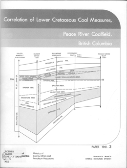
P. Mc, L.D. Duff and R.D. Gilchrist
The 1970's saw the beginning of one of the most ambitious exploration programs ever undertaken in British Columbia when various companies decided to define the coal potential of the northeast part of the province. During a very short period of time an unprecedented number of cored boreholes were drilled in what is now termed the Peace River Coalfield, an area that extends 290 kilometres from the Alberta border to Williston Lake. In addition, rotary holes and geophysical logs of both these and the cored holes have provided a wealth of new information on the Lower Cretaceous rocks containing the coal.
In 1975 the Geological Division of the British Columbia Ministry of Mines and Petroleum Resources decided that an attempt should be made to collate this information in order to: (a) summarize the improvement in our knowledge of the stratigraphy of a structurally complex and poorly exposed area, (b) provide a useful framework for further exploration work, (c) assist in the meaningful assessment of coal resources and reserves, and (d) add to the sum of geological knowledge of the area and point to important areas of geological research.
As a preliminary to such studies it was decided to expand the petroleum core storage facility at Charlie Lake near Fort St. John, so as to be able to accept cores from coal exploration holes as well. There, the cores are available, under suitable restrictions, for examination by geologists. This publication presents progress on the efforts made between 1975 and 1978 to improve methods of correlation in the coalfield and to amplify the excellent stratigraphic framework established by Stott (1968) which expedited coalfield exploration.
Coal-bearing portions of the succession formed in alluvial-deltaic environments. Lateral facies changes in both the coal seams and the associated sedimentary rocks are the norm. Consequently, correlation is difficult, particularly in structurally complex areas. Early correlation attempts with a heavy reliance on geophysical logs often proved unsatisfactory. In some areas it was decided that coal seams were simply a series of disconnected lenses; in other areas correlations of individual beds were 'forced' because lateral continuity was assumed. As in most geological situations neither extreme is correct. To establish the detailed stratigraphy on any property thorough examination of drill core is essential and much information may be missed if the core is examined hastily or if the importance of certain sedimentary features is not recognized.
The correlation charts presented in this publication are a first attempt at an overview of the stratigraphy of the coalfield. The detailed logs show geophysical and geological features which are presently considered to be the most significant aids to correlation from the point of view of the exploration geologist. As in coal-bearing sequences of other ages in other countries, macrofossils, as well as the normal rock types, and sedimentary and other structures in the cores, play an essential part in correlation. In addition, recognition of volcanic ash horizons provide valuable stratigraphic markers and it is hoped that this publication will stimulate the search for them by geologists in the field. In due course, detailed palynological, paleobotanical, paleontological, geochemical, mineralogical, and other studies will undoubtedly modify details of the stratigraphy presented here.
The Carbon Creek basin originally was included in this study. A number of cores from it were examined but the macrofauna found were generally fresh with some brackish water nonmarine species. The stratigraphy was a problem because no Gething/Moosebar contact was found in the basin and there were no satisfactory Cadomin rocks. We have not included the Carbon Creek basin in our interpretations but we have given the fossil list for the holes examined in Appendix I as a reference for future workers.
Inspection and Engineering Branch, Ministry of Energy, Mines and Petroleum Resources
The purpose of this manual is designed primarily to give training in basic rescue procedures to be applied following accidents at surface mining operations bearing in consideration the existing physical conditions such as location, additional hazards, and weather. Also the course provides a limited amount of instruction in safe operational procedures for certain circumstances where the information was not readily available from other sources. This instruction is intended only to supplement the safe job instructional training provided by management.
This paper includes the following articles:
- Inco Oxygen Flash Smelting of Copper Concentrates by T.N. Antonioni, T.C. Burnett and C.M. Diaz
- The Noranda Process by G.D. Hallett
- Recent Operation of Mitsubishi Continuous Copper Smelter at Naoshima by T. Suzuki
- The Outokumpu Flash Smelting Method by K. Murden and J. Sulanto
- Application of the Sherritt-Cominco Copper Process to British Columbia Copper Concentrates by P. Kawulka and C.R. Kirby
- High Efficiency System for Pyrometallurgical Recovery of High-Grade Copper Matte from Sulphide Concentrate by D.dA. Mackie, P. Paschen and G. Melcher
- Top Blown Rotary Converter (TBRC trademark)Process for Non-Ferrous Smelting, Q-S Oxygen Process, Oxygen Sprinkle Process by R. A. Daniele
- Overview of Copper Extraction Technology for British Columbia by W.J.S. Craigen
1980
Sutherland Brown, A., 1980. Geological Fieldwork 1979: A Summary of Field Activities and Current Research. In: Geological Fieldwork 1979, British Columbia Ministry of Energy, Mines and Petroleum Resources, British Columbia Geological Survey Paper 1980-01, pp. 1-8.
Church, B.N., 1980. A Survey of Cenozoic Magnetostratigraphy in South-Central British Columbia. In: Geological Fieldwork 1979, British Columbia Ministry of Energy, Mines and Petroleum Resources, British Columbia Geological Survey Paper 1980-01, pp. 9-10.
Church, B.N., 1980. Anomalous Uranium in the Summerland Caldera. In: Geological Fieldwork 1979, British Columbia Ministry of Energy, Mines and Petroleum Resources, British Columbia Geological Survey Paper 1980-01, pp. 11-15.
Höy, T., 1980. Purcell Project. In: Geological Fieldwork 1979, British Columbia Ministry of Energy, Mines and Petroleum Resources, British Columbia Geological Survey Paper 1980-01, pp. 16.
Höy, T., 1980. Geology of the Bews Creek Area, Southwest Margin of Frenchman Cap Gneiss Dome. In: Geological Fieldwork 1979, British Columbia Ministry of Energy, Mines and Petroleum Resources, British Columbia Geological Survey Paper 1980-01, pp. 17-22.
Höy, T., 1980. CK Prospect, Shuswap Metamorphic Complex. In: Geological Fieldwork 1979, British Columbia Ministry of Energy, Mines and Petroleum Resources, British Columbia Geological Survey Paper 1980-01, pp. 23-27.
Preto, V.A.G., McLaren, G.P., Schiarizza, P.A., 1980. Barriere Lakes-Adams Plateau Area. In: Geological Fieldwork 1979, British Columbia Ministry of Energy, Mines and Petroleum Resources, British Columbia Geological Survey Paper 1980-01, pp. 28-36.
McMillan, W.J., 1980. CC Prospect, Chu Chua Mountain. In: Geological Fieldwork 1979, British Columbia Ministry of Energy, Mines and Petroleum Resources, British Columbia Geological Survey Paper 1980-01, pp. 37-48.
Eastwood, G.E.P., 1980. Sicker Project- Mount Richards Area. In: Geological Fieldwork 1979, British Columbia Ministry of Energy, Mines and Petroleum Resources, British Columbia Geological Survey Paper 1980-01, pp. 49-51.
Church, B.N., 1980. Exploration for Gold in the Black Dome Mountain Area. In: Geological Fieldwork 1979, British Columbia Ministry of Energy, Mines and Petroleum Resources, British Columbia Geological Survey Paper 1980-01, pp. 52-54.
MacIntyre, D.G., 1980. Driftpile Creek- Akie River Project. In: Geological Fieldwork 1979, British Columbia Ministry of Energy, Mines and Petroleum Resources, British Columbia Geological Survey Paper 1980-01, pp. 55-68.
MacIntyre, D.G., 1980. Cirque Barite-Zinc-Lead-Silver Deposit. In: Geological Fieldwork 1979, British Columbia Ministry of Energy, Mines and Petroleum Resources, British Columbia Geological Survey Paper 1980-01, pp. 69-74.
Christopher, P.A., 1980. Mount Leonard Boss-Surprise Lake Batholith. In: Geological Fieldwork 1979, British Columbia Ministry of Energy, Mines and Petroleum Resources, British Columbia Geological Survey Paper 1980-01, pp. 75-79.
Panteleyev, A., 1980. Cassiar Map-Area. In: Geological Fieldwork 1979, British Columbia Ministry of Energy, Mines and Petroleum Resources, British Columbia Geological Survey Paper 1980-01, pp. 80-88.
Panteleyev, A., 1980. Blue River Geochemical Anomalies. In: Geological Fieldwork 1979, British Columbia Ministry of Energy, Mines and Petroleum Resources, British Columbia Geological Survey Paper 1980-01, pp. 89-90.
Pearson, D.E., Grieve, D.A., 1980. Elk Valley Coalfield. In: Geological Fieldwork 1979, British Columbia Ministry of Energy, Mines and Petroleum Resources, British Columbia Geological Survey Paper 1980-01, pp. 91-96.
Church, B.N., 1980. Hat Creek Bocanne-Buchite. In: Geological Fieldwork 1979, British Columbia Ministry of Energy, Mines and Petroleum Resources, British Columbia Geological Survey Paper 1980-01, pp. 97-100.
Gilchrist, R.D., 1980. Wolverine-Hasler Map-Area. In: Geological Fieldwork 1979, British Columbia Ministry of Energy, Mines and Petroleum Resources, British Columbia Geological Survey Paper 1980-01, pp. 101-102.
Karst, R.H., White, G.V., 1980. Coal Rank Distribution Within the Bluesky-Gething Stratigraphic Horizon of Northeastern British Columbia. In: Geological Fieldwork 1979, British Columbia Ministry of Energy, Mines and Petroleum Resources, British Columbia Geological Survey Paper 1980-01, pp. 103-108.
Hora, Z.D., Sharman, K.J., 1980. Texada Island Limestone. In: Geological Fieldwork 1979, British Columbia Ministry of Energy, Mines and Petroleum Resources, British Columbia Geological Survey Paper 1980-01, pp. 109-112.
Addie, G.G., 1980. DEB (SD 18). In: Geological Fieldwork 1979, British Columbia Ministry of Energy, Mines and Petroleum Resources, British Columbia Geological Survey Paper 1980-01, pp. 113-114.
Grieve, D.A., 1980. Base Metal Deposits in the Libby Pondage Reserve Area. In: Geological Fieldwork 1979, British Columbia Ministry of Energy, Mines and Petroleum Resources, British Columbia Geological Survey Paper 1980-01, pp. 115-117.
White, G.P.E., 1980. F & S, FS. In: Geological Fieldwork 1979, British Columbia Ministry of Energy, Mines and Petroleum Resources, British Columbia Geological Survey Paper 1980-01, pp. 118.
White, G.P.E., 1980. Potential Carbonatite Localities. In: Geological Fieldwork 1979, British Columbia Ministry of Energy, Mines and Petroleum Resources, British Columbia Geological Survey Paper 1980-01, pp. 118-119.
Klein, G.H., 1980. Mosquito Creek. In: Geological Fieldwork 1979, British Columbia Ministry of Energy, Mines and Petroleum Resources, British Columbia Geological Survey Paper 1980-01, pp. 120-122.
Schroeter, T.G., 1980. Capoose Lake. In: Geological Fieldwork 1979, British Columbia Ministry of Energy, Mines and Petroleum Resources, British Columbia Geological Survey Paper 1980-01, pp. 123.
Schroeter, T.G., 1980. Sam Goosly. In: Geological Fieldwork 1979, British Columbia Ministry of Energy, Mines and Petroleum Resources, British Columbia Geological Survey Paper 1980-01, pp. 123-124.
Schroeter, T.G., 1980. Lucky Gold. In: Geological Fieldwork 1979, British Columbia Ministry of Energy, Mines and Petroleum Resources, British Columbia Geological Survey Paper 1980-01, pp. 125.
Schroeter, T.G., 1980. Boya. In: Geological Fieldwork 1979, British Columbia Ministry of Energy, Mines and Petroleum Resources, British Columbia Geological Survey Paper 1980-01, pp. 126.
Schroeter, T.G., 1980. Star 9. In: Geological Fieldwork 1979, British Columbia Ministry of Energy, Mines and Petroleum Resources, British Columbia Geological Survey Paper 1980-01, pp. 127.
Schroeter, T.G., 1980. Table Mountain. In: Geological Fieldwork 1979, British Columbia Ministry of Energy, Mines and Petroleum Resources, British Columbia Geological Survey Paper 1980-01, pp. 128.
Schroeter, T.G., 1980. Mount Reed. In: Geological Fieldwork 1979, British Columbia Ministry of Energy, Mines and Petroleum Resources, British Columbia Geological Survey Paper 1980-01, pp. 129-130.
Sinclair, A.J., Fletcher, W.K., 1980. Evaluation Procedure for Geochemical Data, Uranium Reconnaissance Program. In: Geological Fieldwork 1979, British Columbia Ministry of Energy, Mines and Petroleum Resources, British Columbia Geological Survey Paper 1980-01, pp. 131-142.
Sinclair, A.J., Miller, J.H.L., Carter, N.C., 1980. Surface Lithogeochemistry, Northair Mine. In: Geological Fieldwork 1979, British Columbia Ministry of Energy, Mines and Petroleum Resources, British Columbia Geological Survey Paper 1980-01, pp. 143-150.
Greenwood, H.J., Ross, J.V., Klepacki, D., Getsinger, J., 1980. Cariboo Mountains Project. In: Geological Fieldwork 1979, British Columbia Ministry of Energy, Mines and Petroleum Resources, British Columbia Geological Survey Paper 1980-01, pp. 151-156.
Wong, R.H., Godwin, C.I., 1980. K/AR Age Determinations, Wrede Creek Zoned Ultramafic Complex. In: Geological Fieldwork 1979, British Columbia Ministry of Energy, Mines and Petroleum Resources, British Columbia Geological Survey Paper 1980-01, pp. 157-158.
Champigny, N., Sinclair, A.J., 1980. Progress Report on the Geology of the Specogna (Babe) Gold Deposit. In: Geological Fieldwork 1979, British Columbia Ministry of Energy, Mines and Petroleum Resources, British Columbia Geological Survey Paper 1980-01, pp. 159-170.
Godwin, C.I., Sinclair, A.J., Ryan, B.D., 1980. Preliminary Interpretation of Lead Isotopes in Galena-Lead from British Columbia Mineral Deposits. In: Geological Fieldwork 1979, British Columbia Ministry of Energy, Mines and Petroleum Resources, British Columbia Geological Survey Paper 1980-01, pp. 171-182.
Read, P.B., Thompson, R.I., 1980. Geology of the Alkolkolex River Area, an Addendum. In: Geological Fieldwork 1979, British Columbia Ministry of Energy, Mines and Petroleum Resources, British Columbia Geological Survey Paper 1980-01, pp. 183-188.
Carter, N.C., Kalnins, T.E., 1980. Regional Geochemical Survey. In: Geological Fieldwork 1979, British Columbia Ministry of Energy, Mines and Petroleum Resources, British Columbia Geological Survey Paper 1980-01, pp. 189.
J. Clancy and J. Tyhurst
This paper includes the following articles:
- Introduction
- International Sources of Supply
- BC Sources of Supply
- Market Structure, Prices and Projections
- Further Processing
Inspection and Engineering Division, Mineral Resources Branch, Ministry of Energy, Mines and Petroleum Resources
This paper includes the following articles:
- Organizational Outline of Ministry of Energy, Mines and Petroleum Resources and of the Inspection and Engineering Division
- Legislative Framework - General Description
- Legislative Framework - Exploration
- Regulatory Process - Exploration
Inspection and Engineering Division, Mineral Resources Branch, Ministry of Energy, Mines and Petroleum Resources
This paper includes the following articles:
- From Exploration to Producing Mine
- Legislative Framework - as it applies to Producing Mines
- Regulatory Process - Mining
Inspection and Engineering Division, Mineral Resources Branch, Ministry of Energy, Mines and Petroleum Resources
This paper includes the following articles:
- From Exploration to Producing Mine
- Legislative Framework as it Applies to Producing Mines
- Additional Considerations Related to Milling
- Enforcement
Inspection and Engineering Division, Mineral Resources Branch, Ministry of Energy, Mines and Petroleum Resources
This paper includes the following articles:
- Legislative Base
- Tailings
- Waste Rock and Overburden
- Waste Disposal in Uranium Mining
Inspection and Engineering Division, Mineral Resources Branch, Ministry of Energy, Mines and Petroleum Resources
This paper includes the following articles:
- Environmental Protection
- Reclamation
Inspection and Engineering Division, Mineral Resources Branch, Ministry of Energy, Mines and Petroleum Resources
- Mine Safety Administration in British Columbia
- Environmental Control Section - Formation and Development
- Duties and Responsibilities of Environmental Control Inspectors
- Monitoring Methods and Equipment - Environmental Control
- Dust Control in Metal, Coal and Asbestos Mines
- Inspection Methods
- Mining Operations - Radiation Surveys
- Hearing Conservation Program
- Threshold Limit Values and their Application
- Special Studies
- Uranium Exploration Sites - Surveys
Z.D. Hora and F.C. Basham
Sponsored by Technical and Research Committee on Reclamation, British Columbia Ministry of Energy, Mines and Petroleum Resources and the Mining Association of British Columbia
This paper includes the following articles:
- Properties of Soils and their Implications in the Reclamation of Lands Disturbed by Mining by Paul A. Christie, Talisman Land Resource Consultants
- Assessment of Mine Spoil for the Establishment of Vegetation by S.E. Ames, Department of Soil Science, UBC and Talisman Land Resource Consultants
- Fertilizers and Soil Amendments in Mine Reclamation by A.A. Bomke, Department of Soil Sciences, UBC
- Stability and Economic Considerations in Dump Development by D. Campbell, Golder Associates
- Water Quality and its Control in Mining Areas by H. Howie, Waste Management Branch, Ministry of Environment
- Waste Dump Development at Kaiser Resources Ltd., Ricci Berdusco, Kaiser Resources Ltd., C. Pelletier, Utah Mines Ltd.
- Environmental and Engineering Considerations for Waste Dump Designs at the Fording River Operation by D.P. Lane, Fording Coal Ltd.
- Irrigation Equipment and Design of Irrigation Systems by Ted Van der Gulik, Ministry of Agriculture
- Use of Agronomic Species in Mine Land Reclamation by A. Richardson, Richardsons Seeds
- Use of Native Species in Mine Land Reclamation by V.C. Brink, UBC
- Propagation of Native Trees and Shrubs for Reclamation Use by D. Christie, Reid, Collins & Associates

