BC Digital Geology
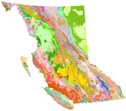
The Survey maintains and delivers province-wide digital coverage of British Columbia's bedrock geology.

The British Columbia Geological Survey offers province-wide integrated digital coverage of bedrock geology, including all details from compilation of field mapping at scales from 1:50,000 to 1:250,000. The BC bedrock geology continuously integrates new regional compilation.
The BC bedrock geology is standardized with consistent stratigraphic code, age and lithology to enable computations. Customized bedrock geological maps and legend can be explored and data downloaded as KML with spatial and non-spatial queries via MapPlace 2, the Survey’s geospatial web services.
The current version of BC bedrock geology is ‘2019-12-19’. Details on updates are provided in the read me notes below. The BC digital geology is available for download under the British Columbia Open Government Licence. The package in the latest data release contains: digital geology in GeoPackage or Esri shapefile format; QGIS or Esri style file for bedrock unit colours, Truetype font for BCGS stratigraphic age symbols, and an image file to illustrate the recommended colour theme for the bedrock polygons.
Read notes on the BC digital geology updates
Download BC digital geology in shapefile (ZIP)
Download BC digital geology in GeoPackage (ZIP)
View Open File 2017-08 for more details on the data release
Recommended citation to use BC digital geology:
Cui, Y., Miller, D., Schiarizza, P., and Diakow, L.J., 2017. British Columbia digital geology. British Columbia Ministry of Energy, Mines and Petroleum Resources, British Columbia Geological Survey Open File 2017-8, 9p. Data version 2019-12-19.
For more information contact: Yao Cui, Director Resource Information Section
Cui, Y., 2021. A geospatial frame data model to simplify digital map compilation and integration. British Columbia Ministry of Energy, Mines and Low Carbon Innovation, British Columbia Geological Survey Paper 2021-03, 20p.
Cui, Y., Hickin, A. S., Schiarizza, P., Miller, D., Nixon, G.T., Nelson, J.L., and Ferri, F., 2018. Methods to update the digital geology of British Columbia and synopses of recently integrated mapping programs. In: Geological Fieldwork 2017, British Columbia Ministry of Energy, Mines and Petroleum Resources, British Columbia Geological Survey Paper 2018-1, pp. 197-215.
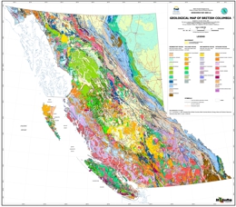
Erdmer, P., and Cui, Y., 2009. Geological Map of British Columbia. British Columbia Ministry of Energy, Mines and Petroleum Resources, British Columbia Geological Survey Geoscience Map 2009-01, 1:1,500,000.


