Till geochemistry
Till geochemistry surveys are targeted at regions of high mineral potential where glacial sediments cover and obscure the underlying bedrock. These surveys are conducted in conjunction with surficial geology mapping.
Till geochemical anomalies identify areas where glaciers eroded mineralized bedrock and redeposited the mineral debris in down-ice dispersal trains. As glacial dispersal trains may be hundreds to thousands of times larger in area than their original bedrock source, they provide a cost effective target for mineral exploration programs in drift-covered terrains. In addition, tills as 'first-derivative' products of bedrock are more readily traced to source than higher order derivatives such as glaciofluvial or glaciolacustrine sediments. Even so, geochemical exploration programs in drift-covered regions must rely on an understanding of glacial processes and the glacial history of the area, especially where the dispersal train may be diffuse or irregularly shaped.
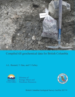
Compiled till geochemical data for British Columbia

A. L. Bustard, T. Han, and T. Ferbey
The complete data set of publicly available, regional-scale, till geochemical surveys carried out in British Columbia by the British Columbia Geological Survey, the Geological Survey of Canada, and Geoscience BC compiles 39 reports released between 1992 and 2017, and includes geochemical data for 10,454 samples. Five Microsoft Excel tables generated from this database provide analytical determinations for the clay (<2 µm) and silt plus clay (<63 µm) size fractions of tills by inductively coupled plasma mass spectrometry after an aqua regia or modified aqua regia digestion, after a lithium fusion, and by instrumental neutron activation. These data tables can be brought into GIS software and integrated with other geoscience data to generate new exploration targets and design follow-up exploration programs.
Recommended citation: Bustard, A. L., Han, T., and Ferbey, T., 2017. Compiled till geochemical data for British Columbia. British Columbia Ministry of Energy, Mines and Petroleum Resources, British Columbia Geological Survey GeoFile 2017-09, 7p.
The current version is downloadable here.
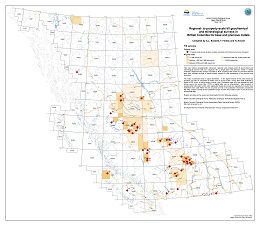
An index of base and precious metal regional- to property-scale subglacial till geochemical and mineralogical surveys in British Columbia

A.L. Bustard and T. Ferbey
Released in PDF, ESRI Map Package, Shapefile, File Geodatabase, and KMZ formats, Open File 2019-04 indexes geographically referenced, regional- and property-scale subglacial till geochemical and mineralogical surveys targeting base and precious metals in British Columbia. It also lists topical studies relevant to drift prospecting in the province and elsewhere. Original source reports can be downloaded using the URLs provided, as can publications that use the data, such as compilations. The digital versions of the index enable advanced searches using fields such as author, source type (digital or PDF), or source.
Recommended citation: Bustard, A.L., Ferbey, T., and Arnold, H., 2019. Regional- to property-scale till geochemical and mineralogical surveys in British Columbia for base and precious metals. British Columbia Ministry of Energy and Mines and Petroleum Resources, British Columbia Geological Survey Open File 2019-04 version 2020-01.
The current version (v.2020-01 updated January 2020) is downloadable here.
Indicator Minerals in Till and Stream Sediments of the Canadian Cordillera

Ferbey, T., Plouffe, A., and Hickin, A.S. (Editors) 2017. Indicator minerals in till and stream sediments of the Canadian Cordillera. Geological Association of Canada Special Paper Volume 50, and Mineralogical Association of Canada Topics in Mineral Sciences Volume 47, 243 p.
It is available for purchase from the Geological Association of Canada or the Mineralogical Association of Canada.
Contents:
- Hickin, A.S., Ward, B.C., Plouffe, A., and Nelson, J., 2017. Introduction to the geology, physiography, and glacial history of the Canadian Cordillera in British Columbia and Yukon, pp. 1-25.
- Hickin, A.S., and Plouffe, A., 2017. Sampling and interpreting stream, lake, and glacial sediments for mineral exploration in the Canadian Cordillera, a review, pp. 27-51.
- Lett, R., and Rukhlov, A.S., 2017. A review of analytical methods for regional geochemical survey (RGS) programs in the Canadian Cordillera, pp. 53-108.
- Lian, O.B., and Hickin, A.S., 2017. Origin and character of till and other diamictons and their applicability to mineral prospecting, pp. 109-127.
- Plouffe, A., and Ferbey, T., 2017. Porphyry Cu indicator minerals in till: A method to discover buried mineralization, pp. 129-159.
- Canil, D., Pisiak, L., Lacourse, T., Plouffe, A., Ferbey, T., and Grondahl, C., 2017. Magnetite as an indicator mineral in porphyry Cu±Au±Mo deposits of British Columbia, Canada, pp. 161-174.
- Simandl, G.J., Mackay, D.A.R., Ma, X., Luck, P., Gravel, J., and Akam, C., 2017. The direct indicator mineral concept and QEMSCAN® applied to exploration for carbonatite and carbonatite-related ore deposits, pp. 175-190.
- Mao, M., Rukhlov, A.S., Rowins, S.M., Hickin, A.S., Ferbey, T., Bustard, A., Spence, J., and Coogan, L.A., 2017. A novel approach using detrital apatite and till geochemistry to identify covered mineralization in the TREK area of the Nechako Plateau, British Columbia, pp. 191-243.
