Information Circulars
Information Circulars provide accessible geoscience information to a broad audience in government, industry, and the general public. Included in the Information Circular series is the annual Provincial Overview of Exploration and Mining in British Columbia.
Jump to:
2025 |2024 | 2023 | 2022 | 2021 | 2020 | 2019 | 2018 | 2017 | 2016 | 2015 | 2014 | 2013 | 2012 | 2011 | 2010 | 2009 | 2008 | 2007 | 2006 | 2005 | 2004 | 2003 | 2002 | 2001 | 2000 | 1999 | 1998 | 1997 | 1996 | 1995 | 1994 | 1993 | 1992 | 1991 | 1990 | 1989 | 1988 | 1987 | 1986 | 1985 | 1984
2025
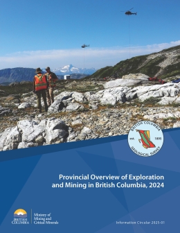
Clarke, G., Northcote, B.K., Corcoran, N.L., Pothorin, C., Heidarian, H., and Hancock, K.
This volume is the latest in a series of annual reviews that dates back to 1874, when the first Annual Report of the Minister of Mines was published. To prepare the details in the district chapters, the Regional Geologists visit project sites to view outcrops and drill core and to discuss results and progress. A significant amount of information is gleaned from corporate press releases, websites and reports. Exploration expenditures, drilling estimates and other metrics for British Columbia were captured in the British Columbia Mineral and Coal Exploration Survey. The survey is a joint initiative between the Province of British Columbia Ministry of Mining and Critical Minerals, the Association for Mineral Exploration, and EY LLP. The forecasted total value of mining production is $16.5 billion, close to the revised estimate for 2023. Exploration expenditures decreased from $643.5 million in 2023 to $552.1 million in 2024, consistent with global downward trends but not with Canada’s other top exploration jurisdictions of Ontario and Quebec.
Clarke, G., Northcote, B.K., Corcoran, N.L., Pothorin, C., Heidarian, H., and Hancock, K., 2025. Exploration and Mining in British Columbia, 2024: A summary. In: Provincial Overview of Exploration and Mining in British Columbia, 2024, British Columbia Ministry of Mining and Critical Minerals, British Columbia Geological Survey Information Circular 2025-01, pp. 1-60. (PDF)
Corcoran, N., 2025. Exploration and mining in the Northwest Region, British Columbia. In: Provincial Overview of Exploration and Mining in British Columbia, 2024. British Columbia Ministry of Mining and Critical Minerals, British Columbia Geological Survey Information Circular 2025-01, pp. 61-91. (PDF)
Heidarian, H., 2025. Exploration and mining in the North Central and Northeast regions, British Columbia. In: Provincial Overview of Exploration and Mining in British Columbia, 2024. British Columbia Ministry of Mining and Critical Minerals, British Columbia Geological Survey Information Circular 2025-01, pp. 93-113. (PDF)
Pothorin, C., 2025. Exploration and mining in the South Central Region, British Columbia. In: Provincial Overview of Exploration and Mining in British Columbia, 2024. British Columbia Ministry of Mining and Critical Minerals, British Columbia Geological Survey Information Circular 2025-01, pp. 115-143. (PDF)
Hancock, K., 2025. Exploration and mining in the Southeast Region, British Columbia. In: Provincial Overview of Exploration and Mining in British Columbia, 2024. British Columbia Ministry of Mining and Critical Minerals, British Columbia Geological Survey Information Circular 2025-01, pp. 145-156. (PDF)
Northcote, B.K., 2025. Exploration and mining in the Southwest Region, British Columbia. In: Provincial Overview of Exploration and Mining in British Columbia, 2024. British Columbia Ministry of Mining and Critical Minerals, British Columbia Geological Survey Information Circular 2025-01, pp. 157-170. (PDF)
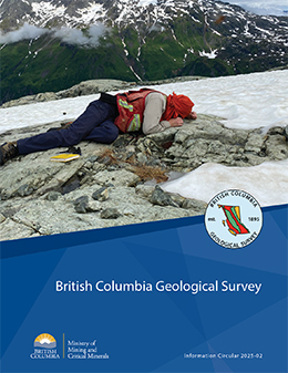
Information Circular 2025-02 summarizes the mission and activities of the British Columbia Geological Survey.
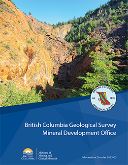
Information Circular 2025-03 summarizes the mission and activities of the British Columbia Geological Survey Mineral Development Office.
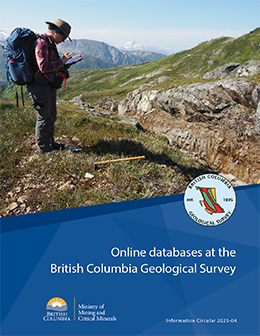
Information Circular 2025-04 describes the databases housed by the British Columbia Geological Survey and how these databases can be used.
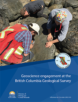
Information Circular 2025-05 describes the geoscience engagement program at the British Columbia Geological Survey
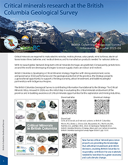
Critical minerals are required to make electric vehicles, mobile phones, solar panels, wind turbines, electrical transmission lines, batteries, and medical devices, and to manufacture products needed for national defence. With increased global demand, long-term critical minerals shortages are predicted. Consequently, jurisdictions around the world are developing strategies to ensure supply chains are robust and resilient.
Information Circular 2025-08 details the British Columbia Geological Survey publications from 2020 to 2024
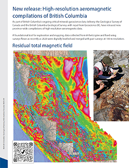
As part of British Columbia’s ongoing critical minerals geoscience data delivery, the Geological Survey of Canada and the British Columbia Geological Survey, with input from Geoscience BC, have released new province-wide compilations of high-resolution aeromagnetic data. A foundational tool for exploration and mapping, data collected from 69 helicopter and fixed-wing surveys flown as recently as 2020 were digitally levelled and merged with past surveys at 100 m resolution.
2024
Clarke, G., Northcote, B.K., Corcoran, N.L., Pothorin, C., Heidarian, H., and Hancock, K.
This volume is the latest in a series of annual reviews that dates back to 1874, when the first Annual Report of the Minister of Mines was published. To prepare the details in the district chapters, the Regional Geologists visit project sites to view outcrops and drill core and to discuss results and progress. A significant amount of information is gleaned from corporate press releases, websites, and reports. Exploration expenditures, drilling estimates, and other metrics were captured in the British Columbia Mineral and Coal Exploration Survey. The survey is a joint initiative between the Ministry of Energy, Mines and Low Carbon Innovation, the Association for Mineral Exploration, and EY LLP. Provincial mining production by value was down compared to 2022, mostly due to lower average coal prices. The forecasted value of total provincial mining for 2023 is $15.9 billion. The year started with significant exploration financing in place but, while robust, the total estimated exploration expenditure of $643.5 million is less than the record set in 2022.
Clarke, G., Northcote, B.K., Corcoran, N.L., Pothorin, C., Heidarian, H., and Hancock, K., 2024. Exploration and Mining in British Columbia, 2023: A summary. In: Provincial Overview of Exploration and Mining in British Columbia, 2023. British Columbia Ministry of Energy, Mines and Low Carbon Innovation, British Columbia Geological Survey Information Circular 2024-01, pp. 1-53. (PDF)
Corcoran, N.L., 2024. Exploration and mining in the Northwest Region, British Columbia. In: Provincial Overview of Exploration and Mining in British Columbia, 2023. British Columbia Ministry of Energy, Mines and Low Carbon Innovation, British Columbia Geological Survey Information Circular 2024-01, pp 55-83. (PDF)
Heidarian, H., 2024. Exploration and mining in the North Central and Northeast regions, British Columbia. In: Provincial Overview of Exploration and Mining in British Columbia, 2023. British Columbia Ministry of Energy, Mines and Low Carbon Innovation, British Columbia Geological Survey Information Circular 2024-01, pp. 85-102. (PDF)
Pothorin, C., 2024. Exploration and mining in the South Central Region, British Columbia. In: Provincial Overview of Exploration and Mining in British Columbia, 2023. British Columbia Ministry of Energy, Mines and Low Carbon Innovation, British Columbia Geological Survey Information Circular 2024-01, pp.103-124. (PDF)
Hancock, K., 2024. Exploration and mining in the Southeast Region, British Columbia. In: Provincial Overview of Exploration and Mining in British Columbia, 2023. British Columbia Ministry of Energy, Mines and Low Carbon Innovation, British Columbia Geological Survey Information Circular 2024-01, pp. 125-135. (PDF)
Northcote, B.K., 2024. Exploration and mining in the Southwest Region, British Columbia. In: Provincial Overview of Exploration and Mining in British Columbia, 2023. British Columbia Ministry of Energy, Mines and Low Carbon Innovation, British Columbia Geological Survey Information Circular 2024-01, pp. 137-149. (PDF)
Information Circular 2024-02 summarizes the mission and activities of the British Columbia Geological Survey.
Information Circular 2024-03 summarizes the mission and activities of the British Columbia Geological Survey Mineral Development Office.
Information Circular 2024-04 describes the databases housed by the British Columbia Geological Survey and how these databases can be used.
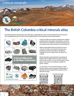
Mining is essential to produce the commodities needed to combat climate change. Low-carbon technologies need critical minerals to produce electric vehicles, mobile phones, solar panels, wind turbines, electrical transmission lines, batteries, and medical devices, and to manufacture products for national defense. Because of global demands, many of these critical minerals are predicted to see shortages, and British Columbia is faced with a generational opportunity for mining that will not only contribute to a low-carbon future but generate significant economic and societal benefits.
2023
Clarke, G., Northcote, B., Corcoran, N.L., Heidarian, H., and Hancock, K.
This volume is the latest in a series of annual reviews that dates back to 1874, when the first Annual Report of the Minister of Mines was published. Detailing significant projects region-by-region. To prepare the district chapters in this volume, the Regional Geologists visit project sites to view outcrops and drill core and to discuss results and progress. A significant amount of information is gleaned from corporate press releases, websites and reports. While Covid continued to cause minor interruptions, 2022 did not have the significant forest fire and flooding disruptions of 2021. Provincial mining production reached a new high due to continued high coal prices. The year started with significant exploration financing in place and exploration expenditures improved for the third year in a row, reaching a new record level. The forecasted value of total provincial mining production reached an all-time high of $18.2 billion, and total exploration expenditures reached a record of $740.4 million.
Clarke, G., Northcote, B., Corcoran, N.L., Heidarian, H., and Hancock, K., 2023. Exploration and Mining in British Columbia, 2022: A summary. In: Provincial Overview of Exploration and Mining in British Columbia, 2022, British Columbia Ministry of Energy, Mines and Low Carbon Innovation, British Columbia Geological Survey Information Circular 2023-01, pp. 1-48. (PDF, 15 MB)
Corcoran, N., 2023. Exploration and mining in the Northwest Region, British Columbia. In: Provincial Overview of Exploration and Mining in British Columbia, 2022. British Columbia Ministry of Energy, Mines and Low Carbon Innovation, British Columbia Geological Survey Information Circular 2023-01, pp. 49-76. (PDF,14 MB)
Heidarian, H., 2023. Exploration and mining in the North Central and Northeast regions, British Columbia. In: Provincial Overview of Exploration and Mining in British Columbia, 2022. British Columbia Ministry of Energy, Mines and Low Carbon Innovation, British Columbia Geological Survey Information Circular 2023-01, pp. 77-92. (PDF,15 MB)
Northcote, B., 2023. Exploration and mining in the South Central Region, British Columbia. In: Provincial Overview of Exploration and Mining in British Columbia, 2022. British Columbia Ministry of Energy, Mines and Low Carbon Innovation, British Columbia Geological Survey, Information Circular 2023-01, pp. 93-113. (PDF,13 MB)
Hancock, K., 2023. Exploration and mining in the Southeast Region, British Columbia. In: Provincial Overview of Exploration and Mining in British Columbia, 2022. British Columbia Ministry of Energy, Mines and Low Carbon Innovation, British Columbia Geological Survey, Information Circular 2023-01, pp. 115-128. (PDF,8 MB)
Northcote, B., 2023. Exploration and mining in the Southwest Region, British Columbia. In: Provincial Overview of Exploration and Mining in British Columbia, 2022. British Columbia Ministry of Energy, Mines and Low Carbon Innovation, British Columbia Geological Survey, Information Circular 2023-01, pp. 129-142. (PDF,16 MB)
Information Circular 2023-02 summarizes the mission and activities of the British Columbia Geological Survey.
Information Circular 2023-03 summarizes the mission and activities of the British Columbia Geological Survey Mineral Development Office.
Information Circular 2023-04 describes the databases housed by the British Columbia Geological Survey and how these databases can be used.
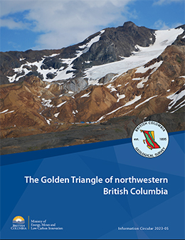
The Golden Triangle is the popular name for a loosely defined area of northwestern British Columbia that includes significant gold, silver, and copper deposits. Most deposits are in west-central Stikinia, a long-lived oceanic arc terrane that extends for about 1000 km along the length of the Canadian Cordillera. These deposits developed during terrane accretion and post-accretion deformation and magmatism, and most are related to the Hazelton Group and affiliated intrusions. More than 150 mines have operated in the region since prospectors first arrived near the end of the 19th century. Important past-producing mines include Granduc, Eskay Creek, Anyox, Kitsault, Premier/Dilworth, Dolly Varden, and Snip. Exploration continues at Eskay Creek, Premier/Dilworth, Dolly Varden (Kitsault Valley), Snip, and Scottie Gold mine. The Brucejack and Red Chris mines operate today, the Premier mine is under construction with an early 2024 production target,and several mines are being proposed (Galore Creek, KSM, Red Mountain).
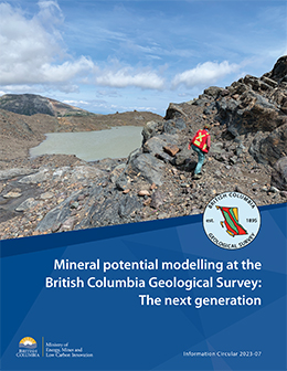
Land-use decisions and co-management of natural resources need high-quality information. As one component of land-use planning, mineral potential modelling uses many different types of geologic data to identify areas favourable for mineral deposits. Advancing British Columbia Survey work carried out in the 1990s, modernized modelling is identifying areas of high prospectivity for key mineral systems. A multi-year Survey project, this new modelling will assist land-use conversations between multiple parties having diverse interests.
2022

Clarke, G., Northcote, B., Corcoran, N.L., and Hancock, K.
This volume is the latest in a series of annual reviews that dates back to 1874, when the first Annual Report of the Minister of Mines was published. Detailing significant projects region-by-region, the volume complements the British Columbia Coal Industry Overview (British Columbia Geological Survey Information Circular 2021-02). To prepare the district chapters in this volume, the Regional Geologists visit project sites to view outcrops and drill core and to discuss results and progress. A significant amount of information is gleaned from corporate press releases, websites and reports.
Clarke, G., Northcote, B., Corcoran, N.L., and Hancock, K., 2022. Exploration and Mining in British Columbia, 2021: A summary. In: Provincial Overview of Exploration and Mining in British Columbia, 2021. British Columbia Ministry of Energy, Mines and Low Carbon Innovation, British Columbia Geological Survey, Information Circular 2022-01, pp. 1-42. (PDF, 5 MB)
Clarke, G., 2022. Exploration and mining in the Northwest Region, British Columbia. In: Provincial Overview of Exploration and Mining in British Columbia, 2021. British Columbia Ministry of Energy, Mines and Low Carbon Innovation, British Columbia Geological Survey, Information Circular 2022-01, pp. 43-65. (PDF, 4 MB)
Corcoran, N.L., 2022. Exploration and mining in the North Central and Northeast regions, British Columbia. In: Provincial Overview of Exploration and Mining in British Columbia, 2021. British Columbia Ministry of Energy, Mines and Low Carbon Innovation, British Columbia Geological Survey, Information Circular 2022-01, pp. 67-83. (PDF, 8 MB)
Northcote, B., 2022. Exploration and mining in the South Central Region, British Columbia. In: Provincial Overview of Exploration and Mining in British Columbia, 2021. British Columbia Ministry of Energy, Mines and Low Carbon Innovation, British Columbia Geological Survey, Information Circular 2022-01, pp. 85-104. (PDF, 4 MB)
Hancock, K., 2022. Exploration and mining in the Southeast Region, British Columbia. In: Provincial Overview of Exploration and Mining in British Columbia, 2021. British Columbia Ministry of Energy, Mines and Low Carbon Innovation, British Columbia Geological Survey, Information Circular 2022-01, pp. 105-116. (PDF, 4 MB)
Northcote, B., 2022. Exploration and mining in the Southwest Region, British Columbia. In: Provincial Overview of Exploration and Mining in British Columbia, 2021. British Columbia Ministry of Energy, Mines and Low Carbon Innovation, British Columbia Geological Survey, Information Circular 2022-01, pp. 117-129. (PDF, 4 MB)
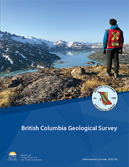
Information Circular 2022-02 summarizes the mission and activities of the British Columbia Geological Survey.
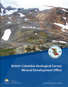
Information Circular 2022-03 summarizes the mission and activities of the British Columbia Geological Survey Mineral Development Office.
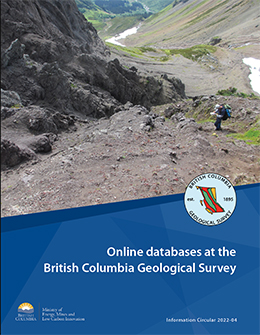
Information Circular 2022-04 describes the databases housed by the British Columbia Geological Survey and how these databases can be used.
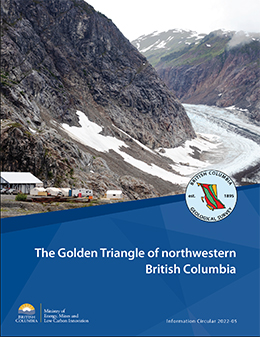
The Golden Triangle is the popular name for a loosely defined area of northwestern British Columbia that includes significant gold, silver, and copper deposits. Most deposits are in west-central Stikinia, a long-lived oceanic arc terrane that extends for about 1000 km along the length of the Canadian Cordillera. These deposits developed during terrane accretion and post-accretion deformation and magmatism, and most are related to the Hazelton Group and affiliated intrusions. More than 150 mines have operated in the region since prospectors first arrived near the end of the 19th century. Important past-producing mines include Granduc, Eskay Creek, Anyox, Kitsault, Premier/Dilworth, Dolly Varden, and Snip. Exploration continues at Eskay Creek, Premier/Dilworth, Dolly Varden, and Snip. Exploration continues at Eskay Creek, Premier/Dilworth, Dolly Varden (Kitsault Valley), Snip, and Scottie Gold Mine. The Brucejack and Red Chris mines operate today, and several mines are being proposed (Galore Creek, Premier, KSM, Red Mountain).
2021
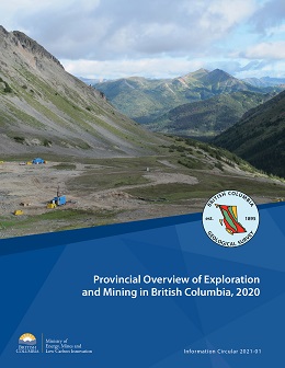
G. Clarke, B. Northcote, F. Katay, and S.P. Tombe
This volume is the latest in a series of annual reviews that dates back to 1874, when the first Annual Report of the Minister of Mines was published. Detailing significant projects region-by-region, the volume complements the British Columbia Coal Industry Overview (British Columbia Geological Survey Information Circular 2021-02). To prepare the district chapters in this volume, the Regional Geologists visit project sites to view outcrops and drill core and to discuss results and progress. A significant amount of information is gleaned from corporate press releases, websites and reports.
Clarke, G., Northcote, B., Katay, F., and Tombe, S.P., 2021. Exploration and Mining in British Columbia, 2020: A summary. In: Provincial Overview of Exploration and Mining in British Columbia, 2020. British Columbia Ministry of Energy, Mines and Low Carbon Innovation, British Columbia Geological Survey, Information Circular 2021-01, pp.1-45. (PDF, 5 MB)
Tombe, S.P., 2021. Exploration and mining in the Northwest Region, British Columbia. In: Provincial Overview of Exploration and Mining in British Columbia, 2020. British Columbia Ministry of Energy, Mines and Low Carbon Innovation, British Columbia Geological Survey, Information Circular 2021-01, pp. 47-64. (PDF, 7.3 MB)
Clarke, G., 2021. Exploration and mining in the North Central and Northeast regions, British Columbia. In: Provincial Overview of Exploration and Mining in British Columbia, 2020. British Columbia Ministry of Energy, Mines and Low Carbon Innovation, British Columbia Geological Survey, Information Circular 2021-01, pp. 65-79. (PDF, 4.2 MB)
Northcote, B., 2021. Exploration and mining in the South Central Region, British Columbia. In: Provincial Overview of Exploration and Mining in British Columbia, 2020. British Columbia Ministry of Energy, Mines and Low Carbon Innovation, British Columbia Geological Survey, Information Circular 2021-01, pp. 81-100. (PDF, 8 MB)
Katay, F., 2021. Exploration and mining in the Southeast Region, British Columbia. In: Provincial Overview of Exploration and Mining in British Columbia, 2020. British Columbia Ministry of Energy, Mines and Low Carbon Innovation, British Columbia Geological Survey, Information Circular 2021-01, pp. 101-119. (PDF, 3.4 MB)
Northcote, B., 2021. Exploration and mining in the Southwest Region, British Columbia. In: Provincial Overview of Exploration and Mining in British Columbia, 2020. British Columbia Ministry of Energy, Mines and Low Carbon Innovation, British Columbia Geological Survey, Information Circular 2021-01, pp. 121-134. (PDF, 11 MB)
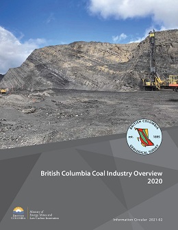
Metallurgical coal prices fluctuated markedly in 2020. Coking coal prices dropped to less than $100/tonne US per tonne because of disruptions caused by the Covid-19 pandemic and global trade tensions. Coal production volumes for British Columbia are forecast to total 25.1 million tonnes, down from 30.0 million tonnes in 2019. Coal remains British Columbia’s most valuable mined commodity with sales forecast at $3.97 billion for 2020, 42.7% of the mining revenue for the province. Coking coal and PCI (pulverized coal injection) products are currently produced from four mines in the Kootenay Mountains in the southeastern part of the province and from three mines in the Peace coalfields in the northeastern part.
Information Circular 2021-03 summarizes the mission and activities of the British Columbia Geological Survey.
Information Circular 2021-04 summarizes the mission and activities of the British Columbia Geological Survey Mineral Development Office.
Information Circular 2021-05 describes the databases housed by the British Columbia Geological Survey and how these databases can be used.
The Golden Triangle is the popular name for a loosely defined area of northwestern British Columbia that includes significant gold, silver, and copper deposits. Most deposits are in west-central Stikinia, a long-lived oceanic arc terrane that extends for about 1000 km along the length of the Canadian Cordillera. These deposits developed during terrane accretion and post-accretion deformation and magmatism, and most are related to the Hazelton Group and affiliated intrusions. More than 150 mines have operated in the region since prospectors first arrived near the end of the 19th century. Important past-producing mines include Granduc, Eskay Creek, Anyox, Kitsault, Premier/Dilworth, Dolly Varden, and Snip. Exploration continues at Eskay Creek, Premier/Dilworth, Dolly Varden, and Snip. The Brucejack and Red Chris mines operate today, and several mines are being proposed (Galore Creek, Premier, KSM, Red Mountain).
2020
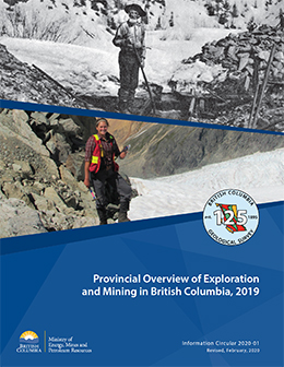
With revised expenditure and drilling estimates, this February 2020 edition supercedes the original volume published in January.
G. Clarke, B. Northcote, F. Katay, and S.P. Tombe
This volume is the latest in a series of annual reviews that dates back to 1874, when the first Annual Report of the Minister of Mines was published. Detailing significant projects region-by-region, the volume complements the British Columbia Coal Industry Overview (British Columbia Geological Survey Information Circular 2020-02). To prepare the district chapters in this volume, the Regional Geologists visit project sites to view outcrops and drill core and to discuss results and progress. A significant amount of information is gleaned from corporate press releases, websites and reports.
Clarke, G., Northcote, B., Katay, F., and Tombe, S.P., 2020. Exploration and Mining in British Columbia, 2019: A summary. In: Provincial Overview of Exploration and Mining in British Columbia, 2019. British Columbia Ministry of Energy, Mines and Petroleum Resources, British Columbia Geological Survey, Information Circular 2020-01, pp.1-40 (revised February 2020). (PDF, 5 MB)
Tombe, S.P., 2020. Exploration and mining in the Northwest Region, British Columbia. In: Provincial Overview of Exploration and Mining in British Columbia, 2019. British Columbia Ministry of Energy, Mines and Petroleum Resources, British Columbia Geological Survey, Information Circular 2020-01, 41-58 (revised February 2020). (PDF, 4 MB)
Clarke, G., 2020. Exploration and mining in the North Central and Northeast regions, British Columbia. In: Provincial Overview of Exploration and Mining in British Columbia, 2019. British Columbia Ministry of Energy, Mines and Petroleum Resources, British Columbia Geological Survey, Information Circular 2020-01, pp. 59-73 (revised February 2020). (PDF, 7.3 MB)
Northcote, B., 2020. Exploration and mining in the South Central Region, British Columbia. In: Provincial Overview of Exploration and Mining in British Columbia, 2019. British Columbia Ministry of Energy, Mines and Petroleum Resources, British Columbia Geological Survey, Information Circular 2020-01, 75-94 (revised February 2020). (PDF, 8 MB)
Katay, F., 2020. Exploration and mining in the Southeast Region, British Columbia. In: Provincial Overview of Exploration and Mining in British Columbia, 2019. British Columbia Ministry of Energy, Mines and Petroleum Resources British Columbia, Geological Survey, Information Circular 2020-01, 95-112 (revised February 2020). (PDF, 6 MB)
Northcote, B., 2020. Exploration and mining in the Southwest Region, British Columbia. In: Provincial Overview of Exploration and Mining in British Columbia, 2019. British Columbia Ministry of Energy, Mines and Petroleum Resources, British Columbia Geological Survey, Information Circular 2020-01, 113-126. (PDF, 4.4 MB)
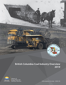
Coal prices weakened in the second half of 2019 after three years of stable and strong prices. Coal production volumes for the province are forecast to total 30.0 million tonnes, down slightly from 31.1 million tonnes in 2018. Coal remains British Columbia’s most valuable mined commodity, with sales of $5.08 billion US this year. Coking coal, PCI (pulverized coal injection) products and small amounts of thermal coal are currently produced from four mines in the Kootenay Mountains in the southeastern part of the province and from three mines in the Peace coalfields in the northeastern. The Quinsam mine on Vancouver Island ceased operations in June, 2019.
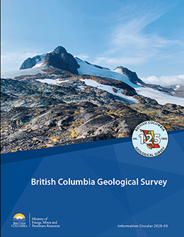
Information Circular 2020-03 summarizes the mission and activities of the British Columbia Geological Survey.
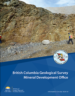
Information Circular 2020-04 summarizes the mission and activities of the British Columbia Geological Survey Mineral Development Office.
Information Circular 2020-05 describes the databases housed by the British Columbia Geological Survey and how these databases can be used.
The Golden Triangle is the popular name for a loosely defined area of northwestern British Columbia that includes significant gold, silver, and copper deposits. Most deposits are in west-central Stikinia, a long-lived oceanic arc terrane that extends for about 1000 km along the length of the Canadian Cordillera. These deposits developed during terrane accretion and post-accretion deformation and magmatism, and most are related to the Hazelton Group and affiliated intrusions. More than 150 mines have operated in the region since prospectors first arrived near the end of the 19th century. Important past-producing mines include Granduc, Eskay Creek, Anyox, Kitsault, Premier/Dilworth, Dolly Varden, and Snip. Exploration continues at Eskay Creek, Premier/Dilworth, Dolly Varden, and Snip. The Brucejack and Red Chris mines operate today, and several mines are being proposed (Galore Creek, Kitsault, KSM, Red Mountain).
2019
G. Clarke, B. Northcote, F. Katay, and J.R. DeGrace
This volume is the latest in a series of annual reviews that dates back to 1874, when the first Annual Report of the Minister of Mines was published. Detailing significant projects region-by-region, the volume complements the British Columbia Coal Industry Overview (British Columbia Geological Survey Information Circular 2019-02). To prepare the district chapters in this volume, the Regional Geologists visit project sites to view outcrops and drill core and to discuss results and progress. A significant amount of information is gleaned from corporate press releases, websites and reports.
Clarke, G., Northcote, B., Katay, F., and DeGrace, J.R., 2019. Exploration and Mining in British Columbia, 2018: A summary. In: Provincial Overview of Exploration and Mining in British Columbia, 2018. British Columbia Ministry of Energy, Mines and Petroleum Resources, British Columbia Geological Survey, Information Circular 2019-01, pp. 1-37. (PDF)
DeGrace, J.R., 2019: Exploration and mining in the North Central and Northeast regions, British Columbia. In: Provincial Overview of Exploration and Mining in British Columbia, 2018. British Columbia Ministry of Energy, Mines and Petroleum Resources, British Columbia Geological Survey, Information Circular 2019-01, pp. 39-56. (PDF)
Katay, F., 2019. Exploration and mining in the Southeast Region, British Columbia. In: Provincial Overview of Exploration and Mining in British Columbia, 2018. British Columbia Ministry of Energy, Mines and Petroleum Resources, British Columbia Geological Survey, Information Circular 2019-01, pp. 57-82. (PDF)
Northcote, B., 2019. Exploration and mining in the South Central Region, British Columbia. In: Provincial Overview of Exploration and Mining in British Columbia, 2018. British Columbia Ministry of Energy, Mines and Petroleum Resources, British Columbia Geological Survey, Information Circular 2019-01, pp. 83-99. (PDF)
Northcote, B., 2019. Exploration and mining in the Southwest Region, British Columbia. In: Provincial Overview of Exploration and Mining in British Columbia, 2018. British Columbia Ministry of Energy, Mines and Petroleum Resources, British Columbia Geological Survey, Information Circular 2019-01, pp. 101-113. (PDF)
Clarke, G., 2019. Exploration and mining in the Northwest Region, British Columbia. In: Provincial Overview of Exploration and Mining in British Columbia, 2018. British Columbia Ministry of Energy, Mines and Petroleum Resources, British Columbia Geological Survey, Information Circular 2019-01, pp. 115-133 (PDF)
Coal prices remained stable and strong for the second consecutive year in 2018. Coal production volumes for the province are forecast to total more than 31 million tonnes. Coal remains British Columbia’s most valuable mined commodity in terms of annual sales. Coking coal and PCI (pulverized coal injection) products are currently produced from four mines in the Kootenay Mountains in the southeastern part of the province, and from three mines in the Peace coalfields in the northeastern part. Thermal coal is produced from the Quinsam mine on Vancouver Island.
2018
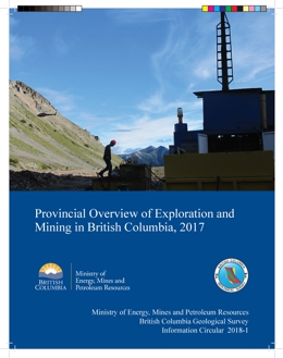
G. Clarke, B. Northcote, F. Katay, and J. DeGrace
Information Circular 2018-1 combines a provincial overview of significant projects with detailed, region-by-region summaries. It is a companion to the British Columbia Coal Industry Overview (British Columbia Geology Survey Information Circular 2018-2) and the map "Operating mines and selected exploration projects in British Columbia, 2017" Open File 2018-01.
Clarke, G., Northcote, B., Katay, F., and DeGrace, J.R., 2018. Exploration and Mining in British Columbia, 2017: A summary. In: Provincial Overview of Exploration and Mining in British Columbia, 2017. British Columbia Ministry of Energy, Mines and Petroleum Resources, British Columbia Geological Survey, Information Circular 2018-01, pp. 1-33. PDF
DeGrace, J.R., 2018: Exploration and mining in the North Central and Northeast regions, British Columbia. In: Provincial Overview of Exploration and Mining in British Columbia, 2017. British Columbia Ministry of Energy, Mines and Petroleum Resources, British Columbia Geological Survey, Information Circular 2018-01, pp. 35-55. PDF
Katay, F., 2018. Exploration and mining in the Southeast Region, British Columbia. In: Provincial Overview of Exploration and Mining in British Columbia, 2017. British Columbia Ministry of Energy, Mines and Petroleum Resources, British Columbia Geological Survey, Information Circular 2018-01, pp. 57-84. PDF
Northcote, B., 2018. Exploration and mining in the South Central Region, British Columbia. In: Provincial Overview of Exploration and Mining in British Columbia, 2017. British Columbia Ministry of Energy, Mines and Petroleum Resources, British Columbia Geological Survey, Information Circular 2018-01, pp. 85-103. PDF
Northcote, B., 2018. Exploration and mining in the Southwest Region, British Columbia. In: Provincial Overview of Exploration and Mining in British Columbia, 2017. British Columbia Ministry of Energy, Mines and Petroleum Resources, British Columbia Geological Survey, Information Circular 2018-01, pp. 105-119. PDF
Clarke, G., 2018. Exploration and mining in the Northwest Region, British Columbia. In: Provincial Overview of Exploration and Mining in British Columbia, 2017. British Columbia Ministry of Energy, Mines and Petroleum Resources, British Columbia Geological Survey, Information Circular 2018-01, pp. 121-139. PDF
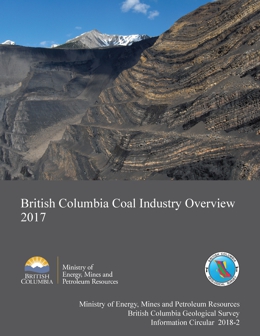
Coal prices stabilized in 2017 following a price spike in the second half of 2016. Coal production volumes for the province are forecast to total 31.5 million tonnes, the highest volume since 2013. The value of coal production is forecast at $5.96 billion, up sharply from $2.63 billion in 2016, and representing about 61% of all mineral revenue in the province.
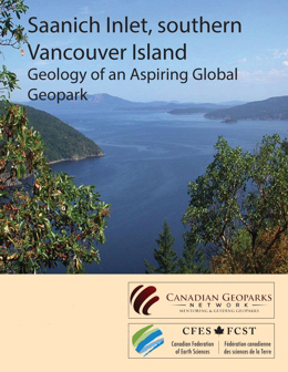
In anticipation of a proposal to the UNESCO Global Geopark Network, the Canadian National Committee for Global Geoparks has accepted Saanich Inlet and its watershed on southern Vancouver Island as an Aspiring Geopark. This Geopark initiative, led by the Saanich Inlet Protection Society, is seeking the support of local residents, First Nation communities, businesses, marine groups and scientists from government, universities, and industry. Geoparks are community-driven enterprises that reflect the desires and values of the people living in them. This Geopark will protect the natural resources and cultural heritage of Saanich Inlet while encouraging environmentally sound economic development. Geoheritage recognizes the continuum between the geological record and cultural values.
Like the more than 75 Geoparks worldwide, Saanich Inlet has an internationally significant geologic record that has been intensively researched on land and in the sea. It also has a long human history, enduring cultural traditions, vibrant communities, and environmentally respectful commercial activities.
The Saanich Inlet region offers exceptional opportunities for public education. It includes the City of Victoria, a major global tourist destination. Although small, the region is rich in venues for experiential learning about oceanography, tectonics, paleogeographic reconstructions, the most recent ice age, and modern coastal and deep-water processes. Easy access to the inlet’s geology is provided by extensive hiking trails, bike paths, road cuts, public beaches, and docking facilities, many of which are in provincial and municipal parks. Visitors will gain an increased appreciation of our natural heritage and a better grasp of the interactive feedbacks between land, air, water, organisms, and human activity. They will also gain an improved understanding of society’s attempts to mitigate, and become more resilient to, problems like climate change, environmental contamination, and geologic hazards including earthquakes, tsunamis, volcanic eruptions, floods, landslides, and wildfires.
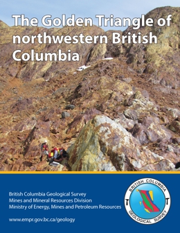
The Golden Triangle includes most of the major gold, silver and copper deposits in west-central Stikinia, a long-lived oceanic arc terrane that extends for about 1000 km along the length of the Canadian Cordillera. Most deposits are related to the Hazelton Group and affiliated intrusions (Latest Triassic to Middle Jurassic). More than 150 mines have operated in the region since prospectors first arrived near the end of the 19th century. Important past-producing mines include Granduc, Eskay Creek, Anyox, Kitsault, Premier/Dilworth, and Snip. Current mines include Brucejack (Pretium Resources Inc.), an epithermal gold-silver deposit that began commercial production in 2017, and Red Chris (Imperial Metals Corporation), a porphyry copper-gold deposit that began commercial production in 2015. The Golden Triangle contains numerous proposed mines and is being intensively explored. Enhanced infrastructure is encouraging exploration and development.
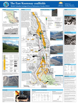
Extending along the northwest-southeast structural grain of the Rocky Mountain Front Ranges in southern British Columbia, the East Kootenay coalfields includes three fields: Flathead, Crowsnest, and Elk River. In the last 20 years, these fields have produced more coal than the rest of British Columbia's coalfields combined. Since 1898, more than 830 million tonnes, mainly of metallurgical coal, have been produced from the Crowsnest and Elk River fields. The East Kootenay fields produce coal from multiple seams in the Mist Mountain Formation, a 100 to 700 m thick unit of sandstone, siltstone, shale, and mudstone in the middle part of the Kootenay Group (Upper Jurassic to Lower Cretaceous). They are predominantly medium-volatile bituminous in rank and have low sulphur contents. High-volatile A bituminous coals occur near the top of the unit; low-volatile bituminous coals occur near the base of the section. Since 2008, Teck Coal Limited has been the operator and primary owner of all active mines.
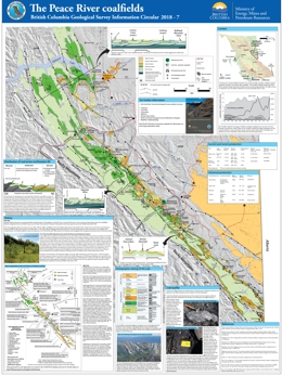
Coal deposits in northeast British Columbia occur in the Foothills and Plains coalfields, together commonly referred to as the Peace River coalfield. The Foothills coalfield, which extends for over 400 km along the Rocky Mountains foothills, has produced approximately 130 million tonnes of bituminous coal. In the Foothills, economically significant coal deposits occur in the Gething and Gates formations (Lower Cretaceous). Although the Minnes Group and Boulder Creek Formation contain coal, beds of adequate thickness and continuity to be profitably mined have not been discovered. Gates Formation coals are generally medium-volatile bituminous, although some of the deposits at the south end of the Foothills coalfield contain high-volatile bituminous coal. Gates Formation coals are low in sulphur and phosphorus. The rank of coal in the Gething Formation is variable, ranging from high-volatile bituminous to semianthracite. Gething coals generally wash easily to low clean ash content; some Gething coals are sufficiently low in ash that they do not require washing. Not all Gething coal seams yield coking coal, but the ultra-low volatile coal is marketed as pulverized coal injection (PCI) coal. The Plains coalfield has not yet been profitably mined.
Information Circular 2018-08 summarizes the mission and activities of the British Columbia Geological Survey.
Information Circular 2018-09 describes the freely available databases housed by the British Columbia Geological Survey and how these databases can be accessed and used.
Information Circular 2018-10 summarizes the mission and activities of the British Columbia Geological Survey Mineral Development Office.
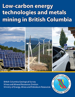
Metals are required for energy production and storage technologies that minimize greenhouse gas emissions. Increased use of low-carbon energy technologies translates to increased demand for metals. By 2050, the global demand for many metals will be several times greater than now and, coupled with finite mine life expectancies and diminishing grades, could lead to metal shortages. Some of the metals that may see shortages (copper, zinc, lead, and possibly nickel) are found in British Columbia. Mining of these deposits, particularly copper, can help contribute to a lower carbon future. Because almost half of Canada’s annual copper production is supplied by British Columbia mines, continued exploration will position the province to help meet the increasing global copper demands needed by low-carbon emission technologies.
2017
G. Clarke, J. Britton, P. Jago, F. Katay, and B. Northcote
Information Circular 2017-1 combines a provincial overview of significant projects with detailed, region-by-region summaries. It is a companion to the British Columbia Coal Industry Overview (British Columbia Geology Survey Information Circular 2017-2) and the map "Selected Exploration Projects and operating mines in British Columbia, 2016" Open File 2017-1.
Clarke, G., Britton, J., Jago, P., Katay, F., and Northcote, B., 2017. Exploration and Mining in British Columbia, 2016: A summary. In: Provincial Overview of Exploration and Mining in British Columbia, 2016. British Columbia Ministry of Energy and Mines, British Columbia Geological Survey, Information Circular 2017-1, pp. 1-29. PDF
Jago, C.P., 2017. Exploration and mining in the North Central and Northeast regions, British Columbia. In: Provincial Overview of Exploration and Mining in British Columbia, 2016. British Columbia Ministry of Energy and Mines, British Columbia Geological Survey, Information Circular 2017-1, pp. 31-72. PDF
Katay, F., 2017. Exploration and mining in the Southeast Region, British Columbia. In: Provincial Overview of Exploration and Mining in British Columbia, 2016. British Columbia Ministry of Energy and Mines, British Columbia Geological Survey, Information Circular 2017-1, pp. 73-107. PDF
Britton, J., 2017. Exploration and mining in the South Central Region, British Columbia. In: Provincial Overview of Exploration and Mining in British Columbia, 2016. British Columbia Ministry of Energy and Mines, British Columbia Geological Survey, Information Circular 2017-1, pp. 109-132. PDF
Northcote, B., 2017. Exploration and mining in the Southwest Region, British Columbia. In: Provincial Overview of Exploration and Mining in British Columbia, 2016. British Columbia Ministry of Energy and Mines, British Columbia Geological Survey, Information Circular 2017-1, pp. 133-147. PDF
Mineral Development Office, 2017. Exploration and mining in the Northwest Region, British Columbia. In: Provincial Overview of Exploration and Mining in British Columbia, 2016. British Columbia Ministry of Energy and Mines, British Columbia Geological Survey, Information Circular 2017-1, pp. 149-169. PDF
In 2016, the value of coal production for the province is forecast at $3.32 billion for 2016, an increase of 9% over 2015. This constitutes about 46% of all mineral production value in the province. Coal exploration expenditures are estimated at $38.5 million. As of November 1, 2016, new coal license applications numbered 27 for a total of 37,875 hectares. New coal licenses issued numbered 89, covering 105,071 hectares. No new leases were issued.2016, annual coal production in British Columbia.
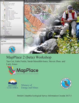
Y. Cui, G. Fortin, S. Meredith-Jones, S. Zhao, and L. Jones
In the modern world of digital data sharing and online web delivery of geospatial and geological information, the need for a reliable, high-performance web service is paramount to the success of any geoscience organization. MapPlace 2 is such a web service.
Developed entirely in-house by the British Columbia Geological Survey (BCGS), MapPlace 2 serves the diverse needs of the mineral exploration industry, resource planners, public safety agencies, communities, First Nations, government, research organizations, and the general public. It builds on the success of the original MapPlace, which was created in 1995 and has a proven record of helping decision makers reduce the costs of accessing and analyzing geoscience data in British Columbia.
The revamped MapPlace 2 is easier to use and has much improved functionality and performance. It can be used on either a Mac or a PC, does not require plug-ins, and works in most web browsers. MapPlace 2 differs from many other web services because it allows visualizing and querying province-wide geoscience data at exceptional speed and provides advanced applications to search, analyze, report, and download these data.
MapPlace 2 embraces the most appropriate open-source software for rendering maps, integrating databases, and developing web applications. The real power of MapPlace 2 derives from databases that ‘talk’ to each other. This enables users to conduct queries and generate personalized results by connecting many data sources that are continuously updated.
This handbook introduces readers to the new MapPlace 2 interface and provides a review of how the basic tools function and what datasets are available. A series of scenario-based exercises teach readers how to get the most out of MapPlace 2 by doing drills and actions designed to reinforce the basic MapPlace 2 functions and some of its more advanced features.
MapPlace 2 results from the efforts of a dedicated team of Survey geoscientists. These efforts continue as BCGS continues to improve the service. Proud to release this beta version of MapPlace 2 to the general public, we gratefully acknowledge the support of our friends in the mineral exploration industry who challenged us to overcome past limitations and develop a web service to carry us into the future.
Information Circular 2017-04 summarizes the mission and activities of the British Columbia Geological Survey.
Information Circular 2017-05 describes the freely available databases housed by the British Columbia Geological Survey and how these databases can be accessed and used.
Information Circular 2017-06 summarizes the mission and activities of the British Columbia Geological Survey Mineral Development Office.
2016
Information Circular 2016-01 combines a provincial overview of significant projects with detailed, region-by-region summaries. It is a companion to the British Columbia Coal Industry Overview (British Columbia Geology Survey Information Circular 2016-02) and the map "Selected Exploration Projects and operating mines in British Columbia, 2015" Open File 2016-01.
Clarke, G., 2016. Exploration and Mining in British Columbia, 2015: A summary. In: Provincial Overview of Exploration and Mining in British Columbia, 2015. British Columbia Ministry of Energy and Mines, British Columbia Geological Survey, Information Circular 2016-1, pp. 1-26. PDF
Jago, C.P., 2016. Exploration and mining in the Omineca and Northeast regions, British Columbia. In: Provincial Overview of Exploration and Mining in British Columbia, 2015. British Columbia Ministry of Energy and Mines, British Columbia Geological Survey, Information Circular 2016-1, pp. 27-56. PDF
Katay, F., 2016. Exploration and mining in the Kootenay-Boundary Region, British Columbia. In: Provincial Overview of Exploration and Mining in British Columbia, 2015. British Columbia Ministry of Energy and Mines, British Columbia Geological Survey, Information Circular 2016-1, pp. 57-87. PDF
Britton, J., 2016. Exploration and mining in the Thompson-Okanagan-Cariboo region, British Columbia. In: Provincial Overview of Exploration and Mining in British Columbia, 2015. British Columbia Ministry of Energy and Mines, British Columbia Geological Survey, Information Circular 2016-1, pp. 89-105. PDF
Northcote, B., 2016. Exploration and mining in the South and West Coast regions, British Columbia. In: Provincial Overview of Exploration and Mining in British Columbia, 2015. British Columbia Ministry of Energy and Mines, British Columbia Geological Survey, Information Circular 2016-1, pp. 107-120. PDF
Kyba, J., 2016. Exploration and mining in the Skeena region, British Columbia. In: Provincial Overview of Exploration and Mining in British Columbia, 2015. British Columbia Ministry of Energy and Mines, British Columbia Geological Survey, Information Circular 2016-1, pp. 121-140. PDF
In 2015, annual coal production in British Columbia dipped about 16% from 2014 values to an estimated 24-25 million tonnes. This production accounted for about $3.04 billion, or close to 44% of revenues from all mines in the province. Exploration expenditures amounted to about $69.1 million in 2015, down from $105 million in 2014. New coal license applications numbered 68 in 2015 for a total of 74,100 hectares. New coal licenses issued numbered 87, covering 70,806 hectares. No new leases were issued.
Information Circular 2016-03 summarizes the mission and activities of the British Columbia Geological Survey Mineral Development Office.
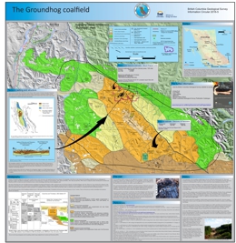
In the Skeena Ranges of northwestern British Columbia, the Groundhog coalfield defines an ovoid (30 x 80 km) area extending southeastwards from the headwaters of the Klappan and Little Klappan rivers to Groundhog Mountain. Coal occurs in several units of the Bowser Lake Group, which consists of Jurassic and early Cretaceous marine and non-marine strata deposited in Bowser Basin. The Groundhog coalfield contains the only significant occurrences of anthracite in Canada. Anthracite is relatively rare, making up about 1% of all coals globally. Of all coals, anthracite has the highest heat content per unit weight. The most significant market for anthracite is as PCI (pulverized coal injection) coal, which is used in making steel.
Information Circular 2016-06 summarizes the mission and activities of the British Columbia Geological Survey.
Information Circular 2016-07 describes the freely available databases housed by the British Columbia Geological Survey, and how these databases can be queried simultaneously to create customized multidisciplinary geoscience maps, via our online portal, MapPlace.
2015
G. Clarke, J. Britton, P. Jago, F. Katay, J. Kyba and B. Northcote
Information Circular 2015-2 details significant projects region-by-region and is a companion to the Provincial Overview of Mines and Exploration, 2014 (British Columbia Information Circular 2015-1), the British Columbia Coal Industry Overview (British Columbia Geology Survey Information Circular 2015-3) and Operating Mines and Selected Exploration Projects in British Columbia, 2014, Open File 2015-1 (map).
View Information circular 2015-02 (corrected February 11, 2015) (PDF, 15 MB)
In 2014, British Columbia produced an estimated 28.3 million tonnes of coal. This production accounted for about $3.36 billion, or close to 46% of revenues from all mines in the province. Exploration expenditures reached nearly $105 million (not including mine development costs), down from $119 million in 2013. New coal license applications numbered 89 in 2014 for a total of 75, 972 hectares, less than half the area applied for in 2013. New coal licenses issued numbered 122, covering 103, 941 hectares, a sevenfold increase from 2013. Coal exploration in mine expansion areas remained busy, but grassroots exploration was less active in 2014 relative to the past three years.
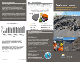
Information Circular 2015-04 is a pamphlet describing the distribution, origin, production, and uses of coal in the province.
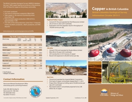
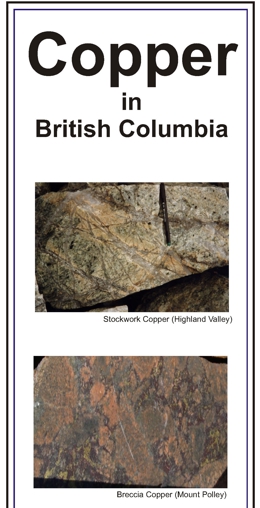
Information Circular 2015-05 is a pamphlet describing the distribution, origin, production, and uses of copper mined in the province.
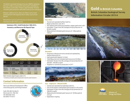
Information Circular 2015-06 is a pamphlet describing the distribution, origin, production, and uses of gold mined in the province.
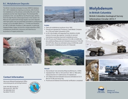
Information Circular 2015-07 is a pamphlet describing the distribution, origin, production, and uses of molybdenum mined in the province.
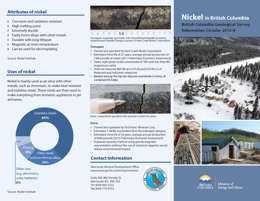
Information Circular 2015-08 is a pamphlet describing the distribution, origin, production, and uses of nickel mined in the province.
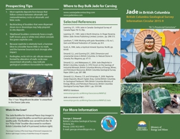
Information Circular 2015-9 is a pamphlet describing the distribution, origin, production, and uses of jade mined in the province.
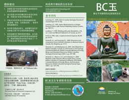
Information Circular 2015-9c 宣传册描述了BC玉的分布、来源、生产、和用途
察看 Information Circular 2015-9c (PDF, 3.3 MB)
更多信息:
Email BCGS 邮箱
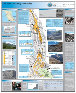
Superseded by Information Circular 2018-6
Extending along the northwest-southeast structural grain of the Rocky Mountain Front Ranges in southern British Columbia, the East Kootenay Coalfields includes three fields: Flathead, Crowsnest, and Elk River. In the last 20 years, these fields have produced more coal than the rest of British Columbia's coalfields combined. Since 1898, over 780 million tonnes, mainly of metallurgical coal, have been produced from the Crowsnest and Elk River fields. The East Kootenay fields produce coal from multiple seams in the Mist Mountain Formation, a 100 to 700 m thick unit of sandstone, siltstone, shale, and mudstone in the middle part of the Kootenay Group (Upper Jurassic to Lower Cretaceous). Most coals in the Mist Mountain Formation are coking coals. They are predominantly medium-volatile bituminous in rank and have low sulphur contents. High-volatile A bituminous coals occur near the top of the unit; low-volatile bituminous coals occur near the base of the section. Since 2008, Teck Coal Limited has been the operator and primary owner of all five active mines. These mines produce about 70% of Canada’s total annual coal exports.
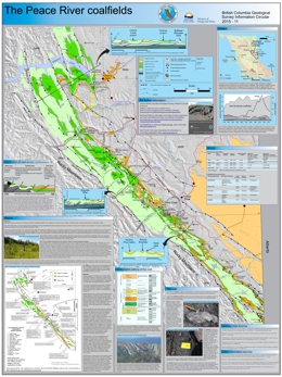
Superseded by Information Circular 2018-7
Coal deposits in northeast British Columbia occur in the Foothills and Plains coalfields, together commonly referred to as the Peace River coalfield. The Foothills coalfield, which extends for over 400 km along the Rocky Mountains foothills, has produced approximately 130 million tonnes of bituminous coal. The Plains coalfield has not yet been profitably mined. In the Foothills, economically significant coal deposits occur in the Gething and Gates formations (Lower Cretaceous). Although the Minnes Group and Boulder Creek Formation contain coal, beds of adequate thickness and continuity to be profitably mined have not been discovered. Gates Formation coals are generally medium-volatile bituminous, although some of the deposits at the south end of the Foothills coalfield contain high-volatile bituminous coal. Gates Formation coals are low in sulphur and phosphorus. The rank of coal in the Gething Formation is variable, ranging from high-volatile bituminous to semianthracite. Gething coals generally wash easily to low clean ash content; some Gething coals are sufficiently low in ash that they do not require washing. Not all Gething coal seams yield coking coal, but the ultra-low volatile coal is marketed as pulverized coal injection (PCI) coal.
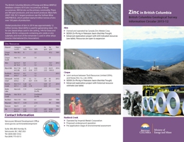
Information Circular 2015-12 is a pamphlet describing the distribution, origin, production, and uses of zinc mined in the province.
Information Circular 2015-13 summarizes the mission and activities of the British Columbia Geological Survey.
2014
J. Britton, P. Jago, F. Katay, J. Kyba, G. Li, B. Madu, and B. Northcote
See also Operating Mines and Selected Major Exploration Projects in BC, 2013, Open File 2014-01 (map)
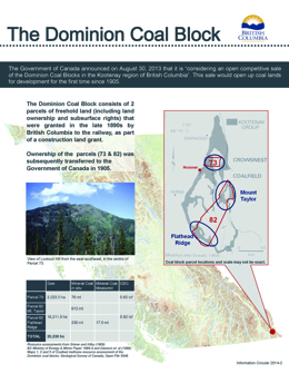
B. Madu, A. Johal, J. Riddell
The Government of Canada recently announced it is considering sale of portions of the Dominion Coal Block. These coal lands are located in the Crowsnest Coalfield, in the south easternmost corner of the Province.
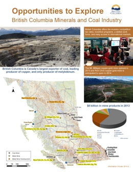
B. Madu, A. Johal, G. Li
Brochure created by the Mineral Development Office outlining opportunities to explore in the British Columbia minerals and coal industries.
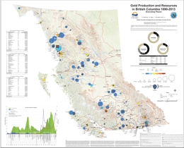
B. Northcote, B. Madu, T. Schroeter, and G. Li
Consisting of a province-wide map (1:175 000 scale) and an appendix with 314 files summarizing camps and individual deposits, Information Circular 2014-04 updates previous British Columbia Geological Survey gold inventories to then end of 2013. Between 2003 and 2013, gold exploration in British Columbia surged, resulting in new discoveries and expansion at known deposits. The growth in total gold resources has far exceeded production over the ten-year period. Since 2003, the total estimated resource has grown from about 78.8 million ounces to about 290 million ounces. Currently, most gold in British Columbia is produced as a byproduct or coproduct at porphyry copper mines; with few exceptions, production has moved away from small vein deposits. British Columbia's rich porphyry copper endowment suggests that a focus on the porphyry copper-gold model will continue, although the possibility of smaller, high-grade deposits remains.
In 2013, British Columbia produced an estimated 31 million tonnes of coal. This production accounted for about $4.6 billion, or close to 58% of revenues from all mines in the province. Coal exploration remained active although, because of lower prices for metallurgical and thermal coal, some exploration projects were reduced and others postponed. For the first time since 2007, two new coal leases were issued. The number of coal exploration licenses issued was steady, but new coal applications dropped from record levels set in 2012.
Information Circular 2014-05 provides a snapshot of the provincial coal industry. It describes industry trends and coal regions, highlights 2013 mining and exploration, describes transportation infrastructure, outlines the tenure system, and lists sources of information and contacts.
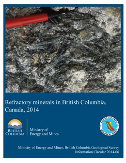
G.J. Simandl, S. Paradis, and P. Luck
Magnesite, silica, olivine, kyanite, andalusite, refractory clays and shale, pyrophyllite, graphite , chromite, and dolomite are some of the traditional refractory minerals in British Columbia. Besides these, the province also has deposits of lightweight heat-insulating materials such as pumice, mineral wool, perlite and vermiculite. The internal demand for traditional heavy-duty refractory raw materials in British Columbia is limited. However, these minerals also have a non-refractory applications and are traded internationally, either in raw form or after processing.
Information Circular 2014-07 summarizes the mission and activities of the British Columbia Geological Survey.
Intended for investors and the general public, Information Circular 2014-08 describes opportunities in British Columbia's minerals and coal industries. It summarizes what commodities the province produces, infrastructure supporting exploration and mining, tenure and permitting procedures, First Nations relations, taxation rules, and investment incentives, and provides contacts and sources of detailed information.
Information Circular 2014-09 describes the freely available databases housed by the British Columbia Geological Survey, and how these databases can be queried simultaneously to create customized multidisciplinary geoscience maps, via our online portal, MapPlace.
2013
J. Britton, R. Chu, D. Grieve, P Jago, J. Kyba, B. Madu, and B. Northcote
The geological evolution of British Columbia, which spans over 2.3 billion years, has endowed the province with abundant mineral and coal resources. As a result, the exploration and development of these resources is a cornerstone of the provincial economy. With more than half of Canada’s exploration and mining companies based in British Columbia, and the world’s largest concentration of exploration companies and mining professionals, the province is recognized as a leader in raising venture capital, and as a centre of excellence in mining and related fields, such as metallurgy, environmental engineering, mine safety, and the geosciences.
British Columbia’s transportation infrastructure provides ready access to world markets through expanding ports, and rail and highway networks. The province boasts attractive industrial electrical power rates; commitments to expand the power grid in the northwestern part of the province have the potential to increase exploration and development in a highly prospective region.
View Information Circular 2013-01 (PDF, 5.1 MB)
See also Operating Mines and Selected Major Exploration Projects in BC, 2012, Open File 2013-1 (map)
British Columbia’s coal industry was busy in 2012. Production tonnages, exploration expenditures, and tenure applications all reached record levels. The estimated total coal output was over 30 million tonnes, which accounted for about $5.1 billion of the $7.4 billion in production revenues from all mines in the province. Major markets for British Columbia coal include Asian countries, notably Japan, China, South Korea and India, and countries in South America and Europe. Looking forward, new mine proposals are being evaluated, and several port facilities are planning to increase export capacity.
This booklet provides a snapshot of the coal industry in British Columbia, including sections on trends, resources, mining, exploration, the tenure system, sources of information, and contacts in government and industry.
Cascadia Region Earthquake Workgroup (Crew)
On January 26, 1700 an estimated M9 earthquake unzipped the 700+ mile Cascadia Subduction Zone fault from northern California, USA to southern British Columbia, Canada, much like recent events in 2011 in Japan and 2010 in Chile. Produced by Cascadia Region Earthquake Workgroup (Crew), this report examines how the Pacific Northwest may fare after the next great ‘megathrust’ earthquake and tsunami. It summarizes not only why these earthquakes occur repeatedly, but also the likely consequences of the next Cascadia fault rupture. Future Cascadia earthquakes and tsunami will have lasting impacts to coastal communities and the potential to inflict tens of billions of dollars in physical damage, dramatically impacting the region’s economy..
Information Circular 2013-04 summarizes the British Columbia Geological Survey's core programs, projects, and activities for 2013.
2012
J. Britton, J. DeGrace, D. Grieve, J. Kyba, B. Madu and B. Northcote
British Columbia’s coal and mineral resources are strategically located to be a significant asset for the international mining industry, particularly as a supplier for North American and Asian markets. The province has well-defined potential for a wide variety of minerals and deposit types. The geoscience database is extensive and easily accessed and the provincial government is committed to aggressively improving that data and encouraging new developments. With attractive energy costs, a well developed, all-weather highway system, rail links and a number of deep-water ports, British Columbia has the infrastructure to cost-effectively get coal, minerals and resulting products to markets.
View Information Circular 2012-01 (PDF, 7.8 MB)
See also Operating Mines and Selected Major Exploration Projects in BC, 2011, Open File 2012-01 (map)
D. Grieve, B. Madu and R. Chu
This booklet is intended to provide a concise snapshot of the BC coal industry for the interested public, including those looking to invest. It includes sections on coal resources, mining, exploration, the tenure system, sources of information, and contacts. It is intended to complement “Exploration and Mining in British Columbia 2011” and “British Columbia Mines and Mineral Exploration Overview 2011”
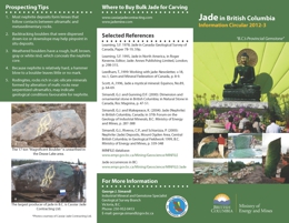
Mineral Development Office, Vancouver
Jade is a commercial term for green, white, black, or yellow-brown jadeite and nephrite. Jadeitite is a rock that consists of the mineral jadeite (a sodium-rich, high pressure pyroxene), whereas nephrite consists of amphibole minerals (tremolite-actinolite) in which prismatic to needle-like crystals are arranged in randomly oriented bundles. All of the known jade deposits in B.C. are nephrite.
This Information Circular summarizes the geology and origin of jade in British Columbia, provides prospecting tips, and points to other sources of information.
2011
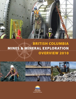
K. Hancock, B. Northcote, D. Grieve, B. Madu, and P. Wojdak
British Columbia’s coal and mineral resources are strategically located to be a significant asset for the international mining industry, particularly as a supplier for North American and Asian markets. The province has well-defined potential for a wide variety of minerals and deposit types. The geoscience database is extensive and easily accessed and the provincial government is committed to aggressively improving that data and encouraging new developments. With attractive energy costs, a well developed, all-weather highway system, rail links and a number of deep-water ports, British Columbia has the infrastructure to cost-effectively get coal, minerals and resulting products to markets.
View Information Circular 2011-01 (PDF, 16.7 MB)
See also Operating Mines and Selected Major Exploration Projects in BC, 2010, Open File 2011-1 (map)
A. Johal, B. Northcote and K. Hancock
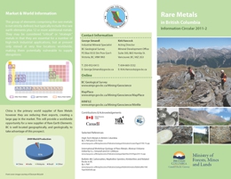
This brochure briefly describes rare metal deposits in British Columbia, including the Aley, Upper Fir, Wicheeda, Carbo, Mount Copeland and Mount Bisson deposits. It has a location map of selected rare metal deposits.
The MINFILE database lists over 90 rare metal occurrences hosted by carbonatites, nepheline syenites, rare element enriched pegmatites, skarns, massive sulphide deposits, sedimentary phosphate deposits and placer deposits. In approximately 25 of these occurrences, rare metals are considered the primary commodities. The recent surge in interest has added a number of new occurrences. To date, only a handful of prospects are developed beyond very early stage exploration.
A. Johal, B. Northcote and K. Hancock
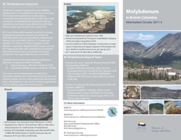
This brochure briefly describes molybdenum deposits in British Columbia, including the Endako and Kitsault deposits. It has a location map of selected molybdenum deposits.
The MINFILE database lists 1275 molybdenum bearing occurrences, 439 of which list molybdenum as the primary commodity. Principal deposit types are Mo and Cu-Mo porphyries. The developed Mo porphyries in BC are classified as low-fluorine type, distinct from the high-fluorine climax type known in the western US. BC is one of the world's premier locations for primary molybdenum porphyry deposits.
A. Johal, B. Northcote and D. Lefebure
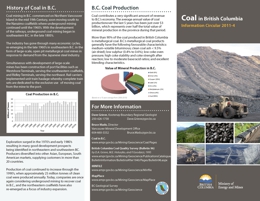
This brochure briefly describes coal deposits in British Columbia, including the East Kootenay, Peace River, and Vancouver Island Coalfields. It has a location map of selected coal deposits.
Coal contributes a very significant amount of revenue to the B.C. economy. The average annual value of coal production over the last 5 years has been just over $3 billion, which represents over half the total value of mineral production in the province during that period.
More than 90% of the coal produced in British Columbia is metallurgical coal. B.C.’s metallurgical coal products generally have the following favourable characterisitcs: medium-volatile bituminous; clean coal ash < 9.5% (air dried); low sulphur (0.4% to 0.6%); low coke oven pressure; high coke stability and coke strength after reaction; low to moderate base/acid ratios; and excellent blending characteristics.
2010
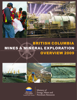
J. Fredericks, D. Grieve, D. Lefebure, B. Madu, B. Northcote, and P. Wojdak
British Columbia’s coal and mineral resources are strategically located to be a significant asset for the international mining industry, particularly as a supplier for North American and Asian markets. The province has well-defined potential for a wide variety of minerals and deposit types. The geoscience database is extensive and easily accessed and the provincial government is committed to aggressively improving that data and encouraging new developments. With attractive energy costs, a well developed, all-weather highway system, rail links and a number of deep-water ports, British Columbia has the infrastructure to cost-effectively get coal, minerals and resulting products to markets.
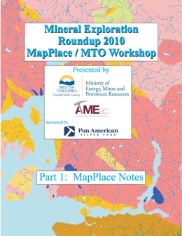
K. Hancock, P. Desjardins, S. Meredith-Jones, K. Samuelson and N. Kohli
Information Circular 2010-2 includes Part I and Part II of the course notes from the MapPlace/MTO short course offered at Mineral Exploration Roundup 2010 on January 17, 2010. The short course was presented by the Ministry of Energy, Mines and Petroleum Resources and AME BC.
Part I of the notes includes an introduction to the MapPlace and a review of its layout and functions. There are exercises to help the user become familiar with the ARIS MapBuilder, buffers, Mapper Wrapper, MapPlace2Go, and the Image Analysis Tool (IAT). The final section of Part I includes an integrated MapPlace exercise incorporating aspects from several of the related databases, including MINFILE, ARIS, and Property File.
Part II of the notes outlines the steps required to login and use the Mineral Titles Online application to manage and stake tenure in British Columbia, including staking claims, filing Exploration and Development Work or making a payment in lieu. There are several hands-on exercises for clarification. How to obtain a Tenure Overlap Report and Landowner Notification procedures is reviewed, as well as other general information regarding mineral titles in British Columbia.
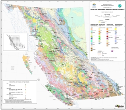
P.J. Desjardins and D.V. Lefebure
The province’s MINFILE mineral occurrence database was used to identify the major coal and mineral deposits, mines and past producers for British Columbia. A larger size threshold was used for identifying open pit mines than the criteria for underground mines. The deposits and mines are plotted on a 1:2M provincial geology map. The resulting map is useful for geologists, prospectors and others wishing to relate rich mineral resources to the geology of the province.
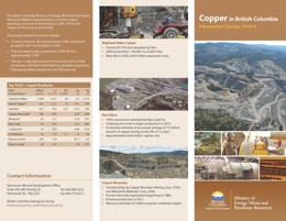
J. Fredericks, B. Northcote, T. Schroeter and L. Wilkin
This updated brochure briefly introduces the copper deposits in British Columbia, including the Highland Valley Copper, New Afton and Copper Mountain deposits. It has a location map of selected copper deposits, by deposit type, and a table of the 20 largest ranked by contained copper.
The MINFILE database lists over 6,950 copper-bearing occurrences in the province; 3,643 of these list copper as the primary commodity. Total copper production (1894 to 2010) is approximately 13 Mt. The top 15 mines account for 90% of total production, with these dominated by calcalkalic porphyries, followed by alkalic porphyries and VMS deposits.
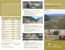
J. Fredericks, B. Northcote, T. Schroeter and L. Wilkin
This updated brochure briefly describes gold deposits in British Columbia, including the Kemess South, Sulphurets Camp and Mount Milligan deposits. It has a location map of selected gold deposits, by deposit type, and a table of the top 20 lode gold producers.
The MINFILE database lists over 2,700 occurrences for which gold is identified as the primary commodity. Of these nearly 700 have recorded gold production (398 lode, 294 placer). Total lode gold (1890-2010) and placer gold (1858-2010) production amounts to 32.6 million ounces and 6 million ounces, respectively. The top 25 producers include the Bridge River, Rossland, Hedley, Premier, Greenwood and Cariboo-Barkerville camps and the Eskay Creek, Island Copper, Snip and Kemess South mines, which have each produced over a million ounces, account for 90% of total production. The province's remaining in-ground gold resources are estimated at more than 130 million ounces.
2009
J. DeGrace, J. Fredericks, D. Grieve, D. Lefebure, B. Madu, B. Northcote, and P. Wojdak
British Columbia’s coal and mineral resources are strategically located to be a significant asset for the international mining industry, particularly as a supplier for North American and Asian markets. The province has well-defined potential for a wide variety of minerals and deposit types. The geoscience database is extensive and easily accessed and the provincial government is committed to aggressively improving that data and encouraging new developments. With attractive energy costs, a well developed, all-weather highway system, rail links and a number of deep-water ports, British Columbia has the infrastructure to cost-effectively get coal, minerals and resulting products to markets.
R. Lett
This brochure describes the Regional Geochemical Survey (RGS) program, surveys, sample media characteristics and application and uses. It has a summary table of all the RGS surveys, dating from 1977.
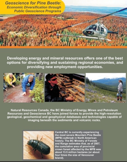
C. Hutton,D. Lefebure, and V. Levson
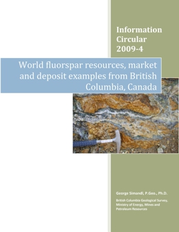
G.J. Simandl
Key questions addressed in this paper are: “Will the demand for fluorspar outstrip supply in foreseeable future?” and “Will there be enough raw materials to cover projected demand?” The demand for fluorspar is linked to global economic cycles. This paper concentrates on the global availability of fluorspar from the perspective of geological and mineral engineering economics. British Columbia has several fluorite-bearing deposits that are discussed in this paper.
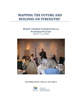
British Columbia Geological Survey staff and some key guests met for two days in March 2008 to discuss the future for the organization. The Workshop was a particularly timely given the plans to hire more staff and the approaching retirement over the next eight years of a number of staff. The objective was to determine how best to chart the future path of the Survey.
2008
J. DeGrace, B. Grant, D. Grieve, D. Lefebure, B. Madu, B. Northcote, and P. Wojdak
British Columbia’s coal and mineral resources are strategically located to be a significant asset for the international mining industry, particularly as a supplier for North American and Asian markets. The province has well-defined potential for a wide variety of minerals and deposit types. The geoscience database is extensive and easily accessed and the provincial government is committed to aggressively improving that data and encouraging new developments. With attractive energy costs, a well developed, all-weather highway system, rail links and a number of deep-water ports, British Columbia has the infrastructure to cost-effectively get coal, minerals and resulting products to markets.
L. Simandl and C.J. Brûlé
This Information Circular aims to enhance the sustainable development of coal and cement raw materials in British Columbia. The main objectives of this study are to confirm the chemical composition of the Quinsam coal mine rejects, find out if the rejects from the Quinsam coal mine washing plant have a favourable chemical composition for use as a raw material in cement making and demonstrate how the use of these rejects could benefit coal and cement producers, the environment, and our society.
The rejects from Quinsam coal mine's washing plant represent a valuable raw material for cement making. The inorganic components of the rejects have appropriate Al2O3 - CaO - SiO2 proportions and low Na2O and K2O content (ideal for cement making). Assuming nearly complete combustion within the conventional cement kiln, the organic components of coal rejects would burn, supplying between 6MJ and 12.5MJ of energy per kg of the feed. The use of these rejects (low grade coal) could extend the life of the mine, reduce or eliminate the problems associated with waste disposal and represent substantial savings for cement producers. The results of this conceptual study are positive; however, detailed work is needed to quantify the benefits. Such work would be most efficiently accomplished in direct collaboration with cement and coal producers.
Although this research was specific to the Quinsam Coal Mine, the same principles can be applied to other coal operations and deposits where alumina-rich clays or shales with low concentrations of alkali elements are associated with coal.
2007
T. Schroeter, D. Grieve, R. Lane, B. Madu, B. Northcote, and P. Wojdak
British Columbia Mines and Mineral Exploration Overview 2007
G.J. Simandl, M.L. Irvine, D. Grieve, R. Lane, P. Wojdak, B. Madu, I. Webster, B. Northcote, and T. Schroeter
This paper summarizes industrial mineral production and exploration activity in British Columbia and identifies selected industrial mineral opportunities. It has a location map of selected industrial mineral resources.
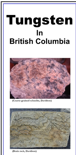
T. Schroeter, E. Man
This brochure references tungsten deposits in British Columbia. The British Columbia Ministry of Energy, Mines and Petroleum Resources' MINFILE database lists 366 tungsten-bearing occurrences in the province. It includes a map of selected tungsten deposits in B.C.
This manual is a guide to the collection and entry of data into the MINFILE database.
2006
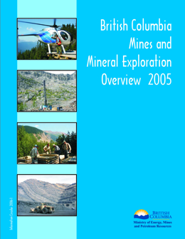
T. Schroeter, M. Cathro, D. Grieve, R. Lane, J. Pardy, and P. Wojdak
British Columbia Mines and Mineral Exploration Overview 2007
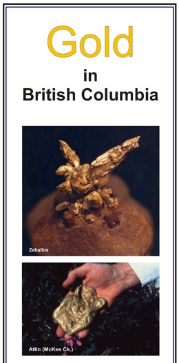
T.G. Schroeter and J. Chou
This brochure briefly describes gold deposits in British Columbia, highlighting the Eskay Creek and Kemess South deposits. It has a location map of selected gold deposits, by deposit type, and a table of the top 25 lode gold producers.
The MINFILE database lists nearly 1000 individual lode and 95 placer deposits in the province. Total lode gold (1890-2005) and placer gold (1858-2005) production amounts to 31.2 million ounces and 5.6 million ounces, respectively. The top 25 past and current producers including the Bridge River, Rossland, Hedley, Premier, Greenwood and Cariboo-Barkerville camps and the Eskay Creek, Island Copper, Snip and Kemess South mines, which have each produced over a million ounces, account for 90% of total production.
Total in-ground gold resources currently stand at over 80 million ounces. Resources listed from 264 deposits, categorized as a percentage by deposit type, are: 74% porphyries; 18% veins; 7% massive sulphides and 1% skarns. Twenty-one deposits each contain in excess of 1 million ounces of gold.
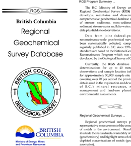
R. Lett
This brochure describes the Regional Geochemical Survey (RGS) program, surveys, sample media characteristics and application and uses. It has a summary table of all the RGS surveys, dating from 1977.
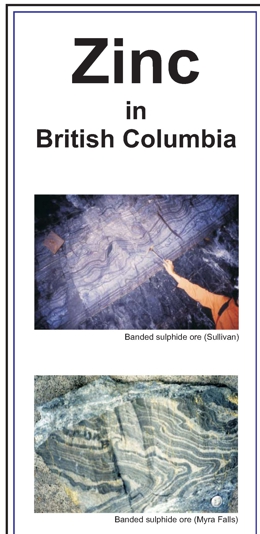
T.G. Schroeter, J. Chou and J.W. Pardy
This brochure briefly describes zinc deposits, highlighting the Sullivan and Cirque deposits. It has a location map of selected zinc deposits and tables of selected zinc producers and resources.
The British Columbia MINFILE database lists 3814 zinc-bearing occurrences in the province. Those with mineral inventories are listed as current producers (1), past producers (876), developed prospects (201) and prospects (754). Total zinc production (1905-2005) from 64 mines is approximately 10 Mt, valued at over $6 billion. The top 13 deposits account for over 99% of total production. Many older mines did not recover zinc as a byproduct, due primarily to its low value at the time. The mine accounted for nearly 80% of the province's total zinc production. Total existing in-ground resources in 90 deposits are estimated at 10.5 Mt of zinc.
T.G. Schroeter, E. Man and J. Chou
This brochure briefly describes copper deposits in British Columbia, highlighting the Galore Creek and Highland Valley Copper deposits. It has a location map of selected copper deposits, by deposit type, and a table 15 BC Copper Deposits ranked by contained copper.
The MINFILE database lists 6831 copper-bearing occurrences in the province; 3566 of these list copper as the primary commodity. Total copper production (1894 to 2005) is approximately 12Mt, valued at $25 billion dollars. The top 15 deposits account for 90% of total production.
Total in-ground gold resources in 215 deposits are estimated at 23 Mt of copper. The 15 largest deposits account for 92% of total resources.
2005
T. Schroeter, M. Cathro, D. Grieve, R. Lane, J. Pardy, B. Ryan, G.Simandl, and P. Wojdak
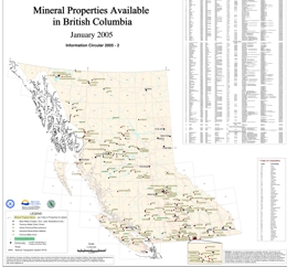
The British Columbia Ministry of Energy and Mines, in partnership with the Association for Mineral Exploration British Columbia (AME BC), maintained the Mineral Properties Available in British Columbia Map from 2004 to 2006. The last update of the map was published as Open File 2006-10. See below for 2005 versions, updated from Information Circular 2004-07.
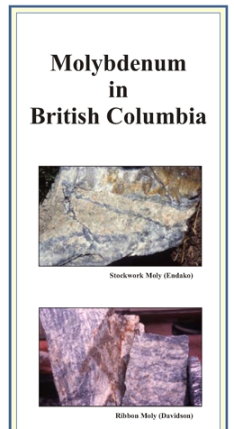
Information Circular 2005-03 pamphlet includes an overview and location map for selected molybdenum deposits in British Columbia. Summaries of the Endako and Kitsault deposits are given.
2004
T. Schroeter, M. Cathro, J. Pardy, R. Lane, B. Ryan, G.Simandl, D. Terry, and P. Wojdak
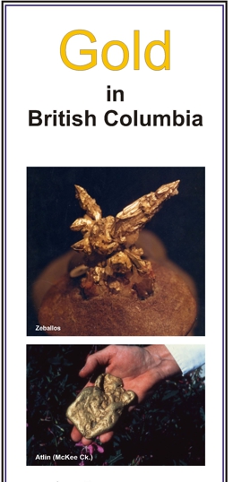
T.G. Schroeter and J.W. Pardy
This brochure briefly describes gold deposits in British Columbia, highlighting the Eskay Creek and Kemess South deposits. It has a location map of selected gold deposits, by deposit type, and a table of the top 25 lode gold producers.
The MINFILE database lists nearly 1000 individual lode and 95 placer deposits in the province. Total lode gold (1890-2003) and placer gold (1858-2003) production amounts to 30 million ounces and 5.6 million ounces, respectively. The top 25 past and current producers including the Bridge River, Rossland, Hedley, Premier, Greenwood and Cariboo-Barkerville camps and the Eskay Creek, Island Copper, Snip and Kemess South mines, which have each produced in excess of one million ounces, account for 90% of total production.
Total in-ground gold resources currently stand at 80 million ounces. Resources listed from 264 deposits, categorized as a percentage by deposit type, are: 74% porphyries; 18% veins; 7% massive sulphides and 1% skarns. Twenty-one deposits each contain in excess of 1 million ounces of gold.
View Information Circular 2004-05 (PDF, 0.99 MB)
Supersedes Information Circulars 2003-2 and 2002-5
G.J. Simandl, N.D. Robinson, P.J. Wojdak, D. Terry, B. Lane, M. Cathro, T.G. Schroeter
Industrial minerals are an increasingly significant component of international trade and British Columbia is strategically located on the west coast of North America. British Columbia has a well-developed infrastructure in the southern, highly populated third of the province, several deep-water ports, and a well maintained highway system that permits efficient long distance trucking. Rail links British Columbia industrial centres to terminal points across the continent. The province has attractive energy costs and untapped mineral resources. The value of solid mineral production for 2003 is estimated at $2.9 billion. Officially, industrial minerals and construction materials account for $578 million of this total; however, this value would be substantially higher if the value-added aspect of the industry was fully taken into account. The forecast value of structural materials (including construction aggregates) is approximately $238 million, while the value for traditional industrial minerals estimated by Natural Resources of Canada reached $340 million. Our own preliminary estimates suggest that the value of industrial mineral production could be substantially higher than this figure.
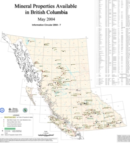
The British Columbia Ministry of Energy and Mines, in partnership with the Association for Mineral Exploration British Columbia (AME BC), maintained the Mineral Properties Available in British Columbia Map from 2004 to 2006. The last update of the map was published as Open File 2006-10. See below for 2004 version, updated in 2005 (Information Circular 2005-02).
2003
T. Schroeter, M. Cathro, J. Houle, R. Lane, B. Ryan, G.Simandl, D. Terry, and P. Wojdak
2002
T. Schroeter, M. Cathro, R. Lane, J. Houle, D. Terry ,P. Wojdak, B. Ryan, and G.Simandl
N. Massey and D. Jakobsen
Compiled by M. Fournier and B. Grant
This publication contains posters and presentations that were presented at Cordilleran Roundup in Vancouver, British Columbia, January 22-25, 2002.
View Information Circular 2002-03 (PDF, 36 KB)
Download Information Circular 2002-03 (ZIP, 284 MB)
Poster Titles (Note: the poster numbers in the list correlate to the actual number in the pdf file name.)
1. Targeting hotspots: metal zoning in VMS belts - D.J. Alldrick
2. Geology and mineral potential of the east Harrison Lake area - C. Ash
3. Sunshine Coast aggregate potential mapping - A. Bichler, E. Brooks, and P. Bobrowsky
4. Coalbed methane opportunities and strategy in British Columbia - D. Brown
5. Coalbed methane resources in British Columbia - D. Brown
6. Bella Coola Targeted Geoscience Initiative: VMS mineralization hosted by Middle Jurassic strata - L. Diakow
7. Quaternary Geology studies in the Huckleberry mine area, West Central British Columbia - T. Ferbey and V. Levson
8. Geology and massive sulphide potential of the Barkerville terrane, Cariboo Lake area, British Columbia - F. Ferri
9. J.T. Fyles Library online - S. Ferris, M. Palmer
10. Southwest region, British Columbia - J. Houle
11. Harrison Lake nickel belt, British Columbia - J. Houle
12. Geology and evolution of the Rossland camp, southern British Columbia - T. Höy
13. BHT and Sedex deposits, Monashee Complex, SE BC - T. Höy
14. NGR Surveys in the BC Cordillera to target and attract mineral exploration - W. Jackaman, R. Lett, and P. Friske
15. Explore the MapPlace - L. Jones, P. Desjardins, D. MacIntyre
16. 2001 mining and exploration activity - north central British Columbia - R. Lane
17. Gold enriched porphyry copper mineralization in the Central Quesnel Terrane - R. Lane, K. MacDonald, B. McGrath
18. Calc-alkalic porphyry Cu-Au mineralization in the Toodoggone Region - R. Lane, K. MacDonald, B. McGrath
19. A layered data approach to coalbed methane geology in NE BC - A. Legun
20. Stream sediment geochemical exploration for platinum in BC - R. Lett and W. Jackaman
21. Platinum group elements in British Columbia placer deposits - V. Levson
22. Intrusion-related mineral occurrences of the mid-Cretaceous Bayonne magmatic belt, SE British Columbia - J. Logan
23. Geological highlights of the Nakina Transect, northwestern British Columbia - M.G. Mihalynuk, S.T. Johnston, C. Lowe, J. English, F. Devine, et al.
24. Cu-PGE mineralization in alkaline plutonic complexes, southern British Columbia - G.T. Nixon
25. WWW MINFILE - gateway to exploration - G. Owsiacki, G. Payie, L. de Groot, and L. Jones
26. Recent corporate donation of exploration reports to Property File: Placer Dome, Starr, Falconbridge, Chevron - G. Payie
27. The Platinum Group Element potential of the Cogburn Ultramafic Suite - R. Pinsent
28. The polymetallic Lustdust porphyry-skarn property, north-central BC - G.E. Ray, I.C.L. Webster, P. Megaw, J. McGlasson, K. Glover, and K.P.E. Dunne
29. Marilla Perlite - volcanic glass occurrence, British Columbia - M.D. Rotella and G.J. Simandl
30. Energy for the future - coal and coalbed methane in BC - B. Ryan
31. Bonaparte Project: the geology of Quesnel and Slide Mountain terranes west of Clearwater, southern BC - P. Schiarizza, S. Heffernan, J. Zuber, and S. Israel
32. Industrial minerals - current trends - G.J. Simandl, A. Rossley
33. ARIS & CoalFile - digital assessment reports on the Internet - A. Wilcox, L. Jones, and L. de Groot
34. Exploration opportunities in northwest BC - P. Wojdak
Presentation Titles (Note: the presentations are in executable PowerPoint format.)
Geological Setting and Origin of Ultramafic Rocks in the East Harrison Lake Belt - C. Ash, R. Pinsent, R. Lett, W. Jackaman and J. Houle
The Barkerville Terrane: Regional Correlations and Massive Sulphide Potential - F. Ferri
The MapPlace - An Internet-based Mineral Exploration Tool - L. Jones, D. MacIntrye, P. Desjardins
British Columbia Mining, Development and Exploration - 2001 - T. Schroeter
Industrial Minerals - Current Trends and Future Opportunities - G.J. Simandl
This brochure briefly describes public and private geoscience partnerships, discussing the eligibility and preferred projects along with current result and successes. It has a location map of selected partnership projects.
2001
Coalbed Methane Brochure
T. Schroeter, M. Cathro, R. Lane, J. Houle, D. Terry ,P. Wilton, P. Wojdak, B. Ryan, and G.Simandl
Organized by: British Columbia Geological Survey and Geological Survey of Canada
One of the key roles of the British Columbia Geological Survey (BCGS) is to provide geoscience data to attract investment by the industry in mineral exploration in British Columbia. The Geological Survey of Canada (GSC) has a complementary role to that of the province in its mandate to carry out “national geoscience programs to define the geology and resources of Canada. The two surveys aid in the discovery of mineral deposits and the development of new mines which drive regional economies and help support a high standard of living for British Columbians and Canadians.
2000
British Columbia Mines and Mineral Exploration Overview 1999
1999
T.G. Schroeter
British Columbia Mines and Mineral Exploration Overview 1999
1998
T.G. Schroeter
1997
T.G. Schroeter
This document, part of the provincial Resource Inventory Committee initiative, provides guidelines and is a step toward development of common standards and methodologies for bedrock mapping in British Columbia. It recommends methodology for the presentation of geological information and describes the types of data that must be collected for the production of geological maps. Implementing these guidelines will make significant progress toward the goal of making comparison and exchange of geological data in the province easier. These standards will be of interest to both specialists and non-specialists, and will help users understand the underlying bedrock data that is used to produce geologic maps and reports. It is important to note that geologic maps are NOT raw data, they are interpretations of the raw data.
Although the standards contain specific recommendations, they should be treated as guidelines. The guidelines are intended to be detailed enough to provide consistency, but not so restrictive that they cannot be easily implemented. They will not be usable in every circumstance, but will cover most applications. It is hoped that this flexible approach will ensure faster and wider acceptance for the recommended standards.
The conceptual design and content of this manual is based on recommendations made by the RIC Bedrock Geology Task Group of the Earth Sciences Task Force, which involved a multi-agency workshop and a client survey. The manual was compiled by W.J. McMillan, F. Ferri and C. Rees with major input and desktop publishing by B. Grant. Comments on earlier drafts were received from many sources, in particular those by M. Mihalynuk and J. Newell are gratefully acknowledged.
This document is broken into five parts:
- provides a general overview of bedrock mapping methodology.
- describes methodology involved in project planning and information about bedrock field surveys. It also describes both essential and desirable data that should be collected to produce geological maps using symbols outlined in Part 3. We strongly recommend that field data be collected on formatted field forms to facilitate digital data capture.
- covers data representation and provides guidelines for the graphical presentation of geological information.
- describes typical map symbols and refers to Appendix IX, which is a “library” containing comprehensive cartographic descriptions of specific geological symbols. Appendix IX contains geologic and digital definitions for geologic symbols. Note: the British Columbia Geological Survey Branch plans to make the descriptions and AutoCad definitions of the symbols available in digital form.
- contains the main references used to help compile this manual and to establish standards in conformance with accepted practice within the geosciences.
Nine appendices provide background information on aspects of bedrock mapping discussed in parts 1 to 3, and provide definitions for selected geological terms.
Focus on B.C. Industrial Minerals '95
1996
History Still Standing: A Guide to Historical Sites of the Boundary Country
T.G. Schroeter
P.T. Bobrowsky, N.W.D. Massey, N.W.D. and P.F. Matysek
Geological Survey Branch, 1996-97 Project Inventory
1995
T.G. Schroeter
British Columbia Mineral Exploration Review 1994
G.J. Simandl, D.H.G. Macgregor, M. Boucher, W. Stipdonk, C.G. Kehl, K.D. Hancock and R. Irvine
Since the Second World War there has been continuous growth of the industrial minerals sector in British Columbia. Now there are 35 active industrial mineral producers in the province, excluding sand, gravel and construction aggregate operations.
This report focuses on the potential for production of refractory minerals, and electricity-intensive materials derived from them, in British Columbia. The processing of imported raw materials into value-added products is also considered.
The scenery of Strathcona park is dramatic. High mountain peaks, deep shaded valleys, lakes and waterfalls are all there in magnificent profusion. From the valley floors, clothed in mature forest, to the wildflower-carpeted alpine meadows it is easy to be impressed. Its geological history is the history of Vancouver Island and its story is an integral part of the story of western North America.
Geological Survey Branch, 1995/96 Project Updates
T.G. Schroeter
British Columbia Mining, Development and Exploration 1995 Overview
1994
British Columbia Mineral Exploration Review 1993
This publication provides information on rockhounding.
Z.D. Hora and L.B. Miller
This publication highlights the past and potential uses of stone as a structural material and also as a culturally valuable and lasting resource. Most of Victoria’s buildings and monuments that have used natural stone in their construction can be found within four to six city blocks of Victoria’s Inner Harbour. While a few buildings outside of this area deserve mention, much of the diversity of Victoria’s architecture and the character of the distinctive building materials can be appreciated without walking any great distance.
Geological Survey Branch - 1994/95 to 1995/96 Business Plan
T.G. Schroeter
1993
British Columbia is in the process of developing a comprehensive provincial land use plan that will be a major contributor towards the goal of a sustainable environment and economy. The Protected Areas Strategy (PAS) is a key initiative within this plan, as it will raise the amount of land in B.C. protected for conservation, recreation or heritage values to 12 percent from the present approximate 7 percent.
British Columbia Mineral Exploration Review 1992
British Columbia has a long history of mining. Coal, copper and other minerals have always and will continue to play a very important role in the economic, social and community development of our province. As we move further into the decade of the 1990s the government of British Columbia will ensure a healthy climate for exploration and improve our overall competitiveness in the global economy. There is strong potential for development in our mineral sector covering a wide array of commodities and related processing activities. This booklet just begins to describe the potential.
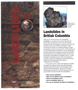
British Columbia's steep, mountainous terrain, its complex geology, its high precipitation, both as rain and snow, its abundance of unconsolidated glacial sediments, and its geographic position astride the earthquake zone that surrounds the Pacific Ocean, all combine to make our province particularly susceptible to landslide activity. In fact, in British Columbia the loss of life and damage to property caused by landslides is greater than losses caused by other natural hazards such as earthquakes and flooding.
Mineral Resource Assessment of Nisga'a Memorial Lava Bed Recreation Area
1993-10: Geological Survey Branch, 1993-1994 Business Plan
Geological Survey Branch, 1993-1994 Business Plan
1993-13: British Columbia Mining, Exploration and Development 1993 Highlights
T.G. Schroeter
1992
L.D. Jones and C.B. McPeek
Information on mineral deposits in a country or province is valuable to the mining industry and essential for government planning, particularly when it is easily stored, searched and distributed. The British Columbia Geological Survey Branch maintains a comprehensive mineral inventory database of over 10 500 metallic, industrial mineral and coal occurrences, known as MINFILE.
This guide is provided for researchers anticipating publication by the British Columbia Geological Survey Branch. Perhaps more importantly, it is a reference for editors and typesetters which will help ensure consistency in style, usage and format in BC Geological Survey products.
This style manual, outlining the elements of good scientific writing and BC Geological Survey usage, has been written for the guidance of authors, editors, secretarial and publications staff. Please review the guide before you start to write - this may save everyone many hours of needless work recovering from inadvertent mistakes.
Geological Survey Branch, 1992-93 Plan
B.C. Geological Survey Branch, 1992 - 1993 Project Inventory
This brochure briefly describes limestone & dolomite deposits, discussing BC's reserves, production and markets or opportunities for the resource. It has a location map of selected major limestone and dolomite occurrences.
This brochure briefly describes magnesite deposits, discussing BC's reserves, production, markets and exploration potential for the resource. It has a location map of selected major occurrences.
This brochure briefly describes Silicon, Ferrosilicon, and Silicon Carbide deposits, discussing BC's reserves, production and markets for these resources. It has a location map of selected major occurrences within BC.
This publication contains two location maps and a quantity/value table of industrial minerals produced in BC in 1990. The first map shows the locations of industrial mineral producers in BC and the second the location of active industrial mineral mines.
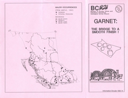
This brochure briefly describes garnet deposits, discussing BC's reserves, production and markets for the resource. It has a location map of selected major occurrences.
This brochure briefly describes peat deposits, discussing BC's reserves, production and markets for this resource. It has a location map of selected major occurrences within BC.
This brochure briefly describes garnet deposits, discussing BC's reserves, production, (global) markets and uses for the resource. It has a location map of selected major occurrences.
This brochure briefly describes Zeolite, Perlite, Fullers Earth, Diatomite, and Kaolin deposits, discussing BC's reserves, production and markets for these resources. It has a location map of selected major occurrences within BC.
The province of British Columbia is richly endowed with more than 19 billion tonnes of coal resources which range from lignite to anthracite in rank. This brochure summarizes available information concerning the major coalfields and provides generalized coal-quality data for each. Averages of quality parameters are generally cited without reference to the range of values.
This is the second edition of the British Columbia Coal Quality Catalogue. It outlines the range of coal qualities occurring in British Columbia on a deposit-by-deposit basis. It is intended to be used in conjunction with Paper 1986-3, Coal in British Columbia. General information concerning coal quality in the province can also be found in Information Circular 1991-20, a brochure entitled British Columbia's Coals - Quality and Resources. The Catalogue is intended to be used as a guide to the quality of available British Columbia coal products and is also intended to provide a scientific database of coal quality information.
W. Kilby
The British Columbia Geological Survey Branch's workshop on mineral potential map methodology was held in Victoria on April 22 and 23, 1992. It brought together both experts on the processes and potential clients for the products. The objective was to define a methodology which would meet the goals of the BC MEMPR's mineral potential initiative.
Participants from across Canada and the western United States of America were present. One day of formal presentations was followed by a day on which the delegates were divided into 4 working groups to address specific areas of concern.
This summary is a compilation of the recommendations from the workshop. A full description of the methodology to be employed on the BC Mineral Potential Initiative will be addressed in a later document. The enthusiastic sharing of expertise and expectations by workshop participants has been critical in the formation of a project strategy.
R. Turner, T. Höy, C. Leitch and D. Anderson
The Sullivan Project - Ocean Drilling Project field trip focuses on the nature of the Aldridge Formation in the vicinity of the Sullivan mine, south-eastern British Columbia. The field trip is not a general overview of the geology of this area but instead pays special attention to elucidating the tectonic setting of this Proterozoic sedimentary basin during a period of syn-rift turbidite sedimentation; intrusion by mafic magma; significant heating, movement and exhalation of hydrothermal fluids, and formation of extensive sediment alteration and mineralization including formation of the world class Sullivan ore-body.
This field guide is a preliminary version of the guide which will be prepared for a Belt Symposium field trip in August, 1993. As such it has not been subjected to the normal scientific and editorial review process.
Mining is important to British Columbia, ranking as the second largest goods producing industry in the province. It generates about $3 billion in revenue annually for the provincial economy and is a cornerstone of regional development. Some of the challenges facing the industry in the 1990s include: declining base metal reserves; technological change; environmental and safety concerns; completing land uses; aboriginal involvement; and, increasing international competitiveness.
The 1991-1995 Canada-British Columbia Mineral Development Agreement (MDA) will address these challenges through government and industry initiated projects.
S.F. Learning
This brochure briefly describes jade deposits, discussing jade in BC's history along with reserves, production and markets or opportunities for the resource. It has a location map of selected major jade occurrences.
R.E. Meyers
British Columbia Exploration and Development Highlights and Initiatives 1992
1991
V.A. Preto
British Columbia Mineral Exploration Review 1989
Retired
Earthquakes in British Columbia
Superceded by Open File 1998-11
The British Columbia geoscience database is made available largely through a variety of reports, maps and computer data generated by the BC Geological Survey. The Ministry of Energy and Mines and its predecessors have issued publications since 1874 but the character of these publications has varied over the years in response to changing demands from clients of government.
This publication provides a listing of 2099 geoscience publications sorted by National Topographic System (NTS) location within the Province of British Columbia and alphabetically by author. It is a comprehensive database containing references up to March 1991. The index includes all Bulletins, Paper, Open Files, maps and Information Circulars as well as indicidual article citations from the compilation volumes Geological Fieldwork, Exploration in British Columbia, Geology, Exploration and Mining in British Columbia, and Geology in British Columbia.
These notes cover the fieldtrip held in conjunction to the 27th Forum on the Geology of Industrial Minerals; May 5 - 10th, 1991, held in Banff, Alberta.
This is an inventory of major projects which the B.C. Geological Survey Branch will carry out during the 1991 field season. This publication is intended to document this current research for government, the mineral industry and the interested public.
This plan is a summary of the Branch's business and what it intends to accomplish in the 1991/92 Fiscal Year. It outlines our mandate, key functions, organization, 1991/92 Action Plans and new initiatives. It should be used in conjunction with the Branch's project inventory, which details all the major projects the Branch will undertake this year. The plan and the inventory are developed by Branch staff to help us translate our goals and objectives into measurable, achievable outputs.
J. Riddell
This booklet is published by the Geological Survey Branch of the British Columbia Ministry of Energy, Mines and Petroleum Resources to assist students, teachers, prospectors, rockhounds and the general public in finding general information on the rocks, minerals and fossils of British Columbia.
V.A. Preto
British Columbia Exploration and Development Highlights for 1991
1990
British Columbia Mineral Exploration Review 1989
The province of British Columbia is richly endowed with coal resources. These abundant in-place reserves (2.9 billion tonnes) have a wide variation in rank (lignite to anthracite) and a broad geographic distribution. This brochure summarizes the major B.C. coalfields and provides generalized coal specifications for each area.
D. Lefebure, M.L. Malott
A Review of 1989 Exploration and Mining Activity in Northwestern British Columbia
This plan is a summary of the Branch's business and what it intends to accomplish in the 1990/91 Fiscal Year. It outlines our mandate, key functions, organization, 1990/91 Action Plans and new initiatives. It should be used in conjunction with the Branch's project inventory, which details all the major projects the Branch will undertake this year. The plan and the inventory are developed by Branch staff to help us translate our goals and objectives into measurable, achievable outputs.
C.R. Barnes, D.A. Barr, J.M. Hamilton, W.D. McRitchie, E.R.W. Neale, and H.G. Rushton
Providing Geological Data for Mineral Resource Development and Management
This is an inventory of major projects which the Geological Survey Branch plans to undertake during the 1990 field season. This publication is designed to inform the mineral industry and interested public of the locations and objectives of our current research.
T.E. Kalnins, A.F. Wilcox, L. deGroot, J.G. McArthur, C. McPeek, S. Morrison, A. Guilbault and D. Edgecombe
This brochure briefly describes the A.R.I.S. database and its history up until the 1990s. It also describes the architecture on a VAX computer using a VMS operating system and lists the types of searches available. Entity-Relationsip Model at the end of the text.
J. Pell and Z.D. Hora
Recent technological breakthroughs in the fields of ceramics, medicine, aerospace engineering and electronics, in particular the areas of computers and superconductors, are creating new uses for a variety of rare and minor metals. These include zirconium (Zr), hafnium (Hf), yttrium (Y), rare-earth or lanthanide elements (REE), germanium (Ge), gallium (Ga), niobium (Nb), tantalum (Ta) and beryllium (Be). As a result, there is now considerable interest in economic deposits of these metals, however, most geologists and prospectors are unfamiliar with these commodities and the geological environments in which they occur.
With the exception of a minor amount of byproduct recovery of gallium and germanium from Cominco’s Trail smelter, none of these metals is currently produced in British Columbia. The purpose of this Information Circular is to increase awareness of these commodities and to provide the background information which will hopefully lead to new discoveries of these resources.
1989
Mineral exploration continued at a very strong pace in 1988, with the main focus remaining on gold and silver. An all-time record of $192 million in mineral exploration expenditures was registered in 1987, and 1988 is expected to reach $150 million. The number of claims staked in 1988 was 73 870, down by 24 387 from the 98 257 claims recorded in 1987. This represents a 25 per cent decrease in staking activity from the previous year, a reasonable figure assuming many companies have commenced advanced exploration programs after completing a ground acquisition phase in the earlier stages of the precious metals boom.
Information circular 1989-02 provides an overview of the industrial minerals programs in British Columbia from 1985 to 1988.
The annual value of industrial mineral production, along with the structural materials, varies between 10 and 15 per cent of the combined value of minerals, coal, petroleum and natural gas, and has been steadily increasing since 1960. In 1986 there was reported production of 13 industrial mineral commodities with a total value of $132 million; structural materials produced accounted for an additional $235 million.
During the period of 1985-1988 many of the programs undertaken by the Industrial Minerals Subsection were funded under the Canada/British Columbia Mineral Development Agreement. These programs varied in scope from literature research and compilation to detailed site specific studies and regional investigations in the field. Increasing support of the BC Geological Survey activities by the Provincial government during the past few years has led to increasing support for new industrial mineral projects.
13th Annual Advanced Prospecting Course, Cowichan Lake Research Station, Mesachie Lake, B.C. April 24 to May 11, 1989
MINFILE/pc is a valuable search-and-report program for explorationists researching the MINFILE database. You can review existing mineral deposit information and use the searching power to follow up your exploration
ideas and models. Searches are conducted by inputting parameters into the simple, userfriendly screen menus; information files are created which can be saved for future reference and to produce plots; reports may be generated with the search results. As a desktop prospecting tool, MINFILE/pc can play a prominent role in the design of any grassroots exploration program.
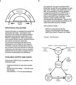
MINFILE/vax is a relational database programmed for a VAX computer. This powerful analytical tool is accessed by using third and fourth generation computer languages and will provide information-output in response to specified queries.
Property File continously expands as new material specific to mineral occurrences and/or areas is received. Information contained in Property File consists of published and unpublished reports, news clippings, bulletins,
ministry reports, theses, papers, field notes, company prospectuses and pamphlets, historical and commodity information, geology, geochemistry, geophysics, drilling data, and claim maps, sketches of workings, photographs, and old mineral inventory summaries and bibliographies (from early 1960's).
This inventory of the major projects the Geological Survey Branch will undertake in Fiscal 1989-90 is primarily designed to inform the exploration industry and interested public of the location and objectives of our 1989 field projects. Project leaders are available for consultation both during and after the field season.
The recently significantly expanded field programs will be continued this year. They are made possible by increases to the base budget of the Branch, to a total of $6.22 million this year, and by an allocation of $984,000 from the Canada/British Columbia Mineral Development Agreement (MDA). Projects funded by the MDA are identified by an (M) in the text. This is the last year of field activity under the current Mineral Development Agreement.
The major program for the Branch in 1989 is 1:50 000-scale regional mapping. Maps at this scale have been identified by industry as the fundamental underpinning for exploration work, yet only 5 per cent of British Columbia has been mapped at this or larger scales. Nine mapping projects will be carried out in poorly known, frontier areas of the province. These projects, together with ongoing and new projects in geochemistry, mineral deposits, industrial minerals and coal will be a valuable stimulus and guide to exploration.
This is the first edition of the British Columbia Coal Quality Catalog. It outlines the range of coal qualities available in British Columbia on a seam-by-seam basis from currently producing coal mines and coal properties which are considered to have potential for economic development in the future. It is intended to be used in conjunction with Paper 1986-03, Coal in British Columbia. We intend to revise the catalog every two years, in order to keep it as up-to-date as possible.
The British Columbia Coal Quality Catalog has been assembled by staff of the Coal Resources Subsection of the British Columbia Geological Survey Branch of the Ministry of Energy, Mines and Petroleum Resources.
British Columbia Geological Survey - Providing Geological Data for Mineral Resource Development and Management
Retired
This plan is a summary of the Branch's business and what it intends to accomplish in the 1989/90 Fiscal Year. It outlines our mandate, key functions, organization, 1989-90 Action Plans and new initiatives. It should be used in conjunction with the Branch's project inventory, which details all the major projects the Branch will undertake this year. The plan and the inventory are developed by Branch staff to help us translate our goals and objectives into measurable, achievable outputs.
1988
1988-01: British Columbia Mineral Exploration Review 1987
British Columbia Mineral Exploration Review 1987
This inventory of the major projects the Geological Survey Branch will undertake in Fiscal 1988-89 is primarily designed to inform the exploration industry and intereste public of the location and objectives of our 1988 field projects . Project leaders are available for consultation both during and after the field season. This is the most extensive field program undertaken in the history of the Branch. It is made possible by recent significant increases in the base budget; $1.5 million in 1988-89 and $2.0 million in 1987-88, for a total base budget of $6.67 million this year. In addition the Branch has been allocated $1.6 million from the Canada/British Columbia Mineral Development Agreement (MDA) for geoscience programs in 1988. Projects funded by the MDA are identified by an (M) in the text .
The major new initiative of the Branch is in 1:50,000 scale regional mapping projects . Maps at this scale have been identified by industry as the fundamental underpinning for exploration work, yet only 5% of British Columbia has been mapped at this or larger scales. Three new mapping projects will be initiated in 1988 in the poorly known, frontier areas in the northwest of the province. These new programs, together with six regional mapping projects and metallogenic industrial mineral and coal already in progress, will be a valuable stimulus and guide to mineral exploration in these areas. Comments, suggestions, and queries regarding the
Branch's geoscience program are welcome.
The major new initiative of the Branch is in 1:50,000 scale regional mapping projects . Maps at this scale have been identified by industry as the fundamental underpinning for exploration work, yet only 5% of British Columbia has been mapped at this or larger scales. Three new mapping projects will be initiated in 1988 in the poorly known, frontier areas in the northwest of the province. These new programs, together with six regional mapping projects and metallogenic industrial mineral and coal already in progress, will be a valuable stimulus and guide to mineral exploration in these areas. Comments, suggestions, and queries regarding the Branch's geoscience program are welcome.
G.V. White and Z.D. Hora
Dimension stone is natural rock which has been quarried and shaped to meet specific requirements. The quarried stone may be finished in a number of ways including: ground polished, honed, bossaged, bush hammered, tooled, crenelated, flamed, denteled, polished and/or scab texture. The measures of these terms are given in the glossary at the end of the booklet.
Igneous, metamorphic and sedimentary rocks are used as dimension stone. Typically though, the most common types include granite, marble, limestone, sandstone and slate. Semi-precious varieties include jade and rhodonite.
At the turn of the century, British Columbia produced a wide variety of quality dimension stone for both domestic and foreign markets. The industry flourished until the 1930s when many of the producing quarries closed. Today, most dimension stone used in the Province is imported and only minor amounts are supplied from local sources. This publication is designed to increase the awareness of natural stone available in British Columbia and promote significant sources of aesthetically attractive dimension stone with good physical properties and excellent development potential.
This project was funded under the Canada/British Columbia Mineral Development Agreement, a 5-year joint federal/provincial $10 million program to enhance and diversify the British Columbia mineral industry.
1987
Geological Survey Branch, 1986-87 Plan
British Columbia Mineral Exploration Review 1986
E. Van der Flier-Keller and W.J. McMillan
The entire earth's surface is made up of rocks. Although in many places the rocks are covered with river, wind or glacially deposited materials, there are few places in British Columbia where rocks cannot be found. A large number of different rock types exist. The identification of common rocks may, however, be complicated by the fact that certain rock types grade into each other. For example, there is every gradation between a shale and a sandstone - including sandy shale and shaly sandstone, and also between granite and gabbro. In addition, a single rock type may vary in appearance.
This publication deals mainly with rock types found in British Columbia. However, the rocks of this province are not unique and the principles used here can be applied anywhere. The geology of British Columbia is fascinating; it is complex, many processes are at work, and there are a great variety of rocks. Rocks are an integral part of the landscape; being able to identify them can greatly enhance your enjoyment of the natural world.
View Information Circular 1987-05 (PDF, 2.11 MB)
The Identification of Common Rocks (PDF, 13.5 MB), Ministry of Energy, Transport and Communications, 1980.
Geological Survey Branch, 1987-88 Project Inventory
1986
1986-01: British Columbia Mineral Exploration Review 1985
British Columbia Mineral Exploration Review 1985
Geological Survey Branch, 1986-87 Plan
Geological Survey Branch, 1986-87 Project Inventory
1985
British Columbia Mineral Exploration Review 1984
1984
British Columbia Mineral Exploration Review 1983

