Open Files 1999-1990
Open Files present the interim results of ongoing research, particularly mapping projects.
Jump to:
2018-2010 | 2009-2000 | 1999 | 1998 | 1997 | 1996 | 1995 | 1994 | 1993 | 1992 | 1991 | 1990 | 1989-1986
1999
G. Owsiacki, M. Cathro, P. Wojdak, R. Pinsent, P. Wilton, R. Lane and T. Schroeter
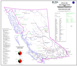
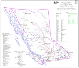
Open File 1999-01 contains 2 maps at 1:2,500,000-scale and a MINFILE data disk. The disk provides data on 117 deposits including operating mines, projects in the Environmental Assessment Review, projects that have received Mine Development Certificates or have been Certified, and exploration highlights and advanced exploration/development projects in British Columbia. The maps show the location of each of the 117 deposits or exploration project contained in the dataset.
The diskette contains the data presented on the 2 maps.
In 1998, a total of 60 deposits (metallic mineral, industrial mineral and coal) were being mined in the province of British Columbia. Kemess South started production and Blackdome was reopened in 1998. Several small high-grade projects continue to produce, or plan to produce, using custom milling arrangements. The deposit types mined include: veins, volcanogenic and sedimentary exhalative massive sulphides, porphyries, transitionals (porphyry to epithermal), coal, industrial minerals, skarns and others.
During 1998 the exploration industry in British Columbia concentrated on known mining camps/areas, particularly near existing infrastructure. A number of advanced projects are in the Environmental Assessment Review, with several in the pre-feasibility stage, as well as some receiving Certification or a Mine Development Certificate.
N.W.D. Massey
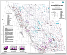
Volcanogenic massive sulphides are an important resource in British Columbia both for base and precious metals. Current exploration interest is focused largely on the precious metal-rich Eskay-type deposits which are attractive because of their polymetallic nature and bonanza grades (e.g. Eskay Creek - 1998 reserves 1,356,240 t at 2684 g/t Ag, 58 g/t Au).
A hundred years of exploitation from 16 major mines has produced nearly 109,000,000 t of ore. This has resulted in the production of over 3,000,000 kg Ag, 82,500 kg Au, 1,460,000 t Cu, 96,400 t Pb, 1,000,000 t Zn and 2,000 t Cd. The bulk of this production has come from four mines - Britannia, Anyox (Hidden Creek), Myra Falls and Granduc. Myra Falls and Eskay Creek are presently operating, while Tulsequah Chief has received mine certification.
The revised Open File 1999-2 documents 269 VMS occurrences recorded in MINFILE, including examples from all four major deposit model types. They occur in all the tectonic belts, except Cratonal North America.
Kuroko-type deposits form the largest number of occurrences (180) being hosted dominantly in Upper Paleozoic (e.g. Myra Falls, Rea Gold, Tulsequah Chief) and Lower-Middle Jurassic sequences (e.g. Seneca), although Cretaceous sequences (e.g. Britannia) are also important.
Besshi-type deposits are second most numerous (58) being hosted primarily in Lower Paleozoic (e.g. Goldstream, J & L) and Triassic (e.g. Windy Craggy) sequences. Cyprus-type and Eskay-type deposits are less common (13 and 18 occurrences respectively) but nevertheless include important mines (e.g. Anyox and Eskay Creek).
D.V. Lefebure, M.A. Fournier, W. Jackaman
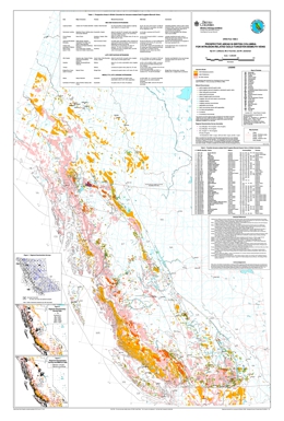
Gold-quartz veins related to Cretaceous age granitic intrusions in Alaska and the Yukon have created the Cordillera's latest gold rush. The initial interest was sparked by the opening of the Fort Knox open pit mine in the Fairbanks District and discoveries in the Yukon, such as Dublin Gulch and Brewery Creek. The discovery of the Pogo gold-quartz vein in Alaska (reserves of 10.9 million tons grading 0.41 oz. gold per ton) has attracted more exploration activity.
Similar mid-Cretaceous and other granitic intrusions are found in British Columbia. This map (at 1:2 000 000 scale) shows their locations, identifies known intrusion-related gold-tungsten-bismuth mineralization and highlights prospective areas for exploration.
Superseded by Open File 2000-15
Compiled by: MINFILE Team
This 192-page report includes a 113-page table of 808 mineral deposits in British Columbia with known reserves and resources. The inventory, which is sorted by deposit name, includes the tonnage and grade of metallic minerals, industrial minerals, and coal occurrences. These deposits are cross-referenced with tables sorted by MINFILE Number, alternate names and deposit type. The tables were generated from MINFILE/pc V. 4.5 and reflect the status of the MINFILE database as of January 1999.
This Open File was created to serve as a handy hard-copy reference for anyone interested in British Columbia’s rich mineral endowment. This publication will appeal to a wide variety of local and international users, including government agencies, mining and exploration companies, researchers and the public.
S.J. Cook, W. Jackaman, R.E. Lett, M.W. McCurdy and S.J. Day
Open File 1999-5 presents new analytical results for three regional lake water geochemical surveys conducted over parts of the Nechako Plateau in central B.C. during the period 1993-1996. The surveys cover the southern Nechako River area, the Pinchi fault zone area north of Fort St. James and the Babine porphyry belt. These areas, almost 9000 square kilometres, are in a region where exploration has been limited by extensive drift cover. Major and trace element data for 630 sites are included in the release. In the case of the Babine porphyry belt, conductivity and total dissolved solids were also determined.
The surface waters were obtained over the course of regional lake sediment geochemical surveys, data for which has been released previously.
Open File 1999-05 is a contribution to the Nechako NATMAP Project, a joint project of the British Columbia Geological Survey and the Geological Survey of Canada.
S.J. Cook, W. Jackaman, P.W. Friske, S.J. Day, G.E.M. Hall and A.M. Coneys
Open File 1999-06 presents new ICP-MS analytical results for a regional lake water geochemical survey conducted over the northern part of the Kechika Trough in 1996. The survey, conducted jointly by the BC Geological Survey and the Geological Survey of Canada, covers an area of approximately 5000 km2 over parts of eleven 1:50,000 map areas immediately south of the B.C.-Yukon border. Exploration for prospective sedimentary-exhalative style Zn-Pb-Ba deposits in this area has been limited by extensive drift cover.
Major and trace element data for 235 surface lake water sites are included in the release. The report provides listings of field and analytical data, summary statistics and element distribution maps. Digital data listings (ASCII format) are provided on a 3.5 inch high-density diskette. This release is also available as GSC Open File 3704.
The surface waters were obtained over the course of a regional lake sediment geochemical survey, data for which has been released previously as Open File 1997-15. A corresponding 1:100,000 geological map of this area (Ferri et al.) has recently been released by the BC Geological Survey as Geoscience Map 1998-10.
C.H. Ash, A. Panteleyev, K.L. MacLennan, C.W. Payne and M.O. Rydman
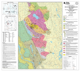
This 1:50 000-scale revised geology map of the Gibraltar region is available in digital format with the geology in colour. The map is centred on the Gibraltar Mine and is a product resulting from a study to define the controls and distribution of copper and molybdenum ore at the mine. After 25 years of production (1972-1998) the mine is currently on standby and may reopen in the near future provided the economic conditions are favourable. This updated map will provide a better understanding of the Gibraltar deposit and its setting, locally and regionally.
Preliminary Abstract: (prior to posting of digital version):
Open File map 1999-07 presents preliminary results of geological field mapping in the Gibraltar mine area (NTS 93B/8, 9) of east central British Columbia. The 1:50 000 scale map covers an area of over 500 square kilometres and provides the basis for a new interpretation of the setting of the Granite Mountain Batholith, its mode of emplacement and its relationship to surrounding Cache Creek accretionary complex rocks. Mineral occurrences and some drill hole localities are also included.
The dominant rock types in the region are metabasalt, limestone and argillaceous metasediments of the Mississippian to Triassic Cache Creek Group. These are intruded by the dioritic to quartz dioritic Late Triassic Granite Mountain pluton and the (?)Cretaceous Sheridan Creek pluton. Jurassic sedimentary rocks overlap both the Cache Creek and Quesnel terranes to the north and east of the plutons. Older rocks are largely obscured by Plateau Basalt of probable Miocene age, to the west.
The Granite Mountain pluton has been affected by regional metamorphism (greenschist facies) and deformation along with the enclosing Cache Creek Group. The Cache Creek Group and the margins of the Granite Mountain pluton record effects of ductile deformation. The main body of the pluton has been cataclastically deformed.
The orebodies are hosted by the Granite Mountain pluton with ore mineralization almost entirely confined to the Mine Phase Tonalite portion of the Granite Mountain pluton. The Mine Phase Tonalite appears to form a thin outer shell about the main body of the pluton. Gibraltar is a porphyry copper deposit with values of molybdenum, silver and gold. Production came from several open pit mines and in excess of 300 million tonnes were milled; potential for similar deposits exists in the area.
S.L. Gardner, Gardner Exploration Consultants
Open File 1999-08 provides an overview of the history of coal mining and exploration on Vancouver Island. A number of maps outline prospective exploration areas and areas of previous mining and exploration. The extent and stratigraphy of the coal bearing rocks are reviewed. Coal mining on the island continues today and there are undeveloped coal reserves.
There is also potential for coalbed methane development. This report provides an excellent starting point for anyone interested in information on Vancouver Island coal.
G.J. Simandl, Z.D. Hora, and D.V. Lefebure
The British Columbia (BC) Geological Survey started a mineral potential assessment in 1992 utilizing deposit models for defining and characterizing mineral and coal deposits which exist, or for which favourable geological environments could exist, in the province. These deposit models are being used to classify known deposits and occurrences, to guide experts in their estimation of the number of possible undiscovered mineral deposits, and to group deposits to allow compilation of representative grade and tonnage data.
The BC Geological Survey formerly relied on mineral deposit models published by the United States Geological Survey (USGS) and Geological Survey of Canada (GSC). However, it became apparent that some models needed revision, and that there are British Columbia deposit types lacking published models. Hence we developed a set of mineral deposit profiles using the BC Geological Survey's considerable in-house expertise, with assistance from economic geologists of the GSC, USGS, industry and academia.
These deposit models are called "deposit profiles" to distinguish them from other published descriptions. This Open File 1999-10 document is the third volume describing deposit profiles, including industrial minerals and gemstones. Other volumes are:
Volume 1 - Metallics and Coal (Open File 1995-20)
Volume 2 - Metallic Deposits (Open File 1996-13)
Volume 3 - Industrial Minerals and Gemstones (Open File 1999-10) contains the following Mineral Deposit Profiles:
D01 - Open-system zeolites; D02 - Closed-basin zeolites; E06 - Bentonite; E07 - Sedimentary kaolin; E08 - Carbonate-hosted talc; E09 - Sparry magnesite; K08 - Garnet skarns; K09 - Wollastonite skarns; M04 - Ultramafic-hosted Ti-Fe-V oxide deposits; M06 - Ultramafic-hosted chrysotile asbestos; M07 - Ultramafic-hosted talc-magnesite; M08 - Vermiculite; N01 - Carbonatite-associated deposits; N02 - Kimberlite-hosted diamonds; N03 - Lamproite-hosted diamonds; P01 - Andalusite hornfels; P02 - Kyanite, muscovite, garnet in metasediments; P03 - Microcrystalline graphite; P04 - Crystalline flake graphite; P05 - Vein graphite in metamorphic terranes; P06 - Corundum in alumina-rich metasediments; Q06 - Columbia-type emeralds; Q07 - Schist-hosted emeralds; Q08 - Sediment-hosted opal; Q09 - Ultramafic-related corundum (contact metamorphic/metasomatic); Q10 - Alkali basalt and lamprophyre-hosted sapphire and ruby; Q11 - Volcanic-hosted opal; R09 - Limestone
These three volumes were combined in a 2018 compilation volume (Miscellaneous Publication 86), which has been proceeded by GeoFile 2020-11.
D. MacIntyre and P. Schiarizza
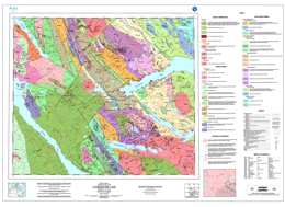
Open File map 1999-11 presents the preliminary bedrock geology of the Cunningham Lake area, Central British Columbia at 1:100,000 scale. The map is in colour and is based on fieldwork completed by the BC Geological Survey and Geological Survey of Canada during the 1997 and 1998 field seasons as part of the Nechako Natmap project. It builds on previous regional scale mapping by J. Armstrong of the Geological Survey of Canada dating back to 1949. The new mapping presents significant revisions to previous geologic maps of the area.
The Cunningham Lake area, which covers parts of Babine, Stuart and Trembleur Lakes, is located north of Burns Lake and west of Fort St. James. This area spans the boundary between the Stikine and Cache Creek geologic terranes. Within the Cache Creek terrane is the Sitlika volcanic belt considered to be prospective for Kutcho Creek type massive sulphide deposits. This belt is well exposed at several localities within the map area. Prior to the current mapping, this belt was believed restricted to the Takla Lake area to the north. Other important mineral prospects in the area include the Mac porphyry molybdenum deposit and the new Fort occurrence discovered in 1998.
N.W.D. Massey, D.J. Alldrick and D.V. Lefebure
The Eskay Creek property lies 80 km north of Stewart, near the western margin of the Intermontane tectonic belt. The property includes several deposits of polymetallic sulphide and sulphosalt mineralization as both exhalative massive sulphides and discordant veins. These deposits are very attractive because of their enhanced precious metal contents and polymetallic nature. Eskay Creek has a mineable reserve of 1.45 Mt grading 57.7 grams per tonne gold and 2493 grams per tonne silver as of January 1, 1999 and is the fifth largest silver producer in the world.
The Eskay Creek deposits are examples of shallow subaqueous hot spring deposits, an important new class of submarine mineral deposits that has only recently been recognized in modern geological environments. The deposit type is transitional between subaerial hot spring Au-Ag deposits and deeper water, volcanogenic massive sulphide exhalites (Kuroko or Besshi types) and shares mineralogical, geochemical and other characteristics of both. They are relatively underexplored and poorly recognized within the geological record.
This study documents relevant geological, mineral deposit and geochemical indicators for Eskay Creek-type deposits in British Columbia on two 1:2 000 000-scale maps. Twenty-two prospective areas with potential for hosting Eskay Creek-type deposits are outlined. MINFILE descriptions are included for 10 known and 20 possible Eskay Creek-type deposits in the province.
1998
G. Owsiacki, M. Cathro, P. Wojdak, R. Pinsent, P. Wilton, R. Lane and T. Schroeter
Open File 1998-01 contains 2 maps at 1:2,500,000-scale and a MINFILE data disk. The disk provides data on 158 deposits including operating mines, projects in the Environmental Assessment Review, projects that have received Mine Development Certificates or have been Certified, and exploration highlights and advanced exploration/development projects in British Columbia. The maps show the location of each of the 158 deposits contained in the dataset.
In 1997, a total of 57 deposits (metallic mineral, industrial mineral and coal) were being mined in the province of British Columbia. Three new mines, Mount Polley, Huckleberry and Golden Bear, started up in 1997. Kemess South is currently under construction. Most mines had significant exploration programs, some with good results. Several small high-grade projects continue to produce, or plan to produce, using custom milling arrangements. The deposit types mined include: veins, volcanogenic and sedimentary exhalative massive sulphides, porphyries, transitionals (porphyry to epithermal), coal, industrial minerals, skarns and others.
During 1997 the exploration industry in British Columbia concentrated on known mining camps/areas, particularly near existing infrastructure. A number of advanced projects are in the Environmental Assessment Review (previously known as Mine Development Assessment Process), with several in the pre-feasibility stage, as well as some receiving Certification or a Mine Development Certificate.
The MINFILE information includes geological descriptions and bibliographies for each deposit as well as production and inventory statistics.
This data is intended to be used independent of the regular provincial MINFILE data release. This publication will interest a wide variety of national and international users, including governments, mining and related industries, and the public.
Note that these deposits are also included in the provincial MINFILE database.
R.C. Paulen, P.T. Bobrowsky, E.C. Little, A.C. Prebble and A. Ledwon
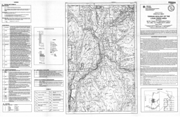
Open File 1998-02, at 1: 50 000 scale, provides surficial geologic information collected during a till geochemistry survey which is part of the integrated Kootenay Terrane project. Information shown on the map includes type and distribution of surficial sediment observed, relative thickness, till sample locations, field verification sites and generalized composite stratigraphy for several key sites in the area of Louis Creek north of Kamloops (NTS 92P/1E). The area has potential mainly for placer and lode gold deposits but also for Kuroko-type massive sulphide deposits. Industrial minerals, such as feldspar in pegmatite bodies, are also of potential interest.
R.C. Paulen, P.T. Bobrowsky, E.C. Little, A.C. Prebble and A. Ledwon
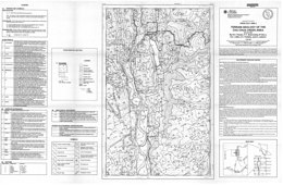
Open File map 1998-03 displays the terrain geology of the Chu Chua creek area (NTS 92P/8E). This map, which is at 1: 50 000 scale, provides surficial geologic information collected during a till geochemistry survey which is part of the integrated Kootenay Terrane project. Information shown on the map includes type and distribution of surficial sediment observed, relative thickness, till sample locations, field verification sites and generalized composite stratigraphy for several key sites in the area of Chu Chua Creek north of Kamloops in south central British Columbia. The area has potential for precious metal and Cyprus massive sulphide Cu (Zn) massive sulphide deposits, like the magnetite-bearing Chu Chua copper, zinc precious metal prospect.
P.T. Bobrowsky, N.W.D. Massey, and A. Matheson
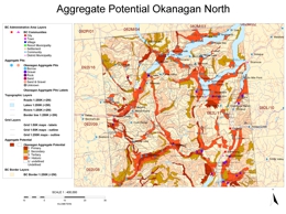
Aggregate potential maps provide guidelines for testing, evaluating and managing aggregate resources within a defined area. The maps provide first approximation estimates of broad, regional aggregate distribution and are suitable for use by municipal and land use planners as well as the aggregate industry.
In 1996, a survey was initiated in the Shushwap and Okanagan areas of southeastern British Columbia, where expansion of population has stressed existing aggregate resources. The study area comprises sixteen 1:50,000-scale map sheets covering the western halves of NTS sheets 82E and 82L. The area forms a corridor 80 km wide and 200 km long stretching from Shushwap Lake south to Osoyoos and the US border.
Fieldwork during 1996 and 1997, combined with air-photo interpretation, identified 308 pits in the study area. Each pit has been accurately located, by hand-held GPS or from published NTS maps, and its host landform type determined. Preliminary results suggest that glaciofluvial deposits, located mainly in and along the low-lying valleys, host 80% of the aggregate pits in the study area. Of these, glaciofluvial fans, terraces and kame terraces account for 75% of the pits. Fluvial sediments (e.g. fans and deltas) form only thin deposits of unconsolidated material and host less than 9% of the pits.
Within the Okanagan area, 3400 individual areas (polygons) have been assessed for hosting potential natural aggregate resources. The polygons are based on soil and landform units identified and delineated by Kowall (1986) and Wittneben (1989), with additions and modifications by the authors. Data derived from these polygons has been combined with the pit inventory, water well records and available geotechnical data to produce the final aggregate resource potential maps.
All polygons (220) which host present or historical aggregate pits were separated out and assigned a classification "H". These represent 9.95% of the total area. In the rest of the project area, 274 polygons have been assessed as being of primary, 552 of secondary and 1296 of tertiary potential. These comprise 5.58%, 16.54% and 34.16%, respectively, of the total map area. Remaining polygons (1085) are classified "U" (Unclassified) comprising 33.78% of the total area.
The resulting aggregate potential maps have been released, in digital format only, as:
P.T. Bobrowsky, PGeo, N.W.D. Massey, PGeo., and A. Matheson, PGeo. (1998); Aggregate Resource Potential of the Okanagan Area (NTS 82E(west) and 82L(west)), B.C. Ministry of Energy and Mines, Open File 1998-5.
P.T. Bobrowsky, R. Paulen, E. Little, A. Prebble, A. Ledwon and R. Lett
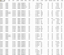
Open File 1998-06 presents new geochemical analytical data for a regional till survey in the Louis Creek - Chu Chua Creek area (NTS 92P/1 and P/8) carried out by the BC Geological Survey in 1997. The till geochemical survey covers over 1500 square kilometres northeast of Kamloops and extends the 1996 regional till sampling program over the adjacent 1:50,000 scale maps sheets 82M/4 and 82M/5 reported in Open File 1997-09.
Open File 1998-06 contains geochemical data for up to 65 elements including gold, copper, lead, zinc and major oxides for 331 till samples in the form of symbol maps and as raw element concentrations. The Open File also has a detailed description of each sample and describes the survey methodology, the surficial geology and the Quaternary history. An interpretation of the gold, copper, silver, lead, zinc arsenic and cadmium geochemistry is presented and the most significant anomalous samples for each element are identified and discussed. Most of the till samples with high geochemical values have no known bedrock source.
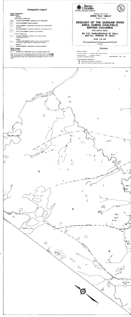
C.G. Cathyl-Bickford and G.L. Hoffman
This Open File comprises fourteen 1: 20 000 scale maps that cover the two major coalfields on Vancouver Island; 8 maps cover the Comox coalfield and 6 maps cover the Nanaimo coalfield. These maps, resulting from mapping completed during the 1980’s and early 1990’s, provide the most up to date and detailed information on the coalfields available.
Some of the information is available in papers published by the BC Geological Survey in Geological Fieldwork for the years 1988, 1989, 1990, and 1991.
Coordinated by D.V. Lefebure
Open File 1998-8 consists of over 500 pages of notes from the course which consisted of 17 presentations by speakers from government, universities and the private sector. The notes include information concerning the tectonic and structural features of arc deposits, geoenvironmental mineral deposit models, epithermal deposits and their transitions to porphyry settings, porphyry copper and gold deposits, gemstones, unconventional metallic deposits, industrial minerals, skarns and volcanogenic massive sulphides. The following are abstracts of those presentations.
The notes include information concerning the tectonic and structural features of arc deposits, geoenvironmental mineral deposit models, epithermal deposits and their transitions to porphyry settings, porphyry copper and gold deposits, gemstones, unconventional metallic deposits, industrial minerals, skarns and volcanogenic massive sulphides. The abstracts are available on line at:
- Arc Metallogeny - Selected Bibliography - J. Thompson, The University of British Columbia
- Tectonic and Structural Features of Arc Deposits - R.V. Kirkham, Geological Survey of Canada
- Geoenvironmental Mineral Deposit Models for the Northern Cordillera - R. Goldfarb, E. du Bray, J. Gray, K. Kelley and G. Plumlee, U.S. Geological Survey
- Potential for High Sulphidation Epithermal Gold Deposits in Canada: The Example of the Hope Brook Au Cu Newfoundland - B. Dubé, Geological Survey of Canada and Greg Dunning, Memorial University of Newfoundland
- Transitions from Porphyry to Epithermal Environments - A. Panteleyev, XDM Geological Consultants
- Porphyry Deposits in Volcanic Arcs with Deposits on the Canadian Cordillera - W.J. McMillan, B.C. Geological Survey
- Alkalic Cu-Au-Ag Porphyry Deposits in the Canadian Cordillera: Tectonic Setting, Magmatic Affiliations and Hydrothermal Characteristics - J. Lang, J.F.H. Thompson, and C.R. Stanley, The University of British Columbia
- Alkalic-Type Epithermal Gold Deposits - J.P. Richards, University of Alberta
- Unconventional Metallic Deposits in Volcanic Arcs - D.V. Lefebure and G.E. Ray, B.C. Geological Survey
- Gemstones in Volcanic Arc Environments - G. Simandl, B.C. Geological Survey
- The Relationship Between Intrusion-related Au-(Cu) Sulphide Veins and Mo Breccias: Rossland - T. Höy, D. Alldrick and K. Dunne, B.C. Geological Survey
- Industrial Minerals in Island Arcs - D. Hora, B.C. Geological Survey
- Skarns and Skarn Deposits in the Canadian Cordillera - G.E. Ray, B.C. Geological Survey
- Arc-related Volcanogenic Massive Sulphide Deposits - J. Franklin, M.D. Hannington, I.R. Jonasson and C.T. Barrie, Geological Survey of Canada
- Geoenvironmental Model of Volcanogenic Massive Sulphide Deposits - C. Alpers and R.A. Zierenberg, U.S. Geological Survey
- Geoenvironmental Characteristics of Epithermal and Porphyry Deposits - G.S. Plumlee, U.S. Geological Survey
- Porphyry Gold Deposits of the Andean Cordillera - J.L. Muntean, Homestake Mining Company
R. Lett, S. Sibbick, and J. Runnells
Open File 1998-09 presents new geochemical analytical data for a regional stream water survey carried out by the BC Geological Survey in 1996. The survey covers 1:50 000 scale map sheets 82M/4 and 82 M/5, an area of about 1200 square kilometres northeast of Kamloops. The survey area corresponds to a 1996 regional till geochemical survey reported in Open File 1997-9.
Open File 1998-09 describes the survey methodology and summarizes results for pH, sulphate, aluminum, fluoride, barium, copper and zinc analyses for samples from 218 stream sites. Maps showing sample locations, selected element variations and raw data listings for over 60 elements are presented as Appendices.
L.D. Jones (P. Geo.), D.V. Lefebure (P. Geo.), G. Owsiacki (P. Geo.) and T.G. Schroeter (P. Eng.)
D.B. Grant, C. Logan, D. Jakobsen and J. Bates
This Open File updates the previous version of the Digital Bibliographic Index (Open File 1994-13) to 1997 and contains the entire bibliographic database for the BC Geological Survey's geoscience publications. This version, and subsequent updates, of the index is only available as free downloadable digital files from this page.
A location map for NTS map sheets is included for your convenience in AutoCad DXF format, and a raster, TIFF format file.

N.W.D. Massey, A. Matheson and P.T. Bobrowsky
In 1998, a survey was initiated in the Nanaimo area of southern Vancouver Island in response to local need for aggregate information to be used for municipal and regional planning. The study area comprises parts of nine 1:50 000-scale map sheets covering an area adjacent to the Straits of Georgia stretching from Parksville to Duncan, and west to Port Alberni.
Fieldwork during August, 1998, combined with air-photo interpretation, identified 101 existing pits in the study area. Each pit has been accurately located, using hand-held GPS or from published NTS maps, and its host landform type was determined in the field. Preliminary results suggest that fluvial and glaciofluvial deposits host 75% of the aggregate pits in the study area. Of these, outwash fans, terraces and kame terraces are the most important host landforms. A significant number of pits (15%) are hosted in marine or glacio-marine deposits.
Within the Nanaimo area, 1394 individual areas (polygons) have been assessed for their potential to host natural aggregate resources. The polygons are based on landform units identified and delineated by Alley (1975, 1977), Cotic (1975), Jungen (1975a,b), Lacelle (1975a,b) and Senyk (1975a,b), with additions and modifications by BC Geological Survey staff as part of this project. Landform data derived from these polygons have been combined with the pit inventory and water well records to produce the final aggregate resource potential maps.
All polygons (48) which host present or historical aggregate pits were assigned a classification "H". These represent 3.64% of the total area. In the rest of the project area, 75 polygons have been assessed as being of primary, 214 of secondary and 662 of tertiary potential. These comprise 5.38%, 15.35% and 47.49%, respectively, of the total map area. Remaining polygons (1085) are classified "U" (Unclassified) comprising 28.34% of the total area.
Massey, N.W.D., PGeo., A. Matheson, PGeo., and P.T. Bobrowsky, PGeo, (1998); Aggregate Resource Potential of the Nanaimo Area (parts of NTS 92B12, 92B13, 92C09, 92C16, 92F01, 92F02, 92F07, 92F08, 92G01); B.C. Ministry of Energy and Mines, Open File 1998-12.
1997
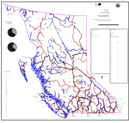
G. Owsiacki, T. Schroeter, P. Wojdak, R. Pinsent, P. Wilton and K. MacDonald
Open File 1997-01 consists of two map sheets. Map sheet one presents the 1996 operating mines and environmental assessment projects in British Columbia. Map sheet two consists of advanced exploration/ development and exploration highlight projects in British Columbia.
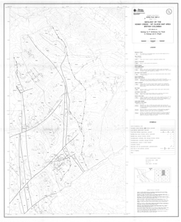
P. Schiarizza, G.J. Payie, S. Holunga and D. Wright
Open File 1997-02 presents the geology and mineral occurrences of the Kenny Creek-Mount Olson map-area (93N/12,13) in central British Columbia. The Open File consists of two sheets: sheet 1 has the geology at 1:50 000 scale, a legend, and references; sheet 2 contains a sample location map and tables of mineral occurrences, lithogeochemistry and stream sediment analyses.
Basement rocks in the area include rocks of the Cache Creek terrane, the Sitlika assemblage and the Stikine terrane. Upper Cretaceous Sustut Group polymictic conglomerate, sandstone and shale of the Tango Creek Formation unconformably overlie the older rocks. Jurassic or Cretaceous biotite granodiorite intrusions cut older strata.
Cache Creek Group rocks of the Cache Creek terrane range from Pennsylvanian to Lower Jurassic age. An ultramafic unit is mainly serpentinite, serpentinized ultramafite and serpentine-magnesite-talc schist and serpentinite melange with greenstone, diabase, amphibolite, chert, and limestone knockers. The unit contains local listwanite alteration, roddingite and nephrite. A mafic unit comprises mainly pillowed greenstone, fragmental greenstone and chlorite schist. A sedimentary unit comprises phyllite, platy quartzite, metachert and lesser recrystallized limestone and volcanic rocks.
Sitlika assemblage strata vary from Permian to possibly Late Jurassic age. A Permian to Early Triassic volcanic unit consists of chlorite schist, fragmental chlorite schist, and pillowed metabasalt. A Late Permian or Early Triassic unit is epidote-chlorite-feldspar schist to semischist, sericite-chlorite-feldspar schist, and weakly foliated hornblende diorite. Light grey, coarse tonalite to quartz diorite is of Early Triassic age. The Triassic to possibly Jurassic ‘Eastern clastic unit’ consists of variably foliated siltstone, sandstone and conglomerate; slate and phyllite; and local foliated limestone, limestone conglomerate, and phyllite. The Middle to possibly Upper Jurassic ‘Western clastic unit’ is phyllite and slate, foliated chert pebble conglomerate to chert sandstone, and lesser foliated limestone and phyllite.
Stikine Terrane assemblages are from Late Triassic to Middle Jurassic age. The Late Triassic to possibly Early Jurassic Topley intrusions (?) are mainly granite with some feldspar porphyry. Lower to Middle Jurassic Hazelton Group rocks are mainly andesite, basalt, and associated breccias and tuffs. Many are feldspar or feldspar-pyroxene phyric.
The three units of the Sitlika assemblage have a single penetrative cleavage or schistosity and greenschist metamorphic grades. The foliation dips steeply to the east-northeast or west-southwest, and the sedimentary units display related upright folds. The Western clastic unit is separated from the volcanic unit by an east-dipping ductile fault zone. The contact of the volcanic unit and the Western sedimentary unit is parallel to the Takla fault. The volcanic unit thins northward and the contact may be a relatively young fault related to the Takla fault. The contact between the Sitlika assemblage and the Cache Creek Group is a relatively young strike-slip fault system.
The Cache Creek Group rocks are also of greenschist grade but have a very different structural style. Layering has been transposed into parallelism with a prominent metamorphic foliation. Second generation structures deform the foliation into east-verging folds. The synmetamorphic deformation may relate to an episode of west-directed thrusting that places Cache Creek over Sitlika rocks. The Takla fault marks the western boundary of the Sitlika assemblage. Across the fault are rocks of the Stikine Terrane. The Takla fault may be part of a Late Cretaceous to Early Tertiary dextral strike-slip fault system. Northeast striking faults are relatively young structures.
The volcanic unit of the Sitlika assemblage correlates with the metavolcanic rocks of the Kutcho Formation. The volcanic unit is bimodal and may host volcanogenic massive sulphide mineralization. The upper part of the unit is most prospective. Nephrite occurrences occur in a restricted area north of Beaverpond Lake.
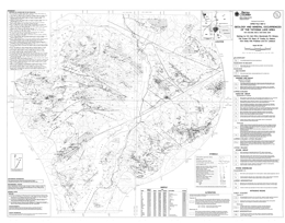
C.H. Ash, R.W.J. MacDonald, P.K. Stinson, T.M. Fraser, P.R. Read, J.F. Pustka, K.J. Nelson, K.M. Arden, R.M. Friedman and D.V. Lefebure
Results of geological bedrock mapping for an area centred on Tatogga Lake, 80 kilometres south of Dease Lake, in northwestern British Columbia are summarized at a 1:50 000 scale. The stratigraphic and plutonic controls of the many mineral occurrences, hosted by Early Mesozoic Stikine arc-volcanic rocks in this area, are illustrated. Base and precious metal analysis for close to 100 samples collected throughout the map area are presented. Upper lower Jurassic stratigraphy, correlative with rocks that host the Eskay Creek mine are shown to be more extensive than indicated by previously published maps.
Superseded by Open File 1998-04
MINFILE Team
This 174-page report includes a 99-page table of 761 mineral deposits in British Columbia with known reserves and resources. The inventory, which is sorted by deposit name, includes the tonnage and grade of metallic minerals, industrial minerals, and coal occurrences. These deposits are cross-referenced with tables sorted by MINFILE Number, name and deposit type. The tables were generated from MINFILE/pc V. 4.5 and reflect the status of the MINFILE database as of January 1997.
This Open File was created to serve as a handy hard-copy reference for anyone interested in British Columbia’s rich mineral endowment. This publication will appeal to a wide variety of local and international users, including government agencies, mining and exploration companies, researchers and the public.
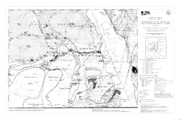
P.T. Doughty, D.A. Brown and D.A. Archibald
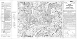
E.R. Leboe, P.T. Bobrowsky, A. Dixon-Warren and A. Ledwon
Open File 1997-06 presents a terrain geology map of the North Barriere Lake area. For an overview of the Quaternary geology of the North Barriere Lake area, refer to the Geological Fieldwork 1996.
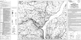
A. Dixon-Warren, P.T. Bobrowsky, E.R. Leboe and A. Ledwon
This 1:50 000-scale map presents the terrain geology of the Adams Plateau Area (NTS 82M/4) in British Columbia.
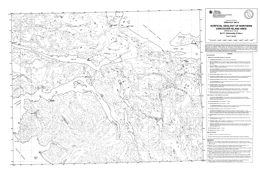
P.T. Bobrowsky
Open File 1997-08 presents the surficial geology of Northern Vancouver Island Area (NTS 82M/4 & 5). Scale is 1:50 000.
P.T. Bobrowsky, E.R. Leboe, A. Dixon-Warren, A. Ledwon, D. MacDougall, and S.J. Sibbick
Open File 1997-09 provides the final results, discussion and interpretation of a drift exploration program conducted northeast of Kamloops by the British Columbia Geological Survey Branch. Centred on the southern part of the Eagle Bay Assemblage and Fennell Formation of the Kootenay Terrain, the "Eagle Bay" drift prospecting program is one of several provincial till geochemistry surveys which has been ongoing since 1990. This program demonstrates the utility of integrating surficial geology mapping and exploration geochemical methods to locate buried mineral deposits in areas of drift-covered terrain.
The objectives of the drift exploration project were to identify types and character of surficial deposits present; estimate overburden thickness based on landform assemblage associations; define new anomalies which may be used in the discovery of mineralization targets; stimulate new exploration and economic activity and; provide information that will be of use in all areas where mineral exploration has been hampered by thick glacial drift cover and where traditional prospecting and exploration techniques have proven unsuccessful despite indications of high mineral potential.
The purpose of the surficial mapping component was to document the variability in the types of sediments observed, including their distribution and general character for this particular area. This data provides critical constraints to a successful drift exploration program. Quaternary geologic history consisting of local and regional stratigraphy, sedimentology and glacial ice dynamics are the focus of much of the work, since an understanding of these parameters provides a framework for a complementary till geochemistry and pebble lithology sampling program.
See Open File 1998-06 for an adjacent 1997 regional till survey in the Louis Creek - Chu Chua Creek area (NTS 92P/1 & 8).
D. MacIntyre, I. Webster and P. Desjardins
Open File 1997-10 portrays the geology and mineral occurrences of the Old Fort Mountain area (93M/1) in north central British Columbia. The geology map is at 1:50 000 scale includes a legend, geologic cross sections, and tables of sources of information and mineral occurrences. Open File 1997-10A presents till geochemical sampling results for the same area.
The oldest rocks exposed are Upper Triassic limestone and interbedded marine sediments of the Takla Group; volcanic interlayers may also be present. Lower to Middle Jurassic Hazelton Group rocks comprise eight mappable units. The three oldest are Lower Jurassic: the Basalt member; the Telkwa Formation, which consists of air fall tuffs, andesite flows and breccia, basalt flows and related epiclastic and volcaniclastic rocks; and the Nilkitkwa Formation, which consists of feldspathic siltstone, wacke, argillite and minor pebble conglomerate and limestone. Lower to Middle Jurassic units include: mainly ash flow tuff, ignimbrite, lapilli and crystal tuff; basaltic flows, breccia and tuff; volcanic sandstone, siltstone and tuff; the Saddle Hill volcanics, which are interlayered amygdaloidal and pyroxene phyric basalt flows and breccia, tuffs, tuffaceous sandstone, ash flow tuff, and rhyolite flows. The Middle Jurassic Smithers Formation contains feldspathic sandstone, siltstone, wacke and volcanic pebble conglomerate. Above the Skeena Group, the Middle to Upper Jurassic Ashman Formation consists mainly of siltstone and sandstone. The Upper Jurassic Trout Creek Formation is mainly chert pebble conglomerate, quartzose wacke, and siltstone. Lower Cretaceous Skeena Group units are: trachytic, andesitic and basaltic andesite flows that locally have coarse bladed feldspar crystals; porphyritic andesite, basalt, lapilli tuff, volcanic breccia and tuffaceous siltstone; feldspar phyric dacite and rhyodacite to rhyolite dome complexes; and the Red Rose Formation quartzose and micaceous sandstone, siltstone, shale, and chert pebble conglomerate. The Eocene Ootsa Lake Group is represented by the Newman volcanics, which are characterized by porphyritic andesite, volcanic breccia, lahar and volcanic conglomerate.
Intrusive rocks are important in the area. The Late Triassic to Early Jurassic Topley intrusions are quartz monzonite, monzonite, megacrystic granite, and rhyolite to aplite dikes. Jurassic to Cretaceous intrusions are diorite, gabbro, and basalts dikes and stocks. Cretaceous granodiorite and quartz diorite bodies occur. The Babine intrusions include: rhyolite to dacite dikes and flow dome complexes; hornblende-augite diorite; quartz diorite and granodiorite cut by porphyry dikes; and crowded porphyry dikes and plugs that are the main hosts for porphyry mineralization.
Four major tectonic events are reflected in the region. Mid to Late Jurassic folding and uplift was followed by mid Cretaceous contraction that produced northwest trending folds and northeast directed thrusts. Crustal extension in Late Eocene time produced north trending grabens and horst, and an event as young as Miocene tilted fault blocks.
The most important mineral occurrences are gold-bearing porphyry copper deposits associated with the Eocene Babine intrusions and the Late Cretaceous Bulkley intrusions. The former producing bell mine and five major prospects are known in the map area. There is also epithermal potential with silver-lead-zinc mineralization like that at the Fireweed prospect in Skeena Group rocks.
V.M. Levson, S.J. Cook, J. Hobday, D.H. Huntley, E.K. O'Brien, A.J. Stumpf and G.W. Weary
Open File 1997-10A describes selected results of a till geochemical sampling program conducted in the Old Fort Mountain map area (NTS 93M/1) by the British Columbia Geological Survey as part of a survey of the entire Babine copper porphyry belt. Several new exploration targets are highlighted by multi-element geochemical anomalies and most existing mineral properties in the map region are also detected by the regional till geochemical data. In addition to reflecting known mineralization, geochemical results around some mineral properties suggest that further exploration in those areas may be warranted. New prospective areas, where recorded mineral showings are not present, include multielement anomalies with greater than 95th percentile concentrations of copper, arsenic and/or antimony in five areas: northeast of Hautéte Lake, northwest of Natowite Lake, northeast of the northern end of Hatchery Arm and near the southern tip of Nakinilerak Lake. Elevated (>95th percentile) gold and molybdenum occurs northeast of Hautéte Lake. Two areas of interest with clusters of sites with elevated arsenic, lead and zinc occur southwest of Takla Lake and several kilometres southwest of Morrison Lake. Antimony and molybdenum concentrations, above the 95th percentile, also occur in till at the latter area.
Open File 1997-10 and 1997-10a have been combined into a single download
G.F. Weary, V.M. Levson and B.E. Broster
Surficial geology mapping and till sampling in the Chedakuz Creek map area were conducted as part of the British Columbia Geological Survey Interior Plateau mapping and mineral exploration project.
Till samples for the regional geochemical exploration program were collected from 143 different sites. Each sample was analysed by instrumental neutron activation (INA) and inductively coupled plasma (ICP) for 39 different elements. Five areas were identified by anomalous (>90th percentile) multi-element concentrations for gold, arsenic, antimony, lead, nickel, silver, zinc, molybdenum or copper. Areas 1, 2 and 3 were previously unidentified. Areas 4 and 5 occur near known mineral settings.
The most pronounced multi-element geochemical till anomalies occur at six sample sites in Area 1. Some of the highest arsenic, antimony, molybdenum, nickel and zinc values encountered in the regional sampling program occur in this area. Two highly anomalous antimony and arsenic sample sites define Area 2. Area 3 is defined by elevated concentrations of copper, nickel and zinc at two sample sites. Seven sample sites in Area 4 are highly anomalous for gold, copper, molybdenum, silver, zinc or lead. Five of the seven gold values above the 95th percentile are located in Area 4, including the highest gold value (79 ppb).
Most anomalous lead and copper concentrations also occur in or near this area. Samples within Area 5 have multi-element anomalies for arsenic, antimony, copper and gold. Anomalous sample sites and the presence of mineralized float suggest that bedrock mineralization may be present near or a short distance up-ice of Area 5.
E.K. O'Brien, V.M. Levson and B.E. Broster
Till geochemical sampling was conducted on the CH, Blackwater-Davidson, and Uduk Lake mineral properties, on the Nechako River map sheet (93F), central British Columbia and the results were used to compare glacial dispersal in areas of variable terrain. For each property, geochemical dispersal trains were typically elongated in the direction of the last major glaciations (045-060˚). Although the dimensions of the dispersal patterns were different, these differences can be attributed to variations in glacier velocity and erosion and to variation in the size and type of mineralization of the bedrock source.
The geochemical dispersal patterns using C-horizon basal till sample media were compared to dispersal patterns using B or C-horizon soil samples, previously collected on each mineral property. The shape, magnitude and size of the dispersal trains were commonly different between the soil and till geochemical surveys. The basal till surveys were very effective at identifying geochemical anomalies. The soil surveys were also effective at identifying most of the geochemical anomalies, in soil samples overlying colluvium, till, and locally-derived glaciofluvial deposits. Soils overlying channelized glaciofluvial or glaciolacustrine deposits generally did not form dispersal patterns or identify local geochemical anomalies.
Results indicate that till geochemical anomalies on each property could have been identified by a regional till program with a sample density of 1 sample on a 2 km grid.
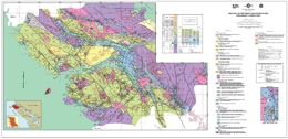
G.T. Nixon, J.L. Hammack, G.J. Payie, L.D. Snyder, V.M. Koyanagi, J.V. Hamilton, A. Panteleyev, N.W.D. Massey, J.W. Haggart, D.A. Archibald
Open File 1997-13 is a coloured geological map of northern Vancouver Island (92L/5,6,11,12; 102I/8, 9), British Columbia. The map is at 1:100 000 scale and includes a legend and an inset map of the geology of the Merry Widow camp, and a table of formations and correlation chart.
The oldest rocks in the area are Upper Triassic and comprise the Vancouver Group. The lowest unit is the Carnian Karmutsen Formation, which consists of coarse plagioclase phyric basaltic lavas and aphanitic to plagioclase phyric subaerial basaltic flows, minor pillow lava, pillow breccia and hyaloclastite and thin layers of limestone. The overlying Carnian to Lower Norian Quatsino Formation is predominantly thin bedded to massive lime mudstone. The Carnian to Upper Norian Parson Bay Formation consists of a series of units: a volcanic member of mafic lapilli tuff and tuff-breccia; shale; mixed sedimentary-volcaniclastic lithologies; mainly calcareous lithologies with interbedded tuff; and argillaceous to silty lime mudstone, calcareous siltstone and mudstone. The overlying Upper Carnian to Upper Pleinsbachian Harbledown Formation is predominantly submarine intercalated pyroclastic, epiclastic and fine sedimentary rocks including lithic tuff, feldspathic tuff/wacke, volcanic breccia, tuffaceous sandstone, and siltstone. Bonanza Volcanics are of Sinemurian to Bajocian age. The volcanics are basaltic to rhyolitic, mainly subaerial flows and pyroclastic rocks with intercalated non-marine to marine pyroclastic, epiclastic and sedimentary rocks. Mappable units of mainly intermediate to felsic or predominantly felsic lavas and/or pyroclastic rocks occur. Lower Cretaceous Longarm Formation equivalents comprise thinly bedded to massive sandstone, siltstone, mudstone, pebble conglomerate, and minor coal. And lower conglomeratic facies and an upper sandstone facies comprise the overlying Coal Harbor Group. The Upper Cretaceous Blumberg Formation also has a lower conglomerate unit but has an upper dominantly lithic to arkosic wacke unit. Upper Cretaceous Nanaimo Group equivalents are arkosic to lithic wackes, conglomerate, siltstone, and minor coal. Tertiary felsic volcanic rocks are mainly andesitic to rhyolitic flows and volcanic breccia.
In the Benson River area Upper Triassic or Lower Jurassic basalt intrusions are columnar-jointed. Rocks of the Early to Middle Jurassic Island Plutonic suite are mainly diorite, quartz diorite, monzodiorite, monzonite, quartz monzonite, granodiorite, and quartz-hornblende porphyry.
Three phases of deformation have been recognized: a pre-Cretaceous event; Late Cretaceous to Tertiary transpression; and Tertiary extension. Faulting is the predominant strain-release mechanism. On the map, northwest trending through-going faults define areas that are internally segmented by northeast trending faults. Block faulting dominates the structural pattern in the map-area.
The area contains economically important porphyry copper-molybdenum-gold deposits, including the Island Copper mine, base and precious metal skarns, like those in the Merry Widow camp, and precious metal mineralization associated with epithermal acid sulphate alteration zones, like that at Mount McIntosh.
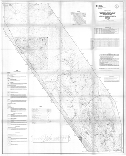
F. Ferri, C. Rees and S. Cook
Open File 1997-14 presents the preliminary geology of the Northern Kechika Trough (94L/14, 15; 94M/3, 4, 5, 6, 12, 13; 104P/8, 9, 15, 16) in northeastern British Columbia. The Open File portrays geology at 1:100 000 scale, a legend, a geological cross section, references, and lithogeochemical assay data on sheet 1. Sheet 2 provides lake sediment geochemical analysis results and a sample location map.
The area is underlain by rocks of ancestral North American affinity and rocks of the Cassiar terrane. Cassiar terrane rocks range in age from Upper Proterozoic (?) to Paleozoic. They consist of quartz-feldspar sandstone and phyllite that may be Ingenika Group; dolomitic siltstone, cherty siltstone, siltstone and chert; silty limestone to calcareous siltstone; and quartz sandstone and slate.
Two informal units are of uncertain age. In the Upper Proterozoic (?) to Lower Paleozoic Aeroplane Lake panel, low-grade metamorphic rocks predominate. Three map units are mainly: limestone, phyllite and sandstone; siliceous schist and quartz sandstone; and calcareous phyllite and schist. The Kitza Creek facies consists mostly of carbonaceous siltstone to silty argillite and shaly slate associated with fetid limestone.
The oldest North American rocks are slate, phyllite, argillite and siltstone with interbedded micaceous sandstone, quartzite, and conglomerate that comprise the Proterozoic Hyland Group. One unit consists of undivided Upper Proterozoic and Cambrian rocks that include Hyland Group and younger strata. Upper Cambrian to Lower Ordovician Kechika Group strata include a siliceous facies that is mainly siltstone and fine sandstone with slate, and silty limestone or dolostone interbeds, and more normal assemblage of laminated slate, calcareous slate, and limestone. Locally Kechika and lower Road River strata are undifferentiated. Upper Ordovician to Middle Devonian Road River Group has a lower recessive part with mostly shale to slate and argillite, and an upper part that is characterized by the ‘Silurian Siltstone’ unit. This consists mainly of buff-brown to orange weathering siltstone and dolomitic siltstone with slate or argillite interbeds. Upper Devonian to Mississippian Earn Group rocks are predominantly argillite, cherty argillite, siltstone and slate; bedded barite is rare. Mississippian to Permian Mount Christie Formation strata are dominated by chert with minor argillite interbeds. Tertiary or Quaternary Tuya Formation basalts are massive to fragmental.
The oldest intrusive rocks in the area are Early Paleozoic (?) gabbro bodies. Early Cretaceous intrusions form sill, dikes and small stocks on Boya Hill. Biotite-feldspar and quartz porphyry predominate. Cretaceous (?) porphyries occur in or near the Aeroplane Lake panel. Granite with small quartz phenocrysts is of Late Cretaceous to Early Tertiary (?) age.
The strata are deformed into upright folds and cut by high angle east-directed thrust faults.
The area has potential for Sedex zinc-lead-silver deposits, barite deposits and tungsten, molybdenum and base metal porphyry or skarn mineralization is known. Placer gold has been reported.
S.J. Cook, W. Jackaman, P.W. Friske, S.J. Day, A.M. Coneys and F. Ferri
Also published as GSC Open File 3499
Open File 1997-15 presents new analytical results for 44 different metals from a regional lake sediment and water geochemistry survey conducted over the northern part of the Kechika Trough in 1996. The survey, conducted jointly by the B.C. Geological Survey Branch and the Geological Survey of Canada, covers an area of approximately 5000 km2 over parts of eleven 1:50 000 map areas immediately south of the B.C.-Yukon border where exploration has been limited by extensive drift cover. Data for base metals, gold, precious metal pathfinders and rare earth elements from 445 sample sites are included in the release, and new exploration targets for prospective Sedex-style Zn-Pb deposits are highlighted. The report provides listings of field and analytical data, summary statistics, metal distribution maps, and sample location maps.
The North Gataga Project is the final phase of a multi-year project of bedrock mapping and regional geochemical surveys in the Kechika Trough, where known sedimentary-exhalative type Zn-Pb-Ag deposits of the Gataga district include the Cirque, Akie and Driftpile Creek deposits.
S.B. Butrenchuk and K.D. Hancock
This report is a comprehensive collection of all known significant occurrences of barite in British Columbia reported before 1996 and includes adjunct information on most minor occurrences of barite where appropriate. Deposits have been grouped by genetic classification and sorted by geographic location from southern to northern British Columbia. The initial compilation of occurrences and field examination of many sites was done in 1989 by the senior author. Subsequent editorial changes, updates of existing descriptions and addition of new material were done by the junior author. The field examinations of selected barite deposits included mapping, sampling and lithogeochemical analyses. Associated research included trace element analysis for possible descriminant characteristics for occurrence classification with a view to aiding deposit evaluation. Additional work includes compilation of information from public and private sources for those deposits not examined in the field. The quality of these descriptions is subject to the source material and should be considered as a guide as any future work may change the current summaries.
Commercial production of barite in British Columbia dates back to 1940 with shipments having been recorded from ten deposits. Currently, significant barite production is limited to a single underground mine at Parson by Mountain Minerals Company Ltd. with some intermittent production from three other deposits. This report documents potential new sources of barite in shale and carbonate-hosted bedded deposits in north-eastern British Columbia, in rocks of Devonian to Lower Mississippian age. In south-eastern British Columbia vein and cavity-filling deposits in Proterozoic and Cambrian rocks represent another potential source. By-product barite may also be recovered from the mining and milling of volcanogenic massive sulphide deposits.
Barite (BaSO4) is a chemically inert mineral with an ideal specific gravity of 4.5. Its major usage is as a weighting agent in drilling muds and markets are closely related to the oil and gas industry. Included in this report is background information on uses, markets and physical properties for barite and barite products.
S.J. Cook, R.E.W. Lett, V.M. Levson, W. Jackaman, A.M. Coneys and G.J. Wyatt
This Open File presents new analytical results for 35 different metals from a regional lake sediment and water geochemistry survey conducted over the Babine Porphyry Belt in 1996. The survey covers an area of approximately 3400 square kilometres in the Nechako Plateau region of central British Columbia where exploration has been limited by extensive drift cover. Data for base metals, gold, precious metal pathfinders and rare earth elements from 332 sites are included in the release. Exploration targets for porphyry copper deposits are highlighted.
V.M. Levson, S.J. Cook, D.H. Huntley, A.J. Stumpf, and J. Hobday
Preliminary till geochemistry data for the Old Fort Mountain map sheet (NTS 93M/01) were collected by the BC Geological Survey as part of the Nechako National Mapping Program.
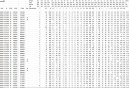
The till geochemistry open file includes data for copper, gold, silver, precious metal pathfinders, base metals and rare earth elements for over 330 sites. The data are provided in two Microsoft Excel files, one for the ICP data and one for the INA data. The map area covers the region north of the Bell and Granisle copper porphyry deposits. This preliminary data release is provided to assist new exploration activity in the region.
A more comprehensive publication with interpretation of the geochemical results, and discussions of the Quaternary geology and glacial ice-flow history of the region was released as Bulletin 110. A 1:50,000-scale bedrock geology map of 93M/01 was also released as Open File 1997-10.
More information on the till geochemistry and surficial geology of the Babine porphyry belt can be found in the following publications:
Huntley, D.H., Levson, V.M. and Weary, G.F. (1996): Surficial Geology and Quaternary Stratigraphy of the Old Fort Mountain Area (93M/01) B.C. Ministry of Energy, Mines and Petroleum Resources, Open File 1996-9, (1:50,000 scale map).
Levson, V.M., Meldrum, D.G., Cook, S.J., Stumpf, A.J., O'Brien, E.K., Churchill, C., Coneys, A.M. and Broster, B.E. (1997): Till geochemical Studies in the Babine Porphyry Belt: Regional Surveys and Deposit-Scale Studies (NTS 93 L/16, M/1, M/2, M/7, M/8); in Geological Fieldwork 1996, Lefebure, D.V., McMillan, W.J. and McArthur, J.G, Editors, British Columbia Geological Survey, Paper 1997-1, pages 457-466.
Levson, V.M., Stumpf, A.J., Meldrum, D.G., O'Brien, E.K., and Broster, B.E. (1997): Quaternary Geology and Ice Flow History of the Babine Lake Region: (NTS 93 L/NE, M/SE); in Geological Fieldwork 1996, Lefebure, D.V., McMillan, W.J. and McArthur, J.G, Editors, British Columbia Geological Survey, Paper 1997-1, pages 427-438.
Levson, V.M. and Giles, T.R. (1997): Quaternary Geology and Till Geochemistry Studies in the Nechako and Fraser Plateaus, Central British Columbia; in Geological, Geochemical and Geophysical Studies in the Interior Plateau, Geological Survey of Canada Open File 3448 and British Columbia Geological Survey, Paper 1997-2, pages 121-146.
Stumpf, A.J., Huntley, D.H. and Levson, V.M. (1996): Surficial Geology and Quaternary Stratigraphy of the Fulton Lake Area (93L/16) B.C. Ministry of Energy, Mines and Petroleum Resources, Open File 1996-10, (1:50,000 scale map).
1996
G. Owsiacki, T. Schroeter, P. Wojdak, R. Pinsent, P. Wilton and K. MacDonald
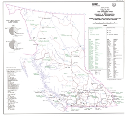
Open File 1996-01 consists of two map sheets. Map sheet one presents the 1995 operating mines and environmental assessment projects in British Columbia. Map sheet two consists of advanced exploration/ development and exploration highlight projects in British Columbia.
J.M. Logan, M. Colpron, B.J. Johnson and C. Rees
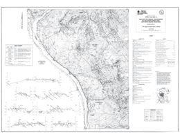
Open File 1996-02 presents the geology and mineral occurrences of the Downie Creek area (82M/8, part of 1) in the northern Selkirk Mountains of southeastern British Columbia. The Open File map portrays geology at 1:50 000 scale and includes a legend, cross sections, and tables of isotopic age data and mineral occurrences. The work complements information in Open Files 1995-02 and 1995-03.
The geology and structure are complex. Proterozoic (?) to Paleozoic (?) rocks include undivided metasediments that feature sillimanite, kyanite and amphibole-bearing calcareous schist, and also Monashee complex amphibolite-bearing pegmatitic gneiss and minor calc silicate gneiss. Neoproterozoic Horsethief Creek Group rocks consist of three units. The lower is phyllite interlayered with micaceous quartzite and dolostone; the intermediate unit is phyllite with local dolostone interbeds; and the upper unit is phyllitic dolostone interlayered with phyllite and some quartzite. Eocambrian Hamill Group comprises three units. The lowest consists of micaceous quartzite interlayered with phyllite. Above are massive and cross-bedded quartzite with micaceous quartzite and phyllite layers, then mafic massive to amygdaloidal metavolcanic flow and associated epiclastic rocks. The Lower Cambrian Mohican Formation has a unit characterized by phyllite, calcareous phyllite and calcareous grit with dolostone intercalations, and a unit dominated by siliceous phyllite with dolostone and micaceous quartzite interlayers. The Lower Cambrian Badshot Formation is dolomitic marble. The Cambrian (?) to Devonian (?) Lardeau Group consists of the Index Formation, a Micaceous Quartzite and Grit assemblage, and the Jowett Formation. The Index Formation is divided into five units. From lowest to highest, the units consist of white orthoquartzites breccia; graphitic to calcareous phyllite; marble, dolomitic marble and phyllitic carbonate; mafic metavolcanic flows including massive flows and pillow breccia, and diorite sills; and a unit with mostly phyllite and quartz grit. The Micaceous Quartzite and Grit assemblage consists of a unit dominated by micaceous quartzite with interbedded phyllite, grit and schist, and a unit with interbedded grit and phyllite with minor marble interbeds. The Jowett Formation is made up largely of actinolite schist and phyllite but includes marble layers.
Intrusive rocks in the area that are of uncertain age include metadiorite and metagabbro bodies and ultramafic intrusions. The Early Mississippian Downie Creek and Clachnacudainn gneisses are foliated granite and quartz monzonite. The Middle Jurassic Pass Creek pluton is megacrystic quartz monzonite. Biotite-hornblende diorite may be Cretaceous and possibly mid-Cretaceous stocks are locally megacrystic biotite granites. The Late Cretaceous (?) Downie stock consists of muscovite-biotite leucogranite that is locally garnet bearing.
Rocks in the area have been multiply deformed into a series of thrust slides that dip easterly and host upright to overturned to west verging isoclinal folds. The map sheet is bounded on the west by the Columbia River fault, which dips moderately toward the east and shows normal movement. Rocks west of this fault comprise the Monashee complex.
Mineral occurrences include: copper-zinc-silver-gold-bearing Besshi-type volcanogenic massive sulphide deposits, like the formerly producing Goldstream mine; stratabound carbonate replacement deposits with lead, zinc, silver and gold values; zinc-copper-silver and tungsten-gold skarns; base metal veins with or without tungsten and gold; placer gold; and industrial mineral potential, particularly for garnet.
F. Ferri, C. Rees, J. Nelson, C. Augereau and A. Legun
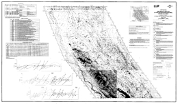
Open File 1996-03 presents the geology and mineral occurrences of the Gataga Mountain area (94L/10, 11, 14, 15) in northeastern British Columbia. The geology map at 1:50 000 scale includes a legend, geological cross sections, and references as well as fossil identification, mineral occurrence, lithogeochemical analysis tables.
The oldest strata in the area are units of the Lower Cambrian Gog Group. The lower unit consists of siliciclastics and carbonates, including quartzite, quartz sandstone, siltstone, slate, limestone and dolostone; the upper unit of volcanic and volcaniclastic rocks including ash and lapilli tuff, agglomerate, basalt flows and flow breccias and volcanic wacke and siltstone. Lower to Middle Cambrian strata include Gog and younger rocks. The Middle Cambrian unit is mainly conglomerate with lesser siltstone, limestone and volcanics. The younger unit consists dominantly of siltstone, slaty siltstone, slate, and micaceous sandstone. Two units of Kechika Group are of Cambrian age; the older is dominated by siliciclastics, including slate, slaty siltstone, and micaceous sandstone; the younger contains mainly carbonates, including limestone, dolostone and dolomitic limestone. The Upper Cambrian to Lower Ordovician strata of the Kechika Group are mainly slate, calcareous slate with local limestone lenses. Road River Group strata include Middle to Late Ordovician recessive carbonaceous graptolitic slate to siltstone, cherty slate, argillite and chert; Lower Silurian to Middle Devonian rocks of the ‘Silurian Siltstone’ unit, and undivided rocks. The Silurian Siltstone consists of mostly of siltstone to dolomitic siltstone, slate and silty slate. Earn Group rocks are of Middle Devonian to Early Mississippian age. Carbonaceous slate, siltstone, cherty slate, cherty argillite and chert predominate.
The fabric of the geology trends northwest due to a series of moderate to very tight overturned folds and northwest trending thrust faults. The thrusts are northeast-verging and dip relatively steeply toward the southwest. Structural detachment is most important in the Kechika and Ordovician Road River shales. Earn lithologies are also relatively incompetent. Major thrust carry Cambrian or uppermost Proterozoic strata in their hanging immediate wall, and there are several major thrusts. Very large, northeasterly overturned folds can be recognized.
The Kechika Basin is part of a metallogenic province characterized by sedimentary exhalative lead-zinc-barite deposits. Devono-Mississippian Earn Group rocks have the highest mineral potential in the area and many stratiform barite occurrences were located. One occurrence was within the Ordovician Road River Group. Rocks in the map area are a northward extension of the structural panel that hosts the Driftpile Creek and other stratiform barite and barite-sulphide deposits. Other occurrences of interest include a zone of lead-rich veinlets in Earn rocks and zinc and barite-rich crosscutting breccia in chert and limestone of the uppermost Road River Group. There are also quartz vein occurrences in carbonates containing copper sulphides or tetrahedrite.
C.H. Ash, P.K. Stinson, T.M. Fraser, R.W.J. Macdonald and K.J. Nelson
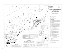
Open File 1996-04 presents the geology and mineral deposits of the Todagin Plateau in the Red Chris area (104H/12NW). The geology map is at 1:20 000 scale and includes a legend, references, and tables of fossil, uranium-lead isotopic ages, and lithogeochemistry. The map shows areas of intense ankerite-magnesite alteration, and the known quartz stockwork zone with copper sulphide mineralization and carbonate-sericite alteration in the Red stock.
The oldest rocks in the area are Upper Triassic Stuhini Group clinopyroxene phyric basalt flows and pillow breccias, siltstone with lesser feldspathic wacke, and feldspathic wacke with lesser sandstone and siltstone. The Siltstone dominated package is locally veined and brecciated by ankerite. Overlying Hazelton Group strata are of Early Jurassic age. The oldest units are Sinemurian volcanic conglomerate with lithic wacke interbeds, and andesitic volcanic breccias with maroon epiclastic conglomerate and wacke intervals. Overlying Pleinsbachian to Toarcian strata include: interbedded feldspathic wacke and siltstone; maroon volcanic breccia and conglomerate; clinopyroxene-phyric basaltic flows and pillow breccia with wacke and siltstone intervals; Limestone and calcareous sandstone; rhyolite breccia, sharpstone conglomerate and feldspathic wacke; autobrecciated rhyolite flows with felsic tuff and sandstone interbeds; rhyolitic volcanics and volcaniclastics with volcanic breccias and welded tuffs; and siliceous siltstone with felsic tuff interlayers. Middle Jurassic Bowser Lake Group rocks include a siltstone-sandstone unit with intercalated silty and limy mudstone, and chert pebble conglomerate with sandstone interbeds. Pliocene to Recent olivine basalt flows comprise the Maitland volcanics.
A suite of high level quartz diorite to monzonite stocks and dikes includes the Red stock and the Groat pluton. The Red stock hosts the Red-Chris deposit. The compositions range from quartz diorite to monzodiorite to monzonite; dikes are usually porphyritic. Isotopic dating indicates that the intrusions are of Sinemurian age. A northwest-elongated pyroxene diorite pluton may be of Pleinsbachian age.
Chalcopyrite in fracture-controlled quartz vein stockworks is related to high level stocks and dikes. Copper mineralization is accompanied by elevated gold and silver values. Other quartz stockworks are associated with pervasive zones of silicification related to dikes and stocks and carry disseminated pyrite and/or chalcopyrite. Ankerite alteration zones are associated with the porphyritic intrusions. The zones can be extensive but copper-gold mineralization appears to be most abundant within and marginal to the intrusive rocks. The Red-Chris porphyry copper-gold deposit is hosted by the Red stock and associated with intense quartz-ankerite-sericite alteration.

A. Matheson, N.W.D. Massey, P.T. Bobrowsky, C.E. Kilby and G. Manson
This database of private aggregate pits in British Columbia was compiled as part of the BC Geological Survey's Aggregate Inventory Project. In this compilation, private pits were considered to be only those natural aggregate occurrences for which an application by an operator for a Notice of Work had been received and subsequently issued by the Ministry of Energy, Mines and Petroleum Resources. All other pits, including public pits operated by the Ministry of Transportation and Highways, are not included.
Information about each pit in the database file includes its location (both latitude/longitude and UTM coordinates), NTS map sheet number, Notice of Work file number and status (active/inactive) and the type of landform hosting the pit.
G.E. Ray and C.E. Kilby
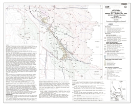
Open File 1996-06 portrays the geology and mineral occurrences of the Mineral Hill-Wormy Lake area (92G/12W), Sechelt, British Columbia. The 1:10 000 scale geology map contains a legend and extensive marginal notes.
The area lies at the southern end of the Coast Plutonic Belt and skarns in roof pendants provide economic interest. The host rocks of the exoskarns may be derived from the Triassic Quatsino Formation. Possibly Triassic supracrustal rocks include marble, and marble with wollastonite- or garnet-dominant skarn. Mafic rocks that include metatuffs and minor metabasalts may represent either the Karmutsen Formation or the Bowen Island Group. Parts of two major Jurassic intrusions dominate the area. The Creston Lake pluton varies form marginal phase pyritic mafic rocks, to skarn-altered (endoskarn) gabbro to leucocratic or melanocratic quartz diorite and gabbro. The Snake Bay pluton is generally quartz diorite to granodiorite with variable mafic content. Minor intrusions include granodiorite dikes and sills, basaltic dikes, tonalitic dikes, gabbro-andesite dikes and sills, and gabbro.
The exoskarns crop out discontinuously for 4.5 kilometres along the Wormy Lake fault. Endoskarn is more restricted and is generally at the margins of the Crowston Lake pluton or with gabbroic sills and dikes. Two known zones of wollastonite-dominated skarn are known and wollastonite is widespread within them. Four types of sulphide mineralization recognized are: pyrite with or without chalcopyrite in veinlets and fractures cutting the Snake Bay plutons, pyrite with or without magnetite and chalcopyrite as disseminations or veinlets in the Crowston Lake pluton, disseminations, layers, pods and lenses of pyrite with or without sphalerite and chalcopyrite in wollastonite skarn, and pyrite with or without pyrrhotite pods and lenses in marble. Gold values in the district are generally low.
P.T. Bobrowsky and S.J. Sibbick
Open File 1996-07 presents the results of a drift prospecting program conducted by the British Columbia Geological Survey on northern Vancouver Island in an area south-west of Port Hardy. This project is part of a three year multidisciplinary, integrated resource assessment program aimed at defining the mineral potential of this part of the province. The northern Vancouver Island drift prospecting program is one of several provincial till geochemistry surveys to demonstrate the utility of integrating surficial geology mapping and exploration geochemical methods to locate buried mineral deposits in areas of drift covered terrain. The program focused on four 1:50 000 scale map sheets including NTS 92L/5, L/6, L/11 and L/12.
The presence of the Island Copper Cu-Mo-Au porphyry deposit, located on the northeast shore of Rupert Inlet, contributed to the selection of this area for regional till geochemistry studies. Mapping of the surficial sediments was undertaken to document the variability in the type and distribution of unconsolidated sediments. The character, origin and age of the various types of unconsolidated sediments present in an area of glaciated terrain are important parameters to document as part of any drift exploration program, and their understanding provides a framework for a complementary till geochemistry and pebble lithology sampling program. The till geochemistry study consisted of a systematic sampling program (1-5 kilograms) primary basal till and colluviated till deposits which were first identified and then targeted during the surficial mapping. Pebble lithology studies consisted of the collection and subsequent identification of 100 clasts at each of the till sample stations.
The integration of mineral deposit studies, detailed bedrock mapping, surficial mapping and till geochemistry addresses the main objective of drift prospecting: to provide data that will lead to the discovery of economic mineralization, covered by a blanket of unconsolidated sediments. This is done by interpreting down-ice glacial dispersal patterns (mechanical dispersal trains) that will help locate the sources of geochemical anomalies and changed clast lithologies. This open file provides a final summation of the till geochemical data collected for northern Vancouver Island.
Superseded by Open File 1997-04
This 186-page report includes a 114-page table of 751 mineral deposits in British Columbia with known reserves and resources. The inventory, which is sorted by deposit name, includes the tonnage and grade of metallic minerals, industrial minerals, and coal occurrences. These deposits are cross-referenced with tables sorted by MINFILE Number, name and deposit type. The tables were generated from MINFILE/pc V. 4.5 and reflect the status of the MINFILE database as of January 1996.
This Open File was created to serve as a handy hard-copy reference for anyone interested in British Columbia’s rich mineral endowment. This publication will appeal to a wide variety of local and international users, including government agencies, mining and exploration companies, researchers and the public.
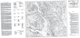
D.H. Huntley, V.M. Levson and G.F. Weary
In 1995, a regional bedrock and surficial geology mapping program was initiated as part of the Nechako Plateau National Mapping Program to stimulate further exploration and define new mineralization targets in the Babine Lake area. This surficial geology map has a scale of 1:50 000 and summarizes the Quaternary geology of the Old Fort Mountain area.
Drift sampling focused on the collection of basal till samples since they are first derivative products of erosion and deposition with relatively simple transport histories. A total of 293 samples were collected from the C-horizon profiles in roadcuts, hand-dug pits, trenches, stream cutbanks, borrow pits, and forest blowdowns.
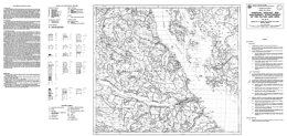
A.J. Stumpf, D.H. Huntley, V.M. Levson and E.K. O'Brien
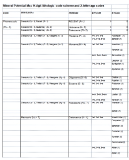
M. Mihalynuk, K. Bellefontaine, D. Brown, J. Logan, J. Nelson, A. Legun & L. Diakow
The geology of Northwest British Columbia was compiled by M. Mihalynuk, K. Bellefontaine, D. Brown, J. Logan, J. Nelson, A. Legun & L. Diakow. The original compilation was released as a BC Geological Survey Open File 1996-11 as digital linework on diskettes.
Mineral Assessment Analysis last updated July 1997.
Geology Polygons and Linework in E00 format
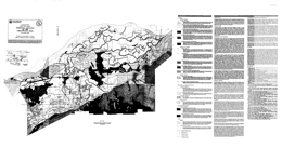
V.M. Levson, R.F. Gerath, D.G. Meldrum and P.A. Monahan
This geological compilation map includes the entire Chilliwack District and parts of the former Fraser-Chean Regional District, now the Fraser Valley Regional District. The map area is located approximately 100 kilometres east of Vancouver via the Trans-Canada Highway. This geological map results from one part of a geological and geotechnical survey of the Chilliwack region that includes surficial geology and earthquake hazard mapping components. The scale of this map is 1:20 000.
The British Columbia Geological Survey (BCGS) started a mineral potential assessment in 1992 utilizing deposit models for defining and characterizing mineral and coal deposits which exist, or for which favourable geological environments could exist, in the province. These deposit models are being used to classify known deposits and occurrences, to guide experts in their estimation of the number of possible undiscovered mineral deposits, and to group deposits to allow compilation of representative grade and tonnage data.
The BCGS formerly relied on mineral deposit models published by the United States Geological Survey (USGS) and Geological Survey of Canada (GSC). However, it became apparent that some models needed revision, and that there are British Columbia deposit types lacking published models. Hence we developed a set of mineral deposit profiles using the Branch's considerable in-house expertise, with assistance from economic geologists of the GSC, USGS, industry and academia.
These deposit models are called "deposit profiles" to distinguish them from other published descriptions. The deposit profiles were completed in three volumes describing metallic, coal, and industrial minerals and gemstone deposits.
- Volume 1 - Metallics and Coal (Open File 1995-20)
- Volume 2 - Metallic Deposits (Open File 1996-13)
- Volume 3 - Industrial Minerals and Gemstones (Open File 1999-10)
These three volumes were combined in a 2018 compilation volume (Miscellaneous Publication 86), which has been proceeded by GeoFile 2020-11.
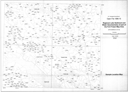
S.J. Cook, W. Jackaman, M.W. McCurdy, S.J. Day and P.W. Fiske
Also published as GSC Open File 3305.
Open File 1996-15 presents new analytical results for 37 metals, at 413 sample sites, from a regional lake sediment and water geochemistry survey conducted over the northeast part of the Fort Fraser map area (NTS 93K) in 1995. The Pinchi Lake survey, covers four 1:50 000 map areas: 93K/9 (Pinchi Lake), 93K/10 (Stuart Lake), 93K/15 (Inzana Lake) and 93K/16 (Tezzeron Creek), in an area north of Fort St. James where exploration has been hindered by extensive drift cover, poor exposure and an insufficient geological database. Ice flow in the area was dominantly from west to east, with significant local deflections.
Lake sediments and waters were obtained from 413 sites, at an average density of 1 site per 9.1 square kilometres, using a float-equipped Bell 206 helicopter and a Hornbrook-type sampler. Sediments were pulverized in a ceramic ring mill and will be analyzed for standard RGS (Regional Geochemical Survey) and NGR (National Geochemical Reconnaissance) AAS and INAA analytical suites. Waters were analyzed for the standard analytical suite of pH, uranium, fluoride and sulphate. Additional lake water samples were collected at every second site for ICP-MS analysis of trace and major elements. This expanded water survey, a first for RGS lake sediment surveys in British Columbia, includes data from 217 sites.
The area straddles the southeast trending Pinchi fault zone, the boundary between the Quesnel and Cache Creek Terranes. New exploration targets for precious and base metals are identified. The report provides listings of field and analytical data, summary statistics, metal distribution maps, and sample location maps.
The Pinchi Lake Survey, conducted jointly by the British Columbia Geological Survey and the Geological Survey of Canada under the Canada-British Columbia Mineral Development Agreement.
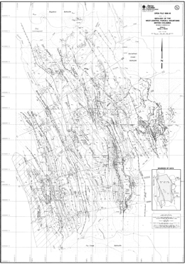
M.J. Warren
Open File 1996-16 describes the geology of the west-central Purcell Mountains (82K/2, 7, and parts of 8, 10) in southeastern British Columbia. The Open File consists of three sheets: sheet 1 presents the geology at 1:75 000 scale and has an inset map showing sources of data; sheet 2 consists of a series of structural geologic cross sections; and sheet 3 contains the legend, a schematic stratigraphic summary, geological notes and references.
The west-central Purcell Mountains of southeastern British Columbia expose Mesoproterozoic to Lower Paleozoic rocks that were deposited on the western margin of ancestral North America during at least two episodes of continental rifting. These strata were subsequently deformed, regionally metamorphosed and intruded by at least two suites of granitic plutons during Mesozoic terrane accretion.
The map-area is divisible into three distinct stratigraphic and structural domains. These comprise, from east to west, the eastern Purcell anticlinorium in the footwall of the Mount Forster thrust, the western Purcell anticlinorium in the hangingwall of the Mount Forster thrust and the Kootenay Arc. New mapping by M. Warren has focused in the western Purcell anticlinorium, in order to investigate the evolution of Proterozoic and Paleozoic stratigraphic contrasts between the hangingwall and footwall of the Mount Forster thrust, as outlined by Reesor (1973) and Root (1987), and the evolution of structural contrasts between the Purcell anticlinorium and the more complexly deformed Kootenay Arc, as documented by Fyles (1964) and Reesor (1973).
In the Purcell anticlinorium, the Mesoproterozoic Purcell Supergroup is unconformably overlain by the Neoproterozoic; Windermere Supergroup; which comprises the Toby Formation and the previously undivided Horsethief Creek Group. The Horsethief Creek Group comprises immature siliciclastic and resedimented carbonate strata that were deposited primarily in a submarine fan setting. The Horsethief Creek Group is laterally variable, but it can be divided into southeastern and northwestern successions that can be correlated using a conspicuous marker unit. The two successions are separated by an abrupt, NE-trending facies and thickness change in the upper Horsethief Creek drainage, interpreted to record motion on a northwest-side-down normal fault that was active during the deposition of the Toby Formation and perhaps of the lower part of the Horsethief Creek Group (see figure below). Other facies changes in the northwestern part of the map-area indicate that the basin deepened to the north and west and was more distal from the sedimentary source. Abrupt E-W thickness changes and the presence of apparently conformable metabasites in the upper part of the Horsethief Creek Group, and a change in the stratigraphic succession beneath these strata across the Four Squatters fault, suggest that normal faulting also occurred during deposition of the upper part of the Windermere Supergroup. Similar syn-Windermere structures, both NE -trending and N- trending, have been documented in the footwall of the Mount Forster thrust by Root (1987) and Pope (1990).
The Windermere Supergroup is overlain by a succession of more mature siliclastic rocks, the Neoproterozoic to Lower Cambrian Hamill Group, in the hangingwall of the Mount Forster thrust. The Hamill Group is divisible into three lower shallow marine or fluvial units, more feldspathic toward the base, that thin, fine and pinch out to the west and an upper, continuous and more mature shallow marine quartzite unit that unconformably overlies the lower units or rests directly on the Horsethief Creek Group. In the Kootenay Arc, the succession of Hamill Group strata is distinctly different from that in the western Purcell anticlinorium. The lower part, whose base is not exposed, includes mafic metavolcanic rocks and possibly turbidites. The upper shallow marine quartzite is considered equivalent to the upper quartzite in the Purcell anticlinorium. In the footwall of the Mount Forster thrust, the Windermere Supergroup is unconformably overlain by Upper Cambrian to Devonian strata (Reesor, 1973; Root, 1987; Pope, 1990). These overstepping unconformities record uplift and eastward tilting of the Windermere High" during Early Paleozoic time.
The lateral variations in the Hamill Group in both the western Purcell anticlinorium and in the Kootenay Arc imply that the lower units of the Hamill Group were deposited in two separate basins that were bounded to the east by west-dipping normal faults and were separated by an uplifted and eastward-tilted block of Horsethief Creek Group strata. The Earl Grey Pass fault, exposed on the eastern limb of the Blockhead Mountain syncline in the hangingwall of the Mount Forster thrust, is a west-side-up thrust fault that cuts the regional cleavage, but stratigraphic relationships across it indicate that it was previously a west side down normal fault. It marks the eastern limit of exposure of the Hamill Group, and it could be the normal fault that bounded the eastern Hamill basin. The fault that bounded the western Hamill basin is closely followed by the Kootenay Arc boundary fault, a Mesozoic structure that separates the Kootenay Arc from the Purcell anticlinorium. The upper quartzite of the Hamill
Group and the overlying Mohican and Badshot Formations were deposited across these basins and the uplifted block between them after normal faulting had ceased. Regiona1 correlation with fossiliferous strata in other ports of the Purcell, the Selkirk and the Rocky Mountains (Warren, 1996) suggests that the lower units of the Hamill Group are Neoproterozoic to lower Lower Cambrian (Placentian) and that the upper quartzite is upper Lower Cambrian (Waucoban) in age.
Normal motion on the fault that bounded the western Hamill basin may have been renewed during Early Paleozoic time, resulting in the deposition of shallow-water siliciclastic and carbonate rocks to the east (Lower Cambrian upper Donald Formation) and deeper-water, immature clastic and volcanic rocks to the west (Lower Paleozoic Lardeau Group). The development of this fault and the basin that it bounded may have strongly influenced mineralization of the Badshot Formation and other Lower Paleozoic carbonate strata, which host numerous sulphide deposits in the Kootenay Arc but not in the adjacent Purcell anticlinorium.
The boundary between the Kootenay Arc and the Purcell anticlinorium is a steep, locally mylonitic fault zone (the Kootenay Arc boundary fault) that juxtaposes a domain of complexly refolded, high-amplitude, west-verging ductile folds (Fyles, 1964) against a domain of upright, more open folds. Stratigraphic relationships across the fault where it intersects Duncan Lake, coupled with geobarometric data (Warren, 1996), imply west-side-up thrust motion, but motion sense indicators imply a component of late dextral strike-slip motion as well. Re-examination of cross-cutting relationships between axial planar foliations and dykes and sills dated at 173 Ma (Smith et al., 1992), coupled with palinspastic analysis (Warren, 1996) indicate that both the F1 and F2 folds in the eastern Kootenay Arc developed in response to west-verging crustal shortening above a blind detachment that propagated beneath the Kootenay Arc, but not the Purcell anticlinorium, in mid-Jurassic time. The location of the Kootenay Arc boundary fault, and perhaps of the eastern limit of the blind detachment, was controlled by the location of one of the syn-Hamill normal faults.
C.E. Dunn, R.G. Balma, S.J. Sibbick
Also published as GSC OF3290
This Open File contains data from a biogeochemical survey in the Mt. Milligan area of central British Columbia. Samples of outer bark from lodgepole pine (Pinus contorts) were collected on three occasions: as part of an orientation survey by one of us (CED) in 1991; in conjunction with a regional till sampling program (Sibbick et al., 1996) in the summer of 1991; and a small follow-up survey in the Philip Lakes area in September, 1995 (CED).
The survey involved the collection of 134 samples from an area of approximately 150 square kilometres, over and to the east of Mount Milligan Cu-Au deposits. Information is presented on the distribution of 27 elements determined by INAA, and 12 elements determined by ICP-ES.
Data listings, statistical summaries, a geology and sample location map, and element distribution maps are presented. The maps show element concentrations in the ash of outer bark scales from lodgepole pine. Instrumental neutron activation analysis (INAA) was used to determine 36 elements, of which 27 were in sufficient concentration to be detected and quantified. In addition, data are included for 12 elements determined by inductively-coupled plasma emission spectrometry (ICP-ES). All data reported are concentrations in ash remaining after controlled ignition at 470°C. For bark of lodgepole pine, the ashing process concentrates the elements with little or no loss of elements except for a few of high volatility (e.g. Br and Hg).
W. Jackaman, R. Lett, and S. Sibbick
Open Files 1996-18 and 1996-30 presents result from new geochemical surveys conducted in the Gataga Mountain area of the northern Kechika Trough. In the area encompassing the Driftpile Creek and Bear deposits several significant sedimentary exhalative barite-lead-silver-zinc deposits, including Stronsay (Cirque), Akie and Mount Alcock have been discovered further south in the Cambrian to Mississippian rocks exposed along the western margin of the northern Rocky Mountains.
A total of 184 stream sediment, 182 stream water samples were systematically collected. Average sample site density was 1 site per 7 square kilometres over the 875 square kilometre survey area. Spring sediment and waters were collected from 38 additional sites along a narrow belt within the regional survey area.
Sediment samples have been analyzed for antimony, arsenic, barium, bismuth, bromine, cadmium, cerium, cesium, chromium, cobalt, copper, fluorine gold, hafnium, iron, lanthanum, lead, lutetium, manganese, mercury, molybdenum, nickel, rubidium, samarium, scandium, silver, sodium, tantalum, terbium, thorium, tungsten, uranium, vanadium, ytterbium, and zinc. Water samples were analyzed by inductively coupled plasma mass spectrometry for trace and major elements in addition to pH, sulphate, fluoride and uranium.
Data packages include survey details, data listings, summary statistics, sample location map, bedrock geology map and element distribution maps. Field observations and analytical data are included
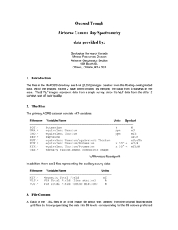
S,P. Williams, B. Ballantyne, R. Balma, K. Bellefontaine, C. Dunn, F. Ferri, J. Grant, A. Plouffe, R. Shives, S. Sibbick, B. Struik
Also published as GSC Open File 3273
The Quesnel Trough project is a joint project of the Geological Survey of Canada and the British Columbia Geological Survey Branch. It was funded mainly through the Canada/British Columbia Mineral Development Agreement (1991-1995), a subsidiary of the Canada-British Columbia Economic and Regional Development Agreement. It was designed to provide new geoscience information in a region in central British Columbia suspected to have economic reserves of precious and base metals in a Triassic and Jurassic island arc volcanic, plutonic and sedimentary setting. That island arc has been traditionally known as the Quesnel Trough.
The Open File consists of geoscience data sets for all or parts of five 1:250,000
NTS map sheets located in the Vanderhoof area: 093J, 093K, 093N, 093O, and 094C. The information is presented in five different categories: Bedrock Geology, Surficial Geology,
Geochemistry, Geophysics and Paleontology.
1. Bedrock Geology: Five bedrock geology map sets are included with this compilation:
- Fort St. James area (93K, 93N) by Armstrong (1948). This map includes 1 inch to 6 mile scale geological information gathered between 1936 and 1946.
- Bedrock compilation of the Fort Fraser (93K), Manson River (93N), and Mesilinka river (94C) 1:250,000 scale map areas by Bellefontaine et al. (1995).
- Aiken Lake (parts of 94C/3,4,5,6,12) areas by Ferri et al. (1996). These 1:50,000 scale maps include data and interpretations.
- McLeod Lake (93J) map area by Struik et al. (1994). This 1:250,000 scale map has both bedrock and surficial geological interpretations. The information dates from a 1987-90 GSC project.
- Pine Pass southwest (93O/SW) map area, Struik (1992, 1996). This 1:250,000 scale map has information dating from a 1990-92 GSC project.
2. Surficial Geology: Included are two maps covering the northeast corner of Fort Fraser (93K) and the southeast corner of Manson River (93N) (Plouffe, 1995, 1996). These maps have been previously published as 1:100,000 scale colour open file maps. Six additional maps of this series will be published in the near future.
3. Geochemistry: Geochemical data included consist of concentrations from till and trees.
- Metal concentrations from glacial till as determined by Plouffe and Ballantyne (1993, 1995) for NTS areas 93K and 93N.
- Metal concentrations from glacial till as determined by Sibbick (1996).
- Thirty three element concentrations of tree bark and wood as determined by Dunn (1996) as part of a GSC project in 1990 and 1991 in the area of the Mount Milligan deposit.
4. Geophysics: Views/images of radiometric, aeromagnetic, and electro-magnetic data are included for selected parts of the area and regional aeromagnetic and gravity data are included for the entire area.
- Radiometric, aeromagnetic and electromagnetic (VLF) data were gathered around the Mount Milligan deposit through a GSC Quesnel Trough project (Shives et al. 1993, 1994, 1995). The original data can be obtained from the Mineral Resources Division, Geological Survey of Canada, 601 Booth Street, Ottawa, Ontario, K1A 0E8.
5. Paleontology: A set of fossil determinations acquired during mapping of the Aiken Lake area (Ferri et al. 1996) is included to supplement the bedrock geological information.
P. Schiarizza and N. Church
The geology of the Thompson - Okanagan Mineral Assessment Region was compiled by P. Schiarizza and N. Church. The original compilation was released as a BC Geological Survey Open File 1996-20 as digital linework.
Mineral Assessment Analysis last updated July 1997.
Geology Polygons and Linework in .E00 format
M. Colpron
Open File 1996-21 portrays the geology of the Tangier River area (parts of 82N/4, 5; 82M/1, 8) in the Selkirk Mountains of southeastern British Columbia. The Open File consists of 2 sheets: sheet 1 presents the geology at 1:50 000 scale and includes a legend; sheet 2 contains structural cross sections.
The area is bounded on the west by the Standfast fault and on the east by the La Forme fault. An amphibolite unit in the section is of uncertain age. The apparently oldest rocks exposed are units of the Neoproterozoic to Lower Cambrian Hamill Group. The lower unit is clean, white cross-bedded quartzite, and the upper unit consists of argillaceous quartzite, psammitic schist and minor greenstone. Mohican Formation phyllite with minor dolostone, and Badshot Formation dolomitic marble or limestone and muscovite schist are both of Lower Cambrian age. The Cambrian Lade Peak Formation consists of argillaceous limestone, calcareous quartzite, and dolomitic limestone. Possibly Cambrian to possibly Ordovician Lardeau Group includes rocks of the Lower, Middle and Upper Index formations. Three units comprise the Lower Index Formation: calcareous phyllite; argillaceous limestone; and graphitic to calcareous to siliceous phyllite, siltstone and quartzite. Three Middle Index Formation units are dominated by marble, greenstone, and mixed phyllite, grit, and quartzite respectively. Upper Index Formation consists mainly of intercalated grit and black lustrous phyllite. Other Lardeau Group units are the Downie Lake sequence of dolostone cobble conglomerate, dolomitic sandstone and schist, the Bridgeland Pass quartzite breccia, a unit of siliceous phyllite with dolomitic sandstone interlayers, and a unit with calcareous slate and phyllite.
Intrusive rocks are diverse. The oldest is the Late Devonian to Mississippian Clachnacudainn granodiorite gneiss. Foliated feldspar porphyry dikes are Paleozoic to Mesozoic (?). Middle Triassic intrusions include the Corbin and Lanark stocks, mainly granodiorite, the Fang and Tangier stocks, dominantly megacrystic quartz monzonite, undifferentiated granitoid rocks, and quartz diorite bodies. Diabase and lamprophyre dikes are Tertiary.
Several phases of deformation have affected the area. Early nappes have later superimposed west verging overturned folds. Low angle faults, like the Downie Creek fault, have reverse movement.
S. Sibbick, R.G. Balma and C.E. Dunn
Also published as GSC Open File 3291
Open File 1996-22 contains data from a geochemical survey conducted in the vicinity of the Mount Milligan porphyry copper-gold deposit. The survey was carried out to provide data to help design and interpret regional till
geochemical surveys for porphyry copper-gold occurrences. The report includes data, maps and a detailed description of the survey and its results.
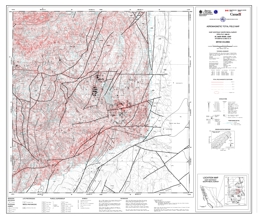
Geological Survey of Canada
Also published as GSC Open File 2628
On behalf of the Government of British Columbia, the Geological Survey of Canada is announcing the publication of airborne survey results. The survey was funded by the Government of British Columbia and co-ordinated by the GSC. The electromagnetic, magnetic, radiometric geophysical survey covers the St. Mary River Valley West half, East half and Findlay Creek areas.
The electromagnetic, magnetic, and radiometric survey results are presented as contour and colour interval maps at 1:50 000 scale, as a set of 6 maps for each area. Each set consists of the following parameters:
- Aeromagnetic Total Field Map (contour, with EM conductors)
- Aeromagnetic Anomaly Map (residual total field, colour interval)
- Map of Conductors and Apparent Conductivity (contour)
- Ternary Radioelement Map (colour interval)
- Equivalent Thorium/Potassium Map (colour interval)
- Potassium Map (colour interval)
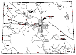
P.T. Bobrowsky, N.W.D. Massey and A. Matheson
Aggregate potential maps provide guidelines for testing, evaluating and managing aggregate resources within a defined area. The maps provide first approximation estimates of broad, regional aggregate distribution and are suitable for use by municipal and landuse planners as well as the aggregate industry.
A pilot study was undertaken in the Prince George area, covering five 1:50 000-scale map sheets (Red Rock 093G10, Isle Pierre 093G14, Prince George 093G15, Wansa Creek 093G16, Salmon River 093J02) forming a cross, centered on the city of Prince George and including the major transportation corridors in the area. The study area has a reasonable endowment of aggregates but suffers from problems in the management of the resource and conflicts with other land uses. Methodologies developed here should also be applicable elsewhere in British Columbia. The project had the support and cooperation of the Ministry of Transportation and Highways, the Ministry of Forests, the City of Prince George, the Regional District of Fraser - Fort George, and faculty members of the University of Northern British Columbia. These partners were invaluable sources of relevant technical data, and also provided input on the effectiveness of the presentation format of final products.
Within the Prince George area, 321 individual areas (polygons) have been identified as significant for hosting potential natural aggregate resources. The polygons are based on soil and landform units identified and delineated by Farstad (1976a,b,c,d,e) and Dawson (1989). The potential was assessed by compiling data pertaining to important geological factors for each of the original 1107 landform polygons within the study area. Parameters used were landform type, soil type, area of polygon, presence/absence of historical aggregate extraction, thickness of overburden, gravel thickness and volume.
Each factor was subdivided into several classes and ranked. The rankings were used to eliminate unfavourable polygons, and to subdivide the remainder into areas of primary, secondary or tertiary significance. For the project area, 61 polygons are of primary, 207 of secondary and 53 of tertiary potential. These comprise 11.8%, 9.2% and 6.0%, respectively, of the total map area. All other polygons are unclassified (class = U).
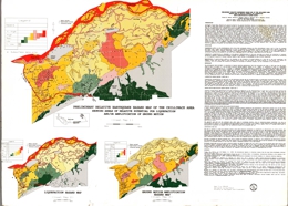
V.M. Levson, P.A. Monahan, D.G. Meldrum, P.F. Matysek, A. Sy, L. Yan, B.D. Watts and R.F. Gerath
The earthquake hazard map of Chilliwack is the first map of its kind to be released by the British Columbia Geological Survey. Earthquake hazard maps show areas where the hazards due to earthquakes are increased due to local geological conditions, such as the presence of sandy soils susceptible to liquefaction, thick deposits of soft clay that can amplify earthquake ground motions, and unstable slopes that could fail. Damage due to earthquakes is commonly concentrated in such areas. The prime users of earthquake hazard maps are civic planners, engineers and building inspectors, emergency response planners, public officials responsible for prioritizing seismic upgrades, insurance companies, engineers and the public.
The Chilliwack map shows areas of relative potential for liquefaction, and amplification of ground motion, individually and combined. These maps were prepared by integrating new surface geological mapping with an extensive database of geotechnical testholes and water well logs to produce a subsurface geological model of the Quaternary deposits of the area. The liquefaction potential of each geological map unit is based on the sediment types present, their properties, and the expected frequency and strength of earthquakes. By this method, the hazard due to liquefaction is quantified and can be compared directly with the liquefaction hazard in other areas of the province. The amplification susceptibility of each geological map unit was determined by correlation of the sediment types present with the amplifications that have been observed in similar sediments during earthquakes. The combined hazard map was prepared by taking the higher of the two hazards for each map unit. Within the Fraser Lowland, the combined hazard rating ranges from low on alluvial fans and on the Cheam Slide, to high and very high along channels of the Fraser River and in areas where thick surficial silts and peats occur. The hazard rating is low to very low along the lower slopes of the Cascade Mountains and within bedrock inliers in the Fraser Lowland.
D.G. MacIntyre, I.C.L. Webster, K. Bellefontaine
R. Lett, W. Jackaman and S. Sibbick
Open Files 1996-18 and 1996-30 present results collected over part of the Kechika Trough in the Gataga Mountain area. Ground water springs in the area are associated with iron oxide precipitate and other secondary mineral deposits. Previous studies have revealed significant differences between the chemistry of ground water draining sedimentary exhalative barite-lead-zinc mineralization and that from pyrite-bearing Paleozoic shale. Spring water and spring sediment samples were collected to test the exploration potential of ground water chemistry for base metal deposits similar to the Stronsay (Cirque), Bear and Driftpile Creek.
A total of 38 stream sediment and water samples were collected from 34 sites in an area covering approximately 500 square kilometres extending from Trough Creek to Matulka Creek.
Spring water samples have been analyzed for aluminium, antimony, arsenic, barium, cadmium, calcium, cobalt, copper, iron, lead, lithium, manganese, magnesium, molybdenum, nickel, potassium, rubidium, selenium, silicon, sodium, strontium, thorium, thallium, uranium, vanadium and zinc by inductively coupled plasma mass spectroscopy. Water samples were analysed for pH, conductivity, fluoride and sulphate. Sediment samples were analysed for antimony, arsenic, barium, bromine, cerium, cesium, chromium, cobalt, gold, hafnium, iron, lanthanum, lutetium, molybdenum, nickel, rubidium, samarium, scandium, sodium, tantalum, terbium, thorium, tungsten, uranium, ytterbium and zinc by neutron activation; for antimony, arsenic, bismuth, cadmium, cobalt, copper, iron, lead, manganese, molybdenum, nickel, silver, and zinc by aqua regia digestive-atomic absorption spectrometry; for fluoride by ion selective electrode and for loss on ignition.
Data packages include survey details, data listings, summary statistics, sample location map, bedrock geology map and element distribution maps. Field observations and analytical data are included
View Open File 1996-30 (PDF, 4.4 MB)
Download Open File 1996-30 (ZIP, 24 KB)
1995
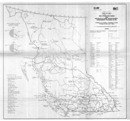
G. Owsiacki, T. Schroeter, P. Wojdak, R. Pinsent, M. Smith and P. Wilton
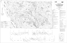
M. Colpron, J.M. Logan, G. Gibson and C.J. Wild
Digital compilation by P.J. Desjardins
Open File 1995-02 discusses the geology and mineral occurrences of the Goldstream River area (82M/9 and part of 10) in the northern Selkirk Mountains in eastern British Columbia. The Open File map presents geology at 1:50 000 scale, and has a legend, several geologic cross sections, and a table of mineral occurrences. More detailed geology of the Goldstream mine area is presented in Open File 1995-3.
The geology and structure are complex. The oldest exposed rocks correlate with the Neoproterozoic Horsethief Creek Group. One unit consists of fine quartz grit, impure quartzite and pelitic schist calc-silicate layers. Others consist of coarse amphibolite, grey marble, feldspathic grit and phyllite, rhythmically laminated phyllite and siltstone, calcareous phyllite and fine grit, micaceous quartzite, greenstone, dolostone, and black calcareous phyllite and dark grey marble. Units with pelitic schist, quartzite, garnet amphibolite, and gneiss may be Paleozoic. Eocambrian Hamill Group comprises five units. The lowest consists of phyllite and quartzite. Above are massive and cross-bedded quartzite with micaceous quartzite, grit and phyllite layers; dolomitic marble; rhythmically laminate sandstone and siltstone; and massive to amygdaloidal greenstone, mafic schist, volcanic conglomerate, grit and tuff. The Lower Cambrian Badshot Formation is dolomitic marble. The Index Formation of the Cambrian (?) to Devonian (?) Lardeau Group is divided into six units generally and undivided locally. From lowest to highest, the units consist of marble and black limestone, graphitic phyllite and schist with calcareous phyllite and marble, micaceous quartzite and siliceous phyllite, chlorite schist and greenstone, marble, quartz grit with laminated micaceous quartzite, calcareous grit, schist and dolomitic layers.
The Middle Jurassic Adamant pluton consists of hypersthene-augite monzonite and hornblende granodiorite. The Early Cretaceous Goldstream pluton contains quartz monzodiorite and biotite granite with local megacrystic granite and aplite dikes. The Cretaceous (?) Long Creek stock is locally megacrystic biotite granite, and the Late Cretaceous (?) Downie stock consists of leucogranite that is locally garnet bearing.
Rocks in the area have been multiply deformed into a series of thrust slides that dip easterly and host upright to overturned to west verging isoclinal folds. The map sheet is bounded on the west by the Columbia River fault, which dips moderately toward the east and shows normal movement. Rocks west of this fault comprise the Monashee complex.
Mineral occurrences include: copper-zinc-silver-gold-bearing Besshi-type volcanogenic massive sulphide deposits, like the formerly producing Goldstream mine; stratabound carbonate replacement deposits with lead, zinc, silver and gold values; zinc-copper-silver skarns; base metal veins with or without tungsten and gold; placer gold; and industrial mineral potential, particularly for garnet.
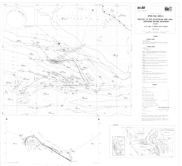
J.M. Logan and G. Gibson
Open File 1995-03 presents a more detailed view of the geology of the area of the Besshi-type Goldstream volcanogenic massive sulphide deposit (82M/9). The geology is presented at 1:10 000 scale and augments information in Open File 1995-02, which is at 1:50 000 scale.
The geology and structure are complex. The oldest exposed rocks correlate with the Neoproterozoic Horsethief Creek Group, and near the mine, these consist of calcareous phyllite and fine grit with local intercalations of marble, micaceous quartzite and greenstone. The Index Formation of the Cambrian (?) to Devonian (?) Lardeau Group is divided into seven units. From lowest to highest, the units consist of marble and black limestone; graphitic phyllite and schist with calcareous phyllite and marble; the so-called Garnet zone, a black, cherty phyllite derived from an iron-magnesium-silica replacement/exhalative horizon; light brown calcareous muscovite-biotite schist, micaceous quartzite and siliceous phyllite; chlorite schist, amphibolite and metabasalt flows and sills; marble and calc-silicate schist; and quartz grit with laminated micaceous quartzite, calcareous grit, schist and dolomitic layers.
The Early Cretaceous Goldstream pluton consists of quartz monzodiorite and biotite granite with local megacrystic granite and aplite dikes.
Rocks in the mine area are multiply deformed. The strata define a fold with a near-vertically dipping west limb and a shallow east limb that is subparallel to the slope of the Goldstream valley. The west limb is cut by the Goldstream pluton. This is actually a younger fold because the east limb is the overturned limb of a large isoclinal anticline. The projection of the axial surface of this anticline more or less coincides with the low point of Goldstream valley.
Drilling has traced the Garnet zone and Goldstream horizon for nearly 6 kilometres. The massive sulphide zone is structurally above and stratigraphically below the Garnet zone. The Goldstream mine is a stratabound copper-zinc-silver deposit of the Besshi type. Potential also exists for carbonate replacement lead-zinc-sulphide deposits, gold-quartz veins and placer gold.
F. Ferri, J. Nelson and C. Rees
Open File 1995-04 presents a preliminary geology map with a 1: 50 000-scale.
M.G. Mihalynuk, D.G. Meldrum, W.A. Sears, G.G. Johannson, B.E. Madu, S.A. Vance, H.W. Tipper and J.W.H. Monger
Scale 1:50 000
K. Bellefontaine, A. Legun and N. Massey
The geology of the Southern Part NEBC Mineral Assessment Region was compiled by D. MacIntyre, A. Legun, K. Bellefontaine and N. Massey. The original compilation was released as a BC Geological Survey Open File 1995-06 as digital linework on diskettes.
Mineral Assessment Analysis last updated July 1997
Geology Polygons and Linework in .E00 format
P. Schiarizza and D.M. Melville
Open File 1995-07 presents the geology and mineral occurrences of the Tatlayoko Lake map sheet (92N/8, 9, 10). The Open File consists of two sheets: sheet 1 features the geology at 1:50 000 scale with a legend; sheet 2 contains tables of mineral occurrences, a sample location map and stream sediment geochemistry results, and lithogeochemistry.
The area includes rocks of the Cadwallader terrane, the Methow terrane, the Nuit Range, southwest of the Yalakom fault, and possible the Stikine terrane. Within the Cadwallader terrane, the oldest rocks are of the Upper Triassic Hurley Formation of the Cadwallader Group. The Hurley is characterized by siltstone and shale, fine to coarse sandstone, and calcareous sandstone. Overlying Lower to Middle Jurassic rocks are mainly argillite and siltstone. Rocks intrusive into the terrane include: the Late Triassic and possibly younger Mount Skinner complex, which comprises diorite and quartz diorite cut by dikes of basalt, diabase, porphyry and aplite; Late Triassic and/or younger quartz diorite and diorite, hornblende feldspar porphyry and granite intrusions; and Cretaceous and possibly Tertiary quartz diorite and granodiorite.
The oldest Methow terrane rocks are Triassic (?) are a unit consisting of purple and welded tuff, a unit of pebble to cobble polylithic conglomerate with lesser sandstone, siltstone and argillite. Upper Triassic sandstone, calcarenite, and lesser siltstone, micritic limestone, arkosic sandstone and pebble conglomerate are overlain by Lower to Middle Jurassic rocks. These are mainly laminated to cross-laminated siltstone, shale and fine sandstone with lesser granule to pebble conglomerate. The overlying Middle Jurassic unit consists mainly of volcanic lithic sandstone, siltstone and mudstone. Above are Upper Jurassic to Lower Cretaceous rocks of the Relay Mountain Group. The oldest unit comprises hornfelsed sandstone and siltstone then a unit with feldspathic-lithic sandstone and pebble to cobble conglomerate that is overlain by shale and arkosic sandstone. The intermediate unit comprises sandstone, siltstone and mudstone with lesser conglomerate. The uppermost unit consists mostly of sandstone, siltstone and shale. Lower Cretaceous Jackass Mountain Group strata are sandstone with conglomerate lenses, siltstone and shale with minor sandstone, and sandstone and gritty sandstone with some siltstone, shale and conglomerate.
In the Nuit Range, Upper Triassic (?) sandstone, calcarenite, shale and limestone cobble conglomerate comprise the lowest unit. Above are Triassic or Cretaceous conglomerate with finer clastic interlayers, and a dominantly volcanic unit with andesite, andesite breccia and tuff, agglomerate and conglomerate.
Southwest of the Yalakom fault, Coast Belt rocks are Upper Cretaceous units of the Powell Creek Formation. The Formation consists of units dominated by sandstone with purple shale interlayers, volcanic breccia and conglomerate, and andesitic volcanic breccia, lapilli tuff, ash tuff, laharic breccia, mafic to intermediate mafic flows, volcanic sandstone and conglomerate.
Northeast of the Yalakom fault in the Intermontane Belt, possible Stikine terrane rocks may correlate with the Lower to Middle Jurassic Hazelton Group. The lower unit consists of volcanic breccia and tuff with lesser conglomerate and sandstone; the upper unit is andesite, local diorite and gabbro, and minor volcanic breccia, sandstone and siltstone. Intrusive rocks include Jurassic and possible Cretaceous quartz diorite and Cretaceous or possibly Tertiary feldspar porphyry intrusions.
Olivine basalt flows characterize the Miocene and Pliocene Chilcotin Group.
The northwest trending Yalakom fault zone cuts across the northeast corner of the map sheet. The fault displaces mid-Cretaceous and older rocks but is overlapped by Neogene plateau lavas; some offset may be Eocene. Movement is postulated to have been about 115 kilometres of right lateral offset. Other northwest trending faults are important in the area and northeast trending faults, mainly within structural blocks defined by the northwest faults, strongly influence the structural fabric. Movement on some of the northwest faults may have been dextral. Thrust faults occur locally and the strata in fault blocks are variably deformed into upright to overturned folds.
Mineral occurrences are mainly in the Nuit Range. Porphyry copper potential exists where disseminated copper occurs in quartz diorites, gold and copper mineralization occur in sheeted quartz veins and fracture fillings in volcanic and sedimentary rocks cut by porphyry intrusions. Production of gold and silver has come from the Skinner deposit where northeast fault zones in the Mount Skinner complex contain gold-quartz veins.
D.V. Lefebure, D.J. Alldrick and G.J. Simandl
Open File 1995-08 presents mineral deposits profile tables. The tables are listed by deposit group and listed by lithological affinities.
J.L. Hammack, G.T. Nixon, G.J. Payie, L.D. Snyder, J.W. Haggart, N.W.D. Massey and D. Barron
Open File 1995-09 presents the preliminary geology and mineral occurrences of the Quatsino-Cape Scott area (92L/12W; 102I/8,9) of northern Vancouver Island. The Open File consists of two sheets: sheet 1 contains the preliminary geology at 1:50 000 scale, and a geological legend; sheet 2 has a list of MINFILE occurrences, tables of macrofossil and radiolaria results, and a table showing stream sediment geochemistry that includes precious metal, base metal and other element data from areas underlain by various rock units.
The oldest rocks in the area are Upper Triassic and comprise the Vancouver Group. The lowest unit is the Karmutsen Formation, which here consists of a lower basalt unit with lime mudstone intercalations, and an upper unit that consists mainly of subaerial basalt flows with minor pillow basalt, pillow breccia and hyaloclastite. The overlying Quatsino Formation is predominantly thin bedded to massive lime mudstone. Above is Parson Bay Formation argillaceous lime mudstone, calcareous shale, siltstone and minor sandstone. The uppermost unit is the Sutton Limestone, which is thin to thickly bedded pale grey lime mudstone. The overlying Bonanza Group is of Lower to Middle Jurassic age. The lower unit consists mainly of sandstone, siltstone, limestone and minor conglomerate. The upper unit consists of submarine to subaerial intercalated basaltic to rhyolitic lavas, pyroclastic, and minor epiclastic rocks. Lower Cretaceous Longarm Formation equivalents comprise thinly bedded to massive sandstone, siltstone, mudstone, pebble conglomerate, and minor coal. The Upper Cretaceous Blumberg Formation has a lower conglomerate unit and an upper dominantly lithic to arkosic wacke unit. Tertiary felsic volcanic rocks are mainly rhyolite and form flows, dikes and a plug. Lithology is broken out in some detail within the Bonanza Group.
The Mount Brandes Porphyry is part of the Early to Middle Jurassic Island intrusive suite. The Porphyry has hornblende and feldspar phenocrysts and includes irregular diorite dikes.
Three phases of deformation have been recognized: a pre-Cretaceous event; Late Cretaceous to Tertiary transpression; and Tertiary extension. Faulting is the predominant strain-release mechanism. On the map, northwest trending through-going faults define areas that are internally segmented by northeast trending faults.
The lack of Island intrusions lessens the potential of the area, and although alteration associated with rhyolitic and basaltic lavas and dikes suggests that acid leaching occurred, it may be related to low temperature solfataric activity. Strong mercury anomalies in stream sediment samples may be related to northwest faults. Limestones of the Quatsino Formation have significant potential. A number of copper showings occur in the area; most are within basalts of the Karmutsen Formation. Pyrophyllite-bearing silicified Bonanza breccia marks a volcanic centre.
T.R. Giles and V.M. Levson
This map is part of a continuation of surficial mapping and regional till geochemical surveys conducted in the Fawnie Creek map sheet. A total of 195 till samples were collected for geochemical analyses in the Tsache Lake (93F/2) map area in order to locate glacially dispersed mineralization potentially present in the region. The scale of this map is 1:50 000.
D.H. Huntley and P.T. Bobrowsky
Open File 1995-11 is a geological map of the Mahatta Creek Area (92L/5) in British Columbia. The scale is 1:50 000.

S.J. Sibbick and K.A. Laurus
Open File 1995-12 is an integrated geological and geochemical map for the prediction of intrusion-related mineralization for Northern Vancouver Island (92L; 102I) in British Columbia. The scale is 1:250 000.
G.F. Weary, T.R. Giles and V.M. Levson
Surficial geology mapping and till geochemical sampling was completed in the Chedakuz Creek and Tsacha Lake map areas during the summer of 1994 as part of the multi-component geological and mineral exploration survey that included bedrock geology and lake sediment geochemistry. This work is a continuation of surficial mapping and regional till geochemical surveys conducted in the adjoining map sheets.
A total of 187 till samples approximately 1 sample every 5 km, were collected for analyses in order to locate glacially dispersed mineralization potentially present in the region
D. Brown
Open File 1995-14 describes the geology and mineral occurrences of the Yahk map-area (82F/1) in southeastern British Columbia. The Open File includes a 1:50 000 scale geology map with a legend, cross sections, and information source map; and notes with a table of mineral occurrences, lithogeochemical data, and selected references for the area.
The area is underlain by rocks of the Middle Proterozoic Purcell Supergroup. The Aldridge Formation in the area comprises the lower unit (Rampart Facies) of quartzite, quartz arenite and quartz wacke; the middle unit of quartz and quartzofeldspathic wacke with argillite and siltstone interbeds; and the upper unit of siltstone and mudstone couplets. Creston Formation rocks include the lower unit of argillite and siltstone with lesser quartz wacke; the middle unit of white to maroon quartz arenite and quartz wacke with black to purple argillite and siltstone; and the upper unit of green siltstone with black or purple argillite and siltstone. Kitchener Formation is represented by dolomitic siltstone and green argillite.
“Moyie Sills” comprise mafic sills and dikes of gabbro to quartz diorite and hornblendite composition. Mafic sills and dikes of similar composition are hosted in strata younger than the middle Aldridge Formation.
Strata define upright folds that are cut by steeply inclined normal, reverse and thrust faults. From west to east across the map-area trends change from north-northwest and north through mainly north to both north and northeast. Within the fault-defined blocks are a series of northwest trending faults.
The major exploration targets in the area are Sullivan-type volcanogenic massive sulphide deposits. Generally the targets are deep and indicator alteration types, like albitized zones, tourmaline replacements and breccias, and silicified zones, and also stratigraphy guide drilling. Also present are semi-concordant quartz veins with silver-enriched lead, zinc and copper mineralization, as well as quartz-chalcopyrite veins and galena-bearing quartz veins. Past production has come from several of the polymetallic veins.
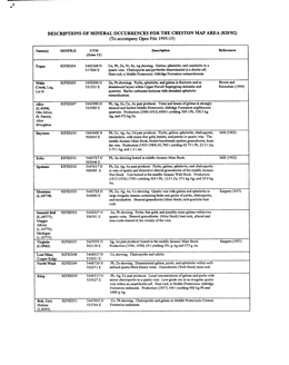
D. Brown, D. Barron, T.P. Doughty, G. Manson and P. Stinson
Open File 1995-15 covers the geology and mineral occurrences of the Creston area (82F/2) in southeastern British Columbia. The Open File consists of a geology map at 1:50 000 scale with a legend, cross section, and selected references, and also two sheets containing a list of mineral occurrences and stream sediment geochemical results.
Rocks of the Middle Proterozoic (Helikian) Purcell Supergroup comprise the oldest strata in the area. Lower, Middle and Upper Aldridge Formation sediments; Lower, Middle and Upper Creston Formation sediments; Kitchener Formation dolomitic and other sediments; rocks equivalent to the Van Creek Formation, calcareous rocks of the Dutch Creek Formation; basalts and andesites of the Volcanic unit; and clastic to dolomitic rocks of the Mount Nelson Formation are exposed. Above are Upper Proterozoic (Hadrynian) strata of the Windermere Supergroup. The lowest, Dropstone unit is overlain by largely conglomeratic rocks of the Toby Formation. Above these are conglomerate, tuff and basalt of the Irene Formation, then limestone and clastic rocks of he Monk Formation. Upper Proterozoic (Hadrynian) and Lower Cambrian grit, quartzite and conglomerate of the Three Sisters Formation are the youngest stratified rocks exposed.
Proterozoic intrusive rocks comprise the Moyie Sills and mafic dikes in strata younger than the Aldridge Formation. Middle Jurassic stocks and plutons are tonalite, and epidote-bearing granodiorite to quartz monzonite. Cretaceous gneisses and plutons are important. The Corn Creek and West Creston gneiss is foliated to gneissic granite. The Rykert batholith varies from granite tot monzogranite to granodiorite; texture varies from granitic to gneissic. The Bayonne batholith consists of three plutons that vary from granodiorite to monzogranite and tonalite, to granite.
In general metamorphic grade and intensity of deformation increase toward the west. Overall, penetrative fabrics, local tight folding and overturned folds in some areas, contrast with broad upright anticlinoria in others. The Okell fault is a contractional, north-northwest-dipping structure; in contrast, the Purcell Trench fault is a brittle, high-level fault. Most faults strike north to northwesterly.
The stratabound Wilds Creek zinc-barite deposit is the most important known mineral occurrence in the area but Sullivan-type Sedex targets have been explored. The Wilds Creek deposit may be similar to the past-producing Mineral King mine.
L.J. Diakow, I.C.L. Webster, J.A. Whittles, T.A. Richards, T.R. Giles and V.M. Levson
Open File 1995-16 presents the bedrock and surficial geology, and the mineral occurrences of the Tsacha Lake area (93F/2) in central British Columbia. The map, at 1:50 000 scale, shows the geology, a legend, references, and assay data.
The oldest stratified rocks in the area are of Lower to Middle Jurassic age. They consist of the Nechako Range assemblage, quartz-bearing crystal tuff, sandstone and siltstone; the Fawnie Range subaerial rhyolitic volcanic sequence; and the Kuyakuz Mountain assemblage, which consists of rhyolitic tuffs and volcaniclastic sediments. Overlying Middle Jurassic rocks comprise the Naglico formation, which consists mainly of andesitic and basaltic flows with pyroxene phenocrysts, feldspathic sandstone and siltstone, and subordinate, andesitic tuff and dacite porphyry flows.
Unconformably overlying Lower Cretaceous conglomerate with chert clasts has interlayers of sandstone and siltstone. Eocene Ootsa Lake Group strata include rhyolite flows, andesite flows, rhyolite ash-flow tuff, and andesitic volcaniclastic rocks. Overlying Miocene and Pliocene Chilcotin Group olivine basalt flows have prominent columnar joints.
Intrusive rocks are Middle (?) Jurassic to Eocene and younger (?). The oldest comprise coarse gabbro, augite porphyry and diorite plutons. Late Jurassic to Early Cretaceous rocks are of the Capoose batholith, which is mainly quartz monzonite. Late Cretaceous porphyritic diorite has pyroxene phenocrysts. Eocene plutons are granites. Eocene and possibly younger dikes and sills are rhyolite porphyry, felsite, and biotite-feldspar porphyry.
Strata are offset along northeast and north to northwest-trending faults. One northerly trending fault is interpreted to be contractional in nature.
The oldest surficial sediments are of Late Pleistocene age. They consist of resedimented glacial debris, morainal diamicton, mainly basal tills, glaciofluvial pebble to boulder gravel and sand, and glaciolacustrine sand, silt and clay. Holocene sediments comprise organic deposits, colluvium, and fluvial sand, pebble gravel and silt.
The Nechako Plateau is underlain by rocks that have potential for porphyry copper, molybdenum or copper-molybdenum deposits, and epithermal precious metal and structurally hosted, porphyry-related precious and base metal-bearing occurrences. There is also potential for skarn mineralization and stratabound base with or without precious metal mineralization. Poor exposure has hampered exploration but known mineral occurrences are encouraging.
L.J. Diakow, I.C.L. Webster, J.A. Whittles, T.A. Richards, T.R. Giles, V.M. Levson and G.F. Weary
Open File 1995-17 presents the bedrock and surficial geology, and the mineral occurrences of the Chedakuz Creek area (93F/7) in central British Columbia. The map, at 1:50 000 scale, shows the geology, a legend, references, and assay data.
The oldest stratified rocks in the area are of Lower to Middle Jurassic age. They consist of the Nechako Range assemblage, quartz-bearing crystal tuff, sandstone and siltstone; the Fawnie Range subaerial rhyolitic volcanic sequence; and the Kuyakuz Mountain assemblage, which consists of rhyolitic tuffs and volcaniclastic sediments. Overlying Middle Jurassic rocks comprise the Naglico formation, which consists mainly of andesitic and basaltic flows with pyroxene phenocrysts, feldspathic sandstone and siltstone, and subordinate, andesitic tuff and dacite porphyry flows.
Unconformably overlying Lower Cretaceous conglomerate with chert clasts has interlayers of sandstone and siltstone. Eocene Ootsa Lake Group strata include rhyolite flows, andesite flows, rhyolite ash-flow tuff, and andesitic volcaniclastic rocks. Overlying Miocene and Pliocene Chilcotin Group olivine basalt flows have prominent columnar joints.
Intrusive rocks are Middle (?) Jurassic to Eocene. The oldest comprise coarse gabbro, augite porphyry and diorite plutons. Late Cretaceous (?) porphyritic diorite has pyroxene phenocrysts. Eocene plutons are granites. Eocene biotite-hornblende granodiorite comprises the CH stock.
Strata are offset along northeast and north to northwest-trending faults. The northerly faults are interpreted to be contractional in nature.
The oldest surficial sediments are of Late Pleistocene age. They consist of resedimented glacial debris, morainal diamicton, mainly basal tills, glaciofluvial pebble to boulder gravel and sand, and glaciolacustrine sand, silt and clay. Holocene sediments comprise organic deposits, colluvium, and fluvial sand, pebble gravel and silt.
The Nechako Plateau is underlain by rocks that have potential for porphyry copper, molybdenum or copper-molybdenum deposits, and epithermal precious metal and structurally hosted, porphyry-related precious and base metal-bearing occurrences. There is also potential for skarn mineralization and stratabound base with or without precious metal mineralization. Poor exposure has hampered exploration but known mineral occurrences are encouraging.
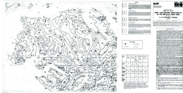
D.H. Huntley and P.T. Bobrowsky
This Drift Exploration Applicability map is an interpretive product of the terrain and surficial geology maps by Pattison (1979) and Huntley and Bobrowsky (1995) and follows the terrain classification system of Howes and Kenk (1988). The concept of sediment derivatives is adapted from Shilts (1993) and the full methodology is detailed in Proudfoot et al. (1995).
The purpose of this map is to assist explorationists to design sampling programs. In practice, the map should be consulted before fieldwork is undertaken, as it identifies types of surficial sediment and categorizes each according to the applicability for drift-related sampling. The sampling applicability of surficial deposits is ranked from very high to very low. Applicability refers to the proximity of the sample to parent material or bedrock as well as the mineralization. The map provides cost-effective information since areas which contain low-ranking deposits can be avoided during sampling. Similarly, areas of exploration interest can be prioritized according to the five categories and sampled sequentially as results from higher potential categories are evaluated first.
Several factors are used in the ranking of surficial deposits, including terrain unit, sediment thickness, transport distance (proximity to bedrock source), diagenesis (history of deposit from erosion to deposition), number of erosive/depositional phases, and ease of interpretation of analytical results. Geological data characterizing paleo-flow is also documented and illustrated to meet the purpose of the map. Collectively, these inter-related factors are used to categorize all surficial sediments identified on a traditional terrain map and generate a Drift Exploration Applicability map. This map should be used to develop a strategy for various levels of drift prospecting. Specific bulk and clast sampling designs can be structured to fit changing project objectives which map rely on data comparisons between different facies. Analytical results can be confidently interpreted after which further action can be taken
Superseded by Open File 1996-08
This 175-page report includes a 110-page table of 736 mineral deposits in British Columbia with known reserves and resources. The inventory, which is sorted by deposit name, includes the tonnage and grade of metallic minerals, industrial minerals, and coal occurrences. These deposits are cross-referenced with tables sorted by MINFILE Number, name and deposit type. The tables were generated from MINFILE/pc V. 4.5 and reflect the status of the MINFILE database as of January 1995.
This Open File was created to serve as a handy hard-copy reference for anyone interested in British Columbia’s rich mineral endowment. This publication will appeal to a wide variety of local and international users, including government agencies, mining and exploration companies, researchers and the public.
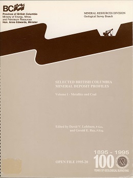
Lefebure, D.V. and Ray, G.E.
The British Columbia Geological Survey (BCGS) started a mineral potential assessment in 1992 utilizing deposit models for defining and characterizing mineral and coal deposits which exist, or for which favourable geological environments could exist, in the province. These deposit models are being used to classify known deposits and occurrences, to guide experts in their estimation of the number of possible undiscovered mineral deposits, and to group deposits to allow compilation of representative grade and tonnage data.
The BCGS formerly relied on mineral deposit models published by the United States Geological Survey (USGS) and Geological Survey of Canada (GSC). However, it became apparent that some models needed revision, and that there are British Columbia deposit types lacking published models. Hence we developed a set of mineral deposit profiles using the Branch's considerable in-house expertise, with assistance from economic geologists of the GSC, USGS, industry and academia.
These deposit models are called "deposit profiles" to distinguish them from other published descriptions. This Open File 1995-20 is the first of three volumes describing deposit profiles, including metallic and coal deposits. Other volumes are:
Volume 2 - Metallic Deposits (Open File 1996-13)
Volume 3 - Industrial Minerals and Gemstones (Open File 1999-10)
Volume 1 - Metallics and Coal (Open File 1995-20) contains the following Mineral Deposit Profiles:
A02 - Lignitic coal; A03 - Sub-bituminous coal; A04 - Bituminous coal; A05 - Anthracite; C01 - Surficial Placers; C02 - Buried Channel Placers; C03 - Marine placers; D07 - Iron Oxide Breccias and veins; E14 - Sedimentary Exhalative Zn-Pb; E15 - Blackbird sediment-hosted Cu-Co; E16 - Shale-hosted Ni-Zn-Mo-PGE; G04 - Besshi massive sulphide Zn-Cu-Pb; G05 - Cyprus massive sulphide Cu; G06 - Noranda/Kuroko massive sulphide Cu-Pb-Zn; G07 - Subaqueous hot spring Au-Ag; K01 - Cu skarns; K02 - Zn-Pb skarns; K03 - Fe skarns; K04 - Au skarns; K05 - W skarns; K06 - Sn skarns; K07 - Mo skarns; L01 - Subvolcanic Cu-Ag-Au (As-Sb); L03 - Porphyry Cu-Au: (Alkalic); L04 - Porphyry Cu+/-Mo+/-Au; L05 - Porphyry Mo (Low-F-Type); L06 - Porphyry Sn; L07 - Porphyry W; L08 - Porphyry Mo (Climax-type)
These three volumes were combined in a 2018 compilation volume (Miscellaneous Publication 86), which has been proceeded by GeoFile 2020-11.
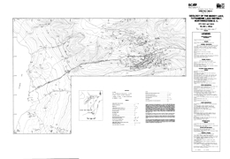
J.L. Oliver
Open File 1995-21 describes the geology and mineral occurrences of the Muddy Lake, Tatsamenie Lake District (104K/1, 8) in northwestern British Columbia. The Open File consists of 5 sheets: sheets A to D are 1:10 000 scale geology maps; the fifth sheet has geologic cross sections. This Open File is an update from Open File 1993-11.
The oldest rocks in the area are packages within the Paleozoic Stikine assemblage that are of Lower Carboniferous, Upper Carboniferous and Permian age. These are overlain by Triassic Stuhini (?) sediments and Jura-Cretaceous volcanic and sedimentary rocks. Miocene basalt flows are columnar jointed and pillowed.
Sheet A covers the extreme northeastern portions of the project area. Much of the rock underlying this portion of the map area is an upper Triassic granodiorite that has been U-Pb dated at 218±3.6 Ma (Oliver and Gabites, 1993). Isolated volcanic roof pendants are also present. Additional geological highlights include:
- A porphyry copper-molybdenum occurrence has been mapped across the eastern portions of the map area. Preliminary unpublished zircon age data for this intrusion indicates that it is upper Triassic in age and about 2.0 Ma years younger than the surrounding granodiorite batholith. Copper-molybdenum mineralization in this zone occurs as classical porphyry style fracture controlled veinlets and disseminations. This mineralized intrusion is tentatively named the Icy Pass Porphyry.
- The upper Triassic hornblende diorite, which hosts porphyry copper-molybdenum mineralization, is cut by a younger quartz-feldspar and biotite porphyry intrusion. Semi-massive stibnite and gold mineralization is associated with this younger intrusive phase. These younger porphyritic intrusions may be correlated with the upper Cretaceous to Tertiary Sloko intrusions.
- Contact relationships between the large dioritic to gabbroic intrusive body, located in the extreme northwestern portions of the map area, and the enclosing granodiorite are poorly constrained. This rock may be simply be a more mafic phase of the larger granodiorite body.
Sheet B covers the northwestern portions of the map area. The following points are relevant to the interpretation of the lithologic and structural relations shown on this map:
- In the extreme southwestern corner of the map Pennsylvanian to Permian age rocks are exposed in the core of a large regional antiform, the Tatsamenie antiform. Felsic volcanics rocks, exposed at the south end of Tatsamenie Lake, have been dated at 307±2Ma (Oliver and Gabites, 1993). The older felsic rock package structurally overlies younger Permian age carbonates. The contact is a south verging thrust.
- Felsic rocks in this area have an unusual map pattern. Rapid changes in the orientation of early linear rock fabrics and the development of an unusual north trending lobe, a weak Type 2 interference pattern, clearly indicates that these rocks have been deformed by a second fold structure. These younger folds typically trend north-northeast, have moderate northeast-directed plunges and are upright.
- An unconformable contact relation is shown in the west central portions of the map area. Highly foliated and strongly actinolite porphyroblastic pre-middle Triassic rocks are overlain by non-foliated, weakly deformed volcanic and sedimentary rocks. These rocks are likely correlates of the upper Triassic Stuhini group.
- A large zone of hydrothermal alteration, approximately 14 square kilometres in extent outcrops from the central to the northeastern portions of the map area. The rock modifier "ak" (ankerite) defines in part the distribution of iron carbonate. This mineral is the principle alteration product and forms a bright orange-buff weathering zone. Green micas, secondary silica, secondary potassic feldspars and pyrite are also important mineral assemblages. The alteration zone does not appear to track the contact of the main granodiorite body exposed on the northern portions of the map area. Rock alteration is likely related to the emplacement of several smaller diorite to granodiorite stocks and the presence of several large extensional faults that are located in this area. One of these large faults, which strikes east-west and dips subvertically, is enveloped by an alteration zone up to 50 metres in width. For up to 100 metres on either side of this fault drag folds deform the rock and rotate supracrustal rocks into this fault zone. Fracture controlled copper mineralization may be identified at several locations within this alteration zone and limited data also suggests that a few of the smaller stocks may host porphyry style mineralization.
Sheet C presents the geology of the central quadrant. Most of the volcanic rocks shown on this map are strongly porphyroblastic. Actinolite, biotite, albite and sometimes hornblende are formed from a mafic volcanic protolith. This metamorphic assemblage is not related to contact effects along the western margin of the granodiorite batholith. Most of these rocks have two cleavages. The younger of these is best identified petrographically and is present as a weak crenulation cleavage. Some rotational fabrics, and pressure shadows are associated with larger porphyroblasts. These are not interpreted as S/C fabrics.
Other features of interest on this map sheet include:
- Ultramafic bodies are exposed in four areas on this map. Although no isotopic age constraints may be imposed on these rocks, they are likely younger than the upper-Triassic. These rocks are clinopyroxene-magnetite Alaskan style intrusions. Near major fault zones they are extensively serpentinized and carbonatized. These rocks were initially interpreted by Oliver and Hodgson (1990) as part of a poorly preserved and dismembered ophiolite. This interpretation has been revised based on updated petrographic data, on the development of a broader geological map base and a revision in the interpretation of field relationships.
- The large north trending fault zone that traverses the central portions of the map area is a continuation of the Bear Fault system which hosts gold mineralization at the Golden Bear deposit, 10 kilometres to the south. This structure is not well exposed on the north side of Tatsamenie Lake. Based on offset stratigraphy, the last movement across this fault is dextral and rotational.
- Contact relations for the intravolcanic limestone unit shown on the west central portions of this map are weakly constrained and have been identified at only three geological stations. This unit does not appear to cross the north trending Bear Fault defined in the central portions of the map area.
- The extreme western contact of the isolated granodiorite body in the north-central portions of the map area is weakly constrained by available field relations. Offsets of this rock mass across the northern extension of the Bear fault have not been determined.
- A northeast trending synform-antiform couple is shown on the extreme southern edge of this map area. The antiform is the northern extension of the Sam Creek antiform. Its position is well constrained by both lithology and rock fabric orientations. The position of the synform is defined by the rapid rotation of early linear rock fabrics across the axial surface of the younger synform.
Sheet D covers the southern quadrant of the study area. Several complex geological relations are shown on this map. The present contact patterns have been strongly influenced by a minimum of two folding events and by both contractional and wrench faults. Significant geological and structural features on this map include:
- The large mass of Permian carbonate rocks shown in the central portions of the map have been deformed into a large north trending antiform, the Tatsamenie antiform. This fold has a south-directed plunge in the southern portions of the map area. To the north, plunges reverse. This reversal is caused by the interaction of a younger northeast trending antiform, the Sam Creek antiform with the older Tatsamenie antiform. The teardrop shaped map pattern of the Permian carbonate rocks is interpreted as a map scale Type 1 to 2 interference pattern.
- The northern contact of the Permian succession with the overlying supracrustral rocks occurs across a south verging thrust. This contraction fault places an older felsic volcanic rock package dated at 301.8 +2/-4 Ma (Oliver and Gabites, 1993) on top of Permian carbonate rocks. These felsic rocks are correlated with the felsic succession exposed on the north shore of Tatsamenie Lake.
- The Sam Creek antiform deforms early rock fabrics and lithology into a northeast plunging antiform. It does not deform the north trending Bear Fault system. K-Ar dates on sericite, formed in association with this fault, suggest that rocks are hydrothermally altered between 205±7 Ma to 179±6 Ma (Schroeter, 1987). The formation of the antiform predates the activation of this fault.
- The Golden Bear deposit, located just north of Bearskin (Muddy) Lake, is bounded to the east by a non-mineralized gabbro and to the west by Permian carbonates. Mineralization forms in dilatant fault zones localized to carbonate-chert-and sulphidized mafic volcanic contacts. Prior to the initiation of mining, the deposit was estimated to contain 625 000 tonnes of 18.63 grams per tonne gold (Oliver and Hodgson, 1989).
- Immediately west of the Golden Bear deposit, map scale second phase folds and interference structures are developed. These structures are believed to have formed at the same time as the larger Sam Creek antiform.
- Several splays or strands of the Bear Fault are shown on this map. Many of these are associated with zones of strong iron carbonate development, sericite, pyrite and green micas or clays. Some of these structural zones, notably the Fleece Zone located 2.0 kilometres north of the Golden Bear mine, are also mineralized. The orientation of second order fault splays and the morphology of mineralized zones suggests that at the time of mineralization movement along the Bear Fault system was sinistral and reverse.
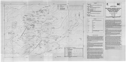
R.A. Lane
The Holy Cross Mountain to Bentzi Lake area (parts of NTS 093F/14, 15), including the Holy Cross epithermal precious metal occurrence (MINFILE 093F 029), was mapped over a two week period during the summer of 1994. The study area is 33 km south of Fraser Lake in the Nechako Plateau area of central British Columbia. It is accessible from each of three secondary loggin groads that branch off the Holy Cross forest service road, a main jaulage way that extends south form Fraser Lake. A 4-wheel-drive road extends west fromt he end of the "37" road to an abandoned exploration camp and several trenches.
Topography consists mostly of gently rolling to moderately steep slopes. Elevations range from 850 to 1410 metres. Outcrop is concentrated on ridges and steep south-facing slopes and covers 5 to 7 per cent of the area. Road building has generated exposures and extensive logging has made out-crops in low-lying areas more obvious and accessible.
This work benefited from previous mapping in the area by Donaldson (1988) and Barber (1989), both of whom were working for Noranda Exploration Company, Limited.
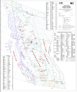
M. Fournier
Open File 1995-23 consists of a porphyry deposits map with a scale of 1:2 000 000. This map contains information on deposits found across the province as well as past and present producers.
K. Bellefontaine, A. Legun and N. Massey
The geology of the Southern Part NEBC Mineral Assessment Region was compiled by K. Bellefontaine, A. Legun and N. Massey. The original compilation was released as a BC Geological Survey Open File 1995-24 as digital linework on diskettes.
Mineral Assessment Analysis last updated July 1997
Geology Polygons and Linework in .E00 format
F.E.L. Harvey-Kelly
This Open File report describes the distribution and geological environment of asbestos occurrences in British Columbia. It comprises 100 pages with 9 tables, 23 figures and maps, and 4 appendices.
The 97 known occurrences of asbestos in B.C. are categorized by regional geology, host rocks, adjacent lithologies, tectonic setting and proximity of intrusions. The individual occurrence descriptions are subdivided by both host terrane and physiographic area. The MINFILE system has been used to develop individual property descriptions. Asbestos mineralization is identified by mineral type - i.e. asbestiform serpentine (chrysotile) or asbestiform amphibole.
Funding for this project was provided by the 1990-1995 Canada - British Columbia Agreement on Mineral Development (MDA) through Natural Resources Canada.
McNeal & Associates Consultants Ltd. and D.F. Gunning
McNeal & Associates Consultants Ltd. were retained by Natural Resources Canada to conduct a market study of the demand for British Columbia (B.C.) mica. Market research assistance was provided by Donald Gunning, P.Eng. and John Chapman, P.Eng., both of whom have extensive backgrounds in industrial minerals and their applications.
This study has been prepared in order to supplement the industrial mineral resource database of the BC Geological Survey of the Ministry of Energy & Mines (MEM) (formerly MEMPR) of the Province of British Columbia, which has identified a number of potentially economic deposits of mica within the province.
1994
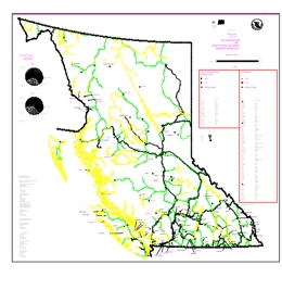
G. Owsiacki
Open File 1994-01 consists of two map sheets. Map sheet one presents the 1993 operating mines and environmental assessment projects in British Columbia. Map sheet two consists of advanced exploration/ development and exploration highlight projects in British Columbia.
L.J. Diakow, I.C.L. Webster, V.M. Levson, and T.R. Giles
Open File 1994-02 presents the bedrock and surficial geology of the Fawnie Creek map area (93F/3) in central British Columbia. The map portrays the geology at 1:50 000 scale, a legend, references, and a table of assay results.
The oldest rocks exposed in the area are the Naglico Formation of the Hazelton Group; they are of Middle Jurassic age. Units are augite phyric basalt and lesser andesite flows; volcanic sandstone, siltstone and conglomerate; and sandstone and siltstone with detrital quartz. Subordinate rocks interlayered with the flows include dacitic tuffs, andesitic lapilli tuff, quartz-bearing lapilli and finer tuffs, rhyolite lithic tuffs, and volcanic sandstone and siltstone. Eocene rocks of the Ootsa Lake Group occur as outliers. Near Cow Lake, basal conglomerate is overlain by dacite flows and rhyolitic flows and intrusives. Along the west-facing slope of the Fawnie Range, rhyolite flows, andesite flows and lapilli tuff containing quartz fragments. Miocene and Pliocene Chilcotin Group comprise basalt flows. Bedrock exposure in the area is sparse, except in higher areas.
Intrusive rocks are varied. Middle Jurassic augite porphyry plugs, dikes and sills are the oldest. Late Cretaceous intrusions include quartz diorite, quartz porphyry dikes, and quartz monzonite and granodiorite of the Capoose batholith. Tertiary felsite dikes and sills occur.
Late Pleistocene units are morainal diamictons, glaciofluvial pebble to boulder gravel and sand, and glaciolacustrine sand, silt or clay. Holocene units are fluvial sand, pebble gravel, and silt and organic deposits.
The area is part of a regional east-trending horst that produced the mountain ranges. Faults typically trend north and northwest.
Epithermal veins and disseminated precious metal mineralization occur at the Wolf property. Most other known occurrences are near the margin of the Capoose batholith. Both epithermal precious metal and skarn mineralization occur.
View Open File 1994-02 (PDF, 7.75 MB)
For further information regarding legend or otherwise, see Open Files 1994-09, 1994-10 and 1995-10.
M. Mihalynuk, M. Smith, K.D. Hancock, S. Dudka and J. Payne
Open File 1994-03 presents the geology of the Tulsequah River and Tulsequah Glacier area (104K/12, 13) in northwestern British Columbia. The Open File consists of three sheets: the 1:50 000 scale Tulsequah River area geology map with schematic cross sections, references, and the area legend, the 1:50 000 scale geology map of the Tulsequah Glacier area, and a lithogeochemical sheet with location map and analytical data tables.
The area is one of extreme geological diversity and structural complexity because it is underlain by several Mesozoic to Paleozoic and older tectonostratigraphic terranes that are juxtaposed and deformed. Involved are the Alexander and Taku, Nisling, Cache Creek, and Stikine terranes. Later events recorded include emplacement of the Triassic Stikine plutonic suite, deposition of the Jurassic Inklin overlap assemblage (Laberge Group), and intrusion of Jurassic plutons. Subsequent intrusion by Cretaceous to Tertiary Coast plutons and burial by Tertiary volcanic rocks further complicate mapping.
Several metamorphic suites are distinguished. Late Proterozoic to Paleozoic suites include the Boundary Ranges and Whitewater suites. Rocks of the Boundary Ranges metamorphic suite mainly underlie the northwest part of 104K/13. They consist of schists of variable composition cut by several phases of igneous rocks. This package may be early Paleozoic or older. The Whitewater metamorphic suite is a distinctive lithologic association of quartz-rich graphitic schist with intercalated quartzite and metabasite and minor marble, quartzofeldspathic schist, orthogneiss and serpentinized ultramafite. Paleozoic to Mesozoic foliated and weakly metamorphose strata comprise the Mount Stapler suite. Varied lithologies in the suite may reflect original facies variations. Both metavolcanic and metasedimentary rocks occur. Major protoliths include: rhyolite, limestone, siliciclastic rocks, intermediate to mafic tuff, and augite phyric volcanic rocks. The Mount Strong suite may be of Mississippian age. It is commonly strongly foliated and may correlate in part with the Mount Eaton suite. Lithologies include: siliceous greywacke, siltstone and shale, basaltic tuff and flows, limestone, pyroxenite, argillaceous chert and andesitic tuff. The Mount Eaton suite is a Devonian to Permian arc succession of the Stikine Assemblage. The lower division of the suite is distinguished by the relatively common occurrence of felsic tuff. The middle division contains pyroxene-phyric volcanic tuff, agglomerate and volcanic turbidite. The sedimentary upper division is characterized by bioclastic limestone that returned middle Pennsylvanian fossils. Triassic Stuhini Group strata include conglomerate, feldspar porphyry flows, augite-phyric breccias and hyaloclastite, augite-phyric flows, turbiditic argillite, arenite and wacke, lapilli tuff and volcaniclastics, volcanic conglomerate and sandstone, and massive carbonate that is probably correlative with the Sinwa Formation. Jurassic Laberge Group strata include: conglomerate, volcanogenic conglomerate and sandstone, greywacke, argillite, and siliciclastics characterized by fine-grained greywacke and siliceous shale. Tertiary Sloko Group comprises a bimodal volcanic package dominated by rhyolite flows and derived epiclastics.
Meta-intrusive rocks include Devonian quartz monzonite orthogneiss, Permian hornblende-rich gneiss, Paleozoic to Triassic K-feldspar megacrystic orthogneiss, Paleozoic to Mesozoic pyroxenite, Mesozoic quartz monzonite, and Early Jurassic hornblende-biotite granodiorite to diorite orthogneiss. Non-metamorphosed intrusive rocks include: the Mississippian (?) Wendy Lake intrusive complex, Triassic to Cretaceous (?) hornblende tonalite, Jura-Cretaceous biotite granite, hornblende-biotite diorite, early Tertiary granodiorite, the Sloko intrusive suite of granite tot granodiorite to tonalite, and Tertiary granodiorite to granite.
The area has common north to northwest trending faults with complex movement histories. Early deformation (pre-Pennsylvanian (?)) developed intrafolial isoclinal folds west of the Llewellyn fault. Faulting and folding occurred during Devonian to Permian arc building, and during construction of the Stuhini arc over the Stikine assemblage basement. Early Mississippian felsic volcanism has associated massive sulphide deposition. Early Jurassic saw mainly sinistral offset on the Llewellyn fault system. Early to Middle Jurassic deformation and metamorphism of older units resulted in imbrication of units along west-directed thrust faults. Early Tertiary events led to easterly-trending cross faulting and associated base and precious metal vein mineralization. Porphyry-style and related skarn mineralization is associated with intrusions of this age.
The area is prospective for deposit types including: Kuroko-style volcanogenic massive sulphide deposits, like Tulsequah Chief and Big Bull; shear-related quartz vein precious metal deposits; and skarn, porphyry and other intrusion-related deposits.
P.T. Bobrowsky and D.G. Meldrum
This map sheet presents the surficial geology of the Port McNeil area of Northern Vancouver Island in British Columbia with a map scale of 1:50 000.
P.T. Bobrowsky and D.G. Meldrum
This Open File presents the surficial geology of the Alice Lake area at a scale of 1:50 000.
P.J. Desjardins and E.C. Grunsky
The geology of the Vancouver Island Mineral Assessment Region was compiled by N.W.D. Massey. The original compilation was released as a BC Geological Survey Open File 1994-06 as digital linework on diskettes.
Mineral Assessment Analysis last updated July 1997.
Geology Polygons and Linework in E00 format
P. Schiarizza, A. Panteleyev, R. Gaba and K. Glover
The geology of the Cariboo - Chilcotin Mineral Assessment Region was compiled by P. Schiarizza, A. Panteleyev, R. Gaba and K. Glover. The original compilation was released as a BC Geological Survey Open File 1994-07 as digital linework on diskettes.
Mineral Assessment Analysis last updated July 1997.
Geology Polygons and Linework E00 format
T. Höy, N. Church, A. Legun, K. Glover, G. Gibson, B. Grant, J.O. Wheeler, K.P.E. Dunn
The geology of the Kootenay Mineral Assessment Region was compiled by T. Höy, N. Church, A. Legun, K. Glover, G. Gibson, B. Grant, J.O. Wheeler, K.P.E. Dunn. The original compilation was released as a BC Geological Survey Open File 1994-08 as digital linework on diskettes.
Mineral Assessment Analysis last updated July 1997.
Geology Polygons and Linework in .E00 format
V.M. Levson and T.R. Giles
Open File 1994-09 examines the surficial geology and quaternary stratigraphy of the Fawnie Creek Area Area (93F/3) in British Columbia.
T.R. Giles and V.M. Levson
The Fawnie Creek map area is located in the Nechako Plateau, in the west-central part of the Interior Plateau physiographic region. This map resulted from one part of a multi-component geological and mineral exploration survey of the Fawnie Creek map area conducted in 1993 that includes bedrock geology, lake sediment geochemistry, till geochemistry and surficial geology and mineral deposit studies. It is intended to show the drift prospecting potential of the area. The map sheet has a scale of 1:50 000.
D.G. Meldrum and P.T. Bobrowsky
Open File 1994-11 presents the drift exploration potential of the Port McNeill area of Northern Vancouver Island in British Columbia. The map scale is 1:50 000.
The principles of surficial geology can be applied to obtain derivative information from basic terrain (surficial) maps to generate interpretive products such as a Drift Exploration Potential Map. This type of map categorizes surficial sediments for drift exploration sampling before a field program is undertaken. Drift exploration is assumed to include bulk sediment sampling for geochemical analysis and pebble/boulder collection for lithological provenance study. The utility of this map is restricted to clastic glacial dispersal and not hydromorphic anomalies.
The purpose of a Drift Exploration Map is to assist explorationists to design sampling programs. In practice, the map should be consulted before fieldwork is undertaken, as it identifies types of surficial sediment and categorizes each according to potential utility for drift-related sampling. The map provides cost-effective information since areas which contain poor or unreliable deposits can be avoided during sampling.
D.G. Meldrum and P.T. Bobrowsky
This Open File presents the drift exploration potential of the Alice Lake area of Northern Vancouver Island in British Columbia. Drift Exploration Potential Maps assist explorationists to design sampling programs. The utility of this map is restricted to clastic glacial dispersal and not hydromorphic anomalies. The scale is 1:50 000.
B. Grant and C. Logan
Open File 1994-13 is a digital bibliographic index of British Columbia Geological Survey Publications from 1874-1993. The Open File provides a list of 2390 geoscience publications keyed to their National Topographic System (NTS) location within the Province of British Columbia. This Open File updates and replaces Information Circular 1991-7, NTS Location & Author Index issued by the Geological Survey in 1991.
This comprehensive database contains references up to December 31, 1993. The index includes all Bulletins, Papers, Open Files, maps and Information Circulars as well as individual article citations from the compilation volumes Geological Fieldwork, Exploration in British Columbia, Geology, Exploration and Mining in British Columbia and Geology in British Columbia. It is recommended that anyone using this index should also consult the Assessment Report Index, and Information Circular 1993-12 (or revisions) - A Catalog of Reports, Maps and Geoscience Databases, issued by the BC Geological Survey.
D.G. MacIntyre, C. Ash and J. Britton
Mineral Assessment Analysis last updated July 1997.
Geology Polygons and Linework in .E00 format
D.A Grieve and F. Goodarzi
The mining, upgrading, transportation, storage and utilization of coal all introduce waste material, including trace elements, to the environment (Gay, 1989). However, the potential for release of trace elements is by far most significant in the case of coal utilization, and probably the single “most important environmental aspect of trace elements in coal" (Swaine, 1989) is related to coal combustion for generation of electricity. With growing global emphasis on the use of thermal coal, and with consideration being given to construction of coal-burning power-generating facilities in British Columbia, it is timely to consider the trace element contents of coals currently being produced in the province.
This study is aimed at determining trace element concentrations in raw British Columbia coal samples from producing mines, interpreting the manner in which trace elements are associated within the coals, and determining potential for removing trace elements through beneficiation. The first two subjects are addressed in this report. Conclusions are preliminary; a more definitive assessment must await further analyses.
P.B. Read
K. Bellefontaine and D. Alldrick
The geology of the Midcoast Mineral Assessment Region was compiled by K. Bellefontaine and D. Alldrick. The original compilation was released as a BC Geological Survey Open File 1994-17 as digital linework on diskettes.
Mineral Assessment Analysis last updated July 1997.
Geology Polygons and Linework in .E00 format
V.M. Levson, T.R. Giles, S.J. Cook and W. Jackaman
Open File 1994-18 presents the results from regional till geochemical sampling in the Fawnie Creek map area, conducted at 171 sites in 1993. The program demonstrates the utility of till geochemical sampling in regions where mineral exploration has been hampered by thick drift cover. Surficial geology mapping was conducted in conjunction with till geochemical sampling in order to understand the glacial history of the area and provide a basis for design of the sampling program. The primary objective of the till geochemical survey in the Fawnie area was to identify areas where glaciers eroded mineralized bedrock and redeposited the mineral debris as till in down-ice dispersal trains.
Survey data has been combined the more recent GeoFile 2006-11.
S.J. Cook and W. Jackaman
Open File 1994-19 presents the results of a 1993 lake survey in parts of 93F. Data for 489 sites includes field observations; sediment by ICPMS and INAA; fluorine (F) and loss on ignition (LOI) in sediments; and pH and fluoride in waters.
L.D. Jones
In November, 1993, the BC Geological Survey of the Ministry of Energy, Mines and Petroleum Resources offered a two-week training course to two geologists from the Mineral Resources Department in Tanzania. The purpose of the course was to provide guidelines on the organization, development and management of mineral resource data using personal computers. The course included talks on systematic database development and used MINFILE and other databases as practical models for managing resources.
The intent of this publication is to document most of the notes and overheads used in the course. It will be of interest to those planning and developing mineral inventory and other earth science related database systems.
MINFILE is a comprehensive, computerized mineral inventory of over 11 400 metallic, industrial mineral and coal occurrences in British Columbia. The information is used for geoscience research, mineral exploration, prospecting, land-use management and other applications requiring data for managing mineral resources. The design of MINFILE, the depth of geological data, and the ability to distribute digital data to clients ensures its continued applicability, data-integrity and system-flexibility.
Some of the course material is based on a training course on Computerized Databases in Mineral Exploration and Development, which took place in Lusaka, Zambia in May 1993, sponsored by the International Atomic Energy Agency and the Government of Zambia.
D.F. Gunning and McNeal & Associates Consultants Ltd.
This study has been prepared in order to supplement the industrial mineral resource database of the BC Geological Survey of the Ministry of Energy, Mines & Petroleum Resources of the Province of British Columbia, which has identified a number of potentially economic deposits of perlite within the Province (White, G.V.). Funding for this project was provided by the Canada-British Columbia Agreement on Mineral Development (MDA.) through National Resources Canada.
The Terms of Reference provided called for a broad literature review, a listing of relevant processing patents, a thorough domestic (B.C.) market survey, and an analysis of the potential viability of a new local perlite operation utilizing B.C. ore. The existing demand is currently being met by imported products, or domestically expanded goods that rely on imported raw perlite.
J.H. Perry, Min-Ex Resource Consultants & B. Ainsworth, Ainsworth-Jenkins Holdings Inc.
Temanex Consulting Inc.
This report, prepared for the British Columbia Ministry of Energy, Mines and Petroleum Resources, BC Geological Survey, provides a detailed overview of B.C.'s pulp and paper industry, with major emphasis on opportunities for high value mineral pigments. It should serve as a starting point for closer development of the two primary B.C. resources, woodfibre and minerals, in a synergistic, mutually beneficial manner.
M. Harris and G.N. Ionides, Temanex Consulting Inc.
This report was prepared for Supply and Services Canada under the Canada-British Columbia agreement on mineral development. It represents an updated market study on prospects for commercialization of British Columbia talc deposits.
Ainsworth-Jenkins Holdings Inc. and Master Mineral Resource Services Ltd.
The objective of this study of bentonite is to determine if there is sufficient usage of bentonite in British Columbia, and/or potential for market development of bentonite products for domestic use or export to the U.S.A. and Pacific Rim countries. Evaluation of the known deposits and exploration and evaluation of new deposits is recommended as a future work program.
The report describes the characteristics of bentonite and correlates them to the grades and specifications in major areas of bentonite applications. It also deals with the industry setting, and briefly describes the geology of known deposits in the Province, before dealing in some detail with the economic factors. The outlook and strategic considerations summarize the conclusions and recommendations of the report, including the potential for production of value-added products that would attract industries to the Province.
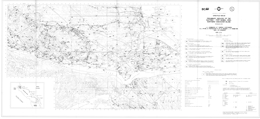
J.L. Hammack, G.T. Nixon, V.M. Koyanagi, G.J. Payie, A. Panteleyev, N.W.D. Massey, J.V. Hamilton and J.W. Haggart
Open File 1994-26 presents the geology of the Quatsino-Port McNeill area (92L/12) on northern Vancouver Island, British Columbia. The Open File consists of two sheets: the first portrays geology at 1:50 000 scale, and a legend; the second has tables of Minfile occurrences, fossil collections, and stream sediment geochemistry data.
The oldest exposed rocks are Upper Triassic rocks of the Karmutsen, Quatsino and Parson Bay formations of the Vancouver Group. Karmutsen Formation contains inter- to subtidal lime mudstone, coarse plagioclase phyric basaltic lavas and aphanitic to plagioclase phyric subaerial basaltic flows, minor pillow lava, pillow breccia and hyaloclastite. Lime mudstone comprises the Quatsino Formation. The Parson Bay Formation has northern and western facies. The northern facies consists of shale and siltstone; the western facies is argillaceous lime mudstone, calcareous shale, siltstone and minor sandstone. A ‘Siliceous Siltstone’ unit includes the Triassic/Jurassic boundary. The unit also contains tuff layers and minor limestone. Lower Jurassic Bonanza Group strata are intercalated basaltic to rhyolitic lavas, pyroclastic and minor epiclastic rocks. Volcanic conglomerate, breccia and cross-laminated sandstone, siltstone and mudstone are Jurassic or Cretaceous. Rocks equivalent to the Lower Cretaceous Longarm Formation are sandstone, siltstone, mudstone and pebble conglomerate. Lower Cretaceous rocks of the Coal Harbour Group consist of a lower conglomeratic facies and an upper sandstone facies. Upper Cretaceous Nanaimo Group equivalents are arkosic to lithic wacke, pebble to cobble conglomerate, siltstone and minor coal.
Rocks of the Early to Middle Jurassic Island Plutonic suite are mainly diorite, quartz diorite, monzodiorite, monzonite, quartz monzonite, granodiorite and quartz-hornblende porphyry.
Block faulting dominates the structural pattern in the map-area. Strata in the individual fault blocks dip and face southwest to define a northwesterly trending homocline. The strata are on the western flank of the Victoria arch, a northwesterly trending anticlinorium.
The area contains economically important porphyry copper-molybdenum-gold deposits, including the Island Copper mine, base and precious metal skarns, and precious metal mineralization associated with epithermal acid sulphate alteration zones, like that at Mount McIntosh.
1993
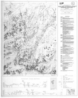
J.A. Bradford and D.A. Brown
Open File 1993-01 presents the geology, mineral occurrences and geochemistry of the Bearskin and South Tatsamenie Lake area (104K/1, 8) in northwestern British Columbia. The Open File consists of three sheets: sheet 1 portrays the geology at 1:50 000 scale, a legend, and geological cross sections; sheet 2 has a sample location map, and tables for mineral occurrences, stream sediment geochemical results, lithogeochemical analyses, isotopic age dates, and fossil lists; sheet 3 contains a map showing structural domains and associated stereonet plots. The coverage is part of a larger project and the geology of other parts is in Open Files 1989-07 and 08, 1990-01 and 02, 1992-02 and 05, 1993-06 and 11.
Paleozoic (?) rocks of the Boundary Ranges metamorphic suite are amphibolite grade schists, orthogneiss, mafic volcanics, metasediments and marble. Paleozoic Stikine assemblage units are Carboniferous (?) marble; penetratively deformed foliated chloritic metavolcanics; and tuff, volcanic sediments and argillite; Upper Carboniferous felsic to mafic volcanics, argillaceous phyllite and limestone; and Permian limestone. Upper Triassic Stuhini Group strata are dominated by plagioclase and augite-bearing volcaniclastics, including ash, crystal, lapilli and block tuff. Also included are megacrystic bladed feldspar porphyry sills, dikes and plugs, and hornblende gabbro intrusives. Sedimentary rocks comprise about 10 percent of the unit. These include argillite, siltstone and minor limestone. Lower Jurassic Takwahoni Formation turbiditic fine to coarse arkosic wackes, shale and siltstone unconformably overlie Takla rocks. The basal Takwahoni is a polymictic conglomerate. Eocene Sloko Group rocks are mainly rhyolite to dacite pyroclastics. Welded tuff and ash tuff occur locally. Tertiary polymictic conglomerates are poorly indurated, and Miocene basalt flows occur locally.
Intrusive rocks cover 25 percent of the area. The Late Triassic Stikine suite Moosehorn batholith is mostly hornblende monzodiorite to quartz monzodiorite but has some monzonite, whereas the Sam batholith is hornblende diorite and melanodiorite with local granite pegmatite dikes. Along its borders, the Sam batholith has pyroxenite and hornblendite zones. Jurassic intrusions include the Ramtut stock, which is quartz monzonite to albitite, and plagioclase or hornblende plagioclase porphyry dikes. Eocene intrusives comprise 2 small stocks of granodiorite and megacrystic granite, and plagioclase and/or quartz phyric rhyolite and dacite dikes.
Stikine assemblage rocks were penetratively deformed, with development of isoclinal folds and chevron folds, during 1 or 2 pre-Triassic periods of deformation. Stuhini Group rocks are also folded and Early Jurassic faulting along north to northwest trends was mostly strike slip and partly dextral.
Mineralization in the area includes large gossans with iron carbonate and quartz-sulphide-albite-potassic feldspar-hematite alteration. Some of these may lie above porphyry systems. Silicified zones in limestone have gold potential. These are associated with high angle faults and volcanic contacts. An example is the Golden Bear mine. Stratabound pyritic zones in Stuhini mafic to intermediate tuffs may have gold potential. Acid sulphate alteration zones in Sloko volcanics could be linked to epithermal mineralization. Porphyry copper and molybdenum mineralization can be associated with Eocene (?) quartz monzonite porphyries.
F. Ferri, S. Dudka, C. Rees and D. Meldrum
Open File 1993-02 portrays the geology, mineral occurrences and geochemistry of the Aiken Lake and Osilinka River area (94C) of north central British Columbia. The Open File consists of 2 sheets: sheet 1 presents the geology at 1:50 000 scale, a legend, references, sections, and a table of fossils collected; sheet 2 has a sample location map and tables of assay, rock and stream sediment geochemical analyses, and mineral occurrences.
The area straddles the boundary between the Intermontane and Omineca tectonostratigraphic belts. It is underlain by accreted volcanic rocks of the Intermontane terrane and displaced rocks of North American affinity. Parts of four terranes are present: Quesnellia, to the west; the Harper Ranch and Slide Mountain terranes centrally; and the Cassiar terrane to the east.
North American, Cassiar terrane rocks consist of the Neoproterozoic Ingenika Group, Cambrian Atan Group, Cambrian and Ordovician Razor Back Group, Middle Ordovician to Lower Devonian Echo Lake Group, Middle Devonian Otter Lakes Group, Upper Devonian to Lower Mississippian Big Creek Group, and the Mississippian (?) to Lower Permian Cooper Ridge Group. Much of the sequence consists of quartz and feldspathic wackes, impure quartzite, sandstone, siltstone, slate, limestone, and their metamorphosed equivalents. These rocks occur east of the Lay Range fault; they were not studied in detail during the mapping. Regionally, units of the North American strata host significant lead-zinc-silver deposits.
Mississippian to Permian Lay Range assemblage rocks are part of the Harper Ranch terrane and consist mainly of sediments and mafic tuffs. Local felsic units occur and these rocks may have volcanogenic massive sulphide potential.
The Pennsylvanian to Permian Nina Creek Group is part of the Slide Mountain terrane. It consists of argillite, siliceous argillite and chert of the Howell Creek Formation, overlain by basalt, gabbro, argillite and chert of the Pillow Ridge Formation.
Overlying Quesnel terrane strata of the Upper Triassic Takla Group consists of the Plughat Mountain formation, which is predominantly basaltic agglomerate, lapilli tuff, ash tuff and epiclastic rocks with local flows. Upper Triassic to Lower Jurassic Takla Group rocks are mainly maroon to brown or green agglomerate, lapilli tuff and tuff with lesser basalt and minor sediments. Overlying is a Lower Cretaceous (?) polymictic conglomerate, sandstone, mudstone sequence, then Cretaceous to Tertiary pebble to boulder conglomerate and sandstone.
Late northwest and northeast normal faults dominate the map patterns.
The oldest intrusive rocks in the area are Pennsylvanian to Permian gabbro bodies. Diorite and gabbro in the Lay Range assemblage may be Paleozoic or Mesozoic. Small Late Triassic to Cretaceous stocks and dikes of monzonite, monzodiorite, diorite and syenite cut Takla rocks. The Hogem intrusive complex is Late Triassic to Early Jurassic in age. It consists of an older gabbro, monzonite, monzodiorite, quartz monzodiorite, granodiorite and syenite phase, and a younger granite phase. The Early Jurassic or older ultramafic unit consists of variably serpentinized pyroxenite, hornblendite, gabbro and diorite. The Polaris Alaskan ultramafic complex consists of dunite, wehrlite and gabbro (see Open Files 1989-17 or 1990-13). Cretaceous or Tertiary intrusions are mainly granites. They are related to the Wolverine metamorphic complex, and some are muscovite bearing. Tertiary dacite forms small stocks, dikes and sills.
There are 73 MINFILE occurrences in the area. Mineral deposit types are porphyry copper-gold deposits in Takla rocks and associated with alkalic phases of the Hogem batholith; stratabound replacement lead-zinc-barite with or without precious metal deposits in Upper Proterozoic an Paleozoic carbonates; quartz-calcite veins with disseminated pyrite, arsenopyrite, pyrrhotite, and lenses of pyrite, pyrrhotite and chalcopyrite in Takla Group rocks; skarns in Takla Group carbonates; chromite in the Polaris complex; and industrial minerals.
J.L. Nelson, K.A. Bellefontaine, K.J. Mountjoy and M.E. MacLean
Open File 1993-03 describes the geology, mineral occurrences and geochemistry of the Klawli Lake map-area (093N/7W) in north central British Columbia. The Open File consists of a geology map at 1:50 000 scale, a legend, cross sections, brief descriptions of the mineral occurrences, a fossil table and a table of rock geochemical results. Open Files 1993-04 and 1993-05 lie to the northwest and north-northwest respectively.
Upper Triassic Takla Group rocks consist of the Inzana Lake formation and the Witch Lake formation. The Inzana formation consists of green lapilli tuff, siltstone and slate. The Witch Lake formation is predominantly augite with or without plagioclase or hornblende porphyritic flows and volcaniclastics. The Lower Jurassic Chuchi Lake formation consists of plagioclase with or without augite porphyry flows and fragmental volcanics.
Intrusive rocks include the Late Triassic to Early Jurassic Valleau Creek intrusive complex, which consists of pyroxenite, hornblendite, gabbro and diorite, the Early Jurassic Aplite Creek intrusive complex, which consists of diorite and gabbro, intrusive breccia and porphyritic monzonite, the Early Jurassic Hogem batholith, which has diorite, monzonite, quartz monzonite and granodiorite phases in this area, and several Early Cretaceous intrusions. A Cretaceous part of the Hogem complex consists of orthoclase megacrystic granite with minor syenite, The Klawli stock is hornblende-biotite megacrystic granite, and the Germansen batholith is even grained to megacrystic granite.
Mineral potential exists in the area for porphyry copper-molybdenum, porphyry copper-gold, skarn, epithermal and lode gold deposits. Within the Aplite Creek intrusive complex, disseminated pyrite, pyrrhotite and chalcopyrite occur in quartz-carbonate veins. Sulphides are also present in the matrix of the country rocks. Takla volcanics have fractures with pyrite and chalcopyrite with precious metal values. Mariposite in a fault zone in carbonate-quartz-sericite-altered rocks suggests a listwanite association and potential for gold mineralization.
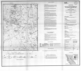
D. Bailey, J.L. Nelson, K.A. Bellefontaine, K.J. Mountjoy
Open File 1993-04 describes the geology, mineral occurrences and geochemistry of the Kwanika Creek map-area (93N/11E) in north central British Columbia. The Open File consists of a geology map at 1:50 000 scale, a legend, cross sections, brief descriptions of the mineral occurrences, a fossil table and a table of rock geochemical results. Open Files 1993-3 and 1993-5 lie to the southeast and south respectively.
Upper Triassic Takla Group rocks consist of the Slate Creek formation, the Inzana Lake formation, and the Plughat Mountain formation. The Slate Creek formation consists of grey slate and siltstone. The Inzana Lake formation consists of green tuff, lapilli tuff, grey siltstone and slate. The Plughat Mountain formation has a lower grey limestone unit, an intermediate maroon augite with or without olivine basalt flows, flow breccia and minor red sandstone, and an upper unit that is predominantly augite with or without plagioclase porphyritic basalt flows and fragmentals with pillowed units, carbonates and epiclastics. The Lower Jurassic Twin Creek formation has green to maroon lapilli tuff and agglomerate, plagioclase with or without augite porphyry flows, feldspar-rich lapilli tuffs and breccia, and green augite porphyritic heterolithic crystal and lapilli tuff, siltstone and argillite.
A Cretaceous to Tertiary unit consists of plagioclase-hornblende rhyolites tuffs and flows.
Intrusive rocks include the Late Triassic to Early Jurassic Valleau Creek intrusive complex, which consists of pyroxenite, hornblendite, gabbro and diorite, the Early Jurassic Aplite Creek intrusive complex, which consists of diorite and gabbro, intrusive breccia and porphyritic monzonite, the Early Jurassic Hogem batholith, which has diorite, monzonite, quartz monzonite and granodiorite phases in this area, and several Early Cretaceous intrusions. A Cretaceous part of the Hogem complex consists of orthoclase megacrystic granite with minor syenite, and the Germansen batholith is even grained to megacrystic granite.
Mineral potential exists in the area for porphyry copper-molybdenum, porphyry copper-gold, skarn, epithermal and lode gold deposits. Within Takla volcanics near the Hogem intrusive complex contact, feldspar alteration and chalcopyrite occur in fractures. Elsewhere, chalcopyrite, bornite, magnetite and pyrite are disseminated in the metamorphosed Takla/Hogem contact. At the Takla-Rainbow prospect, gold mineralization with associated copper and zinc is centred on the Twin Creek fault zone and related to Cretaceous megacrystic granite dikes in the fault zone.
J.L. Nelson, K.A. Bellefontaine, K. Mountjoy and M.E. MacLean
Open File 1993-05 describes the geology, mineral occurrences and geochemistry of the Discovery Creek map-area (093N/14E) in north central British Columbia. The Open File consists of a geology map at 1:50 000 scale, a legend, cross sections, brief descriptions of the mineral occurrences, a fossil table and a table of rock geochemical results. Open Files 1993-03 and 1993-04 lie to the southeast and south respectively.
The Mississippian to Permian Lay Range assemblage rocks include: the Cook Creek panel of siliceous siltstone and argillite, sandstone, tuff and chert; crystal and lapilli tuff, volcanic sandstone, siltstone, argillite, chert and grit; and augite with or without plagioclase porphyritic basalts.
The Pennsylvanian to Permian Nina Creek Group consists of the Mount Howell and Pillow Ridge Formations. The Mount Howell changes from grey chert and argillite in the lower part to red or green ribbon chert with diabase sills in the upper part. The Pillow Ridge has a lower diabase-gabbro sill complex with chert rafts, and an upper pillow basalt dominated package.
Upper Triassic Takla Group rocks consist of the Willy George sequence, the Plughat Mountain formation and an upper felsic unit. The Willy George sequence consists of lapilli tuff, crystal tuff, sedimentary breccia, arkose, argillite and siltstone. The Plughat Mountain formation is predominantly augite with or without plagioclase porphyritic basalt flows. The upper felsic unit, which may be Jurassic, consists of lapilli tuff, agglomerate, conglomerate, basalt flows, crystal-ash tuffs, cherty tuffaceous sediments and monzonite intrusives.
Mesozoic sediments mainly comprise Toarcian arkose, greywacke, sandstone, and siltstone. Cretaceous to Tertiary Uslika Group rocks are conglomerate, sandstone, siltstone, mudstone and minor coal. Overlying these are maroon orthoclase and quartz-bearing tuff with plagioclase phyric fragments.
Intrusive rocks include the Late Triassic to Early Jurassic Lizard intrusive complex, which consists of gabbro, diorite, and plagioclase phyric diorite dikes, and the Early Jurassic Hogem batholith, which has monzonite, quartz monzonite and granodiorite phases in this area.
Known mineral occurrences are mainly disseminated copper sulphides in hornfelsed Takla tuffs and monzonite sills. A coal bed that crops out along Discovery Creek may correlate with the Uslika Formation.
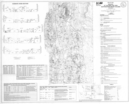
J.M. Logan and J.R. Drobe
Open File 1993-06 portrays the geology, mineral occurrences and geochemistry of the Mess Lake area (104G/7W) in northwestern British Columbia. The geology map is at 1:50 000 scale and includes a geologic legend, cross sections, and tables of fossils collected, mineral occurrences, and geochemical and assay results. The area is north of Open File 1992-05 and east of Open File 1989-07.
The Paleozoic Stikine assemblage consists of Lower Devonian schists, schistose tuffs and minor flows with thin marble interbeds. Overlying Lower Carboniferous limestones give way upward to tuffaceous wacke, siltstone, sandstone and volcanic conglomerate. Upper Carboniferous rocks are basalts and carbonates with intercalated tuff and chert beds. The Lower Permian assemblage consists of four units: plagioclase and pyroxene-phyric andesite flows, lapilli and crystal tuff with local limestone interbeds, rhyolitic lava, breccia and ash flow tuffs, and carbonate with intercalated tuff and chert.
Upper Triassic rocks of the Stuhini Group comprise five units. The lowest consists mainly of mafic tuffs, then feldspar phyric basalt flows and subvolcanic gabbro, lapilli tuffs with interbedded epiclastics, basaltic andesite flows, some of which are plagioclase phyric and some augite phyric. The uppermost unit consists predominantly of well-bedded dust tuffs, siltstone-sandstone turbidites.
Lower to Middle Jurassic conglomerates and coarse sandstones overlie basal crystal-lithic tuffs.
Upper Cretaceous to Tertiary Sustut Group rocks consists of chert pebble conglomerate, sandstone and siltstone. Tertiary to Pliocene rocks consist of the basalt-dominated Nido Formation and the rhyolite-dominated Spectrum Formation. Quaternary to Recent units are the basalt tuff breccias and flows with intercalated glacial deposits of the Arctic Lake Formation, tills and basalts of the Big Raven Formation, and hot spring deposits.
Four plutonic episodes are present. The oldest episode produced the Late Devonian Forrest Kerr pluton, which has ultramafic, gabbro, diorite to quartz diorite and tonalitic phases. The Late Triassic, Hickman pluton consists of monzonite and diorite. Other intrusions of this age are monzonite porphyry and trachyte, diorite and gabbro. The Middle Jurassic Yehinko pluton is biotite-hornblende granite that is flesh to pink coloured. There are also many basaltic to felsic dykes.
Pre-Early Permian deformation and possibly lower greenschist grade metamorphism occur in the Stikine assemblage; metamorphism is sub-greenschist in the Stuhini Group.
Curvilinear north-trending faults control the topography and influence the distribution of almost all the rock units in the area. Faults show at least two episodes of movement. Early normal movement was followed by later reverse motion.
The Schaft creek porphyry copper-molybdenum deposit, near the western border of the area, is a major resource with reserves of 330 million tonnes at 0.40 per cent copper and 0.036 per cent molybdenum. Precious metal values are estimated at 0.32 grams gold and 1.5 grams silver per tonne. Other deposit types in the general area include alkalic copper-gold deposits, like Galore Creek, porphyry molybdenum copper deposits associated with Tertiary intrusions, boulders of semi-massive to massive pyrite with galena and chalcopyrite in vuggy quartz or quartz-carbonate veins, and bedding parallel gold-silver-copper-quartz veins in faults cutting limestone.
A.I. Welbon and R.A. Price
Open File 1993-07 depicts the geology of the Wild Horse and Lussier River area (82G/11, 12, 13, 14), southeast British Columbia. The geology map is at 1:50 000 scale. The area straddles the boundary between Middle Proterozoic Purcell Supergroup rocks and unconformably overlying Lower Paleozoic miogeoclinal rocks. The area is transected by the north-trending Lussier creek thrust fault and a number of easterly trending transverse faults that record repeated motion from Precambrian through Mesozoic time. The area lies immediately east of a number of important silver-lead-zinc mineral deposits in the Purcell Supergroup, including Estella, Kootenay King, and the Sullivan deposit.
Purcell Group rocks in the area are the Aldridge, Creston, Kitchener, Van Creek, Nicol Creek, and Sheppard and Gateway formations. Cambrian sequences include the Cranbrook Formation, and the Jubilee Formation. Cambrian to Ordovician rocks are the Lower McKay Group, the Upper McKay Group, which are subdivisions of the McKay Group. The Ordovician Mount Wilson quartzite is present, as are the Ordovician-Silurian Beaverfoot Formation and a Silurian-Devonian sequence consisting of shale, limestone, volcanic breccia, and lava. The Basal Devonian unit is the youngest stratified rock package exposed.
The succession is cut by Cretaceous monzonite and granodiorite.
J. Riddell, P. Schiarizza, R. Gaba, G. McLaren and J. Rouse
Open File 1993-08 presents the geology, mineral occurrences and geochemistry of the Mount Tatlow map-area (92O/5, 6, 12) in southwestern British Columbia. The open file consists of 2 sheets: sheet 1 has a geology map at 1:50 000 scale, a legend, and references; sheet 2 has a sample location map, references, and tables of mineral occurrences, Regional Geochemical Survey analyses, stream sediment sample analyses, and lithogeochemical analyses.
The area lies along the northeastern edge of the eastern Coast Belt and is underlain by a number of lithotectonic assemblages that originated in ocean basin, volcanic arc and clastic basin environments. The assemblages range in age from Paleozoic to Cretaceous and are intruded by granitic rocks of the mid-Cretaceous through early Tertiary age. The units are juxtaposed across complex systems of contractional, strike-slip and extensional faults of mainly Cretaceous and Tertiary age.
The Mississippian to late Middle Jurassic Bridge River complex is poorly represented in the area. It consists of limited outcrops of sheared ribbon chert northeast of Mount Tatlow, where it forms a fault-bounded lens that separates Cadwallader terrane to the north from Taylor Creek Group of the Tyaughton basin to the south. Rocks of the Cadwallader terrane in the area include siltstone, sandstone, conglomerate and limestone that correlate with the Upper Triassic Hurley Formation. Stratigraphically overlying these are mainly grey to black cherty argillites of the Last Creek Formation, which are of Lower to Middle Jurassic age. The Lower Cretaceous Taylor Creek Formation of the Relay Mountain Group is in fault contact with these argillites. The Taylor Creek consists largely of black shale and siltstone together with chert-rich sandstone and pebble conglomerate. The Upper Cretaceous Silverquick formation rests unconformably on the Taylor Creek Formation and grades upward into the Upper Cretaceous Powell Creek formation. The Silverquick in the area consists mainly of well-stratified volcanic conglomerates and breccias. Powell Creek formation comprises more than 2000 metres of andesitic flow breccias, crystal and ash tuffs, laharic breccias, flows and volcanic sandstones and conglomerates. Rocks of the Methow basin include the Lower Cretaceous Churn Creek facies and the Middle Jurassic to Albian Yalakom Mountain facies. The lower unit of the Yalakom Mountain facies consists of gritty sandstones, and granule to small pebble conglomerates intercalated with lesser volumes of finer sediments. The upper unit consists mainly of feldspathic-lithic sandstones and gritty sandstones. The Churn Creek facies rocks crop out only northeast of the Yalakom fault. The lower unit is dominated by feldspathic sandstone with numerous carbonized logs, branches and twigs. It is at least partly marine. The upper unit is poorly sorted sandy conglomerate. Jurassic or Cretaceous volcanic and sedimentary rocks near Fish Lake include andesite, local rhyolite layers, tuffaceous and pebbly sandstone, flinty siltstone and argillite. Their correlation is uncertain. Flat-lying Miocene to Pliocene Chilcotin Group basalts crop out extensively in the area.
Intrusive rocks of Cretaceous to Tertiary age occur as stocks, plugs and dikes. Diorite and hornblende feldspar porphyry intrude Taylor Creek Group strata. Quartz feldspar porphyry sills and dikes intrude all the Mesozoic rocks. The Beece Creek pluton is Middle Eocene quartz monzonite to granodiorite and intrudes Taylor Creek and Powell Creek rocks. The Cone Hill intrusive suite comprises small stocks and dikes that intrude Jackass Mountain Group strata and the rocks near Fish Lake.
The area underwent mid-Cretaceous deformation documented by the Taylor Creek Group/Powell Creek formation unconformity. The area is divided into four panels by east-striking faults. The Yalakom fault has 80 or more kilometres of dextral strike-slip movement.
Mineral occurrences include gold-bearing copper porphyries, polymetallic quartz veins with gold, silver and copper values, and pyritized hornfelsed conglomerate with sulphides and gold and silver values. The Fish Lake porphyry copper deposit is associated with a diorite to quartz diorite intrusive complex that cuts andesitic volcanic and volcaniclastic rocks. It contains a resource in excess of 1 billion tonnes with average grade 0.23 per cent copper and 0.41 grams/tonne gold (1992 estimates).
C. Ash, R.W.J. MacDonald and I.A. Paterson
Open File 1993-09 describes the geology and mineral occurrences of the Stuart and Pinchi Lakes area (parts of 93K/7, 8, 10, 11) in central British Columbia. The map has geology at 1:100 000 scale, a legend, references, and tables of mineral occurrences, Regional Geochemical Survey results, and rock sample elemental analyses.
The study area covers late Paleozoic and early Mesozoic oceanic rocks of the Cache Creek terrane. The terrane in this area forms a northwest trending belt that is bounded by faults. The belt consists of tectonically intercalated pelagic sediments, limestones and subordinate oceanic metavolcanic and plutonic ultramafic rocks.
Late Paleozoic to early Mesozoic (?) rocks of the Cache Creek complex are dominantly argillite, phyllitic argillite and siliceous limestone with lesser ribbon chert. Limestone frequently occurs as massive blocks in tectonized argillite. Younger rocks of the Takla Group and Uslika Formation were not mapped in detail during this study because it focused on gold related to ophiolitic rocks.
Several large ultramafic-bearing bodies were tectonically emplaced, presumably as klippe. They consist of oceanic crust metabasalt and metagabbro, and upper mantle-derived harzburgites, minor dunites and serpentinized equivalents. Locally the ultramafic rocks are carbonatized and associated with mineralized quartz veins.
The Shass Mountain pluton, which is the largest intrusive body in the area, is of Middle Jurassic age. Other similar-looking but undated intrusions also occur.
Subparallel major faults control the fabric of the mapsheet. Folding and an associated foliation fabric reflect the structural grain of the area.
The most significant occurrence in the area is the Snowbird gold-stibnite deposit. It is a shear-hosted quartz-carbonate vein that is within the Sowchea shear zone. Associated is quartz-carbonate-mariposite alteration of ultramafic or volcanic rocks.
G.T. Nixon, J.L. Hammack, J.V. Hamilton and H. Jennings
Open File 1993-10 presents the geology, geochemistry and mineral occurrences of the Mahatta River area on northern Vancouver Island British Columbia. It consists of 2 sheets: sheet 1 presents the geology at 1:50 000 scale, and a legend; sheet 2 has tables of data for fossils, MINFILE occurrences, lithogeochemistry and stream sediment geochemistry.
The oldest exposed rocks in the area are basaltic flows, pillow basalts, pillow breccias and hyaloclastites of the Upper Triassic Karmutsen Formation. The overlying Quatsino Formation consists mainly of massive limestone but a thinly bedded section occurs at the top and grades into the Parsons Bay Formation. An unnamed Upper Triassic to Lower Jurassic unit that overlies the Parsons Bay consists of sedimentary, volcanic and volcaniclastic rocks with local sandstone, conglomerate, siltstone, limestone, augite phyric basalt and tuff layers. Rocks of the Bonanza Group are the most common in the area. They are marine to continental and range from basalt to rhyolite lavas, pyroclastic and epiclastic rocks. Above the Bonanza is an unnamed Jurassic to Cretaceous unit that consists of volcanic pebble conglomerate, and calcareous sandstone and siltstone that may correlate with the West Coast complex. The Lower Cretaceous Longarm Formation has a lower unit of black shale, then siltstone, pebbly sandstone, and coarse to fine sandstone at the top. Local areas of volcanic pebble conglomerate and lithic wacke occur.
The Island intrusive suite, which comprise the dominant intrusive rocks in the area, consist of hornblende diorite to quartz diorite, dioritic feldspar porphyry, monzonite and minor granodiorite. They have associated skarn and porphyry mineralization. Tertiary amygdaloidal basalt dikes cut the older rocks.
Block faulting dominates the structural pattern. The strata form westerly dipping homoclinal panels between fault blocks. Episodes of folding and faulting are post-Lower Jurassic and pre-Lower Cretaceous, and also Lower Cretaceous, when transcurrent and transpressional faulting occurred. Tertiary normal faulting was widespread.
Mineral prospects in the area include porphyry copper-gold deposits, like Island Copper, gold-bearing iron and copper-rich skarns, precious metal-bearing epithermal systems, and transitional gold-enriched high sulphidation systems. An example of porphyry mineralization in the map-area is the former Yreka mine, where copper-gold-silver ore was mined from skarn developed in Parsons Bay limestone cut by quartz plagioclase porphyry sills and dikes.
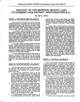
J.L. Oliver
Open File 1993-11 describes the geology and mineral occurrences of the Bearskin (Muddy) Lake, Tatsamenie Lake (104K/1, 8) district, northwest British Columbia. The Open File consists of 4 sheets and explanatory notes. The geology is at 1:10 000 scale.
Sheet A covers the extreme northeastern portions of the project area. Much of the rock underlying this portion of the map area is an upper Triassic granodiorite that has been U-Pb dated at 218±3.6 Ma (Oliver and Gabites, 1993). Isolated volcanic roof pendants are also present. Additional geological highlights include:
- A porphyry copper-molybdenum occurrence has been mapped across the eastern portions of the map area. Preliminary unpublished zircon age data for this intrusion indicates that it is upper Triassic in age and about 2.0 Ma years younger than the surrounding granodiorite batholith. Copper-molybdenum mineralization in this zone occurs as classical porphyry style fracture controlled veinlets and disseminations. This mineralized intrusion is tentatively named the Icy Pass Porphyry.
- The upper Triassic hornblende diorite, which hosts porphyry copper-molybdenum mineralization, is cut by a younger quartz-feldspar and biotite porphyry intrusion. Semi-massive stibnite and gold mineralization is associated with this younger intrusive phase. These younger porphyritic intrusions may be correlated with the upper Cretaceous to Tertiary Sloko intrusions.
Contact relationships between the large dioritic to gabbroic intrusive body, located in the extreme northwestern portions of the map area, and the enclosing granodiorite are poorly constrained. This rock may be simply be a more mafic phase of the larger granodiorite body.
Sheet B covers the northwestern portions of the map area. The following points are relevant to the interpretation of the lithologic and structural relations shown on this map:
- In the extreme southwestern corner of the map Pennsylvanian to Permian age rocks are exposed in the core of a large regional antiform, the Tatsamenie antiform. Felsic volcanics rocks, exposed at the south end of Tatsamenie Lake, have been dated at 307±2Ma (Oliver and Gabites, 1993). The older felsic rock package structurally overlies younger Permian age carbonates. The contact is a south verging thrust.
- Felsic rocks in this area have an unusual map pattern. Rapid changes in the orientation of early linear rock fabrics and the development of an unusual north trending lobe, a weak Type 2 interference pattern, clearly indicates that these rocks have been deformed by a second fold structure. These younger folds typically trend north-northeast, have moderate northeast-directed plunges and are upright.
- An unconformable contact relation is shown in the west central portions of the map area. Highly foliated and strongly actinolite porphyroblastic pre-middle Triassic rocks are overlain by non-foliated, weakly deformed volcanic and sedimentary rocks. These rocks are likely correlates of the upper Triassic Stuhini group.
- A large zone of hydrothermal alteration, approximately 14 square kilometres in extent outcrops from the central to the northeastern portions of the map area. The rock modifier "ak" (ankerite) defines in part the distribution of iron carbonate. This mineral is the principle alteration product and forms a bright orange-buff weathering zone. Green micas, secondary silica, secondary potassic feldspars and pyrite are also important mineral assemblages. The alteration zone does not appear to track the contact of the main granodiorite body exposed on the northern portions of the map area. Rock alteration is likely related to the emplacement of several smaller diorite to granodiorite stocks and the presence of several large extensional faults that are located in this area. One of these large faults, which strikes east-west and dips subvertically, is enveloped by an alteration zone up to 50 metres in width. For up to 100 metres on either side of this fault drag folds deform the rock and rotate supracrustal rocks into this fault zone. Fracture controlled copper mineralization may be identified at several locations within this alteration zone and limited data also suggests that a few of the smaller stocks may host porphyry style mineralization.
Sheet C presents the geology of the central quadrant. Most of the volcanic rocks shown on this map are strongly porphyroblastic. Actinolite, biotite, albite and sometimes homblende are formed from a mafic volcanic protolith. This metamorphic assemblage is not related to contact effects along the western margin of the granodiorite batholith. Most of these rocks have two cleavages. The younger of these is best identified petrographically and is present as a weak crenulation cleavage. Some rotational fabrics, and pressure shadows are associated with larger porphyroblasts. These are not interpreted as S/C fabrics.
Other features of interest on this map sheet include:
Ultramafic bodies are exposed in four areas on this map. Although no isotopic age constraints may be imposed on these rocks, they are likely younger than the upper-Triassic. These rocks are clinopyroxene-magnetite Alaskan style intrusions. Near major fault zones they are extensively serpentinized and carbonatized. These rocks were initially interpreted by Oliver and Hodgson (1990) as part of a poorly preserved and dismembered ophiolite. This interpretation has been revised based on updated petrographic data, on the development of a broader geological map base and a revision in the interpretation of field relationships.
- The large north trending fault zone that traverses the central portions of the map area is a continuation of the Bear Fault system which hosts gold mineralization at the Golden Bear deposit, 10 kilometres to the south. This structure is not well exposed on the north side of Tatsamenie Lake. Based on offset stratigraphy, the last movement across this fault is dextral and rotational.
- Contact relations for the intravolcanic limestone unit shown on the west central portions of this map are weakly constrained and have been identified at only three geological stations. This unit does not appear to cross the north trending Bear Fault defined in the central portions of the map area.
- The extreme western contact of the isolated granodiorite body in the north-central portions of the map area is weakly constrained by available field relations. Offsets of this rock mass across the northern extension of the Bear fault have not been determined.
- A northeast trending synform-antiform couple is shown on the extreme southern edge of this map area. The antiform is the northern extension of the Sam Creek antiform. Its position is well constrained by both lithology and rock fabric orientations. The position of the synform is defined by the rapid rotation of early linear rock fabrics across the axial surface of the younger synform.
Sheet D covers the southern quadrant of the study area. Several complex geological relations are shown on this map. The present contact patterns have been strongly influenced by a minimum of two folding events and by both contractional and wrench faults. Significant geological and structural features on this map include:
- The large mass of Permian carbonate rocks shown in the central portions of the map have been deformed into a large north trending antiform, the Tatsamenie antiform. This fold has a south-directed plunge in the southern portions of the map area. To the north, plunges reverse. This reversal is caused by the interaction of a younger northeast trending antiform, the Sam Creek antiform with the older Tatsamenie antiform. The teardrop shaped map pattern of the Permian carbonate rocks is interpreted as a map scale Type 1 to 2 interference pattern.
- The northern contact of the Permian succession with the overlying supracrustral rocks occurs across a south verging thrust. This contraction fault places an older felsic volcanic rock package dated at 301.8 +2/-4 Ma (Oliver and Gabites, 1993) on top of Permian carbonate rocks. These felsic rocks are correlated with the felsic succession exposed on the north shore of Tatsamenie Lake.
- The Sam Creek antiform deforms early rock fabrics and lithology into a northeast plunging antiform. It does not deform the north trending Bear Fault system. K-Ar dates on sericite, formed in association with this fault, suggest that rocks are hydrothermally altered between 205±7 Ma to 179±6 Ma (Schroeter, 1987). The formation of the antiform predates the activation of this fault.
- The Golden Bear deposit, located just north of Bearskin (Muddy) Lake, is bounded to the east by a non-mineralized gabbro and to the west by Permian carbonates. Mineralization forms in dilatant fault zones localized to carbonate-chert-and sulphidized mafic volcanic contacts. Prior to the initiation of mining, the deposit was estimated to contain 625 000 tonnes of 18.63 grams per tonne gold (Oliver and Hodgson, 1989).
- Immediately west of the Golden Bear deposit, map scale second phase folds and interference structures are developed. These structures are believed to have formed at the same time as the larger Sam Creek antiform.
Several splays or strands of the Bear Fault are shown on this map. Many of these are associated with zones of strong iron carbonate development, sericite, pyrite and green micas or clays. Some of these structural zones, notably the Fleece Zone located 2.0 kin's north of the Golden Bear mine, are also mineralized. The orientation of second order fault splays and the morphology of mineralized zones suggests that at the time of mineralization movement along the Bear Fault system was sinistral and reverse.
M.G. Mihalynuk, M.T. Smith, D.G. MacIntyre, M. Deschenes, J. Timmerman and P. Schiarizza
Open File 1993-12 describes the geology and mineral occurrences of the Yakutat map-area (114O/9, 10, 14, 15, 16) in northwestern British Columbia. The Open File consists of 5 maps: sheet 1 contains a legend, location maps and references; sheets 2 to 4 present 1:50 000 scale geology of the Battle Glacier, Mt. Aylesworth, and Super Cub Lake areas; and map 5 contains a sample location map and tables of lithogeochemical data.
The Tatshenshini project study area is largely underlain by rock of units of the accreted Alexander Terrane, bounded to the east and west respectively by small slivers of the Wrangellia Terrane, and possibly the Chugach Terrane. Four major lithologic packages are represented within the Alexander Terrane: Cambro-Ordovician clastic strata and associated mafic sills and pillow basalts; a thick Ordovician to Silurian carbonate succession; lithologically variable terrigenous, marine, and minor volcanic strata of Silurian to Permian age; and Upper Triassic, moderately deep water, marine carbonate and fine-grained clastic strata with associated rift-related (?) basalts. Two additional metavolcanic and metasedimentary assemblages of probable Alexander Terrane affinity underlie the southwestern part of the study area.
No mineral occurrences are known to have formed during deposition of lower Paleozoic strata. By contrast, Upper Triassic Alexander Terrane lithologies are host to the most significant mineral occurrences in the study area, including the huge Windy-Craggy copper-cobalt deposit. Upper Triassic strata of Wrangellia have many characteristics in common with contemporaneous rocks in the Alexander Terrane and also have demonstrated high mineral potential. Two major intrusive suites are exposed within the map area. Dominantly granodioritic, but compositionally variable Jura-Cretaceous intrusions comprise the Saint Elias Plutonic Suite in the western part of the area. To the east, the Oligocene Tkope Plutonic Suite is also compositionally variable, but is dominated by granite to granodioritic phases. Tkope intrusions thermally metamorphose post accretionary stratified units including deformed Early Tertiary clastic rocks.
Early Tertiary terrigenous sedimentary rocks occupy small, fault-controlled basins along Tats Creek and the western Tatshenshini River valley. The lower Tertiary strata host thin coal seams in both of these basins.
The oldest stratified rocks exposed are mainly silty argillite, silverfish argillite and calcareous argillite of the Lower to Middle Ordovician Argillaceous Division. The overlying Lower Paleozoic (Ordovician to Silurian (?)) package is volumetrically the most significant unit in the map-area. It is a thick succession of limestones and silty limestones. Some mappable units within the succession are thin bedded limestone, ‘Tiger-Stripe’ carbonate (cryptocrystalline to fine grained), massive carbonate, cherty argillite, ribbed carbonate, limestone pebble conglomerate, a marble and dike complex, and calcareous turbidites. Argillaceous strata and minor amounts of lower Paleozoic volcanic rocks also lie within the carbonate sequence. A mainly Silurian and Permian (?) mixed carbonate, clastic and volcanic rocks that comprise a sequence of limestone, argillite, sandstone, conglomerate and mafic volcanic rocks, overlies the carbonate succession. Poorly constrained Paleozoic or Mesozoic rocks including a greenstone-carbonate complex and a Late Pennsylvanian (?) to Permian gneiss and agmatite unit occur. A sequence of sheared mafic volcanic and marine clastic strata is of Paleozoic to Cretaceous age.
Intrusive rocks underlie 25% of the area. Jurassic-Cretaceous plutons predominate and include two batholithic bodies. Homogeneous bodies are dominantly diorite but relatively homogeneous granodiorite to quartz monzonite make up the central areas of the larger intrusions. The Oligocene (?) Tkope plutonic suite consists mainly of hornblende biotite granite but includes granodiorite and alaskite.
The deformational history and structural styles evident within the Tatshenshini map area are complex and highly variable. An early (pre-Triassic?) phase of ductile deformation is manifest primarily by isoclinal folds of variable orientation. The main phase of ductile deformation, evidenced by tight to isoclinal folds and low-grade greenschist facies metamorphism, postdates deposition of the informally named Upper Triassic Tats group. It both predates and is coeval with Late Jurassic to Early Cretaceous plutonism, as some plutons contain a foliation parallel to the regional trend of deformation, while others crosscut some fabric elements. Emplacement of Jurassic-Cretaceous plutons resulted in additional folding, elevated synkinematic metamorphic grade and/or postkinematic contact metamorphism near the margins. The last (composite) phase of deformation is ductile to brittle in nature and resulted in the local development of penetrative shear fabrics and crenulation cleavage, and discrete faults and shear zones, including large northwest-trending faults. Some faults record early sinistral and later dextral strike-slip movement. The latter are associated with east-trending (antithetic?) cross faults. This phase of deformation is suspected to be in part Early Tertiary, based on the presence of fault-related sedimentary rocks of this age in small graben-like structures, and by association with other large dextral strike-slip faults in the region such as the Denali and Border Ranges faults. A separate domain of northwest-striking amphibolite grade gneiss and schist is exposed along the western border of the study area in 1140/15 and 1140/9. Its relationship to the rest of the map area is unclear.
With the exception of visits to showings and prospects described, our observations (and hence interpretations) do not extend to the southern part of the Tatshenshini map area. Additional data will be provided by completion of p regional geochemical surveys. Rocks with high mineral potential are Late Triassic in age and occur in a relatively restricted, northwest trending belt approximately 7 kilometres wide. They may have formed in an ancient rift system not unlike the present-day Red Sea or Gulf of California. Parts of this belt of Upper Triassic rocks contain significant copper deposits, such as Windy Craggy. To emphasize this, our mapping alone resulted in the discovery of four new copper occurrences within 15 kilometres of the Windy Craggy deposit. Most significant of these is the Rainy Monday showing. It is over 600 metres long, over 150 metres wide, and is up to 100 metres thick. Assay samples from this zone have yielded up to 20 per cent copper, up to 2 grams per tonne gold, up to 28 grams per tonne silver and up to 0.27 per cent cobalt.
Metamorphic rocks exposed near the southwestern border of the map area may also have significant mineral potential. A mineral occurrence discovered in this area is visually estimated to contain up to 5 per cent copper in rocks that were originally much like those at Windy Craggy. However, the area is remote, rugged and icebound.
Paleozoic limestone underlies a significant portion of the map area but contains only a few scattered mineral occurrences that appear to be of limited extent. Therefore, areas dominantly underlain by these rocks are tentatively assigned a low mineral potential.
The third major rock type in the map area, Jura-Cretaceous granitic rock, is associated in some instances with iron-copper skarn or lead-silver vein mineralization at intrusive contacts. These occurrences tend to be small and irregular, and therefore offer relatively low mineral potential. However, high-grade veins such as the newly discovered Norm occurrence could have economic significance.
M.G. Mihalynuk, M.T. Smith, D.G. MacIntyre, M. Deschenes, J. Timmerman and P. Schiarizza with contributions by J.J. McDougall
Open File 1993-13 presents the geology of the northwest Tatshenshini River map area (114P/11, 12, 13, 14) in northwestern British Columbia. The Open File consists of 6 maps: sheet 1 contains the legend and location maps, sheets 2 to 5 are 1:50 000 scale geology maps, and sheet 6 has lithogeochemical data.
The Tatshenshini project study area is largely underlain by rock of units of the accreted Alexander Terrane, bounded to the east and west respectively by small slivers of the Wrangellia Terrane, and possibly the Chugach Terrane. Four major lithologic packages are represented within the Alexander Terrane: Cambro-Ordovician clastic strata and associated mafic sills and pillow basalts; a thick Ordovician to Silurian carbonate succession; lithologically variable terrigenous, marine, and minor volcanic strata of Silurian to Permian age; and Upper Triassic, moderately deep water, marine carbonate and fine-grained clastic strata with associated rift-related (?) basalts. Two additional metavolcanic and metasedimentary assemblages of probable Alexander Terrane affinity underlie the southwestern part of the study area.
No mineral occurrences are known to have formed during deposition of lower Paleozoic strata. By contrast, Upper Triassic Alexander Terrane lithologies are host to the most significant mineral occurrences in the study area, including the huge Windy-Craggy copper-cobalt deposit. Upper Triassic strata of Wrangellia have many characteristics in common with contemporaneous rocks in the Alexander Terrane and also have demonstrated high mineral potential. Two major intrusive suites are exposed within the map area. Dominantly granodioritic, but compositionally variable Jura-Cretaceous intrusions comprise the Saint Elias Plutonic Suite in the western part of the area. To the east, the Oligocene Tkope Plutonic Suite is also compositionally variable, but is dominated by granite to granodioritic phases. Tkope intrusions thermally metamorphose post accretionary stratified units including deformed Early Tertiary clastic rocks.
Early Tertiary terrigenous sedimentary rocks occupy small, fault-controlled basins along Tats Creek and the western Tatshenshini River valley. The lower Tertiary strata host thin coal seams in both of these basins.
A Cambro-Ordovician sheet sandstone and basalt unit comprises well-bedded clastic strata and intercalated basaltic sills and pillowed and unpillowed flows and attains a structural thickness of at least 2000 metres where the unit is well exposed on both sides of the Alsek River within 114P/13. Concordant, intermediate to basaltic sills and sub- aqueous, generally unpillowed flows 0.5 to more than 12 metres thick are commonly intercalated with the clastic succession. Locally they make up more than 80 per cent of the section over intervals of hundreds of metres. Other parts of the section are dominated by pillowed flows with associated flow-top breccias or coarse tuff. Carbonate content of the clastic unit increases up section. The clastic strata are overlain (conformably?) by thick, platformal carbonates of Ordovician to Devonian age, providing a minimum age limit for the underlying unit.
The oldest stratified rocks exposed comprise a Late Cambrian to Early Ordovician siliciclastic strata and a sill-flow complex. Diabasic sills and flows, pillow and unpillowed basalt, siltstones and carbonate-dominated sediments predominate. Mainly silty argillite, silverfish argillite and calcareous argillite comprise the Lower to Middle Ordovician Argillaceous Division. Lower Paleozoic (Ordovician to Silurian (?)) package is volumetrically the most significant unit in the map-area. It is a thick succession of limestones and silty limestones. Some mappable units within the succession are thin bedded limestone, ‘Tiger-Stripe’ carbonate (cryptocrystalline to fine grained), massive carbonate, cherty argillite, ribbed carbonate, limestone pebble conglomerate, a marble and dike complex, and calcareous turbidites. Argillaceous strata and minor amounts of lower Paleozoic volcanic rocks also lie within the carbonate sequence. A mainly Silurian and Permian (?) mixed carbonate, clastic and volcanic rocks that comprise a sequence of limestone, argillite, sandstone, conglomerate and mafic volcanic rocks, overlies the carbonate succession. Mainly Silurian and Permian (?) rocks comprise a mixed carbonate, clastic and volcanic sequence. Poorly constrained Paleozoic strata comprise a metamorphosed sequence of sedimentary and volcanic rocks, including amphibolite, metabasite, marble, dioritic orthogneiss, metapelite and metasiltstone, pyritic phyllite and quartz-rich metasediments. The informal Tats group comprises a submarine rift assemblage of fine sediments and mafic volcanic rocks. This sequence is important because it hosts the Windy Craggy volcanogenic massive sulphide deposit, with nearly 300 million tonnes of copper-cobalt reserves.
An Early Tertiary clastic succession, the informal Akie group, is folded and faulted but not cleaved. It contains mainly of shale, siltstone sandstone with coal interlayers, conglomerate, and wacke. The Tertiary (?) Carmine Mountain volcanics comprises volcanic and sedimentary rocks unconformably on Paleozoic strata, mainly lapilli tuff, agglomerate, and several types of conglomerate.
Paleozoic to Mesozoic intrusions form a greenstone-gabbro and diorite complex, there are also gabbro sills and elongate ultramafic bodies. The Triassic to Cretaceous Mount Beaton intrusion is granite. Intrusive rocks underlie 25% of the area. Jurassic-Cretaceous plutons predominate and include two batholithic bodies. Homogeneous bodies are dominantly diorite but relatively homogeneous granodiorite to quartz monzonite make up the central areas of the larger intrusions. The Oligocene (?) Tkope plutonic suite consists mainly of hornblende biotite granite but includes quartz diorite to microgabbro.
The deformational history and structural styles evident within the Tatshenshini map area are complex and highly variable. An early (pre-Triassic?) phase of ductile deformation is manifest primarily by isoclinal folds of variable orientation. The main phase of ductile deformation, evidenced by tight to isoclinal folds and low-grade greenschist facies metamorphism, postdates deposition of the informally named Upper Triassic Tats group. It both predates and is coeval with Late Jurassic to Early Cretaceous plutonism, as some plutons contain a foliation parallel to the regional trend of deformation, while others crosscut some fabric elements. Emplacement of Jurassic-Cretaceous plutons resulted in additional folding, elevated synkinematic metamorphic grade and/or postkinematic contact metamorphism near the margins. The last (composite) phase of deformation is ductile to brittle in nature and resulted in the local development of penetrative shear fabrics and crenulation cleavage, and discrete faults and shear zones, including large northwest-trending faults. Some faults record early sinistral and later dextral strike-slip movement. The latter are associated with east-trending (antithetic?) cross faults. This phase of deformation is suspected to be in part Early Tertiary, based on the presence of fault-related sedimentary rocks of this age in small graben-like structures, and by association with other large dextral strike-slip faults in the region such as the Denali and Border Ranges faults. A separate domain of northwest-striking amphibolite grade gneiss and schist is exposed along the western border of the study area in 1140/15 and 1140/9. Its relationship to the rest of the map area is unclear.
With the exception of visits to showings and prospects described, our observations (and hence interpretations) do not extend to the southern part of the Tatshenshini map area. Additional data will be provided by completion of p regional geochemical surveys. Rocks with high mineral potential are Late Triassic in age and occur in a relatively restricted, northwest trending belt approximately 7 kilometres wide. They may have formed in an ancient rift system not unlike the present-day Red Sea or Gulf of California. Parts of this belt of Upper Triassic rocks contain significant copper deposits, such as Windy Craggy. To emphasize this, our mapping alone resulted in the discovery of four new copper occurrences within 15 kilometres of the Windy Craggy deposit. Most significant of these is the Rainy Monday showing. It is over 600 metres long, over 150 metres wide, and is up to 100 metres thick. Assay samples from this zone have yielded up to 20 per cent copper, up to 2 grams per tonne gold, up to 28 grams per tonne silver and up to 0.27 per cent cobalt.
Metamorphic rocks exposed near the southwestern border of the map area may also have significant mineral potential. A mineral occurrence discovered in this area is visually estimated to contain up to 5 per cent copper in rocks that were originally much like those at Windy Craggy. However, the area is remote, rugged and icebound.
Paleozoic limestone underlies a significant portion of the map area but contains only a few scattered mineral occurrences that appear to be of limited extent. Therefore, areas dominantly underlain by these rocks are tentatively assigned a low mineral potential.
The third major rock type in the map area, Jura-Cretaceous granitic rock, is associated in some instances with iron-copper skarn or lead-silver vein mineralization at intrusive contacts. These occurrences tend to be small and irregular, and therefore offer relatively low mineral potential. However, high-grade veins such as the newly discovered Norm occurrence could have economic significance.
L.J. Diakow, K. Green, J. Whittles and A. Perry
Open File 1993-14 presents the geology of the Natalkuz Lake area (93F/6) in north central British Columbia. The 1:50 000 scale geology map includes a legend, references, and a list of mineral occurrences.
The oldest layered rocks in the area are strata of the Early to Middle Jurassic Hazelton Group. Two mappable units, variegated green and maroon ash and lapilli tuff, and feldspar and augite phyric andesite flows are described. Minor amounts of epiclastic rocks also occur. Overlying Middle to perhaps Upper Jurassic rocks of the Ashman Formation of the Skeena Group consist of argillite and siltstone, and this unit is overlain by andesite to dacite crystal, lapilli and block tuff. Lower to perhaps Upper Cretaceous rocks include pebble breccia, lithic wacke, siltstone and mudstone of the Skeena Group, andesite block to lapilli tuff, and rhyolite flows and cogenetic sills. Lower to Middle Eocene rocks of the Ootsa Lake Group comprise seven mappable units: coarse feldspar andesite flows; blue grey and pink dacite flows; rhyolite flows with associated tuff and tuffaceous sediments; andesite flows; grey rhyolite flows with up to 25% quartz phenocrysts; and rhyolitic crystal-lapilli tuff. Endako Group basalt is of Upper Eocene to Oligocene age. Miocene to Quaternary Chilcotin Group olivine basalt flows overlie the older rocks.
Intrusive rocks include the Late Cretaceous Capoose Lake batholith, which is quartz monzonite to granodiorite, and Tertiary small stocks and dikes of quartz feldspar porphyry, k-feldspar quartz porphyry, and gabbro.
The area is poorly exposed but normal faulting with northeast, north and north-northwest have been mapped.
The area includes the Capoose prospect, which is hosted within and adjacent to garnet-bearing rhyolite sills that intrude Hazelton Group volcanic and sedimentary rocks. Mineralization in this porphyry prospect is mainly disseminated but also occurs in veinlets and fracture fillings. Minerals of interest are sphalerite, galena, and chalcopyrite. Reserves are reported at 28 million tonnes grading 0.51 g/t gold and 36 g/t silver. Other occurrences in the area include vein-controlled and disseminated chalcopyrite and molybdenite in the Capoose Lake batholith.
P. Wojdak and M.L. Malott
Not Completed.
D.E. Kerr and T.R. Giles
D.E. Kerr and T.R. Giles
D.N. Proudfoot and R.F. Allison
D.N. Proudfoot and R.F. Allison
G. Owsiacki
This Open File presents a map of the 1992 operating mines and projects in British Columbia.
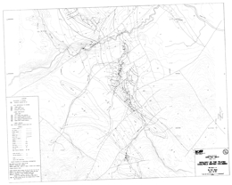
B.D. Ryan
Open File 1993-21 presents the geology of the Telkwa coalfield (93L/11, 14) near Smithers, British Columbia. Sheet 1 is a geology map and legend at 1:20 000 scale. Sheet 2 portrays the geology of the northern part of the coalfield. Sheet 3 consists of 7 geologic cross sections, at 2000 metre spacing across the coalfield.
The country rocks of the coalfield area are undivided volcanic rocks of the Lower Jurassic Telkwa Formation. The Lower Cretaceous Skeena Group is generally subdivided into 4 units. The oldest unit consists of sandstones, conglomerates and coal that underlie marine mudstones and siltstones of unit 2. Above are mudstones, sandstones and coal of unit 3 that are overlain by shallow marine sandstones of unit 4. Late Cretaceous to Eocene granodiorite and quartz monzonite, quartz feldspar porphyry and feldspar porphyry cut the older rocks. Paleocene to Eocene sandstones, mudstones and coal are the youngest rocks exposed.
Strata in the coal basin are gently dipping but block faulted. Gentle folds are developed locally.
Coal in the basin is a bituminous thermal coal. Production at the former Telkwa mine was from coal measures in Unit 3.
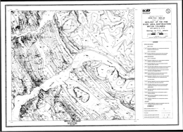
P.C. Jahans
Open File 1993-22 describes the geology of the Pine River area in northeastern British Columbia (93O/9, 10; P/12). The Open File consists of 3 sheets; each has geology and a legend at 1:50 000 scale. They cover part of the Commotion Creek map-sheet, part of the Callazon Creek map-sheet, and the entire Mount Hulcross sheet.
Mesozoic rocks were the focus of the study, and coal bearing rocks in particular. The oldest strata mapped are calcareous and phosphatic shales, sandstone and siltstone. Overlying rocks of the Lower Cretaceous Minnes Group are subdivided into a number of formations. The lowest, the Monteith is mainly quartzose sandstone. Above are silty shales and fine sandstones of the Beattie Peaks Formation. Monach Formation argillite to quartzose sandstone follow, then interbedded sandstone, silty shale and coal of the Bickford Formation. Bullhead Group here comprises chert, sandstone and quartzite pebble conglomerate of the Cadomin Formation, and carbonaceous sandstone, coal and carbonaceous shale of the Gething Formation. The Fort St. John Group consists of six formations in the map-area. The lowest, the Moosebar, consists of dark marine shale with sideritic concretions and minor conglomerate at the base. Above is the Gates Formation, which consists of marine and non-marine sandstones, conglomerate, shale and mudstone. The Hulcross comprises marine shales with sideritic concretions with well-sorted sandstone, massive conglomerate, and non-marine sandstone and mudstone. The Hasler Formation is much like the Hulcross, and the Goodrich Formation contains crossbedded sandstone with shale and mudstone interbeds. Upper Cretaceous rocks include the Cruiser Formation of the Fort St. John Group and the Dunvegan Formation of the Smoky Group. The Cruiser comprises marine shale with sideritic concretions interbedded with siltstones and sandstones. The Dunvegan consists of carbonaceous sandstone and shale with minor coal.
The area is within the Rocky Mountain fold and thrust belt.
Coal of thermal and coking quality was the focus of the BC Geological Survey's mapping in the area.
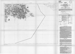
H.E. Blyth and N.W. Rutter
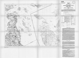
H.E. Blyth and N.W. Rutter
Open File 1993-24 presents the surficial geology of the Sidney area of Southern Vancouver Island in British Columbia. The map scale is 1:50 000.
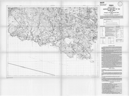
H.E. Blyth and N.W. Rutter
Open File 1993-25 presents the surficial geology of the Sooke area of Southern Vancouver Island in British Columbia. The map scale is 1:50 000.
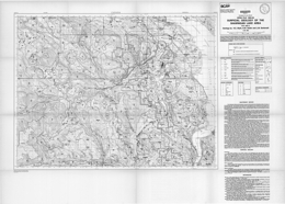
H.E. Blyth, N.W. Rutter and L.M. Sankeralli
Open File 1993-26 presents the surficial geology of the Shawnigan Lake area of Southern Vancouver Island in British Columbia. The map scale is 1:50 000.
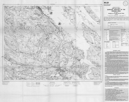
H.E. Blyth and N.W. Rutter
Open File 1993-27 presents the surficial geology of the Duncan area of Southern Vancouver Island in British Columbia. The map scale is 1:50 000.
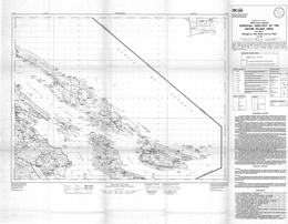
H.E. Blyth and N.W. Rutter
Open File 1993-28 presents the surficial geology of the Mayne Island area of south western British Columbia off southern Vancouver Island. The map scale is 1:50 000.
N.R. Catto and G.L. Thistle
Open File 1993-29 presents the quaternary geology and landforms of the Dawson Creek Region of North-eastern British Columbia (93P/9, 10, 15, 16). The map scales are 1:50 000.
K.C. McTaggart and J. Knight
Open File 1993-30 provides new data on the composition of gold from various lodes and placers in the Cariboo area, Southern British Columbia. This material is based on more than 3600 electron microprobe analyses and is complementary to previous research reports (Knight and McTaggart, 1986, 1989, 1990).
The bedrock geology of the district has been discussed by Holland (1954), Sutherland Brown (1957), Struik (1988), Bloodgood (1990) and many others. Stratigraphic studies of the auriferous gravels have been made by Johnson and Uglow (1926), Clague (1987), Eyles and Kocsis (1989), Levson et al. (1990), Levson and Giles, (1991) and Rouse et al. (1990).
A main objective of this research is to characterize gold by its suite of minor elements. One can then attempt to trace the path of gold from lode to placer by thus fingerprinting different lode sources. In addition, the composition of lode gold is a parameter used in the genetic classification of gold deposits. In general, gold from epithemal lodes has a lower fineness and a wider range than gold from mesothemal lodes (Momson et al. (1991). The study of textures of placer gold yields information on conditions and distance of travel. Placer and lode gold are rarely pure but are alloyed with other elements such as silver, copper and mercury. Early studies on the composition of gold were made before the electron microprobe was developed and Boyle (1979) provides an exhaustive summary of this research. One of the early studies is that of Warren and Thompson (1944) who analyzed gold from many areas, mainly British Columbia, by spectrographic techniques. Holland (1950) lists fineness values for many placers in British Columbia. Microprobe studies include those of Desborough (1970) who has studied placer gold from many localities in the United States, Giusti (1983) who reported on the compositions of placer gold from Alberta, and Guindon and Nichol, (1982) who studied gold from Ontario.
This report presents new compositional data on lode and placer deposits from the Cariboo area and the reader may find it useful to compare these results with those in earlier reports of Knight and McTaggart.
B. Ryan and M. Dawson
Open File 1993-31 presents the coal and coalbed methane resource potential of the Bowser Basin in Northern British Columbia. It consists of a report with illustrations.
1992
D.M. Melville, E.L. Faulkner, R.E. Meyers, H.P. Wilton and M.L. Malott
D.A. Brown, I. Neill, J. Timmerman, F.E.L. Harvey-Kelly, M.G. Gunning and C.J. Greig
Open File 1992-02 presents the geology, mineral occurrences and geochemistry of the Tahltan Lake-Chutine River area (104G/12W, 13) northwestern British Columbia. The Open File consists of two sheets: the first has geology at 1:50 000 scale, a legend, geologic cross sections, and references; the second has a sample location map and tables of MINFILE occurrences, fossils, potassium-argon and uranium-lead ages, lithogeochemical analyses, and stream sediment geochemistry.
The Paleozoic Stikine assemblage underlies four structural culminations in the area. Stikine assemblage rocks are penetratively foliated, unlike the Triassic and younger rocks. Near Missusjay Creek, thick, deformed Permian limestone dominates the exposure and is structurally underlain by silicic metasediments. The Chutine and Rusty Creek anticlines have Permian limestone structurally underlain by phyllitic volcanic and sedimentary rocks. Near Barrington River, the limestone section includes minor maroon tuffaceous mudstone, silicic tuff and chert. Structural trends in the three areas vary. Permo-Triassic contacts may be faulted unconformities.
Triassic chert and related volcano-sedimentary rocks crop out in four areas. Chert predominates but is interbedded with siliceous siltstone and green to maroon ash tuff. Contacts between this unit and Stuhini Group rocks are apparently gradational.
The Stuhini Group, which is of Upper Triassic, mainly Norian, age, is the most abundant map-unit in the area. It consists of sedimentary and volcanic facies. The sedimentary rocks include tuffaceous greywacke, siltstone, discontinuous limestone lenses and minor shale. Volcanic-dominated facies are mainly mafic and intermediate flows and tuffs, tuffaceous wacke, and bladed feldspar porphyry.
Miocene or Recent columnar-jointed potassic andesite flows overlie the Stuhini Group rocks.
Intrusive rocks underlie about 15 percent of the area. There are three Triassic to Jurassic calc-alkaline plutonic suites (suite A) and one Early Jurassic alkalic plutonic suite (suite B) in the area. All cut Stuhini and older strata. Some suite A plutons have monzodiorite to quartz monzonite cores and quartz diorite to diorite borders; some have granodiorite-tonalite cores. Alaskan-type ultramafic plutons of this suite are predominantly clinopyroxenites. Dearly Jurassic (?) suite B plutons are dominantly syenites but have swarms of late phase potassium feldspar megacrystic dikes; some have a clinopyroxenite border phase.
A Middle Eocene granite pluton is exposed in the southwest corner of the map-area.
Eight MINFILE occurrences are recorded for the area. Deposit types are placer gold, porphyry copper, quartz-carbonate veins, gold-bearing massive sulphide zones, skarns, and there is a cumulate magnetite deposit. Numerous anomalous regional geochemical results led to a staking rush and discovery of several new and varied mineral occurrences.
M.L. Malott and J. Crux-Prosser
The open file contains Queen Charlotte information courtesy of Paul Wilton, Southwest District Geologist and Northeastern British Columbia information courtesy of Ted Faulkner, Central District Geologist.
D.N. Proudfoot and R.F. Allison
The Open File consists of 2 sheets: sheet 1 contains geology and mineral potential maps at 1:50 000 scale, a legend, cross sections, brief mineral occurrence descriptions, rock geochemistry, and a fossil table for the Chichi Lake area; sheets 2 has the same information for the Klawli Lake area.
The map-areas are west and northwest of the Mount Milligan porphyry copper-gold deposit, and are underlain by similar Mesozoic geology. The map sheets are underlain predominantly by Early Mesozoic Takla Group rocks of island arc affinity. In the general area, the Takla is provisionally subdivided into four informal formations. The lower Rainbow Creek formation, which is dark grey slate with lesser siltstones and local epiclastic rocks, is not exposed here. The oldest rocks exposed are of the Late Triassic Inzana Lake formation, which consists of extensive volcanic sediments and lesser pyroclastic rocks. It is primarily siliceous argillite with lesser volcanic sandstones and siltstones, and other rocks. The overlying Witch Lake formation consists mainly of augite phyric flows and pyroclastics. Plagioclase-porphyritic latites and other volcanic rocks are locally important. The Early Jurassic Chuchi Lake formation transitionally overlies the Witch Lake formation. It is intermediate to felsic heterolithic agglomerate, plagioclase porphyry trachyte flows and breccias and intervolcanic sediments.
The most prominent intrusive rocks in the sheets are hypabyssal Takla intrusions, the Hogem batholith, and the Klawli stock. The Takla intrusions are mafic to intermediate in composition: microdiorite to diorite, crowded plagioclase hornblende monzonite porphyry, monzonite, and hornblende porphyritic dikes. Rocks of the Late Triassic to Early Jurassic Hogem batholith that crop out in the sheets are alkalic. They range from layered gabbro and pyroxenite, to quartz monzonite to syenite. The Klawli stock is apparently related to the Cretaceous Germansen batholith; it is granite.
Mineral deposit type that are most prospective in these areas include copper-gold porphyries associated with syn-Takla intrusions, such as the BP Chuchi; alteration zones in the Hogem batholith with potassic feldspar, magnetite and sulphides; and disseminated, vein and stockwork copper and copper-gold mineralization in hornfelsed Takla strata around the Hogem batholith.

J.M. Logan, J.R. Drobe and D.C. Elsby
The Open File consists of 2 sheets: sheet 1 contains geology and mineral occurrences at 1:50 000 scale, a legend and cross sections. Sheet 2 contains macro fauna, geochemical, stream sediment, conodont and mineral occurrence data in tabular format.
D.E. Kerr
Open File 1992-06 presents surficial geology of the Quatsino Area (92L/12) of Northern Vancouver Island of British Columbia. Scale is at 1:50,000.
V.M. Levson and D.E. Kerr
M.G. Mihalynuk and M.T. Smith
Open File 1992-08 covers the geology, mineral occurrences and geochemistry of the Atlin west map-area (104N/12W) in northernmost British Columbia. It consists of 1 sheet that portrays the geology at 1:50 000 scale with a legend, geological cross sections, and a table of assay results.
The map-area divides into eastern and western structural domains that are separated by the Nahlin fault. The Late Cretaceous Atlin Mountain pluton intrudes all these tectonic elements.
The oldest rocks are Mississippian to Triassic oceanic crustal and sedimentary rocks of the Cache Creek complex. Rock types include ultramafite, basalt, limestone, chert, argillite and wacke, and may include a mixed ultramafic, gabbro, and pillow basalt unit called the Graham Creek suite. It is intruded by the 171 million year old, synkinematic Fourth of July batholith. The batholith is polyphase, primarily granitic and has related dike swarms. Unconformably overlying both are rocks of the Cretaceous Table Mountain volcanic complex. Basinal wacke and shale of the Lower Jurassic Laberge Group dominate the western structural domain. Paleocene felsic to intermediate volcanic and epiclastic rocks of the Sloko Group sit with angular unconformity on the Laberge.
Placer gold and lode gold are the main potential exploration targets in the area.
1992-09: MINFILE Data on Major Industrial Mineral Deposits in B.C.
P. Fischl and D. Jakobsen
British Columbia is well endowed with a wide variety of industrial minerals. The annual value of their production, together with structural materials, varies between 10 and 15 per cent of the combined value of minerals, coal, petroleum and natural gas (3.28 billion in 1990). It is generally acknowledged that industrial minerals are underutilized in British Columbia and there is much room for growth. Open File 1992-9 consists of a 1:2 000 000 scale map of British Columbia with the locations of the major industrial mineral deposits, and tables containing the MINFILE data on these deposits. This release includes 398 B.C. industrial mineral deposits from the MINFILE database that are prospects (112), developed prospects (57), producers (45) or past producers (184). An industrial mineral is defined as "any rock, mineral or other naturally occurring substance of economic value, exclusive of metallic ores, mineral fuels, and gemstones". MINFILE is the Geological Survey Branch's computerized mineral inventory database. The database, contains information on metallic mineral, industrial mineral and coal occurrences in B.C. The information comprises: location, commodities, mineralogy, structure, host rock, lithologies, reserves, production, a summary text field (capsule geology) and a comprehensive bibliography.

J. Pell, J.L. Hammack, B. Fletcher, W.D. Harris and V. Koyanagi
Open File 1992-10 describes the geology of the Kakwa Recreation area (93H/15, 16; 93I/1, 2) in north central British Columbia. The Open File map shows geology at 1:50 000 scale, a legend, analyses of phosphorites, and assay data from vein and stratiform mineral occurrences.
The area is underlain by a sequence of carbonate and clastic sedimentary rocks ranging in age from Late Precambrian to Early Cretaceous. Folds and southwest dipping, northeasterly directed thrusts are the dominant structures in the area. Strata in major thrust sheets generally young toward the northeast.
The Upper Proterozoic succession consists of argillites, sandstones and conglomerates of the Miette Group. Lower Paleozoic strata are widespread. The quartzite and dolostone-rich Lower Cambrian Gog Group is successively overlain by dominantly carbonates of Middle and Upper Cambrian age, Lower Ordovician quartzite and dolostone-rich sequence, and a Middle Ordovician dolostone-dominated package. Unconformably over these is Middle Devonian conglomerate, siltstone and limestone of the Dunedin Formation. Unconformably over these are a series of Upper Devonian limestones; an unconformity within the series separates the youngest strata, the Palliser Formation. Another unconformity is overlain by Upper Devonian and Lower Carboniferous shale, then limestone and dolostone of the Rundle Group. Upper Carboniferous pebble conglomerate marks the next unconformity, and it is overlain by limestone. Another unconformably marks the first Permian rocks. Above it is basal conglomerate, then limestone, more conglomerate and sandstone. The Triassic Spray River Group of carbonates and evaporites unconformably overlies the Permian strata. Through another unconformity, Jurassic Fernie Formation shales grade upward into largely sandstones and siltstones of the Upper Jurassic and Lower Cretaceous Monteith Formation and the overlying Minnes Group sandstones and siltstones. Unconformably above these is Lower Cretaceous Bullhead Group conglomerate, sandstone siltstone and coal and the overlying Moosebar and Gates formations that also contain coal measures.
Coal licenses are held in the northwest corner of the Recreation area. There are four significant seams in Lower Cretaceous strata. Dimension stone potential exists in the quartzites of the Lower Cambrian Mahto Formation of the Gog Group. Two major prospects exist at Babette Lake, and Wishaw Lake. Phosphate from phosphorite beds in the Whistler Member of the Triassic Sulphur Mountain Formation has been found at three localities. Analyses of grab samples ranged from 21 to 23 percent P2O5. Carbonate-hosted vein and replacement occurrences in carbonates are known to occur in 6 locations in the area, but base metal abundances were low.
F. Ferri, S. Dudka, C.J. Rees, D.G. Meldrum and M.J. Willson
Scale 1:50 000 geology and 1:100 000 geochemistry
Open File 1992-11 presents the geology, mineral occurrences and geochemistry of the Uslika Lake area (94C/3, 4, 6) in north central British Columbia. The Open File consists of two sheets: the first portrays the geology at 1:50 000 scale, a legend, fossil ages, geologic cross sections and references; the second has a sample location map, MINFILE mineral occurrences, assay results, whole rock and trace element geochemistry, and stream sediment analysis results. The report is a contribution to the Canada-British Columbia Mineral Development Agreement, 1985-1990.
The area straddles the boundary between the Intermontane and Omineca tectonostratigraphic belts. It is underlain by accreted volcanic rocks of the Intermontane terrane and displaced rocks of North American affinity. Parts of four terranes are present: Quesnellia, to the west; the Harper Ranch terrane and Slide Mountain terranes centrally; and the Cassiar terrane to the east.
North American, Cassiar terrane rocks consist mainly of the Ingenika Group in this area. The sequence consists of quartz and feldspathic wackes, impure quartzite, sandstone, siltstone, slate, limestone, and their metamorphosed equivalents. These rocks were not studied in detail during the mapping.
The Paleozoic succession is upwards of 2 kilometres thick and comprises carbonate and clastic rocks. Early Cambrian to Mississippian age these strata are of minor importance in the map-area but, regionally, host significant lead-zinc-silver deposits. Lower Cambrian to Middle Devonian rocks are mainly limestone, dolomite, some shale, quartzite and argillaceous limestone. Upper Devonian to Lower Mississippian strata consist mainly of dark grey to blue shales and argillites. Mississippian to Permian rocks of the Lay Range assemblage include dacitic tuffs, argillites, shales, phyllites, limestones, sandstones, and quartzites in the lower part, then mainly basalt, gabbro, serpentine, chert, schist and green to maroon tuffs in the upper part. The Pennsylvanian to Permian Nina Creek Group of the Slide Mountain terrane are mainly argillite, chert and gabbro, then massive to pillowed basalt. Overlying Quesnel terrane strata include Upper Triassic tuffs, tuffaceous siltstones, argillites and agglomerates that are overlain by augite-phyric agglomerates, basalts and tuffs, and the Lower Jurassic Takla Group, which is mainly maroon to grey basalts, agglomerates and tuffs. Takla rocks are both plagioclase and augite phyric. The Lower Jurassic to Lower Tertiary Uslinka Formation is predominantly heterolithic boulder conglomerate and may represent an overlap assemblage along with the Sustut Group. A Lower Cretaceous conglomerate, sandstone, siltstone, argillite sequence has minor coal. It is overlain by sandstone, conglomerate, siltstone and coal of the Upper Cretaceous and Tertiary Sustut Group.
The oldest intrusive rocks in the area comprise the Middle Triassic to Lower Jurassic Wasi Lake ultramafic body, which consists of serpentinite and gabbro; minor listwanite alteration occurs. The Late Triassic to Early Jurassic Tenakihi body consists of monzodiorite and diorite. The Late Triassic to Tertiary Hogem intrusive complex comprises monzonite, quartz monzonite, syenite, and quartz syenite.
Northwest trending faults are the most prominent structural features in the area, but the structural history is diverse and complex.
There are 48 known mineral occurrences in the area. Deposit types include porphyry copper-gold, fracture-controlled mineralization along the contact of the Hogem batholith, carbonates host lead-zinc veins and Mississippi Valley-type replacement lead-zinc mineralization, shear-controlled gold-silver-copper mineralization, mercury showings related to shears, quartz veins with gold in the Hogem batholith, gold-bearing massive arsenopyrite and pyrite in sheared Takla rocks, and minor coal occurrences.
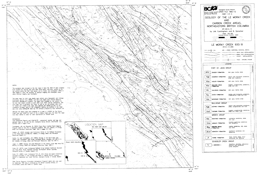
J.M. Cunningham and B. Sprecher
Open File 1992-12 presents the geology of the Lemoray Creek (93O/8) and Carbon Creek (93O/15) areas in northeastern British Columbia. The Open File consists of two geology maps, one for each area. Both have legends, but sheet 1 also has references listed.
The oldest rocks in the area are undivided carbonates, calcareous siltstone and sandstone, and local anhydrite of the Triassic Schooler Creek Group. These are overlain by shales with minor siltstones and sheet sandstones of the Jurassic Fernie Formation. The contact with the overlying Minnes Group rocks is transitional as the number and thickness of sheet sandstone beds increase until sandstone dominates. The lowermost formation, the Monteith, spans Jurassic to Lower Cretaceous time. Grey quartz sandstones and dark lithic sandstones, wackes, siltstone and shale predominate. The sequence records marine regression modified by secondary cycles of transgression. The recessive Beattie Peaks Formation consists largely of dark gray and brown shales. It coarsens upward as the number and thickness of parallel laminated sandstone beds increase and grades into the overlying Monach Formation. The Monach is dominated by sandstone beds up to 20 metres thick separated by thin shale layers. The upper contact occurs where there is a change to thin cyclic units of alternating mudstone, siltstone and sandstone of the Bickford Formation. The Monach represents wave built shoals. The Bickford, which is a sequence of interbedded sandstones and shales, is best identified by defining the Cadomin Formation above and the Monach Formation below. Toward the top of the Formation carbonaceous content increases and thin coal beds occur. Near its base, the Bickford consists of shallow marine storm deposits and post-storm reworked material. Successively higher in the section are rocks deposited in nearshore marine to shoreface conditions, emergent coastal conditions with beach deposits, and finally lagoonal coastal plain deposits.
The coal-bearing Bullhead Group consists of the Cadomin Formation and the Gething Formation. The 200 to 275 metres thick Cadomin Formation contains varying proportions of resistant pebbly sandstone beds up to 20 metres thick separated by recessive units consisting of siltstone, carbonaceous shale, fine-grained sandstone and coal. The lithological components represent fluvial fan deposits, floodbasin and overbank deposits and possibly beach deposits. The Gething Formation, which hosts most of the coal, is about 1100 metres thick. The Formation consists of interbedded sandstones, noncarbonaceous shale, carbonaceous shale and coal. The sandstone units are alluvial channel or delta distributary deposits; the shales are floodbasin to swamp deposits. The coals display a moderately bright luster and variable sulphur content. A number of coal seams that vary to 2.2 metres width occur across a 200-metre section.
The Cretaceous Fort St. John Group consists of the Moosebar, Gates, Hulcross, Boulder Creek, Hasler, Goodrich and Cruiser formations. The dominant lithology is marine shale, and subdivisions are based on intervals of marine and non-marine sandstone and conglomerate, mudstone and coal. Coal is only important in the Gates Formation.
P.T. Bobrowsky, T. Giles and W. Jackaman
Superseded by Open File 2024-09
This publication provides a compilation of data pertaining to surficial geology/terrain maps of British Columbia. This includes data on about 2000 maps covering territory within the provincial boundaries of B.C. The database is presented both as a tabulated listing, and graphically in a series of provincial base maps. The tabulated database presents the location (using National Topographic System grids), scale and publishing agency.
G.J. Simandl, K.D. Hancock, M. Fournier, V.M. Koyanagi, V.Vilkos, R. Lett and C. Colbourne
A number of magnesite deposits, hosted either by ultramafic or sedimentary rocks, are known in British Columbia (Grant, 1987). The most important of these is the Mount Brussilof orebody hosted by dolomites of the Middle Cambrian Cathedral Formation.
The Mount Brussilof deposit was discovered by the Geological Survey of Canada during regional mapping Leech, 1965). The Mount Brussilof deposit is located in southeastern British Columbia, approximately 35 kilometres northeast of Radium Hot Springs.
This report compliments earlier publications by providing a large-scale geological map of the Mount Brussilof area and major oxide analyses of the magnesite-bearing rocks and other carbonate rocks of the Cathedral, Eldon and Pika formations. Its primary objective is the quick release of the geological map and raw geochemical information.
P. Bobrowsky
J. Pell
Scale 1:250 000
A.I. Welbon and R.A. Price
Open File 1992-17 depicts the geology of the Central Hughes Range (82G/11, 12, 13, 14), southeast British Columbia. The geology map is at 1:50,000 scale and covers about 100 square kilometres. The area straddles the boundary between Middle Proterozoic Purcell Supergroup rocks and unconformably overlying Lower Paleozoic miogeoclinal rocks. The area is transected by the north-trending Lussier Creek thrust fault and a number of easterly trending transverse faults that record repeated motion from Precambrian through Mesozoic time. The area lies immediately east of a number of important silver-lead-zinc mineral deposits in the Purcell Supergroup, including Estella, Kootenay King, and the Sullivan deposit.
Purcell Group rocks in the area are the Aldridge, Creston, Kitchener, Van Creek, Nicol Creek, and Sheppard formations. Cambrian sequences include the Cranbrook Formation, the Tanglefoot unit, and the Jubilee Formation. Cambrian to Ordovician rocks are the Lower McKay Group, the Upper McKay Group, which are subdivisions of the McKay Group. The Ordovician Mount Wilson quartzite is present, as are the Ordovician-Silurian Beaverfoot Formation and a Silurian-Devonian sequence consisting of shale, limestone, volcanic breccia, and lava. The Basal Devonian unit is the youngest stratified rock package exposed.
The succession is cut by Cretaceous monzonite and granodiorite.
P.S. Fischl
Limestone and dolomite deposits of varying size and quality are found throughout British Columbia. Some of the more accessible ones are currently being exploited for the manufacture of cement, lime, agricultural soil conditioner and a variety of crushed and ground products. Other carbonate deposits will be explored and possibly developed in the near future to satisfy increasing demand for limestone by the pulp and paper industry and for limestone and dolomite as fillers and extenders. Consumption by the mining industry will also become increasingly important in the very near future for the treatment of a variety of mine effluents.
This open file report has been prepared to meet industry demands for up-to-date information on limestone and dolomite in the province. Detailed descriptions are given for a number of carbonate occurrences (excluding magnesite, marl, travertine, tufa) throughout British Columbia, based on a compilation of previously published and unpublished literature dealing with limestone and dolomite in the province. The report is exhaustive in respect to available, up-to-date geological data. It can be expected, however, that with further exploration, many more exploitable limestone and dolomite bodies will be discovered. This compilation relies extensively on several previous province-wide compilations.
Introduction – Pioneering Geology in the Canadian Cordillera by V.M. Levson
Miners at Work - A History of British Columbia’s Gold Rushes by B. Griffin
The Canadian Cordillera; A History of Who, What and When by C.J. Yorath
The Mineral Survey - Cordilleran Cinderella by A. Sutherland Brown
The Emergence of Engineering Geology in British Columbia "An Engineering Geologist Knows a Dam Site Better!" by D.F. VanDine, H.W. Nasmith and C.F. Ripley
Britannia, the Story of a British Columbia Mine - From Mining Resource to Heritage Resource by M. Mullan
British Columbia’s Hydrocarbon Hunt; "The Hole Story" by N. Wemyss
The History of Earthquake Studies in British Columbia - From Indian Legend to Satellite Technology by G.C. Roger
The Search for the Oldest Fossils in the Cordillera by R. Ludvigsen
The History of Marine Geology in British Columbia - From Infancy to Today by J. Murray and W.H. Mathews
Geological Mapping in the Cordillera - Then and Now by J.O. Wheeler
D.A. Grieve
D.E. Kerr and S.J. Sibbick
Open File 1992-21 presents the analytical results of the Quatsino (NTS 92L/12) drift exploration project, an evaluation of drift sampling as a regional mineral exploration tool. The Quatsino project is part of the British Columbia Geological Survey Branch's Drift Prospecting program and is designed to demonstrate the applicability of combined surficial geology-exploration geochemistry methods in the search for drift-covered mineral deposits in areas of glaciated terrain. The Quatsino map sheet, centred over the North Island copper belt, represents an area of high mineral potential within a glaciated, coastal plateau setting.
Proper use of drift prospecting techniques is dependant upon an understanding of the regional surficial geology history, Quaternary stratigraphy and glacial ice-flow patterns. The relatively simple glacial stratigraphy in the Quatsino map area, reflecting a single glacial advance and retreat, makes this an ideal location for the application of drift prospecting, with only a single till sheet underlain by bedrock and locally overlain by glaciofluvial and glaciolacustrine sediments.
Collected samples were analysed by instrumental neutron activation (INA) and inductively coupled plasma (ICP) methods. Included are data for 42 elements obtained by analysing surficial sediments collected in 1991 by the British Columbia Ministry of Energy, Mines and Petroleum Resources. Data obtained from this project can be used as a basis for detailed drift prospecting work in the area.
D.J. Alldrick and J.M. Britton
Open File 1992-22 describes the geology and mineral occurrences of the Unuk area (104B/7E, 8W, 9W and 10E) in northwestern British Columbia. The Open File consists of 5 sheets. Sheet 1 contains a legend, and tables with mineral occurrences, radiometric age dates, fossil data, whole rock analyses, assays, and also brief marginal notes and references. Sheets 2 to 5 are 1:20 000 scale geology maps of the four quadrants of the map-area.
The Paleozoic Stikine assemblage consists of coralline limestones and intercalated mafic to felsic flows and volcaniclastic rocks, and siliceous siltstone, turbidite, chert and conglomerate. They exhibit local polyphase deformation. Mesozoic strata comprise mixed volcanic and volcanic-derived sedimentary rocks.
Upper Triassic Stuhini Group strata are dominantly sediments with minor pyroxene phyric flows and tuffs, and leucocratic dacitic tuffs. The sediments are siltstones, pebble to cobble conglomerates and wackes.
A Stuhini-Hazelton transitional unit of Hettangian age consists mainly of mixed sedimentary strata: black siltstones, heterolithic pebble to boulder conglomerates and wackes. Granitic stocks cut Stuhini Group rocks.
Lower to Middle Jurassic Hazelton Group volcanic and sedimentary rocks have been folded, faulted and weakly metamorphosed, mainly during Cretaceous time. Three episodes of intrusive activity produced small synvolcanic plutons, satellitic stocks of the Coast plutonic complex and minor dykes and sills.
The Unuk River Formation is of Hettangian to Pleinsbachian age. It consists primarily of andesitic tuffs with lesser black siltstone members. It is cut by the two-feldspar Premier porphyry.
The Betty Creek Formation is Pleinsbachian to Toarcian. It consists of interbedded tuffs, flows and hematitic sedimentary rocks. There are locally pillowed basaltic to dacitic crystal and lithic tuffs and flows, purple to maroon conglomerates, wackes, siltstones and mudstones, and minor black siltstone layers.
The Mount Dilworth Formation consists of felsic pyroclastics and flows. It consists of tuff breccias; lapilli, ash and dust tuffs; and local welded ash flows. The unit is of Toarcian age.
Salmon River Formation, which is Toarcian to Bajocian in age, comprises a thick turbidite succession. It consists of dark siltstones with lesser sandstones, conglomerates, silty limestone and pale siliceous siltstones. Mafic pillow lava and minor intermediate distal tuff also crop out.
Middle to Upper Jurassic Bowser Lake Group strata are marine basin turbidites, black siltstones, fine-grained sandstones, and conglomerates. The Pliocene to Recent Stikine volcanics comprise basaltic flows, tuff and scoria.
Intrusive rocks in the area range from Late Triassic to Tertiary or Quaternary. The oldest is the Stikine plutonic suite of diorite and quartz diorite plutons. The Early Jurassic Texas Creek plutonic suite includes quartz diorite, monzodiorite, and quartz monzonite. The suite includes hypabyssal equivalents of the Hazelton Group. The Middle Jurassic Three Sisters suite consists of olivine-pyroxene gabbro and diorite. Rocks of the Coast plutonic complex are of Paleocene to Eocene age. Granitoid batholiths and stocks are characteristic. Rocks types include granodiorite, granite and dacite in dikes. Oligocene late-tectonic dikes are micro-diorite, andesite and lamprophyre. Basaltic dikes represent the Stikine volcanic suite.
The rich volcanogenic Eskay gold-silver-lead-zinc-copper mine and many other mineral occurrences are known in the area. Six types of veins are identified: base metal quartz, silver-rich base metal, precious and base metal quartz, precious metal quartz, carbonate, and barite. Other deposit types include: porphyry-style copper-molybdenum; disseminated gold (silver) in alteration zones; gold-bearing skarn; and stratabound pyritic zones.
1991
P. Desjardins and R. Arksey
T. Höy and K.P.E. Andrew
Open File 1991-02 depicts the geology and mineral occurrences of the Rossland-Trail map-area (82F/4). The Open File consists of two maps: sheet 1 presents the geology at 1:20 000 scale and a legend; sheet 2 has cross sections, references and a mineral occurrence table.
Paleozoic rocks in the area are the Trail gneiss, Carboniferous argillite siltstone and limestone, and Pennsylvanian to Permian Mount Roberts Formation siliceous siltstone, argillite, silty chert with minor sandstone, and limestone or dolomite.
Stratified Mesozoic rocks comprise the Rossland Group and the Sophie Mountain Formation. Rossland Formation consists of the Archibald, Lower Elise and Elise Formations. The Archibald Formation contains argillite, with minor siltstone and conglomerate. Lower Elise Formation rocks are dominantly augite with or without plagioclase phyric flows and flow breccias. Elise Formation consists of augite with or without plagioclase phyric basalt flows and flow breccias, basaltic lapilli and crystal tuffs, andesitic tuffs, argillaceous siltstone, and tuffaceous conglomerate. The Upper Cretaceous Sophie Mountain Formation is coarse conglomerate.
Diorite and the Rossland monzonite are Lower and Middle (?) Jurassic. Jurassic intrusions include the Rainy Day quartz diorite, and granite and granodiorite of the Nelson intrusions. Middle Eocene rocks include the Marron Formation, the Sheppard intrusions and the Coryell intrusions. The Marron Formation consists of andesite flows, and minor lapilli tuff, sandstone and conglomerate. The Sheppard intrusions are granite and rhyolite dikes, whereas the Coryell intrusions are syenite to quartz monzonite bodies.
Ultramafic rocks of unknown age crop out in the area.
The area is characterized by early thrust and late high angle block faulting. Mesozoic stratified rocks are tilted and broadly folded.
The area covers the historic Rossland gold camp. Mineral deposit types in the area include intrusion-related gold-pyrrhotite veins, subvolcanic copper-silver-gold gold-silver-copper and silver-gold-lead-zinc veins, porphyry molybdenum deposits, and tungsten, iron, wollastonite and gold skarns. Granite dimension stone may also be important.
J. Nelson, K.A. Bellefontaine, K.C. Green and M. MacLean
Open File 1991-03 presents the geology and mineral potential of the Wittsichica Creek and Tezzeron Creek map areas (93N/1; 93K/16) in north central British Columbia. The 1:50 000 scale geology map includes a legend, and a geological cross section.
The Nation Lakes area is predominantly underlain by Early Mesozoic Takla Group rocks of island arc affinity. In the map area, the Takla is provisionally subdivided into four informal formations. The lower Rainbow Creek formation is dark grey slate with lesser siltstones and local epiclastic rocks. The Inzana Lake formation consists of extensive volcanic sediments and lesser pyroclastic rocks. It is primarily siliceous argillite with lesser volcanic sandstones and siltstones, and other rocks. The Witch Lake formation consists mainly of augite phyric flows and pyroclastics. Plagioclase-porphyritic latites and other volcanic rocks are locally important. The Chuchi Lake formation transitionally overlies the Witch Lake formation. It is intermediate to felsic heterolithic agglomerate, plagioclase porphyry trachyte flows and breccias and intervolcanic sediments.
Early Tertiary strata may underlie fairly extensive regions of the map-area. Lithologies include sandstone, mudstone, coal, pebble conglomerate and basalt.
Intrusive rocks in the area comprise a granite suite, a syenite suite, a monzonite suite, and a diorite/monzodiorite suite. The Mount Milligan intrusive complex consists of at least two separate intrusive phases: sphene-bearing monzonite with gabbro and hornblende granite end members, and porphyritic granite. It has numerous pendants and wallrocks are metamorphosed. The Mount Milligan copper-gold alkalic porphyry, with published reserves of 400 million tonnes of 0.48 gram per tonne gold and 0.2 percent copper are related to stocks and dikes that are part of the intrusive complex. There is also potential in the area for epithermal precious and base metal veins, copper-gold skarns, and other deposits.
D.J. Hunter and J.M. Cunningham
M.L. Malott, D.V. Lefebure and A. Havard
Open File 1991-05 describes cretaceous and tertiary stratigraphy and industrial minerals in Hat Creek of Southern British Columbia (92I/12, 13, 14). Scale is at 1:800,000.
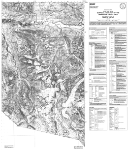
D.E. Kerr
Open File 1991-06 describes surficial geology of the Snippaker Creek Area (104B/6E, 7W, 10W, 11E) of British Columbia. Mapping is at 1:50,000 scale.
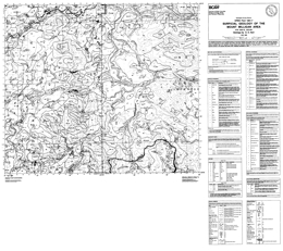
D.E. Kerr
Open File 1991-07 surficial geology of the Mount Milligan Area (93N/1E; 93O/4W) in British Columbia. Mapping is at 1:50,000 scale.
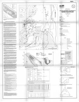
G.E. Ray and I.C.L. Webster
Open File 1991-08 describes the geology and mineral occurrences of the Merry Widow skarn camp (92L/6) on northern Vancouver Island, British Columbia. The Open File consists of a map showing the geology at 1:50 000 scale with a legend, stratigraphic column, longitudinal section, and tables of mineral occurrences, whole rock geochemistry and trace element analyses, as well as various element plots, marginal notes, and a bibliography.
The oldest rocks in the area are massive to pillowed volcanics and subvolcanic gabbroic intrusions of the Upper Triassic Karmutsen Formation
Thick limestones of the Upper Triassic Quatsino Formation conformably overlie these rocks. Lower Jurassic Bonanza Group unconformably overlies the Quatsino. The Bonanza consists of andesitic ash and lapilli tuffs, breccia, greenstone, and tuffaceous siltstone.
Two major episodes of intrusion occurred. The Keystone suite is coeval with the Bonanza Group and may have formed feeders to the volcanic rocks. The intrusions occur as swarms of andesitic sills and dikes, and local breccia pipes. These intrusions are associated with barren and mineralized skarns where they cut Quatsino limestone. The second event is marked by emplacement of the Coast Copper stock, which is dominantly coarse gabbro.
Most bedding in the stratified rocks dips westward at between 20 and 50 degrees. Open folds occur locally and tighter folding near the Coast Copper stock. Thrust faults have been identified, faults with sinistral offset occur, and block faulting occurs.
Mineralization is stratigraphically controlled. It occurs near the top and bottom of the Quatsino limestone. Most mineralization is in skarns or mantos. The skarns tend to be magnetite-rich and mid-Jurassic in age. Mineralization at the Old Sport-Benson Lake deposit consists of magnetite, chalcopyrite, bornite, pyrite, lesser pyrrhotite and trace gold. Elsewhere, sporadic arsenopyrite, sphalerite, marcasite and cobaltite are reported. The Kingfisher deposit comprises two pipes of massive magnetite. Mineralization may be related to the Coast copper stock; alternatively, the Keystone intrusions may be responsible.
K.D. Hancock, Z.D. Hora and G.V. White
This report documents the geology and industrial mineral potential of an olivine deposit within the Tulameen ultramafic complex, southwestern British Columbia. Olivine occurs as dunite in the core of a zoned Alaskan-type ultramafic intrusion that is variably serpentinized. Detailed sampling has identified three zones of fresh rock. Foundry testing of the produced olivine sand has determined that it has similar quality and performance to other foundry sands imported from abroad. The olivine from the Tulameen complex compares favourably with other deposits worldwide and represents a development opportunity.
M.E. MacLean and G.V. White
Open File 1991-10 is a compilation and assessment of the feldspathic mineral prospects in British Columbia. The project was initiated in 1987 and field investigations of ten occurrences selected for their accessibility and the presence of feldspathic sand, nepheline syenite, aplite or phonolite were carried out.
The single most important factor in evaluating a deposits' potential as a feldspathic mineral sources, besides meeting the quality requirements of industry, is proximity to establish transportation routes. The cost of transportation per unit weight frequently far exceeds the value of the mineral itself, so that even the "purest" of deposits will not be economic if the infrastructure does not exist. The most significant use of feldspathic minerals is as a source of alumina, alkalis and silica, in the glass and ceramics industries.
A field study of potential and known deposits of feldspathic minerals was carried out by the British Columbia Geological Survey Branch. The sites were chosen for evaluation are all in southern British Columbia and close to transportation links. In total, markets of 22 500 to 90 000 tonnes per year are potentially attainable by a British Columbia producer of feldspathic minerals. This, however, is dependant on the relative quality of the product, the reliability of the supplier, the establishment of a competitive price and effective sales and marketing strategy.
N.R. Catto
A multi-faceted series of investigations of the Quaternary geology of the Peace River region of British Columbia were undertaken in 1990 (Bobrowsky et al., 1991). As part of this program, the southeastern part of the region, which encompasses the 1:50 000 NTS map areas 094A/1 (Shearer Dale), 094A/2 (Fort St. John), 094A/7 (North Pine), and 094A/8 (Alces River), was mapped in detail. This work involved mapping from aerial photographs, followed by detailed stratigraphic and sedimentologic field investigations and laboratory analyses of sediment texture and mineralogical composition. The detailed surficial geology maps produced from this work are designed to be of practical use to industry, government, and the general public.
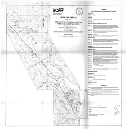
J.M. Riddell, S.M. Helm and J.M. Pautler
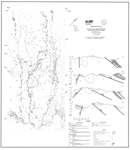
M.E. Coleman
Open File 1991-13 presents the geology and structure of the Mission Ridge area (92J/9, 10, 15, 16) in southwestern British Columbia. The map has geology at 1:50 000 scale, a legend, and several cross sections.
The Shulaps ultramafic complex in this area is of unknown age and consists of a serpentinite melange with blocks of ultramafic rock, gabbro, diorite and greenstone. The Permian to Jurassic Bridge River Group consists of the Bridge River schist, limestone and an undivided mainly ribbon chert, argillite, pillowed to massive greenstone sequence. The Bridge River schist is made up of metachert, chloritic schist, orthogneiss and small amounts of other rocks. Only the Hurley Formation of the Upper Triassic Cadwallader Group is exposed in the area. It comprises mainly sandstone, calcarenite, and shale. Upper Jurassic to Lower Cretaceous rocks are represented by the Brew Group and the Lillooet Group. The Brew Group consists of argillite, quartzite, conglomerate and metamorphosed equivalents. The Lillooet Group is argillite, fine sandstone and coarse volcanic sandstone. Eocene (?) conglomerate, sandstone and siltstone overlie the older strata.
Middle Eocene foliated granodiorite of the elongated Mission Ridge pluton and Eocene (?) leucocratic felsite comprise the intrusive rocks in the area.
The north-trending Yalakom fault bounds the area on the east. Both reverse and dextral (right lateral) movement is documented for the Yalakom fault. The north-trending Marshall Creek fault, along the west side of the area has normal and dextral movement. It displaces the Mission Ridge fault. The more central north- to northeast-trending Mission Ridge fault displays normal offset. The cross sections show folds in the Bridge River rocks have east-dipping axial surfaces, but at least two episodes of penetrative deformation are recorded. Folds in the Lillooet Group are west verging. The sections also indicate that the base of the Mission Ridge pluton can be defined in this mountainous terrain.
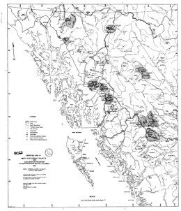
D.V. Lefebure and M.L. Malott
S.B. Butrenchuk
This report provides an inventory and an estimate of the resource potential of gypsum in British Columbia.
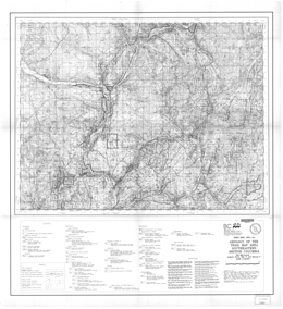
K.P.E. Andrew, T. Höy and P. Simony
Open File 1991-16 portrays the geology and mineral occurrences of the Trail map-area (82F/3, 4, 5, 6) in southeastern British Columbia. The map is at 1:100 000 scale and contains a legend and reference list.
Precambrian Windermere Group is made up of greenstone of the Irene Formation and grit, quartzite, and other rock types of the Three Sisters and Monk formations. Late Proterozoic to Lower Cambrian Hamill Group argillite, micaceous schist and quartzite comprise the Reno and Quartzite Range formations. Overlying Lower Cambrian Laib Formation phyllite, argillite, schist, and micaceous quartzite includes the Reeves (Badshot) limestone member. Nelway Formation rocks are of Middle Cambrian age. Black limestone, calcareous argillite, slate and phyllite predominate. Lower and Middle (?) Ordovician black argillite, slate and quartzite comprise the Active Formation. Upper Mississippian to Lower Permian Milford Group consists of siliceous argillite, phyllite, limestone and chert. Mount Roberts Formation is Pennsylvanian to Permian and contains mainly siliceous siltstone, argillite and silty chert. An undivided sequence consists of metasedimentary rocks and limestone.
Ultramafic rocks in the area consist of serpentinite and minor dunite. Lower Paleozoic Lardeau Group consists mainly of quartzite, schist, argillite, slate and limestone. Other Lower Paleozoic rocks are similar but include black phyllite and schist. Carboniferous rocks are predominantly argillite, silty argillite and siltstone. These may be equivalent to the undivided Paleozoic package described above.
The Devonian to Eocene (?) Trail gneiss comprises amphibolite, gneiss, schist, pegmatite and aplite. Devonian layered granitoid gneiss and amphibolite and the Devonian Johnson Creek pluton also occur. The Castlegar gneiss complex is apparently of Pennsylvanian age. It is made up of homogeneous paragneiss, calc-silicate gneiss and amphibolite. The Cretaceous Kinnaird gneiss comprises leucocratic biotite gneiss with K-feldspar augen, pegmatite, amphibolite layers and orthogneiss.
The oldest Mesozoic strata are argillite, siltstone, grit and impure limestone of the Lower Jurassic and possibly Upper Triassic Ymir Group. The Lower Jurassic Rossland Group consists of the Archibald, Elise and Hall formations. The Archibald argillite, turbiditic siltstone and conglomerate give way to basaltic volcanics of the Lower Elise, basaltic to andesitic mainly pyroclastic rocks of the Upper Elise and argillaceous siltstone of the Elise sediments. Overlying Hall Formation rocks are mainly argillite, carbonaceous siltstone. Diorite and biotite-augite monzonite of the Rossland monzonite are also of Lower Jurassic age. Middle Jurassic intrusions include diorite and plagioclase porphyry of the Silver King intrusions. Several middle Jurassic plutons comprise the Nelson intrusions. Granodiorite, quartz monzonite and granite predominate. Granite and quartz porphyry are of Lower Cretaceous age. The Upper Cretaceous Sophie Mountain Formation is mainly coarse conglomerate.
Cenozoic rocks are Paleocene to Eocene. Megacrystic quartz monzonite is Paleocene. The Marron Formation is Middle Eocene and consists of andesite flows with minor tuffs and epiclastics. The same age Coryell intrusions are biotite and augite monzonites. Leucocratic quartz monzonites are Tertiary, but their age is poorly constrained. Tertiary dikes include hornblende and feldspar porphyries and rhyolites.
Upright to overturned folds, thrusts and normal faults are indicated on the map.
The map covers the historic Rossland gold camp and areas with potential for Shuswap-type silver-lead-zinc deposits. Porphyry molybdenum deposits are also known near Rossland, and there is potential for dimension stone and other industrial minerals.
P. Fischl
Wollastonite, a calcium silicate pyroxenoid used in ceramics, paints, plastics and in asbestos replacements, occurs at several sites in British Columbia as a major component of skarn bodies of contact metamorphic and metasomatic origin. There is potential for wollastonite to occur in significant quantities in carbonatite deposits, although it has yet to be identified in the numerous carbonatites known within the province.
Tremolite, an amphibole of similar origin and with the potential for similar uses as wollastonite, is found in similar geologic environments throughout the province.
Mapping, sampling and a review of the MINFILE database has identified seven skarn occurrences containing significant wollastonite and two with significant tremolite. Of these occurrences, only Snake Bay (Wla) is in the advanced exploration stage with drill-indicated reserves.
Testing by CANMET of bulk samples from four of the wollastonite occurrences and one tremolite occurrence revealed that wollastonite and tremolite with only low to moderate aspect ratios could be produced using conventional grinding and beneficiation techniques. Of the five deposits tested, market able wollast onit e- tremolite concentrates (less than 1% FeaO3 and ignition loss) could be produced from three of the occurrences with wet, high-intensity magnetic separation and reverse flotation.
J.M. Ryder
T.G. Schroeter and R.A. Lane
This Open File updates significant parts of data files in Open File 1989-22: Gold Production and Reserves in British Columbia. The listing of significant gold-bearing deposits, which have produced gold or are known to contain reserves, has been expanded from 192 to 214. There is also an alphabetical listing of deposits for cross-referencing purposes.
Production and reserve statistics are completed to the end of 1990; as in Open File 1989-22, statistics are in Imperial units. The text is purposely brief and intended to provide as factual a database as possible with the aim of updating the database annually.
J. W. Page
This Open File examines an aerial photography study of south-western British Columbia designed to promote the exploration for and development of new dimension stone quarries. The aerial photograph study covered gabbro and granodiorite intrusions as indicated by geological mapping within the area of Knight Inlet, Bute Inlet, Toba Inlet, Jervis Inlet, Howe Sound, Squamish, Permberton, Duffy Lake road, the north side of the Fraser Valley, and the Hope-Coquihalla area.
The study also included quartz diorite intrusions in the Squamish to Duffy Lake road corridor. A total of 30 potential quarry sites were identified, of which approximately 25 were previously unknown. A description of the evaluation techniques and a detailed study report of each potential quarry site are included in this report.
D.J. Alldrick and J.M. Britton
Open File 1991-21 describes the geology and mineral occurrences of the Sulphurets area (104A, B) in northwestern British Columbia. The Open File consists of 5 sheets at 1:20 000 scale. Sheet 1 contains the legend and various tables, including mineral occurrences, assay data, whole rock analyses, potassium-argon ages and fossils. It also contains a schematic stratigraphic column, and brief notes. Sheet 2 to 5 are geological maps of the area. Results of mapping in adjacent areas are presented in Open Files 1990-16, 1990-19, 1989-10, 1988-4 and 1987-22.
Biotite-rich quartzofeldspathic gneiss, phyllite, metawacke, metatuffs and marble are tentatively assigned to the Paleozoic Stikine or Asitka assemblage. They exhibit polyphase deformation. Mesozoic strata comprise mixed volcanic and volcanic-derived sedimentary rocks.
Upper Triassic Stuhini Group strata are dominantly sediments with minor pyroxene phyric flows and tuffs, and leucocratic dacitic tuffs. The sediments are siltstones, pebble to cobble conglomerates and wackes.
A Stuhini-Hazelton transitional unit of Hettangian age consists mainly of mixed sedimentary strata: black siltstones, heterolithic pebble to boulder conglomerates and wackes. Granitic stocks cut Stuhini Group rocks.
The Sulphurets area is largely underlain by Lower to Middle Jurassic Hazelton Group volcanic and sedimentary rocks that have been folded, faulted and weakly metamorphosed, mainly during Cretaceous time. Three episodes of intrusive activity produced small synvolcanic plutons, satellitic stocks of the Coast plutonic complex and minor dykes and sills.
The Unuk River Formation is of Hettangian to Pleinsbachian age. It consists primarily of andesitic tuffs with lesser black siltstone members. It is cut by the two-feldspar Premier porphyry.
The Betty Creek Formation is Pleinsbachian to Toarcian. It consists of interbedded tuffs, flows and hematitic sedimentary rocks. There are locally pillowed basaltic to dacitic crystal and lithic tuffs and flows, purple to maroon conglomerates, wackes, siltstones and mudstones, and minor black siltstone layers.
The Mount Dilworth Formation consists of felsic pyroclastics and flows. It consists of tuff breccias; lapilli, ash and dust tuffs; and local welded ash flows. The unit is of Toarcian age.
Salmon River Formation, which is Toarcian to Bajocian in age, comprises a thick turbidite succession. It consists of black siltstones with lesser sandstones and minor limestone lenses.
Intrusive rocks are not abundant but are spatially and temporally associated with mineralization. The Lee Brant stock, a Jurassic (?) quartz monzonite, comprises the largest intrusion in the area. A wide variety of syn and post-volcanic hypabyssal stocks is concentrated near the Sulphurets and Mitchell glaciers. Most are quartz-poor and have alkaline affiliations; many are porphyritic with potassium, feldspar, hornblende and biotite. These intrusions are similar in composition to the volcanic rocks. Post-volcanic intrusions are generally more phaneritic and clearly cut the country rocks. Compositions differ from enclosing rocks and some are associated with copper and gold mineralization.
More than 60 mineral occurrences are known in the area. Six types of veins are identified: base metal quartz, silver-rich base metal, precious and base metal quartz, precious metal quartz, carbonate, and barite. Other deposit types include: porphyry-style copper-molybdenum; disseminated gold (silver) in alteration zones; gold-bearing skarn; and stratabound pyritic zones.
Deformation in the area is complex, with local folding and penetrative deformation, and many episodes of faulting associated with volcanic and intrusive activity.
Z.D. Hora, W.N. Hamilton, B. Grant and P.W. Kelly
Guidebook for Fieldtrips 2 and 3 (Information Circular 1991-8) Some Significant Industrial Mineral Producers of the Southern Rocky Mountains: Banff - Golden - Radium Area; May 9-10, 1991
Open File 1991-23 discusses industrial minerals of Alberta and British Columbia, Canada. The report is from the Proceedings of the 27th Forum on the Geology of Industrial Minerals; May 5 - 10th, 1991, held in Banff, Alberta.
1990
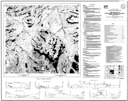
D.A. Brown, C.J. Greig and M.H. Gunning
Open File 1990-01 describes the geology, mineral occurrences and geochemistry of the Stikine River-Yehinko Lake area (104G/11W, 12E) in northwestern British Columbia. There are two sheets: the first provides a geological map at 1:50 000 scale, a legend, and geological cross sections; the second has a geochemical location map at 1:100 000 scale and tables with selected regional geochemical survey results, stream sediment sample data, lithogeochemical results, mineral occurrences, and fossil information.
The Paleozoic Stikine assemblage underlies three small areas. In the Devil’s Elbow area, discontinuous Mississippian limestone lenses within pyritic metasiltstone and argillite are the oldest rocks exposed. They are penetratively foliated, unlike the Triassic and younger rocks. Near Missusjay Creek, thick, deformed Permian limestone dominates the exposure and is structurally underlain by silicic metasediments. Near Barrington River, the limestone section includes minor maroon tuffaceous mudstone, silicic tuff and chert. Structural trends in the three areas vary.
The Stuhini Group, which is of Upper Triassic, mainly Norian, age, is the most abundant map-unit in the area. It consists mainly of mafic tuffs and tuff –breccias that are rich in pyroxene and plagioclase. Augite and plagioclase-phyric basalt flows characterize the Stuhini Group in the area. Small amounts of felsic volcanic rocks are important and widespread. Sedimentary components are recessive but common. They consist of arkosic wackes, siltstone and shale, impure carbonates, and polymictic conglomerates.
Lower to Middle Jurassic volcanic and minor sedimentary rocks occur in the central part of the map-area. Pyroxene and plagioclase-phyric andesite flows predominate but there are subordinate rhyolite flows, rhyolitic ignimbrites, and olivine basalt. The Jurassic rocks are less deformed than the underlying Stuhini package.
Upper Cretaceous to Eocene (?) Sustut Group sedimentary and subordinate volcanic rocks form a northwest-trending belt. Characteristic polymictic cobble conglomerates are poorly indurated. There are also less abundant sandstone and siltstone, and minor but conspicuous pale coloured rhyolite tuffs. The Sustut lies with angular unconformity on Lower Jurassic rocks.
The Eocene Sloko Group volcanics overlie weathered Sustut Group rocks. The section contains flat-lying tuff, breccia and dacite and trachyandesite flows.
Intrusive rocks underlie about ¼ of the area. The intrusion is the Middle to Late Triassic Nightout pluton, which consists of foliated granodiorite that grades to tonalite quartz monzonite and monzodiorite and diorite. The Early Jurassic Conover pluton and associated sills are plagioclase-porphyritic hornblende monzonite to monzodiorite. Late Triassic to pre-Middle Jurassic diorite and quartz monzonite intrusions occur. The Middle Jurassic Yehinko pluton is biotite-hornblende granite that is flesh to pink coloured, and three are five intrusions of granodiorite to quartz monzonite composition at the south edge of the area. The Eocene Sawback pluton consists of biotite granite.
Thirteen Minfile occurrences are recorded in the area. They are auriferous quartz veins, volcanic-hosted porphyry occurrence related to granite to syenite dykes, and precious and base metal skarns. Uranium mineralization is hosted by Sustut conglomerate. New showings discovered during mapping are mainly narrow, discontinuous veins with copper minerals or copper and lead minerals. Regional geochemical multi-element and gold-only anomalies occur in several areas.
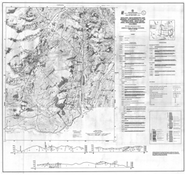
J.M. Logan, V.M. Koyanagi and J.R. Drobe
Open File 1990-02 describes the geology, mineral occurrences and geochemistry of the Forrest-Kerr-Iskut River area (104B/15) of northwestern British Columbia. It consists of two maps: the first, at 1:50 000 scale, shows the geology, map legend and geologic cross sections; the second provides a location map for samples, and tables of mineral occurrences, stream sediment sample analyses, lithogeochemical and assay data, and fossil information.
The area straddles the boundary between the Intermontane and Coast tectonic belts. The Paleozoic Stikine assemblage east of the Forrest Kerr fault consists of Lower Devonian limestone with conglomerate, shale and tuff interbeds; Paleozoic schistose intermediate to mafic metavolcanics and siltstone, argillite and phyllitic metasediments; and Permian carbonates and metatuffs. West of a Jurassic composite pluton, the assemblage the oldest rocks are Mississippian pillowed basalts, flow breccias and tuffs that are overlain by reefal limestone with cherty siltstone interbeds. Cherty siltstone and polymictic pebble conglomerate separate the limestone from Lower Permian bioclastic calcarenite with dolomitic units. Overlying this unit are intermediate volcanics and volcanic breccias then algal limestone followed by shallow water conglomerates, siltstones, lapilli and crystal tuffs with siliceous limestone interbeds.
Middle Triassic sedimentary shales and argillites occur locally. The Stuhini Group, which is of Upper Triassic age, consists of a lower metasedimentary, medial metavolcanic and upper tuffaceous sediment successions. Lower Jurassic shales and siltstones are overlain by Jurassic pillow basalts and flow breccias then siliceous wacke, tuffite and conglomerate. Sediments of the Middle Jurassic Bowser Lake Group are mainly shale with local sandstone and conglomerate layers.
Plutonic rocks underlie 1/3 of the map-area. Paleozoic (?) hornblende quartz diorite and toanlite bodies crop out west of Forrest Kerr Creek. Early (?) Jurassic monzonite and megacrystic granite form sills, dykes and plugs. The Middle Jurassic suite consists of a batholithic composite diorite to quartz monzonite to biotite granite intrusion, small plugs and dykes of quartz feldspar porphyry, and altered diorite bodies along north-northeast faults.
Major northeast to north and lesser northwest faults control the distribution of lithostratigraphic packages and influence mineralization.
Mineral prospects include gold-copper-iron skarns, mesothermal copper-gold-silver-bearing quartz veins, and stratabound massive sulphide occurrences. The skarns are generally developed in the Mississippian limestones. Mesothermal veins are related to northwest structures. Stratabound occurrences are associated with dacitic (?) pyroclastics or hyaloclastites in cherty siltstones and carbonaceous argillites within a basic pillowed and brecciated volcanic succession on Forrest Kerr Creek, and massive sulphide boulders were located on More Creek. Paleozoic and Jurassic strata are prospective for this kind of mineralization.
Multi-element geochemical anomalies were defined by the geochemical survey and two ultramafic bodies have nickel-cobalt anomalies.
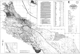
I.C.L. Webster and G.E. Ray
Open File 1990-3 portrays the geology and mineral occurrences of Northern Texada Island (92F/9, 10, 15), southwest British Columbia. The map, at 1:20 000 scale, contains the geological map. A legend, a mineral occurrence table, and descriptive notes.
Texada Island lies at the eastern edge of both the Wrangellia Terrane and the Insular Belt It is mostly underlain by volcanic rocks of the Middle to Late Triassic Texada Formation which, in the northern part of the island, is conformably overlain by 60 to 500 metres of massive limestone belonging to the Late Triassic Marble Bay Formation. These are respectively correlated with the Karmutsen and Quatsino formations of the Vancouver Group. Poorly exposed Cretaceous sediments of the Nanaimo Group crop out around Gillies Bay; these represent the eastern margin of the Comox basin.
The Texada Formation largely comprises pillowed and massive, amygdaloidal and spherulitic basaltic flows with thick sequences of pillowed breccias; in the Surprise Mountain area it includes a 15-metre thick subhorizontal unit of columnar jointed basalt. Near the top of the formation the flows and pillow breccias contain thin, impersistent beds of fossiliferous limestone (Unit L).
Various stocks and minor intrusions, ranging in composition from gabbro through diorite to quartz monzonite, intrude the volcanics and limestones. The more mafic stocks, which tend to be concentrated along the northwest-trending Marble Bay fault, are characterized by mafic xenoliths and coarse homblende crystals; some, such as the Cornell stock, which yielded a preliminary zircon U-Pb radiometric age of 175 Ma, are associated with copper-gold skarn mineralization. The felsic stocks include the Gillies, Little Billy and Pocahontas stocks. The Gillies stock yielded a zircon U-Pb radiometric age of 178 Ma (Ettlinger and Ray, 1989), and is associated with several magnetite-rich skarn deposits. The Little Billy stock is spatially associated with copper-gold skarn mineralization at the Little Billy mine but the Pocahontas stock is not related to any known skarn mineralization. A distinct, easterly trending quartz porphyry dike that transects the island from Limekiln Bay to the east coast appears to postdate the major northwest trending faults.
The limestones and volcanics have been deformed into a series of broad, northwest trending open folds that plunge gently to moderately northwards. However, the rocks have undergone more intense ductile and brittle deformation within three subparallel, northwesterly striking structural lineaments. These lineaments coincide with the Ideal, Holly and Marble Bay faults, and the brittle transcurrent sinistral offset along these faults is atypical of the mostly dextral fractures present elsewhere in the province. The emplacement of some of the Jurassic intrusions and their associated skarn mineralization has apparently been influenced by these structural lineaments.
The mineral deposits and occurrences on northern Texada Island are listed on this map. Mineralization mainly comprises either skarns or veins, both of which carry base and precious metals. Between 1896 and 1976 the polymetallic skarns produced 10 million tonnes of magnetite concentrate (from 20.8 million tonnes of iron ore mined), 35 898 tonnes of copper, 3.3 tonnes of gold and approximately 40 tonnes of silver; by contrast, the quartz-carbonate veins have been relatively unproductive. After 1976, mining virtually ceased, but large scale quarrying of the pure limestone to produce cement and lime still continues.
Skarn mineralization is marked by garnet-pyroxene-wollastonite-amphibole alteration assemblages; it can be divided into iron-rich occurrences, which are spatially associated with the felsic Gillies stock, and copper-gold-rich occurrences, which are mostly related to a suite of mafic intrusions. Iron skarn mineralization is seen at the Prescon, Yellow Kid, Paxton and Lake mines, while the copper-gold skarns are more widely distributed and include the Marble Say, Little Billy, Copper Queen, Cornell, Loyal and Florence mines. All of the iron and some of the copper-gold skarns lie close to the base of the Marble Bay Formation where the limestones are less pure. However, occurrences of copper-gold skarn mineralization, including that at the Marble Bay and Little Billy mines, occur throughout the 500-metre thick limestone succession.
The iron skarns contain abundant magnetite with minor chalcopyrite and pyrite; there is local cobalt enrichment but gold values are low. The main ore minerals in the copper-gold skarns are chalcopyrite and bornite with minor to trace amounts of molybdenite, pyrite, magnetite and sphalerite. Gold generally occurs as minute 20 to 50 micron blebs. The Little Billy includes traces of galena, scheelite, tellurides and native silver, while the Paris includes rare crystalline native arsenic. The iron and copper-gold skarns are believed to be coeval and related, and both formed within a similar high level, oxidized to intermediate environment. The local presence of extensive bleaching in the limestones is believed to indicate skarn alteration at depth.
M.G. Mihalynuk, K.J. Mountjoy, L.D. Currie, D.L. Lofthouse and N. Winder
Open File 1990-04 describes the geology, mineral occurrences and geochemistry of the Edgar Lake area and the Fantail Lake map-area. The Open File consists of three maps: the first contains the geology of Fantail Lake (104M/9E) at 1:50 000 scale, a geologic legend for the Open File, and interpretive cross sections; the second presents the geology at 1:50 000 scale and cross sections for Edgar Lake (104M/8); and the third presents a location map, a mineral occurrence table, and lithogeochemical and moss mat survey data tables.
The area straddles the boundary between the Coast and Intermontane geomorphologic belts. The structural grain of the country parallels the contact, which trends north-northwest. It also roughly delineates the boundary of the Nisling assemblage and strata of the Whitehorse trough.
Proterozoic to Paleozoic metamorphics form a roughly 15 kilometre–wide belt that varies from upper amphibolite to greenschist grade. Typical rock types vary from schists and gneisses in the Boundary Ranges to pelites, semi-pelites, marbles, amphibolites, calc-silicates and minor quartzite in the Florence Range.
Upper Triassic Stuhini Group strata represent a change from coarse terrigenous sediments to submarine mafic volcanics. Basal conglomerate gives way to pyroxene-phyric flows, breccia and interlayered sediments then volcaniclastic followed by the distinctive Sinwa limestone.
The ages of the Mesozoic Graham Creek igneous suite and Peninsula Mountain volcanic and sedimentary rocks are not well constrained. The Graham Creek suite includes tectonized harzburgites and gabbros associated with cherts, pillow basalts overlain by felsic volcanics and epiclastic rocks of the Peninsula Mountain suite.
There is either a depositional hiatus or an unconformity between Laberge Group strata and the Sinwa. Turbidite sequences representing coalescing subaqueous fans characterize the Laberge Group. Typical rock types are argillites and greywackes.
Pre-Cretaceous rocks are folded into upright to overturned, gently plunging folds.
The Mid to Late Cretaceous Tagish volcanics comprise rhyolitic through basaltic flows and pyroclastic sequences. They are cut by the Engineer stock, which is Late Cretaceous.
The Late Cretaceous Hutshi and Mount Fetterly volcanics cap Mount Fetterly and low mountains to the west. They may be correlative with the Engineer suite of the Tagish volcanics. Conglomerates at the base give way to epiclastic rocks then rhyolites then basalts.
Intrusive rocks have a long history in the area. The oldest is the Mississippian to Triassic (?) Ear Mountain quartz syenite. Early Mesozoic foliated tonalite is followed by mid to Late Triassic foliated hornblende-rich gabbro, Late Triassic megacrystic hornblende granodiorite, Late (?) Jurassic to Early Cretaceous zoned granodiorite to diorite bodies, and then the Coast Intrusions, which form two plutons along the west margin of 104M/8. Rocks types are biotite granite to biotite hornblende diorite and potassic feldspar megacrystic granite.
Mineralization is well known in the area. Past producers are the Engineer mine, with gold and silver from quartz veins sparsely mineralized with tellurides and base metals, and Ben My Cree where gold and silver was mined from quartz veins with abundant sulphides. In both instances, the veins cut Laberge Group argillites and greywackes. Other deposit types of interest are sulphide-free quartz gold silver veins and sulphide-bearing carbonate-quartz veins associated with the Llewellyn fault zone. Gold may also occur in association with carbonatized ultramafic rocks, and placer gold has been produced historically. Prospective lithologic packages are the Laberge Group, mafic and ultramafic rocks and the Boundary Ranges metamorphic suite. There is also potential within and near the Llewellyn fault zone.
P. Desjardins, L. Lyons, S. Pattenden, D.G. MacIntyre and J. Hunt
Open File 1990-05 describes the geology, mineral deposits and geochemistry of the Thautil River area (93L/6). The Open File consists of one map that shows the geology at 1:50 000 scale, a legend and geologic cross section, and lithogeochemical/assay, mineral occurrence, regional geochemical survey data, and silt sediment geochemistry tables.
The oldest rocks exposed are Early to Middle Jurassic calc-alkaline volcanics, volcaniclastics and sediments of the Hazelton Group. These consist of the Lower Jurassic Telkwa and Nilkitkwa Formations, and the Middle Jurassic Smithers Formation. The Telkwa Formation comprises andesitic pyroclastics (including welded tuffs), basalt flows, silicic pyroclastics including ash flows and rhyolite flows, a sedimentary section with limestone and siltstone, and mixed red tuffs and basalt. The overlying Nilkitkwa Formation is dominantly red tuffs. The Smithers Formation consists of sandstones, greywackes and shales.
Overlying Middle to Upper Jurassic successor basin sandstones, siltstones and greywackes are of the Ashman Formation of the Bowser Group. These give way to Lower Cretaceous Skeena Formation sandstones, siltstone and shales that are coal bearing. Paleocene to Miocene friable conglomerates, sandstones and siltstones are overlain by basalt flows and breccias.
Ages of intrusions in the area are poorly constrained, but they cut Late Jurassic rocks. Diorite, granodiorite, quartz monzonite, granite, various porphyritic, and rhyolite intrusions occur.
Mineralization is associated with the intrusive rocks. Potential deposit types are porphyry copper and molybdenum, related mesothermal and epithermal veins, and massive sulphides. Known deposits are mainly copper-silver veins and pods in mafic volcanic rocks. These could indicate porphyry mineralization at depth.
M.A. Bloodgood, K.A. Bellefontaine, I.C. Gertz and L. Maddison
Open File 1990-06 describes the geology, mineral deposits and geochemistry of the Dixie Lake, Teresa Island area (104N/5, 6) in northern British Columbia. It consists of 2 sheets: the first presents the geology, a legend and fossil tables; the second contains a sample location map, and tables of radiolaria and conodont samples, whole rock analyses, and assay results.
The area is in the Intermontane belt at the Atlin and Stikine terrane boundaries. West of the Nahlin fault, Mesozoic and Cenozoic clastic rocks of the Inklin overlap assemblage dominate. East of the fault, Cache Creek Group clastic and volcanic rocks that are cut by Cretaceous plutons characterize the Atlin terrane. The Tertiary (?) Birch Mountain pluton plugs the Nahlin fault.
Cache Creek clastic sediment assemblages consist of siliceous mudstone, siltstone, sandstone and wacke. Limestone cliff-forming masses that may be slumped blocks dominate the area south of Sentinel Mountain. Limestone layers occur within the volcanic and chert section on Sentinel Mountain. Cherts occur with mafic flows, tuffs and diabases. Pillowed flows occur locally. Ultramafic rocks form small, fault-bounded exposures. They consist of serpentinized harzburgites with some dunite and gabbro.
Possible Triassic sediments consist of siltstone, sandstone, gritty limestone, maroon chert, greywacke and volcanic conglomerate. These rocks are unconformably overlain by Jurassic Laberge Group greywackes with lesser siltstone, mudstone and shale.
Tertiary Sloko rhyolite and minor basalt with interlayers of tuff, greywacke, and volcanic conglomerate overlie the Laberge. Tertiary olivine basalt flows occur locally.
One stock consists of Late Cretaceous (?) quartz diorite and diorite. Three other stocks are Tertiary (?); one consists of quartz monzonite, another is leucocratic quartz monzonite with some diorite and gabbro, and the third is diorite to gabbro.
Faulting dominates the structure with numerous thrust faults and some tear faults.
Placer gold is the only known commodity in the area. However, there is potential for precious metal mineralization related to listwanite and carbonate alteration of ultramafic rocks, and epithermal quartz-carbonate veins and stockworks with precious metal mineralization associated with east-northeast-trending Eocene fault.
I.C.L. Webster and W.J. McMillan
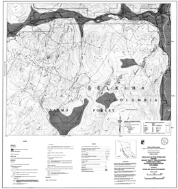
T. Höy and K.P.E. Andrew
Open File 1990-08 describes the structure, tectonic setting, geology and mineral occurrences of the Rossland Group, Mount Kelly-Hellroaring Creek area (82F/3W) near Salmo in southeast British Columbia. It consist of a geology map at 1:25 000 scale with legend, a mineral occurrences table, and two separate sheets with geological/structural cross sections.
The Lower Jurassic Rossland Group in the area consists mainly of the clastic rocks of the Archibald Formation overlain by a succession of volcanic rocks of the Elise Formation and the clastic rocks of the Hall Formation.
The Archibald Formation comprises a homoclinal, west-facing succession. Argillite with thin siltstone interbeds at the base gives way to interbedded siltstone, argillite and minor conglomerate. The Elise Formation comprises a thick succession of augite-phyric flows, tuffs, some epiclastic deposits with minor interbedded siltstone and argillite sequences. In some areas the Formation is divisible into mappable units but facies changes are marked. The Hall Formation is mainly black argillite.
The earliest structures are tight folds with local penetrative foliation, shearing and west-verging thrust faults related to the Waneta fault, which is a thrust that separates rocks of Quesnellia and North America. At least four generations of faulting occurred. Extension occurred prior to intrusion of Late Jurassic plutons. Late normal faulting may be related to an Eocene extensional event.
Mineral occurrences include shear-related conformable gold-copper zones, and gold-silver-lead-zinc, gold-silver-copper and molybdenum veins. Conformable zones are closely linked to Rossland Group lithologies and early structures. Vein occurrences are post-tectonic and formed during intrusion of Middle Jurassic granites.
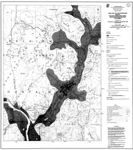
T. Höy, K.P.E. Andrew and J. Drobe
Open File 1990-09 presents the geology of the Rossland Group, Beaver Creek Area; in Southeastern British Columbia. (82F/4E) Scale is 1:20 000.
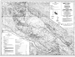
P. Schiarizza, R.G. Gaba, M. Coleman, J.K. Glover, R. Macdonald, T. Calon, J. Malpas, J.I. Garver and D.A. Archibald
Open File 1990-10 describes the geology and mineral potential of the Yalakom River area (92J/15, 16; 92O/1, 2) in southern British Columbia. It consists of two maps at 1:50 000 scale. The first portrays the geology, a geologic legend and references; the second is a mineral potential map with a map showing mineral occurrences, and tables for mineral occurrences, lithogeochemical analyses, and stream sediment (Regional Geochemical Analyses) and moss mat geochemical analyses. This Open File is a contribution to the Canada/British Columbia 1985-1990 mineral development agreement.
The map-area encompasses the whole of the Shulaps ultramafic complex, a dismembered ophiolite sequence. The Shulaps complex is bounded by the Yalakom fault on the northeast and juxtaposed against Bridge River and Cadwallader rocks across thrust and high-angle faults on the north, west, south and southeast. The topographically highest part of the complex is variably serpentinized harzburgite with lesser dunite and orthopyroxenite. Along the southwest margin of the complex, cumulate-derived serpentinite melange structurally underlies the mantle harzburgite unit. In turn, Bridge River schists and Cadwallader Group metasediments structurally underlie it. The foliated serpentinite contains blocks of ultramafic, gabbroic, volcanic and sedimentary rock. Serpentinite also dominates the poorly exposed northern half of the Shulaps complex.
The Permian (?) to Jurassic Bridge River complex includes variably metamorphosed and structurally imbricated chert, mafic extrusive and intrusives, limestone, clastic rocks, and serpentinite. It is structurally interleaved with rocks of the Shulaps complex and the Cadwallader Group. The Cadwallader Group consists of mafic volcanic rocks of the Pioneer Formation and overlying clastic sediments of the Hurley Formation.
The Relay Mountain Group comprises Middle Jurassic to Lower Cretaceous shallow marine sediments that are found in fault slivers in the map-area. A Middle Jurassic unit of mainly volcanic sandstone crops out along the Yalakom river northeast of the fault. Overlying Jackass Mountain Group rocks are of Lower Cretaceous age. In the map-area, coarse-grained feldspathic-lithic wacke is the predominant lithology.
Eocene volcanic and sedimentary rocks outcrop in two areas. The sedimentary unit is dominantly volcanic and chert-rich conglomerate interbedded with siltstone and sandstone. The volcanic unit consists of light grey to buff-weathering volcanic flows and breccias. They overlie sedimentary rocks.
The Blue Creek porphyries comprise numerous dykes and small plugs of hornblende feldspar porphyry, diorite and quartz diorite that intrude the Shulaps ultramafic complex are Late Cretaceous to Paleocene (?) in age. The Mission Ridge biotite granodiorite pluton intrudes Bridge River schists; it is Eocene. The Rexmount dacite porphyry may also be Eocene.
Late Cretaceous sinistral and compressional features were followed by a complex series of mid-Cretaceous to Tertiary strike-slip, compressional and extensional deformation in the area. In the Shulaps complex is structurally stacked and as a unit defines a major southwest verging linked thrust system. Many other faults that occur in the area are discussed.
Mineral prospects in the area include mesothermal gold-quartz veins associated with Blue Creek porphyry bodies, and veins, disseminations, and stockworks containing molybdenum, copper and gold along the northeast margin of the Mission Ridge pluton. In addition, the ultramafic rocks have small chromite concentrations, and potential for jade, magnesite and chrysotile. Cinnabar veinlets and disseminations occur locally near the Bridge River fault.
P.F. Matysek, G.P. McLaren, W. Jackaman and G.G. Stewart
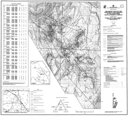
G.T. Nixon, J.L. Hammack, W.P.E. Paterson and C. Nuttall
Open File 1990-12 presents the geology and noble metal geochemistry of the Lunar Creek mafic-ultramafic complex (94E/13, 14) in northern British Columbia. The Open File consists of one map that portrays the geology at 1:16 000 scale, a geologic legend, a regional setting map and a table of noble metal abundances in selected samples of the complex. The Open File is a contribution of the Canada/British Columbia Mineral Development Agreement 1985-1990.
The Lunar Creek complex is part of the “Polaris suite” of Alaska-type intrusions. The Lunar Creek complex is within Quesnellia at the boundary between the Stikine and Quesnel tectonostratigraphic terranes, which, in the map-area, is defined by the Kutcho fault. Diorite within the complex yielded a Middle Triassic zircon age; however, along its eastern margin the complex is in contact with and may intrude augite phyric volcanic rocks that are assigned to the Upper Triassic Takla Group. Early Jurassic granitoids of the Pitman batholith intrude both the volcanics and the ultramafic rocks.
Paleozoic rocks east of the Kutcho fault are of uncertain affiliation. Some are Mississippian but may range to Devonian and Permian. Lithologies are chlorite and sericite schist, phyllite, rhyolite flows and tuffs, chert, sandstone and carbonate.
Takla augite-plagioclase porphyry, volcanic wackes and siltstones crop out north and east of the complex. They are metamorphosed to lower amphibolite grade. The contact with the complex is a ductile deformed zone along which both lithologies have been mylonitized.
The Lunar Creek complex is an elongate body trending northwest. It is unusual compared to other Alaskan complexes. It has two gabbroic phases, and one of these displays ductile deformation and is older than the main phase; cumulate layering is locally very well developed, which is rare in Alaskan complexes; and quartz-rich pegmatitic segregations are common in the gabbroic to dioritic phases, a relatively unusual feature in this type of intrusion.
Ultramafic rocks in the complex include dunite, chromitiferous dunite, wehrlite, olivine wehrlite, olivine clinopyroxenite, clinopyroxenite and gabbro. Wehrlite and clinopyroxenite units are chaotically mixed. Layering is locally developed in the peridotites. Some clinopyroxene crystals in clinopyroxene-rich units have been replaced by olivine to create irregular replacement dunite bodies. Main phase gabbro and diorite appear to be the youngest rocks in the complex. Quartz-plagioclase veins occur.
Lithogeochemical analyses suggest that the Lunar Creek complex is not a prime target for chromitite or platinum-group element exploration. Copper-bearing skarn and porphyry occurrences near the eastern margin of the complex may be related to the granitoids of the Pitman batholith rather than the ultramafic intrusion.
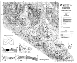
G.T. Nixon, J.L. Hammack, C.H. Ash, J.N. Connelly, G. Case, W.P.E. Paterson and C. Nuttall
Open File 1990-13 describes the geology and mineral potential of the Polaris ultramafic complex (94C/5, 12) in northern British Columbia. The Open File consists of two sheets. The geology map of sheet 1 is at 1:16 000 scale and presents the generalized geology of the complex, with location map, geologic legend and geologic cross sections. The second sheet provides more detailed geology, at 1:5000 scale, of the western part of the complex; it also has geologic cross sections. The Open File is a contribution of the Canada/British Columbia Mineral Development Agreement 1985-1990.
The Polaris ultramafic complex is one of the largest Alaskan-type bodies in the province. It lies within the Omineca crystalline belt. The host rocks are arc-derived metamorphosed volcaniclastic and metasedimentary rocks of the Lay Range assemblage, which is Upper Paleozoic and tentatively correlated with the Harper Ranch Group. The age of the complex is not well established; Jurassic potassium-argon ages are apparently too young.
The Lay Range assemblage is entirely fault-bounded and consists of a series of northwest trending fault slices. Immediately host rocks of the Polaris complex are argillites, siltstones, sandstones, minor carbonates, lithic-crystal tuffs, and lava.
The Polaris complex forms a northwest trending elongated body. The main mass of dunite is in the eastern half of the complex. Concentrations of chromitite are essentially confined to the dunite. It forms irregular pods, schlieren and millimetre-scale laminae. Olivine wehrlite and wehrlite are extensive in the northern and central parts of the complex. Olivine clinopyroxenite and clinopyroxenite outcrops are widely distributed throughout the ultramafic parts of the complex. Mixed wehrlite/clinopyroxenite units are found near the margins of wehrlite and clinopyroxenite bodies. Hornblende clinopyroxenite and hornblendite are virtually restricted to the upper parts of the complex. Gabbroic rocks comprise hornblende and/or clinopyroxenite gabbros. They are restricted to the margins of the complex. Dykes and veins of ultramafic to syenite/leucomonzonite or quartzofeldspathic composition are widespread.
The complex is interpreted to represent a high level, sill-like intrusion. Later tilting turned the sill on edge and the transgressive northern contact of the complex represents the top of the sill. Gross internal distribution of rock types in the complex is systematically disposed about the margin.
About 130 representative samples of the complex were analyzed for gold, platinum group and “pathfinder” elements. Interesting but rather localized anomalies were found. Platinum was highest in chromitite-bearing dunite; a clinopyroxenite sample yielded anomalous platinum and palladium values; and gold anomalies show a preference for mafic lithologies at the margins of the ultramafic complex.
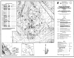
J.L. Hammack, G.T. Nixon, R.H. Wong, W.P.E. Paterson and C. Nuttall
Open File 1990-14 describes the geology and noble metal geochemistry of the Wrede Creek ultramafic complex (94D/9) in northern British Columbia. The geology map is at 1:16 000 scale. It includes a legend, location map, and a table of noble metal abundances for representative samples from the complex. The Open File is a contribution of the Canada/British Columbia Mineral Development Agreement 1985 -1990.
The Wrede Creek complex intrudes volcaniclastic rocks of the Upper Triassic Takla Group that forms part of Quesnellia. The Takla consists primarily of augite and augite-plagioclase crystal tuffs, flows and volcanic breccias.
The Wrede Creek complex exhibits a crude concentric zonation of rocks types from ultramafic rocks in the core to mafic phases at the margins. Dunite in the core of the body grades outward through a narrow wehrlite transition zone into olivine clinopyroxenite and clinopyroxenite, and these units ultimately pass into hornblende-rich gabbroic rocks at the periphery of the complex. The body may represent a high level intrusive stock. Chromitite is ubiquitous as tiny crystals in the dunite and is concentrated locally into pods and schlieren. Minor intrusions in the complex include dykes of dunite, wehrlite, and olivine clinopyroxenite. Pegmatitic hornblende plagioclase dykes cut the dunite. Quartz monzonite, quartz diorite and diorite dykes of Middle to possibly Late Jurassic age intrude both the Wrede Creek complex and the country rocks.
Sulphide mineralization at the southern end of the complex is hosted by dioritic to granitic dykes that cut the complex and also the Takla country rocks. Mineralization consists of disseminations and fracture fillings of pyrite, chalcopyrite, molybdenite and bornite. Bornite and pyrite are also found locally in fault-related carbonate alteration zones in the dunite. Chromite is restricted to the dunite; chromite horizons in the core of the Wrede Creek complex are markedly enriched in platinum.
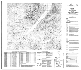
L.J. Diakow and J. Timmerman
Open File 1990-15 presents the geology of the Nanika Lake area (93E/13) in northern British Columbia. The Open File map has geology at 1:50 000 scale, a legend, and mineral occurrence, lithogeochemical assay results, and regional geochemical stream and lake sediment analysis data tables.
The area straddles the Coast belt/Intermontane belt boundary. In the southwest plutons of probable Late Cretaceous and Tertiary age cut plutonic and metamorphic rocks of the Early to Middle Jurassic Gamsby complex. In the northeast, the Morice Lake pluton bounds Lower and Middle Jurassic Hazelton Group volcanic and minor sedimentary rocks. Sedimentary rocks of the Lower Cretaceous Skeena Group crop out locally. Plutons and swarms of mid-Jurassic to Tertiary age dikes cut the layered successions.
Hazelton Group strata comprise a homoclinal succession that consists mainly of sub-aerial volcanic rocks. The lowest unit exposed consists of well layered, mainly lapilli tuffs with minor basalt, andesite, and dacite lava flows. This grades upward into a unit that consists largely of basalt, andesite and rhyolite flows. Above this is a heterogeneous succession dominated by maroon and green lapilli tuff. The upper unit is a distinctive succession characterized by tuffs with rhyolitic fragments.
The Gamsby complex consists of metavolcanics, schists and orthogneisses that are cut by highly variable hornblende diorite and lesser quartz diorite. The diorites are apparently of Early Jurassic age.
The Morice Lake pluton underlies the southwest part of the map-area. It consists mainly of granodiorite. The pluton and local satellite bodies cut the Jurassic volcanic succession.
Mineral prospects in the area include quartz veins containing gold and silver and abundant base metals, stratabound copper-zinc sulphides as thin lenses that are associated with interlayered limestone and chert, iron-copper skarns associated with Tertiary granodiorite intrusions, and disseminated chalcopyrite with or without molybdenite associated with Middle Jurassic and Late Cretaceous (?) plutons.
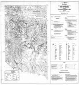
D.J. Alldrick, J.M. Britton, M.E. MacLean, K.D. Hancock, B.A. Fletcher and S.D. Hiebert
Open File 1990-16 presents the geology and mineral deposits of the Snippaker area (104B/6E, 7W, 10W, 11E) near Johnny Mountain in northwest British Columbia. The map portrays the geology at 1:50 000 scale, a legend, a mineral occurrence table, and selected references. Adjacent areas are covered by Open File maps 1988-4 and 1989-10.
The geology defines four major lithostratigraphic sequences. Biotite-rich quartzofeldspathic gneiss, phyllite, metawacke, metatuffs and marble are tentatively assigned to the Paleozoic Stikine or Asitka assemblage. They exhibit polyphase deformation. Mesozoic strata comprise mixed volcanic and volcanic-derived sedimentary rocks.
Upper Triassic Stuhini Group strata are sediments, intermediate volcanics, melanocratic basaltic tuffs, and leucocratic dacitic tuffs. Most of the volcanics are basaltic to andesitic with pyroxene and plagioclase as phenocrysts phases. Pyroclastic units are more common than flows. The dacitic rocks are pyroxene-plagioclase crystal and lapilli tuffs. Scattered lenses and blocks of recrystallized limestone occur in the tuff successions.
Lower Jurassic Hazelton Group strata are mainly andesitic to dacitic fragmental volcanics with minor basaltic tuffs and lesser amounts of siltstone, wacke and conglomerate. Lateral facies changes are pronounced.
Pleistocene and Recent basaltic flows, cones and tephra occupy several river valleys. The basalts are olivine and plagioclase phyric.
Intrusive rocks underlie 1/3 of the area. The oldest are Triassic sills, dikes and plugs of hornblende diorite. Jurassic intrusions include synvolcanic stocks and large plutons. Rock types range from felsite and feldspar-quartz porphyries in stocks, to quartz diorite through quartz monzonite to coarse monzonite or diorite to megacrystic monzonite in the larger plutons. The Coast Mountains batholith varies from quartz diorite through granodiorite to granite.
Deformation in the area is complex, with local folding and penetrative deformation, and many episodes of faulting associated with volcanic and intrusive activity.
The Snip and Johnny Mountain mines and the Inel prospect are within the map-area. At the Johnny Mountain gold mine, ore is mainly in quartz-carbonate veins with green mica and some specular hematite that cut volcanic rocks. They carry pyrite and chalcopyrite with trace amounts of base metal sulphides. The Snip deposit is within a sedimentary sequence. The mineralization is as veins in shear zones. Massive sulphide ore has pyrite>pyrrhotite and minor sphalerite; crackle quartz ore consists of shattered quartz veins infilled with green mica and chlorite and disseminated sulphides; and streaky quartz ore has quartz laminae in sheared and altered country rock. The Inel mineralization is hosted by a volcanic-sedimentary sequence. Mineralization occurs as sulphide and quartz-sulphide veins. Skarns occur along the border of the Lehto batholith east of Snippaker Creek. Sulphides are chalcopyrite and sphalerite with magnetite. Some contain precious metal values. Disseminated sulphides that are known within large gossanous zones may be related to precious metal-bearing porphyry copper mineralization.
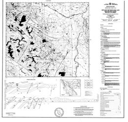
F. Ferri and D.M. Melville
Open File 1990-17 describes the geology and mineral occurrences between Nina Lake and the Osilinka River in north-central British Columbia. The Open File consists of two maps: the first portrays geology at 1:50 000 scale, a legend, and geologic cross sections; the second contains a sample location map, geochemical data and a mineral occurrences table. Tables present results of stream sediment, moss mat and whole rock geochemical analyses.
Both displaced North American rocks and accreted rocks of the Intermontane superterrane are exposed in the map-area. The oldest North American rocks are part of the Proterozoic Ingenika Group, which is predominantly clastic with lesser carbonate. Typical lithologies are feldspathic and quartz wackes, siltstones, slates, sandstones, limestones and their metamorphosed equivalents. Lower Paleozoic clastic and carbonate rocks in the area correlate with the Lower Cambrian Atan Group, the Cambrian to Ordovician Kechika Group, the Ordovician to Silurian Road River Group, the Silurian to Lower Devonian Sandpile Group, the Middle Devonian McDame Group, and the Upper Devonian to Mississippian Earn Group.
Allochthonous rocks in the area are the Pennsylvanian to Permian Slide Mountain Group, the Middle to Upper Paleozoic Harper Ranch Group (?) and the Upper Triassic to Lower Jurassic Takla Group.
The Manson Creek left lateral fault zone and the boundary between the Slide Mountain and North American miogeoclinal strata are the major tectonic elements in the area. This boundary is layer-parallel and is presumably a thrust fault. Older strata that are metamorphosed to as high as sillimanite grade in the northeast part of the map are polydeformed. Elsewhere, greenschist or lower metamorphic grades exist and brittle deformation predominates.
Known mineral occurrences are predominantly related to the McDame dolomitic units but there is a lead-zinc-silver showing in the Sandpile Group and a gold-silver-copper prospect in Slide Mountain rocks. Mineralization in the interval from the Earn-McDame contact down to the uppermost Tapioca sandstone unit of the Sandpile Group consists primarily of argentiferous galena, sphalerite, barite and minor amounts of pyrite. In general stratabound carbonate-hosted base metal deposits could occur throughout the McDame Group. In the middle division of the Slide Mountain Group, shear zones in gabbros and argillaceous cherts may host podiform lenses of sulphide mineralization, generally pyrite and chalcopyrite with varying amounts of gold and silver.
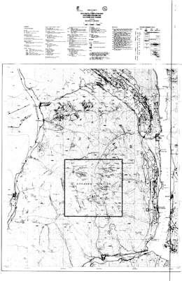
G. Beaudoin
Open File 1990-18 presents a geological compilation map of the northern Kokanee and southern Goat Ranges (82F, 82K) in southern British Columbia. The geology map is at 1:50 000 scale and the sheet also contains a legend, a schematic stratigraphic column, and references.
Mineral deposits are not shown on the map, but the area many silver-lead-zinc vein deposits, including those of the Riondel, Ainsworth, Slocan, Silverton, New Denver and Sandon camps. In the west, near Kootenay Lake, the oldest strata are rocks of the Proterozoic Purcell and Windermere supergroups. The Paleozoic assemblage includes the Cambrian Hamill Group and Badshot-Mohican formations, the Cambro-Ordovician Lardeau Group, the Mississippian Milford Group, and the Permian Kaslo Group. Slocan Group rocks comprise the Mesozoic strata in this area. The layered rocks are cut by the Middle Jurassic Nelson batholith, Cretaceous syn-tectonic granite, and Tertiary lamprophyric, gabbroic, intermediate, and felsic dikes. In the north, the Sandon area lacks Proterozoic rocks and syn-tectonic granites, but otherwise has the same rock packages. In the east, in the Valhalla Range, there are no Proterozoic rocks exposed and the Paleozoic poorly constrained metamorphic rocks that are partly of Mississippian age, and rocks that are Permo-Triassic in the Nemo Lakes belt. Above these are Jurassic Rossland Group strata. Intrusive rocks include the Jurassic Nelson batholith, the Paleocene Ladybird granite and dikes similar to those near Kootenay Lake. The Mulvey gneiss was emplaced during Cretaceous time.
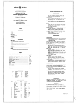
B.A. Fletcher and S.D. Hiebert
Open File 1990-19 presents the geology and mineral occurrences of the Johnny Mountain area (104B/11). The Open File consists of 2 sheets. Sheet 1 consists of a legend, descriptions of rock units in the area, references, and mineral occurrence table. Sheet 2 portrays the geology at 1:10 000 scale.
The area is underlain by stratified rocks that range from Paleozoic metasediments to Upper Triassic sediments, and Lower Jurassic volcanic rocks that are cut by Upper Triassic diorites, Lower Jurassic potassic feldspar porphyries and Jurassic felsite intrusions. The Upper Triassic sedimentary sequence consists of a lower package of deformed tuffaceous clastic rocks with local limestone and tuff layers, and an overlying sequence of undeformed fine to coarse clastic sediments. The undeformed sequence includes the Snip mine series. The Lower Jurassic volcanic sequence has a lower unit of tuffaceous wackes and conglomerates; a Lower Andesite package of lapilli, crystal and ash tuffs; a Middle Dacite package of tuff breccias, welded tuffs, plagioclase porphyry, lapilli tuff and ash tuff; and an Upper Andesite and Basalt package of lapilli, crystal and ash tuffs.
Upper Triassic diorites and Lower Jurassic, locally megacrystic K-feldspar porphyry and Jurassic felsite intrusions form stocks and dikes. Underground at Snip gold mine, a biotite porphyritic mafic dike occurs at the Twin zone, which is cut off by lamprophyre dikes. The Hoodoo olivine plagioclase basalt dikes are seen underground at Johnny Mountain gold mine. Commodities in the 29 mineral occurrences listed are copper-gold-silver, gold-silver-copper-lead-zinc, silver-lead-zinc-gold, gold-silver, lead-zinc, gold only and molybdenum.
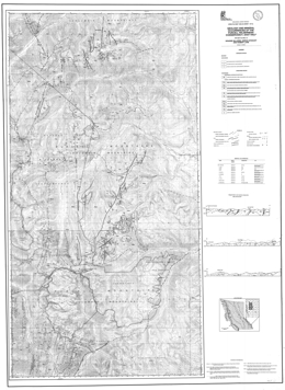
G. McLaren, G. Stewart and R. Lane
Open File 1990-20 presents geology and mineral occurrences of the Purcell Wilderness Study Area, east half (82F/16, 82K/1, 8) in British Columbia. Mapping is at 1:50 000 scale.
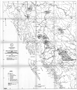
D.V. Lefebure and M.L. Malott
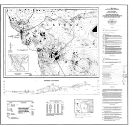
C.H. Ash and R.L. Arksey
Open File 1990-22 presents the tectonic setting of listwanite-lode gold deposits in the Atlin area of northwestern British Columbia (NTS 104N/12). Mapping is at 1:20 000 scale.
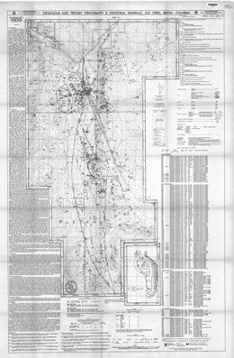
P.B. Read
Open File 1990-23 describes the stratigraphy and industrial mineral occurrences of the Hat Creek area in southern British Columbia (NTS 92I/12,13,14). It represents data from an ongoing investigation of industrial minerals in Tertiary basins funded by the Canada/British Columbia Mineral Development Agreement 1985-1990. The Open File is comprised of a 1:25 000 scale map of the Hat Creek outlier of Tertiary and Upper Cretaceous sediments and volcanic rocks. Based on extensive palynological and drilling data, a completely new outlook on the structure and stratigraphy of the area is presented.
Accompanying notes briefly describe the stratigraphy, structure and industrial minerals including 171 palynological results and 12 bentonite tests.
Rocks are poorly exposed in the area but because of the coal potential, British Columbia Hydro conducted an extensive drill program and excavated a number of test pits that provide a major database. The oldest rocks exposed are marble, phyllite and greenstone of the Upper Paleozoic Cache Creek complex. They are unconformably overlain by porphyritic and amygdaloidal dacite, andesite and local basalt of the Cretaceous Spences Bridge Group. Unconformably over the older rocks are mid-Cretaceous sandstone, siltstone and chert pebble conglomerate. Overlying Kamloops Group rocks consist of a lower mid-Eocene volcanic unit and an Eocene to perhaps Oligocene sedimentary unit. The volcanics begin with rhyolite, then rhyolite tuff and breccia with lenses of waterlain siltstone and sandstone. Overlying dacite and andesite flows have interfingering red volcanic breccias and polymictic lahars. The sedimentary unit is more than 1600 metres thick. The lower or Sandstone unit is mid to upper Eocene and consists of sandstone, siltstone and chert pebble conglomerate. The overlying coal-bearing Hat Creek member contains up to 4 coal seams, each 60 to 80 metres thick. The upper or Claystone unit consists of siltstone and claystone. Local areas of Chilcotin basalt are of Miocene age.
Industrial minerals in the area are bentonite and kaolinite. Both commodities are mainly found as the clay component in the claystone beds, but they are inversely correlated. Clay and/or fly ash from a coal operation could provide a source of alumina.
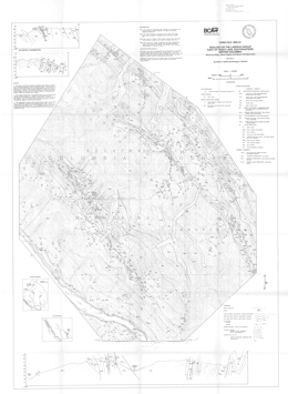
M.T. Smith and G.E. Gehrels
Open File 1990-24 presents the most recent geological mapping at 1:25 000 scale of the Lardeau Group in the Silvercup Ridge, Mount Wagner and Mount Aldridge areas near Trout Lake (NTS 82K/11) in southeastern British Columbia. The Open File contains a highly detailed stratigraphy and several structural cross sections which shed new light on the geology of the area. The most significant interpretation is that the contact between the Lardeau Group and the underlying strata of the Badshot, Mohican and Marsh Adams formations is not a depositional contact as previously assumed but a shear zone up to a few kilometres wide which considerably disrupts the original stratigraphy.
The area was mapped as part of a regional study of the Lower Paleozoic eugeoclinal strata and their contact relations with miogeoclinal strata in the Kootenay Arc. The objective was to gain un understanding of the Lower Paleozoic evolution of the ancient Cordilleran continental margin and the deformational and accretionary history of the Kootenay Terrane. The Lower Paleozoic Lardeau Group underlies much of the Kootenay Arc. It is transitional in age and in structural position between autochthonous Precambrian to Lower Cambrian passive margin strata, and Late Paleozoic to Mesozoic arc terranes of uncertain paleogeographic affinity.
Lower Cambrian strata are the oldest rocks exposed in the map-area. They consist of the sedimentary member of the Marsh Adams Formation, green phyllite and minor limestone of the Mohican Formation, grey marble of the Badshot Formation and a black phyllite and argillite unit that overlies the Badshot Formation.
Lower Paleozoic rocks of the Lardeau Group include the Index Formation, Triune phyllite, Ajax quartzite, Sharon Creek phyllite, Jowett volcanics and the Broadview Formation. From old to young, the Index Formation consists of quartzofeldspathic sandstone, black siliceous argillite, black and grey phyllite, undifferentiated grey, green, and black phyllite, turf; and carbonate, green, grey, and black phyllite, grey carbonate, green phyllite and metatuffs, and pillow basalt. An undifferentiated siliceous argillite and phyllite unit separates the Index Formation and Triune phyllite, which consists of black siliceous argillite, chert, and phyllite. The Ajax quartzite, which is massive grey quartzite, is overlain by the Sharon Creek phyllite, which consists of black siliceous argillite, chert, and phyllite. The Jowett volcanics consist of metamorphosed mafic tuff; pillow basalt, and undifferentiated greenschist. The top of the Lardeau Group is the Broadview Formation. It consists of marine volcanic rock, marble lenses, black and grey phyllite, green, gritty quartzofeldspathic metasandstone and phyllite.
Intrusive rocks in the area include Cretaceous or older ultramafic rocks, including talc schist, pyroxenite and serpentinite, and coarse gabbroic as dikes and small stocks. Cretaceous felsite dikes also occur.
The most important mineral occurrences in the general area are Shuswap-type lead-zinc-silver deposits. Most deposits were discovered before 1900, and a great deal of the exploration and mining was done before 1920. In the Fergusson area, for example, total production amounts to 44,259 tons. Gross contents: Gold, 6,941 ounces: silver, 2,205,383 ounces; copper, 5,439 pounds; lead, 9,056,174 pounds; zinc, 435,033 pounds.
As early as 1903, it was recognized that the mineral deposits in the Lardeau district fall into three belts - the lime dyke belt, the central mineral belt, and the southwest mineral belt (see Bulletin 45). The most common deposits in the lime dyke belt contain galena in siderite, which has replaced Lade Peak limestone and limestones in the Index formation. More than 85 per cent of the ore mined in the Ferguson area came from the central mineral belt. The polymetallic veins of the Silver Cup, Triune, Nettie L, and True Fissure mines account for most of the production. These deposits are veins and lodes containing galena, argentiferous tetrahedrite, sphalerite, and locally chalcopyrite.

J.T. Fyles
Open File 1990-25 portrays the geology of the Greenwood – Grand Forks area in southern British Columbia. The report gives details of the formations and contains eleven measured stratigraphic sections. It presents the geology and the structural style in a modern context and gives new information that will be important to mineral exploration in the well-known Boundary mining camp.
The Greenwood - Grand Forks area contains Late Paleozoic and Mesozoic volcanic and sedimentary rocks, which are intruded by Mesozoic plutons and unconformably overlain by Tertiary volcaniclastic and flow rocks. The pre Tertiary stratiform rocks are contained in a series of five, north-dipping thrust slices with bounding faults, which are marked at many places by layers and lenses of deformed serpentinite. These thrust slices lie above high-grade metamorphic complexes, which are exposed to the south in northern Washington and to the east beyond the Granby River fault.
This publication consists of a 1:50 000-scale geological map with cross sections, accompanied by a 19-page report covering the geology of the Rock Creek - Greenwood - Grand Forks area, in southern British Columbia.
The focus of the mapping was to provide a geological framework for the interpretation of mineral deposits in the area. The Paleozoic Knob Hill Group comprises most of the pre Tertiary rocks in the area. It is a thick assemblage of mainly greenstone and chert. The volcanics are dominantly pillow lavas and breccias, and agglomerates derived from them. Dioritic intrusions and altered serpentine or listwanite are included in the Knob Hill Group. Unconformably over the Knob Hill rocks are sediments of the Middle Triassic Brooklyn Formation. There is a lower unit of chert-pebble conglomerate and chert breccia, and an upper unit of limestone, siltstone, sandstone, limestone conglomerate and skarn. Above a disconformity, is an Early Jurassic fragmental greenstone. These rocks are intruded by the Jurassic and Cretaceous Nelson plutonic rocks. These comprise feldspar porphyry, granodiorite and quartz diorite. Unconformably overlying all the older rocks are rocks of the Tertiary Penticton Group. A lower package of feldspathic and lithic tuffaceous sandstone, conglomerate and siltstone is overlain by mainly flows of andesite, trachite and phonolite and intruded by dikes, sills and small plutons of alkaline syenite.
Tertiary faults dominate the structure of the area. They bound the Tertiary rocks and are often filled by Tertiary dikes. The most important are listric normal faults but later block faults predominate.
A.J. Pope
Open File 1990-26 presents the results of 10 months of fieldwork undertaken from 1985 to 1987, in the Toby-Horsethief Creek area (NTS 82K) of the northern Purcell Mountains, west of Invermere in southeastern British Columbia as part of a Ph.D. thesis. An area of 800 square kilometres was mapped at a scale of 1:15 000) and a total of 4300 metres of stratigraphic section was measured. This report summarizes the geology known as a result of research into the stratigraphic and structural controls on metallogeny in the Horsethief Creek area.
Particular emphasis is given to the stratigraphy of the Upper Belt Purcell Supergroup and to detailed descriptions of the main lead, zinc, silver and copper occurrences in the area. The report concludes with a summary and discussion of the controls on mineralization within the map area.
The report is accompanied by a 1:50 000-scale geology map with corresponding stratigraphic-structural cross sections and a 1:50 000-scale mineral occurrence map.
Open File 1987-8 is a 1:50 000 scale map that depicts the geology, stratigraphy and structure of the west half of the Skookumchuck map area (82G/13W). The area contains a number of lead-zinc-silver vein occurrences and Creston rocks have potential for red bed copper-silver deposits. The mapping improved correlation between Dutch Creek-Mount Nelson rocks to the north and Gateway-Phillips and Roosville stratigraphy to the south.
Belt-Purcell Supergroup rocks in the area include the: Van Creek Formation, Lower Gateway Formation, Dutch Creek Formation, Mount Nelson Formation (Lower Quartzite, Lower Main Dolomite, Middle Quartzite, Orange Dolomite, White Markers, Purple Sequence, Upper Middle Dolomite, Upper Quartzite, and Upper Dolomite).
Windermere Supergroup rocks include the Toby Formation (Boulder Breccia lithofacies, Diamictite lithofacies, Sparse Clast Diamictite, and Siltstone-Argillite lithofacies), Horsethief Creek Formation (Black Carbonate, Siltstone-Argillite lithofacies, Dolomite, Quartz Feldspar Arenites and Pebble Conglomerates, and Red and Varicoloured Argillites).
Lower Paleozoic rocks include the: Lower Cambrian Cranbrook Formation, Middle Cambrian Jubilee Formation, and Ordovician-Silurian Beaverfoot Formation. Upper Paleozoic strata include the Mount Forster Formation and the Starbird Formation.
Thrust faulting is important in the area. Major faults include the Mount Nelson, Mineral King, and Mount Forster thrust sheets. Deformation Phases include Helikian to Devonian extension, Jurassic to Paleocene ‘Columbian-Laramide’ contraction, and Eocene extension.
Igneous rocks in the area are the Toby volcanics, green metadiabase dikes, Devonian volcanics, lamprophyric to kimberlitic dikes and the Horsethief Creek granite. The granitic body is largely quartz monzonite.
Mineral occurrences include stratabound massive replacement (manto) lead-zinc-silver-iron sulphide deposits occur in dolomites of the upper Belt-Purcell Supergroup, examples are the Mineral King mine and the Paradise mine. Veins, including: ferroan dolomite breccia; stratabound fault veins can be very rich and occur mainly in dolomites of the upper Belt-Purcell Supergroup; examples are the Ptarmigan mine, Kootenay King mine, Silver Queen mine and other deposits; stratabound fracture veins with silver-lead and copper-barium mineralization also occur mainly in dolomites of the upper Belt-Purcell Supergroup; an example is the Copper King mine; Mississippian-type deposits, as the Falcon prospect; and stratiform disseminated zinc-lead-deposits with or without silver and iron values.
K.D. Hancock
This Open File report records the most significant mafic-ultramafic-associated chromite and nickel occurrences in British Columbia. Its primary focus is the chromite occurrences in the province, however, due to the mineralogical association of platinum group metals and nickel with ultramafic rocks, they are also included where appropriate.
All known chromite and nickel occurrences are compiled, using the MINFILE database as the initial data set. Geological information available to the BC Geological Survey was evaluated for reported occurrences and they were then divided into two groups. The first group includes all deposits where sufficient data are available for concise descriptions including location, geology, mineralization, history and current claims, if any. These occurrences are grouped by genetic classification andgeographic location. The second group is listed by MINFILE number and geographical coordinates in an appendix, as sufficient geological information is not available or the occurrence is not appropriate for inclusion in the body of this report.
W.K. Fletcher
Open File 1990-28 examines stream sediment geochemistry and heavy mineral surveys in gold exploration. The purpose of this report is to summarize and present the findings of studies conducted from 1985 onward in a convenient form that emphasizes their practical implications for use of stream sediment surveys in gold exploration. The report is divided into three main sections: (i) size distribution of gold in sediments; (ii) distribution among bed-forms and along longitudinal profile; and (iii) seasonal variations in gold concentrations.
Part A by J.M. Moore and A.R. Pettipas; Part B by R.E. Myers and T.B. Hubner
Open File 1990-29 is a 30-page report detailing the geology and mineral deposits of the Nicola Lake region (NTS 92I/SE). Geology is presented at 1:250 000, 1:100 000 and 1:50 000 scales for various areas.
Since the late 1800s the region around Nicola Lake has been known for its varied mineral deposits concentrated in the Stump Lake, Swakum Mountain and Iron Mountain areas. Over 200 mineral occurrences are documented in this small area but only one major producing mine, the Craigmont copper-iron skarn deposit, has been discovered. Because of easy access, proximity to the Highland Valley camp and wealth of encouraging prospects there is potential for further significant discoveries, particularly for copper porphyries and precious and base metal skarns.
Early geological studies established that the mineral occurrences are largely hosted by a thick, Late Triassic volcanic assemblage, the Nicola Group. It is complex and underlies an area of relatively low relief and limited exposure compared to much of the Cordillera; earlier studies failed to established the internal structure and stratigraphy with any certainty. However, recently the LITHOPROBE Southern Cordilleran Transect was routed through the Highland Valley and Nicola Lake areas. This report presents the results of new geological mapping and compilation, undertaken in 1988, initially to provide an adequate database for interpretation of the LITHOPROBE seismic data, and extended in 1989 from the transect line to better understand parts of the Nicola Group that had not been systematically mapped since the 1940s.
In the southernmost part of the map area and to the south, toward Princeton, the Nicola rocks have been divided into three “belts” by Preto (1979) that contain distinct facies and assemblages. The western belt is an easterly facing succession of calcalkaline, mainly plagioclase-phyric andesitic flows and breccias, with lenticular interlayers of limestone and bedded volcaniclastic rocks. Although flows are more abundant relative to clastic facies in the western part of the belt that is not evident on Swakum Mountain where sedimentary facies can be found throughout its entire width. The alternation of thick successions of massive uniform green flows and unsorted breccias with bioclastic limestones, volcanic conglomerate and local subaerial volcanic facies such as maroon scoriaceous breccias testifies to deposition near a rapidly fluctuating shoreline. Local felsic centres contain dacite and rhyolite flows, welded tuff and breccia, with intercalated heterolithic, intermediate to felsic volcaniclastics.
The central belt, as represented in the south-central part of the map area and probably in the extreme northwest, comprises mainly augite and plagioclase phyric basaltic flows and associated breccias. These are largely submarine and of alkalic composition; probable correlatives near Logan Lake are among the very few occurrences of pillow lava in the Nicola Group. Subvolcanic intrusions of diorite and gabbro are abundant in the central belt.
The eastern belt facies consists almost entirely of mafic augite-phyric volcaniclastic rocks, ranging from coarse, probably laharic, breccias to fine wacke and siltstone; coarse facies predominate. In the fault blocks between the Nicola horst and Stump Lake there are thick successions of turbidite wacke. Fine-grained sedimentary facies of the Nicola Group, underlying the Meander Hills and the Douglas Lake area, are medium to thin-bedded wacke, siltstone and mudstone. An assemblage of red-brown, plagioclase-phyric subaerial andesitic flows and volcaniclastic rocks that lies at the south edge of the map area, in the vicinity of Mount Nicola, contrasts with the surrounding Nicola Group facies, from which it is separated by faults and Jurassic Ashcroft Formation sedimentary rocks. Originally assigned to the Kingsvale (now Spences Bridge) Group and later to the Nicola Group (central belt), these rocks have yielded one questionable Jurassic fossil locality but remain of uncertain age. Similarity to a few of the Nicola units on Iron Mountain, and the presence of one copper prospect suggest that the succession may be an emergent part of the western Nicola belt.
The Nicola Group rocks have been intruded by Triassic and Jurassic plutons, of which the Guichon Creek batholith is the largest and most important from the metallogenic standpoint. The stratified rocks are complexly faulted and regionally metamorphosed, typically to low greenschist facies.
The Nicola Group is overlain unconformably by clastic and volcanic rocks ranging in age from Jurassic to Tertiary, that are less altered but rotated to steep attitudes on mainly extensional faults. Clastics correlated with the Early and Middle Jurassic Ashcroft Formation are mostly unlayered, poorly sorted coarse conglomerate, with discontinuous interbeds of pyritic, rusty weathering sandstone and siltstone. In the Swakum Mountain area there is a grey, commonly fetid bioclastic limestone, up to 200 metres thick, near the base of the formation. Clasts in the conglomerate consist mainly of volcanic rocks resembling the Nicola Group, and granitic and dioritic boulders. At several localities a chert-pebble conglomerate, containing distinctive green clasts, overlies the polymictic conglomerate and may be of Cretaceous age; however chert-bearing units are also found near the base of the succession, so the chert-clast conglomerate may also be Jurassic. Andesitic volcanic rocks of the Cretaceous Spences Bridge Group occupy the southwest corner of the area. Eocene clastic sediments ("Coldwater beds"), that include coal at Merritt and Quilchena, and volcanic rocks (Kamloops and Princeton groups) occupy fault-bounded depressions; the Kamloops Group also underlies the highlands bounding the area on the northeast. The volcanic rocks are predominantly basalts and andesites, but rhyolitic centres occur north of Stump Lake and east of Guichon Creek.
The Nicola horst is a major structure bounded by Tertiary faults. It contains Nicola strata (comparable to central and eastern belt facies) and quartzite (metachert?), metaconglomerate and black schist of unknown age that are penetratively deformed and metamorphosed to amphibolite facies. These are cut by a variety of plutonic rocks ranging from metagabbro and tonalite to granite. The youngest, and the only body that has escaped penetrative deformation and recrystallization, is the Paleocene Rocky Gulch granodiorite.
The oldest strata that are consistently flat lying are Miocene Chilcotin basalts that occur northeast of Lac Le Jeune and probably in smaller outliers elsewhere. These flows are difficult to distinguish from the Pleistocene and Recent "valley basalts" that once filled the major drainage channels of the area, and now occur as remnants in the Nicola and Quilchena valleys. The tectonic history of the area is dominated by brittle deformation. Only in the Nicola horst are penetratively deformed rocks encountered; these exhibit westerly plunging stretching features that are probably related to accretion of the Nicola arc in Mesozoic time. Most of the Nicola rocks are steeply tilted but not penetratively strained except near small shear zones and, although a few mesoscopic folds were seen, top criteria indicate that the strata face east, implying that blocks have been rotated on listric faults. In the Swakum Mountain area discontinuities along strike of the Nicola rocks imply an easterly striking fault, but in general the breaks must be oriented in a northerly direction. The Ashcroft strata occupy northwest to north-striking slices, bounded on their easterly sides by faults presumed to be normal. Major northwest trending lineaments are also seen within the Nicola rocks (e.g. Rey Creek valley). These structures are transected by northerly striking Tertiary fault systems in the Nicola River, Guichon, Clapperton and Quilchena Creek valleys; along these faults Eocene sedimentary and volcanic strata have been rotated to dips approaching the vertical, and the Nicola horst elevated relative to its surroundings. These faults are part of a regional system of Eocene extensional features, proposed by Ewing (1980) and elaborated by Monger and McMillan (1989). Where exposed, as in road cuts along the Coquihalla Highway and Nicola Lake, the fault zones exhibit intense shattering, veining and local alteration.
In the area, five main groups of mineral deposits occur. Skarn-hosted copper-iron deposits with or without gold formed near Jurassic intrusives; porphyry-style copper-gold and copper-molybdenum deposits associated with Triassic-Jurassic and younger plutons, lead-zinc-barite deposits within Nicola felsic volcanics and volcaniclastic rocks, precious metal-bearing quartz veins as lodes or epithermal veins, and stockwork quartz-carbonate veins with gold-silver-copper-lead-zinc mineralization.
The Swakum area is of particular interest for two principal deposit types, both polymetallic: copper-bearing skarns, and lead-zinc-copper-silver-gold quartz-stockwork veins associated with iron-rich carbonate alteration zones, both within and outside the skarn zone. The former type is exemplified by the Lucky Mike, where copper is accompanied by subordinate tungsten, silver, gold, lead and zinc. Old Alameda and the other deposits are of the latter type.
Magnetite-copper skarn deposits occur along the southern border of the Guichon Creek batholith. Craigmont mine produced more than 29 million tonnes averaging 1.37 percent copper with gold and silver values.
Most of the few mineral occurrences in the Nicola horst are copper showings, with anomalous gold, associated with the metadiorite and included metabasalts near Nicola Lake. Molybdenum occurs on the Turlight property, and also in pegmatites cutting meta-Nicola volcaniclastic rocks near the north end of the horst.
B.J. Johnson
Open File 1990-30 portrays the geology adjacent to the western margin of the Shuswap metamorphic complex in parts of NTS sheets 82L and 82M. A 1:100 000 scale geology maps accompanies the report.
The boundary of the Shuswap metamorphic complex has long been recognized as a sharp transition between upper amphibolite fades rods within the complex and rocks of greenschist facies that overlie it. Mapping and geochronology during the - decade have demonstrated that the Shuswap and other metamorphic complexes in the southern Omineca Belt are bounded by Eocene normal faults which juxtapose rocks of different metamorphic grades and with different cooling histories. The present work undertaken as part of a Ph.D. study focused on the Eagle River fault, and the Shuswap complex, which forms its footwall, in the Shuswap-Adams Lake area.
Detailed mapping has identified stratigraphic successions in both the hanging and footwall of the Eagle River fault, which will allow comparison with known miogeoclinal strata in other parts of the southern Omineca Belt. These data have implications for exploration in the Omineca Belt and for construction and restoration of crustal cross-sections through the Omineca Belt.
The west margin of the Shuswap metamorphic complex is bounded by low to moderate-angle, ductile-brittle, west-side-down, Eocene normal faults of the Okanagan - Eagle River fault system, which between 50 30'N and 51030'N latitude juxtapose upper amphibolite facies rocks of the Shuswap assemblage against greenschist to lower amphibolite facies rocks of the Eagle Bay and Mount Ida assemblages. The Shuswap assemblage contains a succession of migmatitic semipelite, psammite, calcareous amphibolite, calcsilicate gneiss and marble that is inferred to be correlative with the Hadrynian Horsethief Creek Group. The Eagle Bay and Mount Ida assemblages contain quartzite, semipelite, marble, calcsilicate schist, metabasite, and calcareous and graphitic phyllites that are interpreted to be correlative with uppermost Hadrynian to lower Paleozoic rocks of the Hamill Group, Badshot Formation and Lardeau Group.
Compositional layering and subparallel S1 foliation in all three assemblages are folded by tight to isoclinal, recumbent to gently inclined, synmetamorphic D2 folds. The metamorphic peak predated or was synchronous with development of upright (in the Eagle Bay) to moderately inclined (in the Shuswap), gently northwest and southeast plunging D3 folds. S3 crenulation cleavage is well developed in the Eagle Bay and Mount Ida assemblages and in the Shuswap assemblage near Adams Lake.
Footwall mylonites in the Eagle River and northern Adams Lake segments of the Okanagan - Eagle River fault system consistently display west-directed shear sense and are overprinted by retrograde metamorphism and cataclasis beneath a brittle detachment. In the Scotch Creek segment, strain is partitioned in a zone of ductile-brittle and brittle faults that strike at low angles to the shearing direction.
D.G. Bailey
Open File 1990-31 presents the geology of the central Quesnel belt in central British Columbia (Parts of NTS 93A, 93B, 93G & 93H). It consists of a 1:100 000-scale geological map accompanied by a short set of notes on the geology and mineral occurrences within the map area. The map mainly covers the volcanic stratigraphy of the Central Quesnel belt and is compiled from work by Bailey between 1976 and 1989 and by Panteleyev (1987, 1988) and Panteleyev and Hancock (1989).
The Central Quesnel belt comprises a portion of Quesnellia, a predominantly Mesozoic terrane which, during the Upper Triassic -Lower Jurassic, developed as a volcanic island arc to the west of Mesozoic North America. Subsequent northeasterly movement of Quesnellia, during the Lower Jurassic, ended with the accretion of the volcanic arc and associated sedimentary facies along with underlying oceanic crust (Crooked Amphibolite or Slide Mountain Terrane) on the Omineca Belt to the east.
The lowermost stratigraphic unit (unit 1) in the map area consists mainly of fine-grained epiclastic sedimentary rocks but towards the top volcaniclastic rocks become more common. The age of this unit ranges from Anisian to Carnian. It consists of dark grey pelite with psammitic interbeds that are exposed both to the east and west of the central volcanic terrane. Towards the top of the unit mafic volcanic material commonly occurs within psammitic strata along with conglomerate beds in which occur basaltic clasts of similar composition to the overlying rocks (Unit 2). These rocks, along with lenses of basaltic breccia intercalated within the sedimentary rocks, indicate the onset of basaltic volcanism probably during the Carnian Stage of the Upper Triassic.
Unit 2 represents the oldest entirely volcanic unit within the Central Quesnel belt and is mainly composed of alkali basalt. The lowermost rocks of this unit comprise green and grey olivine and pyroxene-bearing pillow basalt, basaltic breccia, and tuff deposited under probably relatively deep marine conditions. Overlying these rocks is a basaltic subunit characterized by its maroon colour and vesicular nature although it is generally of the same composition as the underlying basalt. Tuff and volcaniclastic sandstone interbeds occur within the subunit, especially towards the top. In places this subunit is overlain by a polylithic breccia horizon, dominated by mafic clasts but with scattered clasts of more felsic compositions. The youngest volcanic rocks of Unit 2 consist of analcite-bearing basaltic breccia in which analcite is prominent as euhedral phenocrysts up to two centimetres in diameter.
Unit 3 is composed of a variety of volcanic breccias including polylithologic "slump" breccias, crystal and crystal-lithic tuff and tuff breccia, and, volcanically derived sandstone and siltstone with intercalated breccia horizons. However, all of these rocks are characterized by felsic volcanic debris, while felsic clasts are absent or rare in breccias of the underlying Unit 2. Lithologies range from basalt derived from underlying strata, through more intermediate compositions (andesite or latite) to trachyte. While clasts are generally volcanic, clasts of intrusive rocks such as diorite, monzonite and syenite also occur within the breccia pile, especially in proximity to plutons. Unit 3 ranges from Sinemurian to possibly late Lower Jurassic.
These stocks are interpreted, for the most part, as representing the centres of lower Jurassic volcanoes. Coarse breccias proximal to these centres grade into conglomerate, sandstone and siltstone deposited in small intervolcanic basins distal to the centres.
Maroon analcite and olivine-bearing basalt of unit 4 crop out from the south bank of the Quesnel River in the north, to near Horsefly in the south. This basalt was erupted subaerially and represents the last volcanic event related to the development of the Triassic Jurassic arc of Quesnellia in the Central Quesnel belt. Unlike analcite-bearing basalt of Unit 2, in which analcite phenocrysts are generally large and white or grey in colour, the analcite phenocrysts of Unit 4 are very small and brown, pink or red. Unit 4 is younger than the Canadense zone of the Sinemurian and possibly older than the Pleinsbachian of Unit 5.
Unit 5 comprises epiclastic sedimentary rocks deposited in a post-volcanic basin that developed along the eastern side of the volcanic arc. These sedimentary rocks are similar to those of Unit 1, consisting of medium to dark grey siltstone and sandstone, but differ in the common development of syngenetic pyrite, suggesting euxinic depositional conditions. The oldest possible age of Unit 5 is Pliensbachian. However, its stratigraphic position is similar to that of Unit 6, which is possibly Bajocian in age.
Unit 6 consists of grey and maroon polylithologic conglomerate characterized by clasts of granite and of rock of continental provenance as well as clasts from the underlying strata. This unit unconformably overlies both the Cache Creek Group to the west of the map area, and Quesnellia and, thus, ties the two terranes together. This unit is probably Bajocian in age, by comparison with similar rocks outside the map area.
Unit 9, formerly mapped as Lower Jurassic is now considered much younger, possibly Upper Jurassic or Cretaceous. The unit comprises polylithologic conglomerate with local fining-upwards sequences of carbonaceous mudstone, sandstone and conglomerate typical of a fluvial or estuarine environment. Clasts range in composition from rocks typical of the Cache Creek Group (greenstone, argillite, limestone) to those possibly derived from the Omineca Belt. Clasts of the underlying Upper Triassic -lower Jurassic volcanics are also present.
Unit 10 consists of intermediate to felsic volcanics and sedimentary rocks of Eocene age. The volcanics in part resemble those of the lower Jurassic (Unit 3) but they can be distinguished by the presence of primary biotite. Outcrop distribution of Unit 10 strongly suggests an unconformable relationship with older rocks. A subunit consists of grey, fine-grained sediments in which Eocene fossil fish have been identified
Unit 11 is widespread across south-central British Columbia and consists of Miocene alkali plateau basalt. In the map area the basalt consists of grey and maroon, subhorizontal subaerial flows and tephra and is distinguished from basalt of units 2 and 4 by its attitudes and the presence, locally, of ultramafic xenoliths. These xenoliths are commonly orthopyroxene-bearing.
Two groups of intrusive rocks occur within the map-area; those associated with Upper Triassic-Lower Jurassic volcanism (unit 7), which are of alkalic compositions; and those related to a period of probable Cretaceous calcalkalic magmatism. The alkalic intrusions consist of pyroxene-bearing diorite, monzonite and syenite with minor amounts of clinopyroxenite, peridotite and gabbro. They generally represent subvolcanic intrusions formed in, or near, volcanic centres from which the volcanics of Unit 3 were erupted. Unit 7 intrusions are commonly host to copper (±gold) deposits like Mt. Polley (Cariboo-Bell).
Unit 8 consists of granodiorite, quartz monzonite and granite and probably formed during the same period of magmatism that gave rise to the Cretaceous Naver plutonic suite to the north.
The structures of the Central Quesnel belt can be separated into two groups, those formed during accretion of Quesnellia with North America and those which postdate this event. The collision of Quesnellia with North America resulted in folding about northwesterly-striking axes. These folds are best developed in Unit 1 sediments but are also well developed in sedimentary rocks of Unit 2, especially in Morehead Creek, south of Quesnel River in the centre of the map area. Volcanic rocks, probably because of their more massive character, do not display folds although folding of these rocks is assumed. Early folds in the eastern part of the map area have been refolded about north-easterly-striking axes. While a penetrative fabric is associated with the early folds, later folds have no accompanying penetrative fabric although an S2 crenulation cleavage has developed. At least three periods of faulting have occurred in the map area. Earliest faults are those formed in response to accretion of Quesnellia with North America and are generally low-angle thrust faults. The major thrust in the region is the Eureka thrust. The hangingwall consists of rocks of the Crooked Amphibolite overlain by Unit 1 sedimentary rocks, while the footwall consists of rocks of the Barkerville Terrane (Struik, 1983). Within the Central Quesnel belt smaller thrusts have been recognized, all with the same easterly or northeasterly sense of vergence as the Eureka thrust.
Of the 47 mineral occurrences documented in the map area, and listed on the accompanying map, almost half are related to Upper Triassic-Lower Jurassic plutonism and associated volcanism. Economically the most important deposits and occurrences arc within, or adjacent to, alkalic felsic stocks. Consisting of copper with associated gold (or in the case of OR, gold with associated copper), they have been the main targets of exploration within the map area. The largest of these deposits is the Mt. Polley copper-gold porphyry deposit, with stated mineable reserves of 51 400 000 tons at 0.38% copper and 0.55 gram per tonne gold. This deposit occurs within the felsic intrusive complex of the Lower Jurassic Mt. Polley stock. The QR deposit, located on the north side of the Quesnel River, is also associated with a Lower Jurassic alkalic felsic stock but, unlike Mt. Polley and other similar occurrences throughout the map area, it lie outside the stock within carbonate-altered mafic volcanic rocks. The QR deposit has a reported mineral inventory of 1.5 million tonnes of 5.00 grams per tonne gold,
Other mineral occurrences within the central volcanic portion of the Central Quesnel belt that are related to intrusive rocks are occurrences of copper with molybdenum within quartz-bearing calcalkalic stocks. Base and precious metals also occur within fine-grained sedimentary rocks of Unit 1 within quartz veins that occupy extensional fractures.
Gold placer deposits in fluvial sediments of the Quesnel River and its tributaries, such as Cottonwood River and Maud Creek, have been worked intermittently since the 19th Century. The largest deposit of this type was that of the Bullion Pit, near Likely, where gold was recovered from gravels within an early channel of the Quesnel River.
L.D. Jones
Scale 1:2 000 000
The geological diversity of British Columbia provides a wide variety of settings for the occurrence of uranium and thorium. The Victoria deposit, a gold-silver-cobalt-molybdenum occurrence south of Hazelton, contains uraninite erratically distributed in narrow veins in granodiorite. The Little Gem deposit, located near Gold Bridge, contains uranium, gold and cobalt in veins within granodiorite. The Verity prospect, near Lampriere, contains uranium-bearing pyroclore in carbonatite. Uranium and thorium occur in amphibolite at the Husselbee showing, located on the west side of Atlin Lake. To the east, north of Surprise Lake, metazeunerite occurs in shears within quartz monzonite at the Purple Rose showing. The Rexspar uranium deposit is in volcanic rocks north of Kamloops. The Vowell and Malloy creek placers of the Bugaboo area contain uranium and thorium minerals in stream gravels produced from erosion of quartz monzonite rocks. The Blizzard, Cup Lake, Hydraulic Lake, Haynes Lake, Fuki and other stratabound, basal uranium occurrences lie in fossil stream-channel sandstones and conglomerates in the Okanagan Highland and are between 1 and 4 million years of age. Even younger deposits, which are still forming today, include the many surficial uranium-enriched post-glacial organic-rich basins located along the west side of Okanagan Lake. They include the Prairie Flats, Covert Basin, Sinking Pond and North Wow Flat occurrences.
Of the 182 known uranium and thorium occurrences in British Columbia, only a few have the hold the grade and tonnage to have economic potential. These include the Rexspar deposit, some of the stratabound, basal deposits and possibly the placer and surficial deposits. Total in situ uranium in British Columbia is estimated at over 7400 tonnes of uranium.
However, due to the availability of high-grade large-tonnage deposits elsewhere in the World and Canada, such as those in northern Saskatchewan, uranium production from deposits in British Columbia may not be economically feasible in the foreseeable future.
The main purpose of this report is to document the known uranium and thorium occurrences. The information may be useful to geological researchers and explorers, land use planners and environmental health planners.
A. Legun
This project provides a stratigraphic framework for interpreting of the geology of the Gething Formation in the southern portion of the northeast British Columbia coalfield which lies between the Sukunka River and Kinuseo Creek. The study area is covered by NTS map sheets 93P/1 to 8 and 93I/14 and 15, but focuses on a slightly smaller area that excludes 93P/1, 7 and 8 (Figure 1). The study integrates data from the Plains, largely from oil and gas wells, with Foothills data from coal exploration work. The area potentially underlain by economic coal measures roughly coincides with the surface exposure of the Gething and Moosebar Formations within the Foothills, as illustrated by Figure 2, which is based on mapping by Kilby et al., (1989). Figure 2 also illustrates the distribution of the stratigraphic data used in the study.
