Fire danger
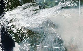
Weather has a significant impact on wildfires – in how they start, how aggressively they spread, and how long they burn. Find out the current fire danger rating in your area and other information about fire weather.
The BC Wildfire Service operates about 260 weather stations, which send reports on an hourly basis. These hourly weather observations, supplemented by data from other agency stations, support fire weather forecasting and the Canadian Forest Fire Danger Rating System (CFFDRS).
The computer-based CFFDRS is the primary fire management decision aid in Canada. With it, fire managers can assess the potential for ignition, spread and burning intensity. This information is used for making fire prevention, preparedness and suppression decisions, as well as other general fire management decisions.
Temperature, relative humidity, precipitation, wind speed and wind direction are recorded by the fully automated stations. This data is transmitted to BC Wildfire Service headquarters every hour from April through October, but less frequently and from fewer stations during the winter months. Data from other agencies’ weather stations is also used and transferred electronically to headquarters.
Fire danger rating
The fire danger rating (the risk of a wildfire starting) for the province is updated daily at approximately 2 pm.

What the danger class ratings mean
Low: Fires may start easily and spread quickly but there will be minimal involvement of deeper fuel layers or larger fuels.
Moderate: Forest fuels are drying and there is an increased risk of surface fires starting. Carry out any forest activities with caution.
High: Forest fuels are very dry and the fire risk is serious. New fires may start easily, burn vigorously, and challenge fire suppression efforts. Extreme caution must be used in any forest activities. Open burning and industrial activities may be restricted.
Extreme: Extremely dry forest fuels and the fire risk is very serious. New fires will start easily, spread rapidly, and challenge fire suppression efforts. General forest activities may be restricted, including open burning, industrial activities and campfires.
NOTE: The danger class map is intended for general public information only. For regulated forest operations, the danger class value must be derived from weather data representative of the site on which operations are being conducted.
Where discrepancies exist between the colour display on the weather maps and the numerical values posted for the weather stations, the posted numerical values shall take precedence for the purpose of implementing the Wildfire Regulation.
Danger class report
A detailed danger class report provides estimated and forecast fire danger rating values for specific weather stations.
The danger class report is updated every day based on weather station data collected from around the province. To find out what the fire danger rating is near you, please select a region from the list below or view all regions.
Cariboo Fire Centre
Coastal Fire Centre
Kamloops Fire Centre
Northwest Fire Centre
Prince George Fire Centre
Southeast Fire Centre
Please note that the data within the danger class report is only relevant for the geographic location of the weather station. Persons carrying out industrial activities who want to apply the danger class information from this website must determine that the weather station location is representative of their operational area.
Find out about weather stations operated by the BC Wildfire Service, view weather maps showing the precipitation levels, wind speed, relative humidity and temperature across B.C. and read the latest seasonal outlook.

