Recreation Orders
Recreation Orders, written under Section 58 of the Forests and Range Practices Act (FRPA), allows the Ministry of Environment and Climate Change Strategy (ENV) to order the restriction or prohibition of recreation uses on Crown land.
Generally speaking, the orders are aimed at separating incompatible or conflicting uses, or attaching conditions to the manner in which uses occur to make them more compatible.
Section 58 orders, are referred to as “Recreation Orders,” and commonly issued to implement public recreation management provisions in a government approved land-use plan or recreation management plan or strategy.
In most cases, ENV/ Recreation Sites and Trails BC (RSTBC), Regional Managers will issue Recreation Orders only where:
- There is inter-agency agreement to do so
- Voluntary compliance has been unsuccessful
- There are resources to implement and effectively manage the order
- The RSTBC Regional Manager authority DOES NOT apply to the protection of range values
In establishing, amending or canceling Recreation Orders to control recreation uses on Crown land, Regional Recreation Managers follow procedural requirements set out in the Forest Recreation Regulation (e.g. public advertisement and notice).
ENV will employ Recreation Orders for the purpose of protecting and managing public recreation resources and uses on Crown land. By using Recreation Orders in a responsible and collaborative manner, ENV can help protect vulnerable public recreation values, and prevent or minimize public recreation conflicts on Crown land.
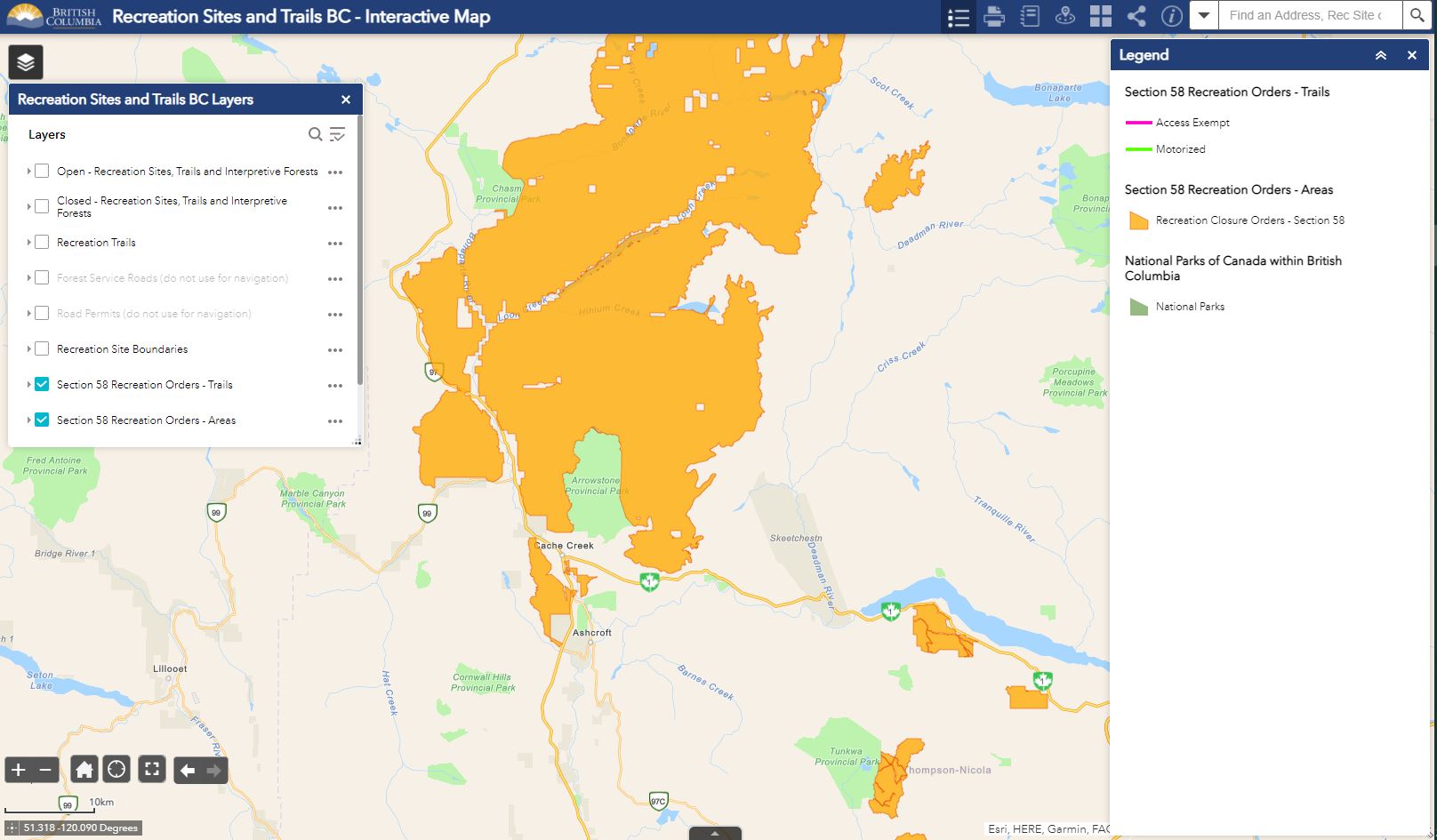
Recreation Orders can be viewed spatially on the RSTBC interactive map.
- Open the interactive map
- On the left hand toolbar, find the icon that looks like a stack of books (Recreation Sites and Trails BC layers)
- Open the layers and make sure there is a check mark beside these two layers:
- Section 58 Recreation Orders - Trails
- Section 58 Recreation Orders - Areas
If the text appears "greyed-out," it is because the map extent is too large. Zoom in the map and the layers become visible. The layers will also be identified on the map legend.
Provincial Recreation Orders administered by RSTBC are available in PDF format. The name of the order indicates the geographical reference point.
- Alexis Creek Recreation Trails (PDF, 30.6KB)
- Allan Creek (PDF, 123KB)
- Beyond Westridge (PDF, 28.9KB)
- Bonanza-Tyaughton (PDF 308.8 KB)
- Bone North (PDF 28.6KB)
- Boulder Mountain (PDF, 21.8KB)
- Bulldog (PDF, 28.6KB)
- Burnie-Shea Lakes (PDF, 668.6KB)
- Callaghan Valley (PDF, 253.7KB)
- Canoe North (PDF, 28.1KB)
- Canoe West (PDF, 28.3KB)
- Cedar (PDF, 28.1KB)
- Chief Gray Lake Trail (PDF, 25.4KB)
- Chilliwack River Valley (PDF, 264.6KB)
- Clearwater Forest District Walk-in Zones (PDF, 176.5KB)
- Cranbrook Community Forest (PDF, 135.1KB)
- Crater Mountain (PDF, 166.7KB)
- Dave Henry (PDF, 28.1KB)
- Dixon's Glacier (PDF, 28.5KB)
- Eagle Mountain (PDF, 29.5KB)
- East Fork (PDF, 27.9KB)
- Eastmere-Westmere (PDF, 15.5KB)
- Englishman Creek (PDF, 28.8KB)
- Forster Creek, Catamount Glacier and North Star Glacier (PDF, 48KB)
- Frisby Ridge (PDF, 22.6KB)
- Go Go Juice (PDF, 27.7KB)
- Gorman Lake (PDF, 22.6KB)
- John Hart Lake Community Watershed (PDF, 286.2KB)
- Jumbo Creek Area (PDF, 145KB)
- Keystone Standard Basin (PDF, 23.4KB)
- Kp'itl'els/Brilliant Flats (PDF, 166.1KB)
- Koocanusa Recreation Strategy Area (PDF, 27.5KB)
- Logan Lake Recreation Trails (PDF, 530.4KB)
- Manteau (PDF, 27.8KB)
- McCrae Lake Trail (PDF, 26.4KB)
- McLennan (PDF, 27.6KB)
- Mount Macpherson (PDF, 26.5KB)
- Nehalliston Plateau (PDF, 110.3)
- North Thompson (PDF, 28.1KB)
- Ole Sandbert Hut (PDF, 24.4KB)
- Placer Mountain to Boulder Lake (PDF, 27.9KB)
- Raft Recreation (PDF, 53KB)
- Ski World (PDF, 28.1KB)
- Small River (PDF, 29.1KB)
- Snowshoe Plateau-Yanks Peak (PDF, 32.3KB)
- Squamish Ashlu Elaho River Floodplains (PDF, 636KB)
- Stake Lake Area (PDF, 514.5KB)
- Swift Creek (PDF, 27.8KB)
- Tatla Lake Cross-country Ski Trails (PDF, 34.1KB)
- Telemark Cross-country Ski Trails (PDF, 157.1KB)
- Thunder Lookout (PDF, 28KB)
- Thunder Plateau (PDF, 28KB)
- Upper Spillimacheen (PDF, 334.6KB)
- Westridge (PDF, 37.6KB)
- Williams Lake River Valley (PDF, 203KB)
- Windfall (PDF, 27.9KB)
- Yellowjacket (PDF, 28KB)

