Monitoring aquifers: Provincial Groundwater Observation Well Network
The Provincial Groundwater Observation Well Network program collects and reports information about groundwater quantity and chemistry.
On this page
- Groundwater level monitoring
- Groundwater level data interactive map
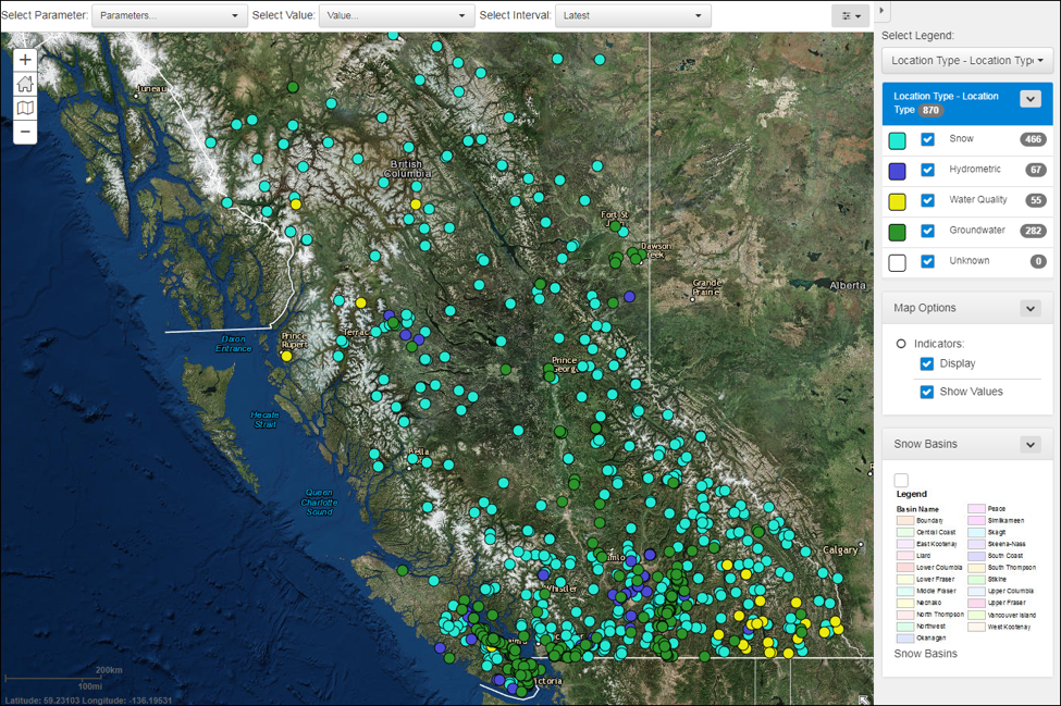
- Real-time water data tool
- British Columbia Drought Information Portal
- Environmental Monitoring System
There are over 240 active observation wells that provide data from various developed aquifers in B.C. The network was established in 1961, and archived data from previous years allows for the monitoring of groundwater patterns and trends.
- Read the program's vision, mission and objectives
- Learn more about the groundwater level data interactive map
- Browse a list of active groundwater observation wells
Groundwater level monitoring
Within the Provincial network, groundwater levels are continuously monitored using pressure transducers. Almost two-thirds of the observation wells in the network transmit information through satellite telemetry, allowing decision makers and the public to observe groundwater levels as they rise and fall in near real-time.
Groundwater level monitoring of the provincial network is guided by the PGOWN Operations Manual & Standard Operating Procedures which is available upon request by contacting Groundwater@gov.bc.ca.
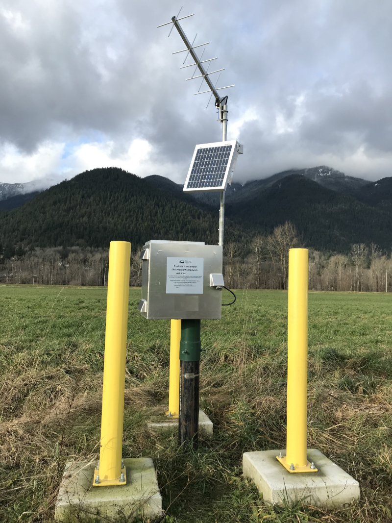
The photograph on the right shows a provincial groundwater observation well equipped with a datalogger and telemetry equipment.

Groundwater level data interactive map
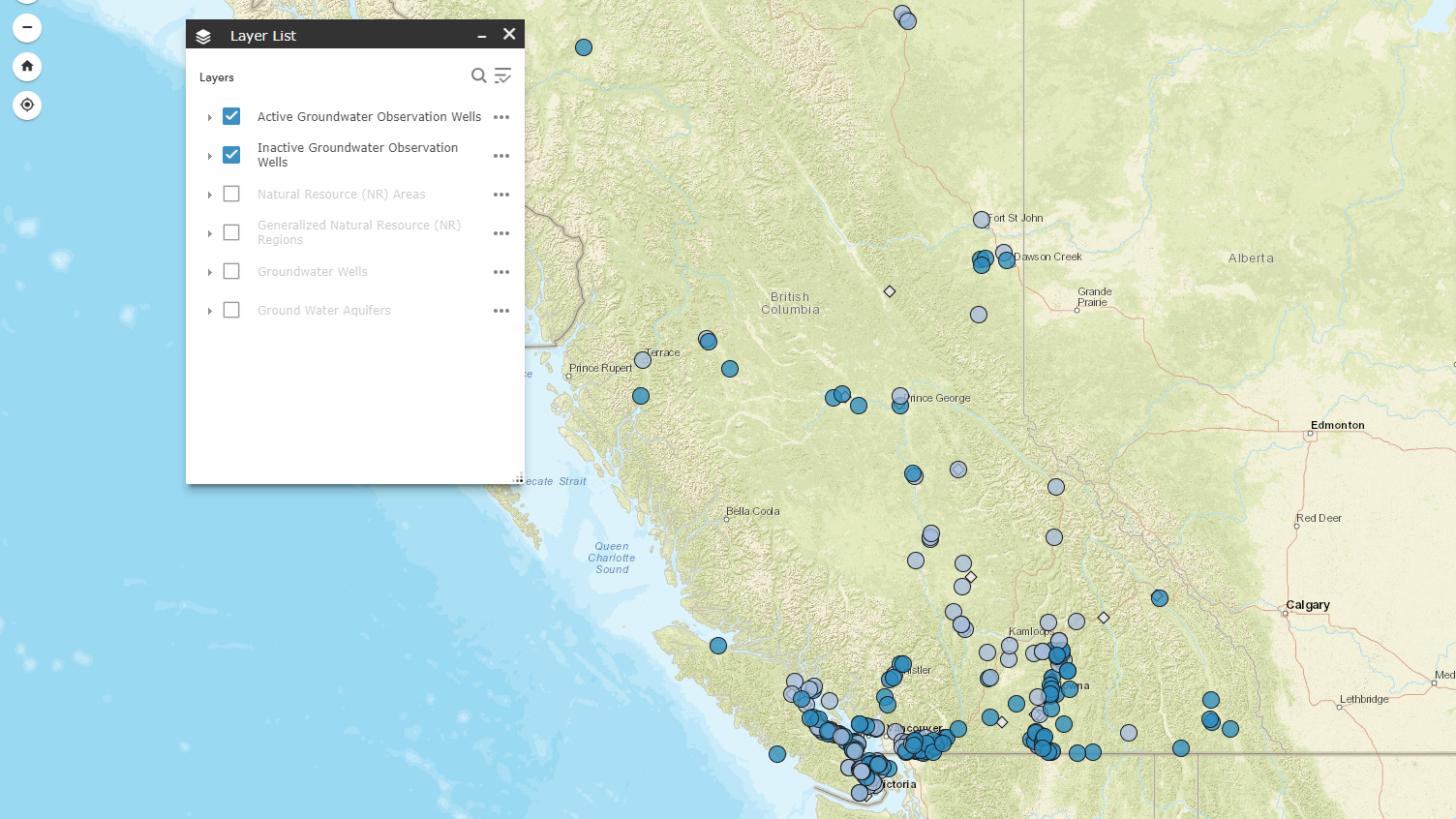
Find groundwater level data collected from observation wells throughout the Provincial network using this interactive map or browse through the list of active observation wells.
British Columbia Drought Information Portal
Drought is a recurrent feature of climate involving a deficiency of precipitation over an extended period of time, resulting in a water shortage. The British Columbia Drought Information Portal (DIP) was created as a single source geographic drought level information system for British Columbians. This application uses multiple embedded maps to provide information on provincial drought levels, historical drought time-lapse information and other drought information. Drought levels and other data are updated regularly as they become available. A “Groundwater Conditions” tab in this application includes data from the Provincial Groundwater Observation Well Network as groundwater and surface water are often hydraulically connected.
Environmental Monitoring System
When new observation wells are added to the network, groundwater samples are collected and analyzed for nutrients, metals and general water chemistry. In some circumstances, a well may require more frequent sampling. The results of all tests are publicly available in the Environmental Monitoring System (EMS) database.
Contact information
Contact us for more information on the Provincial Groundwater Observation Well Network.


