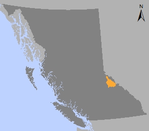
Valemount to Blue River Sustainable Resource Management Plan
The Valemount to Blue River Winter Recreation Sustainable Resource Management Plan (SRMP) covers approximately 700,000 hectares of land between Mount Robson Park in the east, Wells Gray Park in the west, Horsey Creek in the north and Blue River in the south.
The area is within the claimed traditional territory of the Simpcw First Nation (North Thompson Indian Band).
Winter recreation activities, such as heli-skiing and snowmobiling, are a major driver of the local economy in the plan area. These activities include public and commercial (guided) recreation. Existing recreation-related businesses and new recreation business investments depend upon sustaining these activities and managing their growth. In addition to providing economic benefits, these activities also give access to the general public to enjoy recreational experiences.
Environmental issues associated with winter recreation in the area are being addressed—in particular, the potential impacts of winter recreation on mountain caribou, a nationally threatened red-listed species.
Strategic recreation planning:
- Ensures sustainable development of public and commercial winter recreation activities in the area
- Improves the compatibility of winter recreation activities in the area
- Improves the safety and quality of experience for public and commercial recreationists
- Reduces risks to mountain caribou, other wildlife species, and the environment in general
- Improves integration of winter recreation development and other industrial activities while maintaining existing tenure rights
- Maintains public access.
The Valemount to Blue River SRMP, and the processes used to develop it, address these issues.
Plan & Plan Maps
Decision Support Material
Related Links
Contact information
Contact us if you have questions about land and resource management in the Thompson / Okanagan region.
TOR.LUP@gov.bc.ca

