Open Files 1989-1986
Open Files present the interim results of ongoing research, particularly mapping projects.
Jump to:
2018-2010 | 2009-2000 | 1999-1990 | 1989 | 1988 | 1987 | 1986
1989
L.J. Diakow and J.R. Drobe
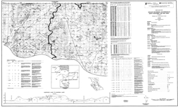
Open File map 1989-01 presents the geology and mineral occurrences of the North Newcombe Lake map sheet, NTS 093E/14 in the Interior Plateau of central British Columbia. The mapping was a contribution to the Canada/British Columbia Mineral Development Agreement, 1985-1990. Lithogeochemical assay data, moss mat geochemical and stream sediment geochemical results are tabulated.
The oldest rocks in the area are Lower Jurassic Telkwa Formation of the Hazelton Group. These consists predominantly of andesitic flows; ash, lapilli and accretionary lapilli tuffs; and rhyolite flows. The overlying Middle Jurassic Smithers Formation of the Hazelton Group consists of siltstone, arkosic sandstone and granule pebble conglomerate. The Ashman Formation of the Middle Jurassic Bowser Lake Group is also sedimentary, consisting of argillite, sandstone and minor sandstone.
The Lower Cretaceous Skeena Group has an older volcanic division and a younger sedimentary division. Andesitic flows of the lower division are commonly porphyritic and often amygdaloidal. Phenocrysts are plagioclase and pyroxene. Siltstone, argillite and micaceous sandstone comprise the sedimentary division. The Upper Cretaceous Kasalka Group also has volcanic and sedimentary components. Andesitic flows give way upward to basaltic flows and toward the top there are intraformational conglomerate beds with cobbles of volcanic rock and pink granite.
The Eocene Ootsa Lake Group consists of rhyolite flows and polymictic conglomerate with andesite and rhyolite clasts.
Quaternary alluvium and glacial till mantle much of the map area; outcrop is not abundant.
Many of the mineral occurrences are granite-related types: molybdenum mineralization in biotite monzonite, disseminated chalcopyrite and molybdenite in quartz monzonite porphyries or altered Lower Jurassic volcanic rocks, and stockwork quartz veins carrying chalcopyrite in granodiorites and adjacent hornfelsed Telkwa Formation volcanics. Other occurrences are in altered volcanic rocks with no clear tie to plutonic activity, such as disseminated magnetite and hematite in chlorite and epidote altered Telkwa andesite. Extensive Quaternary cover has hampered mineral exploration in the area.
P. Louis, U. Mader and J. Russell
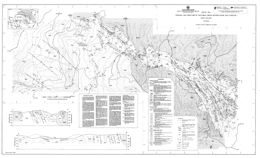
Open File 1989-02 describes the geology and structure of the Kobau Group between Oliver and Cawston (82E/4E). The geology map is at approximately 1:6667 scale and contains a legend, cross sections and descriptive notes. The Open File is a contribution to the Canada/British Columbia Mineral Development Agreement 1985-1990.
The Kobau Group consists of banded, foliated quartzite lithologies with minor intercalated mafic schists, and mafic schists with intercalated quartzite. Minor meta-carbonates and meta-volcanic flows occur within the quartzites and schists.
Pre-Early Jurassic dacite dikes are weakly to distinctly foliated. Two Jurassic intrusions cut the Kobau Group: the Fairview Granodiorite and the Oliver Granite. Other Jurassic intrusions include aplite dikes, small granitic, dioritic and mafic stocks; there are also Tertiary mafic dikes. The Oliver pluton is heterogeneous, varying from diorite to granite, quartz monzonite and syenite. The Fairview intrusion is more homogeneous.
The main deformation is pre-Jurassic and syn-kinematic metamorphism reached greenschist grade. At least three discrete folding events are recorded in the Kobau Group. The earliest are isoclinal, mesoscopic folds. The second phase produced tight to isoclinal folds and occurs on all scales. The third phase formed megascopic open buckle folds. A series of north-south, steeply inclined sinistral faults offset the lithology.
Quartz veins are ubiquitous in the metasedimentary rocks. Veins adjacent to the Fairview Granodiorite contact are auriferous. The Stemwinder gold mine exploited this kind of veining.
J. Garver, P. Schiarizza, P. Umhoefer, M.E. Rusmore and R.G. Gaba
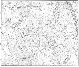
Open File 1989-03 describes the geology of the Eldorado Mountain area (92O/2; 92J/15). The geology map is at 1:20 000 scale and includes a legend, and a tectonostratigraphic legend. The Open File is a contribution to the Canada/British Columbia Mineral Development Agreement 1985-1990.
The oldest rocks exposed in the area comprise the Bridge River complex, which is of Permian (?) to Jurassic age. The structural complex consists of chert, metachert, clastic rocks, limestone, greenstone, blueschist-greenschist, and serpentinite. A serpentinite melange has tectonic inclusions of various Bridge River complex lithologies.
The Cadwallader Group consists of the upper Carnian to lower Norian Pioneer Formation, a transitional unit, and the lower Norian Hurley Formation. The Pioneer Formation consists predominantly of basaltic volcanic rocks; the transitional unit is mainly felsic tuffaceous sandstone and polymictic conglomerate; the Hurley Formation consists of fine grained sediments, sandstone and argillite, tuffaceous sandstone with conglomerate interlayers, mafic to intermediate volcanic rocks, and quartz-bearing plutonic rocks. Tyaughton Group, which is of middle to upper Norian age, has a basal ‘Red beds’ unit that consists of conglomerate and conglomeratic sandstone, and is overlain by limestone, then limestone conglomerate, conglomerate and green sandstone at the top.
An unnamed Lower to Middle Jurassic sequence consists of sandstone, siltstone, conglomerate and calcareous shale. The overlying of Middle Jurassic to Lower Cretaceous Relay Mountain Group strata consist mainly of shale, siltstone, and some conglomerate.
The Lower Cretaceous Taylor Creek Group consists of the Dash conglomerate, and the Lizard formation. The Dash is mainly chert pebble conglomerate and sandstone; the Lizard formation is mainly sandstone and shale. Upper Cretaceous rocks include the Silverquick conglomerate, a transitional unit, and the Powell Creek volcanics. The Silverquick is mainly pebble to cobble conglomerate; the transitional unit consists of volcanic breccia, and conglomerate; and the Powell Creek volcanics consist of andesitic breccia, volcaniclastic sandstone, an some pyroxene porphyry flows.
Intrusive rocks comprise Upper Cretaceous and/or Tertiary felsic to intermediate porphyritic stocks and dikes, and quartz diorite to granodiorite bodies.
The structure of the area is dominated by northwest-trending high angle normal and reverse faults. A pronounced angular unconformity separates non-marine Upper Cretaceous from Lower Cretaceous marine units. Folding and thrusting have affected the older rocks, but only tilting and gentle folds occur in the younger strata.
The area covered has potential for gold and base metal deposits associated with intrusive rocks, and cinnabar, stibnite and/or scheelite occurrences associated with fault zones.
P. Schiarizza, R.G. Gaba, J.I. Garver, J.K. Glover, B.N. Church, P.J. Umhoefer, T. Lynch, P.P. Sajgalik, K.E. Safton, D.A. Archibald, T. Calon, M. MacLean, M.J. Hanna, J.M. Riddell and D.A.R. James
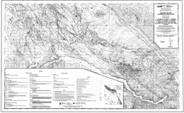
Open File 1989-04 presents the geology and mineral potential of the Tyaughton Creek map-area. The data is portrayed on two maps at 1:50 000 scale. The map-area is largely underlain by partially coeval rocks of the Bridge River complex, the Cadwallader Group, and the Shulaps ultramafic complex. This geological map documents the lithological characteristics and distribution of these units, and the nature of the structures that separate them. It also shows elements of an important Late Cretaceous fault system that were traced into the area from the north and west, and provides further information on the structural and stratigraphic relationships of mid Cretaceous rocks within the region. The results of the mapping and related study are summarized as follows:
- The Bridge River complex comprises structurally imbricated chert, greenstone, limestone, clastic rocks, gabbro and serpentinite; it is at least in part Middle Triassic to Early Jurassic in age. Gabbro occurs locally as sheeted dykes, corroborating the oceanic origin suggested by the predominant lithologies. The local importance of clastic rocks, limestone beds and limestone olistoliths suggests derivation from a topographically diverse basin or basins, perhaps in a back-arc or marginal ocean basin setting. Most of the complex is at prehnite-pumpellyite metamorphic grade and is characterized by pervasive brittle faulting. Pre-Middle Cretaceous blueschist-facies metamorphism in the Eldorado Mountain area suggests that deformation and metamorphism in part occurred in a subduction zone. Predominantly greenschist-facies metamorphism characterizes the Bridge River complex where it is structurally imbricated with the Shulaps ultramafic complex.
- The Cadwallader Group comprises pillowed and massive greenstone of the Pioneer Formation and overlying conglomerate, sandstone and shale of the Hurley Formation. It is Late Triassic in age and therefore coeval with parts of the Bridge River complex. In the Eldorado Mountain area it is juxtaposed against the Bridge River complex across north-northeast-trending faults that predate the Castle Pass strike-slip fault and may also predate mid Cretaceous compressional structures. In the Shulaps Range it is penetratively deformed, metamorphosed, and thrust-imbricated with rocks of the Bridge River complex and Shulaps ultramafic complex.
- The Shulaps ultramafic complex includes a harzburgite unit with a mantle tectonite fabric, together with structurally underlying serpentinite melange, which contains elements of the ultramafic cumulate to volcanic section of an ophiolite assemblage. The serpentinite melange is thrust-imbricated with rocks of the Bridge River complex and Cadwallader Group. Structures preserved within this thrust zone suggest a complex history of deformation and metamorphism that in part predates movement on the bounding Marshall Creek fault zone. Final uplift and cooling, however, may have been coincident with Late Cretaceous strike-slip faulting on the Yalakom-Marshall Creek system.
- The tectonic juxtaposition of the Shulaps ultramafic complex, the Bridge River Complex and the Cadwallader Group represents an important event in the accretionary history of the western Cordillera. Several lines of indirect evidence suggest that the initial juxtaposition occurred in Middle Jurassic time. The preliminary results of our 1988 mapping program provide only a pre-Middle Cretaceous age for this event; dating presently in progress may provide further constraints.
- Deposition of the late Early Cretaceous Taylor Creek Group was coincident with the onset of regional compressional tectonism. Clasts within the Taylor Creek Group provide the first evidence of uplift and erosion of the Bridge River complex, while clasts in the overlying Silverquick conglomerate were derived from both the Bridge River complex and Cadwallader Group Furthermore, the Taylor Creek Group is the oldest unit within the Tyaughton basin that is documented to sit unconformably above Bridge River basement. This suggests the possibility that thrust imbrication (and accretion?) of the Bridge River and Cadwallader terranes was predominantly a late Early Cretaceous event.
- The map area is cut by a northwest-trending system of dextral strike-slip faults that was active in Late Cretaceous time. Northerly trending splays of the Relay Creek-Marshall Creek fault system connect with the Yalakom fault system to define a large-scale extensional duplex structure. This fault system steps across and bounds the northwestern margin of the Shulaps ultramafic complex at its southeastern end. In contrast to the extensional zone to the northwest, the Shulaps complex may have been deformed and uplifted during Late Cretaceous movement on the bounding strike-slip fault systems.
- Metallic mineral concentrations are within or adjacent to strike-slip faults or associated structures, and have a close spatial relationship with plutons or dykes. The age of mineralization seems closely tied to igneous activity between Late Cretaceous and Early Tertiary time. The protracted history of mineralization and plutonism combined with differential uplift across faults has led to the juxtaposition of deposits of contrasting structural level and local inconsistencies in the pattern of regional metal zoning documented by Woodsworth et al. (1977).
The map-area straddles the northern part of the Bridge River mining camp, which is British Columbia’s foremost historical gold producer from low sulphide mesothermal quartz veins. Other known and potential deposit types in the area are copper-molybdenum porphyries, pluton-associated high sulphide auriferous veins, skarns, scheelite-stibnite or stibnite-only veins, gold-silver polymetallic veins, epithermal gold-silver veins and cinnabar veins and disseminations.
R.E. Meyers, W.A. Taylor and D. Templeman-Kluit
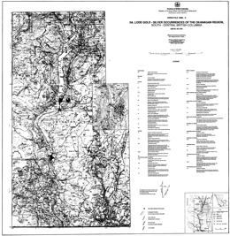
Open File 1989-05 looks at lode gold-silver occurrences of the Okanagan Region, South Central British Columbia (82E/W; 82L/SW).
N.W.D. Massey S.J. Friday, J.M. Riddell and S.E. Dumais
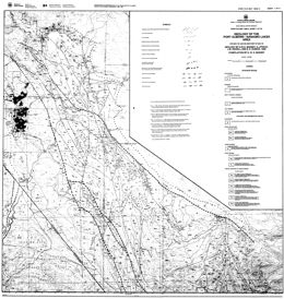
Open File 1989-06 covers the geology and mineral potential of the Alberni - Nanaimo Lakes map area, which is located on Vancouver island, to the east of Alberni Inlet and to the southeast of Port Alberni in southwestern British Columbia. It consists of 9 sheets; one sheet is a 1:50 000 scale compilation of the geology, one sheet contains the map legend, and one sheet shows mineral occurrences and geochemical sample locations and analyses for the area at 1:50 000 scale; the remaining sheets present the geology at 1:20 000 scale. The area lies at the southeastern end of the Vancouver Island Ranges and is characterized by fairly rugged topography with fault-line scarps and fault-controlled valleys that were accentuated by glaciation. The area covers the northwestern end of the Cowichan uplift, one of a series of major geanticlinal structures constituting the structural fabric of the Wrangellia terrane of Vancouver Island.
The oldest rocks in the Alberni - Nanaimo Lakes area belong to the Paleozoic Sicker and Buttle Lake groups which contain volcanic and sedimentary units ranging from Middle Devonian to Early Permian age. The Devonian Sicker Group is a thick package of lower greenschist metavolcanic and volcaniclastic rocks that formed in an oceanic island-arc environment The lowest unit is the Duck Lake Formation which comprises a suite of grey to maroon and green pillowed basalts and basaltic breccias with chert, jasper and cherty tuff interbeds near the top of the sequence. Well-bedded felsic tuffs and lapilli tuffs are associated with the cherts and jaspers. Massive dacite-rhyolite dikes and sills intrude the pillowed basalts. The pillowed basalts can be divided into two subunits on the basis of geochemistry. The apparently lowermost flows are tholeiitic with an affinity to enriched-type mid-ocean ridge basalts and probably represent the oceanic substrate upon which the Sicker arc developed. The uppermost lavas, and dacite intrusions, are of high-potassium calcalkaline chemistry and mark the initiation of arc construction. These two suites were not recognized nor distinguished in the field.
Overlying the Duck Lake Formation is the Nitinat Formation characterized by pyroxene-feldspar-porphyritic basalts and basaltic andesites. These typically occur as agglomerates, breccias, lapilli tuffs and crystal tuffs that formed as pyroclastic flows, debris flows and lahars. Pyroxene-phyric, amygdaloidal, pillowed and massive flows are also developed.
The Nitinat Formation passes upwards transitionally (over a thickness of about 150 m) into the McLaughlin Ridge Formation, a sequence of volcaniclastic sediments dominated by thickly bedded, massive tuffites and lithic tuffites, interbedded with thinly bedded tuffites and laminated tuffaceous sandstone, siltstone and argillite. The beds tend to form fining-upward cycles from tuffite to argillite, but overall the sequence becomes coarser towards the top with more frequent development of lithic tuffite and coarse pyroclastic horizons. The sequence probably formed as a volcaniclastic apron around a volcanic island and grades eastwards into more proximal volcanic-dominated facies in the Duncan area. The Nitinat and McLaughlin Ridge formations form a coherent suite of sodium-potassium calcalkaline chemistry typical of island arcs.
The Buttle Lake Group is made up of a dominantly epiclastic and bioclastic limestone sedimentary sequence ranging from Mississippian to Early Permian in age. This sedimentary package is apparently conformable on the underlying volcanics along the northeastern limb of the Cowichan uplift, for example, in the upper Cameron River valley and St Mary's Lake area, but is unconformable along the southwestern limb and in the Fourth Lake area.
The Fourth Lake Formation comprises mostly thin-bedded, often cherty sediments. These vary from green and red ribbon cherts, black cherty argillites, green and white cherty tuffs, grey and green siltstones and argillites, to thicker bedded green volcanic sandstones. The upper part of the formation is characterized by thinly bedded, turbiditic sandstone-siltstone-argillite intercalations, with some thicker beds of volcanic sandstone. These pass upwards into argillite-calcarenite interbeds at the top of the sequence.
The Mount Mark Formation conformably overlies and laterally interfingers with the Fourth Lake Formation. It consists of well-bedded bioclastic calcarenite and calcirudite with minor argillite and chert interbeds. The overlying St Mary's Lake Formation is sporadically preserved beneath the Triassic unconformity. It comprises clastic sediments varying from polymictic conglomerates to volcanic sandstones and argillites.
Rocks of the Upper Triassic Vancouver Group are exposed throughout the map area, flanking the Paleozoic core of the Cowichan uplift. The group is subdivided into a thick lower basaltic volcanic package (Karmutsen Formation) and a thin upper sedimentary package (Quatsino and Parson Bay formations). The lower Karmutsen Formation basalts rest unconformably on the underlying Paleozoic rocks. The basalts form pillowed flows, pillow breccias and hyaloclastite breccias interbedded with massive flows and sills. There is a tendency for the massive flows to dominate the sequence towards the top and the pillowed flows the lower parts. The Karmutsen Formation basalts show amydgule infillings and alteration assemblages typical of the prehnite-pumpellyite facies. The mafic bodies of the Mount Hall gabbro, intrusive into the Paleozoic rocks, are coeval and consanguineous with the Karmutsen Formation basalts. The basalts formed from an iron-titanium enriched tholeiitic magma, similar to continental tholeiite or enriched mid-ocean ridge basalt, probably in an oceanic flood-basalt province. Succeeding limestones, argillites and tuffaceous sediments of the Quatsino and Parson Bay formations are poorly developed in the map area.
All of the Paleozoic and Triassic sequences have been intruded by granodioritic stocks of the Early to Middle Jurassic Island Plutonic Suite. These bodies are usually elongate in shape, although the Fourth Lake stock is roughly circular. The intrusions are dominantly equigranular quartz diorite to granodiorite but show considerable lithological variation. The Corrigan pluton in particular is heterogeneous and composite, comprising a mix of diorite, quartz diorite, granodiorite and monzogranite phases with abundant minor intrusive dikes. Most of the large intrusive bodies are rich in inclusions, especially in marginal agmatitic intrusive breccias. Contact metamorphic aureoles are developed around the intrusions causing hornfelsing and skarning in Paleozoic rocks. A variety of dikes and small irregular intrusions that are probably coeval with the Island Plutonic Suite occur throughout the area. Lithologically they include intermediate feldspar porphyry, hornblende feldspar porphyry and minor diabase. The Jurassic intrusions form a metaluminous, medium to high-potassium calcalkaline suite typical of a convergent-margin environment.
Clastic sediments of the Upper Cretaceous Nanaimo Group lie unconformably on the older rocks. They are most thickly developed in the Alberni Valley, though only exposed around the margins due to Quaternary cover. The lower Benson Formation comprises basal conglomerates and overlying medium to coarse-grained sandstones. These are succeeded by the black argillites and siltstones of the Haslam Formation. Younger formations of the Nanaimo Group are absent.
Tertiary dacite porphyries of the Mount Washington Intrusive Suite occur throughout the area. Where the magma has penetrated the Nanaimo Group sediments, it has spread out laterally to form thick sills.
Southern Vancouver Island has a complex structural history with frequent rejuvenation of previous structures. All Paleozoic rocks are affected by a series of southeast trending, upright to overturned, southwest-verging folds. Associated schistosity and lineation are absent from most of the area, only occurring to the west of the Mineral Creek fault. Regional-scale warping of Vancouver Island occurred during the Early to Middle Jurassic, facilitating the emplacement of the Island Plutonic Suite intrusions and producing the geanticlinal Cowichan uplift. The present map pattern is dominated by the northwesterly trending contractional faults of the Tertiary Cowichan fold and thrust system. These are high angle reverse faults that become listric at mid-crustal levels. They generally place older rocks over younger. The deformation probably took place during the crustal shortening accompanying the formation and emplacement of the Pacific Rim and Crescent terranes out-board of Wrangellia. The north-trending Mineral Creek fault and associated northwest-trending faults, such as the Stokes fault, are subvertical with small, apparently sinistral offsets. They may have formed during minor extension accompanying late-stage post-contractional relaxation.
The Alberni - Nanaimo Lakes area has had a long history of mineral exploration and production, starting with small-scale placer-gold mining on China Creek in 1862. The localization of metal deposits in the area is controlled by the interplay of stratigraphy and spatial association with later intrusions and structures. Three major metallogenic epochs are recognized. Syngenetic mineralization occurred during the building of the Sicker arc. Oxide facies exhalites, such as the 900 zone of the Mineral Creek area, are found in the uppermost Duck Lake Formation. Sulphide facies equivalents are also found, although less commonly. Thin syngenetic manganese oxide beds and sulphidic argillites occur within the radiolarian cherts of the basal Fourth Lake Formation in the upper Shaw Creek area.
The Early to Middle Jurassic arc was characterized by epigenetic mineralization of various types and styles, spatially related to the Island Plutonic Suite intrusions. Copper-molybdenum veins and stockworks occur within intrusions and volcanic country rock. Production has been minor from these deposits but came from the Havilah and WWW mines. Rhodonite forms by contact metamorphism of manganiferous chert. Iron-copper-gold skarns are developed in calcareous tuffs and limestones of the Karmutsen and Quatsino formations, though are rare in Mount Mark lithologies. A stratiform auriferous hematite cap has developed on the top of the skarn on the Villalta property, probably formed by residual weathering during the middle Cretaceous.
Mesothermal gold-bearing quartz-carbonate veins are located along Tertiary structures and have been one of the main exploration targets in the area. Historic production has ensued from the Victoria, Thistle and Black Panther mines. Tertiary epigenetic quartz-arsenic-(antimony) veins are variably developed in dacite porphyry sills and Haslam Formation argillites on the Coal and Grizzly properties.
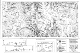
D.A. Brown and M.H. Gunning
Scale 1:50 000 (Geology), 1:100 000 (Geochemistry and Mineral Occurrences)
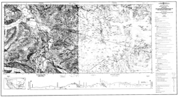
J. Logan, V. Koyanagi and D. Rhys
Open File 1989-08 presents the geology and mineral occurrences of the Galore Creek map-area (104G/03, 04) in northwestern British Columbia. It consists of two sheets; sheet 1 portrays the geology; sheet 2 lists MINFILE occurrences, highlights of a regional geochemical survey and isotopic age dating information.
The oldest exposures in the area are rocks of the Stikine assemblage. They consist mainly of Devonian (?), Mississippian and Permian bimodal flows and pyroclastics, interbedded carbonates and minor shale and chert. The Permian and older rocks are penetratively deformed and metamorphosed. Mississippian limestone consists of two members separated by a wedge of chert and phyllitic volcaniclastic rocks. The Permian section is characterized by two thick, extensive carbonate units.
Middle Triassic sediments lie with apparent conformity on the uppermost Permian limestone. The sequence consists of shales, argillites and calcareous siltstones overlain by a sequence dominated by cherty siltstones. The overlying Middle to Upper Triassic Stuhini Group comprises a variety of flows, tuffs, volcanic breccias, and sedimentary rocks. Andesitic flows, breccias, tuffs and lahars give way up section to pyroxene porphyry flows and fragmental rocks, well-bedded green and maroon lapilli-ash tuffs and epiclastic rocks. Thin, lenticular sediments that include siltstone, sandstone, conglomerate, and local limestone layers are interbedded with the volcanics.
Early (?) Jurassic sediments comprise a fault-bounded wedge in the eastern part of the area. It consists of pebble to boulder conglomerate with intrusive clasts in an arkosic matrix that is overlain by three fining-upward sequences of conglomerate, sandstone and siltstone.
Three intrusive episodes include the Middle Triassic to Middle Jurassic Hickman plutonic suite that is coeval with Stuhini volcanics, Jurassic to Tertiary Coast Range plutons, and Tertiary plugs and bimodal dykes. The Hickman suite comprises the Nightout pluton, which is of granodiorite to monzo-diorite composition, the Mount Hickman ultramafic complex, which is an Alaskan-type ultramafic body that is mainly clinopyroxenite and olivine-clinopyroxenite but has a dunite core, and the Hickman pluton, which has three phases: a mafic phase, a heterogeneous main phase, and a megacrystic quartz diorite phase. The suite also has small megacrystic intrusions of monzonite to granodiorite composition. The Galore Creek intrusions comprise a syenite complex that is, from oldest to youngest, dark syenite, porphyry garnet syenite megaporphyry, fine-grained porphyritic syenite, and epidote syenite megaporphyry. This suite is closely aligned with porphyry copper gold mineralization. The Coast intrusions underlie one-quarter of the map-area. They consist of intrusive bodies of biotite hornblende diorite, biotite granite, and megacrystic granite. The Eocene suite comprises small plugs and stocks of biotite quartz monzonite, plugs and dykes of diorite and narrow dykes of rhyolite or lamprophyre/basalt.
Four phases of deformation have influenced the area. The first three phases acted on the Paleozoic rocks, the final phase affected he older rocks, Stuhini Group and younger strata. Four main sets of faults divided the area into a mosaic of fault-bounded blocks.
Mineral deposits of three main types occur in the area. Middle Triassic deposits are conformable massive polymetallic sulphides with or without gold and silver. Early Jurassic deposits include porphyry copper-silver-gold mineralization associated with syenitic sills and monzonite plugs like Galore Creek and Copper Canyon, and mesothermal silver-gold and copper-zinc mineralization in quartz and carbonate veins.
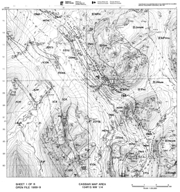
J. Nelson, J. Bradford, M. MacLean and L. Maddison
Open File 1989-09 describes the geology and metallogeny of the Cassiar and McDame map-areas (104P/5 and P3 (NW ¼)) in northernmost British Columbia. The Open File consists of 8 maps, including: 5 geological maps at 1:25 000 scale; a mineral potential map at 1:50 000 scale; a map with tables of rock geochemical and assay data, regional geochemical data, and stream sediment data; and a map with legends, MINFILE Occurrence tables and geological cross-sections.
The project is a contribution to the Canada/B.C. Mineral Development Agreement 1985-1990.
The main elements of the geology are displaced North American strata of the Cassiar terrane, ranging in age from Hadrynian to Early Mississippian, that are structurally overlain by the Sylvester allochthon, which occupies the core of the McDame synclinorium. Components of the Sylvester allochthon range in age form at least Early Mississippian to Late Triassic, and include marginal basin and arc volcanic-sedimentary complexes, and subcrustal ultramafite-gabbro complexes.
Middle to Late Cretaceous granitic stocks intrude miogeoclinal strata along he western margin of the Cassiar map-are. The Eocene Mount Hoskins stock lies in the southeast corner.
High angle faults occur near the western and eastern margins of the Sylvester allochthon, and the Marble Creek fault cuts both autochthonous and allochthonous strata. This structure is a probable control for asbestos mineralization in the Cassiar mine and also silver-lead-zinc replacement deposits of the Marble Creek system. The high-angle Blue Dome fault is associated with lenses of serpentinite-matrix melange. It truncates thrusts bounding lithotectonic units within the Sylvester allochthon but is not known to cut underlying autochthonous strata.
Miogeoclinal strata of the Hadrynian Ingenika Group vary from mainly phyllite to siltstone with intercalated limestone and slate to phyllite with minor quartzite layers. The contact with the overlying Lower Cambrian Atan Group is gradational, with the proportion of quartzite increasing. The siliciclastic rocks give way up section to carbonates that host molybdenum-tungsten skarns and silver-lead-zinc mineralization adjacent to the Cassiar and Mount Hoskins stocks. The Cambro-Ordovician Kechika Group crops out in the western part of the Cassiar map-area, where it is strongly hornfelsed by the Troutline stock. Where it is not metamorphosed, calcareous slates predominate. Ordovician-Silurian Road River Group mudstone, slate and black argillaceous limestone are exposed locally. The Lower Devonian Tapioca sandstone consists of dolostone, dolomitic quartz arenite and quartzite. It crops out along both limbs of the McDame synclinorium. Resistant Middle Devonian McDame Group dolostone, micritic limestone, wackestone and packstone are overlain by recessive Upper Devonian to Lower Mississippian slates of the Earn Group. Barite exhalites occur in this unit in two thrust panels north of the Cassiar mine.
The Sylvester allochthon is flanked by allochthonous rocks. Three divisions are recognized. Division I consists of Early Mississippian to Middle Pennsylvanian pelagic and hemipelagic sedimentary sequences: black argillite, chert, sandstone, siltstone, a few diabase sills and rare baritic exhalites. Division II consists of a set of basalt-diabase-sediment packages and ultramafite-gabbro-amphibolite slivers. It is at least in part of Early Mississippian to Early Permian age. Division III is an Early Permian package of mainly intermediate volcanic rocks, shallow water limestones with chert interbeds, and a zoned hornblende gabbro to granodiorite pluton. Division III occupies the highest structural level in the Allochthon.
During the Jurassic compressional event, autochthonous strata of the Cassiar platform formed duplex stacks with multiple repetitions, and allochthonous Sylvester rocks were stacked along easterly-directed thrust sheets. Décollement surfaces in the autochthonous rocks are at the Road River/Kechika contact, and in the Earn Group near the base of the Sylvester allochthon.
Mineralization of the Cassiar-Erickson camp consists of the following: Early Mississippian sedex deposits, minor volcanic exhalites, and bedded Permian (?) rhodonite; Early Cretaceous mesothermal gold-quartz and related veins, such as the Erickson-Taurus system; Early Cretaceous (?) asbestos stockworks as in the Cassiar and McDame miens; an Late Cretaceous and Eocene skarns, replacements and veins associated with the Cassiar and Mount Hoskins stocks, respectively.
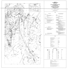
D.J. Alldrick, J.M. Britton, I.C.L. Webster and C.W.P. Russell
Open File 1989-10 presents the geology and mineral occurrences of the Unuk area (104B/7E, 8W, 9W, 10E), in northwestern British Columbia. Gossanous areas are identified. The map sheet is published at 1:50 000 scale and covers about 1000 square kilometres at the east-central end of the Iskut River gold belt. Two mines are under development in the area immediately to the east several precious metal deposits lie to the west. The region is underlain by Lower to Middle Jurassic calcalkaline volcanic and associated sedimentary rocks of the Hazelton Group.
The area is underlain by rocks ranging in age from Upper Triassic to Recent. The oldest comprise the lower volcano-sedimentary sequence of the Stuhini Group. The sequence consists of andesitic breccia, basalt, ash tuff, sandy limestone, tuffaceous wacke and a siltstone, shale argillite unit. The Triassic to Jurassic Hazelton Group consists of a number of formations. An Upper Triassic to Lower Jurassic andesite sequence, called the Unuk River Formation, is overlain by Lower Jurassic Betty Creek Formation pyroclastic and epiclastic rocks. They are andesitic to felsic and local siltstone-shale-argillite turbidite units occur. An overlying felsic volcanic sequence, called the Mount Dilworth Formation, consist of felsic flows, tuffs and airfall tuffs. A Middle Jurassic siltstone sequence, the Salmon River Formation, includes andesitic pillow lavas, thin-bedded wacke, rhythmically banded siltstone and shale, and chert pebble conglomerate and arenite. Local areas of basalt flow and tephra are of Pleistocene to Recent age.
The oldest intrusive rocks in the area are foliated to gneissic quartz diorites of the Bucke Glacier stock. Jurassic intrusions comprise the Unuk River diorite suite, syn- to post-volcanic diorite, and granodiorite to syenite intrusions that may be equivalent to the extrusive rocks, and an olivine-pyroxene gabbro body. Tertiary Coast Plutonic complex intrusions include the Lee Brant stock, which is quartz monzonite, and diorite and granite bodies. Post-tectonic dikes are leuco-monzonite; porphyritic dacite, andesite and diabase; and lamprophyres
More than 55 mineral occurrences are known in the area, including one past producer. Deposits are stratabound, related to intrusive contacts, veins, and dissemination. Stratabound deposits are mainly pyrite zones and lenses within felsic volcanics. Note: subsequently, the Eskay Creek gold deposit, a shallow VMS deposit, was discovered near MacKay Lake. Intrusive contact occurrences include copper-iron skarns and nickel-copper mineralization. High-grade precious veins are the main targets of vein-oriented exploration programs. Porphyry-style copper-molybdenum and disseminated gold (silver) in alteration zones are other deposit types of interest in the area.
T. Höy and K. Andrew
Open File 1989-11 describes the geology and mineral occurrences of the Nelson map-area (82F/06) in southern British Columbia. The Open File consists of two maps. The first presents geology at 1:50 000 scale and a legend. The second has a series of cross sections, a table of mineral occurrences and references.
The oldest rocks in the area Precambrian, possibly Windermere, age rocks of the Three Sisters Formation, which consists mainly of grit and quartzite with minor schist and limestone. Quartzites of the Quartzite Range Formation, argillaceous quartzite, argillite and schist of the Reno Formation, phyllite, argillite, schist, micaceous quartzite and minor limestone of the Laib Formation, and a sequence of quartzite, schist, argillite, slate and limestone with minor igneous members are all of Lower Cambrian age. Middle Cambrian black limestone, calcareous argillite, slate and phyllite comprise the Nelway Formation. Lower and Middle (?) Ordovician black argillite, slate and quartzite make up the Active Formation. Stratified Mesozoic rocks comprise the Ymir and Rossland Groups. Ymir Group consists mainly of argillite, siltstone, grit and impure limestone. Rossland Formation consists of the Archibald, Elise and Hall Formations. The Archibald Formation contains siltstone, sandstone and argillite. Lower Elise Formation rocks are dominantly augite with or without plagioclase phyric flows, flow breccias and subvolcanic intrusions. Pyroclastic units are basaltic lapilli, crystal and fine-grained tuffs. Upper Elise Formation consists of basaltic and rhyolite to dacite flows, andesitic tuffs, basaltic tuff, tuffaceous siltstone and sandstone, and tuffaceous conglomerate. Hall Formation strata are siltstone, sandstone, conglomerate and argillite with minor limey units.
Intrusive rocks in the area are Lower and Middle (?) Jurassic diorite, porphyritic diorite, and plagioclase porphyry that is locally sheared. Jurassic intrusions include pseudodiorite and pyroxenite, as well as granodiorite, quartz monzonite, diorite porphyry and breccia of the Nelson intrusions.
Mineral occurrence types in the area include: porphyry copper-molybdenum deposits; skarns with gold-copper, copper-gold, or molybdenum-tungsten mineralization; veins with gold-silver-copper, silver-gold, lead-zinc, or gold-silver values; stratiform sulphides with lead-zinc and silver; and conformable gold mineralization with plagioclase porphyry intrusions.
F. Ferri and D. Melville
Open File 1989-12 presents the geology, geochemistry and mineral occurrences of the Germansen Landing area (93N/10N, 15S) in central British Columbia. The Open File consists of two sheets: the first contains geology at 1:50 000 scale; the second has tables of stream sediment geochemical results and mineral occurrences.
The oldest rocks in the area are Lower to Middle Paleozoic carbonates and sandstones. Over these are Upper Paleozoic Harper Ranch Group (?) rocks. The Harper Ranch consists of a lower unit of mafic flows with lesser fragmental volcanics and sediments, and an upper unit of cliff-forming limestone. The Upper Paleozoic to Triassic Slide Mountain Group is varied in character. The lower division consists of variably listwanite-altered serpentinite; phyllite to argillite, limestone, chert and quartz wacke; and felsic tuff. The middle division contains siltstone, siliceous siltstone and argillite, chert, gabbroic sills and dikes, minor mafic flows, lithic arenite and conglomerate. The upper division consists of mainly of massive to pillowed basalts and breccias. Upper Triassic to Lower Jurassic Takla rocks comprise four main units. The lowest is predominantly argillite, calcareous argillite, siltstone, chert volcanic wackes, and limestone. Above is a unit consisting of volcanic conglomerate and sandstone, then a unit dominated by first agglomerate, lapillistone and tuffite, then mafic flows which are either feldspar and pyroxene phyric or have bladed feldspar crystals. The uppermost unit consists mainly of volcanic sandstone and conglomerate. Quaternary alluvium partially covers the area.
Upper Paleozoic to Triassic foliated gabbro comprises the Wolf Ridge Gabbro. Coarsely crystalline gabbro is Jurassic (?) or younger. Rocks of the Upper Cretaceous Germansen batholith vary from monzonite to quartz monzonite to foliated granodiorite with local potassic feldspar megacrysts.
Early to Middle Paleozoic Omineca belt rocks are sparsely exposed in the northeast corner of the map sheet. They area separated from the Slide Mountain rocks by a major fault. Rocks of the Slide Mountain terrane are separated from other strata by the northwest trending Manson fault zone. Intermontane belt, Harper Ranch Group strata underlie Takla rocks along Evans Creek. Takla Group rocks underlie much of the area southwest of the Manson fault zone. Structural elements in the Slide Mountain terrane trend northwesterly. Takla rocks define broad easterly-directed structures that swing into parallelism with the Manson fault zone as it is approached. Normal and thrust faults cut the rocks.
Aside from a few copper showings, most mineral occurrences in the area are associated with the Manson fault zone. In most, precious metals occur in sulphide-bearing quartz-carbonate veins associated with listwanite alteration along the fault zone. Mineralization occurs in both Takla and Slide Mountain host rocks.
R.L. Arksey and M.G. Mihalynuk
Open File map 1989-13, for the Fantail Lake (west) and Warm Creek (east) map areas, NTS 104M/9W and 10E in northwestern British Columbia, consists of two maps. The first presents the geology; the second shows stream sediment and lithogeochemical survey results and lists mineral occurrences.
Lithologies vary from metamorphic rocks of probable Proterozoic marine clastic protoliths, to Mesozoic volcanics and coarse clastic marine sediments. The layered rocks are cut by three granitoid suites, loosely constrained as Late Triassic, Early Cretaceous, and Late Cretaceous through Paleocene age. The Llewellyn fault transects the area diagonally and separates the Upper Proterozoic Boundary Range metamorphics on the west from Mesozoic strata of the Whitehorse trough to the east. The metamorphic terrain and even more the fault zone are anomalous in arsenic and gold; they represent significant exploration targets.
The map portrays subdivisions of the poorly understood Laberge and Stuhini Groups, the boundary Ranges metamorphic suite, and the Coast intrusives. Units recognized can be correlated over tens of kilometres.
The Llewellyn fault diagonally bisects the area from southeast to northwest, separating probable Upper Proterozoic Boundary Ranges metamorphics (unit PPM) in the west from Mesozoic strata of the Whitehorse trough to the east. One exception is the Teepee Peak volcanic outlier, possibly of Late Jurassic age, which sits unconformably above the metamorphic rocks, A previously unmapped hornblendite body crosscuts this unconformity near the Teepee Peak gold-cobalt skarn locality and may be genetically related to it. Skarn zones at other places within Unit PPM may also have precious metal potential. The potential of two other exploration targets within the map area is indicated by the assay results presented on Sheet 2. These include: (I) sulphide-bearing quartz veins, both concordant and discordant, within Unit PPM; and (2) inferred splays off the Llewellyn fault. The 1987 regional geochemical survey in the Tutshi Lake map area showed that both the belt of Unit PPM and the Llewellyn fault zone are anomalous with respect to gold and arsenic.
Three distinct styles of mineralization are known in the area, gold-cobalt skarns, gold-bearing quartz veins, and antimony-silver veins. The skarns are developed in carbonate layers within the metamorphic suite. Gold in the old Engineer Gold mine was in gold-bearing quartz-carbonate veins cutting Lower Jurassic Laberge strata. Layered veins containing stibnite, minor galena and crustiform quartz have been found in foliated argillites and siltstones of the Laberge Group.
Four geologic environments appear most prospective for precious metals; these are:
- Veins hosted in Laberge Group strata that are associated with splays off the Llewellyn fault zone as at the old Engineer mine. A possible splay is inferred east-southeast of Kirtland where brecciated argillite and drusy quartz occur within a linear steep-walled valley with slickensided walls. A grab sample returned assays of 5.35 and 4.74 grams per tonne gold.
- Both concordant and discordant veins and breccia zones within the Unit PPM. Large numbers of barren quartz veins and "sweats" require that careful prospecting and/or geochemistry be used to focus in on precious metal-bearing veins.
- Sheared and altered/silicified rocks within and immediately adjacent to the Llewellyn fault zone are shown to yield anomalous, albeit sporadic gold assays (Mihalynuk and Rouse, 1988b; Rouse et al., 1988).
- Skarns within the Unit PPM, particularly those that are related to ultramafic and/or granodioritic bodies and/or extensive dyking have precious metal potential.
A. Panteleyev and K. Hancock
Open File 1989-14 portrays the geology and mineral occurrences of the Beaver Creek-Horsefly River area (93A/05, 06) in central British Columbia. The Open File map presents the geology at 1:50 000 scale.
The oldest strata in the area are fetid limestone, graphitic argillite and siltstone of the Paleozoic Cache Creek Group. A Carnian and younger (?) siltstone and sandstone unit becomes volcaniclastic toward the top. Norian rocks compose seven units. Pyroxene phyric alkali basalt flows, alkali basalt flows, pillow lava and pillow breccia make up unit 2A. Pyroxene-phyric basalt breccia, lithic lapilli and ash tuff, and mafic wacke predominate in unit 2B. Mafic breccia, debris flow or lahar deposits comprise most of unit 2C. Pyroxene basalt breccia, tuff and pyroxene-rich wacke make up unit 2D. Analcite-bearing alkali basalt dominates unit 2E. Unit 2F is mafic sandstone and siltstone, calcareous siltstone, and limestone breccia. Feldspar-lath, pyroxene phyric basalt is the most abundant rock type in unit 2G. Norian (?) or younger sandstone, siltstone and calcareous siltstone comprise unit 2H. Sinemurian rocks are polylithic breccias, hornblende phyric andesite flows, and analcite-bearing alkali olivine pyroxene phyric basalts. Polylithic conglomerate, shale and sandstone are Late Jurassic (?) and possibly Cretaceous. Eocene rocks are lacustrine siltstone and siltstone, crystal ash tuff, biotite trachyandesite and andesite. Miocene plateau basalts occur with basal conglomerate and fluvial channel deposits.
Intrusive rocks include Early Jurassic diorite, monzodiorite, syenodiorite, monzonite and syenite bodies and Late Jurassic (?) or possibly Cretaceous quartz diorite and granodiorite.
The area is known for important historic and active placer gold deposits. It also has potential for quartz vein gold, porphyry copper-gold, and porphyry copper-molybdenum deposits. Much of the exploration for lode gold and copper-gold deposits has concentrated on intrusion-related alteration zones in and near alkaline intrusions. Copper-molybdenum mineralization has focused on granodioritic rocks of Cretaceous (?) and Eocene age.
M.A. Bloodgood, C.J. Rees and D.V. Lefebure
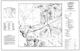
Open File 1989-15 presents the geology and mineral occurrences of the Atlin area (104N/11W, 12E) in northernmost British Columbia. The Open File consists of two sheets: sheet 1 contains the geology at 1:50 000 scale, a legend, references, and a table of mineral occurrences; sheet 2 has a sample location map and tables of fossil determinations, whole rock analyses, and assay results.
Upper Paleozoic Cache Creek Group rocks predominate in the area mapped. Chert and siliciclastic metasediments, carbonates, mafic volcanic rocks including volcanic conglomerates and cherty sediment interlayers, and ultramafic rocks occur. The ultramafic rocks are variably serpentinized and carbonate altered (listwanite). They include peridotite and dunite as well as gabbro. Quaternary olivine basalt flows, tephra and scoria crop out locally.
Intrusive rocks in the area include: the Cretaceous (?) Fourth of July batholith, which varies from diorite to granodiorite to granite; the Late Cretaceous Surprise Lake batholith, which consist of leucocratic granite, quartz feldspar porphyry and aplite; and dikes and minor intrusions of uncertain age.
Major faults systems in the area strike northerly and east-northeaster.
Placer gold deposits are well known in the Atlin area and some are still active. Lode gold occurrences are associated with carbonate-altered zones in the ultramafic rocks near fault zones. Vein-hosted occurrences are predominantly silver-lead systems with associated copper, lead and gold. Mineralization at the former Atlin Ruffner mine is confined to dioritic and diabasic dikes. Skarns, veins and porphyry systems are related to the Surprise Lake batholith. Skarn mineralization occurs in Cache Creek carbonates and carry lead-zinc and copper values. Porphyry mineralization is characterized by the Adanac deposit, where molybdenite is associated with quartz veins. High background uranium values in the Surprise Lake batholith have attracted some interest.
D. MacIntyre, P. Desjardins, P. Tercier and J. Koo
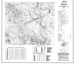
Open File map 1989-16 presents the geology of the Telkwa River area, NTS 93L/11, in north central British Columbia. It also shows mineral occurrences on the map and in tabular form and presents results of stream silt and lithogeochemical surveys.
The oldest rocks in the area are Lower Jurassic, Sinemurian to Lower Pleinsbachian) volcanics of the Telkwa formation. Three subdivisions are mapped: an andesitic pyroclastic facies, which is subaerial in part; a basalt flow-red tuff facies; and a siliceous pyroclastic facies with ash flows, ignimbrites and some basalt and rhyolite flows. These give way upward to Pleinsbachian to Toarcian rocks of the Nilkitkwa Formation. The lower unit consists of marine shales, siltstones and limestones. Conglomerate at the base implies a period of erosion. The overlying Red Tuff member is predominantly well bedded, air fall tuff. The Middle Jurassic (Bajocian to Callovian) Smithers Formation consists mainly of feldspathic sandstone, greywacke, siltstone and shale. It is highly fossiliferous. The overlying Middle to Upper Jurassic (Callovian to Oxfordian) Ashman Formation marine consists of black shale, siltstone and greywacke. The youngest rocks exposed are Red Rose Formation of the Lower Cretaceous (Albian) Skeena Group. The formation contains shale, micaceous greywacke, chert pebble conglomerate, mudstone and coal.
Metallic mineral occurrences are dominantly within quartz veins in altered volcanic rocks. Many contain copper (bornite and chalcopyrite) with or without values in gold and silver; some veins are polymetallic with minor amounts of galena, sphalerite, tetrahedrite or molybdenite. There are 4 past producers and 16 showings tabulated. Two of the showings have disseminated chalcopyrite in volcanic rocks. Coal occurrences listed are 1 prospect and 2 past producers. The product was thermal coal.
G.T. Nixon, C.H. Ash, J.N. Connelly and G. Case
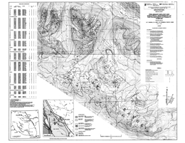
Open File map 1989-17 portrays the geology and noble metal geochemistry of the Polaris mafic-ultramafic complex, NTS 94C/5 and 12, west of Williston Lake in northern British Columbia. The complex, which is one of the largest Alaskan-type bodies in the province, is hosted in Upper Paleozoic metasedimentary and metavolcanic rocks, probably of the Lay Range assemblage of the Harper Ranch Group. The dominant lithologies are argillite, siltstone, phyllite, volcaniclastic rocks and minor limestone.
The Polaris complex is interpreted to be of Late Triassic age. In general, the gross internal distribution of rock types is systematically disposed about the margins. Dunite and olivine-bearing pyroxenitic rocks are concentrated near the base of the intrusion; hornblende-pyroxenites and gabbros are well developed near the roof. Contact relationships among the major lithologic units are sharp to gradational. The complex is cut by felsic intrusions of syenite to granophyre.
The complex is contained within a northwest-trending, southwest-facing and southwest-dipping homocline that is a fault-bounded slice of Lay Range assemblage rocks. The roof and margins of the sill display intrusive contacts; the basal contact is a ductile thrust zone. High angle faults with mainly northwesterly and westerly trends cut both the ultramafic body and the country rocks. Deformation complicates the distribution patterns of the various rock units.
Rock samples from the components of the Polaris complex were analyzed for platinum, palladium, rhenium and gold. Results are presented in tabular form and sample locations are shown on the map. Interesting but localized anomalies in platinum occur in chromitite-bearing dunite, and both platinum and palladium in a clinopyroxenite sample. Gold anomalies occur in mafic lithologies at the margins of the ultramafic complex.
G.T. Nixon, C.H. Ash, J.N. Connelly and G. Case
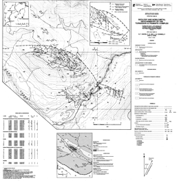
Open File 1989-18 describes he geology and noble metal geochemistry of the Turnagain ultramafic complex (104I/7, 10) in northern British Columbia. The geology map is at 1:16 000 scale and includes a legend and a table of noble metal analyses from various rock types in the ultramafic body. The Open File is a contribution to the Canada/ British Columbia Mineral Development Agreement 1985-1990.
The country rocks include the Upper Proterozoic to Lower Cambrian Atan Formation with argillite, siltstone, minor quartzite and limestone; Paleozoic graphitic slate and phyllite; and Upper Paleozoic metasedimentary and metavolcanic rocks of the Harper Ranch Group.
The Turnagain ultramafic complex is thought to be of Late Triassic age. The Complex consists of dunite; wehrlite with minor dunite, olivine clinopyroxenite, clinopyroxenite and hornblendite; olivine clinopyroxenite; hornblendite and feldspathic hornblendite; and serpentine. Early Jurassic (?) granodiorite bodies cut the older rocks.
The ultramafic body is separated from North American rocks by a reverse or thrust fault. To the west is a major transcurrent fault and rocks of the Harper Ranch Group lie to the west of it. Along the southern contact of the ultramafic body, it apparently intrudes rocks of the Harper Ranch Group.
The ultramafic body has chromite and sulphide occurrences. Net textured sulphide-rich wehrlite-clinopyroxenites yielded locally anomalous values in platinum, palladium and gold.
T. Harms, M. Ball, P. Fischer and J. Nelson
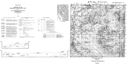
Open File map 1989-19 presents the geology of Needlepoint Mountain area, in NTS 104P/4, northern British Columbia. Included are 9 geochemical analyses for base and precious metals, and the pathfinder elements mercury, arsenic and antimony. There is also a table of mineral occurrences. The sample and occurrence locations also are plotted on the map.
The area features North American miogeoclinal strata of Cambrian to Mississippian age and Devonian to Triassic rocks of the Sylvester allochthon. The two rock packages are in thrust contact. West of the map-area, both packages are intruded by the Cassiar batholith.
The oldest North American rocks are rusty biotite hornfels of the Cambrian to Ordovician Kechika Group. These are overlain by Middle Devonian fetid carbonates of the McDame Group and Devonian to Mississippian argillite, porcellanite and shale of the Earn Group.
Age constraints in the Paleozoic component of the Sylvester allochthon are poor. The lowest unit exposed is a sedimentary argillite unit or black chert with local basalt and diorite. Higher (?) in the section, the Blackfox Mountain volcanic-sedimentary unit is dominantly green basalt and chert; the Needlepoint Mountain volcanic-sedimentary unit is mainly aphanitic green basalt but includes large volumes of fine to medium grained gabbro; and the Table Mountain volcanic-sedimentary unit is aphanitic green basalt with large lenses of sedimentary rock. The Table Mountain ultramafic rocks are extensively altered to serpentine and locally listwanite-altered. It occurs as small lenses along the basal fault of the Triassic Table Mountain sedimentary unit.
The Pennsylvanian Huntergroup massif augite porphyry basalt is a thick volcanic suite. It is in thrust contact with the Table Mountain sedimentary unit, which consists of black slaty argillite with interbedded siltstone and fine-grained black quartzite.
The main exploration focus in the area has been for mesothermal gold silver deposits like the Erickson mine, where multiphase quartz veins dip steeply in sheared, carbonate-altered basalts. They contain free gold and gold disseminated within pyrite and tetrahedrite. Veins also occur along the contact between footwall listwanites and overlying Triassic sediments or within the listwanites. Historically, placer mining was also important in the area.
D.G. Bailey
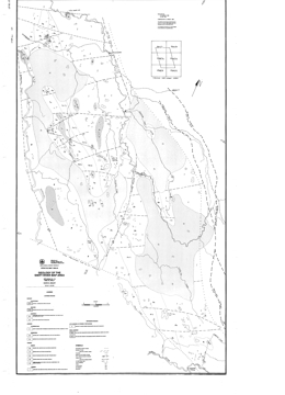
Open File 1989-20 describes the geology and mineral occurrences of the Swift River map area (93A/12, 13; 93B/16; 93G/1) in the central Quesnel belt in central British Columbia. The geology is presented at 1:50 000 scale.
The oldest rocks in the area are of Triassic age. Carnian siltstone, sandstone, mafic tuff and minor conglomerate are overlain by Norian alkali basalt and breccia, analcite-bearing pyroxene basalt, maroon siltstone and sandstone, and grey limestone and calcareous sandstone. Jurassic rocks are Sinemurian and Pleinsbachian. Sinemurian strata comprise maroon polylithic breccia with feldspathic clasts, and latite tuff and breccia. Pleinsbachian rocks are mainly pyritic interbedded sandstone and siltstone. Eocene (?) sandstone and siltstone are overlain by latite tuff and tuffaceous sandstone, tuff breccia and autobrecciated flows. Pleistocene plateau basalts are maroon and grey.
Generally fine-grained syenite, monzonite and diorite or megacrystic syenite, gabbro and diorite intrusions that are of Early Jurassic age cut the Triassic-Jurassic volcanic stratigraphy. Late Jurassic and possibly Cretaceous granodiorite and quartz monzonite intrusions also occur.
The area is bounded on the west by the Quesnel fault, and on the east by the Eureka and Spanish thrust faults. It is split internally by the north trending, dextral Chiaz fault. Between faults the blocks are inferred to be broken by a series of east and east-northeast trending faults. The structures represent the effects of collision between the Quesnel and Omineca belts, and a later period of extension.
The central Quesnel belt is well known for its porphyry potential. The main targets are gold-bearing copper porphyries associated with alkaline intrusions. Some molybdenite mineralization is known within a Cretaceous granodiorite body.
P.B. Read
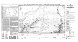
Open File 1989-21 presents the Tertiary stratigraphy and information on industrial mineral occurrences in the area that extends from the Bonaparte River to the Deadman River (92P/2, 3). The Open File gives results of field investigations of industrial mineral occurrences in the Miocene and Eocene rocks of the map area. It was funded by the Canada/British Columbia Mineral Development Agreement. The Open File consists of a 1:50 000-scale geological map that outlines the distribution of the Middle Eocene Kamloops Group and Miocene Chilcotin Group volcanic and sedimentary rocks, and also contains cross sections and a table of industrial mineral occurrences in the area. The mapping identified five Miocene channels with indicators that the area drained to the north and west. Accompanying notes briefly describes the Tertiary stratigraphy, Miocene drainage, nine diatomaceous earth and three volcanic ash occurrences.
The Tertiary strata and the setting of the Red Lake diatomaceous earth deposit are the focus of this Open File. Country rocks to them are the Pennsylvanian to Triassic Cache Creek complex, Middle and Upper Triassic Nicola Group, Late Triassic intrusive rocks, Lower Jurassic intrusive rocks, Lower and Middle Jurassic Ashcroft Formation, and Lower and Upper Cretaceous chert pebble conglomerate and sandstone.
Middle Eocene Kamloops Group volcanic and epiclastic rocks are separated into 12 mappable units. Rhyolite flows; rhyolite intrusions; crystal tuff and tuffaceous sandstone; rhyolite tuff and volcanic breccia; pebble to boulder conglomerate; shale, siltstone and carbonaceous shale with zeolitized rhyolite tuff and sandstone lenses; rhyodacite breccia and andesite breccia; basalt flows and breccia; andesite breccia; porphyritic andesite breccia; porphyritic andesite flows; and aphanitic andesite flows.
The Chilcotin Group is Miocene and consists of the Deadman River and Chasm formations. Deadman River Formation rocks include rhyolite ash, tuffaceous sandstone, siltstone, shale; some shales are diatomaceous. Vesicular and amygdaloidal basalt flows comprise the Chasm Formation.
Industrial minerals of interest are diatomaceous earth and massive rhyolite volcanic ash that occur in the Chilcotin Group.
T.G. Schroeter, A. Panteleyev, C. Lund and G. Carter
Open File 1989-22 documents the abundance and diversity of gold discoveries that have resulted from the tightly focused and successful exploration effort over the last several years. The report places them in context with the province's earlier history of precious metal production.
Gold production in British Columbia in 1987 totaled 11.7 tonnes, 10.6 per cent of Canadian production, ranking the province third-equal with the Northwest Territories as a gold producer, behind Ontario (44.8%) and Quebec (26.6%). Production is projected to double, and possibly triple, reaching more than 30 tonnes (1 million ounces) annually by early in the next decade; this is equivalent to 60 per cent of Canada's total production in 1981. There can be no better demonstration of the high potential for making new discoveries.
D.V. Lefebure, M.L. Malott
D.V. Lefebure and M.H. Gunning
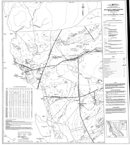
Open File 1989-24 consists of a geological compilation of the Atlin area (NTS 104N/12E, 11W) on two sheets at a scale of 1:20 000. The map includes a table of assay results for base and precious metals and pathfinder elements. BC Geological Survey staff have combined their work with geological maps completed by exploration companies in the area. These geology maps show mineral occurrences, drill hole locations and outcrop distribution.
The Atlin placer gold camp has produced almost 1 million ounces of gold since its discovery in 1898 but is still little explored for lode deposits. Auriferous quartz veins associated with listwanite alteration are common in the area and are the focus of several exploration programs.
Five stratified bedrock units are distinguished. The first four units are subdivisions of the Late Paleozoic Cache Creek Group; the fifth consists of olivine basalt flows and tephra of Tertiary and Quaternary age. The dominantly mafic volcanic unit of the Cache Creek Group comprises basaltic flows, andesite flows, mafic tuff, and volcanic conglomerate. Other units are limestone, argillite and sandstone, and chert. Unconsolidated glacial till and poorly sorted alluvium cover is important because of placer gold activity.
The oldest intrusive rocks are the Atlin intrusions, a series of ultramafic rocks that are mainly peridotite and dunite, and serpentinized equivalents. The Jurassic and Cretaceous Fourth of July batholith is made up of quartz monzonite, granodiorite and granite, whereas the Cretaceous Surprise Lake batholith consists of quartz monzonite, leucocratic granite and monzonite.
Major faults systems in the area strike northerly and east-northeaster.
Placer gold deposits are well known in the Atlin area and some are still active. Lode gold occurrences are associated with carbonate-altered zones in the ultramafic rocks near fault zones. Vein-hosted occurrences are predominantly silver-lead systems with associated copper, lead and gold. Mineralization at the former Atlin Ruffner mine is confined to dioritic and diabasic dikes. Skarns, veins and porphyry systems are related to the Surprise Lake batholith. Skarn mineralization occurs in Cache Creek carbonates and carry lead-zinc and copper values. Porphyry mineralization is characterized by the Adanac deposit, where molybdenite is associated with quartz veins. High background uranium values in the Surprise Lake batholith have attracted some interest.
G. McLaren and J. Rouse
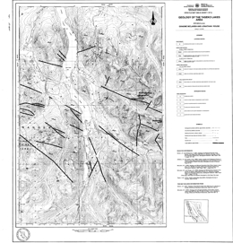
Open File 1989-25 (UTM 92O/3, 4, 5 and 6) completes 1:50 000-scale mapping by the Geological Survey Branch to the east and west of Taseko Lakes (see also Open Files 1987-3 and 1987-12). Sheet 1 of this Open File provides continuity with the previous geological mapping. Stream sediment survey data collected in 1988 complements data previously released for Map sheet 92O/4 (see Open File 1986-6). Sheet 2 includes analyses of stream sediments and rock-chip samples presented in Table format in the margin of the sample location map. Mineral occurrences in the area are highlighted on the map.
The oldest strata in the area are andesitic pyroclastics and breccias, and black argillite, siltstone and sandstone of the Relay Mountain Group. Lower Cretaceous Taylor Creek Group units consist of an argillite, siltstone and sandstone unit, and a unit with rhyolitic to basaltic tuffs and flows, black argillite, siltstone and sandstone. The Upper Cretaceous Silverquick Formation comprises polymictic conglomerates, limestones and argillites. The overlying Powell Creek Formation consists of two units: a lower andesite breccia, lapilli tuff, crystal tuff, ash tuff sequence, and an upper laharic andesite breccia and epiclastic sediment sequence.
Intrusive rocks in the area are granodiorite and quartz diorite of the Coast plutonic complex, felsite porphyry dikes, and quartz monzonite to granodiorite, and diorite stocks. Ages are uncertain.
Northwest trending transcurrent faults dominate the structural geology of the area. One of these is the Tchaikazan fault.
Precious metal veins and porphyry copper-molybdenum with or without gold occurrences predominate in the area. Two significant mineral occurrences in the area are the Chita porphyry copper-molybdenum occurrence, and gold-bearing sulphide veins on Taseko Mountain. Copper-bearing skarn mineralization is known. Other deposit types associated with fault zones include silicified and carbonate-altered fractures with copper-mercury-arsenic-antimony mineralization and epithermal mineralization.
G. McLaren and J. Rouse
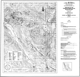
Open File 1989-26 describes the geology and presents geochemical survey results for the Tenquille Creek to Owl Mountain area. It consists of 2 map sheets at 1:50 000 scale that outline the geology and present geochemical survey results for an area north of Pemberton (NTS 92J/7, 10) which contains numerous mineral occurrences. The geological map focuses on lithologies pertinent to the mineral occurrences of the area. A new discovery of massive sulphide mineralization and the previously known vein and skarn occurrences highlight the mineral potential of the area. Analytical results of a moss-mat and stream sediment geochemical survey conducted in 1988 are tabulated on the sample location map. This map also includes a table of analytical results from an extensive rock chip sampling program conducted during mapping of the area.
Upper Triassic rocks tentatively correlated with the Cadwallader Group underlie most of the area. The sequence consists largely of andesite tuffs and flows with lesser rhyolite to dacite tuffs and breccias that are interbedded with argillite, greywacke, conglomerate, limestone and epiclastic volcanic sediments. Within the sequence are intervals with distinctive lithologies: limestone, quartz-rich sediments, coarse volcanic conglomerate, and argillite, greywacke, conglomerate package, and rhyolitic to dacitic volcanics and tuffs.
Coast intrusions of unknown age are diorite or hornblende diorite, and quartz diorite to granodiorite to granite.
Mineral prospects in the area include copper-lead-zinc-silver skarns, copper-iron skarns, polymetallic precious metal and copper-zinc veins, copper-iron and cooper-zinc massive sulphides, and porphyry copper-molybdenum occurrences.
K. Green
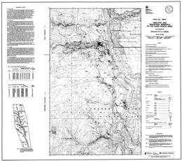
Open File 1989-27 presents the geology and industrial mineral occurrences in the Gang Ranch Area (92O/8, 9) in southern British Columbia. It is part of an ongoing investigation of industrial minerals in Tertiary basins, and was funded by the Canada/British Columbia Mineral Development Agreement. It comprises a 1:50 000-scale geological map of the area of Tertiary volcanic and sedimentary rocks west of the Fraser River fault system between Gaspard Creek and Lower Cabin Creek.
Accompanying notes briefly describe the Tertiary stratigraphy, eight zeolite, three bentonite and two perlite occurrences. Data on Mercury, Calcium, Sodium and Potassium cation exchange capacity and radiometric dating are provided.
This open file presents current data from an ongoing investigation of industrial minerals in Tertiary basins funded by the Canada/British Columbia Mineral Development Agreement.
In the vicinity of Gang Ranch, approximately 80 to110 kilometres at right-lateral, strike-slip movement on the Fraser fault has juxtaposed a western assemblage of Lower Cretaceous and Eocene volcanic, volcaniclastic and sedimentary rocks against Pennsylvanian to Triassic marine sediments and mafic volcanic rocks of the Cache Creek complex. This package of Lower Cretaceous and Eocene strata is bounded to the southwest by the Hungry Valley Thrust that places Jurassic to Cretaceous marine clastics of the Jackass Mountain Group on top of Eocene volcanic rocks.
East of the Fraser fault, siliceous volcanic tuffs, black and green ribbon chert and sheared, siliceous black argillite comprise the major part of the Cache Creek complex. In the southeast corner of the map area, a 150-metre-thick lens of light grey, recrystallized limestone is interbedded with black argillite and chert. Along the northern side at Gaspard Creek, mafic volcanic flows and gabbro underlie green chert and argillite.
West of the Fraser fault, approximately 700 metres of maroon, green-brown, and grey, crystal-phyric to aphanitic andesite flows and local hornblende porphyry flows of the Lower Cretaceous Spences Bridge Group are the oldest rocks exposed. A subgreenschist grade metamorphic assemblage of pumpellyite, zeolite, calcite and chlorite fills fractures and amygdules throughout the Spences Bridge Group volcanic package. This alteration assemblage provides a field criterion for distinguishing between Cretaceous and overlying Eocene volcanic flows.
Approximately 2000 metres of Eocene volcanic and volcaniclastic rocks overlie the Spences Bridge Group volcanic rocks on a gently west-dipping surface. The base of the Eocene package consists of red, yellow-beige and brown, andesitic to dacitic volcaniclastics and interlayered volcanic flows. In the western portion of the map-area, these volcanic rocks are overlain by a thick accumulation of pink, grey and white rhyolite flows, quartz-rich welded crystal tuffs and lithic tuffs. Towards the east, the coarse-grained, rhyolite tuff grades laterally into layers of white and green rhyolite crystal and ash tuffs that are interlayered with andesite, dacite and basalt volcaniclastics and flows. In the southwestern corner of the map sheet a grey-green feldspar porphyry flow overlies rhyolite lithic and crystal tuff. A sequence of well-bedded sediments containing layers of bentonitic ash and thin coal seams overlies the volcanic strata at a number of localities immediately west of the Fraser fault.
Flat-lying, erosional remnants of Miocene to Pleistocene plateau basalts and minor Miocene fluviatile sediments, in places overlain by a cream-coloured, rhyolitic ash layer, occur throughout the map area. In places they directly overlie the trace of the Fraser fault.
Volcanic rocks of the Spences Bridge Group are exposed in the footwall of a major northwest-trending normal fault, informally referred to as the Empire Valley fault. The Empire Valley fault appears to merge with the Fraser fault, but most likely postdates dextral, transcurrent motion. East-dipping reverse faults and northwest-trending upright folds developed in Eocene sediments and volcaniclastics west of the Fraser fault. Latest movement on the Fraser fault was dip-slip.
Eocene rhyolite crystal and ash tuffs are extensively altered to zeolite and bentonitic clay. Montmorillonite, illite and heulandite group zeolites have been identified. Perlite occurs at two locations in the southern part of the map-area. One of these is the Frenier perlite deposit. Fragments of diatomite were found in Miocene rhyolite ash west of the Gang Ranch.
D.V. Lefebure and M.H. Gunning
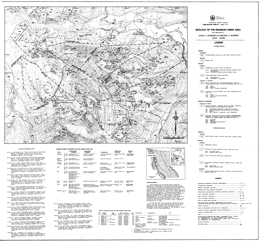
Open File 1989-28 presents the geology, geochemistry and mineral occurrences of he Bronson Creek area (104B/10W, 11E) in northwestern British Columbia at 1:25 000 scale. Sheet 1 has the geology, legend and a table of selected mineral deposits. Sheet 2 has a geochemical sample location map and tables of geochemical results.
The oldest rocks exposed in the area are Triassic or older sandstone, siltstone, shale, pebbly sandstone, small lenses of limestone that are also metamorphosed to phyllite, argillite and schist. These are overlain by Triassic or Jurassic plagioclase dacite porphyry flows, crystal tuffs and ash flows, and breccias as also mafic plagioclase and pyroxene phyric flows and volcaniclastic rocks. The two are locally interbedded. Jurassic orange-weathering siltstones, sandstones and conglomerates are overlain by a unit consisting of hornblende plagioclase andesite porphyry flows and breccias, and dacite porphyry flows. Tertiary basalt flows occur locally. Quaternary deposits are represented by glacial till and alluvium.
Triassic diorite and gabbro dykes and sills generally intrude the Triassic or older rocks. Jurassic intrusive rocks are more diverse and widespread. Granite porphyry and potassium feldspar porphyry comprise stocks, dykes and sills. Hornblende diorite occurs locally. Tertiary alkali basalt dykes are typically less than 2 metres across.
Deposits in the area are mesothermal shear-veins, with copper, lead, zinc and precious metals, such as the Snip mine; transitional shear-veins, with similar metal signatures; polymetallic veins, like Inel; and mesothermal lead-zinc or copper and precious metal veins.
1988
K. Andrew and T. Höy
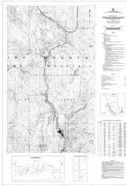
Open File Map 1988-01 presents the preliminary geology and mineral occurrences in the Rossland Group between Nelson and Ymir, southeastern British Columbia. The map is a 1:20 000-scale compilation within NTS 82F/06. The boundaries of the map are the 'tail' of the Nelson batholith on the east, longitude 117o19'E on the west, and latitudes 49o26'20"N and 49o15'30''N on the north and south. The map area contains 51 mineral occurrences, dominantly silver, gold and base metal veins, but also a variety of other deposit types and commodities.
Geology has been derived from fieldwork completed in 1987, published regional mapping by the Geological Survey of Canada, and published assessment report maps.
The map area lies within the Selkirk Mountains and is underlain by the Rossland Group, a suite of volcanic and sedimentary rocks of probable Upper Triassic to Middle Jurassic age. Special emphasis has been placed on differentiating units of the Elise Formation, which is a sequence of autoclastic, pyroclastic and epiclastic volcanic rocks.
The oldest rocks in the area are Lower Cambrian and older quartzite, schist, argillite, slate and limestone. Lower Cambrian rocks of the Laib Formation include phyllite, argillite, schist, micaceous quartzite and minor limestone. Lower Jurassic and older (?) Ymir Group rocks include argillite, siltstone, grits, and impure limestone with minor chert, feldspathic wacke and limey siltstone near the top. Conformably over the Ymir rocks are Lower to Middle Jurassic Rossland Group strata. The Rossland is subdivided into the Elise and Hall formations. The Elise is characterized by a series of interfingering lenses or massive to brecciated flows, tuffs, subvolcanic porphyries, and minor epiclastic deposits. The lower part consists of coarse-grained augite porphyry flows and flow breccias. The upper part consists of medium grained augite porphyry flows and flow breccias but upward in the section includes mafic ash tuff and plagioclase augite crystal tuff then plagioclase phyric flows, epiclastic rocks and subvolcanic plagioclase porphyry. The overlying Hall Formation is a succession of sedimentary rocks. There is a lower coarsening upward sequence of argillites, siltstones, grits and conglomerates overlain by a succession of interbedded siltstone and argillite.
Jurassic Nelson intrusions are granodiorites, diorite porphyries, quartz monzonites and quartz monzonite breccias. Middle Eocene Coryell intrusions are monzonites with biotite and/or augite phenocrysts. Tertiary or older (?) dikes are diorites, rhyolites and lamprophyres.
The dominant structures in the area are northerly trending tight folds and associated shears. The intensity of deformation increases toward the east.
Historic deposits in the area produced mainly gold and silver from the Rossland and Ymir camps. The main type of mineral occurrences are: porphyry or stockwork molybdenum-copper; skarn molybdenum, tungsten, copper and gold; vein gold-silver-copper or gold—silver-lead-zinc; and ‘conformable’ gold. The conformable gold occurrences are related to early structures and Rossland Group strata. They lie parallel to foliation or bedding and are related to synvolcanic intrusions.
L.J. Diakow and V. Koyanagi
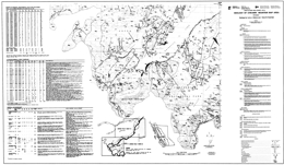
Open File 1988-02 portrays the geology of the east half of the Whitesail Reach and northeast half of the Chikamin Mountain map sheets (93E/10E and 93E/6). These partial 1:50 000 map sheets refine Mesozoic and Cenozoic stratigraphic and structural mapping in areas adjacent to Whitesail Lake.
Pre-Jurassic metavolcanic and metaplutonic rocks are the oldest rocks exposed in the area. They occur in a thrust panel that overlies mid-Cretaceous sedimentary rocks at Linquist Peak. Volcanic strata dominate the Mesozoic stratigraphy in the area. The volcanics include Lower Jurassic, Cretaceous and Tertiary lava flows and pyroclastic rocks. Middle Jurassic and mid-Cretaceous marine deposits comprise the sedimentary successions. The sediments separate maroon pyroclastic rocks that are very difficult to separate if the sediments are not present.
The oldest intrusive rocks in the area are foliated quartz diorites within the pre-Jurassic metamorphic rocks. Porphyritic granodiorites and quartz monzonites are linked to the Bulkley intrusions, which are 70 to 84 million years old. The youngest, Nanika intrusions are dated at 47 to 56 million years. The compositions range from diorite to granodiorite to quartz monzonite. The host quartz monzonite intrusion of the Red Bird porphyry copper-molybdenum mineralization has been dated at about 49 million years.
Easterly directed thrust movement post-dates mid-Cretaceous and pre-dates Eocene rocks. Mineralized veins in the metamorphic rocks are localized along the thrusts. Mesozoic strata are offset along high angle gravity faults. Quartz veins with silver-lead-zinc mineralization occur locally in steep, northwest-trending fractures.
The area contains several types of mineral prospects, namely: gold and silver telluride veins hosted by a thrust panel of pre-Jurassic Gamsby Group metavolcanic rocks; extensional fracture-controlled silver-lead-zinc veins that cut Lower and Middle Jurassic strata; and porphyry copper-molybdenum deposits associated with quartz monzonite intrusions.
New lithogeochemical analytical results are compiled for the map area, together with data from the 1987 Regional Geochemical Survey (BCMEMPR RGS-16, GSC Open File 1360). This is a contribution to the Canada/B.C. Mineral Development Agreement.
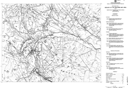
B.N. Church, M. MacLean, R. Gaba, M. Hanna and D. James
Open File 1988-03 presents the geology and mineral deposits of the Bralorne map-sheet (92J/5), which contains the Bridge River mining camp, 170 kilometres north of Vancouver. The Camp remains the foremost gold producer in British Columbia (4 million ounces). Open File 1988-3 is at 1:50 000 scale and covers approximately 1000 square kilometres. It depicts the geology of the central part of the Bridge River camp, and is based on property evaluations and regional mapping by the ministry in 1986 and 1987.
The principal stratigraphic assemblages in the area are the possibly pre-Permian Fergusson, the Upper Triassic Cadwallader and Cretaceous Taylor Creek groups.
The Fergusson Group consists largely of chert, with some marble, schist, gneiss and hornfels. Locally, greenstone sills and dykes cut these rocks. The Cadwallader Group consists of greenstones, and black argillites and siltstones with local limestone layers. The Taylor Creek Group consists mainly of coarse clastic sedimentary rocks.
The oldest intrusive rocks in the area are the Paleozoic Bralorne diorite, the President ultrabasic rocks and the Coast plutonic rocks. The Bralorne diorite bodies may have been emplaced along a fault. The often-serpentinized ultrabasic rocks occur as lenses that follow the diorite belt. Most Coast intrusions lie along the southwest and west parts of the map-area. Most are granodiorites, but local quartz diorite and granite phases occur.
The main exploration target in the area has been gold, which occurs in mesothermal quartz veins with arsenopyrite gangue. Other targets are stibnite and cinnabar.
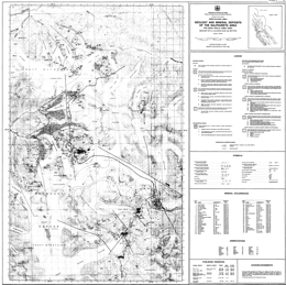
D.J. Alldrick and J.M. Britton
Open File 1988-04 presents the geology, major mineral deposits, mineral occurrences and gossans in the Sulphurets area (NTS 104A/5, 12; 104B/8, 9), one of British Columbia’s newest gold-silver camps. The map sheet is published at 1:50 000 scale and covers 1000 square kilometres at the eastern end of the Iskut River gold belt. Two mines are under development in the area and current reserves are tabulated for five precious metal deposits. The region is underlain by Lower to Middle Jurassic calcalkaline volcanic and associated sedimentary rocks of the Hazelton Group.
The area is underlain by Lower to Middle Jurassic Hazelton Group volcanic and sedimentary rocks that have been folded, faulted and weakly metamorphosed, mainly during Cretaceous time. Three episodes of intrusive activity produced small synvolcanic plutons, satellitic stocks of the Coast plutonic complex and minor dykes and sills.
The Hazelton Group consists of four lithostratigraphic map units in the Sulphurets area. Map unit 1 is a thick sequence of interbedded sedimentary and volcanic rocks. The sediments include sandstones, fine-grained conglomerates, rhythmically banded siltstones and mixed epiclastic/pyroclastic rocks. Quartz-poor lithic or arkosic wackes predominate. Intermediate pyroclastic comprise the volcanic component. Unit 2 consists of red, green and purple heterogeneous pyroclastic and epiclastic rocks. Unit 3 is light coloured and consists predominantly of felsic pyroclastic rocks, including welded tuffs. Unit 4 consists of marine, dark grey siltstone and fine-grained sandstone. It is well bedded but displays complex disharmonic folding.
Intrusive rocks are not abundant but are spatially and temporally associated with mineralization. Jurassic (?) quartz monzonite comprises the largest intrusion in the area, the Lee Brant stock. A wide variety of syn and post-volcanic hypabyssal stocks is concentrated near the Sulphurets and Mitchell glaciers. Most are quartz-poor and have alkaline affiliations; many are porphyritic with potassium, feldspar, hornblende and biotite. These intrusions are similar in composition to the volcanic rocks. Post-volcanic intrusions are generally more phaneritic and clearly cut the country rocks. Compositions differ from enclosing rocks and some are associated with copper and gold mineralization.
Only one syndepositional fault was recognized but they could be more numerous and important in controlling distribution of rock types in units 1 and 2.
More than 60 mineral occurrences are known in the area. Six types of veins are identified: base metal quartz, silver-rich base metal, precious and base metal quartz, precious metal quartz, carbonate, and barite. Other deposit types include: porphyry-style copper-molybdenum; disseminated gold (silver) in alteration zones; gold-bearing skarn; and stratabound pyritic zones.
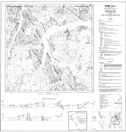
M.G. Mihalynuk and J.N. Rouse
Open File 1988-05 comprises two map sheets at 1:50,000 scale that present geological and geochemical survey data from the Tutshi Lake map area (NTS 104M/15), 120 kilometres south of Whitehorse, Yukon. Sheet 1 depicts the geology of the area, which is dominated by northwest-trending belts of pre-Permian metasediments, and Mesozoic volcanics and deep-water clastic sediments that have all been intruded by Cretaceous granitoids of the Coast crystalline belt. It also has geological cross sections and references. Sheet 2 contains a sample location map and stream sediment and lithogeochemical survey results for the area.
The area has long been recognized as part of an anomalous antimony-arsenic province hosting significant gold occurrences. This is reflected by lithogeochemical and regional stream sediment survey data presented on Sheet 2. These are the first published geochemical survey results for Map sheet 104M.
Proterozoic to Paleozoic metamorphics form a roughly 15 kilometre-wide belt that varies from upper amphibolite to greenschist grade. Typical rock types vary from schists and gneisses in the Boundary Ranges to pelites, semi-pelites, marbles, amphibolites, calc-silicates and minor quartzite in the Florence Range. Above are Paleozoic (?) to uppermost Triassic conglomerates with mainly Boundary Range metamorphic clasts.
The basal Upper Triassic Stuhini Group strata consist of Norian carbonates. Above are lapilli ash tuffs and tuffites overlain by conglomerates and associated sediments. The upper part consists of pyroxene-feldspar porphyry tuffs and breccias and feldspar-phyric tuffs.
Laberge strata are of Lower Jurassic age. The basal conglomerate gives way up section to argillites then siltstones and arenaceous wackes. Middle to Upper Jurassic (?) rocks are conglomerate, lapilli tuffs and balded feldspar porphyry flows. Upper Cretaceous Montana Mountain volcanics are intermediate to felsic pyroclastics and flows.
Pre-Cretaceous rocks are folded into upright to overturned, gently plunging folds.
Intrusive rocks have a long history in the area. The oldest intrusive rocks in the area are Paleozoic (?) to Triassic altered and deformed intrusive rocks that range from leuco-granite to quartz diorite.
Triassic (?) foliated granodiorite is followed by mid to Late Jurassic foliated porphyritic granodiorite to quartz monzonite, Cretaceous granodiorite, quartz monzonite, granite and diorite, then the Upper Cretaceous Coast Intrusions, which are mainly biotite hornblende granites with lesser granodiorite, quartz monzonite and diorite.
Mineralization is well known in the general area. Past producers are the Engineer mine, with gold and silver from quartz veins sparsely mineralized with tellurides and base metals, and Ben My Cree where gold and silver was mined from quartz veins with abundant sulphides. In both instances, the veins cut Laberge Group argillites and greywackes. Other deposit types of interest are sulphide-free quartz gold silver veins and sulphide-bearing carbonate-quartz veins associated with the Llewellyn fault zone. Gold may also occur in association with carbonatized ultramafic rocks, and placer gold has been produced historically. Prospective lithologic packages are the Laberge Group, mafic and ultramafic rocks and the Boundary Ranges metamorphic suite. There is also potential within and near the Llewellyn fault zone.
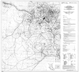
G.E. Ray and G.L. Dawson
Open File 1988-06, published at 1:25 000 scale, depicts the geology and distribution of major gold deposits and mineral occurrences within an area of 500 square kilometres covering the Hedley gold-skarn mining camp (92H/8E and 82E/5W) of southern British Columbia. The camp includes the newly re-opened Nickel Plate open-pit gold mine, Canada’s largest gold-bearing skarn deposit, as well as the French, Canty and Goodhope gold mines, which have produced in the past.
The region is largely underlain by sedimentary and volcaniclastic rocks of the Upper Triassic Nicola Group. These have been intruded by two plutonic suites of Early Jurassic age, the older of which is associated with the auriferous skarn mineralization. This project was funded in part by the Canada/B.C. Mineral Development Agreement.
The southeast margin of the map-area is underlain by the oldest rocks exposed, a highly deformed Paleozoic to Mesozoic ophiolitic sequence, the Apex Mountain complex. The Upper Triassic Nicola Group is cut by large Early Jurassic granodiorite to quartz monzonite intrusive bodies and the important Hedley intrusion of quartz diorite, diorite and gabbro. The Nicola Group is separated into 5 mappable formations. From older to younger, these are a basaltic ash tuff and flow unit; limestone, limestone breccia and pebble conglomerate; thinly bedded siltstone with thick limestone beds; thinly bedded argillite and limestone; bedded to massive ash and lapilli tuff with a distinctive limestone boulder conglomerate (Copperfield conglomerate) at the base. Early Cretaceous rocks of the Spences Bridge Group and Cretaceous porphyry dykes and a granite stock cut Nicola rocks.
Gold-bearing skarns are the primary exploration focus in the area. Small to large zones of skarn developed in the area in association with contact metasomatic alteration around the Hedley intrusions. Favorable indicators of potential mineralization are large numbers of sills and dykes, fold hinges, and the presence of limestone-rich shallow marine facies sedimentary rocks of the Nicola Group. The preferred host rocks immediately underlie the Copperfield breccia.
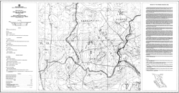
G.E. Ray and G.L. Dawson
Open File 1988-07 presents the geology of the Pennask Mountain area (92H/16), situated approximately 60 kilometres west of Penticton in south-central British Columbia. The map, at 1:25 000-scale covers an area of 200 square kilometres and is accompanied by descriptive marginal notes.
The area is mainly underlain by a roof pendant of sedimentary and volcanic rocks of the Upper Triassic Nicola Group. These rocks are intruded by the Early Jurassic Pennask batholith and the Late Jurassic Osprey Lake batholith. The Brenda porphyry copper-molybdenum mine is located immediately east of the map area. Brenda had proven reserves of about 160 million tonnes grading 0.18 percent copper and 0.049 percent molybdenum. The mineralization is hosted by the zoned and composite quartz diorite Brenda stock, which forms part of the Pennask batholith.
The oldest rocks in the area, informally called the Peachland Creek formation, may represent the oldest Nicola Group rocks yet known in the province. A lower mafic tuffaceous and volcanic unit in the east gives way to more felsic suite of dacitic ash tuff, flows and subvolcanic intrusions. To the west, is a younger argillite-rich sequence that may be equivalent to the Stemwinder Mountain formation of the Hedley area. It has a basal polymictic conglomerate and local graphitic limestone layers. The youngest Nicola rocks are mainly andesitic amphibole and pyroxene-bearing ash and lapilli tuffs that may be equivalent to the Upper Triassic Whistle Creek formation. Small bodies of diorite to quartz diorite to granodiorite of unknown age intrude the Nicola Group rocks. The Early (?) Jurassic Pennask quartz diorite to granodiorite batholith and the Late Jurassic Osprey lake quartz monzonite to granite batholith also cut and metamorphose Nicola Group rocks.
In the north, the Princeton Group crops out sporadically. At the base, vesicular lavas are overlain by dust tuffs. There are also poorly exposed arkosic sandstone beds in the basal section.
The Nicola Group occupies the western limb of major, easterly-closing anticline.
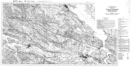
N.W.D. Massey, S.J. Friday, P.E. Tercier, and T.E. Potter
Open File 1988-8 comprises a set of 10 maps depicting the geology, stratigraphy and structure of the Duncan and Chemainus River area (92B/13; 92C/15E). The Open File contains one 1:50 000 geology map, one 1:50 000 mineral occurrence map, seven 1:20 000 maps and a legend sheet. This is a contribution to the Canada/B.C. Mineral Development Agreement.
The Open File updates part of Open File 1987-2 and continues the mapping eastwards to the eastern shoreline of Vancouver Island. The area is underlain by volcanic and sedimentary rocks of the Paleozoic Sicker Group intruded by gabbros of Late Triassic age and granodiorites of the Middle Jurassic Island Intrusions. Upper Cretaceous Nanaimo Group sediments lie unconformably on the older rocks. Late Cretaceous to Tertiary high-angle listric reverse faults cut all sequences resulting in a series of west-northwest-trending panels. The area is a past producer of base metals and has significant potential for polymetallic massive sulphides, rhodonite, quartz-carbonate gold veins and auriferous jaspers.
The oldest rocks in the map area belong to the Paleozoic Sicker and Buttle Lake groups which contain volcanic and sedimentary units ranging from Middle Devonian to Early Permian age. The Devonian Sicker Group is a thick package of lower greenschist facies, metavolcanic and volcaniclastic rocks that formed in an oceanic island-arc environment. The lowest unit exposed is the Nitinat Formation, characterized by pyroxene-feldspar-porphyritic basalts and basaltic andesites. These typically occur as agglomerates, breccias, lapilli tufts and crystal tuffs that formed as pyroclastic flows, debris flows and lahars. Pyroxene-phyric, amygdaloidal, pillowed and massive flows are also developed.
The Nitinat Formation is overlain, apparently conformably, by a heterogeneous sequence of mafic to felsic volcanics and volcaniclastic sediments of the McLaughlin Ridge Formation. The volcanics are predominantly intermediate pyroclastics, commonly feldspar crystal-lapilli tufts, heterolithic lapilli tufts and breccias and minor pyroxene-phyric lapilli tuffs. A thick package of felsic quartz-crystal, quartz-feldspar-crystal and fine dust-tuffs is developed in the Chapman Creek - Mount Sicker -Mount Richards area. It thins to the west, where it interfingers with andesitic lapilli tufts and breccias. The uppermost unit is a distinctive maroon schistose heterolithic breccia and lapilli tuff with minor jasper, exposed in the Chapman Creek area. Coeval, and probably consanguineous, with the felsic volcanics in the McLaughlin Ridge Formation is a suite of granodiorite stocks and quartz porphyry dikes collectively known as the Saltspring Intrusive Suite. The Sicker Group volcanic rocks and associated intrusions form a coherent suite of medium-potassium calcalkaline chemistry typical of an island-arc.
The Buttle Lake Group is made up of a dominantly epiclastic and bioclastic limestone sedimentary sequence ranging from Mississippian to Early Permian in age. Within the area, the Buttle Lake Group is most often found in fault contact with the lower volcanic units of the Sicker Group. However, it is conformable on the McLaughlin Ridge Formation south of Sansum Point and in the Chapman Creek area and on the southwest limb of the Cowichan uplift, is unconformable on the lower volcanics.
The Fourth Lake Formation comprises mostly thin-bedded, often cherty sediments. South of the Chemainus River, the base of the formation is marked by a sequence of radiolarian ribbon cherts and cherty siltstones 100 to 200 metres thick, informally called the Shaw Creek member. This passes upwards into monotonous thinly bedded, sometimes cherty, turbiditic sandstone-siltstone-argillite intercalations. The ribbon cherts of the Shaw Creek member are absent north of the Chemainus River, where thinly bedded turbiditic clastic sediments conformably overlie the McLaughlin Ridge volcanics and dominate the sequence. Minor volcanism was synchronous with early Fourth Lake Formation sedimentation in the Coronation Mountain area. This 'Coronation Mountain suite' consists of hornfelsed, amygdaloidal diabasic flows, which are generally massive but occasionally pillowed, and interbedded cherty tufts and sediments. The basalts are slightly undersaturated olivine tholeiites or transitional basalts, with somewhat enriched incompatible trace-element contents akin to ocean-island tholeiite or enriched ocean-floor basalt.
The Mount Mark Formation conformably overlies the Fourth Lake Formation, although outcrops of the formation are restricted to the Fairservice Mountain -Bear Creek area, south of the Cowichan River. It comprises massive and laminated crinoidal calcarenites with chert and argillite interbeds.
Basalts of the Karmutsen Formation underlie Mount Whymper and the Mount Landalt-El Capitan area. They comprise pillowed flows, pillow breccias and hyaloclastite breccias interbedded with massive flows and sills.
The Paleozoic and Triassic rocks have been intruded by granodioritic bodies of the Early to Middle Jurassic Island Plutonic Suite. With the exception of the large Ladysmith pluton, these granodiorite intrusions are elongate in surface outcrop shape, paralleling the overall structural grain of the area. The dominant lithology is a medium to coarse-gained, equigranular granodiorite to quartz diorite with a characteristic 'salt-and-pepper' texture. Most of the large intrusive bodies are rich in mafic inclusions, especially in marginal agmatitic intrusive breccias. Contact metamorphic aureoles are developed around the intrusions causing hornfelsing and skarning in Paleozoic rocks. A variety of dikes and small irregular intrusions, that are probably coeval with the Island Plutonic Suite, occur throughout the area. Lithologically they include intermediate feldspar porphyry, hornblende feldspar porphyry and minor diabase. The Jurassic intrusions are coeval with the Bonanza volcanics, which outcrop in the Cowichan Lake area to the west. They form a metaluminous, medium to high-potassium calcalkaline suite typical of a convergent-margin environment.
Clastic sediments of the Upper Cretaceous Nanaimo Group lie unconformably on the older rocks. They are most thickly developed in the Maple Bay to Mount Prevost area, the Cowichan and Chemainus River valleys and the shoreline from Crofton to Ladysmith. The lower Benson Formation comprises basal cobble and boulder conglomerates and overlying medium to coarse-grained sandstones. These are succeeded by the black argillites and siltstones of the Haslam Formation. Pebble and cobble conglomerates of the Extension Formation conformably overlie Haslam Formation argillites on top of Mount Prevost and along the Chemainus River. Grey, medium to coarse-grained sandstones are interbedded with and overlie the conglomerates. Argillites of the Fender Formation, overlying the Extension Formation, are exposed in the incised gorge along the Chemainus River just below its confluence with Chipman Creek. Younger formations of the Nanaimo Group are absent.
Southern Vancouver Island has a complex structural history with frequent rejuvenation of previous structures. All Paleozoic rocks are affected by a series of southeast trending, upright to overturned, southwest-verging folds. Penetrative axial planar foliation is absent throughout most of the area, except north of the Fulford fault, where foliation (schistosity in volcanics and cleavage in sediments) is well developed and trends north-northwest with generally steep northeasterly dips. Lineations plunge gently, up to 150, to the west-northwest or east-southeast. Regional scale warping of Vancouver Island occurred during the Early to Middle Jurassic, facilitating the emplacement of the Island Plutonic Suite intrusions and producing the geanticlinal Cowichan uplift. The present map pattern is dominated by the northwesterly trending contractional faults of the Tertiary Cowichan fold and thrust system. These are high-angle reverse faults that become listric at mid-crustal levels. They generally place older rocks over younger. Mesoscale footwall folds and minor imbricate faults are developed along most of the thrusts, particularly where thicker sections of Nanaimo sediments occur in the footwall, as in the Mount Prevost area where a deformational zone up to 1.5 kilometres wide occurs beneath the Fulford fault. The deformation probably took place during the crustal shortening accompanying the formation and emplacement of the Rim and Crescent terranes outboard of Wrangellia.
The Duncan area has had a somewhat intermittent history of mineral exploration since the late nineteenth century. 'Three mines on Mount Sicker (Lenora, Tyee and Richard III) formed the foci for one of the largest townsites in the area at the turn of the century. However, only sporadic production has ensued since then. The localization of metal deposits in the area is controlled by the interplay of stratigraphy and spatial association with later intrusions and structures. Three major metallogenic epochs are recognized. Syngenetic mineralization occurred during the building of the Sicker arc. Kuroko-style massive sulphides are associated with felsic volcanics in the upper part of the McLaughlin Ridge Formation. They occur in a belt extending from Saltspring Island to Rheinhart Creek, bounded to the south by the Fulford fault and appear to have formed close to the volcanic centre located in the Duncan - Saltspring Island area. Jasper and oxide-rich cherts occur within the volcanics of the Nitinat and McLaughlin Ridge formations but appear to have negligible economic mineralization. Thin syngenetic manganese oxide beds and sulphidic argillites occur within the radiolarian cherts of the basal Fourth Lake Formation.
The Early to Middle Jurassic arc was characterized by epigenetic mineralization of various types and styles, spatially related to the Island Plutonic Suite intrusions. Copper-molybdenum veins and stockworks occur within intrusions and volcanic country rock. Rhodonite forms by contact metamorphism of manganiferous chert.
Mesothermal gold-bearing quartz-carbonate veins are located along Tertiary structures and have been one of the main exploration targets in the area.
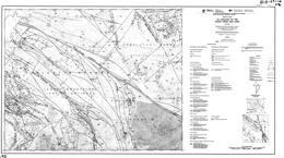
J.K. Glover, P. Schiarizza and J.I. Garver
Open File 1988-09 comprises 1:50 000 geological and mineral potential maps of the Noaxe Creek map area (920/2). The area is transected by the northwest-trending Yalakom fault and underlain by Mesozoic and Tertiary rocks that host epithermal to mesothermal gold occurrences, fault-related mercury showings and porphyry copper prospects with low gold values such as the Poison Mountain deposit. This is a contribution to the Canada/B.C. Mineral Development Agreement.
Southeast of the Yalakom fault, much of the Noaxe Creek map area is underlain by partially coeval rocks of the Bridge River complex, the Cadwallader Group, and younger Tyaughton, Relay Mountain, Taylor Creek and Battlement Ridge groups. This map documents the lithological characteristics and distribution of these units, and the nature of the structures that separate them. It also portrays elements of an important Late Cretaceous fault system that were traced into the area from the north and west, and provides further information on the structural and stratigraphic relationships of mid Cretaceous rocks within the region.
The Bridge River complex comprises structurally imbricated chert, greenstone, limestone, elastic rocks, gabbro and serpentinite; it is at least in part Middle Triassic to Early Jurassic in age. Gabbro occurs locally as sheeted dykes, corroborating the oceanic origin suggested by the predominant lithologies. The local importance of clastic rocks, limestone beds and limestone olistoliths suggests derivation from a topographically diverse basin or basins, perhaps a back-arc or marginal ocean basin setting. Most of the complex is at prehnite-pumpellyite metamorphic grade and is characterized by pervasive brittle faulting. Pre-Middle Cretaceous blueschist facies metamorphism is documented in the Eldorado Mountain area, and suggests that deformation and metamorphism in part occurred in a subduction zone.
The Cadwallader Group comprises pillowed and massive greenstone of the Pioneer Formation and overlying conglomerate, sandstone and shale of the Hurley Formation. It is Late Triassic in age and therefore coeval with parts of the Bridge River complex. In the Eldorado Mountain area it is juxtaposed against the Bridge River complex across north-northeast-trending faults that predate the Castle Pass strike-slip fault and may also predate mid Cretaceous compressional structures.
Tyaughton Group Middle to Upper Norian red conglomerates and sandstones, and thick-bedded limestone are overlain by Hettangian to Lower Bajocian shales, sandstone, siltstone and conglomerate. Relay Mountain Group rocks are variably shale, sandstone, conglomerate and calcareous rocks. Lower Cretaceous Taylor Creek rocks range from the Paradise Formation, a siltstone, sandstone, polymictic conglomerate unit, through the Dash chert pebble conglomerate, to the Lizard Formation shale and muscovite-rich arkosic sandstones. Upper Cretaceous rocks of the Battlement Ridge Group consist of the Silverquick Formation of dominantly pebble to cobble conglomerate, and the Powell Creek Formation of andesitic volcanic breccia, and related tuffs, flows and epiclastic rocks. Eocene rhyolitic to dacitic flows occur locally, and Miocene and/or Pliocene basalt flows cap high areas.
Northeast of the Yalakom fault, Lower Cretaceous Jackass Mountain Group volcanic-lithic sandstones, pebble to boulder conglomerates give way up section to arkosic sandstones, siltstone and shale. Overlying Upper Cretaceous andesitic volcanic breccia, lapilli tuff and lahar and epiclastic sediments are correlative with the Powell Creek Formation. Eocene epiclastic rocks, and andesitic to rhyolitic flows and breccias are more prominent and variable than Eocene rocks to the southwest and are abundant northeast of the Red Mountain fault. Miocene and/or Pliocene basalts are uncommon.
Deposition of the late Early Cretaceous Taylor Creek Group was coincident with the onset of regional compressional tectonism. Clasts within the Taylor Creek Group provide the first evidence of uplift and erosion of the Bridge River complex, while clasts in the overlying Silverquick conglomerate were derived from both the Bridge River complex and Cadwallader Group Further-more, the Taylor Creek Group is the oldest unit within the Tyaughton basin documented to sit unconformably above Bridge River basement. This suggests the possibility that thrust imbrication (and accretion?) of the Bridge River and Cadwallader terranes was predominantly a late Early Cretaceous event.
The map area is cut by a northwest-trending system of dextral strike-slip faults that was active in Late Cretaceous time. Northerly trending splays of the Relay Creek-Marshall Creek fault system connect with the Yalakom fault system to define a large-scale extensional duplex structure. This fault system steps across and bounds the northwestern margin of the Shulaps ultramafic complex at its southeastern end. In contrast to the extensional zone to the northwest, the Shulaps complex may have been deformed and uplifted during Late Cretaceous movement on the bounding strike-slip fault systems.
Metallic mineral concentrations are within or adjacent to strike-slip faults or associated structures, and have a close spatial relationship with plutons or dykes. The age of mineralization seems closely tied to igneous activity between Late Cretaceous and Early Tertiary time. The protracted history of mineralization and plutonism combined with differential uplift across faults has led to the juxtaposition of deposits of contrasting structural level and local inconsistencies in the pattern of regional metal zoning documented by Woodsworth et al. (1977). In Noaxe Creek area epithermal gold, precious metal-bearing polymetallic veins, porphyry copper-molybdenum, tungsten skarn and shear-related mercury occurrences are documented.
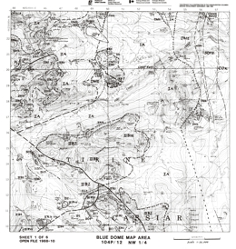
J. Nelson, T. Harms, J. Bradford, K. Green and H. Marsden
Open File 1988-10 presents the geology, geochemistry and mineral occurrences of the Blue Dome map-area (104P/12) in northern British Columbia. The Open File consists of 6 sheets: sheets 1 to 4 present geology at 1:25 000 scale; sheet 5 metallogeny and rock geochemistry; and sheet 6 has the geological legend and mineral occurrences. This Open File is a contribution to the Canada/British Columbia Mineral Development Agreement 1985-1990.
The Blue Dome area covers parts of the Cassiar platform and the Sylvester allochthon. The autochthonous section exposed in this part of the Cassiar platform ranges from Lower Cambrian to Lower Mississippian in age. Thick carbonate units, the Lower Cambrian Rosella Formation and the mid-Devonian McDame Group, are regional exploration foci, hosting such deposits as Ketza River in Yukon and Midway in northern British Columbia. In the Blue Dome area quartz breccias with silver and base metal sulphide mineralization occur where faults cut Rosella carbonates.
The oldest North American rocks exposed in the area are Lower Cambrian carbonates and clastic sediments of the Atan Group. Above these are Cambrian to Ordovician Kechika Group limy slate, siltstone and limestone, Ordovician to Silurian Road River Group slates, argillaceous limestone and dolomite, Ordovician to Lower Devonian Sandpile Group dolomite, quartz arenite and limestone, then Lower Devonian Tapioca sandstone, which consists of dolomitic quartz arenite, quartzite and dolomite. Overlying McDame Group dolomite, limestone and dolomite breccia are Middle Devonian. Devonian to Mississippian Earn Group slate, argillite, greywacke, siltstone, limestone and exhalites followed.
In the project area, the Devonian to Triassic Sylvester allochthon comprises three structurally stacked divisions, each of which represents a separate late Paleozoic tectonic and depositional environment. Upper Triassic sediments are restricted to the highest structural level in Division II. It is suggested that they correlate with autochthonous Triassic strata in the Rocky Mountains and Selwyn basin. Division I, the lowest and therefore assumed to represent the facies originating closest to the late Paleozoic continental margin, is primarily a sedimentary sequence with strong similarities to the Earn Group and overlying Mississippian to Early Permian chert and argillite which occurs at the top of the Cassiar Terrane stratigraphic succession. Division II is an ophiolitic assemblage. It contains fragments of oceanic, ultramafic-gabbroic basement and stratified early Mississippian to Early Permian sequences of interbedded basalt, sediments and diabase sills. Significantly, siliciclastic units identical to Earn Group sandstones are intimately interbedded with basalt flows and tuffs in Division II.
Division III is a late Paleozoic island-arc package that resembles Yukon Tanana and Harper Ranch Terrane assemblages, rather than the Slide Mountain Terrane. It contains three suites: a pyroclastic-epiclastic sedimentary sequence with interbedded continentally derived sandstones, that is intruded by an early Mississippian pluton; and a widespread Pennsylvanian-Permian island-arc edifice with fringing reefs and chert-limestone-epiclastic marginal facies.
The Cretaceous Cassiar batholith consists of granite and granodiorite.
Tertiary to Recent basalt and olivine basalt flows comprise the Thuya Formation.
The diverse geology of the project area is reflected in its metallogeny and mineral potential. Deposits include Devono-Mississippian exhalites in the Earn Group and Sylvester allochthon, the Cassiar and McDame asbestos deposits in Sylvester serpentinites, the Erickson and Taurus gold deposits in mesothermal quartz veins, and silver-lead-zinc mantos, tungsten skarns and porphyry molybdenum deposits. There are strong geological ties between the Midway silver-lead-zinc manto deposit and Late Cretaceous intrusions, porphyry deposits and skarns.
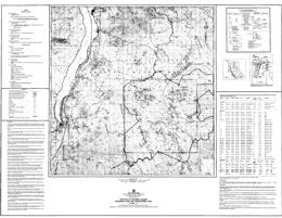
D.A. Brown and J.M. Logan
Open File 1988-11 portrays the geology, geochemistry and mineral occurrences of Kokanee Glacial Provincial Park and the surrounding area (NTS 82F/11, 14) in southern British Columbia. This set of three 1:50 000-scale maps and accompanying data sheet presents the geology, mineral occurrences, rock and stream sediment geochemistry together with compiled geochronometry and Pb-isotope data. Tables of geochemical results are included for 1977 and 1987 stream sediment samples and about 230 rock samples.
The park covers about 305 square kilometres within the Selkirk Mountains of southeastern British Columbia. It is centred 35 kilometres northeast of Nelson, between Slocan and Kootenay lakes. Topography is rugged with glacier-covered mountain peaks over 2750 metres high. Keen Creek valley is the lowest area in the park at 1200 metres elevation.
The map area is underlain predominantly by the Middle Jurassic Nelson batholith. Late Triassic Slocan Group sedimentary rocks occupy the northern third of the map area and occur within the batholith as small pendants. Early Jurassic Rossland Group volcanic pendants, host to the Willa porphyry copper-gold deposit, are limited to the west side of the map area. The district contains batholith and sediment-hosted quartz veins and rare skarns. Hydrothermally altered fault zones have epithermal gold-silver potential.
The Nelson batholith is about 170 million years old. The composite batholith can be divided into six phases. The main phase is potassium-feldspar megacrystic granite. Other less important phases are: hornblende potassium-feldspar porphyritic granite, biotite granite/granodiorite, diorite/amphibolite and biotite lamprophyre. The Nelson plutonic suite is subalkaline and metaluminous with Cordilleran I-type affinities.
The northern end of the batholith intrudes the Upper Triassic Slocan Group, which consists of argillite, siltstone and minor amounts of limestone. The eastern edge intrudes a sequence of Lower Cambrian to Upper Triassic metasedimentary and metavolcanic rocks that dip westward at a moderate angle. The western boundary is defined by the Slocan Lake fault zone and Cretaceous to Tertiary gneissic intrusions of the Vahalla complex.
There are fifteen past producers and fourteen mineral prospects in Kokanee Glacier Park. Total production from the park was 82 209 tonnes that yielded 126 461 grams gold, 38 439 kilograms silver, 3 821 758 kilograms lead, 1 246 305 kilograms zinc, 1 473 kilograms copper and 13 875 kilograms cadmium. The value of past production is about 17 million dollars (February, 1988). All producers are low tonnage (<56 000 tonnes) and occur within the batholith. No mines are currently operating in the park.
Metallogenic studies, combined with detailed geological mapping, indicate that Kokanee Glacier Park holds potential for discovery of new, low tonnage mesothermal vein-type deposits. Based on past production, new discoveries will probably be less than 50 000 tonnes in size but rich; carrying silver, lead, and zinc. Gold-bearing veins are possible but less likely. Assessment of the resource potential of the vein deposits is difficult because the veins are narrow and discontinuous, have very thin alteration haloes and are apparently not related to obvious linear structures.
About 40 per cent of the park is alpine meadow or felsenmeer with almost complete rock exposure. As a result, few if any surface mineral showings have escaped detection by conventional prospecting methods. Batholith-hosted veins are narrow and in the past have been located only in the well-exposed areas above treeline. Subsequent exploration and development have followed these veins to lower elevations that are generally covered by overburden. In the 60 per cent of the park below treeline, rock exposure is limited.
Placer gold has reportedly been panned by individuals from Enterprise Creek (Little, 1960) and Woodbury Creek, which drain the western and eastern portions of the park, respectively. The gold source may be the Scranton-Pontiac deposit, however, it could be from other as yet undiscovered sources.
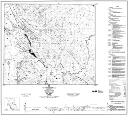
F. Ferri and D.M. Melville
The Manson Lakes 1:50 000 map sheet (93N/9) is located in east-central British Columbia and straddles the boundary between the Intermontane and Omineca tectonic belts. The northeastern half of the map sheet encompasses high-grade metamorphic rocks of the Ingenika Group and Wolverine Complex. The southwestern half is underlain by the slide Mountain Group, which is made up of volcanic and deep-water sediments of oceanic affinities. These have been intruded by the Germansen batholith and overlain by intermediate volcanics.
Open File 1988-12 consists of two 1:50 000-scale sheets that present the geology and mineral occurrences for the Manson Lakes map sheet, together with selected rock and stream sediment geochemistry compiled from 1983 and 1987 Regional Geochemical surveys.
Proterozoic rocks in the area are represented by the Ingenika Group and the Wolverine complex. The Wolverine complex comprises a calc-silicate amphibolite division and a pelitic division; the protoliths are Ingenika Group. The rocks are schists and gneisses. They are cut by granodiorites and pegmatites of Cretaceous to Tertiary age. The Ingenika complex has lower, middle and upper divisions. The lower division contains mainly sillimanite-bearing schists and gneisses, metamorphosed feldspathic wackes; the middle division metamorphosed quartzite, arkose and schists; and the upper division a limestone or marble unit, and a phyllite, siltstone, arkose unit that is locally schistose.
Upper Devonian to Lower Mississippian carbonatite-bearing unit contains syenite, monzonite and aegirine sovite bodies. These have been metamorphosed to upper greenschist or lower amphibolite grade.
The upper Paleozoic to Triassic Slide Mountain Group has components that are dominantly ultramafic rocks, gabbros, basalts, siliceous sediments, arenaceous wackes and graphitic sediments with limestone and chert layers.
Takla Group (?) rocks are hornblende andesites and tuffs.
Mesozoic intrusive rocks are dominated by the Cretaceous, two-mica Germansen batholith, which is diorite, granodiorite and granite.
Tertiary intermediate volcanics include plagioclase-biotite phyric flows, tuffs and agglomerates.
The Proterozoic rocks have undergone polyphase deformation and metamorphism. Slide Mountain rocks display mainly one phase of deformation. The oceanic Slide Mountain rocks were emplaced over Ingenika Group rocks, which have North American affinities. Most structures in the area trend northwest and are inclined toward the northeast and the Intermontane and Omineca belts are separated by normal faults.
Mineralization ranges from rare-earth-bearing carbonatites to sulphide and precious metal veins related to the Manson fault zone. Potential deposits include chromite in ultramafic rocks, sediment-hosted barite deposits, vein-hosted molybdenum and tungsten deposits, sulphide-bearing amphibolite gneisses, and vein-hosted precious and base metal deposits.
S.B. Butrenchuk, Z.D. Hora, G.V. White, K.D. Hancock and M.E. MacLean
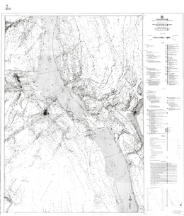
T. Höy and G. Carter
Open File 1988-14 is a compilation at 1:100,000-scale of the geology of the Fernie West-half map sheet and the eastern edge of the Nelson East-half sheet in southeastern British Columbia. It includes data from published and unpublished geological mapping by the authors, published maps by the Geological Survey of Canada and unpublished maps by mineral exploration companies. Also included on separate sheets are ten cross sections and a list of the 143 mineral occurrences and deposits in the area.
Fernie West-half straddles the Rocky Mountain Trench with the fold and thrust belt of the Rocky Mountains on the east and the Purcell anticlinorium on the west. The map emphasizes the geology of the Purcell Supergroup. The most important deposit in the area is the Sullivan, a massive sulphide, clastic-hosted lead-zinc-silver deposit. Other significant deposits include numerous silver and gold veins and the gold placer camps on Wild Horse River and Moyie River. Many of the occurrences carry copper, often with precious metals. Industrial minerals that are potentially important in the area include magnesite, graphite gypsum, dolomite, limestone and phosphates. Copper-gold mineralization may be associated with the Cretaceous alkalic intrusions and skarn mineralization is possible.
The area is underlain by a varied sequence of strata. The oldest are rocks of the Helikian Purcell Supergroup and the following formations are represented: Fort Steele, Aldridge, Creston, Kitchener and Sheppard, Dutch Creek and Phillips and Gateway, Mount Nelson and Roosville. The Moyie sills cut the sequence. The Toby conglomerate represents the Hadrynian Windermere Supergroup. Paleozoic strata range in age from Lower Cambrian to Permian. Strata that the crop out are the: Eager and Cranbrook Formations, Elko and Gordon Formations, Tanglefoot unit, Jubilee Formation, McKay Group, Wonah Formation, Beaverfoot Formation, “Basal Devonian unit”, Fairholme Group, Palliser Formation, Banff and Exshaw Formations, Rundle Group, and Rocky Mountain Group. Mesozoic rocks that occur include the Triassic Spray River Group, Jurassic and the Cretaceous Fernie Group and Kootenay Formation. Upper Cretaceous monzonite, quartz monzonite and granodiorite intrusions occur.
West of the Rocky Mountain Trench the structural fabric of the countryside is northwesterly. East of the Trench the Rocky Mountain fold and thrust belt dominates the structural fabric.
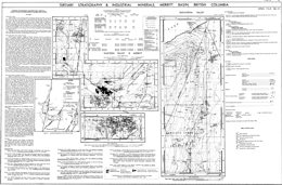
P.B. Read
Open File 1988-15 presents the geology, stratigraphy, coal and industrial mineral potential of the Merritt basin (NTS 92I/1, 2) in south central British Columbia. It comprises two geological maps - Merritt Basin at 1:50 000 scale with 1:25 000 scale detail of the coal deposit area, and Quilchena Outlier at 1:25 000 scale, compiled on a single sheet. The accompanying notes provide detailed descriptions of bentonite occurrences of potential economic significance.
Bentonite-rich zones up to eight metres in thickness occur near coal seams in the Quilchena and Guichon valleys. Two tables provide location details for four bentonite occurrences and exchangeable cation analyses on selected samples.
The oldest rocks exposed in the area are aphyric to augite phyric andesite to basalt flows and crystal lithic tuffs of the Upper Triassic Nicola Group. These are cut by fine to medium grained diorites of uncertain age, and Jurassic quartz monzonite to granodiorite intrusions.
The Merritt basin contains a wedge of Eocene volcanic rocks that underlie Eocene sedimentary cover rocks. The basin is broken into three parts by northerly trending normal (?) faults. The western segment underlies the lower end of Guichon valley to Lower Nicola, the central segment is around and east of Merritt, and the eastern segment is underlies the lower part of Quilchena valley.
Princeton Group rocks in the basin are of Middle Eocene age and are subdivided into the Cedar and Coldwater formations. The Cedar Formation consists of lower flows and volcanic breccia that give way upward to dacite, andesite and basalt flows, breccia and minor tuff, then rhyolite flows and breccia. The Coldwater Formation has a lower section of sandstone, pebble conglomerate, siltstone, shale and rare coal that is overlain by white to buff-weathering sandstone and pebble conglomerate with local siltstone and shale and rare coal. The upper unit contains grey shale, carbonaceous shale, minor coal and rare bentonite. Bentonite zones up to 8 metres thick occur near coal seams in Quilchena and Guichon valleys.
This open file presents current data from an ongoing investigation of industrial minerals in Tertiary basins, funded by Canada/British Columbia Mineral Development Agreement.
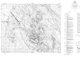
P.J. Umhoefer and J.I. Garver
Open File 1988-16 is a 1:20 000 scale geological map of the Relay Mountain area (NTS 92O/2W and 92O/3E). It covers approximately 300 square kilometres within the Chilcotin Mountains, 200 kilometres north of Vancouver, British Columbia. The area is underlain by fossiliferous, dominantly marine sedimentary strata of Mesozoic age. At least two phases of deformation are evident within a zone of northwesterly trending right-lateral strike-slip faulting and older thrust faults and folds. The resulting complex structural pattern is outlined on the geological map by structural measurements and the distribution of well-defined stratigraphic units.
The oldest rocks exposed in the area comprise the Tyaughton Group, which is of Norian age. The lowest ‘Red beds’ unit consists of conglomerate and conglomeratic sandstone, and is overlain by limestone, then limestone conglomerate, conglomerate and green sandstone at the top. The overlying of Middle Jurassic to Lower Cretaceous Relay Mountain Group strata are the focus of this mapping project. The Group consists of shale, siltstone, calcarenite, greywacke, grit and some conglomerate. The Lower Cretaceous Taylor Creek Group consists of the Paradise Creek formation, the Dash conglomerate, the Lizard formation, and the Elbow Pass formation. The Paradise Creek formation is dominantly shale and siltstone turbidites; the Dash is a chert pebble conglomerate; the Lizard formation is mainly shale; the Elbow Pass is primarily grey green sandstone and conglomerate. The Upper Cretaceous Battlement Ridge Group consists of the Silverquick formation and the Powell Creek formation. The Silverquick is mainly pebble to cobble conglomerate; the Powell Creek consists of volcanic breccia, lapilli tuff with interbedded flows and epiclastic sediments. Miocene and/or Pliocene plateau basalts are locally extensive.
Intrusive rocks comprise Upper Cretaceous to Eocene hornblende plagioclase porphyries.
The structure of the area is dominated by northwest-trending high angle normal and reverse faults. A pronounced angular unconformity separates non-marine Upper Cretaceous from Lower Cretaceous marine units. Folding and thrusting have affected the older rocks, but only tilting and gentle folds occur in the younger strata.
The area covered has potential low grade gold and base metal deposits associated with intrusive rocks, and cinnabar, stibnite and/or scheelite occurrences associated with fault zones.
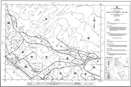
R. Gaba, B.N. Church, M. Hanna and D. James
Open File 1988-17, at 1:20 000 scale, depicts the geology of the Marshall Lake area in the southern part of the Shulaps Range, and part of Marshall Ridge in the northeast section of the Bridge River mining camp (B.C. Map Series 92J/098). Geology is plotted on a 1:20 000-scale base showing logging access roads (adjoins Open File 1988-18).
The rocks of the Marshall Lake area comprise a variety of Paleozoic, Mesozoic and Tertiary volcanic and sedimentary strata and igneous intrusions.
The Paleozoic Fergusson Group rocks are mainly recrystallized ribbon cherts with intercalated phyllites, schists and thin marble bands. The Upper Triassic Cadwallader Group consists in this area of the Pioneer and Hurley formations. The Pioneer formation is predominantly amygdaloidal basalt, pillow basalt, and breccias. Hurley formation rocks comprise volcanic breccias, polymictic conglomerates, sandstones, argillites and limestones. Tertiary lavas and hoodoo-forming pyroclastic deposits occur locally.
The Bralorne intrusions are small gabbro and diorite stocks mostly aligned along the Cadwallader break. Zircon from a coarse-grained phase near Gold Bridge yields a U-Pb date of 293±13 Ma, indicating that the intrusions are among the oldest rocks in the area. Lower Jurassic ultramafic rocks of the Shulaps complex comprise harzburgite, peridotite, dunite and serpentinized rocks. Listwanite alteration is associated with some faults. Upper Cretaceous Coast Plutonic complex diorite, granodiorite and granite form stocks and plutons. The Tertiary Rex Peak porphyry is a felsic phase of the Mission Ridge pluton.
The Bridge River mining camp, which is known principally for mesothermal gold-quartz vein mineralization, encompasses five former mines including two large gold producers, Bralorne and Pioneer; three small producers, Wayside, Minto and Congress; and more than 60 surrounding mineral prospects. Other potential deposit types are veins with stibnite, mercury, and chromite in the ultramafic rocks.
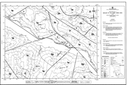
R. Gaba, B.N. Church, M. Hanna and D. James
Open File 1988-18 depicts the geology at 1:20 000 scale of the Marshall Ridge -Rex Peak area, which is adjacent to Carpenter Lake and the Tommy Creek - Keary Creek area (B.C. Map Series 92J/088) in the eastern part of the Bridge River mining camp. Geology is plotted on a 1:20 000-scale base map showing logging access roads. The area adjoins the area covered by Open File 1988-17.
The rocks of the Tommy Creek area comprise a variety of Paleozoic, Mesozoic and Tertiary volcanic and sedimentary strata and igneous intrusions.
The Paleozoic Fergusson Group rocks are mainly recrystallized ribbon cherts with intercalated phyllites, schists and thin marble bands. The Upper Triassic Cadwallader Group consists in this area of the Pioneer and Hurley formations. The Pioneer formation is predominantly amygdaloidal basalt, pillow basalt, and breccias. Hurley formation rocks comprise volcanic breccias, polymictic conglomerates, sandstones, argillites and limestones. Tertiary lavas and hoodoo-forming pyroclastic deposits occur locally.
The Bralorne intrusions are small gabbro and diorite stocks mostly aligned along the Cadwallader break. Zircon from a coarse-grained phase near Gold Bridge yields a U-Pb date of 293±13 Ma, indicating that the intrusions are among the oldest rocks in the area. Lower Jurassic ultramafic rocks of the Shulaps complex comprise harzburgite, peridotite, dunite and serpentinized rocks. Listwanite alteration is associated with some faults. Upper Cretaceous Coast Plutonic complex diorite, granodiorite and granite form stocks and plutons. The Tertiary Rex Peak porphyry is a felsic phase of the Mission Ridge pluton.
The Bridge River mining camp, which is known principally for mesothermal gold-quartz vein mineralization, encompasses five former mines including two large gold producers, Bralorne and Pioneer; three small producers, Wayside, Minto and Congress; and more than 60 surrounding mineral prospects. Other potential deposit types are veins with stibnite, mercury, and chromite in the ultramafic rocks.
M.E. MacLean
The purpose of Open File 1988-19 is to aid prospectors and the industry in the discovery and development of the local talc resources to replace the present imported product.
There are many ultramafic belts in British Columbia which are ideal settings for a higher purity talc deposit. The number of known talc occurrences, together with favourable geology and laboratory research, indicated that talc meeting the industry's standards can be produced in British Columbia. This report outlines the known occurrences of talc and pyrophyllite in British Columbia, and provides information and references that will be useful as guides to exploration.
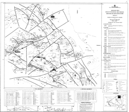
D.G. MacIntyre and P.J. Desjardins
Open File 1988-20 presents the geology of the Silver King-Mount Cronin area (NTS 93L/15) of the Babine Range at 1:20 000 scale. The map area is located approximately 20 kilometres east of Smithers in went-central British Columbia and covers part of the Babine Range between Little Joe and Reiseter creeks. Rocks in the area include the Early to Late Jurassic Hazelton Group, the Middle to Late Jurassic Bowser Lake Group, the Early Cretaceous Skeena Group and the Late Cretaceous Kasalka Group. Rhyolite, feldspar porphyry, diorite and andesite dykes and plugs cut these rocks. The map includes a legend and cross sections, as well as a table of rock geochemical analyses for altered and mineralized samples collected from the area in 1987, and a table of regional geochemical silt sample analyses.
The oldest rocks exposed are mainly lapilli and crystal tuff, volcanic breccia, and andesite flows of the Telkwa Formation of the Lower to Middle Jurassic Hazelton Group. These are overlain by augite phyric basalts with epiclastic or tuff interbeds that grade up section into calcareous siltstone and pebble conglomerate of the Nilkitkwa Formation, then glauconitic siltstone, sandstone and pebble conglomerate of the Smithers Formation. Over these are Middle to Late Jurassic black shale, siltstone, quartzose wacke and pebble conglomerate of the Ashman Formation of the Bowser Lake Group. Early Cretaceous polymictic pebble conglomerate with sandstone and shale interbeds comprise the Red Rose Formation of the Skeena Group. Overlying rocks of the Late Cretaceous Brian Boru Formation of the Kasalka Group are subdivided into a lower division that begins with conglomerate and sandstone then records the onset of volcanism with deposition of lahars, augite porphyritic basalt, lapilli tuff and andesitic rocks. The upper division is also dominantly volcanic. It consists of volcanic breccia, lapilli tuff, crystal tuff, and hornblende-feldspar phyric andesite. Late Cretaceous to Tertiary siltstone, argillite and conglomerate beds overlie the older rocks.
Intrusive rocks are primarily of Late Cretaceous to Tertiary age. They are variably basalt or andesite, diorite, quartz diorite to granodiorite, or rhyolite to dacite.
Mapping has delineated major faults that bound and offset an area of Late Cretaceous to Tertiary volcanic and sedimentary rocks. These rocks are preserved in a series of tilted fault blocks that are interpreted to be part of a major cauldron subsidence complex centred on Mount Cronin. The major mineral deposits in the area are silver-gold-bearing base metal rich veins such as the old Cronin mine, and the Debenture, Silver King and Lorraine prospects.
W.E. Kilby and S.T. Johnston
Open Files 1988-21 and 1988-22 depict the geology of an area with extensive coal and petroleum reserves with excellent potential for new discoveries. Open File 1988-21 presents the bedrock geology, at 1:50 000 scale, for the Kinuseo Creek area (93I/15) in northeastern British Columbia.
The maps were produced using semi-automated techniques. Data were obtained from a compilation of existing information followed up by field verification and fill-in mapping.
The oldest map units are undivided but are mainly Paleozoic carbonates. The Jurassic Fernie Formation consists of marine black shales. Lower Cretaceous rocks comprise the Minnes, Bullhead and Fort St. John groups. Minnes Group rocks are largely undivided but are characterized by thinly bedded sandstone, shale and coal. Overlying pebble conglomerate of he Cadomin Formation and conglomerate, sandstone, shale and coal of he Gething Formation comprise the Bullhead Group. Moosebar Formation grey marine shale; Gates Formation conglomerate, sandstone, shale and coal; Hulcross Formation dark marine shale; Boulder Creek Formation conglomerate, sandstone, shale and coal; and Shaftesbury Formation dark marine shale comprise the Fort St. John Group. Upper Cretaceous rocks are represented by the Smokey Group and the Wapiti Formation. The Smokey Group consists of sandstone, shale and coal of the Dunvegan Formation; dark marine shale of the Kaskapau Formation; sandstone of the Cardium Formation; grey marine shale of the Muskiki Formation; quartz sandstone of the Badheart Formation; concretionary grey marine shale of the Pushwaskau Formation; and grey marine sandstone of the Chungo Member. Non-marine conglomerate, sandstone, shale and coal comprise the Wapiti Formation.
The area straddles the foothills structural province. Shortening in the area was accommodated mainly by development of northwest trending box and chevron folds. No major faults occur in the area but minor thrusts are present.
Coal prospects are dominantly in the Gates Formation of the Fort St. John Group. An example of an operating mine in coal of this Formation is Quintette.
W.E. Kilby and S.T. Johnston
Open Files 1988-21 and 1988-22 depict the geology, at 1:50 000 scale, of an area with extensive coal and petroleum reserves and excellent potential for new discoveries. Open File 1988-22 portrays the bedrock geology of the Kinuseo Falls area in northeastern British Columbia.
The maps were produced using semi-automated techniques. Data were obtained from a compilation of existing information followed up by field verification and fill-in mapping.
The oldest map units are undivided but are mainly Paleozoic carbonates. The Jurassic Fernie Formation consists of marine black shales. Lower Cretaceous rocks comprise the Minnes, Bullhead and Fort St. John groups. Minnes Group rocks are largely undivided but are characterized by thinly bedded sandstone, shale and coal. Overlying pebble conglomerate of the Cadomin Formation and conglomerate, sandstone, shale and coal of he Gething Formation comprise the Bullhead Group. Moosebar Formation grey marine shale; Gates Formation conglomerate, sandstone, shale and coal; Hulcross Formation dark marine shale; Boulder Creek Formation conglomerate, sandstone, shale and coal; and Shaftesbury Formation dark marine shale comprise the Fort St. John Group. Upper Cretaceous rocks are represented by the Smokey Group and the Wapiti Formation. The Smokey Group consists of sandstone, shale and coal of the Dunvegan Formation; dark marine shale of the Kaskapau Formation; sandstone of the Cardium Formation; grey marine shale of the Muskiki Formation; quartz sandstone of the Badheart Formation; concretionary grey marine shale of the Pushwaskau Formation; and grey marine sandstone of the Chungo Member. Non-marine conglomerate, sandstone, shale and coal comprise the Wapiti Formation.
The area straddles the foothills structural province. Shortening in the area was accommodated mainly by development of northwest trending box and chevron folds. No major faults occur in the area but minor thrusts are present.
Coal prospects are dominantly in the Gates Formation of the Fort St. John Group. An example of an operating mine in coal of this Formation is Quintette.
A. Matheson
Open File 1988-23 discusses producing and developing thermal coal properties in British Columbia. This report examines the variability of BC's coal and how this resource can meet a large spectrum of market demands. The total in situ reserve and resource figure for thermal coal in British Columbia is 12.14 billion tonnes, almost 30 percent of the entire provincial coal resource. At present, major coal production is from two areas in the province, the southeast and the northeast. Limited production is also obtained from Vancouver Island.
A. Sutherland-Brown
Open File 1988-24, "Mineral Inventory of the Alberni Region, Vancouver Island, British Columbia", is the product of an office study undertaken to augment the field mapping program that was part of the LITHOPROBE study of southern Vancouver Island.
This project was intended to investigate the third dimension in an area with an active subduction zone. It is a coordinated series of geophysical, geological and geochemical investigations undertaken by government, university and industry geoscientists. There are four vibroseismic profiles on southern Vancouver Island with the principal one a transect across the island from near Parksville to Bamfield and one of the others along the Nitinat valley.
The study relied mainly on assessment reports, MINFILE and minor incidental field visits. The British Columbia Geoscience Research Grant Program provided funds to support the study. The project included 1:50 000 mapping of the following areas: Little Nitinat River (92C/15), Alberni Inlet (92C/14), Horne Lake (92F/7), the Vancouver Island part of Parksville (92F/8), and part of Barkley Sound (92C/14) and Nanaimo lakes (92F/1).
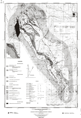
G. Nixon
Open File 1988-25 is geological map (1:25 000) of the Tulameen ultramafic complex (92H/7, 10) that was completed during the initial phase of the Geological Survey Branch ultramafic program that has long-term goals directed towards an understanding of the platinum group mineral potential of ultramafic and mafic rocks in British Columbia. The map includes a compilation of previous work and a new interpretation of the structure of the complex and its relationships with host Nicola Group. Previously known and newly discovered sulphide and magnetite occurrences are indicated, together with the distribution and structure of platiniferous chromitite horizons within the dunite core. This map is a contribution to the Canada/B.C. Mineral Development Agreement.
The Tulameen complex was emplaced into metasedimentary and intermediate to felsic metavolcanic lithologies of the western facies of the Upper Triassic Nicola Group. The Complex and its host rocks are unconformably overlain by sedimentary and volcanic sequences of the early Tertiary Princeton Group, and Miocene plateau lavas.
The Tulameen ultramafic complex consists primarily of dunite, olivine clinopyroxenite, hornblende clinopyroxenite and gabbroic rocks. Dunite is restricted to the northern part of the complex. Olivine clinopyroxenite envelopes the dunite core and extends southward. Breccia bodies occur within this unit. Hornblende clinopyroxenite occurs generally at the periphery of the complex. Gabbroic rocks are most abundant along the eastern side of the complex.
The structural fabric of the area is north-northwest with westward dipping foliation. The Tulameen complex is elongated and concordant with the structural grain. The east margin of the dunite is faulted and cataclastically deformed. Contacts between the dunite and olivine clinopyroxenite may be a thrust fault. A high angle fault is marked by a mylonite zone at the contact between the pyroxenite and mappable gabbroic rocks. It is apparently a reverse fault.
Chromite-magnetite occurrences in the area may contain platinum group elements. Chromite schlieren occur within the dunite but their distribution is poorly known. Magnetite layers also have PGE potential. Platinum has been recovered from gold placer deposits in watercourses draining the Tulameen complex.
J. Pell
Within British Columbia, rocks containing garnet and kyanite group minerals are mainly distributed in two linear belts, the Omineca crystalline belt and the Coast Mountain belt; however, within these areas, strata which are sufficiently pelitic to contain major concentrations of these minerals are sporadically distributed. Within the Omineca Belt, garnet and kyanite - enriched strata are found in the Nelson map area (82F), the Vernon map area (82L), the Seymour Arm area (82M), the Canoe River map area (83D) of south - central British Columbia, and in the Mesilinka area (94C) further north. Garnet and kyanite - enriched strata in the Coast Mountain belt are found in the vicinity of Hope -Yale - Harrison Lake - Lytton (92H and I) and in the Prince Rupert - Skeena - Douglas Channel area (103G, H, 1 , J ). Garnet and andalusite are also present in the Insular Belt on southern Vancouver Island (920, C ). Strata within these areas locally contain in excess of 10 to 15 percent kyanite group minerals and in excess of 25 percent almandine garnet which are potentially economically interesting concentrations. The economic viability in terms of accessibility, tonnage and beneficiation potential has not been determined. Although not addressed in detail, the potential also exists for secondary placer accumulations to be present in the vicinity of hard rock showings.
Z.D. Hora
This report completes the basic inventory of the construction aggregate resource in British Columbia. The information for the Lower Mainland has already been published in the Sand and Gravel Study 1980 - Paper 1980-10, by Z.D. Hora and F.C. Basham, which covers the transportation corridors and populated areas of the mainland. A similar inventory for Vancouver Island was deemed unnecessary, because the whole area of the island is covered by 1:50 000 landform maps outlining where granular units can be readily identified. There are many more but these are the best documented in the available literature and ministry files.
K.D. Hancock
This report documents 81 significant magnetite occurrences in British Columbia. There are many more but these are the best documented in the available literature and ministry files.
P.B. Read
Open File 1988-29 presents current data from an ongoing investigation of industrial minerals in Tertiary basins, funded by the Canada/British Columbia Mineral Development Agreement. It comprises 1:50 000 scale geological maps of the area of Tertiary volcanic and sedimentary rocks outcropping along the Fraser River fault system between the Stein River and China Gulch (92I/05, 12, 13; 92O/01, 08; 92P/04), that is along the Fraser River from Lytton to the Gang Ranch.
The accompanying notes provide detailed descriptions of seven bentonite occurrences, five zeolite occurrences and five occurrences of volcanic glass (one of them perlite) having potential economic significance. Data on exchangeable cation capacity values for selected samples are included. Important new information correlating the Ward Creek and Fountain Valley assemblages with rocks assigned to the Spences Bridge Group is based on a number of new radiometric and palynological dates.
Eocene and older rocks in the area are sliced into slivers and wedges by the Fraser and Yalakom fault systems. Several areas previously mapped as Eocene, are now reassigned to the Lower Cretaceous Spences Bridge Group. Lower Cretaceous volcanics are selectively amygdaloidal, and complexly jointed and veined, whereas Eocene volcanics are vesicular, simply jointed and unveined. Two fault-separated blocks are separated by a middle wedge. The eastern block and middle wedge have similar Eocene volcanics and Lower Cretaceous sediments and volcanics. The western block lacks Eocene rocks and Lower Cretaceous volcanics.
The oldest rocks in the eastern block are Pavillion beds or western facies of the Cache Creek complex consists dominantly of basic flows, breccia and tuff and grey phyllite to ribbon chert. It is intruded by the metadiorite of the Late Jurassic Tiffin Creek stock and by post-kinematic diorite to granodiorite plutons. Only plagiphyric flows and breccia represent the Spences Bridge Group. Aphanitic grey breccia, bentonitic andesite and white rhyolite breccia and flows of Middle Eocene age are locally preserved.
In the middle wedge, the oldest rocks are Lower Cretaceous conglomerate to argillite that underlie volcanics. The Eocene succession consists mainly of varicoloured aphanitic volcanics of andesite to rhyolite composition that underlie a distinctive volcanic conglomerate and bentonitic siltstone and shale.
Industrial minerals in the map-area are confined to Eocene rocks. Perlite and volcanic glass localities are located in the volcanic rocks. Bentonite-bearing lenses occur in probable waterlain andesite breccia or there are bentonite-bearing siltstones and shales. Zeolites replace waterlain rhyolite ash, tephra or tuffaceous arenites.
P.B. Read
Open File 1988-30 presents the results of a field investigation of stratigraphy and industrial mineral occurrences in the Tertiary rocks of the Cache Creek map area (92I/14) that was funded by the Canada/British Columbia Mineral Development Agreement. Areas underlain by predominantly volcanic rocks of the Middle Eocene Kamloops Group extend northwards from Cache Creek along the valley of the Bonaparte River, eastwards through the Cache Creek Hills, and northwards again towards the Deadman River. The geology of these areas is presented at 1:50 000-scale.
Accompanying notes briefly describe the Tertiary stratigraphy and four zeolite occurrences in the basal tuffaceous lenses of the Kamloops Group. Data on exchangeable Ca, Na, K and Mg analyses, cation exchange capacity, and paleontological and radiometric dating are provided in three tables.
The Mid-Eocene Kamloops Group occupies an open northwesterly trending syncline. The Deadman River fault truncates the northeastern limb and the Bonaparte fault may truncate the southwest limb. Beyond the fault Eocene erosional remnants lie on a faulted basement of Cache Creek complex, Guichon Creek batholith and Ashcroft Formation rocks. The basal Eocene unconformity is very uneven, with paleorelief of nearly 600 metres.
Volcanic rocks dominate the Kamloops Group in the map-area, albeit volcaniclastic sediments form local lenses. The oldest volcanism produced rhyolite and rhyodacite from local centres. In Cache creek, rhyolite breccia, tuff and quartz-biotite-feldspar porphyry are either extrusive or high level sub-volcanic and comprise an eruptive centre. Lenses of waterlain lithic and vitric-crystal tuff at the base are locally zeolitized east of Cache Creek. Most of the Kamloops volcanics are interfingering dacite to andesite flows and volcanic breccia.
Within a few hundred metres of the base of the Group, two cream-weathering lenses of tuffaceous and carbonaceous sediments and volcanic conglomerate crop out. Sandstone interlayers have a crystal and zeolitized ash component. Only these sedimentary lenses contain industrial minerals.
E.L. Faulkner and B.A. Gordon
Open File 1988-32 presents the results from a questionnaire mailed to placer miners active in British Columbia in 1985 and 1986. The purpose of the questionnaire was to obtain basic statistical information for placer miners and the placer mining industry in the province for the years 1981 to 1986, and some additional information for 1986.
A total of 868 questionnaires were mailed and 343 returns were processed, for a response of 39.5 per cent. The returns show that the industry spent a an average of over $30.4 million per year during the period, ranging from $25.4 million in 1984 to $37.0 million in 1982. In 1986, expenditures were over $26.2 million, with 94 per cent of this being spent in British Columbia. Using a round-figure multiplier of two, placer miners were responsible for over $52 million in direct and indirect expenditures during the year.
Approximately 3000 people worked on placer mines in 1986, with 90 per cent of these being British Columbia residents. The industry was dominated in numbers by hand operations or small mechanized operations processing less than 40 cubic metres of gravel per day, and in expenditures by a small number of large operations processing 200 cubic metres or more per day. Five per cent of operations in fact accounted for approximately 50 per cent of expenditures in the years studied.
D.E. Maynard
This project is a contribution to the Canada/British Columbia Mineral Development Agreement, 1985-1990.
1987
D. MacIntyre, P. Desjardins, P. Mallett and D. Brown
Open File 1987-1 is a 1:20 000-scale map that covers the area around the Dome Mountain gold camp (93L/10, 15) near Smithers in north central British Columbia. The area is underlain by calc-alkaline andesites, fragmental volcanics and tuffs of the Lower Jurassic Telkwa Formation; flows, volcanic sediments, argillite, siltstone and limestone of the Middle Jurassic Nilkitkwa Formation of the Hazelton Group; and siltstone and sandstone of the Middle to Upper Jurassic Smithers Formation. Mineral deposits include the economically important mesothermal gold-silver-lead-zinc-copper veins of the Dome Mountain camp, and regionally, porphyry copper-molybdenum deposits, copper-silver veins in basalt and small stratabound massive sulphide occurrences. The mapping has helped improve the understanding of the stratigraphy and structure of the area and the genesis of the mineral occurrences.
The core of Dome Mountain is underlain by a southwest-verging, southeast-plunging anticlinal structure that is cut by high angle northeast and northwest-trending faults. Several small plugs or dykes of diabase intrude the Hazelton Group rocks on Dome Mountain. A stock of quartz porphyry or quartz monzonite is exposed near the Free Gold showing.
Most Dome Mountain veins trend northwest and dip steeply to the northeast or southwest. In contrast, the Hoopes, Cabin and Boulder Creek veins trend northeast, albeit they may be part of the same vein system. Veins occur in several stratigraphic units. The Free Gold showing is in slightly altered andesites but foliated, fine-grained volcaniclastic rocks host most veins. The veins are probably related to buried intrusive bodies that were emplaced during the early stages of folding.
N.W.D. Massey, S.T. Friday, P. Tercier and V.J. Rublee
Open File 1987-2 consists of a set of maps that depict the geology, stratigraphy and structure of the Cowichan Lake area (092C/16) of southern Vancouver Island, British Columbia. The northern half of the map is underlain by Paleozoic Sicker Group rocks in a thrust-sliced geanticlinal uplift. These rocks have potential for Kuroko-style polymetallic massive sulphide deposits. Limestone in both Sicker Group and Quatsino Formation has been exploited for cement elsewhere on the Island. There is also exploration potential for the industrial mineral commodity manganese, mainly in rhodonite.
Mesozoic strata of the Vancouver and Bonanza Groups underlie the southern half of the area. The latter shows potential for epithermal gold-silver deposits associated with high-level intrusives. Island intrusive rocks also have copper-molybdenum porphyry potential.
Limestone is found in both the Sicker Group and the Vancouver Group, and copper skarns occur where the limestones are cut by Jurassic Island intrusives. Gold-bearing quartz-carbonate veins are related to shear zones across both Sicker Group rocks and Karmutsen Formation sills north of Cowichan Lake.
The Open File comprises one 1:50 000 map, seven 1:20 000 maps and a legend sheet.
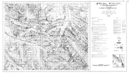
J.K. Glover, P. Schiarizza, P.S. Umhoefer and J. Garver
Open File 1987-3 describes the geology and mineral potential of the Warner Pass area (92O/3) of southern British Columbia. The area is on the northeast margin of the Coast Mountains. The open File consists of two 1:50 000 scale maps. Map A depicts the stratigraphy, structure and distribution of intrusive rocks in the area; Map B shows the locations of known mineral occurrences and hydrothermal alteration zones in the same area. New geochemical data for gold and related elements for 130 rock samples, together with stream sediment analyses from the 1979 Regional Geochemical Survey (re-released at 1:50 000-scale for the Warner Pass area) are included on the mineral potential map. The area covered has potential for both epithermal and porphyry-related gold deposits. This Open File is a contribution of the Canada/British Columbia mineral development agreement 1985-1990.
Stratified volcanic and sedimentary rocks comprise 8 units in the area. Unit 1 is equivalent to the lower part of the Tyaughton Group and is of Norian to Hettangian age. The unit consists of conglomerate and conglomeratic sandstone at the base, overlain by limestone, then limestone conglomerate, conglomerate and green sandstone, and calcareous shale and argillite at the top. Units 2 and 3 may be equivalent to the lower part of the Relay Mountain Group and is of Middle Jurassic to Lower Cretaceous age. Unit 2 consists of shale, siltstone, calcarenite, greywacke, grit and conglomerate. Overlying unit 2 rocks are a lower greywacke-dominated package, then interbedded greenish grey siltstone, shale and greywacke. Unit 4 rocks correlate with the Early Cretaceous Taylor Creek Group and consists of argillite, siltstone, sandstone, chert pebble conglomerate, and dacitic to andesitic flows and volcaniclastic rocks. Unit 5 comprises sandstone, shale and conglomerate; it may correlate with the Kingsvale Group. Unit 6 consists of mid to Late Cretaceous volcanic, volcaniclastic and clastic sedimentary rocks that correlate with the Kingsvale Group. The lower part is micaceous sandstone, shale and conglomerate, then andesitic breccia and related rocks, another sequence similar to the basal one, an upper andesitic breccia, lapilli tuff, and crystal tuff sequence, an upper zone with laharic andesitic breccia and epiclastic sediments. Unit 7 rocks are of Eocene age. The lower part consists of rhyolite and dacite flows with pyroclastic rocks and sediments, the upper part has basaltic flows and flow breccias. Miocene and/or Pliocene plateau basalts are locally extensive.
Intrusive rocks include Cretaceous and possibly Eocene hornblende plagioclase porphyries, Middle to Late Cretaceous rocks of the Coast Plutonic complex, which are mainly quartz diorite to quartz monzonite, Eocene (?) hornblende plagioclase biotite porphyries with accessory quartz, and Tertiary (?) quartz monzonite to granodiorite.
The structure of the area is dominated by northwest-trending high angle normal and reverse faults. A pronounced angular unconformity separates non-marine Upper Cretaceous from Lower Cretaceous marine units. Folding and thrusting have affected the older rocks, but only tilting and gentle folds occur in the younger strata.
The Taylor Windfall property is a historic gold producer. A fracture-related silicified zone carries pyrite, tennantite, chalcopyrite and minor sphalerite in a chlorite-sericite gangue. Other gold-bearing silicified zones occur and several properties have been explored for their porphyry copper gold potential. Most mineralization is apparently related to Eocene intrusive rocks.
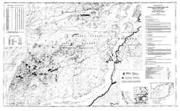
L. Diakow and M. Mihalynuk
Open File 1987-4 describes the geology and mineral deposits of the Whitesail Reach and Troitsa Lake area (93E/10W, 11E) of north central British Columbia. The area is 90 kilometres from Burns Lake. The geology map is at 1:50 000 scale and includes a legend, and tables of mineral occurrences and assay results. The map-area encompasses approximately 650 square kilometres of terrain centred on the Whitesail Range. The district contains quartz vein occurrences and zones of argillic alteration that indicate potential for mesothermal and epithermal gold-silver mineralization. The map area is underlain by Lower Jurassic and Upper Cretaceous-Tertiary calc-alkaline volcanic rocks interlayered with subordinate Middle Jurassic sedimentary rocks. Mineral property locations are documented together with assay results from 37 sample sites within zones of hydrothermal alteration. This Open File is a contribution of the Canada/British Columbia mineral development agreement 1985-1990.
The oldest rocks in the area are Early to Middle Jurassic strata of the Telkwa Formation and Smithers Formation of the Hazelton Group, and the Ashman Formation of the Bowser Group. These are separated by an angular unconformity from rocks of the Ootsa Lake Group, which are of Upper Cretaceous to Tertiary age.
Telkwa Formation rocks are mainly andesitic lapilli tuffs and tuff breccias interlayered with flows ranging from basalt to rhyolite. The Smithers Formation has a lower, dominantly marine sedimentary marine to subaerial facies that consists mainly of arkosic sandstone, siltstone and granule conglomerate, and an upper facies of red and green lapilli tuff and tuffite. The Ashman Formation consists of siltstone, chert pebble conglomerate, coarse sandstone and shale, similar to the Smithers Formation. Lower Cretaceous Skeena Group strata comprise micaceous sandstones, pebble conglomerate and shale. Upper Cretaceous Kasalka Group rocks are mainly amphibole-bearing ash tuff, lapilli tuff and tuff breccia. Upper Cretaceous and lower Tertiary rocks of the Ootsa Lake Group consists mainly of rhyolite flows with lesser basalt, andesite, and pyroclastic and sedimentary rocks.
Intrusive rocks include Cretaceous stocks and cupolas of granite, syenite, granodiorite, diorite and gabbro. They are assumed to correlate with the late Cretaceous and early Tertiary Bulkley and Coast intrusions.
Rocks in the area have been folded and faulted. Generally, the folds are gentle and open. Faults delimit downdropped blocks that locally preserve thick sections of Ootsa Lake strata.
Mineral prospects have features in common with epithermal gold-silver deposits. Two settings recognized are: fracture and shear-controlled veins, and pervasive clay-silica-pyrite ± barite replacements of the country rock near intrusions.
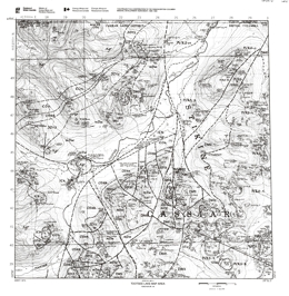
J. Nelson and J. Bradford
Open File 1987-5 portrays the geology and mineral deposits of the Midway area of northernmost British Columbia. Sheet 1 has a legend, a table of mineral occurrences, and geologic cross sections. The other four 1:25 000 maps depicts the geology, stratigraphy and structure of the Tootsee Lake map area (104O/16). The area contains manto silver-lead-zinc deposits and silver veins, controlled in part by a system of Late Cretaceous block faults. This Open File is a contribution of the Canada/British Columbia mineral development agreement 1985-1990.
The area lies within the Cassiar Platform, a splinter of North American continental shelf. Miogeoclinal strata range from Lower Cambrian to Lower Mississippian and form the footwall of a regional bedding-parallel thrust fault. The hangingwall is the Late Devonian to Late Triassic Sylvester Allochthon. Emplacement of the Allochthon took place between Late Triassic and mid-Cretaceous time, when it was cut by the Cassiar batholith.
The oldest strata are miogeoclinal Lower Cambrian siliciclastics of the Boya Formation and carbonates of the Rosella Formation of the Atan Group. The overlying Cambrian to Ordovician Kechika Group slate, siltstone and limestone gives way to slates and carbonates of the Ordovician to Silurian Road River Group, which is overlain by the Silurian (?) to Lower Devonian Tapioca sandstone. This ‘sandstone’ is a distinctive sequence of dolomitic quartzite, quartzite and dolomite. Middle Devonian McDame dolomite and limestone are overlain by Upper Devonian to Lower Mississippian slate, sandstone, greywacke, conglomerate and siltstone of the Earn Group.
The Sylvester Allochthon consists of an internally imbricated assemblage of chert, argillite, serpentinite, basalt and their intrusive equivalents, gabbro, diorite-granodiorite, limestone and greywacke. Tertiary to Recent basalt flows occur locally.
The Cretaceous Cassiar batholith is dominantly potassium feldspar megacrystic granite but includes leucogranite and coarse-grained granodiorite. Late Cretaceous or Eocene rhyolite dikes cut the older rocks.
Two major structural events are recorded in the area. The Early Jurassic collisional event caused major shortening of the North American continental margin and emplaced the Sylvester Allochthon. The younger event reflects Late cretaceous to early Tertiary wrench faulting.
Three major episodes of mineralization can be identified in the area. Upper Devonian to Lower Mississippian siliceous and baritic exhalative events produced barite layers and pyrite, sphalerite and some galena; Mid-Cretaceous mineralization associated with the Cassiar batholith produced molybdenum in quartz veins, scheelite in adjacent skarns, and silver-lead-zinc replacement lenses and veins; Late Cretaceous to Eocene mineralization associated with late phases of the Cassiar batholith produced lead-zinc-silver manto deposits, like Midway, mainly in massive carbonate units; silver-lead-zinc veins in the batholith; and porphyry-type mineralization.
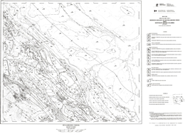
W. Kilby and C.B. Wrightson
Open File 1987-6 describes the geology and coal deposits of the Bullmoose area (93P/3) in northeastern British Columbia. The Bullmoose Creek map area contains the producing pit areas of the Quintette and Bullmoose mine operations of the Northeast Coal Project. Production from these two operations is approximately 6.5 million tonnes of metallurgical coal per year. A large portion of the Sukunka-Bullmoose gas fields is also contained within this map sheet. Units ranging from the Jurassic-Cretaceous Minnes Group to the Upper Cretaceous Cadomin Formation were mapped during the project.
The project also entailed significant compilation of existing map and borehole data. This information will be made available later on open file in computer form. The geology is presented at 1:50 000 scale. This Open File is a contribution of the Canada/British Columbia mineral development agreement 1985-1990.
Although rocks ranging from Devonian to Late Cretaceous age are exposed in the area, the mapping focused on rocks of he Jurassic Minnes Group and the Cretaceous Bullhead and Fort St. John Groups, the rocks with coal potential. Paleozoic and Triassic rocks are not differentiated on the map. The Jurassic Fernie Formation consists mainly of marine black shales. The Bullhead Group consists of the Minnes group, the Cadomin Formation and the Gething Formation. The undivided Minnes Group is more than 1800 metres of interbedded shale, siltstone, sandstone and coal. The Cadomin Formation is unconformably over the Minnes and consists of three bands of massive conglomerate containing chert and quartzite pebbles, and interbeds of sandstone. The Gething is a deltaic, mostly non-marine sequence of carbonaceous sandstone, coal, carbonaceous shale and conglomerate. Marine transgressive-regressive intervals occur. The Fort St. John Group consists of the Lower Cretaceous Moosebar, Gates, Hulcross, Boulder Creek, Hasler, and Goodrich formations, and the Upper Cretaceous Cruiser Formation. The Moosebar consists of marine shales with glauconitic sandstones at the base. The Gates consists of marine and non-marine sandstones with conglomerate, coal, shale, and mudstone layers. The Hulcross is mainly marine shale with siderite concretions. The Boulder Creek is largely sandstone and conglomerate. The Hasler is mainly marine shale with sideritic concretions, siltstone and sandstone. The Goodrich consists of cross-bedded sandstone, shale and mudstone. The younger Cruiser Formation is dominantly marine shale with siderite concretions. Other Upper Cretaceous rocks are marine and non-marine sandstone and shale of the Dunvegan Formation, shale with siderite concretions of the Kaskapau Formation, and sandstone with minor shale of the Cardium Formation.
The dominant structures in the area are northwest-striking folds and thrust faults. The Front Range thrust brings Paleozoic strata to the surface and marks the eastern edge of the Rocky Mountains. The Bullmoose fault zone is the only major thrust that affects the surface exposures of the coal-bearing strata.
The coal-bearing Gates and Gething formations are the most prominent targets for coal exploration. Both the Quintette and Bullmoose mines exploit coal measures in the Gates Formation. Economic gas pools are also known in the area.
W. Kilby and C.B. Wrightson
Open File 1987-7 describes the geology and coal deposits of the Sukunka River map sheet (93P/4), which is located in the Peace River Coalfield of northeastern British Columbia. A portion of the producing Bullmoose pit lies within the map area, as do several coal properties at the exploration stage. Coal measures of interest are found in the Gething and Gates Formations. Mapping concentrated on strata of the Rocky Mountain Foothills, which contain Jurassic-Cretaceous Minnes Group to Cretaceous Boulder Creek Formation rocks.
The map is the result of field mapping and a computer-based compilation project. The compiled data will be made available later in computer form as an open file release. This Open File is a contribution of the Canada/British Columbia mineral development agreement 1985-1990.
Although rocks ranging from Devonian to Late Cretaceous age are exposed in the area, the mapping focused on rocks of he Jurassic Minnes Group and the Cretaceous Bullhead and Fort St. John Groups, the rocks with coal potential. Paleozoic and Triassic rocks are not differentiated on the map. The Jurassic Fernie Formation consists mainly of marine black shales. The Bullhead Group consists of the Minnes group, the Cadomin Formation and the Gething Formation. The undivided Minnes Group is thinly to thickly interbedded shale, siltstone, sandstone and coal. The Cadomin Formation is unconformably over the Minnes and consists of three bands of massive conglomerate containing chert and quartzite pebbles. The Gething is a deltaic, mostly non-marine sequence of carbonaceous sandstone, coal, carbonaceous shale and conglomerate. Marine transgressive-regressive intervals occur. The Fort St. John Group consists of the Lower Cretaceous Moosebar, Gates, Hulcross, Boulder Creek, Hasler, and Goodrich formations, and the Upper Cretaceous Cruiser Formation. The Moosebar consists of marine shales with glauconitic sandstones at the base. The Gates consists of marine and non-marine sandstones with conglomerate, coal, shale, and mudstone layers. The Hulcross is mainly marine shale with siderite concretions. The Boulder Creek is largely sandstone and conglomerate. The Hasler is mainly marine shale with sideritic concretions, siltstone and sandstone. The Goodrich consists of cross-bedded sandstone, shale and mudstone. The younger Cruiser Formation is dominantly marine shale with siderite concretions. Other Upper Cretaceous rocks are marine and non-marine sandstone and shale of the Dunvegan Formation, shale with siderite concretions of the Kaskapau Formation, and sandstone with minor shale of the Cardium Formation.
The dominant structures in the area are northwest-striking folds and thrust faults. The Front Range thrust brings Paleozoic strata to the surface and marks the eastern edge of the Rocky Mountains. The Bullmoose fault zone is the only major thrust that affects the surface exposures of the coal-bearing strata.
The coal-bearing Gates and Gething formations are the most prominent targets for coal exploration. Both the Quintette and Bullmoose mines exploit coal measures in the Gates Formation. Economic gas pools are also known in the area.
G. Carter and T. Höy
The Creston Formation is divided into three informal members: a lower silty unit, a central quartz-rich unit, and an upper silty and quartzite unit. The Skookumchuck lavas, which extend through the west half of the map-area, grade westward into basic tuffs and volcaniclastic rocks. South of Skookumchuck Creek, individual formations in the upper Purcell succession show little facies or thickness changes from correlative rocks to the south. In the vicinity of the creek, the upper Purcell succession thickens dramatically and facies changes are apparent. For example, maroon siltstones and argillite of the Phillips Formation grade into green siltstones of the Dutch Creek Formation. The Mount Nelson Formation at Lookout Mountain rests with gradational contact on a relatively thin Dutch Creek Formation. The tectonic instability indicated by outpourings of basic volcanics and local erosion is manifested by growth faults that initiated in late to post-Nicol Creek time and continued through Gateway time.
M.A. Bloodgood
Open File 1987-09 comprises a 1:25 000-scale geology map that details the structure and stratigraphy of Triassic to Jurassic metasedimentary and metavolcanic rocks in the Eureka Peak area (93A/7), central British Columbia. The 300-square-kilometre area is adjacent to the Omineca Belt-Intermontane Belt boundary, and lies within the Quesnel terrane of the Intermontane Belt. Gold mineralization has been documented on the Frasergold property in quartz veins and as disseminations in the Triassic metasediments. This Open File is a contribution of the Canada/British Columbia mineral development agreement 1985-1990.
Rocks of the Omineca belt in the area are represented by the Hadrynian and younger Snowshoe Formation, which consist of quartzofeldspathic gneiss, pelitic schist, sandy marble layers and lenses and minor quartzite, and augen gneiss. Mississippian to early (?) Permian Crooked amphibolite consists of amphibole-chlorite schist, epidote schist and nodules of ultramafic rock. Middle to Late Triassic rocks of he Quesnel River Group comprise the Black Phyllites, banded shales and tuffs with minor phyllite and limestone, and volcaniclastic rocks. The Black Phyllite unit consists of phyllites, slates, interbeds of quartzite and limestone and micaceous quartzite. The Late Triassic to Early Jurassic Takla Group consists of massive, porphyritic flows, breccia and tuff, agglomerates, ash flow tuffs, pillow basalts, mafic dikes, and minor limestone.
Three major phases of deformation occur in the area. Phase 1 folded bedding and developed penetrative cleavage. Phase 2 established the regional map pattern and folds the Omineca belt/Intermontane belt tectonic boundary. Phase 2 folds develop crenulation cleavage and have a southwesterly sense of vergence. Phase 3 structures warp bedding and previous structures. Locally they form small-scale crenulations. Faulting associated with phase 1 structures is important. Two major thrusts have been identified.
Gold mineralization is the prime economic target in the area. The Frasergold property, for example, lies on the northeast limb of the Eureka Peak syncline. At Frasergold, gold is associated with pyrite, pyrrhotite and chalcopyrite and occurs both as disseminations in the phyllite country rocks and in quartz veins.
G.E. Ray and G.L. Dawson
Open File Maps 1987-l0a, l0b, and l0c present the geology and mineral occurrences in the Hedley gold camp (92H/8E) in southern British Columbia. These three 1:20 000 maps outline areas containing both skarn and hornfelsic alteration. The mapping resulted in the recognition of a stratigraphic succession and a structurally related sedimentary facies change in the Upper Triassic rocks, both of which have been important controls on the distribution of the auriferous skarns in the district. Open File is a contribution of the Canada/British Columbia mineral development agreement 1985-1990.
The Hedley mining district of British Columbia lies within the allochthonous Quesnel Terrane of the Intermontane Belt. It is situated at the eastern edge of the Upper Triassic Nicola Group, close to the group's contact with Paleozoic and Triassic oceanic rocks of the Apex Mountain Complex.
The Nicola Group is a westerly thickening, late Carnian to late Norian calcareous sedimentary and arc-related volcaniclastic sequence that was deposited on a tectonically active, west-dipping paleoslope. Sedimentary facies changes and paleocurrent indicators suggest that the sediments in the group were derived largely from an eastern source. The Nicola Group in the Hedley area was laid down across a structural hinge zone that marked the rifted margin of the westerly deepening, shallow-marine Nicola basin.
A sedimentary succession is recognized in the Nicola Group. This includes an upper, widely developed and thick (at least 1200m) unit, the Whistle Creek sequence, which consists largely of andesitic tuffs, dacite tuffs, and tuffaceous sediments, and minor limestone. The base of the formation is marked by an extensive limestone-clast-bearing unit, the Copperfield conglomerate, which reaches 200 metres in thickness and 16 kilometres in strike length. The unit is an important stratigraphic marker horizon in the district. (see Bulletin 87 for current interpretation).
The Whistle Creek is underlain by the Hedley sequence, a succession in which five sedimentary facies are distinguished: predominantly siltstone; predominantly argillite; limestone and/or marble; mainly andesite ash tuff; and polymictic pebble conglomerate.
The Hedley sequence is underlain by Paleozoic and Triassic rocks of the Apex Mountain Group. Siltstone, argillite, greenstone, ash tuff, limestone and marble, chert and gabbro comprise the Apex Mountain Group.
A newly recognized mid-Jurassic unit, the Skwel Peken Formation, overlies the Nicola Group. It consists of a 1900-metre succession of calcalkaline andesitic to dacitic tuffs with minor amounts of epiclastic sediments, and pyroclastic surge deposits. It was laid down in a non-marine, subaerial to shallow water environment and is believed to represent volcanism related to the mid-Jurassic plutonism represented by the Cahill Creek and Lookout Ridge plutons.
Minor amounts of the Eocene Springbrook Formation sandstone and Marron Formation basalt flows are also present in the area.
Several episodes of plutonism are recognized. The oldest resulted in the Middle Jurassic quartz dioritic and gabbroic Hedley intrusions that are associated with widespread gold skarn mineralization. The intrusions occur as large and small stocks, as abundant sills, or as rare dikes; the sills are preferentially developed in the thinly bedded Late Triassic rocks. A slightly younger intrusive episode produced the Middle to Upper Jurassic large, granodioritic Cahill Creek and Pennask plutons. Minor intrusions of uncertain age are quartz monzonite, quartz-eye rhyolite andesite, diorite and basalt.
Two deformational episodes are identified in the Apex Mountain Complex, the first and predominant of which resulted in tight to isoclinal folds with moderate to strong penetrative axial planar fabrics. Two structural phases are also recognized in the Nicola Group, neither of which produced dominant penetrative fabrics. These are probably pre mid-Jurassic in age. A younger phase of folding produced gentle, open folds. The first phase, which was only locally developed in the Nicola Group, produced minor flexure folds that were probably related to the forcible emplacement of the Hedley intrusions. At Nickel Plate, these structures partly controlled the gold skarn mineralization.
The second deformational phase to overprint the Nicola Group was the dominant structural event in the district. It resulted in overturned minor and major asymmetric folds, including the large Hedley anticline.
The Hedley district has important skarn deposits as well as some minor gold-bearing quartz-carbonate veins. The skarns are separable into two types, the most important being gold skarns which are characteristically pyroxene dominant. The second and less common type is garnet dominant and contains some tungsten and copper but little or no gold; the Mount Riordan skarn represents the largest of this second type.
Between 1904 and 1987 the gold skarns produced almost 60 tonnes of gold, of which over 97% was won from the Nickel Plate deposit; lesser amounts were recovered from gold skarns at the French, Canty and Good Hope mines.
The gold skarns are genetically and spatially related to the dioritic stocks and sill-dike swarms of the Hedley intrusions. Economic gold skarns are hosted only by the Nicola Group and are structurally, stratigraphically and lithologically controlled; they favour areas where the Hedley intrusions cut the calcareous, shallower marine sedimentary facies rocks of the Hedley and French Mine formations. The district has good exploration potential for new gold-skarn discoveries.
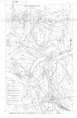
B.N. Church and M. MacLean
Open File 1987-11 describes the geology and mineral occurrences of the Bridge River mining camp, centred in the Gold Bridge area 185 kilometres north of Vancouver, British Columbia. The area has 73 mineral localities including the Bralorne-Pioneer mining operation which attained the status of foremost historical gold producer in British Columbia and sixth largest in Canada. The area, mapped at 1:20 000 scale, covers approximately 500 square kilometres and is underlain by 22 defined lithological units comprising bedded volcanic and sedimentary assemblages and a variety of intrusive igneous rocks ranging from Paleozoic to Tertiary age. These units are faulted and locally invaded by quartz veins, which are the loci of gold mineralization.
The area is underlain by complex geology comprised of bedded volcanic and sedimentary assemblages, and a variety of intrusive rocks ranging from Paleozoic to Tertiary in age. These rocks are faulted and locally invaded by quartz veins that form the loci of gold mineralization. Mesothermal gold deposits are the primary exploration targets in the camp.
Geological units range from Paleozoic to Tertiary in age. The Paleozoic Fergusson Group consists of ribbon chert, gneissic rocks, marbles and amphibolites. The Triassic Cadwallader Group consists of the Pioneer, Noel and Hurley formations. The Pioneer is mainly basaltic pillow lave, tuff and related rocks; the Noel is mainly black argillite and siltstone; and the Hurley consists of argillite, sandstone, conglomerate, limestone and volcaniclastic rocks. Jurassic shale, sandstone and conglomerate overlie the Triassic rocks. Cretaceous Taylor Creek Group rocks are mostly boulder to pebble conglomerates and sandstone. The Tertiary Bid Sheep volcanics are mainly felsic to intermediate pyroclastics and flows.
Intrusive rocks in the area are varied. The Paleozoic Bralorne intrusives are mainly amphibolite, diorite and gabbro. Mesozoic ultrabasic rocks are mainly peridotite with serpentine and listwanite alteration. The Coast intrusions range through diorite and granodiorite to granite. Tertiary andesites, dacites and trachytes form sills, dikes and stocks.
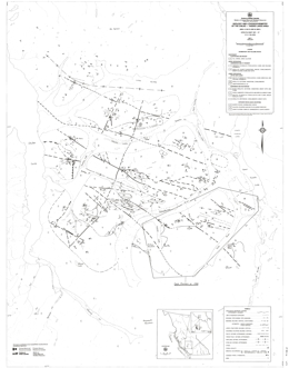
G.P. McLaren
Open File 1987-12 describes the geology, mineral occurrences and lithogeochemistry of the Taseko-Chilko Lakes area (92N/1, 8; 92O/4, 5) in southwestern British Columbia. This open file, consisting of three maps at 1:50,000 scale, is an extension of work previously released in Open Files 1986-4 (see also Bulletin 81 for a more recent interpretation) and 1986-6. The maps depicting geology and lithogeochemical sample locations in the Chilko-Taseko Lakes area are a re-issue of Open File 1986-4. New data on geology and mineral occurrences have been added in the Tchaikazan River to Falls River area. A table of lithogeochemical analytical results is included. The geology west of Chilko Lake is shown on a separate map. A paper on this project has been published in Geological Fieldwork, 1986 (Paper 1987-1). An Open File detailing the lithogeochemistry and stream sediment geochemistry west of Chilko Lake will be published in the future. This Open File is a contribution of the Canada/British Columbia mineral development agreement 1985-1990.
The oldest rocks in the area are of Lower Cretaceous age and are in the Barremian and Hauterivian stages. There are 4 units: a lower argillite, greywacke and conglomerate sequence; dacitic to basaltic pyroclastics and flows; purple andesitic pyroclastics and breccia; and an upper sequence of argillite, siltstone, sandstone with minor tuffs and flows. Rocks of Aptian and Albian age comprise 2 units or are undifferentiated. The lower sequence is argillite, siltstone, sandstone and conglomerate; the upper consists of dacitic to basaltic pyroclastics, floes, breccias and volcanic sediments. Overlying Upper Cretaceous rocks are Cenomanian and possibly younger. The lower package consists of argillite, quartz sandstone, arkose, conglomerate and minor volcanic rocks; the upper comprises andesitic to basaltic pyroclastics, flows, and volcanic sediments.
Intrusive rocks in the area are granodiorite and quartz diorite of the Coast plutonic complex, felsite porphyry dikes, and diorite stocks. Ages are uncertain.
Northwest trending transcurrent faults dominate the structural geology of he area. Two of these are the Tchaikazan and Stikelan faults.
The Lord River Gold mine is in the southeast corner of the map-sheet. Copper-bearing skarn mineralization is known. Other deposit types associated with fault zones include silicified and carbonate-altered fractures with copper-mercury-arsenic-antimony mineralization and epithermal mineralization. Copper-molybdenum occurrences may have porphyry associations. Felsic rocks of Hauterivian age may correlate with the Gambier Group. Many carry pyrite and pyrrhotite mineralization and there is potential for volcanogenic massive sulphide deposits.
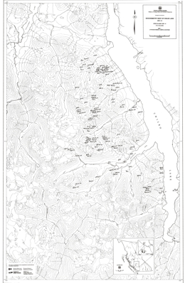
G.P. McLaren
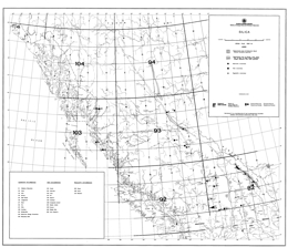
G. Foye
Open File 1987-15 describes silica occurrences in British Columbia. The silica occurrences described in this Open File were considered at the time of writing to represent the most significant silica deposits known in British Columbia. References, listed by occurrence, are found at the end of the report. Each occurrences has been assigned a number with a prefix of "S". These numbers identify the deposits on the accompanying British Columbia silica occurrence map and in the bibliography. The occurrences are organized by genetic type as being quartzite, vein or pegmatite.
Many of the occurrences were examined in the field during 1981 and 1982 by staff of the Geological Survey Branch of British Columbia Ministry of Energy, Mines and Petroleum Resources. Most of the mineral exploration in British Columbia has been directed toward base and precious metals. In many cases quartz bodies and quartzites have been regarded as barren rock or gangue, rather than as potential sources of silica. There are likely numerous silica occurrences in the province that have not been recognized and are therefore not documented.
S.B. Butrenchuk
J. Pell
Open File 1987-17 describes the occurrences found in the province. It comprises of carbonatites, agpaitic nepheline and sadlite syenites, some ijolite series rocks, one kimberlite locality and numberous ultramafic and lamprophyric diatreme breccias, all of which intrude the Cordilleran miogeoclinal succession prior to the deformation and metamorphism associated with the Jura-Cretaceous Columbian orogeny. The purpose of this report is to describe these occurrences.
Carbonatites are ultrabasic igneous rocks composed of more than 50 per cent carbonate materials. They may contain significant amounts of olivine, magnetite, pyroxene, sodic amphibole, biotite, vermiculite, apatite, columbite, zircon, rare earth carbonate minerals and pyrochlore. Carbonatites occur most commonly as intrusive bodies, generally associated with other alkaline igneous rocks.
Kimberlites are volatile-rich, potassic, ultrabasic igneous rocks which occur as small volcanic pipes, dykes and sills. Kimberlites may contain diamond, but only as a rare constituent. Kimberlite has traditionally been considered the only important primary source of diamond. Recent studies have shown that diamonds may also be present in economic concentrations in lamproites. Kimberlites and lamproites are the only known economic primary source of diamonds; however diamonds have been occasionally reported from carbonatites and peridotites.
In British Columbia, the carbonatites and related rocks were intruded into the sedimentary prism deposited along the rifted continental margin, making this a somewhat anomalous alkaline province in a structural setting which differs from most others worldwide.
N. Mortimer
Open File 1987-18 comprises a geological map of part of the Pavilion map area (92I/13), southern British Columbia, together with descriptive notes. Dr. N. Mortimer completed fieldwork while he was a post-doctoral Fellow at The University of British Columbia in 1985 and 1986.
The 1:50 000 map covers an area of 250 square kilometres lying east of the Fraser fault and extending from Pavilion Mountain on the north to Mount Martley on the south. It depicts the structure and lithology of the western belt of the Permo-Triassic Cache Creek Group and the overlying Triassic Pavilion beds. This investigation expands on the work of Duffell and McTaggart (1952), Trettin (1961) and Monger and McMillan (1984), providing more detailed subdivision of rock units and revising the position of lithologic contacts.
Central belt Cache Creek rocks are exposed in Marble Canyon, where lower basalt and chert are overlain by a thick limestone and marble unit. Western belt Cache Creek rocks are dominantly argillite and siliceous argillites with local ribbon chert, carbonate and volcaniclastic sandstone. The proportion of carbonate bodies increases eastward toward the contact with the central belt. The contact is placed at the edge of he Marble Canyon formation with its cliff-forming carbonates. The contact is apparently stratigraphic.
Although the informally named Pavillion beds are faulted against western belt rocks, they are lithologically similar and interpreted to be correlative with rocks of the eastern part of the western Cache Creek belt.
The Mount Martley pluton consists of hornblende biotite granodiorite and is Late Jurassic. Hornblende diorite stocks in the area are apparently also of Jurassic age.
The rocks are deformed and cleavage and schistosity developed. Most dips steeply and strikes north-northwest, except near the near the Mount Martley pluton, where it parallels the contact. Cleavage and schistosity apparently predate the intrusion. Minor high angle faulting offsets the intrusive and all older rocks. Mid-Cretaceous chert pebble conglomerate unconformably overlies these faulted contacts.
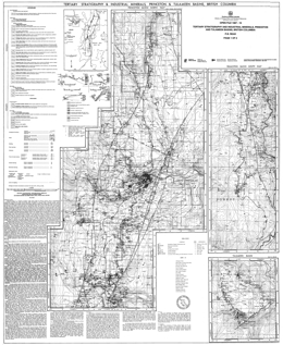
P.B. Read
The Princeton basin is a northerly trending trough partly filled by Eocene rocks of intermediate composition composing the Cedar Formation, which corresponds to the previously informally named lower volcanic formation. An overlying Eocene sedimentary sequence of sandstone, shale, waterlain rhyolite tephra and coal, up to 2000 metres thick, comprises the Allen by Formation (Rice, 1947, McMechan, 1983. At the north end near the middle of the basin, acid to intermediate flows and breccia of the informally named Upper Volcanic formation are intercalated within the Allenby Formation. The trough is the site of a major northerly trending half-graben, bounded on the east by the northerly to north-northeasterly trending Boundary fault, and near the western edge by Asp Creek fault. Both faults dip easterly and probably have both strike-slip and dip-slip components of displacement.
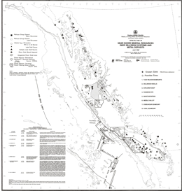
K.E. Marks, M.A. Bloodgood and A. Panteleyev
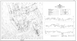
A. Legun
Open File 1987-21 comprises a 1:50 000 geological map of the Carbon Creek area (930/15) together with three cross-sections illustrating the structure and stratigraphy of the Carbon Creek and West Carbon Creek synclines. Fieldwork, begun in 1982, was completed in 1986 and is part of an ongoing mapping project in the Peace River Coalfield, funded in part by the Canada/British Columbia Mineral Development Agreement.
The mapped area is bounded by the Pardonet and Carbon faults on the west and east respectively, and extends southwards from the Peace Reach of Williston Lake to the headwaters of Carbon Creek. It is underlain by Jurassic and Lower Cretaceous rocks of the Fernie Formation and Minnes, Bullhead and Fort St. John Groups, including the coal-bearing Cadomin and Gething Formations. The map incorporates new interpretations of the stratigraphy of the area.
Thinning and facies changes occur across the Carbon Creek fault. The Jurassic to Lower Cretaceous Monteith Formation of the Minnes Group consists of a 50-metre interval of quartz arenite in the area. Thickness of Minnes Group strata between the Monteith and Cadomin formations thins dramatically from about 990 metres in the Carbon Creek area southwest of the fault, to 145 metres in the Butler Ridge area. In Carbon Creek area, Minnes Group rocks above the Monteith Formation are the Beattie Peaks Formation shale, the Monach Formation arenite, and the Bickford Formation arenite and shale. In the Butler Ridge area, thinning prevents lithostratigraphic subdivision. The section consists of interbedded arenites and siltstones with no persistent markers.
The Cadomin Formation contact with the Minnes varies from gradational in the west to sharp in the east. The Cadomin is dominantly pebbly arenites and conglomerates. Gething Formation rocks overlie the Cadomin and are the main coal-bearing strata.
A major fault on Mount Gething dips 25 degrees near surface and steepens to near vertical at depth. Hangingwall strata form a box anticline with the west limb cut off by the fault.
The geology of the adjacent Butler Ridge area is portrayed by Preliminary Map 57.
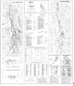
D.J. Alldrick
The map covers a 500-square kilometre area north of Stewart. The region is underlain by lower Jurassic calc-alkaline volcanic and associated sedimentary rocks of the Hazelton Group. These intensely mineralized rocks were deformed during Cretaceous time and intruded by Tertiary stocks and dykes of the Coast plutonic Complex.
During Late Triassic to Early Jurassic time, volcanism was accompanied by coeval subvolcanic magma emplacement. This was followed by late-stage dyke emplacement and quiescent flysch sedimentation in Toarcian to Callovian time (190 to 160 million years). Moderate deformation accompanied regional greenschist metamorphism that peaked during Cretaceous time (110 to 90 million years). Stocks and dykes of the Coast Range batholith intruded the deformed rocks in early to middle Eocene time and this was followed by a period of microdiorite and biotite lamprophyre dyke emplacement.
The deposits in the Stewart mining camp apparently formed during two metallogenic epochs. Gold-silver-pyrrhotite veins, like Scottie Gold mine, and gold-silver-lead-zinc-copper deposits, like the Silbak Premier mine, formed during the first epoch. Silver-lead-zinc veins with high silver grades, and spatially associated molybdenum and/or tungsten occurrences formed during the second epoch. Exploration potential in the camp remains high.
1986
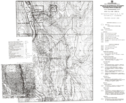
G.E. Ray
This series of 7 maps covers the Geology of the Hozameen Fault Area between Boston Bar and the Coquihalla River, Southwest British Columbia.
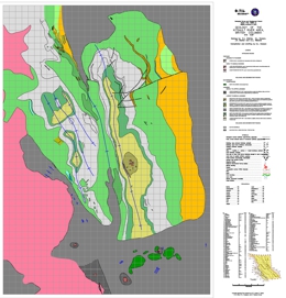
D.J. Alldrick, G.L. Dawson, J.A. Bosher and I.C.L. Webster
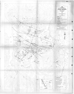
Superseded by Bulletin 81
G.P. McLaren
Open File 1986-04 describes the geology and lithogeochemistry of the Chilko and Taseko Lakes area of British Columbia. Mapping is done at 1:50 000 scale. The two maps and accompanying notes describe the sample descriptions and associated analytical data.
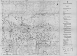
P. Schiarizza
Open File 1986-5 describes the geology and mineral deposits of the Vavenby area, NTS 82M/5, 11 and 12, within the Shuswap Highland of south-central British Columbia. The topography is dominated by the North Thompson River valley in the north and west, and the Adams Lake valley in the east.
The map area covers a belt of structurally complex low-grade metamorphic rocks that lies along the western margin of the Omineca Belt. It is flanked by high-grade metamorphic rocks of the Shuswap Complex to the east and by rocks of the Intermontane Belt to the west. The area is underlain mainly by Paleozoic metasedimentary and metavolcanic rocks of the Eagle Bay Assemblage and the Fennel Formation. Late Devonian granitic orthogneiss locally intrudes Eagle Bay rocks. The Paleozoic rocks are cut by midCretaceous granodiorite and quartz monzonite of the Raft and Baldy batholiths, and by Early Tertiary quartz feldspar porphyry, basalt and lamprophyre dykes. They are locally overlain by Eocene sedimentary and volcanic rocks of the Kamloops Group and by Miocene plateau lavas.
The Paleozoic rocks occur in four structural slices separated by southwesterly-directed thrust faults. The upper three fault slices contain only Eagle Bay rocks, while the lowest slice comprises Eagle Bay strata structurally overlain by the Fennell Formation.
Rocks assigned to the Eagle Bay Assemblage range in age from Early Cambrian to Late Mississippian. They are in part correlative with Paleozoic successions in the Kootenay Arc and in the Barkerville-Cariboo River area The oldest Eagle Bay rocks comprise quartzites and quartzose schists overlain by a unit of predominantly mafic metavolcanic rocks and limestone which, at one locality, contains Lower Cambrian archaeocyathids. An undated package of grit, phyllite, carbonate and metavolcanic rocks overlies the Early Cambrian succession. It is locally overlain by calcareous phyllite and associated calc-silicate schist and skarn or by mafic metavolcanic rocks. The upper part of the Eagle Bay Assemblage comprises a Devono-Mississippian succession consisting of felsic metavolcanic rocks overlain by intermediate, locally alkalic, metavolcanics and fine to coarse-grained clastic metasediments. These Devono-Mississippian rocks may be separated from older portions of the Eagle Bay Assemblage by a significant unconformity. Late Devonian orthogneiss that intrudes Eagle Bay rocks is probably related to the felsic metavolcanics.
The Fennell Formation comprises imbricated oceanic rocks of Slide Mountain terrane that were tectonically emplaced onto Mississippian clastic rocks of the Eagle Bay Assemblage prior to synmetamorphic southwesterly directed folding and thrusting. The formation comprises two major divisions. The lower structural division is a heterogeneous assemblage of bedded chert, gabbro, diabase, pillowed basalt, sandstone, quartz-feldspar-porphyry rhyolite and intraformational conglomerate. Conodonts extracted from bedded chert range in age from Early Mississippian to Middle Permian, while zircons extracted from quartz feldspar porphyry yield a Devonian uranium-lead age. The distribution of dated units indicates that the lower division is segmented into at least three and locally four imbricate thrust slices. The upper division consists almost entirely of pillowed and massive basalt, together with minor amounts of bedded chert and gabbro. Conodonts from two separate chert lenses within the division are respectively Early (?) Pennsylvanian and Middle Permian in age. The two divisions are therefore the same age, at least in part, and are inferred to be separated by a thrust fault.
Deformation is predominantly Jura-Cretaceous and early Tertiary in age. The earliest macroscopic structures are the thrust faults that imbricate the Fennell Formation and separate it from Mississippian clastic rocks of the Eagle Bay Assemblage. East-verging, pre-metamorphic mesoscopic folds within the Fennell Formation probably also formed at this time. Tectonic emplacement of the Fennell Formation was followed by synmetamorphic southwesterly directed folding and associated thrust faulting, which gave rise to several large overturned folds, and also the thrust faults which define the structural/stratigraphic panels that dominate the map pattern. The associated synmetamorphic schistosity is the dominant mesoscopic fabric within the area. These early structures are cut by post-metamorphic northwest-trending mesoscopic folds with associated steeply dipping crenulation cleavage and axial crenulation lineation, and by later west trending macroscopic and mesoscopic folds which are synchronous with intrusion of the mid-Cretaceous Raft and Baldy batholiths. The youngest structures recognized are northeast-trending strike-slip faults and later northerly trending faults and associated folds that are Eocene in age.
Large-tonnage disseminated pyrite-pyrrhotite-chalcopyrite mineralization, such as that at the Harper Creek deposit, occurs within Eagle Bay rocks where they are intruded by Devonian orthogneiss. This spatial relationship suggests that the mineralization is Devonian in age and related to the orthogneiss, although it has been remobilized during later deformation and metamorphism.
In the Vavenby area, uranium-thorium-fluorite mineralization is hosted by a trachytic intrusive-extrusive complex within DevonoMississippian Eagle Bay rocks along Foghorn and Lute creeks (Rexspar and Bullion showings). There are also polymetallic occurrences, like Red Top, that could be sedimentary exhalative deposits and polymetallic silver-lead-zinc±gold veins, like Leonie. To the south, the CC deposit is a cupriferous pyrite volcanogenic massive sulphide deposit hosted by oceanic basalts of the Fennel Formation east of Chu Chua Mountain. The area also contains small pods of skarn mineralization near Cretaceous and Devonian granitic intrusions.
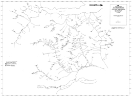
G.P. McLaren
V.J. Rublee
Platinum-group occurrences in the Canadian Cordillera are poorly documented, and with the exception of the Tulameen Ultramafic complex, superficially studied. The main sources of information available on the platinum potential in British Columbia were investigations undertaken by the Munition Resources Commission in 1920, and the Canada Department of Mines in 1934. From this framework, publications by the Geological Survey of Canada, British Columbia Ministry of Energy, Mines and Petroleum Resources, United States Geological Survey, Industrial Sector, and unpublished thesis material aided in substantiating, and detailing the platinum-group mineral inventory of British Columbia.
Open File 1986-08 is an external review of the Geological Survey Branch, commissioned by the Deputy Minister, Mr. R.A. Illing, in 1981 on the recommendations of the then Deputy Minister, Mr. A. Freyrnan and Chief Geologist, Dr. A. Sutherland Brown. The review was undertaken in the fall and winter of 1981 and was finalized in 1982. The report captures the status of the Branch in 1981, a time of some disarray due to the exodus of many professional staff to an expanding local mining industry.
The terms of reference required the Committee, drawn from industry, government and academia, to conduct a wide-ranging overview of all aspects of the Branch, including the question of its continued existence.
The insights and recommendations in the report have been widely used by Dr. W.R. Smyth, the new Chief Geologist, and the new management team of the Branch in charting initiatives and directions during recent years. In particular, the section "Need for a Geological Branch" helped justify and maintain programs during the restraint evaluation process.

