Open Files 2009-2000
Open Files present the interim results of ongoing research, particularly mapping projects.
Jump to:
2018-2010 | 2009 | 2008 | 2007 | 2006 | 2005 | 2004 | 2003 | 2002 | 2001 | 2000 | 1999-1990 | 1989-1986
2009
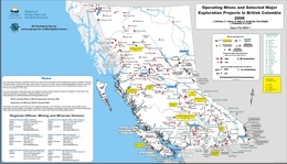
J. DeGrace, D. Grieve, B. Madu, B. Northcote, P. Wojdak, J. Fredericks and K. Cobb
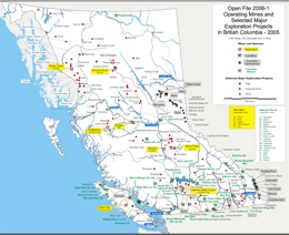
This Provincial Map shows the location of major exploration projects and producing metal, coal and industrial mineral mines in 2008.
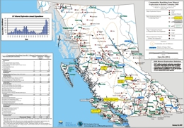
B. Northcote, J. DeGrace, D. Grieve, B. Madu, P. Wojdak, K. Cobb and S. Meredith-Jones
This Provincial Map shows the location of major exploration projects; producing metal, coal and industrial mineral mines and the communities they influenced in 2008.
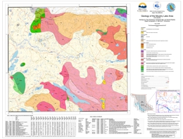
P. Schiarizza, K. Bell and S. Bayliss
The Murphy Lake map area encompasses 950 square kilometers of subdued topography within the Fraser Plateau and Quesnel Highland, including NTS map area 093A/03 and a small portion of adjoining area 093A/06. Access is via roads that branch east from Highway 97 at Lac La Hache and 150 Mile House. This new geological map is based on fieldwork conducted in 2008. The map area is underlain mainly by Mesozoic rocks of the Quesnel magmatic arc, including volcanic and volcaniclastic rocks of the Upper Triassic Nicola Group, Late Triassic monzodiorite of the Spout Lake pluton, and Early Jurassic granitic rocks of the northwestern part of the Takomkane batholith. It also includes Eocene volcanic rocks of the Kamloops Group, Neogene basalt of the Chilcotin Group, and small exposures of Quaternary basalt that are outliers of the Wells Gray volcanic field to the east. The Takomkane batholith and adjacent Nicola Group host significant Cu-Au-Mo mineralization near Woodjam Creek, and Cu-Au mineralization is hosted by the Spout Lake pluton near Murphy Lake.
This program was partially funded through the Geological Survey of Canada's Geoscience for Pine Beetle Program.
T. Ferbey, V.M. Levson, and R.E. Lett
The clay-sized fraction of 533 archived basal till samples collected within the Babine porphyry copper belt was analyzed for 37 elements by aqua regia digestion followed by inductively coupled plasma mass spectrometry (ICP-MS). The spatial distribution of samples elevated in Ag, As, Cu, Hg, Mo, Pb, and Zn are the focus of this study. Data presented here confirm and further constrain previously identified till geochemical exploration targets within the Babine porphyry copper belt. These data also outline two new multi-element, multi-site till geochemical exploration targets.
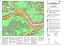
K.J. Vickers and T. Ferbey
Open File 2009-05 presents a 1:50 000-scale surficial geology map of the Redstone area, located approximately 150 km east of Williams Lake, British Columbia. This map characterizes the surficial materials and glacial features that occur within the map area and shows their areal distribution. This mapping was conducted as part of a mineral potential assessment of the Redstone and Loomis Lake areas (NTS 093B/04, 05). Till samples were collected for trace element analyses, heavy mineral separations, and gold grain counts to assess the base and precious metal potential of the area. Till sample locations are included in this map. The analytical portion of this assessment was supported by the Geological Survey of Canada (Natural Resources Canada) through the Mountain Pine Beetle Program.
Areas of unstable ground, and areas that contain deposits of sand and gravel, have been identified in this map. This information may be useful for future development in the map area.
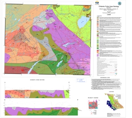
M. Mihalynuk, E.A Orovan, J.P. Larocque, T. Bachiu and J. Wardle
In an area extending from Kamloops northward to Smithers, and from the Coast Mountains eastward to the Rocky Mountain Trench, infestation by Mountain Pine Beetle was essentially continuous in 2004. We refer to this area as the Beetle Impacted Zone (BIZ). It is predicted that only ~10% of the already diminished 2006 volume of pine will be left standing by 2016 (Eng et al., 2006). Anticipating an economic downturn in the forestry sector within the BIZ by 2015, the Provincial Government is supporting economic diversification throughout the region. Geological mapping and related studies in the Chilanko Forks area are part of that provincial effort.
Accelerated timber harvest and overburden disturbance, needle loss, and forest fires, create unprecedented opportunities to find never-before-seen outcrops of prospective rocks within the BIZ.
The Clusko - Chezacut - Chilanko Forks areas were targeted for revision mapping because of relatively good logging road access and a historical lack of mineral exploration that we believed to be unwarranted. This viewpoint was validated with 2007 mapping in the Chezacut area, and supported by results from 2008 mapping in the Clusko River - Chilanko Forks area. Geological mapping demonstrated that rock exposures are more extensive than previously recognized, and that the economically uninteresting Chilcotin basalt cover is less extensive. Both observations provide incentive for future mineral exploration in the area.
Open File 2009-6 presents geological data collected in 2008, plus an interpretation of the geology that is expected beneath areas of thick glacial and alluvial cover. It provides a 1:50 000 scale geological map context for new mineral occurrences that were encountered during the course of mapping the area, and which were reported in Mihalynuk et al. (2009)1 with geochemical analyses available from Larocque and Mihalynuk (2009)2. Please note that Open File 2009-6 is combined with the geological compilation for Open File 2008-2.
Eng, M., Fall, A., Hughes, J., Shore, T.L., Riel, B., Walton, A. and Hall, P. (2006): Provincial-level projection of the current mountain pine beetle out break: Up date of the projection of non-recovered losses for the reference management scenario based on the 2005 Provincial Aerial Overview of Forest Health and revisions to “the model” (BCMPB.v3); B.C. Ministry of Forests, <www.for.gov.bc.ca/hre/bcmpb/BCMPB.v3.BeetleProjection.Update.pdf>, 7 pages, [October 15, 2006]
1Mihalynuk, M.G., Orovan, E.A., Friedman, R.M., Larocque, J. and Bachiu, T. (2009): Geology, Geochronology and Mineralization of the Chilanko Forks to Southern Clusko River Area, West-Central British Columbia (NTS 093C/01, 08, 09S); in Geological Fieldwork 2008, B.C. Ministry of Energy, Mines and Petroleum Resources, Paper 2009-1
2Larocque, J.P. and Mihalynuk, M.G. (2009): Analytical Results from Investigations in the Chilanko Forks and Clusko River Areas (NTS 93C/01, 09S) within the Beetle Impacted Zone 2008; B.C. Ministry of Energy, Mines and Petroleum Resources, Geofile 2009-1
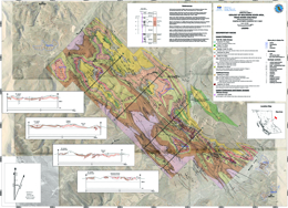
A. Legun
The Wolverine river area lies southwest of the town of Tumbler Ridge in northeastern British Columbia. The map area extends from Bullmoose creek in the north to the Murray river in the south, encompassing about 300 sq km of the Peace River coalfield. The Gething and the Gates formations of early Cretaceous age are the two main coal bearing formations in the area. The Quintette and Bullmoose mines opened in the early 1980’s and exploited coal measures within the middle Gates member in a number of pits that include South Fork, Mesa, Wolverine (Frame). The Quintette mine closed in 2000 and the Bullmoose (South Fork pit) in 2003. In 2006 Western Canada Coal started production from the Perry Creek mine in the Perry syncline area on the north side of the Wolverine river.
The study was initiated to provide a more accurate geologic base for further resource development. It is based on review and compilation of previous data, fill-in mapping and stratigraphic assessment of new drill data, including petroleum well data.
Gates Coal Development and Potential
Proposed pit developments in the area include the EB pit near Mt Spieker, and the Hermann property south of the Quintette mine conveyor belt. Potential pit areas are found in the Transfer and Grizzly fold structures facing the reclaimed Shikano pit at the Murray river.
The West Fork, Transfer and Grizzly areas underwent substantial exploration drilling in the 1980’s but have not been examined recently.
Some areas of Gates exposure remain relatively untested by drilling or detailed mapping. This includes the rather tightly folded Gates that faces the Perry pit across the Wolverine River, the Fortress anticline area and the southerly portion of Mt Spieker syncline. These areas were characterised as secondary opportunities for pit development in early evaluations of the area.
The largest potential in the Gates Fm in this area is probably in the subsurface and undergound mining scenarios. This includes the area on the east border of the map where fold structures bring the Gates locally within 200 metres of surface (Dupont Wolverine ddh 79-2).
Gething coals
The coals of the Gething Formation remain undeveloped in the map area. The Gething underlies a much larger area than the Gates. Upper Gething (Chamberlain member) coals underlie large portions of the northern part of the area near Mt Spieker. They include locally, underground reserves of Bird seam. In the south a resource in Lower Gething coals (Gaylard member) is known in the Hermann Gething area. Elsewhere isolated drillhole and coal outcrop data provides a basis for further exploration.
Map Elements
Elements of the map include:
- A revised contact for the base of the Gates Formation. The contact is adjusted to the base of the Quintette sandstone.
- Traces of the top and basal seam of the middle Gates member from company maps.
- A large database of bedding data for structural analysis.
- Locations of coal boreholes and oil and gas wells.
- 1:20000 scale orthophoto maps in ecw format.
- Lidar imagery for parts of the area.
- Schematic cross-sections.
- Old and new locations of Gething coal exposures.
- Improved trace of geologic contacts, fold and fault elements based on fieldwork and compilation of numerous assessment reports.
- Outlines of old, developing and potential coal mine open pits.
- Photos from fieldwork linked to location symbols on the map. Some of these may be of interest in sedimentological studies of the Gates Formation (marine Falher cycles).
Links to photos is based on the URL field in the Photos table. For example C:\Wolv_OF\Wphotos\DSC00751.jpg
If the digital files are placed in a different directory the URL field will need to be changed to reflect the new location, example C:\Myname\Wolv_OF\Wphotos\DSC00751.jpg
Manifold software is required to view the .map files and databases. The BCGS symbols file, BCGSgeosymbolV.2.0.4.xml, needs to be placed in the Manifold config directory (ie C:\Program Files\Manifold System\config). The basic map is provided as a pdf file. Files in other formats (kml,csv,shp) will be made available.
Acknowledgements
The author was assisted in the field by Andrew Stephenson in 2006, David Lilly in 2007 and Doug Wells in 2008. Project support by chief geologist Dave Lefebure, is much appreciated.
Mapping and Compilation N.W.D. Massey, J.M.S. Vineham and S.L. Oliver
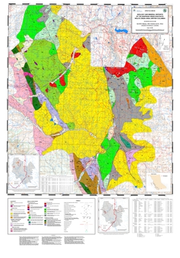
The map covers an area about 15 km to the southwest of Princeton. The map area stretches from the Wolfe Creek area and Copper Mountain southwest to Eastgate and the boundary of Manning Park and west to the Whipsaw Creek and Hudson Flats areas.
The map area lies at the western edge of Quesnellia and includes the southernmost exposures of the late Triassic Nicola Group. To the east of the Boundary Fault, rocks of the Nicola group are assigned to the “Eastern Belt” (Preto 1979; Mortimer 1987). Interbedded black argillites, grey siltstones and sandstones are overlain by volcanic and volcaniclastic rocks of the Wolfe Creek Formation, which display an alkalic affinity. They host the important porphyry and skarn deposits of the Copper Mountain area (Preto, 1972).
To the west, the Nicola Group is lithologically similar to that in the east, though differing in details of stratigraphic succession. Here, clastic sedimentary rocks are intercalated with feldspathic tuffs and tuffaceous sediments. These pass westwards, and probably upwards, into typical Nicola pyroxene-feldspar tuffs, lapilli tuffs and breccias. However, in contrast to the eastern part of the map area, most of the exposed volcanic rocks are deformed and schistose. The change from massive to schistose rocks is transitional and gradual from east to west as foliation becomes progressively more penetrative and steeper.
In the west of the map area, rocks of the Eastgate-Whipsaw metamorphic belt have been correlated with the Nicola by Rice (1947) and Monger (1989). The belt is bound by the syntectonic Eagle Plutonic Complex to the west and the Similkameen fault to the east. The belt shows significant lithological differences to the immediately adjacent Nicola volcanic rocks. It can be divided it into three northwest trending lithological assemblages that show increasing metamorphic grade from greenschist in the east to amphibolite in the west. The belt is host to VMS mineralization (e.g. Red Star and S&M group), as well as porphyry-Cu style mineralization associated with the Eocene Whipsaw porphyry. The belt may be equivalent to the Late Permian to Early Triassic Sitlika-Kutcho sequences, including volcanic rocks and intrusions from the Ashcroft area (Childe et al., 1997), about 150 km to the north-northwest of Princeton.
Volcanic and sedimentary rocks of the Eocene Princeton Group occur at higher elevations in the central and eastern parts of the map area. They lie unconformably on the Nicola Group and all older intrusive rocks. Comagmatic minor intrusions occur throughout the map area, particularly to the east of the Boundary fault. They include the bimodal felsic-mafic “Mine Dykes” suite in the area around and to the east of Copper Mountain, as well as ubiquitous intermediate-felsic porphyry dykes.
T. Ferbey
The silt plus clay-sized fraction of 117 basal till samples collected within the Redstone and Loomis Lake map areas (approximately 150 km west of William’s Lake) was analyzed for 37 elements by aqua regia digestion followed by inductively coupled plasma mass spectrometry (ICP-MS) and 35 elements by instrumental neutron activation analysis (INAA), while an additional 38 basal till samples were collected for analysis of heavy metal concentrates and gold grain counts. The spatial distribution of samples elevated in Cu, Mo, Pb, Zn, Ag, Ni, Hg, As, Cr, Sb, and visible gold grains are the focus of this study. Data presented here outline two new multi-element, multi-site till geochemical exploration targets. Follow-up field work is required to assess the significance of these new exploration targets.
Mapping and compilation by J.M. Logan, D.P. Moynihan, G. Leroux and L. Able, MEMPR
Geochronology by T.D. Ullrich and R. Friedman, The University of British Columbia
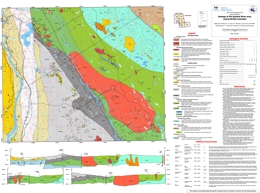
Open File 2009-10 presents a 1:50 000-scale bedrock geology map of the Quesnel River area (NTS 93B/16), encompassing and extending southeast of Quesnel, British Columbia and adjoining Open File 2008-06. It presents the results of new mapping, geochronological dating and compilation of private industry research that provides new insight into the geologic and metallogenic evolution of this largely overburden covered portion of the Quesnel terrane.
The Quesnel River map area is bounded on the west by the Fraser Fault system and bisected diagonally from northwest to southeast by the Pinchi Fault system which marks the boundary between the Cache Creek and Quesnel terranes. West of the Quesnel River, Jurassic sedimentary rocks correlative with the Ashcroft Formation in southern BC, overlie Cache Creek rocks and mask the terrane boundary with Quesnellia. Triassic to Jurassic volcanic and plutonic arc rocks and associated sedimentary rocks which comprise the Quesnel terrane crop out east of the Quesnel River.
With the exception of Tertiary and younger placer gold, coal and diatomite occurrences, mineralization in the Quesnel River area is related to Mesozoic subduction-generated arc magmatism and high-level emplacement of stocks and plutons that occupy the north-eastern half of the map area. Porphyry mineralization at Mouse Mountain (Cu-Au) to the north and at the Gibraltar mine (Cu±Mo), Mount Polley mine (Cu±Au) and QR (Au) to the south comprises important exploration models for this part of the Nicola Arc. The analytical portion of this assessment was supported by the Geological Survey of Canada (Natural Resources Canada) through the Mountain Pine Beetle Program.
H.J. Greenwood with M.G. Mihalynuk
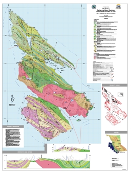
Open File 2009-11 is a map of Saltspring Island and an accompanying document of descriptions and comments meant to enhance the 1:25,000 scale map. The accompanying notes contain photographs of key outcrops and representative lithologies, including their UTM grid locations. These can be keyed to the Open File map. The notes also contain brief summary descriptions of lithologies and structures and a list of pertinent references.
This Open File may find use in land-use planning, water resources, tourist interest, and the place of Saltspring in B.C. geology.
The map and notes have been compiled by Hugh Greenwood, Professor Emeritus, Department of Geological Sciences, The University of British Columbia.
The British Columbia Geological Survey hosted an Open House on November 13th, 2009. Open File 2009-12 presents a selection of talks presented at the Open House
- Mining and Mineral Exploration Update - 2009 presented by Dave Lefebure and Jay Fredericks
- MINEovation and Efficiencies with MapPlace.ca presented by Larry Jones
- Key Geological Concepts on the Distribution of Jurassic Porphyry Au-Cu (Mo) and Epithermal (Au-Ag) Deposits in the Toodoggone District, North-Central B.C. presented by Stephen M. Rowins
- Applied Geochemistry in Mineral Exploration - Pitfalls & Puzzles presented by Ray Lett
- The Wingdam Conglomerate: Geological Setting, Detrital Zircon Geochronology and Regional Significance presented by Filippo Ferri
- Stratigraphic and Plutonic Framework for Copper, Gold and Molybdenum, Thuya Creek - Woodjam Creek, South-Central BC presented by Paul Schiarizza
2008
K.D. Hancock and B. Grant, with J. DeGrace, D. Grieve, B. Madu, B. Northcote and P. Wojdak
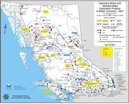
This Provincial Map shows the location of major exploration projects and producing metal, coal and industrial mineral mines in 2007.
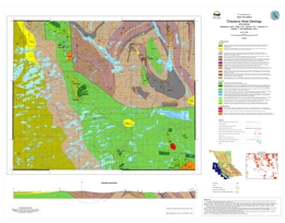
Please note that this file is combined with and superceded by the geological compilation for Open File 2009-6.
M.G. Mihalynuk, C.R. Peat, E.A. Orovan, K. Terhune, T. Ferbey, M.A. McKeown
Open File 2008-2 is part of a Provincial program to help reduce the long term economic impact of the Mountain Pine Beetle through support of economic diversification. The program includes geological mapping projects aimed at locating areas of potential interest to the mining and oil and gas industries. Open File 2008-2 is a 1:50 000-scale geological map for the Chezacut mapsheet (NTS 93C/08).
The Chezacut mapsheet, part of the Anahim area, is ~200 km west of Williams Lake. It was targeted for geological mapping because of a historical lack of mineral exploration. A network of logging roads provided access to large parts of the area, and did not exist in the late 50’s, when geological mappers last passed through the region.
Geological mapping does not specifically focus on the search for mineral occurrences, but occasionally significant mineralization is discovered during the course of mapping. During the summer of 2007, mapping crews in the Chezacut area discovered five mineralized zones in a ~1000-kilometre area where only one mineral occurrence was known previously. See Geofile 2008-2 for lithogeochemical data from rock samples collected in the Chezacut map area.
The new showings span the Chezacut area and occur primarily in the oldest rock package which is now interpreted to extend over more than twice the area previously mapped. Young basaltic and glacial blankets are exploration hindrances. However, neither is as extensive as has in the past been generally assumed. These discoveries demonstrate the untapped mineral potential beneath the beetle-infested forests of Interior British Columbia.
J.L. Nelson, J. Kyba, M. McKeown, and J. Angen
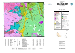
Open File 2008-03 presents a 1:50 000-scale geoogy map of the Chist Creek Map area. Located 15 kilometres south of Terrace, in northwestern BC, the Chist Creek map area is underlain by upper Paleozoic through Jurassic stratified rocks of the Stikine assemblage and overlying Telkwa Formation, and is intruded by Jurassic to Eocene intrusions.
The area contains mineral showings of several types, including precious metal veins such as the Dardanelle prospect, redbed-copper style replacements such as Treasure Mountain, and – newly established in the course of 2007 mapping – significant potential for volcanogenic massive sulphide deposits in an extensive belt of Paleozoic rocks. These, called the Mt. Attree Volcanics, are analogous to the host rocks of the Tulsequah Chief deposit in northern Stikinia. This geological map is the third open-file release from the Terrace Project, which has been ongoing since 2005. Previous maps included Open File 2006-3 and Open File 2007-4.
T. Lane
also published as Geoscience BC Report 2008-9 in Geoscience BC Project 2006-015
Open File 2008-04 presents the Rock Properties Database, a collaborative Geoscience BC project among Mira Geoscience, the Geological Survey of Canada and CAMIRO. This database brings together geophysical and geological information into a common format, facilitating interpretation of rock properties and corresponding geological descriptions across geological areas of British Columbia. This fully operative web based system provides a single database for all rock property data allowing aggregation of large amounts of data and in-depth analysis of rock property relationships. It is an oracle-based relational management database that stores, maintains and queries geophysical, geochemical and geotechnical property data. It also queries metadata in correlation with geological information.
Through cross-correlation, this database assigns physical property values to geological units and uses this information to characterize the rock property environment of specific ore deposits. Proper characterization of the physical properties environment of ore deposits lead directly to significant exploration benefits through improved geophysical survey design, forward modelling, inversion, and interpretation. The physical properties, mostly density and magnetic susceptibility, along with location, lithology and other metadata have been compiled for 11,582 sites and the list is continuously growing.
The rock property data for 13,554 measurements are available as three layers on the BCGS map of MapPlace. The layers display magnetic susceptibility, density, and electrical conductivity measurements. The sites are also linked to detailed reports and downloads as well as metadata, publications about the data, and the Mira Geoscience website.
Rock Property Database System at Mira Geoscience
Geoscience BC Report 2008-9 (PDF, 3.28 MB)
P. Schiarizza, J. Bligh, B. Bluemel and D. Tait
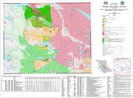
Open File 2008-05 presents a 1:50 000-scale geology map of the Timothy Lake area, based on fieldwork conducted in 2007. The Timothy Lake map area covers about 950 square kilometres near the eastern edge of the Interior Plateau of south-central British Columbia. It encompasses the communities of Lac La Hache, Forest Grove and the west subdivision of the main Canim Lake Indian Reserve.
The map area is underlain mainly by sedimentary, volcanic and volcaniclastic rocks of the Middle to Upper Triassic Nicola Group, together with Late Triassic to Early Jurassic dioritic to granitic plutonic rocks, including the southwestern part of the Takomkane Batholith. These rocks are part of the Quesnel magmatic arc, which hosts the Afton and Mount Polley porphyry Cu-Au deposits to the south and north, respectively. The map area also includes Eocene volcanic rocks of the Kamloops Group, Neogene plateau basalts of the Chilcotin Group, and small exposures of Quaternary basalt. Numerous Cu-Au mineral occurrences are found in the north-central part of the map area, south of Spout and Peach lakes. Mineralization occurs mainly as porphyry-style fracture and vein stockworks, and local skarn zones, within and adjacent to monzodioritic stocks of the Spout Lake intrusive suite.
J.M. Logan, G. Leroux and L. Able
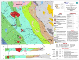
Open File 2008-06 presents a 1:50 000-scale geology map of the Cottonwood area and provides new insight into the geology, geochronology and mineral potential of the Nicola Arc of central British Columbia. It presents the results of new mapping, mineral deposit studies and compilation of private industry research that document the geologic and metallogenic evolution of this largely overburden covered portion of the Quesnel terrane.
Past-producing surficial placer gold deposits are known in the area but the focus of current mineral exploration is porphyry Cu-Au mineralization like that associated with alkalic intrusions at Mouse Mountain. These magmatic/mineralized centres comprise important exploration targets for Cu-Au±Ag porphyry deposits along the length of the Nicola Arc (i.e. Copper Mountain, Mount Polley, QR). Delineation of new exploration targets by Richfield Ventures Corp. at Mouse Mountain underlines the potential for new discoveries in correlative rocks in the map area.
P. Chan and K.D. Hancock
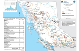
This Provincial Map shows the location of major exploration projects; producing metal, coal and industrial mineral mines and the communities they influenced in 2007.
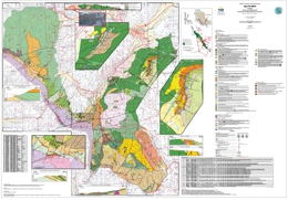
L.J. Diakow and A. Barrios
This geological map shows new stratigraphic subdivisions and geochronology for the Spences Bridge Group, south of Merritt. The product is based on fieldwork conducted in 2007 and 2008. The map area is underlain by two magmatic arc successions, the Late Triassic Nicola Group and overlying Early Cretaceous Spences Bridge Group. The Nicola Group near Merritt is uniquely characterized by Late Triassic (Carnian) felsic volcano-sedimentary-limestone successions containing silica-carbonate exhalite and sinter with a weakly elevated epithermal geochemical signature. Low-sulphidation epithermal gold quartz veins occur throughout the range of Spences Bridge Group stratigraphy. A new U-Pb isotopic date confirms previous work of an Early Cretaceous age for the lower, Pimainus Formation, and a contemporaneous Ar/Ar date on hydrothermal alteration is derived from a gold-bearing epithermal quartz vein system hosted by the upper, Spius Formation.
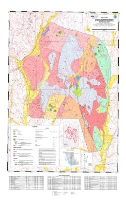
Mapping and Compliation by N.W.D. Massey and A. Duffy
The map covers an area to the east of Beaverdell, between the Kettle and West Kettle rivers. It focuses on rocks of the Wallace Formation, previously correlated with the Anarchist Schist in the Bridesville area, but now thought to be Triassic in age and correlative with the Brooklyn Formation of the Greenwood area. The Wallace Formation is dominated by fine to medium-grained clastic sediments which are essentially unmetamorphosed, though they do show extensive hornfelsing from Jurassic plutons. Limestone and greenstone members occur in the Crouse Creek area, and are the lowest exposed units. Except for one small area, to the west of Crouse Creek, no penetrative deformation is observed.
Intrusive rocks envelope the Wallace formation. These comprise several major granodiorite plutons and stocks in the west and central part of the map area, designated the Westkettle batholith (Reinecke 1915) and probably correlative with the mid-Jurassic Nelson Intrusions. Templeman-Kluit (1989) has also ascribed some of the granodiorites to the north of the area as being part of the Jura-Cretaceous Okanagan Batholith. Megacrystic granite of the Coryell suite forms two intrusions in the east and south of the map area, as well as the small Beaverdell stock. Tertiary-age porphyry dykes abound through the area intruding all older lithologies. Gold veins of the Beaverdell camp and the surrounding area are histed in the Wallace Formation and Jurassic intrusions but are believed to be genetically related to the Tertiary intrusions. Disseminated and porphyry style copper mineralization of the GK property is of unknown age.
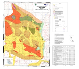
Mapping and Compliation by N.W.D. Massey and A. Duffy
The map covers the McKinney Creek area, to the north of Bridesville, between Rock Creek and Baldy Mountain and bordering on OF 2007-7. It further expands westwards, studies of the pre-Tertiary rocks by Fyles in the Greenwood area (1990). The area is underlain predominantly by Paleozoic rocks belonging to the Anarchist Schist. These comprise a meta-sedimentary unit of quartzite (meta-chert), argillaceous quartzite, quartz-chlorite and quartz-biotite schists with minor metabasalt and limestone, and a meta-volcanic unit of massive greenstone flows with minor breccias and tuffs and minor meta-sediments. The general map pattern of the metasedimentary and metavolcanic units seems to define a major northwesterly trending fold. However, the lack of conclusive way-up structures and stratigraphic relationship precludes determining if the fold is antiformal or synformal.
Intrusive rocks rim the McKinney Creek area on north, west and south sides. Jurassic intrusions comprise two major bodies – the McKinney Creek and Mount Baldy granodiorites as well as an unnamed suite of ultramafic and mafic intrusions. The granodiorites have been correlated with the mid-Jurassic Nelson Intrusions, though geochronological data is lacking. The mafic rocks may be an older phase of the Nelson suite and are both intruded by granodiorite as well as included as xenoliths in granodiorite. The north-eastern margin of the map area is marked by a white to pinkish K-spar megacrystic granite intrusion typical of the Coryell Suite. Tertiary-age porphyry dykes abound through the area intruding all older lithologies.
Gold veins of the Camp McKinney camp and the surrounding area are hosted in the Anarchist Schist but are believed to be genetically related to Tertiary intrusions. The band of ?Jurassic mafic and ultramafic intrusions is related to those seen to the southwest of the map sheet (e.g. the Old Nick) and similarly bear chromite and magnetite mineralization, as well as talc and soapstone.
2007
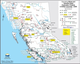
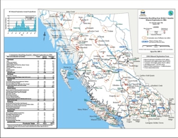
T.G. Schroeter and E. Man
This Provincial Map shows the location of major exploration projects and producing metal, coal and industrial mineral mines in 2006.
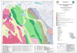
T.G. Schroeter and E. Man
This Provincial Map shows the location of major exploration projects; producing metal, coal and industrial mineral mines and the communities they influenced in 2006.
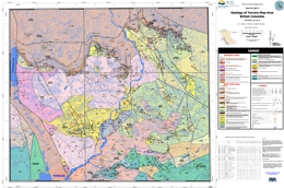
P. Schiarizza and J. Macauley
The Hendrix Lake map area covers about 800 square kilometres within the Quesnel Highland of south-central British Columbia. This new geological map is based on fieldwork conducted during 2006 which is part of a larger program. The map area is underlain mainly by sedimentary, volcanic and volcaniclastic rocks of the Middle to Late Triassic Nicola Group, together with Late Triassic to Early Jurassic ultramafic to granitic plutonic rocks, including the eastern part of the Takomkane Batholith. These rocks are part of the Quesnel magmatic arc, which hosts the Afton and Mount Polley porphyry Cu-Au deposits to the south and north, respectively. The map area also includes Late Paleozoic mafic schists of the Crooked amphibolite (Slide Mountain Terrane), Proterozoic and/or Paleozoic metasedimentary rocks of the Snowshoe Group (Kootenay Terrane), stocks of Cretaceous granite, and small exposures of Quaternary basalt. Many of the mineral occurrences located within the map area are associated with Cretaceous granitic rocks. These include the past-producing Boss Mountain porphyry molybdenum deposit, tungsten-molybdenum skarns, and gold-bearing shears and vein systems.
View Open File 2007-03 (PDF, 17.6 MB)
Download Open File 2007-03 (ZIP, 15 MB)
J.L. Nelson, R. Kennedy, J. Angen and S. Newman
Open File 2007-4 covers the area north of Terrace, BC, from Kitsumkalum Lake to the mountains east of the Skeena River. It incorporates and builds on Open File 2006-3 (Usk map area), adding geological and assay data collected during the 2006 field season. The area includes extensive volcanic exposures of the Lower Jurassic Hazelton Group, overlain by strata equivalent to the Salmon River (Troy Ridge facies) in the Iskut area, that form a distinct siliceous interval below the base of the Bowser Lake Group. Jurassic and Eocene plutons are host to precious metal veins and copper and molybdenum porphyry mineralization. The area has a core consisting of a major Paleocene-Eocene uplift of metamorphosed Hazelton Group strata and deformed ca 60 Ma plutons. Regional rock relationships shown on the map suggest that this was a footwall panel below an earlier (Cretaceous?) northeast-vergent thrust fault. Hanging wall strata are exposed east of the Skeena River. Provincial Map shows the location of major exploration projects; producing metal, coal and industrial mineral mines and the communities they influenced in 2006. The PDF of the map is plot size and in colour.
View Open File 2007-04 (PDF, 23 MB)
See also Geofile 2008-11, Terrace Preliminary Geodata Release
N.T. Boudreau
Open File 2007-5 with illustrations is a thesis submitted to Saint Mary's University, Halifax, Nova Scotia in partial fulfillment of the requirements for the degree, Bachelor of Science, Honours, Dept of Geology. The field work was carried out as part of an ongoing geoscience project in the Terrace region by the BC Geological Survey.
The Lower Jurassic Kitselas volcanic sequence of the Hazelton Group is located within the Intermontane Stikine Terrane in the western part of the Usk map-area in north-western British Columbia. It is surrounded by intrusive units to the north and south and by Hazelton Group volcanic rocks of the Telkwa Formation to the east. Telkwa and Kitselas rocks are coeval in age; however, the primary relationship between the two map units is enigmatic due to a structural contact and differences in composition and metamorphic grade. The objective of this report was thus to characterize the Kitselas volcanic rocks in terms of volcanology, petrography, and geochemistry and to use this data to determine the primary relationship between Kitselas and Telkwa rocks. The field and petrographic characteristics are consistent with a model wherein the Kitselas volcanic rocks comprise the foot-wall of a detachment fault system, which includes the Usk Fault. The geochemical characteristics of the Telkwa and Kitselas volcanics indicate that rocks from both of these map units are part of a volcanic arc calc-alkaline suite and their trace element similarities indicate that they are genetically related.
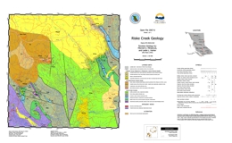
M.G. Mihalynuk and L.L. Harker
Pine forests extend across much of the interior plateau of southern British Columbia where they are the principal commercial tree species. These forests are infested by the Mountain Pine Beetle, and it is estimated that by 2016 less than ~10% of the already diminished 2006 volume of pine will be left standing. Economic welfare of the many forestry-dependent communities in the Beetle Infested Zone (BIZ) will be severely impacted. Anticipating an economic downturn in the forestry sector, the Provincial Government is supporting economic diversification throughout the region via stimulation of other industries. Work presented in Open File 2007-6, Riske Creek Geology, is a part of that provincial effort, and is aimed at stimulating new jobs in the high-paying mineral exploration industry.
Centred approximately 30 km southwest of Williams Lake, the Riske Creek area is part of the Interior Plateau where it is dissected by the Fraser River. It is underlain by oceanic crustal, and sedimentary rocks of the Cache Creek complex, and Eocene felsic volcanic strata. Poorly lithified gravel, basalt hyaloclastite and lavas of the Chilcotin Group mantle the older rocks. Regional geochemical stream sediment data from the area are elevated in copper (94th percentile), zinc (96th percentile), and gold (>99th percentile), with respect to the remainder of the 50 000 samples collected throughout the province. As a consequence, this area was chosen for additional sampling and geological mapping.
Open File 2007-6 presents a new version of the geology of this important area, covering about 200 km2. It outlines belts of carbonate, serpentinite and basalt not previously recognized on earlier geological maps. Geochemical data are available as part of Geofile 2007-5.
View Open File 2007-06 (PDF, 8.65 MB)
Download Open File 2007-06 (ZIP, 26.1 MB)
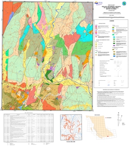
Mapping and Compilation by N.W.D. Massey
This new geological map builds on and expands westward, the studies by Fyles of pre-Tertiary rocks in the Greenwood area (1990).
The map covers an area centred on the Kettle River Valley extending from the Washington state border to Westbridge. Paleozoic rocks, south of Highway 3, belong to the Anarchist Schist, comprising quartzite (meta-chert), argillaceous quartzite, quartz-chlorite and quartz-biotite schists, massive and tuffaceous greenstones. A white dolomite unit, south of Rock Creek, is being exploited at the Mighty White Mine but its relationship to other units is somewhat enigmatic. Minor barite in meta-argillites is an exploration target in the Budy Creek area.
The Paleozoic rocks, north of Highway 3, belong to the Devonian to Permian ophiolitic Knob Hill Complex. Serpentinite and gabbro are overlain by massive, pillowed and volcaniclastic greenstones and well-bedded to ribboned cherts and argillites. Listwanite alteration of serpentinite has resulted in some anomalous gold. The Knob Hill Complex and Anarchist Schist are separated by a postulated thrust, which is the continuation of the Mt Attwood and Lind Creek faults of the Greenwood area. Middle Triassic sharpstone conglomerate and limestone of the Brooklyn Formation overlie both Paleozoic sequences. All pre-Tertiary rocks can be host to Tertiary epithermal quartz veins, though few have yet proved to carry gold.
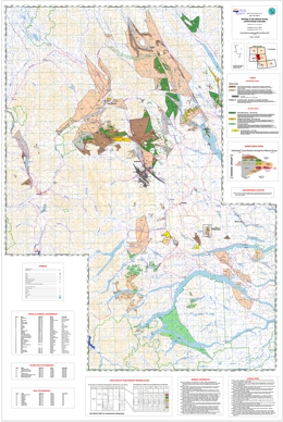
Compilation by D.J. Alldrick; Cartography by C.M. Lin
The Skeena Group map area covers 75,000 square kilometres in central British Columbia. Open File 2007-8 is a 1:250 000-scale geological map based on fieldwork conducted during 2006, combined with compilation from earlier regional mapping programs. The map highlights areas underlain by sedimentary, volcanic and volcaniclastic rocks of the early to middle Cretaceous Skeena Group.
This volcano-sedimentary succession hosts a major precious metal deposit at the past-producing Equity Silver mine (see Open File 2007-9) within the Mount Ney intermediate volcanics, a series of gold prospects associated with the Kitseguecla Lake Rhyolites, and the important coal deposits of the Telkwa mining district hosted in mudstone members of the Bulkley Canyon Formation sandstones and conglomerates.
Field and laboratory studies indicate that all these deposits are contemporaneous with their hostrock successions. Regionally extensive correlative strata delineated on this map have been only partially explored for similar deposits.
This geology map is available in PDF format for printing. The digital files include the map in GIS format (Manifold GIS) and a second version of the GIS map containing 96 georeferenced files of anomalous RGS samples suites for Cu, Pb, Zn, Ag, Au, Hg, Sb, As. The zipped file also includes complementary report, poster and lecture files, plus a comprehensive bibliography of reports and maps on the Skeena Group.
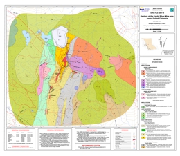
Geological Compilation by D.J. Alldrick; Geology by D. Alldrick, R. Pease and A. Panteleyev
The Equity Silver Mine map area covers 60 square kilometres southeast of Houston in central British Columbia. Open File 2007-9 is a 1:20 000-scale geology geological map based on fieldwork conducted during 2006 combined with compilation from earlier industry mapping programs. The map area profiles areas underlain by volcanic, volcaniclastic and sedimentary rocks of the Mount Ney Volcanics, part of the early to middle Cretaceous Skeena Group.
The dacite units within this volcano-sedimentary succession hosts the four precious-metal orebodies at the past-producing Equity Silver Mine plus four similar and adjacent mineral prospects.
Field and laboratory studies indicate that all deposits are contemporaneous with their hostrock succession. Regionally extensive correlative strata have been only partially explored for similar deposits (see Open File 2007-8).
This geology map is available in PDF format for printing. The digital files include the map in GIS format (Manifold GIS), as well as complementary report, poster and lecture files, plus a comprehensive bibliography of reports and maps on the geology of the Equity Silver Mine area.
L.C. Struik, D.G. MacIntyre and S.P. Williams
Also published as GSC Open File 5623
Open File 2007-10, a collection of digital geoscience information, was produced by members of the Geological Survey of Canada (GSC), British Columbia Geological Survey (BCGS), universities and industry under the auspices of the Geological Survey of Canada's National Mapping Program (NATMAP) as the Nechako Project (1995-2000). The information consists of geoscience data sets for all or parts of six 1:250,000 scale NTS map sheets located in central British Columbia: Manson River (093N), Fort Fraser (093K), Nechako River (093F), Prince George (093G/W), Smithers (093L/9,16), and Hazelton (093M/1,2,7,8). The information is presented in several categories: 1. Geologic summary, 2. Papers, 3. Photographs, 4. Maps, 5. References, and 6. Partners.
The Geologic summary section presents an overview of the project, the geologic setting, and some of the contributions that have been made. The Papers section consists of forty-four GSC Current Research papers and eleven BCGS Geological Fieldwork papers. The Photographs section presents of a collection of photographs in four categories: Bedrock, Surficial, Paleontology and Miscellaneous. The Maps section consists of a variety of attributed spatial data sets (shape files). The information includes: bedrock and surficial geology, geophysics, mineral occurrences, chemistry, and age data. For ease of use the spatial data resides within folders specified by file format and geographic region. The References section presents a comprehensive list of outputs for the project including talks, posters, maps and written publications. The Partners section consists of a list of the individuals who participated in the project and their affiliation.
The CD-ROM also includes a limited edition of SurView, a viewing application for Microsoft Windows, developed at the Geological Survey of Canada and originally released as GSC Open File 2661. SurView runs directly off the disk. It can display, print, and to a limited extent query the spatial data. This provides an opportunity for those without specialized GIS software to delve into the realm of digital geoscience data. A tutorial is available on the CD-ROM.
NOTE regarding Nechako NATMAP Project Website: This website was active from 1995 to 2000 and serves as a record of the project. It contains project summary, objectives, team members, references and newsletter. As the website was not maintained after 2000, many of the external links and contact information will not be correct. Download the file (Nechako.zip), unzip and launch Nechako.htm with your Internet Browser.
2006
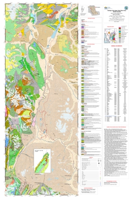
J. Pardy and T. Schroeter
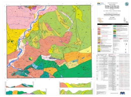
D.J. Alldrick, J.L. Nelson, T. Barresi, M.L. Stewart and K.A. Simpson
J.L. Nelson, T. Barresi, E. Knight and N. Boudreau
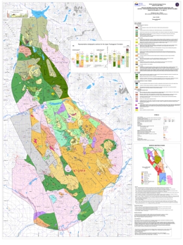
L. Diakow, R. Rhodes and A. Barrios
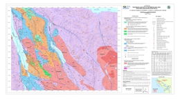
G.T. Nixon, M. Kelman, D. Stevenson, L. Stokes, and K. Johnston
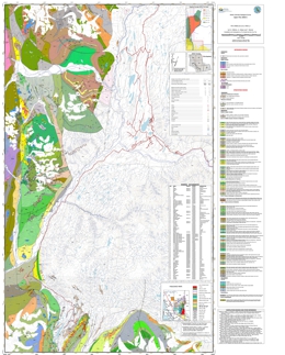
D.J. Alldrick, J.L. Nelson and T. Barresi
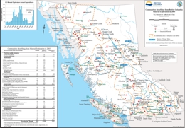
T. Schroeter, A. Fulford and J. Chou
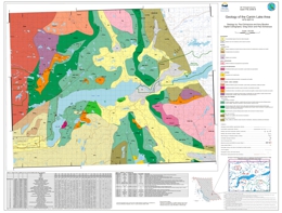
P. Schiarizza and A. Boulton
The Canim Lake map area covers about 1000 square kilometres within the Quesnel Highland and Fraser Plateau of south-central British Columbia. This new geological map is based on fieldwork conducted during 2005. The map area is underlain mainly by sedimentary, volcanic and volcaniclastic rocks of the Middle to Upper Triassic Nicola Group, together with Late Triassic to Early Jurassic ultramafic to granitic plutonic rocks. These rocks are part of the Quesnel magmatic arc, which hosts the Afton and Mount Polley porphyry Cu-Au deposits to the south and north, respectively. Younger rocks in the map area include mid-Cretaceous granitic stocks and batholiths, Eocene volcanic and sedimentary rocks, and Quaternary basalt. Mineral occurrences located within the map area include disseminated and fracture controlled Cu-Au (locally with Pt, Pd) within ultramafic, dioritic and monzonitic rocks of the Quesnel arc suite, as well as porphyry Mo within mid-Cretaceous granite and Au-bearing quartz-carbonate veins and mineralized shears.
J. Lewis, G.J. Simandl and D.V. Lefebure
P. Desjardins
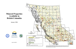
The British Columbia Ministry of Energy, Mines, and Petroleum Resources in partnership with the Association for Mineral Exploration British Columbia (AME BC), new name of British Columbia and Yukon Chamber of Mines, maintains the Mineral Properties Available in British Columbia Map. This map shows the locations of mineral properties available for option or sale in British Columbia.
Mapping and Compilation by J.M. Logan and M.G. Mihalynuk, BC Geological Survey
Geochronology by T. Ullrich and R. Friedman, University of British Columbia
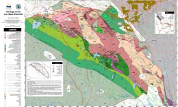
This new geological map provides new insight into the geology, geochronology and mineral potential of the Iron Mask Batholith in the Kamloops region of southern British Columbia. It presents the results of new mapping and a compilation of University and private industry research designed to clarify the copper-gold metallogeny of the batholith. Past metal production from the batholith includes the Afton copper-gold-silver-PGE bearing deposit. Delineation of additional reserves and a likely return to production by New Gold Resources makes correlative rocks important exploration targets throughout the batholith and underlines the potential for new discoveries and mines in the area.
The Iron Mask survey was delivered with support from the Rocks to Riches (AMEBC) program and Geoscience Partnerships developed between Abacus Mining and Exploration, Imperial Metals Corporation and Nova Gold Corporation to study alkaline porphyry copper-gold deposits.
Integrated Airborne Geophysical, Geology and Mineral Occurrence Data, Iron Mask Batholith is available in Open File 2006-12. The geophysical data represents a subset of the 1995 Iron Mask Survey completed by the Geological Survey of Canada and released as BCMEMPR Open File 2005-13 and GSC Open File 2817. See GeoFile 2006-5 for a review of the regional geological setting, tectonics, geochronology, geophysics, mineralization and alteration characteristics of the Iron Mask Batholith.
Compiled by James M. Logan, Mitchell G. Mihalynuk (BC Geological Survey) and Carmel Lowe (Geological Survey of Canada)
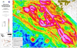
This product comprises 3 magnetic and 6 radiometric parameters, geo-referenced and displayed on separate 1: 25 000 scale sheets with geological contacts and major mineral occurrences shown. The map area corresponds to Open File Map 2006-11, Geology of the Iron Mask Batholith. The geophysical data represents a subset of the 1995 Iron Mask Geophysical Survey completed by the Geological Survey of Canada and released as BCMEMPR Open File 2005-13 and GSC Open File 2817 and includes re-contoured residual, vertical gradient and horizontal gradient magnetics and potassium, thorium, uranium, thorium/potassium, uranium/potassium and uranium/thorium plots. The geophysical data provides new insight into the geology and mineral potential of the Iron Mask Batholith particularly in areas covered by overburden.
The Iron Mask survey was delivered through support from the Rocks to Riches (AMEBC) program and Geoscience Partnerships developed between Abacus Mining and Exploration, Imperial Metals Corporation and Nova Gold Corporation to study alkaline porphyry copper-gold deposits.
See GeoFile 2006-5 for a review of the regional geological setting, tectonics, geochronology, geophysics, mineralization and alteration characteristics of the Iron Mask Batholith.
View Open File 2006-12 (PDF, 125 MB)
Reference:
Carr, J.M. (1957): Copper deposits associated with the eastern part of the Iron Mask Batholith near Kamloops; B.C. Minister of Mines Annual Report, 1956, pages 47-69.
Logan, J.M. and Mihalynuk, M.G. (2006): Geology of the Iron Mask Batholith, south central British Columbia, B.C. Ministry of Energy, Mines and Petroleum Resources, Open File 2006-11, 1:25,000 scale.
Ross, K.V., Godwin, C.I., Bond, L. and Dawson, K. M. (1995): Geology, alteration and mineralization in the Ajax East and Ajax West deposits, southern Iron Mask Batholith, Kamloops, British Columbia; In Porphyry Deposits of the northwestern Cordillera of North America, T. G. Schroeter (Editor), Canadian Institute of Mining, Metallurgy and Petroleum, Special Volume 46, pages 565-580.
Sebert, C. and Mroczek, M. (2004): Afton Copper Gold Project - Afton Pit Geology Map; In Geological Fieldwork 2003, B.C. Ministry of Energy and Mines Paper 2004-1, page 268.
Shives, R.B.K. and Carson, J.M. (1995): Airborne geophysical survey, Iron Mask Batholith, British Columbia, Geological Survey of Canada, Open File 2817, 1:150,000 scale, 61 pages, 18 maps.
Stanley, C.R., Lang, J.R. and Snyder, L.D. (1994): Geology and mineralization in the northern part of the Iron Mask Batholith, British Columbia (92I/9, 10); in Geological Fieldwork 1993, edited by B. Grant and J.M. Newell, B.C. Ministry of Energy, Mines and Petroleum Resources, Paper 1994-1, pages 269-274.
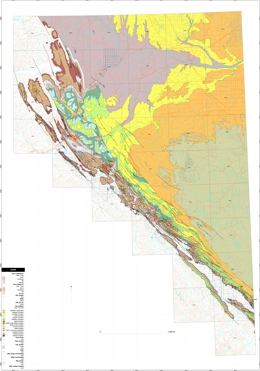
A. Legun
This interim release presents GIS files of Peace River coalfield geology in Manifold software “map” (.map) format. The components include maps, databases, isopach plots, orthophotos, and a composite shaded relief image. The files cover the coal district south of latitude 56 30' and the area east of the coalfield extending to the Alberta border. These files update data presented in Geoscience Map 2003-2. The updates include:
- Corrections to geologic contact linework. The linework has been closed and geologic polygons created under Manifold software. These are exportable into other formats such as Map Info “mif” or ESRI “shp”.
- A current database of wells within the map area (adapted from B.C. Oil and Gas Commission download files).
- A formation top database for wells within the map area (adapted from B.C. Oil and Gas Commission download files). Formation tops have been picked and tabulated by individual well geologists over the years. The database is suitable for a quick view of depths to an interval of interest (see caveats below).
The .map files may be useful to individuals:
- involved in surface coal and subsurface coalbed gas exploration;
- assessing lithologic trends in the Gates formation;
- assessing depths to coal-bearing formations immediately east of the coalfield;
- pursuing coals at shallow depths with potential for underground mining; and
- involved in land use planning relating to coal.
Project components are organized around several Manifold digital map files:
Map PeaceR geo
This map shows bedrock geology and distribution of coal open pits. The pits are characterised as reclaimed, active, developing, or potential pits for coal extraction.
Map PeaceR ortho
This map provides 1:20k orthophoto coverage of the coalfield and immediate areas to the east. The images are in compressed (ecw) format and linked to the map (they may need to be relinked if copied to your own directory). Geologic linework can be “turned on” to relate it to the bedrock structural grain. A semi-transparent shaded relief image can also be “turned on” to accent topographic relief.
Map Falher C, Map Falher D
The Gates includes upward coarsening units of marine origin. These are known as Falher cycles in subsurface nomenclature and relevant to regional studies of gas reservoirs in the Alberta deep basin. Map Falher C and D are isopach plots derived from “clean sand” gamma log profiles. These isopachs illustrate buildups of nearshore sand and conglomerate in the Tumbler Ridge - Wolverine river area. The plots are local updates of the regional Falher C and D “clean sand” plots of Leckie (1986) and the Falher shoreline plots of Carmichael (1983). In the case of Falher C these nearshore units appear to merge with landward attached deposits of broad channels near the Shikano pit. A table of values derived from examination of gas well logs and coal boreholes supports the plots.
The maps include a line of section showing the stratigraphic relation of Falher C and D to the middle Gates coal bearing section at Wolverine river.
Downloads and PDF maps (ZIP format):
- Manifold GIS .Map File
- ESRI Shape Files
- PDF Maps
Map PeaceR geo
Map PeaceR ortho
Map PeaceR ortho & geology
Map Falher C
Map Falher D - Well Tables
MS Access Database
CSV Files - Composite Shaded Relief Image
- Orthophoto Images
View Open File 2006-13 (PDF, 33.3 MB)
Download Open File 2006-13 (ZIP, 15.5 MB)
Caveats:
The coal borehole database has not been fully scanned for location errors. Not all potential coal pits are shown. Many oil and gas wells are drilled to intersect deep stratigraphic intervals of interest and little attention paid to details of the near surface. The formation picks near surface are occasionally clearly in error and do not agree with nearby coal boreholes and stratigraphic section data. The formation top database should be supplemented by databases specific to each formation (for example Leckie, Hayes and Staniland 1995). Local updates to the geology (eg. Wolverine river area, Legun 2007) are in progress.
Acknowledgements:
My thanks to Brian Grant (Manager) and Dave Lefebure (Director) of the Geological Survey Branch for project support. Thanks also to Steve Glover and Dave Richardson of the Oil and Gas Division for directions in the well file library.
Selected geologic references, Peace River coalfield:
B.C. Geological Survey (2006): Bedrock Mapping Index; BC Ministry of Energy, Mines and Petroleum Resources,
Carmichael, S.M. (1983): Sedimentology of the Lower Cretaceous Gates and Moosebar Formations, northeast coalfields, British Columbia; unpublished PhD thesis, University of British Columbia, 285 pages.
Carmichael, S.M. (1988): Linear Estuarine Conglomerate Bodies Formed During a Mid-Albian Marine Transgression; "upper Gates" Formation, Rocky Mountain foothills of northeastern British Columbia; in Sequences, Stratigraphy, Sedimentology: Surface and Subsurface, James, D.P. and Leckie, D.A., Editors, Canadian Society of Petroleum Geologists, Memoir 15, pages 49–62.
COALFILE (2006): COALFILE BC Peace River NE BC coal assessment reports; BC Ministry of Energy, Mines and Petroleum Resources,
Duff, P.McL.D. and Gilchrist, R.D. (1981): Correlation of Lower Cretaceous Coal Measures, Peace River Coalfield, British Columbia; BC Ministry of Energy, Mines and Petroleum Resources, Paper 1981-3, 31 pages.
Gibson, D.W. (1992): Stratigraphy, Sedimentology, Coal Geology and Depositional Environments of the Lower Cretaceous Gething Formation, northeastern British Columbia and west-central Alberta; Geological Survey of Canada, Bulletin 431, 127 pages.
Gibson, D.W. (1992): Stratigraphy and Sedimentology of the Lower Cretaceous Hulcross and Boulder Creek Formations, northeastern British Columbia; Geological Survey of Canada, Bulletin 440, 111 pages.
Gilchrist, R.D. and Flynn, B.P. (1978): Coal resources, Peace River Coalfield, northeastern British Columbia; BC Ministry of Energy, Mines and Petroleum Resources, Preliminary Map 33.
Grieve, D.A., Holuszko, M.E. and Goodarzi, F. (1995): British Columbia Coal Quality Survey, B.C. Ministry of Energy, Mines and Petroleum Resources, Bulletin 96.
Kalkreuth, W., Langenberg, W., McMechan, M. (1989): Regional Coalification Pattern of Lower Cretaceous Coal - Bearing Strata, Rocky Mountain Foothills and Foreland, Canada - Implications For Future Exploration; International Journal of Coal Geology, Volume 13, no. 1-4, 1989; pages 261-302.
Kalkreuth, W. and Leckie, D.A. (1989): Sedimentological and petrographical characteristics of Cretaceous strandplain coals: a model for coal accumulation from the North American western interior seaway; in Peat and Coal: Origin, Facies and Depositional Models, Lyons, P.C. and Alpern, B., Editors, International Journal of Coal Geology, Volume 12, pages 381–424.
Kilby, W.E. (1984): Some Chemical and Mineralogical Characteristics of Tonsteins and Bentonites Northeast British Columbia; in Geological Fieldwork 1984; B.C. Ministry of Energy, Mines and Petroleum Resources, Paper 1985-1, pages 139-150.
Lamberson, M.N., Bustin, R.M. and Kalkreuth, W. (1991): Lithotype (maceral) composition and variation as correlated with paleo-wetland environments, Gates Formation, northeastern British Columbia, Canada, International Journal of Coal Geology, vol.18, pages 87-124.
Leckie, D.A. (1983): Sedimentology of the Moosebar and Gates Formations (Lower Cretaceous), Ph.D. Thesis, McMaster University, Hamilton, Ontario, 515 pages (unpublished).
Leckie, D.A. (1986): Rates, controls, and sand-body geometries of transgressive-regressive cycles: Cretaceous Moosevale and Gates formations, British Columbia; American Association of Petroleum Geologists Bulletin, volume 70, pages 516-535.
Leckie, D.A., Hayes, B., and Staniland, M. (1995): Formation and member top database for the Peace River Formation in the Peace River arch area; Geological Survey of Canada, Open File 3096, 74 pages.
Legun, A. (1990): Stratigraphic trends in the Gething Formation; BC Ministry of Energy, Mines and Petroleum Resources, Open File 1990-33.
Legun, A.S. (2003): Coalbed methane geology of the Peace River district, northeastern BC (parts of 94A, 94B, 93I, 93O, 93P); B.C. Ministry of Energy, Mines and Petroleum Resources, Geoscience Map 2003-2, scale 1:200000.
Legun, A.S. (2007): Mapping and Review of Coal Geology in the Wolverine River Area, Peace River Coalfield (NTS 93P/03), northeastern British Columbia, B.C. Ministry of Energy, Mines and Petroleum Resources, Geological Fieldwork 2006, Paper 2007-1, pages 67-76.
McMechan, M.E. (1994): Geology, Dawson Creek, west of the sixth meridian, British Columbia; Geological Survey of Canada, "A" Series Map, 1858A.
MINFILE (2006): MINFILE BC mineral deposits database; BC Ministry of Energy, Mines and Petroleum Resources,.
McMechan, M.E. (1994): Geology, Dawson Creek, west of the sixth meridian, British Columbia; Geological Survey of Canada, "A" Series Map, 1858A.
Ryan, B.D. (1997): Coal Quality Variations in the Gething Formation, Northeast British Columbia (93 O, J, I); in Geological Fieldwork 1996, BC Ministry of Energy, Mines and Petroleum Resources, Paper 1997-1, pages 373–397.
Stott, D.F. (1998): Fernie Formation and Minnes Group (Jurassic and lowermost Cretaceous), northern Rocky Mountain Foothills, Alberta and British Columbia; Geological Survey of Canada, Bulletin 516, 516 pages.
Wadsworth, J., Boyd, R., Diessel C., and Leckie, D. (2003): Stratigraphic Style of Coal and Non-marine Strata in a High Accommodation Setting: Falher Member and Gates Formation (Lower Cretaceous), western Canada; Bulletin of Canadian Petroleum Geology 2003, volume 51: 275-303.
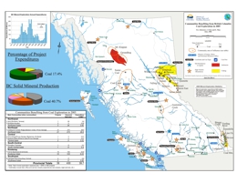
T.G. Schroeter, J. Chou, and E. Man
This map shows community benefits related to coal exploration activity in BC in 2005.
2005
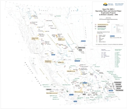
J.W. Pardy
This Provincial Map shows the location of major exploration projects and producing metal, coal and industrial mineral mines in 2004.
For more information on mines and exploration projects see BC Mineral Exploration Review 2004, Information Circular 2005-1.
N.W.D. Massey, D.G. MacIntyre, P.J. Desjardins and R.T. Cooney
Digital regional compilations of the geology of B.C. at 1:250,000-scale were made by the staff of the BC Geological Survey (BCGS) in 1992-96 in support of the Mineral Potential Project. These were released as Open Files and digital downloads from the BCGS website.
However, numerous errors and inconsistencies were noted within these data sets. The Digital Geology Map of British Columbia Project was designed to address these problems and, in the process, try to produce a seamless digital map of the Province with consistent geological tagging. Where feasible, updates to the geology have also been incorporated during the editing process. However, some “scratch lines” remain in the data reflecting problems due to unresolved differences in geological designations in original sources.
Release of the recompilation is based on the same tiles as the Cordilleran GIS Map Library (Journeay and Williams, 1995) which conforms to the International Map of the World standard used for indexing 1:1,000,000-scale topographic maps. This differs from the numbering convention used for the National Topographic System maps. Preliminary versions of the tiled data were released in 2003, with updates in 2004. This new province-wide version, and associated tiled data, supersedes the earlier files.
All data sets are in shape file format that should be readily usable by most GIS software. They are provided in tiled form for nine regions of B.C. and as complete Provincial coverages. All data sets are presented as decimal degrees (suffix _ll) and BC Albers (suffix _alb), while tiled data are also available in UTM (suffix _utm) projections. All projections use NAD83 as the datum. The data sets are intended to be used at 1:250,000-scale and their use at greater scales is not recommended.
Data sets
Each data set includes several topographic and geological shape files:
| Topographic data: | |
| BC_road | important roads (excludes many roads in built-up areas); the legend file, e.g. BC_road_ll.avl, will symbolize for paved or gravel surface (lines). |
| BC_rail | rail track; includes some disused lines (lines). |
| BC_communities_2M | regional significant population centres; attributed for name (points). |
| BC_250K_grid | 1:250,000 NTS map sheet grid (polygons). |
| BC_tiles | areas of tiled data (polygon). |
| BC_ocean | coastline (polygon). |
| BC_river | rivers (lines). |
| BC_riverpoly | major rivers (as polygons). |
| BC_lake | lakes (polygons). |
| BC_ice | areas of permanent ice cover (polygons). |
ESRI users (*.avl and BCDigitalMap.style)
Each data set includes several topographic and geological shape files: ArcView legend files are supplied for all data set files (e.g. BC_roads_ll.avl). These will automatically symbolize the data when loaded into ArcView. Geology can be symbolized in various ways depending upon the user’s requirements. The following legend files are supplied for this purpose.
| BC_basins1.avl | sedimentary basins: each with a unique colour. |
| BC_basins2.avl | sedimentary basins: grouped by age. |
| BC_lithology.avl | colours bedrock geology by lithology (ROCK_TYPE). |
| BC_strat_2M.avl | colours bedrock geology by stratigraphy (units being grouped at a regional level, commensurate with a 1:2,000,000-scale); colours have been assigned based on stratigraphic age for all rock types. |
| BC_tecass.avl | colours bedrock geology by tectonic assemblage (TECUNIT); colours are as close as possible to those used by Wheeler and McFeely (GSC Map 1712A). |
| BC_terranes.avl | colours bedrock geology by tectono-stratigraphic terrane (TERRANE). |
Tile specific versions of these legend files (e.g. NM10_tecass.avl) are also supplied with the tiled data. ArcMap 8.x users should use the supplied BCDigitalMap.style style sheet to symbolize all data sets except geology. The style sheet is included in all the zip files. The above avl files can be imported into ArcMap for geology symbolization.
Geoscience Map 2005-3 is a 1:1M Geology of BC map.
Download Open File 2005-02 (ZIP, 24.7 MB)
This publication has been superseded
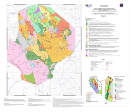
L.J. Diakow, G.T. Nixon, R. Rhodes and B. Lane
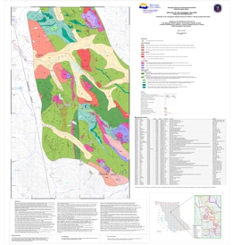
Bedrock mapping completed at 1:20:000 scale in 2003 and 2004 covers approximately 700 km2 of under-explored terrain in the eastern part of the Toodoggone camp between the Finlay River, at the southeast, and Toodoggone River in the northwest portion of the mapped area. Recent discoveries here include porphyry (Sofia, Alexandria) and epithermal (Sickle-Griz) exploration targets in the Early Jurassic rocks. These highly prospective rocks are extrapolated to continue northwest between the Toodoggone and Chukachida rivers.
Mapping east of the Pillar Fault, has defined three new members of the uppermost, Early Jurassic Toodoggone Formation. Regional faults include the Black Fault and the Pillar Fault and field work has recognized that parallel, north trending minor structures are host to epithermal base and precious metal veins. At lower topographic levels, monzonites of the Black Lake Intrusive Suite contain new copper-gold porphyry prospects (e.g., Alexandria and Sophia).
This new geology continues to expand detailed map coverage in the Toodoggone mining camp. It provides refinement to existing stratigraphy, structure, and timing constraints for magmatic and mineralizing events.
This bedrock map is a result of the Federal-Provincial Targeted Geoscience Initiative (II), the University of British Columbia, and partnerships with Stealth Minerals Ltd., Northgate Exploration Ltd., Finlay Minerals Ltd., Bishop Resources Inc. and Sable Resources Ltd. We gratefully acknowledge the general financial and logistical support that these companies provided to the mapping program. Stealth Minerals Limited is thanked for providing local geological information that enabled the authors to fine tune parts of this map. Ryan Rhodes provided the cartographic expertise, building upon work initiated by Harpreet Jaswal.
P. Schiarizza, S.H. Tan, R. Friedman, M.J. Orchard, R. Rhodes
Contribution to the Targeted Geoscience Initiative II - Mining Company Partnership
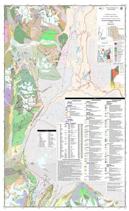
The Johanson Lake map area encompasses about 540 square kilometres within the Swannell Ranges of the Omineca Mountains. It extends from the upper Mesilinka River in the south to the headwaters of Wrede Creek in the north, and is transected by the Omineca Resource Access Road. The geological map is based on fieldwork conducted in 2003 and 2004, as well as compilation of data available in previously published government reports and mineral exploration assessment reports. This map is a result of the Federal-Provincial Targeted Geoscience Initiative (II) and a partnership with Northgate Minerals Corporation.
The area is underlain by Upper Triassic volcanic and volcaniclastic rocks of the Takla Group, together with numerous intrusions. The intrusive rocks are subdivided into 3 main suites: a Late Triassic ultramafic-mafic suite of Alaskan-type bodies and related dioritic rocks; an early Middle Jurassic quartz monzonite-monzodiorite-diorite suite; and a suite of Early Cretaceous granites, granodiorites and tonalites. Cu-Au mineralization, as veins, disseminations, and magnetite-pyrite-chalcopyrite skarns and replacements, is associated with dioritic rocks of the Late Triassic suite. Cu-Mo porphyry mineralization is associated with the Middle Jurassic quartz monzonite suite, and porphyry Mo occurrences occur in Early Cretaceous granitic rocks. Structurally controlled Au-bearing quartz veins are locally associated with Cretaceous-Tertiary dextral strike-slip fault systems.
D. Alldrick, J. Nelson and T. Barresi
This geological map provides new insight into the geology and mineral potential of the Iskut-Eskay region. It is the second map produced from a mapping program designed to delineate the critical Eskay ore horizon through the region north of the mine and to assess the potential for additional Eskay-type deposits within an Early to Middle Jurassic, arc-related rift sequence of rocks along the northwest perimeter of the Bowser Basin.
There are 50 mineral occurrences along the west side of Highway 37, including the Eskay Creek gold-silver mine. This map covers the southern half of the area located between the Red Chris deposit and Eskay Creek mine. The map also displays the sample sites from the Regional Geochemical Survey. Felsic volcanic horizons prospective for Eskay Creek-type volcanogenic massive sulphide deposits are highlighted. Detailed stratigraphy and structural information for the key Hazelton Group strata are included.
The survey received support from the Targeted Geoscience Initiative II program, and was completed in cooperation with the Geological Survey of Canada.
T.G. Schroeter, J.W. Pardy and I.C.L. Webster
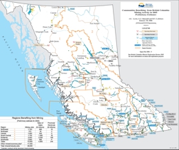
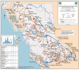
Every year companies and prospectors explore for new mineral and coal deposits in almost all regions of the province. This activity is crucial to find the new mines to supply the metals and minerals that are so important to meet society's needs and to provide jobs for many British Columbians.
This map documents some of the principal communities to benefit from mineral exploration activities during 2004. It shows the various exploration areas and major exploration projects. An accompanying table documents the number of exploration projects, associated seasonal jobs and total expenditures in each region. For a more complete review of exploration activity please refer to the following reports.
For detailed information on industry activities in the province please also see: Mineral Exploration Review or Exploration and Mining in British Columbia.
Shives, R.B.K., Geological Survey of Canada
Also published as GSC Open File 2535
Helicopter-borne gamma ray spectrometric and magnetic total field geophysical survey, Mount Milligan Area, British Columbia (Parts of NTS 092N/01; 093N/02E; 093O/04W)
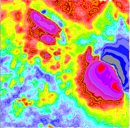
In 1991 the Geological Survey of Canada conducted a multisensor (gamma-ray spectrometric, magnetic total field) helicopter-borne geophysical survey in the Mount Milligan area, British Columbia, Canada.
Shives, R.B.K., Holman, P.B. and Rebolledo, L., Geological Survey of Canada
Also published as GSC Open File 2801
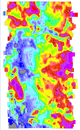
Helicopter-borne gamma ray spectrometric and magnetic total field geophysical survey, Inzana-Salmon Lakes Area, British Columbia (Parts of NTS 93J/13SW; 93J/13NW; 93K/15SW; 93K/15NW; 93K/16)
In 1995 the Geological Survey of Canada conducted a multisensor (gamma-ray spectrometric, magnetic total field) helicopter-borne geophysical survey in the Inzana-Salmon Lakes area, British Columbia, Canada.
Shives, R.B.K.; Holman, P.B. and Rebolledo, L.
Also published as GSC Open File 2800
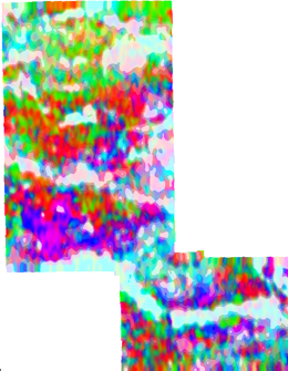
Helicopter-borne gamma ray spectrometric and magnetic total field geophysical survey, Fish Lake Area, British Columbia
In 1995 the Geological Survey of Canada conducted an airborne geophysical survey in the Fish Lake area, British Columbia, Canada.
Geological Survey of Canada
Also published as GSC Open File 3534
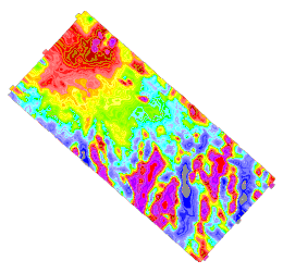
Helicopter-borne gamma ray spectrometric and magnetic total field geophysical survey, Endako Area, British Columbia
In 1997 the Geological Survey of Canada conducted a multisensor (gamma-ray spectrometric, magnetic total field) helicopter-borne geophysical survey in the Endako area, British Columbia, Canada.
R.B.K. Shives and J.M. Carson
Also published as GSC Open File 2815
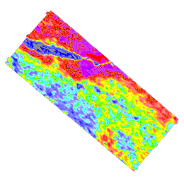
Helicopter-borne gamma ray spectrometric and magnetic total field geophysical survey, Clisbako River Area, British Columbia
In 1994 the Geological Survey of Canada conducted an airborne geophysical survey in the Clisbako River area, British Columbia, Canada.
R.B.K. Shives and J.M. Carson
Also published as GSC OF 2817
Helicopter-borne gamma ray spectrometric and magnetic total field geophysical survey, Iron Mask Area, British Columbia
In 1995 the Geological Survey of Canada conducted an airborne geophysical survey in the Iron Mask area, British Columbia, Canada.
The downloadable files from this website are in georeferenced TIF – tagged image and PNG formats (UTM NAD 83 and Albers projections) and GRD - Geosoft gridded data format (UTM NAD 83 only). PDF theme files are also available in Open File 2006-12: Integrated Airborne Geophysical, Geology and Mineral Occurrence Data, Iron Mask Batholith. Geology of the Iron Mask Batholith is available as Open File Map 2006-11. See GeoFile 2006-05 for a review of the regional geological setting, tectonics, geochronology, geophysics, mineralization and alteration characteristics of the Iron Mask Batholith.
Shives, R.B.K., Carson, J.M., Dumont, R., Holman, P.B., Geological Survey of Canada; Lane, R., BC Ministry of Energy and Mines
Helicopter-borne gamma ray spectrometric and magnetic totalfield geophysical survey, Mount Sylvester Area, British Columbia
In 2004 the Geological Survey of Canada conducted a multisensor (gamma-ray spectrometric, magnetic total field) helicopter-borne geophysical survey in the Mount Sylvester area, approximately due west of MacKenzie, British Columbia, Canada. Flight lines were oriented E-W, spaced at 500 m intervals. The survey was flown under contract by Fugro Airborne Surveys. Funding was provided by the British Columbia and Yukon Chamber of Mines Rocks to Riches Program, under a project submitted by the District of MacKenzie. Support for the Geological Survey of Canada’s Radiation Geophysics Section, acting as the Scientific Authority for the survey, was provided under Natural Resources Canada – Earth Sciences Sector’s Northern Resources Development Program. This survey covers rocks of the Quesnel Terrane, a belt prospective for bulk tonnage copper-gold deposits similar to the well-known Mount Milligan deposit.
The downloadable files from this website are in georeferenced TIF – tagged image and PNG formats (UTM NAD 83 and Albers projections) and GRD - Geosoft gridded data format (UTM Nad 83 only). PDF theme files area also available. A full product release (in late spring 2005) will be made by the Geological Survey of Canada as a series of Open Files, including printed colour maps, images of the printed maps in PDF format, and digital line and grid data.
Shives, R.B.K., Carson, J.M., Dumont, R., Holman, P.B., Wells, R., Geological Survey of Canada
Helicopter-borne gamma ray spectrometric and magnetic total field geophysical survey, Fran Property Area, British Columbia
In 2004 the Geological Survey of Canada conducted a multisensor (gamma-ray spectrometric, magnetic total field) helicopter-borne geophysical survey in the Fran Property Area, southwest of Mount Milligan, British Columbia, Canada. Flight lines were oriented N-S, spaced at 150 m intervals. The survey was flown under contract by Fugro Airborne Surveys. Funding was provided by Yankee Hat Industries Corp. Support for the Geological Survey of Canada’s Radiation Geophysics Section, acting as the Scientific Authority for the survey, was provided under Natural Resources Canada – Earth Sciences Sector’s Northern Resources Development Program.The downloadable files from this website are in georeferenced TIF – tagged image and PNG formats (UTM NAD 83 and Albers projections) and GRD - Geosoft gridded data format (UTM Nad 83 only). PDF theme files area also available. A full product release (in late spring 2005) was made by the Geological Survey of Canada as a series of Open Files, including printed colour maps, images of the printed maps in PDF format, and digital line and grid data.
Shives, R.B.K., Carson, J.M., Dumont, R., Holman, P.B., Yeager, D., Geological Survey of Canada
Also published as GSC Open File 5292 and Open File 5293
Helicopter-borne gamma ray spectrometric and magnetic total field geophysical survey, Tisdall Lake Area, British Columbia
In 2004 the Geological Survey of Canada conducted a multisensor (gamma-ray spectrometric, magnetic total field) helicopter-borne geophysical survey in the Tisdall Lake Area, southeast of Mount Polley, British Columbia, Canada. Flight lines were oriented NE-SW, spaced at 250 m intervals. The survey was flown under contract by Fugro Airborne Surveys. Funding was provided by Amarc Resources Ltd. Support for the Geological Survey of Canada’s Radiation Geophysics Section, acting as the Scientific Authority for the survey, was provided under Natural Resources Canada – Earth Sciences Sector’s Northern Resources Development Program.
The downloadable files from this website are in georeferenced TIF – tagged image and PNG formats (UTM NAD 83 and Albers projections) and GRD - Geosoft gridded data format (UTM NAD 83 only). PDF theme files are also available.
A full product release of the Tisdall Lake survey and the 2005 Eagle (Murphy) Lake-McKinley Creek surveys were made July 2006 by the Geological Survey of Canada as Open File 5292 and Open File 5293.
2004
T.G. Schroeter and J.W. Pardy
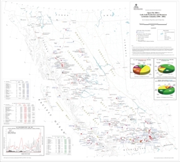
This report is the provincial compilation of gold production and current resources for hardrock mines and deposits in British Columbia. It contains statistics updated to the end of 2002. The main data table lists 299 gold deposits which have produced or have resources totaling greater than 5 kilograms. Also included are summary tables and figures containing information about production, resources and total inventory. A map displays the location of the 299 gold deposits. Refer to Open File 2004-18 for statistics on gold production and resources, updated to the end of 2003.
D. Alldrick, M. Stewart, J. Nelson and K. Simpson
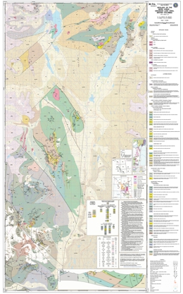
This new geological map in northwestern B.C., covers 1900 square kilometres along the west side of Highway 37 - the northern half of the area between the Red Chris and Eskay Creek ore deposits.
There are 25 known mineral occurrences within the area of new geological mapping. These include porphyry copper-gold-molybdenum deposits (16), strata bound showings (4), precious-metal veins (2), one bulk-tonnage epithermal deposit, one skarn prospect and one past-producing placer gold mine. Major prospects include the Spectrum, GJ and Mary porphyry deposits and the Hank epithermal deposit.
The map includes the sample sites from the Regional Geochemical Survey, and those felsic volcanic horizons, which are prospective for Eskay Creek-type VMS deposits, are highlighted. The map also includes detailed stratigraphy and structural information for the Hazelton Group rocks, identifies an early to middle Jurassic island arc complex, which is host to the Eskay Creek gold mine to the south.
This new geological map provides a new insight into the geology and mineral potential of the area. It is the initial map product from the BC Geological Survey regional mapping program carried out with support from the BC-Canada Targetted Geoscience Initiative program.
K. Breitsprecher and J.K. Mortensen
BCAge 2004 is an MS-Access based database containing all reported non-proprietary isotopic age determinations for bedrock units from British Columbia. This release contains 7759 age determinations from 4828 rock samples, summarizing 622 published articles, theses or unpublished reports. The data is fully relational, and may be queried by the user on the basis absolute age (in Ma), location (NTS mapsheet, terrane polygon, or decimal lat-long, as specified by the user) or source (e.g. author, journal title, etc.). The product is not stand-alone; the end user must install Microsoft Access.
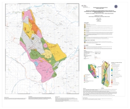
Geology by L. Diakow with geochronology by R. Friedman
Contribution to the Toodoggone Targeted Geoscience Initiative II - Mining Company Partnerships
This map is part of a series of bedrock geology and airborne geophysical data releases resulting from the geoscience partnerships between Stealth Minerals Ltd., Northgate Exploration Ltd., Finlay Minerals Ltd., Bishop Resources Inc. and Sable Resources Ltd., and the B.C. Geological Survey, the Geological Survey of Canada, and the University of British Columbia.
This new geological map covers approximately 215 km2 in the Swannell Ranges between the Finlay and Toodoggone rivers. It expands detailed 1:20000-scale mapping to the north beyond published BCGS Geoscience Map 2001-1, which portrays the detailed geological setting of the operating Kemess South Mine and developing Kemess North gold-copper porphyry deposits.
This map distinguishes a suite of smaller, high-level mineralized monzonite porphyry intrusions (Circa 197-198 Ma) from larger biotite-hornblende granodiorite stocks that are characteristic of the Early Jurassic Black Lake plutonic suite. In addition, the map portrays the detailed stratigraphy of co-magmatic subaerial volcanic rocks of the Toodoggone formation. Regionally, these extrusive-intrusive rock units are highly prospective, associated with Early Jurassic gold-copper porphyry and volcanic-hosted low sulphidation epithermal precious metal mineralization. Also shown is the distribution of Early Permian limestone, which hosts notable copper-magnetite*gold bearing skarns (ie. VIP), where cross cut by Early Jurassic plutons.
Epithermal quartz vein mineralization at the Shasta deposit and the Baker Mine are situated near the western boundary of the new map area, and porphyry prospects associated with monzonitic intrusions on the Brenda and Pil North properties, situated along the eastern map boundary. Argon-argon dates from alteration minerals attendant to epithermal and porphyry mineral prospects in the region were not completed in time for this publication, however their locations are given for future reference.
This new geology continues to expand detailed 1:20 000-scale map coverage in the Toodoggone mining camp. It provides refinement to existing stratigraphy, structure, and timing constraints for magmatic and mineralizing events.
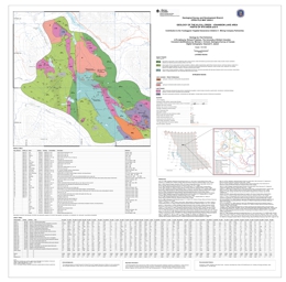
Geology by P. Schiarizza; U-Pb geochronology by R. Friedman;
Conodont Identifications by M. Orchard; Cartography by H. Jaswal
Contribution to the Toodoggone Targeted Geoscience Initiative II - Mining Company Partnerships
The Kliyul Creek - Johanson Lake map area encompasses about 150 square kilometres within the Swannell Ranges of the Omineca Mountains. It is bounded to the north by the Omineca Resource Access Road. The geological map is based on fieldwork conducted during July and August 2003, as well as compilation of data available in previously published government reports and mineral exploration assessment reports. The area is underlain by Late Triassic volcanic and volcaniclastic rocks of the Takla Group, together with numerous intrusions. The map features a more accurate portrayal of the spatial distribution, compositional range and age of plutonic rocks than was available on previous maps of the area.
These include a clinopyroxenite-gabbro-diorite suite of Late Triassic age, a quartz diorite-tonalite suite of Middle Jurassic age, and less common granitic stocks of Late Jurassic - Early Cretaceous age. It also contains an updated mineral occurrence database that demonstrates a strong spatial relationship between Cu-Au mineralization and dioritic intrusions of the Late Triassic suite.
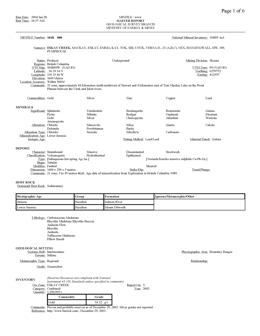
Retired. Please use MINFILE search or download.
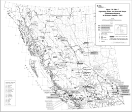
J. Pardy
This Provincial Map shows the location of major exploration projects and producing metal, coal and industrial mineral mines in 2003. The PDF version of the map is plot size and in colour.
For more information on mines and exploration projects see BC Mineral Exploration Review 2003, Information Circular 2004-1.
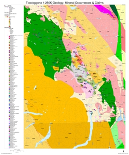
Shives, R.B.K., Carson, J.M., Ford, K.L., Holman, P.B., Geological Survey of Canada, Diakow, L., BC Ministry of Energy and Mines
Also published as GSC Open Files 4606 - 4613
Helicopter-borne gamma ray spectrometric and magnetic total field geophysical survey, Toodoggone Area, British Columbia
In 2003 the BC Ministry of Energy and Mines and the Geological Survey of Canada conducted a multisensor (gamma-ray spectrometric, magnetic total field) helicopter-borne geophysical survey in the Toodoggone area, British Columbia, Canada. Flight lines were oriented NE-SW, spaced at 400 m intervals. The survey was flown under contract, by Fugro Airborne Surveys. The survey was funded by the British Columbia Ministry of Energy and Mines and Natural Resources Canada through the Targeted Geoscience Initiative, and by a consortium of companies including Bishop Resources Inc., Finlay Minerals Ltd., Northgate Exploration Ltd., Sable Resources Ltd., and Stealth Minerals Ltd.
The downloadable files from this website are in georeferenced TIF – tagged image and PNG formats (UTM NAD 83 and Albers projections) and GRD - Geosoft gridded data format (UTM NAD 83 only). PDF theme files are also available.
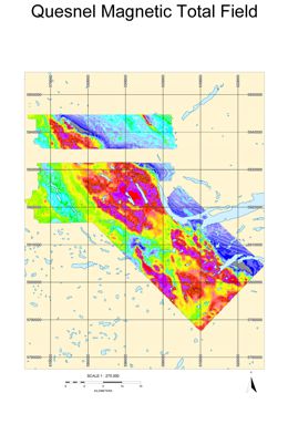
Shives, R.B.K., Carson, J.M., Ford, K.L., Holman, P.B., Geological Survey of Canada, Cathro, M., B.C. Ministry of Energy and Mines
Also published as GSC Open File 4615, 4616 & 4617
Helicopter-borne gamma ray spectrometric and magnetic total field geophysical survey, Horsefly Area, British Columbia
In 2003 the Geological Survey of Canada conducted a multisensor (gamma-ray spectrometric, magnetic total field) helicopter-borne geophysical survey in the Horsefly area, British Columbia, Canada. Flight lines were oriented NE-SW, spaced at 500 m intervals. The survey was flown under contract, by Fugro Airborne Surveys. The survey was funded by the British Columbia and Yukon Chamber of Mines’ “Rocks to Riches” Program. Results are combined with the previously flown 1993 Mount Polley Survey (93A/12) published as GSC Open File 2802.
The downloadable files from this website are in georeferenced TIF – tagged image and PNG formats (UTM NAD 83 and Albers projections) and GRD - Geosoft gridded data format (UTM NAD 83 only). PDF theme files are also available.
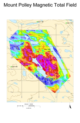
Shives, R.B.K., Carson, J.M., Ford, K.L., Holman, P.B., Geological Survey of Canada; Cathro, M., B.C. Ministry of Energy and Mines
Also published as GSC Open File 4619
Helicopter-borne gamma ray spectrometric and magnetic total field geophysical survey, Imperial Metals Corporation’s Mount Polley Mine area, British Columbia
In 2003 Imperial Metals Corporation conducted a multisensor (gamma-ray spectrometric, magnetic total field) helicopter-borne geophysical survey over the Mount Polley Mine area, British Columbia, Canada. Flight lines were oriented east-west, spaced at 100 m intervals. The survey was flown under contract, by Fugro Airborne Surveys. The survey was funded by Imperial Metals Corporation and the British Columbia & Yukon Chamber of Mines "Rocks to Riches" Program.
The downloadable files from this website are in georeferenced TIF – tagged image and PNG formats (UTM NAD 83 and Albers projections) and GRD - Geosoft gridded data format (UTM NAD 83 only). PDF theme files are also available.
J. Logan
P. Schiarizza
The Cariboo Lake - Wells map area encompasses about 700 square kilometres within the northern part of the Quesnel Highlands. The interpretation of bedrock geology shown on Open File 2004-12 is based on fieldwork carried out around Cariboo Lake in 2000 and 2001, and between Cariboo Lake and the town of Wells in 2002. The map features an updated lode mineral occurrence database for the area, which includes the past-producing Cariboo Gold Quartz and Cariboo Hudson mines, as well as the recently discovered Bonanza Ledge prospect.
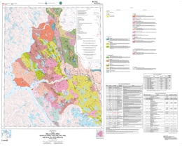
This publication is superseded by Geoscience Map 2006-7 and GSC Open File 5410.
L.J. Diakow, J.B. Mahoney, S.M Gordee, L.C. Struik, J.W. Haggart, G.J. Woodsworth and M.G. Hrudey
Also published as GSC Open File 4639
This 1:50 000-scale geological map of the Bella Coola area is a preliminary product from the Bella Coola Targeted Geoscience Initiative (TGI), which is a regional mapping program directed jointly by Geological Survey of Canada and the British Columbia Geological Survey in collaboration with the University of Wisconsin and the University of British Columbia. The principal objective is to update geology and to provide a regional assessment of mineral potential in Mesozoic magmatic arc assemblages underlying the eastern half to the Bella Coola map area (NTS 093D).
The Bella Coola area is relatively under explored and has potential for volcanogenic massive sulphide (VMS) mineralization (e.g. Nifty - MINFILE 093D 006), gold-silver veins, and Cu-Mo porphyry deposits. The area is underlain by the Mesozoic Hazelton Group, Coast Complex plutonic rocks and Cretaceous-Tertiary intrusive rocks. BC Geological Survey and Geological Survey of Canada geologists mapped parts of the Bella Coola area during 2002 and 2003.
Results of mapping suggest that volcanogenic massive sulphide potential exists within two stratigraphic successions. An older Middle Jurassic succession composed of submarine bimodal volcaniclastic rocks hosts the principal known stratabound Zn-Pb-Ag-Ba exhalite prospect at the Nifty property. A younger volcano-sedimentary succession of Early Cretaceous age has favourable geology for volcanogenic massive sulphides; however, no economic mineralization has been identified to date within this rock package. To the west of the project area, results of the Bella Coola Regional Geochemical Survey (RGS) identify multi-element anomalies indicative of base metal sulphides which coincide with a northwest-trending tract of Paleozoic metavolcanic and metasedimentary rocks that are believed to represent a southwestward extension of the Ecstall Belt containing numerous volcanogenic massive sulphide occurrences.
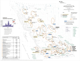
T.G. Schroeter and J.W. Pardy
Every year companies and prospectors explore for new mineral and coal deposits in almost all regions of the province. This activity is crucial to find the new mines to supply the metals and minerals that are so important to meet society's needs and to provide jobs for many British Columbians.
This map documents some of the principal communities to benefit from mineral exploration activities during 2003. It shows the various exploration areas and major exploration projects. An accompanying table documents the number of exploration projects, associated seasonal jobs and total expenditures in each region. For a more complete review of exploration activity please refer to the following reports.
For detailed information on industry activities in the province please also see: Mineral Exploration Review or Exploration and Mining in British Columbia.
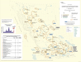
T.G. Schroeter and J.W. Pardy
This map documents the anticipated rise in exploration expenditures and the principal communities expected to benefit from these activities during 2004. It also shows the various exploration areas and major exploration projects. An accompanying table documents the number of exploration projects and total expenditures for each region.
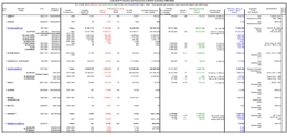
T.G. Schroeter, P. Eng/P.Geo and J.W. Pardy, P.Geo.
This publication contains statistics on gold production and resources in British Columbia updated to the end of 2003. It consists of an alphabetically-sorted main data table of 299 deposits (camps) that have produced gold or have resources totaling greater than 5 kilograms, and numerous summary tables and figures on production, resources and total inventory (production + resources). Refer to Open File 2004-1 for the map of the 299 deposits.
2003
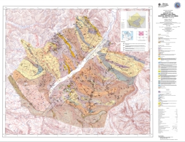
F. Ferri and B. O'Brien
This new geological map covers an area of some 750 square kilometres around Cariboo Lake. This area is part of the historic Cariboo placer gold belt and also encompasses parts of the Yanks Peak lode gold occurrences and the old Cariboo Hudson mine site. The Cariboo Lake area has recently attracted interest based on the discovery of massive sulphide mineralization along Frank Creek (MINFILE 093A 152) and precious metal-rich sulphide mineralization at the Ace property, just south of Little River (093A 142). The map presents a re-interpretation of Snowshoe Group stratigraphy based on the delineation of a large, re-folded, southwest verging nappe structure some 25 kilometres in amplitude. This new geological model suggests that stratigraphic units along the western parts of the Snowshoe belt are equivalent to lithologies along the eastern margin, the latter of which hosted the bulk of lode gold mineralization.
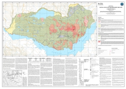
T. Ferbey and V.M. Levson
This surficial geology map is a product of the 2000 field survey of the Huckleberry Mine area and interpretations of 1:15,000 scale aerial photographs. The terrain mapping conventions used here are based on those of Howse and Kenk (1997), and focus primarily on surficial materials and surface expression. A composite stratigraphic section (Figure 2) based on the detailed stratigraphic and sedimentologic studies conducted on the mine property, is included to assist in characterizing the quaternary sediments of the Huckleberry Mine area.
L.N. Barazzuol and G.G. Stewart
This 125-page report on a scoping study of the 1887 historic mines in BC and focuses on the 1171 mines that have environmental concerns and present public health and safety issues. A number of sites (about 3%) have been selected as those which may show the greatest potential environmental impact. They include the Midway (MINFILE 082FSW021), Lenora (MINFILE 092B 001), Bralorne-Takla (MINFILE 093N 008), Ymir (MINFILE 082FSW067-068), Second Relief (MINFILE 082FSW187), and Sultana (MINFILE 082FSW061).
It is recommended these be studied in greater detail. It is further recommended that the potential problems be addressed on a watershed by watershed approach to fully study the impact on a drainage system.
G.T. Nixon and G.R. Peatfield
An opportunity to examine the Lorraine Cu-Au-Ag±PGE deposit was presented by the inception of the BC Geoscience Partnership Program under a joint agreement between the Ministry of Energy and Mines and Eastfield Resources Limited that was designed to enhancethe development of mineral resources in the province. Geological investigations at Lorraine form part of a broader mandate to examine the potential for PGE in these alkaline porphyry Cu-Au-Ag deposits. This study examines the geological setting of theLorraine deposit in light of previous work, and provides some additional observations on the mineralization and alteration assemblages. The results build upon the existing geological infrastructure already in place at Lorraine and are based on eighteen days of field mapping (1:10 000 scale), geochemical analysis of samples from outcrop and drill core, and petrographic studies of selected rock specimens. These data, and especially data collected outside the main zones of alteration and mineralization, clarify the magmatic and emplacement history of the plutonic hostrocks and support a new interpretation for the environment of porphyry Cu-Au mineralization at Lorraine.
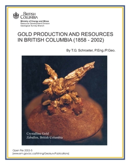
T.G. Schroeter
A summary of past gold production 1980-2002, and a brief summary by each regional geologist as to where the best opportunities for gold prospects are in each of the regions. Contains Information Circular IC 2003-2 as an addendum.
A.J. Bichler, University of Victoria and P.T. Bobrowsky, Geological Survey of Canada
Surficial geology of the Hydraulic map sheet (NTS 93A/12) was mapped in partial fulfillment of the Master's of Science thesis being conducted at the University of Victoria and in association with the British Columbia Geological Survey and the Geological Survey of Canada.
The study area was divided into terrain units based on the surficial material, geomorphic attributes, and geologic/geomorphic processes found within their boundaries. Each enclosed terrain unit, or terrain polygon, represents a homogeneous parcel of land with respect to its inherent attributes. Three hundred and twenty eight terrain polygons were identified of which 104 were ground-truthed by 137 field stations. For all field stations, location and a description of the surficial material including its type, texture, thickness and geomorphic expression were recorded.
2002
G. Owsiacki, M. Cathro, P. Wojdak, J. Houle, D. Terry, R. Lane and T. Schroeter
Open File 2002-1 contains 2 maps at 1:2,500,000-scale and a MINFILE data disk. The maps show the location of 120 operating mines, projects in the Environmental Assessment Review, projects that have received Mine Development Certificates or have been Certified, and major exploration projects in British Columbia. The disk provides data on 108 of these mines or projects. The data can and also be browsed using MINFILE.
In 2001, a total of 62 deposits (10 metallic mineral, 45 industrial mineral and 7 coal) were being mined in the province of British Columbia. There are 58 major exploration projects. Projects in the Environmental Assessment Review are Silvertip, Prosperity, Red-Chris, Bronson Slope, Cariboo Gold, Tulsequah Chief and Telkwa Coal. There are 4 slag producers in B.C., Anyox, Greenwood, Trail and Grand Forks.
D. Alldrick
Open File 2002-3 presents three map sheets with a 1:50 000 scale depicting the geology of the Ecstall Greenstone belt in British Columbia.
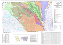
P. Schiarizza, S. Israel, S. Heffernan and J. Zuber
Macrofossil Identifications: E.W. Bamber, T.P. Poulton, GSC Calgary; H.W. Tipper, GSC Vancouver; P.L. Smith, The University of British Columbia
Conodont Identifications: M.J. Orchard, GSC Vancouver
Isotopic Dating: R.M. Friedman, The University of British Columbia
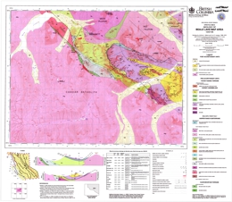
J. Nelson and L.D. Lepage
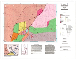
W. Jackaman
Open File 2002-08 presents field and analytical data from a stream sediment and water geochemical survey conducted by the BC Geological Survey in the Triumph Bay Area during 2001. Results for over 48 different metals in stream sediments and pH, uranium, fluoride and sulphate in stream waters are included in this report. The survey covers parts of seven 1:50,000 NTS map sheets in the Douglas Channel (NTS 103H) map. A total of 196 sites were sampled over a combined area of approximately 1800 square kilometres at an average density of 1 site per 7 square kilometres.
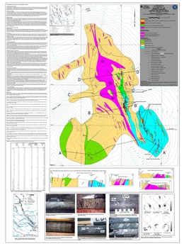
G.E. Ray, P.K.M. Megaw, J.A. McGlasson and J.K. Glover
Open File 2002-09 consists of a geology map of the Lustdust mineralization which lies in the Cache Creek Terrain. The map scaled is 1:5 000.
V.M. Levson, D. Mate, with contributions from J.E. Dubois, E.K. O'Brien, A. Stewart, and A.J. Stumpf
A regional till geochemistry survey conducted within the Marilla and Tetachuck Lake map areas during the summers of 1997 and 1998 has identified seven known mineral occurrences and highlighted five new exploration targets, three of which are multi-element anomalies. Basal till, collected at almost all of the 273 sample sites, was the preferred sampling medium. It is a first derivative product of bedrock, has been deposited in a linear direction down-ice from its source, and forms large dispersal trains. Research at the Uduk Lake prospect found that gold and arsenic dispersal trains were approximately 2 kilometres long and 0.5 kilometres wide. Sedimentologic data collected in the field was used to distinguish basal till from other Quaternary sediments. Distinguishing till from other Quaternary sediments, glacigenic debris-flows, colluvium, glaciofluvial and glaciolacustrine, is important because element concentrations contained within them are rarely derived from local sources. Therefore, they are not useful for identifying local sources of mineralization.
Till geochemistry results from this study also suggest that mineralization at the Uduk Lake, Loon, Exo, Godot, Tet, Rhub, and WT occurrences are more extensive than originally believed. At the Uduk Lake and Loon prospects two >95th percentile gold concentrations occur away from and up-ice of exploration trenches and areas of known mineralization. Multi-element geochemical anomalies occur at till sites 2.5 kilometres west and 2 kilometres southwest from the centre of the Exo prospect.
The three new prospective areas with multi-element anomalies occur around Square Lake, along and north of Chelaslie River, and along the shoreline of Chelaslie Arm. Groupings of >90th and >95th percentile gold, arsenic, copper, lead, zinc, and barium concentrations occur around Square Lake, located in the northwest corner of the Marilla map area. The highest gold concentration in the study area, 77 ppb, occurs here and may be related to the Skins Lake Pluton. A large area of anomalous concentrations of copper, chromium, nickel, lead and zinc occur along and north of the Chelaslie River while anomalous concentrations of gold, arsenic, copper, lead and zinc occur along the shoreline of Chelaslie Arm. A 1 metre wide and 5 metre long vein sample from mineralized bedrock close to Chelaslie Arm assayed 612 ppb gold and 85.5 ppm. Along the southwestern shoreline of Chelaslie Arm the highest assayed gold concentration from mineralized float was 40 ppb. The highest molybdenum concentration in till in the study area, 8 ppm, also occurs in this area. Other new exploration targets include high gold concentrations in till along the Cheslatta River and north of Michel Creek.
A.J. Bichler, E.D. Brooks, and P.T. Bobrowsky
This release consists of a CD-ROM containing: 18 Maps (.pdf): 092F/8, 9, 10, 15, 16; 092G/5, 6, 11, 12, 13; 092J/4; 092K/1, 2, 3, 6, 7, 8, 9. It Includes: a project summary (ProjectSummary.pdf) and an Open File 2002-14 report (OF2002-14.pdf); a related Geological Fieldwork article; an Adobe Acrobat version of the map area results; an ArcView copy of the digital data; and a ReadMe.txt file with instructions.
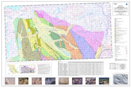
P. Schiarizza, S. Heffernan, S. Israel and J. Zuber
Macrofossil Identifications: E.W. Bamber, T.P. Poulton, GSC Calgary; H.W. Tipper, GSC Vancouver; P.L. Smith, The University of British Columbia
Conodont Identifications: M.J. Orchard, GSC Vancouver
Isotopic Dating: R.M. Friedman, The University of British Columbia
2001
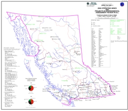
G. Owsiacki, M. Cathro, P. Wojdak, J. Houle, P. Wilton, R. Lane, T. Schroeter
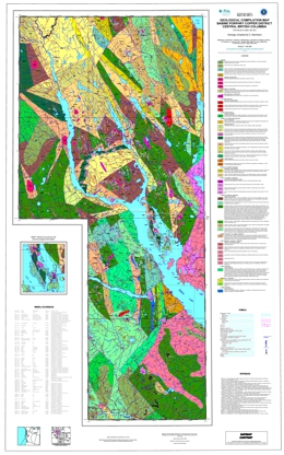
D. MacIntyre
Open File 2001-03 is a geological compilation of the geology of the Babine porphyry copper district in north central British Columbia. The coloured geology map is at 1:100 000 scale and includes a legend, an insert map showing mineral occurrences in the Granisle and Bell mine areas and geochronological information, references, and a table of mineral occurrences in the area.
The oldest rocks exposed are limestones of the Lower Permian Asitka Group. Permian to Triassic rocks comprise a metavolcanic suite and sedimentary rocks that may correlate with the lower Takla Group. Upper Triassic rocks of the Takla Group include pyroxene phyric basalt, andesite flows and breccias and marine sedimentary rocks. The sediments include siltstone, mudstone, local limestone, and volcanic conglomerate. Lower to Middle Jurassic Hazelton Group rocks comprise six mappable units. The oldest is the Telkwa Formation, which is mainly air-fall tuff, feldspar phyric andesite flows and breccia, basalt flows, and related epiclastic rocks. The overlying Nilkitkwa Formation consists of feldspathic wacke, siltstone and conglomerate, whereas the Ankwell member of the Nilkitkwa is greenstone, basalt breccia, flows and tuff and interbedded sedimentary rocks. The Saddle Hill volcanics unit contains basalt, andesite, dacite and rhyolite flows, tuffs and related volcaniclastic rocks. Dacite and rhyolite domes feature this unit. Overlying Smithers Formation contains feldspathic sandstone, siltstone, feldspathic wacke and minor volcanic tuff, breccia and volcanic conglomerate. The Middle to Late Jurassic Bowser Lake Group consists of the Ashman and Trout Creek formations. The Ashman Formation consists mainly of feldspathic wacke, siltstone and shale. The Trout Creek Formation consists mainly of polymictic conglomerate with minor wacke, siltstone and shale. Lower Cretaceous Skeena Group units are: undivided felsic and intermediate volcanic rocks, the Kitsuns Creek Formation, which contains sandstone, siltstone, shale and mudstone but is locally carbonaceous to coal bearing. The overlying Hanawald conglomerate is dominantly chert pebble conglomerate with quartz sandstone and siltstone interbeds. The Kitsumkalum shale has interbedded sandstone. Rocky Ridge Formation consists mostly of augite-plagioclase phyric alkaline basalt to basaltic andesite, feldspar phyric andesite to dacite, basalt, volcanic breccia, and lapilli tuff. Overlying rhyolites to rhyodacites comprise flows and flow breccias and form subvolcanic domes. Red Rose Formation rocks include quartzo-feldspathic sandstone, siltstone, chert pebble conglomerate and siltstone to mudstone interbeds. The uppermost unit consists of sandstone, siltstone, shale, mudstone, and pebble conglomerate. Upper Cretaceous Kasalka Group rocks consist of andesite tot dacite flows, volcanic breccia, and lahar. Paleocene to Eocene sandstone, siltstone, conglomerate, shale, coaly shale and coal with interbedded tuffaceous siltstone and fanglomerate. Eocene rocks include a basal heterolithic conglomerate, and the Newman Formation, the Ootsa Lake Group, and the Endako Group. The Newman Formation consists of porphyritic andesite to dacite flows breccia and lahar. Ootsa Lake Group is characterized by felsic volcanics. Endako Group volcanics are generally amygdaloidal and vesicular basalt flows with minor flow top breccia and bladed feldspar porphyry.
Intrusive rocks are important in the area. The Late Triassic to Early Jurassic Topley suite of intrusions contains granodiorite, quartz diorite, monzonite, porphyritic granodiorite, megacrystic feldspar porphyry dikes, and intrusive breccia. The Early to Middle Jurassic Spike Peak intrusive suite includes porphyritic granodiorite to quartz diorite, granodiorite tot quartz monzonite, diorite, and basalt dikes. Early Cretaceous intrusions are quartz monzonite, monzonite, rhyodacite and granodiorite to quartz diorite. The Late Cretaceous Bulkley intrusions include diorite to gabbro, porphyritic granodiorite to quartz diorite, and porphyritic quartz monzonite. The Eocene Babine intrusions include granodiorite to quartz diorite, porphyritic granodiorite, and quartz monzonite.
Four major tectonic events are reflected in the region. Mid to Late Jurassic folding and uplift was followed by mid Cretaceous contraction that produced northwest trending folds and northeast directed thrusts. Crustal extension in Late Eocene time produced north trending grabens and horst, and an event as young as Miocene tilted fault blocks.
The most important mineral occurrences are gold-bearing porphyry copper deposits associated with the Eocene Babine intrusions and the Late Cretaceous Bulkley intrusions. The former producing Bell and Granisle mines and many major prospects are known in the map area. There is also epithermal potential with silver-lead-zinc mineralization like that at the Fireweed prospect in Skeena Group rocks. Potential also exists for Besshi-type massive sulphides, volcanic redbed copper deposits, polymetallic veins with silver-lead-zinc and possibly gold, and intrusion-related gold-pyrrhotite deposits.
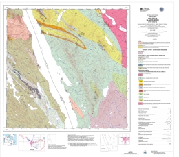
M.G. Mihalynuk, J.L. Nelson, R.M. Friedman, T.P. Gleeson, C.F. Roots
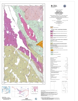
M. Mihalynuk, J.L. Nelson, M. De Keijzer, R.M. Friedman, C.F. Roots and T.P. Gleeson
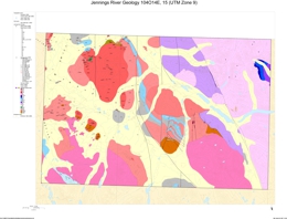
J.L. Nelson, T.A. Harms, C.F. Roots, R.M. Friedman and M. de Keijzer
Reference: Nelson, J.L. (2001): Geology of North-Central Jennings River Map Area, 104O/14E,15, B.C. Ministry of Energy and Mines, Geological Survey Branch, Geological Fieldwork 2000, Paper 2001-1, pp. 51-66.
R.E. Lett
This Open File describes the results of detailed studies carried out by the British Columbia Geological Survey Branch in the Gataga District of north-eastern BC (Figure 1) to study the geochemical response of massive sulphide mineralization in stream sediment, moss mat sediment, spring sediment, spring water, soil and till.These studies were carried out in conjunction with geological mapping and mineral deposit studies (Ferri et al. 1995). Lett and Jackaman, 1995, reported the results of geochemical orientation studies around Driftpile Creek. The detailed geochemical studies reported in this Open File were carried out to improve geochemical exploration techniques for shale-hosted sedex Pb-Zn-Ag deposits and to develop geochemical models for simplifying data interpretation.
The Open File is published in two parts. Part 1 describes a geochemical exploration model (GEM) for sedex Pb-Zn-Ag sulphide deposits in the Gataga District developed from detailed survey data for five areas north and south of the Driftpile Creek deposit. The geology, topography, soils and survey results for the areas are summarized in Part 1. Survey results are augmented by assessment report data. Part 2 describes the results of the geochemical surveys in more detail with all of the supporting field and analytical data. Essentially, Part 1 provides a "Readers Digest" of the information compiled in Part 2.
There are 74 maps of the Bear Area, North Bear Area, Red Gossan Area, Driftpile Deposit Area, and Saint Area. Lead, zinc, silver, barium, aluminium, and thallium were among the elements tested in these areas. The maps are useful as geochemical exploration models for shale hosted Pb-Zn-Ag deposits in north-eastern British Columbia.
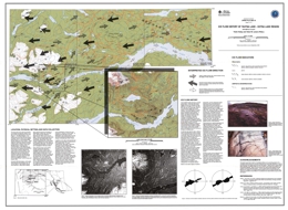
T. Ferbey and V.M. Levson
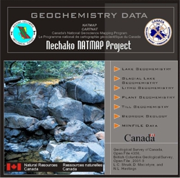
L.C. Struik, D. MacIntyre and N.L. Hastings
Also published as GSC Open File 4356
This provides new geochemical data, acquired for central British Columbia, as part of the Nechako NATMAP project. This was a joint partnership among the Geological Survey of Canada, the BC Geological Survey of the B.C. Ministry of Energy and Mines, universities and industry. The geochemical data is in Geographic Information System (GIS) accessible format and was derived by analyses of glacial till, glacial lake sediment, lake bottom sediment, lake water, lodgepole pine bark, stream silt and rocks. The concentrations can be viewed combined with the new geological maps of the Nechako NATMAP project, which are included digitally on the CD-ROM.
This release provides an invaluable compilation of high-quality geochemical data, integrated with new bedrock and surficial geology maps, which will enhance mineral exploration and environmental studies in central B.C. The dataset is compiled to provide a baseline resource for a variety of users who may require geoscience information.
Includes a limited edition of SurView®, a GIS viewing application for Microsoft Windows, developed at the Geological Survey of Canada and originally released as GSC Open File 2661. SurView® runs directly from the CD-ROM. It can display, print and, to a limited extent, query spatial data. This provides an opportunity for those without specialized GIS software to create and view various geochemical and geological thematic maps on screen. The data is available in ArcInfo and various GIS transfer formats for use in the GIS software of your choice.
P.T. Bobrowsky, A. Bichler
Open File 2001-10 provides the results of a reconnaissance level, till geochemistry survey completed during the summer of 2000 over a 1000 square kilometre area northwest of Wells, B.C.
Results of analysis for about 400 basal till samples representing 324 stations is presented; data reflects a high sampling density of about one sample per 2.5 square kilometres. Analytical information includes data on 31 elements analyzed by ICP-MS and INAA, as well as 11 major oxides, loss on ignition and seven minor elements examined by LiBO2 fusion ICP-ES.
The report includes a brief discussion on the geologic setting, survey methodology, quality control and data interpretation for this study. Detailed discussion regarding sample integrity, ice-flow history and probable bedrock source location for the five highest values for each of the following elements is also included: Ag, Cu, Au, Pb, Zn, As, and Cd. At the time of this Open File release, approximately two-thirds of the study area is still available for staking. Many of the elevated element occurrences remain unstaked and warrant further exploration attention.
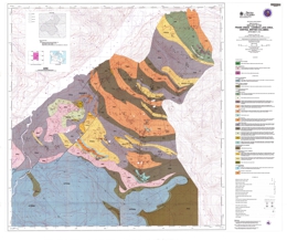
F. Ferri
Open File 2001-11 presents a map of the Frank Creek- Cariboo Lake area of central British Columbia.
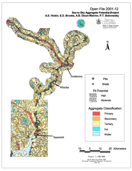
A.S. Hickin, E.D. Brooks, A.B. Dixon-Warren, P.T. Bobrowsky
The Sea-to-Sky region, north of Vancouver, British Columbia, is currently experiencing competing land use options which range from the development of scarce, but economically important aggregate resources to complete conservation and preservation of the natural resources. However, with the continued urban growth of communities such as the Villages of Whistler and Pemberton and the City of Squamish, coupled with a potentially successful bid for the 2010 Winter Olympics, pressure on the existing local aggregate reserves will eventually reach a critical stage. To address these concerns, the Ministry of Energy and Mines with funding assistance from the Corporate Resource Inventory Initiative (CRII), British Columbia Assets and Lands (BCAL), and Ministry of Transportation and Highways (MoTH), initiated a joint project to assess, at a reconnaissance level, the aggregate potential of the Sea-to-Sky corridor.
W. Jackaman
Open File 2001-13 presents the geochemistry of the Ecstall Greenstone Belt of British Columbia (103H/103I) between the Skeena River and Douglas Channel. A total of 242 sediment samples and 241 water samples were collected from 228 sites covering over 1,800 square kilometers at a density of one sample per 7 km2. Sediment samples were analysed by INAA and aqua regia-ICPMS for base and precious metals, pathfinder and rare earth elements. Water samples were analysed for pH, uranium, sulphate and fluoride. This region has a high potential for the discovery of new volcanogenic massive sulphide (VMS) mineralization. The survey was conducted in 2000.
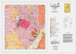
G.T. Nixon
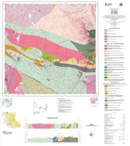
M. Mihalynuk, T.A. Harms, C.F. Roots, J.L. Nelson, M. de Keijzer, R.M. Friedman and T.P. Gleeson
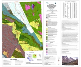
A. Legun
Open File 2001-18 describes the geology of the southern McConnell Range and Sustut River areas (94D/3,7,9,10,15,16) in central British Columbia. The coloured 1:50 000 scale geological map includes a legend, fossil references, references, and a list of mineral occurrences.
The oldest stratified rocks in the area are cherty mudstone, felsic to mafic volcanics, limestone and shale of the Early Permian Asitka Group. Unconformably overlying Late Triassic Takla Group rocks are subdivided into four formations. The Dewar Formation consists of epiclastic sandstone, siltstone and mudstone. Lower Savage Mountain units are: basalt porphyry, pillow basalt flows, pillow breccia, and feldspar and/or augite phyric basalt. Upper Savage Mountain units are andesitic bladed feldspar porphyry, and lithic tuff aprons that may be associated with vent breccia. Moosevale Formation units are marine siltstone, lithic tuff and submarine slide breccia, the middle sandy unit, the upper semi-stratified breccia and lahar conglomerate, conglomerate and sandstone, and undifferentiated breccias. Early Jurassic Hazelton Group contains the Telkwa and Nilkitkwa Formations. Telkwa Formation units are polymictic conglomerate, feldspar porphyry breccia with sandstone, mudstone and tuff interlayers, red and lapilli tuffs with andesite flows, andesitic to dacitic flows with welded tuffs and sediments, and undifferentiated andesitic to dacitic volcanics. The Nilkitkwa Formation is represented by argillite, siltstone and tuff with minor limestone and volcanic interlayers. Middle to Late Jurassic Bowser Lake Group sediments are conglomeratic sandstone, siltstone, carbonaceous claystone and coal. The Late Cretaceous Sustut Group has basal quartz-bearing conglomerate, mudstone and coal overlain by pebbly sandstone and mudstone.
Intrusive rocks in the area are of Late Triassic and Early Jurassic age. The Late Triassic suite includes the Menard complex, with clinopyroxenite, gabbro and diorite; subvolcanic dacitic to andesitic porphyry intrusions; and augite porphyry. Early Jurassic intrusions include rhyolite porphyry, gabbro, monzodiorites and dacite porphyries, and the Black Lake intrusive suite with stock to batholithic granodiorite to diorite to monzogranite phases.
The map pattern is dominated by faults with trends that vary from northeast to north to northwest. Offset of geologic units indicates both strike-slip and vertical offset.
Mineral occurrences copper with or without precious metals but some have associated lead, zinc or molybdenum. The most important occurrence known is the Sustut volcanic redbed copper deposit in Late Triassic semi-stratified breccia and lahar conglomerate host rocks. The area also has potential for porphyry copper +/- molybdenum +/- gold deposits and skarns.
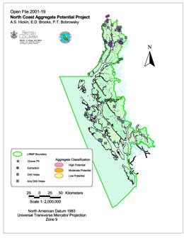
A.S. Hickin, E.D. Brooks, and P.T. Bobrowsky
The North Coast LRMP Aggregate Potential Map provides a mechanism for identifying target areas for further aggregate investigation. In general, there is limited aggregate potential within the North Coast LRMP, as access and availability of material is relatively restricted. However, a number of possible aggregate locations were identified in this project that, with further investigation, may prove to be economic for either local use or export. Almost all locations will have to rely on transportation by water, as the existing road network infrastructure does not extend beyond Prince Rupert and the Skeena River corridor.
2000
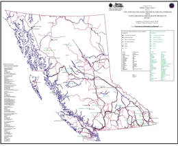
G. Owsiacki, M. Cathro, P. Wojdak, R. Pinsent, P. Wilton, R. Lane and T. Schroeter
Open File 2000-01 contains 2 maps at 1:2,500,000-scale and a MINFILE data disk. The disk provides data on 109 deposits including operating mines, projects in the Environmental Assessment Review, projects that have received Mine Development Certificates or have been Certified, and exploration advanced exploration/development projects in British Columbia. The maps show the location of each of the 109 deposits or exploration projects contained in the dataset.
In 1999, a total of 61 deposits (12 metallic mineral, 41 industrial mineral and 8 coal) were being mined in the province of British Columbia. There are 20 projects in the advanced exploration and development stage and 32 exploration projects are highlighted. Projects in the Environmental Assessment Review are Silvertip, Prosperity, Red-Chris, Bronson Slope and Telkwa Coal. There are 4 slag producers in B.C., Anyox, Phoenix, Trail and Grand Forks.
T. Schroeter and R.H. Pinsent
The purpose of this report is to document the abundance and diversity of gold discoveries that resulted from exploration in the province over the last several years, and place the new deposits in context with its earlier history of precious metal production. This Open File updates significant parts of Open File 1989-22 and Open File 1991-19 and provides selected references to gold-bearing deposits and appropriate exploration models for the province.
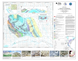
J. Nelson, W. Zantvoort and S. Paradis
Open File 2000-03 describes the geology of the Robb Lake lead-zinc deposit (94B/13) in northeastern British Columbia. The coloured map at 1:20 000 scale includes a legend, cross section, a schematic presentation of the textural and mineralogical zonation of the deposit, photographs, a regional geologic setting map, and a summary of the property geology.
The Robb Lake Mississippi Valley-type Pb-Zn deposit (MINFILE 094B 005) is hosted by platform carbonate rocks in the Rocky Mountains of northeastern British Columbia (56°56N, 123°43W; 94B/13). The deposit, hosted by Silurian-Devonian dolostone of the Muncho-McConnell Formation, consists of a series of interconnected bedding-parallel and crosscutting breccia bodies with sparry dolomite, sphalerite, galena, pyrite, quartz, calcite, and pyrobitumen in their matrix. It is the most promising and the best-developed carbonate-hosted lead-zinc occurrence in the northern Rockies, with significant showings over an 8 square km area.
Lead-zinc mineralization was discovered near Robb Lake in 1971 by Arrow-Interamerican Corp., Barrier Reef Resources Ltd., and Ecstall Mining Ltd. Drilling between 1972 and 1975 led to the incomplete delineation of three deposits, the "lower zone", the East Webb ridge zone, and the West Webb ridge zone (at depth south of the Webb showing). Drilling was continued by Texasgulf in the summers of 1980 and 1981. The geological resource at Robb Lake is quoted as 6.5 million tonnes at 7.11 % combined lead and zinc (2.4 metre mining width, 5% cutoff grade; Consolidated Barrier Reef Resources, Rights Offering Circular, November 29, 1984). Core is stored at an airstrip at the confluence of Mississippi Creek and the Halfway River.
Most of the lead-zinc mineralization at Robb Lake occurs within the Muncho-McConnell Formation, although a few occurrences lie within a thin overlying sequence attributed to the Stone-Dunedin formations. The deposit is located next to the tectonically telescoped shelf-slope facies boundary. The strata that host Robb Lake lie in the immediate footwall of a major thrust fault, which has deep water, early Paleozoic strata in its hanging wall.
The showings are in and near the valley of Mississippi Creek. Mineralization occurs as breccias, veins and vein stockworks, with breccia mineralization the most important. The breccias form interconnected, bedding-parallel and/or crosscutting bodies, which are partly to wholly mineralized. The favorable mineralized sections form a stratabound zone occupying the upper 200 metres of the lower unit of the Muncho-McConnell Formation and the lower 130 metres of the upper unit. The base of the cliff-forming unit exerted a strong control on the location of the main stratiform breccia bodies, as is illustrated on the cross-section of the valley of Mississippi Creek. The south slope of Tennessee Mountain is more or less a dip slope, and the showings along the creek - the Lower, Canyon, and Cascade zones - are stratigraphically equivalent to those on the south side of Tennessee Mountain - the Upper, Waterfall, Camp, and North Face zones.
The Robb Lake deposit has unexplored stratabound potential in the zone bounded above by unit Silurian-Devonian Muncho-McConnell Formation cliff forming dolostone unit. Breakthrough zones of cross-cutting mineralization may be associated with zones of more intense mineralization, such as Webb Ridge and the as yet unexplored zone around Tennessee Mtn., Monocline and Bear on the south side of Tennessee Mountain. The area of the Talis zone is also of interest because of the steep faults outlined there.
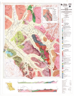
J. Nelson, T.A. Harms, W. Zantvoort, T. Gleeson and K. Wahl
Open File 2000-04 describes the geology of the southeastern Dorsey terrane (104O/7,8,9,10) in northernmost British Columbia. The Open File coloured geology map at 1:50 000 scale includes a legend, geologic cross sections and a map showing major geological units.
The area includes is mainly underlain by rocks of the North American Cassiar and allochthonous Dorsey terranes and also post-accretionary Mesozoic intrusive units and Quaternary basalts. The oldest rocks are Cassiar terrane units. Upper Proterozoic to Cambrian units consist of quartzite; marble and calc-silicate; and silty meta-argillite, slate, quartzite, marble and calc-silicate. The Ordovician to Silurian (?) Road River Group consists of siliceous-calcareous black argillite and slate. Devonian to Mississippian Earn Group units are marble; baritic cherty exhalites; and siliceous black argillite, metachert, porcellanite, and minor baritic chert and marble.
Dorsey terrane units are the Ram Creek assemblage, the Dorsey assemblage, the Swift River assemblage, and the Klinkit assemblage. The Ram Creek assemblage is Mississippian but may include older and younger rocks. Components are tonalite, diorite to gabbro, ribbon chert, marble, quartz-muscovite and quartz-sericite schist, and an undivided greenstone intrusive unit containing greenstone, intermediate metatuff, felsic metatuff, tonalite, diorite and gabbro. The Dorsey assemblage begins with pre-Mississippian rocks consisting of three metasediments-amphibolite units that contain amphibolite, garnet amphibolite, meta-argillite, quartzite, limestone, quartz-muscovite schist, and, toward the top, chlorite (garnet) schist. A Post-Devonian quartzite-pelite unit contains phyllite, quartzite, and minor grit and metachert. Foliated to gneissic tonalite to diorite and muscovite granite intrusions are of Mississippian age. Late Triassic intrusions include gabbro and pyroxenite, quartz monzonite, granodiorite, and a heterogeneous late kinematic intrusion with granodiorite, quartz monzonite, gabbro and clinopyroxenite. Swift River assemblage rocks are Paleozoic and crop out northeast of Parallel Creek. A dark phyllite-quartzite-marble unit is overlain by a phyllitic metasedimentary unit with limestone; metatuff chlorite schist; small dioritic intrusions; phyllitic argillite, metasiltstone and quartzite; and two units with phyllitic argillite, quartzite, limestone, metatuff and diorite. The Klinkit assemblage rocks are Upper (?) Paleozoic and crop out southwest of Parallel Creek. This limestone-mafic tuff-chert unit contains ribbon chert that is locally manganiferous, dust to lapilli tuff, limestone, and undivided areas with similar lithologies.
Early Jurassic intrusions, circa 187 Ma are also pre-accretionary. The Simpson Peak batholith and associated intrusions are granodiorite, monzonite, diorite and gabbro. Post-accretionary intrusions include Early Cretaceous, circa 110 Ma, granite, granodiorite, quartz monzonite and diorite, and Late Cretaceous granite.
Quaternary Tuya Basalt forms basalt flows, cinder cones and tuyas.
The Cassiar and Dorsey terranes are separated by a northwest trending major fault that is generally a low angle thrust. There are also major northwest trending faults (thrusts) within the Dorsey terrane and northeast trending faults (normal) within the major fault blocks.
Some quartz-sericite schists that may be metamorphosed rhyolite tuffs in the central Jennings River area are rusty weathering and pyritic. Sulphide-bearing float with pyrite and wisps of galena in laminated metachert have been found. Nearby magnetite-bearing rocks are either skarn or banded magnetite like that in the hangingwall of the Wolverine deposit. The volcanogenic massive sulphide potential is intriguing.
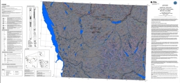
A. Dixon-Warren and A. Hickin
Open File 2000-05 consists of a surficial geology map with a scale of 1:100 000.
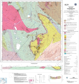
M.G. Mihalynuk, J.L. Nelson, T.P. Gleeson, C.F. Roots and M. de Keijzer
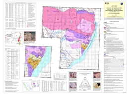
J. Logan, R. Mann
Open File 2000-07 presents the geology and mineralization around Baldy Batholith of South Central British Columbia (82M/03, 04, 05, 06) at 1:50 000 scale.
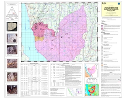
J. Logan and R. Manns
Describes the geology and mineral occurrences of the Mount Skelly pluton (82F/7E) near Kootenay Lake in southeastern British Columbia. The 1:50 000 scale coloured geological map includes a legend, references, photographs with rock types and mineralization, and tables with modal analyses, selected chemical analyses, and mineral occurrences.
The oldest rocks in the map area are from the Helikian Purcell Supergroup. Middle Aldridge siltite and fine quartzite with argillite interbeds, are overlain by Upper Aldridge argillite, silty argillite with characteristic white siltite laminae. Lower Creston Group rock units consist of siltite and thinly interbedded siltite and argillite; middle Creston rocks are siltite, fine quartzite, black to purple argillite and white quartzite. The Coppery Creek Group has a gray carbonate member; a lower unit with dolomite, dolomitic siltstone, argillite, siltite and quartzite; a middle unit of thinly laminated argillite and siltstone; and an upper unit of dolomite interbedded with quartzite. The Moyie intrusions are mainly metadiorite and metaquartz diorite. The lower unit of the La France Group consists of thinly bedded argillite and siltite; the upper unit is interbedded siltite and argillite. Mt. Nelson Formation units are dominated by: quartzite; dolomite, dolomitic siltstone, and argillite; thinly interbedded argillite and siltstone; and dolomite. Rocks of the Hadrynian Windermere Supergroup are represented by the Toby Formation and the Horsethief Creek Group. Toby Formation is composed of polymictic conglomerate, quartzite and grit, and phyllite. Horsethief Creek Group units are phyllite, siltite and carbonate; quartzite and pebbly quartzite; cobble conglomerate; pebble conglomerate; grey limestone, marble and dolomite; and phyllite and schist with interbedded quartzite, conglomerate and marble. Argillite, silty argillite, siltstone, and silty limestone comprise the Cambrian, Eager Formation.
Intrusive rocks of the Cretaceous Bayonne suite include the Sanca stock, which is biotite granodiorite, and the Mount Skelly pluton, which consists mainly of granodiorite and biotite monzogranite.
Mineral deposit types with potential in the area include low-sulphide quartz veins with elevated arsenic and values in lead, silver, gold, and tungsten; greisen veins with molybdenum and tungsten values (some also carry copper minerals); quartz veins with values in copper, silver and gold; and polymetallic quartz veins with values in silver, lead, zinc and sometimes gold. Four of the occurrences have past production. Most of the occurrences are either in Horsethief Creek strata or Cretaceous intrusive rocks.
D.J. Mate and V.M. Levson
The Quaternary geology of the Marilla map area was mapped in conjunction with 1:50 000 scale till geochemistry studies (Levson et al. 1999) and is part of the Nechako National Mapping (NATMAP) program conducted jointly by the British Columbia Geological Survey and the Geological Survey of Canada. Unlike other regions in the Nechako Plateau, the stratigraphy in this area is exceptionally well exposed. The completion of the Nechako Reservoir (1952) is largely responsible for the abundance of large Quaternary sections. Development of shoreline bluffs on the Nechako Reservoir and downcutting along the Cheslatta River Spillway have provided excellent cross-sections through Quaternary sequences and in some places the entire Holocene sequence, including sections through a number of drained Holocene lakes and deltas. A total of 12 Quaternary sections along the Cheslatta River and Nechako Reservoir were described from this map sheet. An overview of the stratigraphy in the Marilla map area is provided by Mate and Levson (Fieldwork1998, pp. 25-32).
The map area is approximately 70 km south of Burns Lake in central British Columbia and lies east of Tweedsmuir Provincial Park. Besides the reservoir, which was built to generate power for aluminum refineries in Kitimat, other types of land use are forestry and ranching. Access is reasonable in parts of the map area, consisting mostly of logging roads and some well maintained secondary roads. A private barge is needed to access forestry roads south of Ootsa Lake.
This area lies entirely within the Nechako Plateau physiographic region (Holland 1976), an area of low relief with large surfaces of flat or gently rolling topography and elevations up to 1500 m (see photo). Most of the ground surface is covered by thick glacial sediments and very little bedrock is exposed. The Quanchus Range (including Mt. Wells, Tweedsmuir Peak, and Michel Peak) lie immediately west of the map area in Tweedsmuir Provincial Park, while the Fawnie and Nechako ranges occur to the southeast. Highest elevations within the Marilla map sheet range from 1160 m - 1370 m a.s.l. and are found within the Windfall and Henson hills (see location figure).
Stratigraphic units identified within the map area are:
- Pre-Late Wisconsinan Sediments:
- Early Wisconsinan Till: Massive, slightly sandy, clayey silt diamicton is the oldest Pleistocene sediment in the map area. This unit underlies organic bearing nonglacial sediments and sediments deposited during the Late Wisconsinan (Fraser) Glaciation. It is exposed at the base of section DMA-9808 on Ootsa Lake (see figure below).
- Lacustrine Sediments: This unit consists of dark, blue-grey, very fine sand, with silt and clay laminations. Wavy and discontinuous lenses, laminae, and finely disseminated organics are present within this unit. It overlies Early Wisconsinan till at section DMA-9808 and lies beneath Late Wisconsinan sediments. Therefore this unit is believed to have been deposited during the Olympia Nonglacial Interval. These sediments are rare within the Nechako Plateau because they were eroded during the Fraser Glaciation and only occur as erosional remnants in specific areas. Recently, several new Olympia Nonglacial sites have been discovered in the general region (Plouffe and Jetté 1997; Levson et al. 1998; Mate and Levson 1999).
- Late Wisconsinan Advance-Phase Sediments:
- Till: This sediment is commonly found in Quaternary exposures and is the most widespread unit within the map area. It has two facies, the first of which is a clayey to silty, massive diamicton with a moderate to high density, high fissility, and moderate to well jointing. This facies is interpreted to have a lodgement origin. The second faices is a massive to crudely bedded, gravelly to sandy diamicton. It generally has a high density, strong fissility, and is well jointed. Thin, wavy and discontinuous sand and gravel lenses are common in this facies. This facies is interpreted as having a subglacial melt-out origin.
- Glaciofluvial: This unit consists of fine to coarse sands and pebble to cobble-sized gravels. Sands are moderately to well sorted, show crude horizontal to subhorizontal bedding, and locally have small to medium scale trough cross-bedding and ripple bedding. Gravels are characterized by subrounded to rounded clasts, poor sorting, and crude medium to large-scale trough cross-bedding. Both sands and gravels occur above and below till and often have lense shapes.
- Glaciolacustrine: This unit is dominated by silt and interbedded silts and clays. Occasionally silts are interbedded with sands. Bedded silts and clays above till are commonly deformed and occur in areas of hummocky topography. Glaciolacustrine silts and clays below till are also deformed and have sheared slickenside surfaces on bedding planes.
- Glacigenic Debris Flows: This unit is characterized by stratified silty to silty sand diamicton with high density, moderate to strong fissility, and poor jointing. The unit is commonly interstratified with sands, gravels, and silts and occurs above and below till.
- Holocene Sediments:This unit includes organic, fluvial, and colluvial deposits. These sediments overly all other stratigraphic units in the map area. Organic sediments dominate and occur as fens and bogs, some of which resemble string bogs. Fluvial sands and gravels sometimes contain numerous buried organic horizons and are interpreted to be floodplain deposits.
Late Wisconsinan glacial ice originated in the Coast Mountains west of the map area (Tipper 1971). Orientations of streamlined landforms and striae within the Marilla map area have a general northeasterly trend. Some striation directions from the shoreline of Ootsa Lake are valley parallel indicating that during early or late phases of glaciation ice moved through the Ootsa Lake valley system.
Ice confined to major valleys (Ootsa Lake valley) was responsible for damming local tributaries like the Cheslatta River (see location figure). Rare, advance-phase glaciolacustrine sediments were formed in local proglacial lakes due to this damming. Aggradation in this valley by glaciofluvial outwash soon followed. Glacigenic debris flows overlying the outwash probably originated from the ice margin as it advanced into the area. Ice advancing from the Coast Mountains, coalesced and thickened in the Interior Plateau and the influence of topographic control on its movement diminished. This movement probably resulted in the dominant subglacial flow in the map area which is northeast. During this phase thick lodgement tills were deposited over extensive areas of the map sheet.
During deglaciation ice stagnation occurred in some areas. Evidence of stagnant ice is provided by till ridges, found in the southwest portion of the map area, that are interpreted to be crevasse fillings. Also, areas of poorly sorted pebble to cobble gravel commonly occur as thin veneers throughout the study region. These deposits probably reflect the winnowing of fine material from surficial sediments washed by glacial meltwater during ice stagnation. Rare retreat-phase glaciolacustrine and occasional glaciofluvial sediments were formed in retreat-phase proglacial lakes dammed by stagnant ice blocks and small outwash plains.
Holland, S.S. (1976): Landforms of British Columbia, a physiographic outline. British Columbia Department of Mines and Petroleum Resources. Bulletin 48, 138 p.
Howes, D.E., and Kenk, E. (editors) (1997): Terrain Classification System for British Columbia. British Columbia Ministry of Environment, Manual 10, Version 2, 102 p.
Levson, V.M., Stumpf, A.J., and Stuart, A.J. (1998): Quaternary geology and ice-flow studies in the Smithers and Hazelton map areas (93 L and M): implications for exploration. In Geological Fieldwork 1997. British Columbia Geological Survey, Paper 1998-1, pp. 5-1 to 5-8.
Levson, V.M., Mate, D.J., and Stuart, A.J. (1999): Quaternary geology and drift prospecting studies in the north central Nechako Plateau (93 F and K). In Geological fieldwork 1998. British Columbia Geological Survey, Paper 1999-1, pp. 15 - 23.
Mate, D.J., and Levson, V.M. (1999a): Quaternary geology of the Marilla map sheet 93 F/12. In Geological fieldwork 1998. British Columbia Geological Survey, Paper 1999-1, pp. 25 - 32.
Mate, D.J., and Levson, V.M. (in prep.): Stratigraphy and Quaternary history in the Marilla map area (NTS 93 F/12), Nechako Plateau, central British Columbia. Paper submitted to Canadian Journal of Earth Sciences.
Plouffe, A., and Jetté, H. (1997): Middle Wisconsinan sediments and paleoecology of central British Columbia: sites at Necoslie and Nautley rivers. Canadian Journal of Earth Sciences, 34: 200 - 208.
Tipper, H.W. (1971): Glacial geomorphology and Pleistocene history of central British Columbia. Geological Survey of Canada, Bulletin 196, 89 p.
GIS support provided by Pat Desjardins. Field assistance provided by Andrew Stuart, Stephen Mate, and Crystal Huscroft. Edited by Gib McArthur and Brian Grant. Andrew Stumpf conducted reconnaissance surficial mapping and till sampling in the map sheet. Mapping was conducted by the British Columbia Geological Survey and the University of Victoria as part of the Nechako NATMAP project.
Geology based on air photo interpretation by D. Mate. 1:40 000 scale air photos were used in mapping. 0.4 field checks per square kilometer. 20% of the polygons were field-checked on this map.
Magnetic declination in 1984 was 26°48’, annual change decreases 8.8’. North American Datum 1983, UTM Zone 10. Map base from digital 1: 50 000 NTS data. Map Projection is UTM.
Recommended Citation:
Mate, D.J., and Levson, V.M. (2000): Quaternary geology of the Marilla map area (93F/12). British Columbia Geological Survey, Open File 2000-09, scale 1:50 000.
G.E. Ray and I.C.L. Webster
Open File 2000-10 covers the geology of the Heffley Lake area (92I/16) in south central British Columbia. The 1:20 000 scale coloured geological map includes a legend, an inset map of the Heff skarn occurrence at 1:5 000 scale, a description of the geology and mineralization, diagrams of structural measurements, and tables with major and trace element analyses for the Heffley Creek pluton, assay data from the skarn occurrence, and assay results from mineralized intrusive rocks.
The Heffley Lake area lies approximately 26 kilometres northeast of Kamloops and is accessible via the road between the township of Heffley Creek and the Sun Peaks ski resort. It lies within the Intermontane Belt and is underlain by metasediments of the Quesnel Terrane and younger mafic intrusive rocks.
Past exploration and drilling have been concentrated on the Heff property, which lies at the base of a series of northwest trending limestone cliffs, immediately north of Heffley Lake. In 1915, Cu and Fe mineralization were first noted in the area (MMAR. 1916), and in 1966 drilling intersected over 10 metres of massive magnetite and another 4.5 metres thick zone of semi-massive magnetite with chalcopyrite; the latter zone graded 1.67 percent Cu and 0.48 g/t Au.
In 1980, Cominco identified a broad, 600 metres-long Cu soil anomaly; later, a drill-hole intersected 16 metres of semi-massive magnetite, a 6 metre interval of which assayed 25 percent Fe and 0.5 g/t Au.
Later sampling showed that the Heff magnetite skarn contained moderate anomalous quantities of REE's (up to 570 ppm La and 490 ppm Ce). In 1997, Echo Bay Mines outlined soil anomalies adjacent to the magnetite skarn with values exceeding 1200 ppm Cu and 1000 ppb Au.
The area is extensively covered with superficial glaciofluvial deposits. The stratified rocks were originally mapped as Cache Creek Group but more recently they are considered to belong, in part, to the Harper Ranch Group. They mainly comprise steeply dipping, northwest striking argillites and calcareous siltstones with lesser andesitic ash and lapilli tuff and some limestone. These rocks were folded and overprinted by lower to sub-greenschist metamorphism producing slaty and phyllitic planar fabrics. The magnetite-bearing garnet-pyroxene skarn on the Heff property is hosted by calcareous metasediments and dioritic minor intrusions; it is best exposed in a number of overgrown trenches that are 200 to 300 metres north of the Heffley Creek-Sun Peaks road.
The area southwest of Heffley Lake includes units of blue-grey crinoidal limestone and black argillites whilst the coarsely clastic to conglomeratic limestones in the vicinity of the Heff skarn, north of Heffley Lake, lack crinoids and the argillites are less organic-rich. This and other lithological differences suggest that the supracrustal rocks may be separated into northern and southern packages; these are believed to represent the Nicola and Harper Ranch groups respectively. Limestone samples from these packages are currently being processed for microfossils that may verify this, suggestion. The contact between these packages is thought to pass under the Heffley lakes and continue southeastward along Armour Creek. The Heffley Creek Pluton has intruded this presumed stratigraphic contact and has undergone later brittle movement along the Armour Creek Fault.
Two intrusive phases are recognized. The oldest and most economically important of these is the Heffley Creek Pluton and its marginal dike-sill swarm. This intrusion is probably related to the Heff skarn and was coeval with the district-wide folding. A younger generation, which post-dates the folding, resulted in minor bodies of megacrystic, feldspar-porphyry syenite.
The main Heffley Creek pluton is exposed south and southwest of Heffley Lake, where small, scattered outcrops are traceable over a 10 km2. It contains pyroxene-amphibole-bearing ultramafic rocks as well as some gabbros, diorites, quartz diorites and monzodiorite. The ultramafics contain up to 10 percent disseminated magnetite, which results in an elongate aeromagnetic anomaly that extends southeast of Little Heffley Lake.
Major and trace element analytical data for the various rock types in the Heffley Creek Pluton are presented in Table 1 on the map. The total alkali content of the gabbroic and dioritic rocks indicates a weak alkalic affinity; however, chemical plots suggest these rocks were originally calc-alkaline and that their higher alkali content is due to hydrothermal alteration.
The Nicola Group limestones along the northeast margin of the pluton are cut by a swarm of strongly altered, rusty-weathering dioritic sills and dikes that are probably related to the Heffley Creek Pluton. Individual bodies are usually less than 10 metres wide; they mostly strike northeast, but some intrusions are irregular and bifurcating.
A younger phase of porphyritic syenite is best seen south of Heffley Lake, although the Nicola limestones northeast of Heffley Lake are cut by a few dikes up to 3 metres thick. These leucocratic rocks contain up to 7 percent chloritized amphibole and biotite, as well as some minor quartz. They are characterized by abundant elongate feldspar crystals up to 15 cm in length.
Only one episode of major folding is recognized (FI); this resulted in the moderately to steeply dipping beds and a southeast trending axial planar slaty cleavage (Sl). No fold axial linear features (e.g. mineral lineations) were seen and very few minor Fl folds were identified. However, bedding-cleavage intersections in the Nicola Group limestones north of Heffley Lake reveal the presence of several tight synforms and antiforms.
During the Fl episode, the limestones throughout the area underwent ductile deformation while most of the more competent dikes were disrupted by boudinage and brittle extension. Stereo plots of bedding and Sl cleavage measurements are presented on the map. These suggest that the tight F1 folds in the northern part of the area have sub-horizontal to moderately southeasterly plunging axes and that their axial planes are southeast striking and steeply northeast dipping. Plots of the southern structural data also indicate the presence of southeast striking isoclinal folds but their axial planes are more vertical. The large arcuate unit of strongly cleaved limestone exposed southwest of Heffley Lake may represent a major isoclinal Fl structure.
Most of the pyritic sills and dikes on the Heff property strike northeasterly and were structurally controlled by a-c fractures developed during the Fl folding. However, some thin sills in the limestones have undergone open to tight Fl folding, and these folded intrusions are invariably overprinted by the S1 slaty cleavage. The folding of some sills together with the joint control of the dikes is supportive evidence that both the intrusions and the skarns were coeval with the FI deformation.
The area contains two types of chalcopyrite-bearing mineralization: magnetite-rich garnet-pyroxene skarns, like the Heff occurrence, and pyrite with or without magnetite disseminations and veins in the Heffley Creek pluton. The Heff skarn is an unusual copper with or without gold, REEs and phosphorous. The skarn is related to northeast striking sills and dikes that have potential for more occurrences. The Heffley Creek pluton probably represents an Alaskan-type body. It has the potential to host copper, gold, chrome and PGE mineralization.
W. Jackaman, S. Cook and R. Pinsent
Open File 2000-11 presents lake sediment and water geochemistry of the Cape Caution Area (NTS 92L/13, 14, 15; 92M/3, 4) of Coastal British Columbia. This report examines new analytical data for 43 different elements from a regional lake sediment and water geochemical survey conducted by the British Columbia Geological Survey in the Cape Caution area during 1999.
The lake sediment survey was designed to cover a region of NW-SE trending geological structures and associated shear-hosted gold mineralization. Extending from Cape Caution to Broughton Island, this portion of the Hecate Lowland and physiographic region is characterized by subdued topography, poor drainage and abundant lakes which make lake sediments an ideal geochemical exploration sample medium. Lake sediment surveys are an effective tool to delineate regional geochemical patterns and anomalous metal concentrations related to mineral occurrences. Most examples of the successful application of lake sediment geochemistry to Cordilleran mineral exploration come from the Nechako Plateau in central BC were topography is more subdued than in most parts of the Coast Mountains.
Sample collection, preparation, analytical procedures and quality control conform to established standards of the National Geochemical Reconnaissance and Regional Geochemical Survey (RGS) programs; details are provided within this report. Analytical results and field observations compiled by the RGS program in British Columbia are used in the development of a high-quality geochemical database suitable for mineral exploration, resource assessment, geological mapping and environmental studies. Funded under the government's Corporate Resource Inventory Initiative, this survey is part of the Ministry of Energy, Mines and Petroleum Resources' contribution to the Central Coast Land Resource Planning process.
W. Jackaman and R. Pinsent
Open File 2000-12 presents new analytical data for 43 different elements from a regional drainage sediment and water geochemistry survey conducted by the British Columbia Geological Survey in the Khutze River area during 1999. The survey covers parts of three 1:50,000 NTS map sheets in the Douglas Channel (NTS 103H) area of BC's central coast: 103H/01 (Khutze River), 103H/02 (Butedale) and 103H/07 (Ursula Channel).
Sample collections, preparation and analytical procedures conform to establish standards of the National Geochemical Reconnaissance (RGS) and Regional Geochemical Survey programs. Analytical results and field observations compiled by the RGS program in British Columbia are used in the development of a high-quality geochemical database suitable for mineral exploration, resource assessment, geological mapping and environmental studies. Funded under the government's Corporate Resource Inventory Initiative, this survey is part of the Ministry of Energy, Mines and Petroleum Resources contribution to the Central Coast Land Resources Planning process.
W. Jackaman, S. Cook, R. Pinsent and T. Ferbey
Open File 2000-13 presents new analytical data for 43 different elements from a regional drainage sediment and water geochemistry survey conducted by the British Columbia Geological Survey Branch in the Bella Coola area during 1999. The survey covers parts of four 1:50,000 NTS map sheets in the Bella Coola (NTS 93D) area of BC's central coast: 93D/01 (Jacobsen Glacier), 93D/02 (South Bentinck Arm), 93D/07 (Bella Coola) and 93D/08 (Stuie).
Sample collection, preparation and analytical procedures conform to establish standards of the National Geochemical Reconnaissance and Regional Geochemical Survey programs. Analytical results and field observations compiled by the RGS program in British Columbia are used in the development of a high-quality geochemical database suitable for mineral exploration, resource assessment, geological mapping and environmental studies. Funded under the government's Corporate Resource Inventory Initiative, this survey is part of the Ministry of Energy, Mines and Petroleum Resources contribution to the Central Coast Land Resource Planning process.
W. Jackaman, G. Payie, and P. Wojdak
This report presents new analytical data for 43 different elements from a regional stream sediment and water geochemistry survey (Figure 1) conducted by the British Columbia Geological Survey on the Queen Charlotte Islands during 1999. The survey covers parts of seven 1:50,000 NTS map sheets in the Graham Island (NTS 103F) and the Hecate Strait (NTS 103G) areas: 103F/01 (Skidegate Channel), 103F/07E (Rennell Sound), 103F/08 (Yakoun Lake), 103F/09 (Port Clements, 103F/10E (Awun Lake), 103G/04 (Cumshewa Inlet) and 104G/05 (Lawnhill). Details on the geology and mineral potential of the Queen Charlotte Islands are described by Lefebure (1998).
Superceeded by GeoFile 2005-24
This Open File was created to serve as a handy hard-copy reference for anyone interested in British Columbia’s rich mineral endowment. This publication will appeal to a wide variety of local and international users, including government agencies, mining and exploration companies, researchers, and the public.
This 190-page publication documents the known reserves and resources of 824 mineral deposits from the MINFILE database. The reserves/resources are reported in tonnes and grade of commodities. The MINFILE Reserves/Resources Inventory reflects the status of the database as of January 2000. Data for each deposit include name, MINFILE number, geographic location, NTS map, status, mining division, deposit type, zone name, year, reference, comments, tonnage, category, grade and commodity. Various reports and sorted tables are included: a Commodity Legend, a sample Master Report, an Alphabetical Index, a MINFILE Number Index, a table of Mineral Deposit Profiles, and a Deposit Type Index. Deposit type is based on the British Columbia Mineral Deposit Profiles of the BC Geological Survey.
The Reserve category is used only for an inventory in an operating mine or a mine near production. Ore reserves are reported as Proven, Probable and Possible. The Resource category is used for all other inventories. Resources are reported as Measured, Indicated and Inferred. A combination of categories is reported as Combined.
Qualitative and quantitative reporting of deposit economics are affected by several parameters. Some of these include the variable reliability of reporting, differences in interpretation of terms, and changing economic conditions. Reserves and resources are not calculated by Ministry personnel but are quoted from referenced industry sources and/or publications. Due to differences in identifying categories in the data sources, Ministry personnel may occasionally need to interpret the category that the figures belong to. The reader should refer to the original data for detailed information.
R.C. Paulen, P.T. Bobrowsky, R.E. Lett, W. Jackaman, A.J. Bichler and C. Wingerter
Open File 2000-17 provides the final results, discussion and interpretation of a drift exploration program conducted north of Kamloops by the British Columbia Geological Survey. The till geochemistry project discussed here represents the end product of field investigations undertaken during the summer of 1998 as part of a larger, multidisciplinary, integrated resource assessment program aimed at defining the mineral potential of south-central British Columbia.
The survey was undertaken as part of the Eagle Bay Assemblage and Fennell Formation of the Kootenay Terrane. Interesting results from the 1997 till geochemistry survey directly south and east encouraged a further extension of the program into the Upper Triassic-Jurassic rocks of the Nicola Group. The "Eagle Bay" drift prospecting program is one of several provincial till geochemistry surveys which have been ongoing since 1990 to demonstrate the utility of integrating surficial geology mapping and exploration geochemical methods to locate buried mineral deposits in areas of drift-covered terrain.
R.C. Paulen, P.T. Bobrowsky, R.E. Lett, W. Jackaman, A.J. Bichler and C. Wingerter
Open File 2000-18 provides the results, discussion and interpretation of a drift exploration program conducted north of Kamloops by the British Columbia Geological Survey Branch. The till geochemistry program represents the end product of field investigations undertaken during the summer of 1998 as part of a larger, multidisciplinary, integrated resource assessment program aimed at defining the mineral potential of south-central British Columbia. The survey was undertaken as year three of the Eagle Bay Project which centred on the eastern part of the Devono-Mississippian rocks of the Eagle Bay Assemblage.
The "Eagle Bay" drift prospecting program is one of several provincial till geochemistry surveys which have been ongoing since 1990 to demonstrate the utility of integrating surficial geology mapping and exploration geochemical methods to locate buried mineral deposits in areas of drift-covered terrain.
Drift exploration integrates two allied components: surficial geology mapping and till geochemistry sampling. The objectives of the drift exploration project were to: define new anomalies which may be used in the discovery of mineralization targets; establish the dispersal of pathfinder elements down-ice from a known sources; stimulate new exploration and economic activity; document ice flow indicators including both local and regional ice flow patterns to aid drift prospecting in the area and; provide information where mineral exploration has been hampered by thick glacial drift cover, and where traditional prospecting and exploration techniques have proven unsuccessful despite indicators of high mineral potential. The purpose of the surficial mapping component was to document the variability in the types of sediments observed, including their distribution and general character for this particular area. The integration of surficial mapping and till geochemistry with mineral deposits studies and detailed bedrock mapping addresses the main objective of drift prospecting: to provide data that will lead to the discovery of economic mineralization in areas now covered by a blanket of unconsolidated sediments.
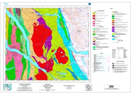
P. Schiarizza, N. Massey and D. MacIntyre
Open File 2000-19 presents the geology of the Tsayta Lake area (93N/3, 4, 5, 6) in central British Columbia. The coloured 1:100 000 scale geology map includes a legend, sources of information map, and a table of mineral occurrences.
The geology of the area is complex; it is underlain by undivided Quesnel terrane strata, rocks of the Cache Creek and Stikine terranes, and overlap assemblage rocks. The Cache Creek terrane includes the Sitlika assemblage and the Cache Creek complex. The Upper Carboniferous to Triassic Cache Creek complex includes the limestone with minor basalt, chert and phyllite package of the Pope succession, the phyllite-quartzite-metachert with lesser limestone of the Sowchea succession; the Trembleur harzburgite- and dunite-bearing ultramafic unit, which is extensively serpentinized and carbonate-talc altered with serpentinite melange containing greenstone, diabase, amphibolite, chert, and limestone knockers; the Rubyrock intrusive complex, which consists of gabbro, diorite, sheeted diabase as well as greenstone dikes and sills, and tonalite to quartz feldspar porphyry; and the ‘North American succession’ with one unit of mainly of mafic volcanic flows, breccias and tuffs, another of silicified slate, quartzite pebble conglomerate and limestone, and an upper unit of chert, limestone, phyllite, schist and metabasalt. The Sitlika assemblage includes a Permian to Lower Triassic volcanic unit with a section of chlorite schist, greenstone and pillowed metabasalt, and another of chlorite schist, fragmental chlorite schist, and pillowed metabasalt. A Late Permian or Early Triassic unit is epidote-chlorite-feldspar schist to semischist, and weakly foliated hornblende diorite. Early Triassic tonalite is medium to coarse grained. Upper Triassic to Lower Jurassic strata of the ‘Clastic unit’ are mainly slate, phyllite, banded siltstone, sandstone and conglomerate.
The Stikine terrane includes mainly volcanic arc-related strata of Late Triassic to Middle Jurassic age. Upper Triassic Takla Group rocks are mainly pyroxene-feldspar phyric basalt and basalt breccia with minor epiclastic components. Upper Triassic to Lower Jurassic siltstone and shale, mudstone and minor limestone have wacke and chert interbeds. Lower to Middle Jurassic Hazelton Group rocks are mainly subaerial feldspar phyric andesite to dacite flows and pyroclastic rocks.
Overlap assemblages are of Middle Jurassic to Upper Cretaceous age. Middle Jurassic rocks of the Spike Peak intrusive suite include hornblende diorite, tonalite, granodiorite, monzonite, quartz monzonite and monzogranite. Possibly Middle Jurassic quartz diorite, diorite and tonalite locally includes gabbro and pyroxenite. Early Cretaceous intrusives are predominantly granodiorite and granite. Upper Cretaceous Sustut Group rocks are represented by the Tango Formation, which consists of polymictic conglomerate, sandstone and shale.
The area has two main structural domains. The eastern domain includes penetratively deformed greenschist facies rocks of the Cache Creek complex and the Sitlika assemblage. These are arranged as a series of linear, northwest trending fault panels that apparently originated as east-dipping thrust slices in Middle Jurassic time. The western domain is underlain by the various stratigraphic and plutonic components of the Stikine terrane. Only some of these rocks display penetrative fabrics and east-dipping thrust faults are only locally preserved. Regional relationships indicate that the Stikine terrane formed the footwall to the west-directed thrust system within adjacent Cache Creek terrane. Younger structures include steep north to northwest-striking faults that originated during Late Cretaceous to Early Tertiary dextral strike slip faulting. Northeast-striking faults with apparent dextral displacements are prominent and locally offset the northerly faults.
The volcanic unit of the Sitlika assemblage correlates with the metavolcanic rocks of the Kutcho Formation. The volcanic unit is bimodal and may host volcanogenic massive sulphide mineralization. The upper part of the unit is most prospective. The area also has potential for vein and disseminated copper, breccia and vein copper, silver, molybdenum, lead and zinc mineralization, molybdenum-copper with or without gold porphyry deposits, as well as chrome from podiform chromite, asbestos, jade, talc and rhodonite from the ultramafic rocks. Placer gold is known from the area.
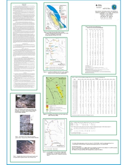
G.E. Ray and I.C.L. Webster
Follow-up sampling of the Howser and Tea creeks area was completed as part of a 1999 field program to check areas with a potential for Fe oxide-Cu-Au-REE mineralization of the Candelaria-Kiruna-Ernest Henry-Olympic Dam family. This program initially involved a library search together with an examination of the BC MINFILE and Regional Geochemical Survey (RGS) databases.
The authors spent two days in the field area. Thirteen stream sediment samples were collected, including silt from the two anomalous sample-sites revealed in the RGS program. In addition, six rock samples with sulphide or quartz alteration were collected for assay, and the geology of both the bedrock and stream-boulders in the area were examined.
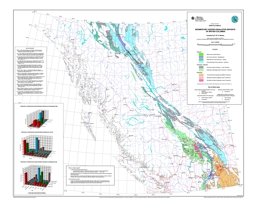
N.W.D. Massey
Sedimentary hosted exhalative deposits are an important resource in British Columbia primarily for lead, zinc and silver. A hundred years of exploitation from 22 mines has produced over 166,000,000 t of ore (to 1998). This has resulted in the production of over 9,379,000 kg Ag, 1,326 kg Au, 8,557,000 t Pb, 8,478,000 t Zn, 5,150 t Cu and 8,840 t Cd. The bulk of this production has come from one mine, the Sullivan Mine, which accounts for 87% of ore produced. Current exploration interest is focused on finding a replacement for this world class deposit which is due to close in the next few years.
Open File 2000-22 documents 239 sedimentary hosted exhalite occurrences recorded in MINFILE. These include examples from four major deposit model types - clastic sediment-hosted exhalative Zn-Pb-Ag, sedimentary-hosted stratiform barite, carbonate-hosted exhalative Zn-Pb and metasedimentary-hosted Pb-Zn-Ag. They occur in cratonic or pericratonic terranes of the Omineca or Cratonal North American belts.
The 65 occurrences of the clastic sedimentary-hosted deposit type form two main clumps located in southeastern B.C., including the world class Sullivan Mine, and northeastern B.C. The southern group of occurrences are found in rocks of the Middle Proterozoic Purcell Supergroup, while the northern group are hosted in the Devono-Mississippian Earn Group. The latter is also the host to most of the 47 occurrences of sedimentary hosted stratiform barite deposit type. Carbonate-hosted (Irish-type)deposits (62 occurrences) are concentrated mostly in Cambrian aged limestones of the Kootenay terrane.
The metasedimentary-hosted deposits (65 occurrences) include Broken Hill or Shushwap type deposits as well as possible metamorphic equivalents of the clastic and carbonate hosted types. They are hosted in Upper Proterozoic to Cambrian aged rocks of the Eagle Bay Assemblage and Monashee Complex.
R.E. Lett, W. Jackaman, and L. Englund
Open File 2000-23 presents data from geochemical surveys carried out over two areas of southern British Columbia to compare the geochemical response of pluton-related quartz-vein gold mineralization in different reconnaissance scale stream sediment sample media. Moss sediments, stream sediments and water samples were collected at 40 sites in NTS 82M/4,5,6, three sites in 92P/8 and 26 sites in 82F/7. Bulk stream sediment samples for preparation of heavy mineral concentrations and rock samples for estimation of element background levels were also taken at selected sites. The results indicate that moss sediments and heavy mineral concentrates provide higher geochemical contrast and are a stronger indication of gold mineralization than routine regional survey scale stream sediments. The moss sediment and heavy mineral gold geochemistry has highlighted several drainage basins within the Baldy Batholith and Mount Skelley Pluton where the multi-element associations suggest new areas of pluton-related mineralization. However, there are may be other sources for typical pathfinder elements (e.g. Bi, Mo). The high variability of gold and bismuth in moss sediment suggests that these elements are present in relatively large mineral grains. Reconnaissance sampling for moss sediment or heavy minerals is recommended at a density of one sample per ten square kilometres. Follow-up basal till samples to trace the up-ice source of the stream anomaly should be collected at a density of one to two samples per square kilometre.
Open File 2000-23 presents stream geochemical exploration for pluton-related quartz-vein gold deposits in Southern British Columbia.
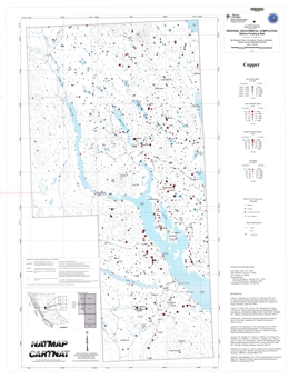
S. Cook, V. Levson, W. Jackaman, D. Law and M. Douville
Open File 2000-24 consists of 9 maps representing the Babine Porphyry Belt area.
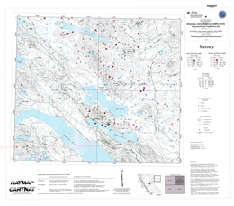
S. Cook, W. Jackaman, A. Plouffe, J. Nelson and M. Douville
Open File 2000-25 consists of 9 maps of the Tezzeron-Pinchi Fault Zone area.
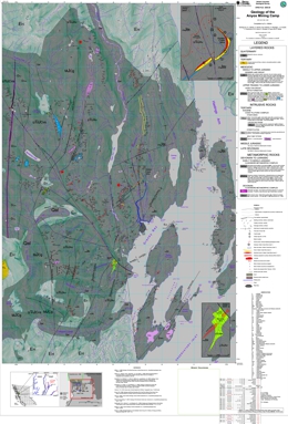
Open File 2000-28 has been superceded by Geoscience Map 2003-3.
D.J. Alldrick
Open File 2000-28 portrays the geology of the Anyox mining camp (103P/5 and 12W) in northwestern British Columbia. The 1:20 000 scale coloured geology map has a legend, a inset maps for the Bonanza and Hidden Creek mine areas, references, a mineral occurrence table, and a map showing sources of data.
Metamorphic rocks in the area are of Devonian to Jurassic age. The Devonian Clashmore metamorphic complex contains massive to gneissic gabbro and diorite, and ultramafic rocks with fine rhythmic laminations that are probably tectonic. Early to Middle Jurassic rocks of the Complex include an assemblage of metavolcanic, metasedimentary and metaplutonic rocks that may be correlatives of the Anyox Formation, and fault-bounded brecciated granite to granodiorite bodies.
The Late Triassic to Early Jurassic Hazelton Group is represented by the Anyox Formation, which consists of pillow basalt flows, pillow breccias, basalt flows, minor tuffs and their metamorphosed equivalents, as well as minor sedimentary members, diorite, gabbro and pyroxenite sills, and mafic dikes. Middle to Upper Jurassic Bowser Lake Group rocks consists of siltstone, mudstone, shale, sandstone, minor wacke and conglomerate with local pyrite disseminations and laminations. Tertiary strata are volcanic breccia and flows, and granite pebble to cobble conglomerate.
Tertiary intrusive rocks include the Moly May stock, a garnet-muscovite granite with quartz stockworks, the Hyder pluton, which varies from granodiorite to quartz monzonite to granite, the Larcom dike swarm, of feldspar porphyry, lamprophyre and felsite, and the Hyder dikes, which are variably granodiorite, diorite, felsite, porphyritic syenite, pyroxene-feldspar porphyry, lamprophyre, andesite and basalt.
Within the metamorphic complex, rocks are foliated and locally mylonitized. Mesozoic rocks in the area have upright folds and are cut by north, northwest and northeast trending faults.
Volcanogenic massive sulphide deposits are important targets in the area and two past producers occur in Anyox Group host rocks. Seven other past producers in the area are mineralized quartz veins. Simple gold quartz veins occur but most are polymetallic with values in gold, silver, cobalt and zinc; or gold, silver, lead and zinc with or without copper.
R. Lett, W. Jackaman
Open File 2000-31 presents new data from detailed surveys covering eight areas of southern B.C. near Adams Lake. Part 1 of this Open File contains a summary of data collected and interpretational models. The detailed results are compiled in Part 2. The surveys were carried out to study the geochemical response of precious and polymetallic volcanogenic sulphide (VMS) deposits in Kootenay terrane rocks and to develop models for portraying the essential characteristics of geochemical dispersion for different elements in surficial deposits. These models aim to assist in the design of geochemical surveys and to simplify the interpretation of geochemical data.
Over 300 C and B-soil horizon samples were analysed for 49 elements by a combination of instrumental neutron activation (INAA) and aqua regia digestion inductively coupled plasma emission spectroscopy (ICPES). A number of the samples were also analysed for major oxides by lithium metaborate fusion-ICPES. Results of a multi-media survey demonstrate that sampling the C-horizon till is often more effective than B-horizon soil for detecting buried mineralization because the C-horizon geochemistry more directly reflects the parent mineralogy of the source material. Knowledge of ice-flow direction and till thickness is important for predicting the position of a concealed source from geochemical data.
A geochemical exploration model (GEM) for massive sulphide deposits in a glaciated area of southern B.C. has been developed from detailed and regional till, B-horizon soil and stream sediment, and water geochemical survey data. Using three dimensional block diagrams, the model explains the relationship between bedrock source and the subsequent dispersal of mineralized drift in the surficial deposits, drainage, topography and surficial geochemistry. Elements in till, soil, stream sediment and water associated with different types of sulphide mineralization are shown on the model to illustrate how geochemistry can distinguish between different element sources for multi-media anomalies.
A.F. Wilcox and L.D. Jones
Open File 2000-32 includes 170 scanned (PDF format) Mineral Assessment Reports from southeastern British Columbia (parts of 082F, G, J and K). Companies financially contributing to the scanning of the documents include Abitibi Mining Corp., Black Bull Resources Inc., Eagle Plains Resources Ltd., Kennecott Canada Exploration Inc., Klondike Gold Corp., and Sedex Mining Corp. The reports in this collection are to June 2000. Reports after this date can be discovered through the ARIS search application.
Tectonostratigraphic Map Purcell Supergroup, after Trygve Höy, Derek Brown and others, produced in MapInfo by Kennecott Canada Exploration Inc., April 19, 1999.
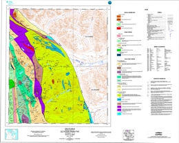
P. Schiarizza
Open File 2000-33 presents the geology of the Old Hogem (western part) map area (93N/11, 12, 13) in central British Columbia. The coloured 1:100 000 scale map includes a legend, a data source map, sources of information, and a mineral occurrence table. The geologic coverage does not extend east or north of the north to northwest trending Pinchi Fault.
The geology of the area is complex; it is underlain by rocks of the Cache Creek and Stikine terranes, and overlap assemblage rocks. The Cache Creek terrane includes the Sitlika assemblage and the Cache Creek complex. The Carboniferous to Permian (?) Cache Creek complex rocks consist of limestone with minor basalt, chert and phyllite. Late Carboniferous to Triassic (?) units include serpentinite and serpentinite melange containing greenstone, diabase, amphibolite, chert, and limestone knockers; foliated serpentinite; and a unit dominated by greenstone, diabase, gabbro and massive to pillowed metabasalt. Permian to Triassic rocks are limestone with minor chert, phyllite and basalt. Permian to Jurassic (?) quartz phyllite, quartzite and metachert have lesser interlayered limestone, phyllite, greenstone and schist, metasandstone and blueschist.
The Tezzeron succession (?) is of Late Triassic to Early Jurassic (?) age. The lower unit consists mainly of feldspathic wacke and siltstone; the upper unit is pebble to cobble conglomerate.
Sitlika assemblage includes a Permian to Lower Triassic volcanic unit of with a section of chlorite schist, greenstone and pillowed metabasalt, and another of chlorite schist, fragmental chlorite schist, and pillowed metabasalt. A Late Permian or Early Triassic unit is epidote-chlorite-feldspar schist to semischist, and weakly foliated hornblende diorite. Early Triassic tonalite is medium to coarse grained. Upper Triassic to Lower Jurassic strata of the ‘Clastic unit’ are mainly slate, phyllite, banded siltstone, sandstone and conglomerate.
The Stikine terrane includes mainly volcanic arc-related strata of Late Carboniferous to Middle Jurassic age. Late Carboniferous Asitka Group (?) strata are slate, slaty siltstone and chert intruded by metagabbro with minor serpentinite and listwanite alteration. Upper Triassic Takla Group rocks are mainly pyroxene-feldspar phyric basalt and basalt breccia. Upper Triassic to Lower Jurassic rocks are dominantly foliated chert pebble conglomerate and chert-quartz sandstone. Lower to Middle Jurassic Hazelton Group rocks are mainly subaerial feldspar phyric andesite to dacite flows and pyroclastic rocks. Middle Jurassic intrusive rocks are monzonite, quartz monzonite and monzogranite.
Overlap assemblages are of Early Cretaceous to possibly Tertiary age. Early Cretaceous (?) intrusives are predominantly granodiorite and granite. Upper Cretaceous Sustut Group rocks are represented by the Tango Formation, which consists of polymictic conglomerate, sandstone and shale. Biotite-hornblende-feldspar porphyry, felsite and syenite intrusives are of Cretaceous or Tertiary age.
The area has two main structural domains. The eastern domain includes penetratively deformed greenschist facies rocks of the Cache Creek complex and the Sitlika assemblage. These are arranged as a series of linear, northwest trending fault panels that apparently originated as east-dipping thrust slices in Middle Jurassic time. The western domain is underlain by the various stratigraphic and plutonic components of the Stikine terrane. Only some of these rocks display penetrative fabrics and east-dipping thrust faults are only locally preserved. Regional relationships indicate that the Stikine terrane formed the footwall to the west-directed thrust system within adjacent Cache Creek terrane. Younger structures include steep north to northwest-striking faults that originated during Late Cretaceous to Early Tertiary dextral strike slip faulting. Northeast-striking faults with apparent dextral displacements are prominent and locally offset the northerly faults.
The volcanic unit of the Sitlika assemblage correlates with the metavolcanic rocks of the Kutcho Formation. The volcanic unit is bimodal and may host volcanogenic massive sulphide mineralization. The upper part of the unit is most prospective. The area also has potential for vein and disseminated copper, breccia and vein copper, silver, molybdenum, lead and zinc mineralization, molybdenum-copper with or without gold porphyry deposits, as ell as chrome from podiform chromite, asbestos, jade, talc and rhodonite from the ultramafic rocks. Placer gold is known from the area.

