Preliminary Maps
Discontinued in 1990, the Preliminary Map series delivered early drafts of maps intended for ultimate publication in Papers or Bulletins. Preliminary maps are now released digitally in the Open File series. Missing numbers in the series indicate that the publication was superseded by more current versions.
1956-1966 | 1-24 | 25-49 | 50-68
1956-1966
W.R. Bacon
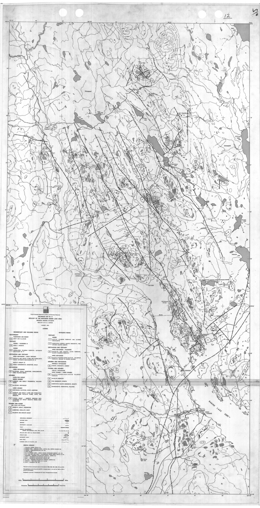
This report is a 1:1-mile scale preliminary geology map, with descriptive notes, of Granduc area of British Columbia.
A. Sutherland Brown and W.G. Jeffrey
Preliminary Map 1960 gives a 1:125 000-scale preliminary geological map for southern Queen Charlotte Islands. It is accompanied by 5 pages of notes.
W.G. Jeffrey
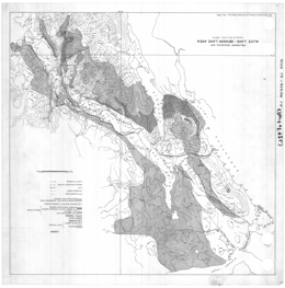
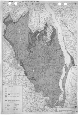
Preliminary Map 1962 gives a preliminary geological map for the Alice Lake - Benson Lake of British Columbia and includes a legend.
W.G. Jeffrey
Preliminary Map 1964 gives a preliminary geological map of the Buttle Lake Area of Vancouver Island
J.M. Carr and R. Lee
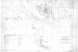
Preliminary Map 1966 gives a geological map of the Highland Valley Area of British Columbia
1-24
N.C. Carter and R.V. Kirkham
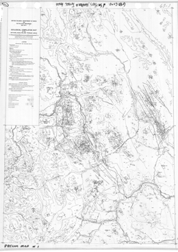
Geological Compilation Map of the Smithers, Hazelton and Terrace Areas (parts of 93L, M and 103I)
B.N. Church
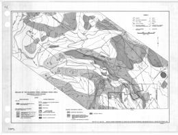
Preliminary Map 2 describes the geology of the McCarren Creek, Goosmus Creek Area, Greenwood Mining Division (parts of 82E/2E).
J.T. Fyles
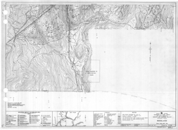
Preliminary Map 4 describes the geology of the Rossland area.
W.J. McMillan, P.M. McAndless and D. Blanchflower
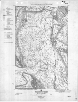
Preliminary Map 7 describes the geology of the Highland Valley area
N.C. Carter and E.W. Grove
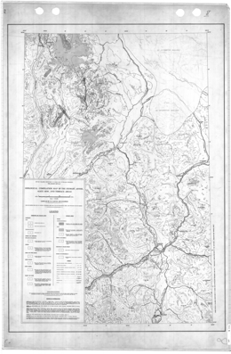
Preliminary Map 8 presents the geology of the Stewart, Anyox, Alice Arm and Terrace areas of British Columbia. The 1:250,000 scale geology map includes a legend
J.A. Garnett
Preliminary Map 9 describes the geology of part of the Hogem Batholith, Duckling Creek Area (parts of 93N/13, 14; 94C/3, 4).
P.A. Christopher
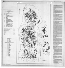
Preliminary Map 10 presents the geology and mineral occurrences of the Aspen Grove area (92H/15E) in south central British Columbia. The map contains a legend, a list of crown granted claims in the area, and descriptive notes. The map is published at scale 4 inches to 1 mile or 1:15840. For more details about the area, see Bulletin 69.
The area is underlain mainly by rocks of the Upper Triassic Nicola belt, an island arc volcanic-sedimentary succession. Massive andesite flows and coarse pyroclastic rocks predominate in the central part of the map; a sequence of layered and massive volcanogenic rocks predominates along the eastern margin. The southwestern section is underlain by intercalated volcaniclastic rocks, flows and calcareous sediments that are partly covered (?) by coarse volcanic breccia.
The Nicola Group consists of 8 main units. Units 1, 2 and 3 are sedimentary rocks. They consist of limy siltstone, argillite and limestone layers. Massive andesite comprises unit 4. Flows, dikes and sills are common. Unit 5, 6 and 7 consist of massive volcanic rocks. Volcanic breccia, volcanic conglomerate, and lahar deposits characterize unit 5. Augite porphyries make up most of unit 6; some form ropy lavas and agglomerates. Massive and amygdaloidal augite porphyry comprises unit 7. Unit 8 consists of volcanic siltstone and sandstone.
Intrusive rocks in the area are mainly dioritic and partly comagmatic with the Nicola volcanic rocks. Small monzonite bodies also occur and small breccia pipes, some of which have copper mineralization.
Two major north-trending fault zones with many splays dissect the area, and brittle faulting is characteristic of the area.
Copper-bearing occurrences dominate the mineral occurrences in the area. Four main occurrence types are: copper minerals in fine grained and brecciated zones in the intrusive rocks; chalcopyrite, bornite, pyrite and magnetite in breccia zones in andesite and diorite; chalcocite, native copper and hematite in fracture zones in the volcanics; and copper minerals and pyrite in limestone and argillite.
B.N. Church
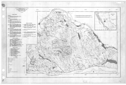
Preliminary Map 11 is a 1:50 000-scale preliminary geological map of the Buck Creek area in British Columbia.
B.N. Church
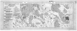
Preliminary Map 13 is a preliminary geological map of the Owen Lake-Goosly Lake area of British Columbia
Petrochemical Overlays, Maps 13b to 13i by J. Barasko and B.N. Church
V.A. Preto
Preliminary Map 14 gives geological overlays for the Copper Mountain area (to accompany geological maps of Bulletin 59) in British Columbia
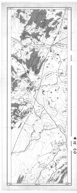
P.A. Christopher, D. Coombes, V.A. Preto, T.E. Kalnins, N.A. Thomsen and J. Nebocat
Preliminary Map 15 describes the geology of the Aspen Grove area of British Columbia.
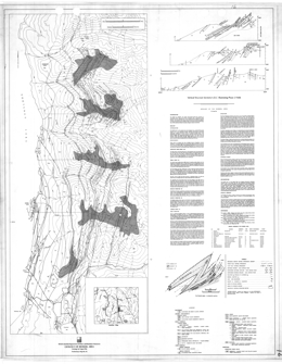
T. Höy
Preliminary Map 16 describes the geology of the Riondel area of British Columbia.
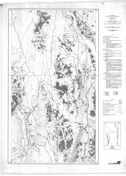
V.A. Preto, S.J. Atkinson and J. Nebocat
Preliminary Map 17 describes the geology of the Allison Lake - Missezula Lake area of British Columbia.
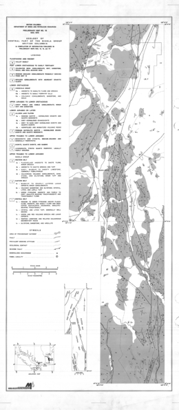
P.A. Christopher, D. Coombes, V.A. Preto, T.E. Kalnins, N.A. Thomsen and J. Nebocat
Preliminary Map 18 describes the geology of the central part of the Nicola Group, British Columbia.
H.D. Meade
Preliminary Map 19 describes the geology of the Germansen Lake area in British Columbia.
D.G. Bailey
Preliminary Map 20 describes the geology of the Morehead Lake area (93A/12) in south central British Columbia. The Preliminary Map consists of a geology map at 1:31 250 scale and accompanying notes.
The lowermost rocks in the area are argillite, sandstone, conglomerate and limestone of possible Norian age. Overlying is unit 2, which consists of green and maroon basaltic andesites, which have pyroxene with or without hornblende phenocrysts. Flows, volcanic breccias, lahars, pillow lavas and pillow breccias occur. Above unit 2b, nearly all the rocks are maroon. Rocks of unit 2c tend to be highly amygdaloidal. Units 2d to 2e are basaltic with analcite phenocrysts. Polylithic laharic breccia comprises unit 2f. Unit 2g consists of pyroxene basaltic andesite or hornblende-pyroxene andesite. Unit 2h pyroxene basaltic andesites occur as dikes or feeders for 2g. The style of volcanism changed and unit 3 is characterized by the presence of felsic clastic material of trachytic, latitic, syenitic, and monzonitic texture and composition. Polylithic laharic breccias are typical. Sedimentary interlayers in unit 3 are limestone, immature sandstone, conglomerate, and mudstone. It may be of Hettangian age. A series of monolithic felsic breccias, brecciated syenite plugs and tuffs may represent eroded felsic dome complexes. Unit 4 is similar to the maroon basaltic andesites of unit 2, except that it is analcite-rich and plagioclase is rare. Unit 5 comprises quartzofeldspathic sandstone and grit. It is Cretaceous or younger.
Intrusive rocks form three main groups. The oldest are medium to fine-grained monzonites and diorites. Somewhat younger are medium- to fine grained syenites and monzonites that comprise the bulk of the Mount Polley stock. These returned a K-Ar age of 184±5 m.y. and intrude Hettangian Weyla-bearing strata. The Bootjack stock is nepheline syenite. It is likely Lower Jurassic or younger. There are also possible Cretaceous intrusions, mainly quartz monzonite dikes and monzonite plugs that cut unit 4 rocks.
Block faulting is the dominant structural style of the map-area. Northeasterly striking faults are the most common. Most dip steeply.
Five kinds of copper deposits have been recognized in the area. These are: copper associated with amygdaloidal basalts; stratiform deposits, chalcocite in felsic sandstone; alkalic porphyry deposits, like the Cariboo Bell (later called the Mount Polley) deposit, which is associated with syenites and monzonites; copper in hornblende diorite and monzonite, where copper minerals occur in pyrite zones; and copper and molybdenum in quartz monzonite. Alluvial gravels along the Cariboo and Quesnel rivers also contain some placer gold.
V.A. Preto
Preliminary Map 21 describes the geology of the Nicola Group, south of Allison Lake, British Columbia
Superseded by Open File 1990-32.
P.A. Christopher
Preliminary Map 22 is a 1:3 000 000-scale map which shows radioactive occurrences in British Columbia.
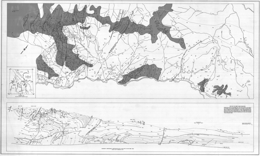
S.J. Atkinson
Preliminary Map 23 describes the geology of the Toby Creek area of British Columbia.
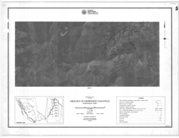
D.E. Pearson, F.B. Gigliotti and D.A. Grieve with N.C. Ollerenshaw
Preliminary Map 24 describes the geology of the northwest portion of the Crowsnest Coalfield in British Columbia.
25-49
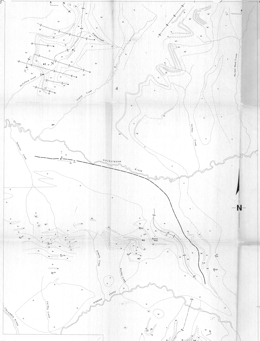
R.L. Brown, T. Höy, L. Lane
Preliminary Map 25 describes the geology and mineral deposits of the Goldstream area (82M), which includes about 400 square kilometres of mountainous terrain in the northern Selkirk Mountains of southeastern British Columbia. The geology map is at 1:50 000 scale and cross-sections, structural domain plots, and lists of mineral occurrences.
The geology of the area consists of intensely deformed Late Proterozoic/Early Paleozoic metasedimentary and metavolcanic rocks, which have been intruded by a number of granitic plutons. The metasedimentary and metavolcanic rocks comprise a heterogeneous package of quartzites, schists, phyllites, calc-schists, and carbonates, interlayered with greenstone and chloritic phyllite.
The greenstones and chloritic phyllites are metamorphosed equivalents of tholeiitic flows and basic tuffs. Derivatives of more acid volcanic rocks may now be preserved as quartz-sericite phyllite, quartz-augen phyllite, quartz-feldspar-sericite-chlorite phyllite, and perhaps some of the 'grit' unit.
Horsethief Creek Group rocks are separated into three units. The lower unit consists of pelitic schists, marbles and amphibolites and are the oldest strata exposed. The middle unit comprises marbles and calcareous pelitic schists, and the upper unit rocks are very similar to those of the overlying Lowe Paleozoic package. The Paleozoic package consists of quartzites, semi-pelites, psammites, grits, pelitic rocks including graphitic schists, marbles impure marbles, metavolcanic rocks and amphibolites.
The structure of the area is dominated by tight to isoclinal, north trending Phase 2 folds. These folds are interpreted to have developed in an initially inverted panel of rocks, which may be the underlimb of an earlier (Phase 1) nappe.
The most important mineral deposits of the area are stratabound copper-zinc deposits. They include Standard, in a basic volcanic pile, and Montgomery and Goldstream, contained in metasedimentary rocks.
Goldstream is a sheet of massive sulphides (dominated by pyrrhotite, sphalerite, and chalcopyrite) 3 to 4 metres thick, 500 metres wide, and at least 1 200 metres long. It occurs within a quartz-rich phyllite that is structurally overlain by a spessartine-chlorite phyllite and chert unit, which in turn is overlain by 220 metres of dark calcareous phyllite. The massive sulphide layer and quartz-rich phyllite are underlain by a grey limestone.
Massive sulphide deposits in the Goldstream area are similar to the 'bedded cupriferous iron sulphide' or 'Besshi' deposits. They are commonly bed-like in form, are composed primarily of iron sulphide/chalcopyrite ore, and occur in geosynclinal crystalline schists associated with basic submarine volcanism.
Placer and lode gold occurrences are also known.
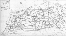
Ken E. Northcote
Preliminary Map 26 describes the geology of the Iron Mask Batholith in British Columbia.
D.E. Pearson and D.A. Grieve
Preliminary map 27 shows the geology of the west part of the Crowsnest Coalfield in British Columbia with 5 orthophotos.
Superseded by Preliminary Map 36
T. Höy
Preliminary Map 28 describes the geology and mineral occurrences of the Estella-Kootenay King area (82G/11, 12, 13, 14) in the Hughes Range of southeastern British Columbia. The map is at 1:25 000 scale and includes a legend, cross sections and diagrams portraying paleo-directional structures, such as cross beds. It represents work done in 1976 and 1977. An updated version of the geology is presented in Preliminary Map 36.
The oldest strata in the area are within the Helikian (Proterozoic) Purcell Supergroup. The lowest unit exposed consists of siltstones and quartzites of the Fort Steele Formation. These are overlain by the Aldridge Formation with a lower unit consisting mainly of finely laminated argillite and siltstone, a middle unit of dominantly quartzite and siltstone interlayered with dark argillite, and an upper unit of argillite with minor siltstone. The overlying Creston Formation consists mainly of siltstone, argillite and quartzite with colours ranging from white to green to purple and locally abundant mud cracks, cross beds and grades beds. Above is the Kitchener-Siyeh Formation, which consists primarily of dolomite, siltstone, and siltstone-argillite couplets. Gateway Formation quartzite and siltstone are overlain by massive to amygdaloidal andesitic lava and all the older rocks are cut by Purcell sills and dikes.
Cambrian dolomite and marble overlie the Proterozoic rocks. The only intrusive rocks in the area are Cretaceous (?) quartz monzonite and syenite.
Large scale overturned folds are offset by north-south faults and east-west cross faults. Reverse faults are generally steeply inclined and shallow normal faults or slides occur.
The past producing Estella and Kootenay King deposits are within the map-area. Estella is classified as a polymetallic vein deposit with commodities Ag-Pb-Zn±Au. The veins also carry cadmium and copper values. Kootenay King is classified as a sedimentary exhalative deposit with commodities Zn-Pb-Ag. The deposit also has values in cadmium, copper and gold.
P.A. Christopher
Preliminary Map 29 presents the geology and mineral occurrences of the east Okanagan uranium area (82E/10, 11, 14, 15) from Kelowna to Beaverdell in south central British Columbia. The map portrays the geology at 1:50 000 scale and has a legend and marginal notes.
The focus of the study was uranium-bearing Tertiary strata. The basement rocks were not studied in detail. The oldest strata in the area are layered gneisses of the Monashee Group.
Metasedimentary and metavolcanic rocks comprise the Anarchist Group or Wallace Formation. Cache Creek Group is dominated by greenstone. Nelson plutonic rocks are mainly quartz diorite to granodiorite and are part of the basement package. The Valhallah plutonic rocks are dominantly quartz monzonites, which are locally megacrystic with large potassic feldspar crystals, and related pegmatites. The Kettle River Formation rocks contain many rhyolite flows and tuffs and may be extrusive equivalents of the Valhallah plutonic rocks. Tuffs, flows and related volcaniclastic sedimentary rocks of the Kamloops Group may correlate with rocks of the Marron Formation.
Coryell intrusives are mainly syenite and monzonite; many have high background radiation. The Marama (?) Formation consists mainly of dacite. Miocene and Pliocene plateau basalts are olivine bearing and generally flat-lying. They form the main capping to the unconsolidated fluvial and lacustrine sediments that host the uranium deposits.
Uranium mineralization occurs in unconsolidated fluvial or lacustrine carbonaceous sediments that are capped by an impervious cover. Coryell or Valhallah intrusive rocks or their extrusive equivalents are the key basement rocks. The distribution of the plateau basalts is controlled by strong faulting that probably represents ground preparation for mineralization. Other metals of potential interest found in the map-area are molybdenum, copper and tungsten.
W.J. McMillan, J.D. Blanchflower, P.M. McAndless, D. Coombes, P. Garvin
Preliminary Map 30 includes a 1:100 000-scale colour geological map of the Guichon Creek Batholith and Highland Valley porphyry copper district of British Columbia and a compilation of 10 sheets of 1:2500-scale maps. The area covers NTS maps 092I/02W, 06E, 07W, 10W, 11E and small areas of 14E and 15W.
F.B. Gigliotti, D.E. Pearson
Preliminary Map 31 presents the geology of the northeast part of the Crowsnest Coalfield in southeastern British Columbia. The Preliminary Map consists of 3 sheets. Each is a 1:10 000 scale geological map with legend, explanatory notes and sections through the coal measures showing coal seams.
The maps show the distribution of coal seams of the Jurassic-Cretaceous age Kootenay Formation in the vicinity of Mount Taylor at the north end of the southern Dominion Coal Block. The coal measures, which occur between the basal sandstone and the overlying Blairmore Group on the east side of Mount Taylor, are approximately 500 metres thick. To the south of Leach Creek, this interval occupies 180 metres with only two coal seams. Here the East Crop fault, a low angle normal fault, has evidently displaced about two-thirds of the succession.
The rank of the coal has been measured. In the Leach Creek area, high-volatile bituminous coals are separated across the East Crop fault from low-volatile coals. All medium-volatile coals have been displaced on the fault. The rank of the coals decreases northward over the Barnes anticline, so that on the east side of Michel Head, the seam overlying the basal Moose Mountain sandstone is of medium-volatile rank.
Seam correlation on the west side of Mount Taylor is difficult because there is a normal fault with downthrow to the east.
The area is structurally complex. The dominant feature of the area is the East Crop fault, the throw of which increases toward the south. The Barnes anticline is a major structural slip fold that affects the coal measures in the Michel Ridge area. Thrusting repeats both coal measures and the basal Moose Mountain sandstone at the north end of Michel Head.
T.E. Kalnins
Preliminary Map 32 consists of 2 figures and a table. Figure 1 shows the survey areas. Figure 2 is a composite map of the geology, letter-coded mineral occurrences and numbered sample location sites. Table 1 presents analytical results of the stream sediments and stream waters.
R.D. Gilchrist and B.P. Flynn
7 geological maps plus index map.
M.E. McMechan
Preliminary Map 34 describes the geology of the Mount Fisher-Sand Creek area, east of Fort Steele in southeastern British Columbia. The 1:50 000 scale geology map has a legend, cross sections, and a table of mineral workings. Accompanying notes describe the geologic setting.
The oldest exposed rocks are of Middle Proterozoic Purcell Supergroup rocks. The Aldridge Formation consists of a quartzite, grey siltite, and argillite unit is overlain by a grey siltite, argillite unit with two dolomitic siltite layers near the top. The Creston Formation has two units. The lower has three subdivisions: a siltite with or without quartzite unit, a green siltite unit, and a purple siltite, white quartzite unit; the upper has two subdivisions: a coarse siltite to fine quartzite and white quartzite unit, and a mainly green siltite unit with dolomitic siltite near the top and white quartzite. Kitchener Formation has a lower dolomitic siltite and green siltite unit, and a silty dolomite, dolomitic siltite, siltite and stromatolytic dolomite unit. Above the Kitchener is a generally green non-dolomitic siltite unit. Middle Proterozoic rocks include parts of the Purcell Supergroup and a metadiorite to metagabbro Moyie sill. The lowest lava and sediment unit consists of andesitic lava, sandstone and siltite. The Sheppard Formation has stromatolytic dolomite, siltite, quartzite, and silty dolomite. The Gateway Formation contains siltite with dolomitic siltite near the top. The Phillips Formation consists of red micaceous quartzite and siltite. Cambrian rocks are represented by the Eager Formation with shale, limestone, siltstone and quartzite, and the ‘Tanglefoot Unit’ with shaly limestone, limestone, sandy shale and dolomite. Middle Devonian and perhaps earlier rocks comprise shaly limestone, shaly dolomite, limestone breccia, and gypsum. Upper Devonian to Permian rocks are undifferentiated limestone, shaly limestone, shale, quartzite, and dolomitic quartzite.
The area is divided into three segments by the right lateral, reverse Dibble Creek and Bull Canyon faults. The stratigraphy of the Purcell Supergroup differs in each segment. The Dibble Creek fault trends easterly and dips northerly. North of the fault are a series of asymmetric overturned anticlines; cleavage is axial to these structures. The entire region is cut by a series of northeast trending transverse faults with complex offsets. South of the fault, the area forms part of the upright limb of the Hosmer Nappe.
One important copper-silver-gold deposit and numerous smaller copper-gold and/or lead-silver with or without zinc showings. Known showings are veins, generally in the Aldridge and Creston Formations. The Bull River deposit consists of chalcopyrite-siderite-quartz veins that cut argillite, siltite and quartzite of the Aldridge Formation.
revised by B.N. Church
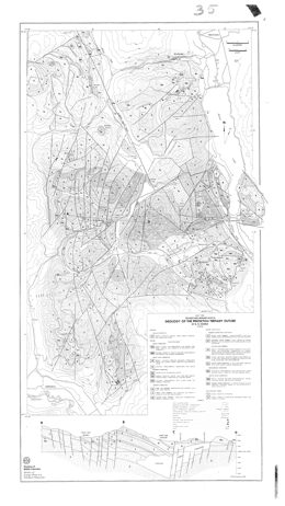
Preliminary Map 35 describes the geology of the Penticton Tertiary outlier, southwest of Penticton and north of Keremeos in southern British Columbia. The 1:50 000 scale geology map includes a legend and a cross section.
The basement rocks to the Tertiary sequence consists of pre-Tertiary sediments, including chert, metavolcanic and schistose units, and mainly granitic intrusions. Early Cenozoic rocks of the Kettle River Formation, Springbrook Formation, the Marron Formation, the Marama Formation, the White Lake Formation, and the Skaha Formation are exposed. The Kettle River Formation consists primarily of the Shingle Creek porphyry, and conglomerate, arkose, wacke and rhyolite breccia. The Springbrook Formation consists mainly of polymictic conglomerate and breccia.
The Marron Formation contains the Yellow Lake member, which has a lower sill-like body, the Clark Creek porphyry, a wacke, ash flow, sandstone and conglomerate unit, and a unit dominated by mafic phonolite, the Shatford Creek member, an andesitic flow and breccia unit, the Kitchley Lake member, which is made up of trachyandesite flows, the Kearns Creek member of pyroxene phyric basalt, the Nimpit Lake member with mainly trachyte and trachyandesite flows and minor breccia units, and the Park Rill member, which is andesitic lava. Marama Formation is represented by rhyolitic pyroclastic rocks, volcanic conglomerate, and dacite lava and breccia. The White Lake Formation consists of a unit with volcanic conglomerate, sandstone, and shale, and a unit with mostly volcanic breccias. Skaha Formation rocks consist of a unit with granite boulder conglomerate and breccia, and arkosic sandstone, and a unit with slide breccia with mainly chert and greenstone clasts, and fanglomerate deposits.
Block faults with mainly northeast, north and northwest trends dominate the Tertiary map pattern. Normal and reverse movement have tilted the Tertiary strata.
The Dusty Mac mine is hosted by dacites of the Marama Formation. The deposit comprises polymetallic veins with silver-lead-zinc-gold values. It is an epithermal silver-gold, low sulphidation deposit. Potential exists for similar deposits in the area.
T. Höy
Supersedes Preliminary Map 28.
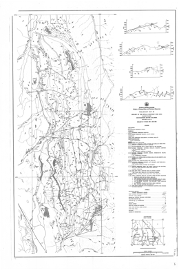
Preliminary Map 36 describes the geology and mineral occurrences of the Estella-Kootenay King area (82G/11, 12, 13, 14) in the Hughes Range of southeastern British Columbia. The map is at 1:50 000 scale and includes a legend, cross sections and diagrams portraying paleo-directional structures, such as cross beds. It represents work done in 1976, 1977 and 1988. An earlier version of the geology was published as Preliminary Map 28.
The oldest strata in the area are within the Helikian (Proterozoic) Purcell Supergroup. The lowest unit exposed consists of mud-cracked siltstone, argillite and quartzites of the Fort Steele Formation. These are overlain by the Aldridge Formation with a lower unit consisting mainly of finely laminated argillite and siltstone but also dolomite and dolomitic siltstone, a middle unit of dominantly quartzite and siltstone interlayered with dark argillite, and an upper unit of argillite with minor siltstone. The overlying Creston Formation consists mainly of siltstone, argillite and quartzite with colours ranging from white to green to purple and locally abundant mud cracks, cross beds and grades beds. Above is the Kitchener Formation, which consists primarily of dolomite, silty dolomite and siltstone. Above is a siltstone unit, Purcell lavas with interbeds of siltstone and argillite. The overlying Sheppard Formation consists of dolomite, siltstone and quartzite. The Gateway Formation siltstone, argillite, dolomite and limestone are overlain by red to purple argillite and siltstone of the Phillips Formation, then green siltstone and argillite of the Roosville Formation. All the older rocks are cut by Purcell sills and dikes.
Overlying but still Hadrynian conglomerate, siltstone and argillite are within the Toby Formation.
Cambrian dolomite and marble of the Jubilee Formation and quartzite of the Cranbrook Formation overlie the Proterozoic rocks. The only intrusive rocks in the area are Cretaceous (?) quartz monzonite and syenite.
Large scale overturned folds are offset by north-south faults and east-west cross faults. Reverse faults are generally steeply inclined and shallow normal faults or slides occur.
The past producing Estella and Kootenay King deposits are within the map-area. Estella is classified as a polymetallic vein deposit with commodities Ag-Pb-Zn±Au. The veins also carry cadmium and copper values. Kootenay King is classified as a sedimentary exhalative deposit with commodities Zn-Pb-Ag.
The deposit also has values in cadmium.
B.N. Church
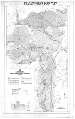
Preliminary Map 37 presents the geology of the Terrace Mountain Tertiary outlier in southern British Columbia. The 1:50 000 scale geology map includes a legend and a cross section.
Pre-Tertiary rocks in the area are bedded rocks including metavolcanics, limestone, schists, chert and quartzite, and mainly granitic intrusions. Six Eocene units are mapped. The lowest consists of sandstones, shales, and coarse conglomerate. Above are units of mainly andesite and dacite lava and breccia, feldspar phyric andesite lava and hornblende trachyte (?), syenite and monzonite feeders to Marron lavas, rhyolite tuff breccia and glassy lava, and dacite and andesite lava and breccia. Possibly Miocene feeder dikes and remnants of olivine basalt lava flows occur on hillsides and ridge tops.
The structure of the area is dominated by block faults that tilted the Tertiary strata. Northerly trending faults predominate; other faults trend northeast and northwesterly.
The Tertiary rocks have potential for epithermal precious metal deposits.
D.G. McIntyre
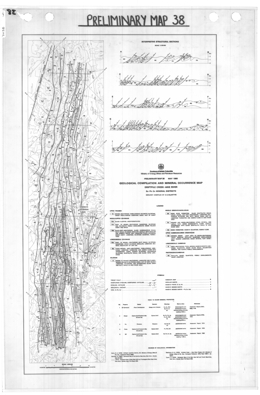
Preliminary Map 38 presents the geology and mineral occurrences of the Driftpile Creek - Akie River Ba-Pb-Zn Mineral District in British Columbia. The 1: 250 000-scale map includes interpretive structural sections at a 1:125 000-scale.
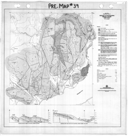
B.N. Church
Preliminary Map 39 describes the geology of the Kelowna Tertiary outlier (west half) along the north side of Okanagan Lake in southern British Columbia. The 1:50 000 scale geology map includes a legend and cross sections.
The basement rocks to the Tertiary sequence consists of pre-Cenozoic sediments, including chert, argillaceous rocks, metavolcanic and schistose units, and mainly granitic intrusions of the Early Cretaceous to Late Jurassic Okanagan batholith. Early Cenozoic rocks of the Springbrook Formation, the Kettle River Formation, the Marron Formation, the Marama Formation, and the White Lake Formation are exposed. The Springbrook Formation consists mainly of conglomerate channel deposits. The Kettle River Formation consists primarily of the Trepannier rhyolitic lava and breccia unit. The Marron Formation has a lower andesitic flow and breccia unit cut by Coryell granite to syenite intrusions, the Kitchley Lake member, which is made up of trachyte and trachyandesite flows, and the Nimpit Lake member with mainly trachyandesite flows and minor ash flow units. Marama Formation is represented by the Mount Boucherie dacite dome, which is comprised of flows and breccias. The White Lake Formation consists of conglomerate, sandstone, and minor shale. Much younger plateau alkali basalt (11.8 Ma) and valley basalt (0.7 Ma) also occur.
Block faults with mainly north and northwest trends dominate the Tertiary map pattern. Normal and reverse movement have tilted the Tertiary strata.
The area is prospective for epithermal precious metal deposits.
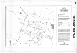
G.E.P. Eastwood
Preliminary Map 40 describes the geology of the Mount Richards area near Crofton on southern Vancouver Island. The 1:15 840 scale geology map includes a legend and notes about the geology.
The Sicker Group is host to the Lenora-Tyee gold-silver-copper-lead-zinc-cadmium orebodies on Big Sicker Mountain and to the orebodies of Western Mines Limited near Buttle Lake. The latter orebodies appear to be controlled stratigraphically as well as structurally, therefore detailed mapping was begun to determine the stratigraphic sequence near the type area. On Big Sicker Mountain the nature and relationships of the rocks are obscured by intense shearing, but in the Richards group intense shearing is largely confined to the most northerly ridge.
In the north part of the Richards group there is a north-south progression of rock types in the Sicker Group, which appears, from comparison with the sequence in the Cowichan Lake area, to be in order of increasing age. Poor graded bedding in a few places is consistent with this interpretation. Along the crest and south face of Mount Richards ridge the Sicker rocks are more or less coarsely fragmental and include at least two bands characterized by medium to coarse hornblende grains in a fine-grained matrix. These grains may be phenocrysts but are more likely pyroclastic. It is uncertain whether the sequence is homoclinal or whether the hornblendic layer has been repeated by folding.
The Sicker rocks have been successively intruded by mainly small bodies of quartz-feldspar porphyry and medium to large bodies of shonkinite. The shonkinite resembles gabbro in texture and the abundance of dark minerals, but the feldspar is albite-oligoclase. The older rocks are overlapped on the north by poorly exposed clastic sedimentary rocks of the Nanaimo Group, and are probably in fault contact with them to the south. Post-Nanaimo faulting has produced a Sicker inlier along the Chemainus River.
Pyrite is common to abundant, particularly in the Sicker upper division, but contains only traces of gold and silver. Small amounts of chalcopyrite and malachite occur in several small shear zones and quartz veins.
The area is prospective for Noranda/Kuroko massive sulphide copper-lead-zinc-precious metal deposits.
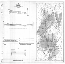
B.N. Church
Preliminary Map 41 presents the geology of the Rock Creek Tertiary outlier in southern British Columbia.
The 1:50 000 scale geology map includes a legend and cross sections.
The basement rocks to the Tertiary sequence consists of pre-Cenozoic basic intrusions, including serpentinite and peridotite, and metasediments, including conglomerate, chert, argillaceous rocks, metavolcanic and metasedimentary units (Anarchist Assemblage). There are also mainly granitic intrusions of the Late Jurassic to Early Cretaceous age . Early Cenozoic rocks of the Springbrook Formation, the Kettle River Formation, and the Marron Formation are exposed. The Springbrook Formation consists mainly of polymictic conglomerate. The Kettle River Formation consists primarily of the Ed James Lake member, of fanglomerate, breccia and arkose, and the Storm Hill member, of sandstone that passes laterally to shale with carbonaceous seams. The Marron Formation consists of the Yellow Lake member, which consists mainly of pyroxene-rich mafic phonolite lava and associated dikes, tuff and breccia, the Rock Creek chonolith, which is a variety of Coryell syenite, and the Kitley Lake member, which is made up of trachyandesite flows, and equivalent dikes.
Block faults with mainly north, northeast and northwest trends dominate the Tertiary map pattern. Normal and reverse movement have tilted the Tertiary strata.
The area is prospective for epithermal precious metal deposits.
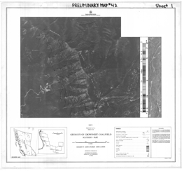
D.E. Pearson and D.A. Grieve
Preliminary Map 42 presents the geology of the southern part of the Crowsnest Coalfield in southeastern British Columbia. The Preliminary Map consists of 7 sheets that wrap around the south end of the coalfield. Each is a 1:10 000 scale geological map with legend, explanatory notes and sections through the coal measures showing coal seams.
The maps show the distribution of coal seams of the Jurassic-Cretaceous-age Kootenay Group in the vicinity of Morrissey Creek and Flathead Ridge, across the western part of the South Dominion Coal Block (Parcel 82). At the south end of Morrissey Ridge (section G-H) the thickness of the coal measures is 560 metres, of which 10 per cent is coal; the structurally thickened section exposed on Flathead Ridge (K- J) is by contrast 770 metres thick yet did not reach the overlying Elk Formation. Of this succession, 11 per cent is coal.
The rank of coal has been determined by measuring in oil the mean maximum reflectance (Ro) of the coal maceral vitrinite. Values >1.51 per cent indicate low volatile bituminous coal; values <1.51 per cent indicate medium volatile bituminous coal. All coals exposed in Morrissey Creek valley are of low volatile rank; all coals exposed beneath the Flathead Ridge fault are low volatile in rank. Medium volatile coals are restricted to the structural plate riding on the Flathead Ridge fault, though they are also present on the eastern margin of the map sheet close to the ridge crest.
The rank of coal changes down-dip of seams. For example, the seam at 400 metres elevation above the basal sandstone with Ro maximum of 1.38 per cent shown in section G-H has increased in reflectance in Morrissey Creek valley to 1.65 per cent Ro. This is because much of the coalification in this area of the coalfield occurred subsequent to folding and tilting.
Flathead Ridge fault, which cuts across the hinge zones of a syncline-anticline couple at the south margin of the sheet, is a post-coalification structure that separates coal of markedly different rank. Overturned, constrictional structures at the southern extremity of the fault may indicate a thrust component prior to normal movement of about 1 000 metres (vertical).
Moving south along the strike of the measures on Morrissey Ridge, there is an increase in rank, so that at the south end of the map sheet the coals exposed in the lower half of the succession are of low volatile rank. The Ridge exposes a striker section of coal measures with the thickest development of the overlying Elk Formation in the Crowsnest Coalfield. However, correlation of individual seams is difficult due to rapid changes in lithology.
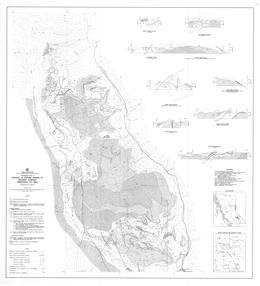
T. Höy, R.L. Brown
Preliminary Map 43 describes the geology of the eastern margin of the Shuswap complex in the Frenchman Cap area northwest of Revelstoke, British Columbia. The 1:100 000 scale geology map includes a legend, references, and a series of geologic cross sections.
The Aphebian (?) core gneiss complex consists of a unit of dominantly granitic orthogneiss and paragneiss, and a unit of mixed paragneiss and orthogneiss, biotite-hornblende gneiss, amphibolite and minor calc-silicate gneiss, micaceous schist and quartzite. The age of the autochthonous Monashee complex cover is unknown. Five units in the cover succession are: basal quartzite with minor conglomeratic quartzite, schist and calc-silicate gneiss; calc-silicate gneiss, sillimanite and kyanite-bearing schist, quartzite, hornblende gneiss and marble with local carbonatite layers; quartzite, schist, quartzofeldspathic grit and gneiss with local amphibolite interbeds; micaceous schist, hornblende gneiss, calc-silicate gneiss, marble and quartzite; and nepheline syenite gneiss and syenite gneiss. Allochthonous Hadrynian (?) cover rocks consist of pegmatite-laced quartz-biotite-feldspar paragneiss, amphibolite, hornblende gneiss, and calc-silicate gneiss. Apparently younger porphyritic granite gneiss has also been mapped.
The area is structurally complex. Early deformation produced isoclinal folds that are subsequently refolded during later events. The complex is bounded to the east by the east-dipping Columbia River fault and the contact of the allochthonous cover is marked by a shallow west-dipping fault. Moderately inclined west-dipping faults cut the rocks of the complex and younger high angle faults are normal and reverse.
The area has a known stratabound lead-zinc-silver deposit south of Hiren Creek and a former producing molybdenum mine at Mount Copeland. The stratabound base metal deposit is in the calc-silicate gneiss, marble and micaceous schist unit. They are interpreted to be of Broken Hill or Sedimentary Exhalative type. The molybdenite mineralization is associated with syenite and nepheline syenite. The nepheline syenite may also have industrial mineral potential.
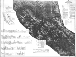
D.G. McIntyre
Preliminary Map 44 describes the geology of the Akie River Ba-Pb-Zn Mineral District of British Columbia.
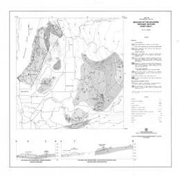
B.N. Church
Preliminary Map 45 describes the geology of the Kelowna Tertiary outlier (east half) along the north side of Okanagan Lake in southern British Columbia. The 1:50 000 scale geology map includes a legend and cross sections. It adjoins Preliminary Map 39.
The basement rocks to the Tertiary sequence consists of pre-Cenozoic sediments, including argillaceous rocks, limestone, and metavolcanic rocks, schistose and gneissic units, and mainly granitic intrusions of the Early Cretaceous to Late Jurassic Okanagan batholith. Early Cenozoic rocks of the Kettle River Formation, the Marron Formation, and the White Lake Formation are exposed. The Kettle River Formation consists of a lower siltstone and sandstone unit, a central rhyolitic lava and breccia unit, and the Black Knight dacite lava and breccia unit. The Marron Formation has a lower andesitic flow and breccia unit, the Kitchley Lake member, which is made up of trachyte and trachyandesite lava flows, and the Nimpit Lake member with mainly trachyte and trachyandesite lava flows. The White Lake Formation consists of sandstone and siltstone with some carbonaceous seams. The much younger Daves Creek plateau basalt (14.9 Ma) also occurs.
Block faults with mainly north-northeast and northwest trends dominate the Tertiary map pattern.
The area is prospective for epithermal precious metal deposits.
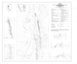
G. Gibson
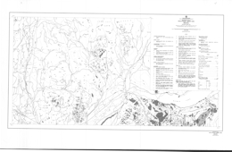
Preliminary Map 46 describes the geology of the Munroe-Alpine-Boivin carbonate-hosted lead-zinc occurrences in the Rocky Mountain Front Ranges (82J/3E) in southeastern British Columbia. The 1:25 000 scale geology map includes a legend, descriptive notes, 1:10 000 scale insert maps for each of the three occurrences, and three cross sections.
The Paleozoic and/or younger rocks comprise the Bull River amygdaloid. Upper Cambrian and Lower Ordovician McKay Group rocks are mainly shale and limestone. Lower and Middle Ordovician strata consist of shale, siltstone, argillaceous limestone and sandstone of the Glenogle Formation, and sandstone of the Tipperary Formation. Middle Ordovician to Lower Silurian Skoki Formation rocks are mainly limestone and dolomite, the Mount Wilson Formation consists of quartzite, and the Beaverfoot Formation is made up of cliff forming dolomite and limestone. Middle and/or Upper Devonian strata of the ‘Basal Devonian Unit’ include dolomite, mudstone, sandstone, conglomerate and gypsum. Upper Devonian rocks include strata of the Fairholme Group, the Alexo Formation, and the Palliser Formation. Fairholme strata include argillaceous limestone with lesser dolomite and mudstone. Alexo Formation units are mainly sandstone, dolomitic sandstone, dolomitic siltstone; and mainly thinly interbedded dolomite and limestone. Palliser Formation is subdivided into two members: the Morro Member has a basal limestone with dolomitic mottling unit, a limestone and argillaceous limestone unit, a dolomite unit, a dolomite unit with fenestral porosity (has associated zinc mineralization), and a unit of limestone with dolomite mottling. The Costigan Member has a lower unit of interbedded dolomite and limestone, and an upper unit of thinly interbedded dolomite and limestone. Mississippian strata are represented by the Exshaw Formation, with mainly shale and limy shale, the Banff Formation, with a lower unit of mainly shale, limestone, argillaceous limestone and chert, and an upper unit dominated by limestone, the Livingston Formation, with mainly limestone, the Mount Head Formation, with limestone and argillaceous limestone, and the Etherington Formation, with limestone, dolomite and siltstone. Pennsylvanian and Permian strata are quartz sandstone, dolomitic sandstone, silty dolomite, chert, and phosphorite of the Rocky Mountain Group.
Stratabound zinc mineralization is confined to the Lower Morro Member of the Upper Devonian Palliser Formation. The distinctive dolomite host has fenestral porosity developed and sparry white dolomite. Zinc mineralization post-dates the sparry dolomite. It occurs as disseminations and pods. The area may also have potential for the industrial minerals phosphorous and gypsum. The Munroe, Alpine and Boivin showings are all on the inverted limb of a major eastward verging anticline. The folded strata are also cut by a series of steep west dipping normal and listric normal faults. West of the Alpine occurrence the fold is truncated by a moderately dipping thrust fault.
W.J. McMillan
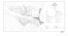
Preliminary Map 47 describes the geology and mineral occurrences of the Merritt area (92I/2f, 2g and 2h) in south central British Columbia. The two geology maps are at 1:25 000 scale and depict outcrops and mineral occurrence locations.
The oldest rocks exposed are mainly volcanic units of the Late Triassic Nicola Group. Components of the Nicola rocks are distinguished in some detail and are further separated into Central Belt, probably Central Belt and Western Belt assemblages. Central Belt rocks comprise 7 units. They are dominated by andesite to basalt flows that are typically augite phyric but include areas of laharic breccias, tuffs, limestone pods, greywacke, sandstone and siltstone. Extensive areas of epidote and potassic alteration are shown. Probable Central Belt rocks comprise 10 units. The assemblage is like that of the Central Belt but also includes a series of rhyolite flows, and felsic tuffs and fragmental volcanic rocks.
The Western Belt rocks comprise 16 units. Andesite with either plagioclase or augite phenocrysts form flows and breccias predominate but dacite flows and felsic breccias, ash flow tuffs, limestone, volcanic sandstone and siltstone, argillite and rhyolite units occur. Unconformably above the Nicola strata are Jurassic to perhaps Lower Cretaceous chert pebble to cobble conglomerate and Jurassic or Lower Cretaceous conglomerate, sandstone, siltstone and shale.
Cretaceous rocks include plagioclase and augite-plagioclase phyric flows and epiclastic rocks of the Kingsvale Group, and sandstone, arkose and shale of the Lower Cretaceous to perhaps Tertiary ‘Coldwater Beds’. The ‘Coldwater Beds’ are locally coal bearing. Rhyolite, andesite, basalt flows and fragmental volcanics are probably of Eocene age, and valley basalts were dated at about 500 000 years.
Intrusive rocks in the area include Triassic diorite, microdiorite and porphyry dikes, the Late Triassic Guichon Creek batholith, which varies from quartz diorite to granodiorite, and the Lower Jurassic or younger Pennask batholith, which is mainly granodiorite. All cut the Nicola Group rocks.
The area has potential for gold-copper vein, volcanogenic massive sulphide, copper-iron skarn and both alkalic and calc-alkalic porphyry copper deposits.
T. Ewing
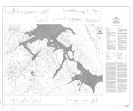
Preliminary Map 48 presents the geology of Tertiary rocks of the Afton-Tranquille area (92I/9, 10) west of Kamloops, British Columbia. The 1:50 000 scale geology map includes a legend.
The Late Triassic country rocks include argillites and meta-andesite and tuff of the Nicola Group. Unconformably over these is Jurassic polymictic conglomerate. Unconformably above the older rocks are Eocene Kamloops Group strata. The basal Kamloops Group unit is the Tranquille Formation. It consists of 8 units: basal lithic and arkosic wacke, shale and local coal; lacustrine mudstones, tuffaceous siltstones and tuff; coarse-grained andesite to basalt; siltstone, mudstone and tuff; lacustrine sedimentary rocks and tuffs; pillowed andesite, breccia and deformed sedimentary rocks; tuffs and lacustrine sediments; and hyaloclastite and aquagene tuff. The overlying Dewdrop Flats Formation contains 15 units: the Nipple basalt breccia; the Kissick andesite breccia; the Mara Hill member of basaltic andesite flows; the Wheeler Mountain breccia with 4 units: andesite flow breccia and mud flows, andesitic phreatic breccia and flow breccia, coarse andesite flow breccia, and phreatic basalt breccia; the Castle Butte plagioclase phyric andesite breccia, with local hyaloclastites and aquagene tuff; the Doherty Creek member of basaltic andesite, flows and intermediate to felsic tuffs; the Rosseau Mountain basalt breccia with local hyaloclastite facies; the Red Plateau member with basaltic andesite flows and sedimentary rocks; and the Opax aphanitic andesite flow breccia. Quaternary cover materials include gravels, terrace gravels, drift, proglacial lakebeds, delta fan deposits, landslide debris, alluvial fan deposits and alluvium.
Intrusive country rocks consist of Upper Triassic to Lower Jurassic diorite and syenite of both the Iron Mask batholith and the Cherry Bluff pluton. Tertiary intrusive rocks include the basal, middle and upper sills; the Battle Bluff diabasic intrusive complex; andesite dome-plugs and related sills; hypabyssal andesite; and andesite to dacite dikes and subvolcanic masses.
The Triassic rocks host the Afton alkalic porphyry copper deposits and have potential for other porphyry deposits and gold-copper veins deposits. The Tertiary strata have potential to host epithermal precious metal deposits.
T. Höy, L.J. Diakow
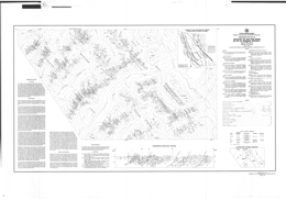
Preliminary Map 49 describes the geology of the Moyie Lake area (82G/W) in southeastern British Columbia.
Accompanying notes present results of a reconnaissance stream sediment sample survey of the Moyie Lake sheet.
The geology map is at 1:50 000 scale and includes a legend, 4 geological cross sections, descriptive notes, and references.
The Moyie lake area is underlain dominantly by clastic rocks of the Purcell Supergroup of Helikian and Hadrynian age. Two past producers, the Midway mine and the St. Eugene mine, numerous small silver-lead-zinc and copper vein occurrences, and placer gold on Moyie River make the area an attractive exploration target area. Virtually the entire area is below timberline with relief varying from approximately 929 metres (3,050 feet) near Moyie Lake to 2302 metres (7,554 feet) in the northwest corner. Exposure is generally poor, because many of the rounded hills and most valleys are covered by a veneer of Quaternary and Recent sand and gravel.
The oldest rocks within the map-area, rusty weathering siltstone and quartzite of the lower Aldridge Formation, occur in the hangingwall of the Moyie fault. They are sheared, tightly folded, and locally overturned adjacent to the fault. Moyie intrusive rocks (metadiorites) crosscut lower Aldridge rocks, although the general aspects of most are sill-like. Only the largest and most continuous are shown on the map, and these (as in the middle Aldridge) commonly consist of a number of separate intrusions with screens of sedimentary rocks. The boundary between the lower and middle Aldridge is gradational. It has been placed at the surface above which grey-weathering quartz-wacke beds predominate over siltite, although quartz wackes occur throughout the upper part of the lower Aldridge, and rusty weathering thin to medium-bedded graded siltite beds, typical of the lower Aldridge, occur in the basal part of the middle Aldridge.
Grey-weathering graded quartz-wacke beds interpreted to be turbidite deposits occur throughout the middle Aldridge. Basal scour marks indicate northerly-directed current transport. In general, in the middle Aldridge, quartz-wacke beds become thinner, less pure, and less volumetric up-section; the upper part comprises a number of distinct cycles of massive, grey quartzite-wacke beds capped by siltstone and argillite. The contact with the upper Aldridge is placed above the last bed of massive grey quartzite. Metadiorite sills are the most important markers within the thick middle Aldridge section and allow correlation across many of the faults. Some of the larger of these sills have been designated by letter symbols on the map.
The base of the Creston Formation is commonly marked by a thick, generally massive, grey quartzite unit. It is commonly overlain by dark argillite and siltstone that is distinguished from the upper Aldridge by the presence of thin green siltstone lenticles and occasional mud cracks. Green siltstone is characteristic of much of the Creston Formation, but may also be dominant in the basal unit of the overlying Kitchener Formation. The base of the Kitchener is placed beneath the first section containing prominent buff- weathering dolomitic siltstone. The contact between the Kitchener and the Van Creek Formation is gradational, from thin-bedded grey argillaceous limestone into grey siltstone with a few green and brown silty limestone layers in the basal part of the Van Creek Formation.
50-68
D.G. McIntyre
Preliminary Map 50 describes the geology of the Akie River Ba-Pb-Zn Mineral District of British Columbia.
D.A. Grieve and D.E. Pearson
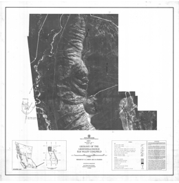
Preliminary Map 51 presents the geology of the Jurassic-Cretaceous Kootenay Group exposures on the Greenhills Range of the Elk Valley coalfield west and south of Fording in southeastern British Columbia. Coal-bearing lands belonging to Fording Coal and B.C. Coal were covered. The Preliminary Map consists of three 1:10 000 scale geology maps on an orthophoto base; each contains a legend and schematic sections showing the distribution of coal seams in the coal-bearing rocks.
Data presented are based on examination of surface outcrops and road-cuts, with minor air-photograph interpretation.
In many cases, poor exposure has limited the amount of data and has restricted the ability to correlate seams.
Seam pinch-outs and wash-outs are common, however, and account for many of the discontinuities in seam traces.
Kootenay Formation is composed of, from oldest to youngest, the Morrissey Formation (basal sandstone), Mist Mountain Formation (former Coal-bearing Member), and Elk Formation. The last, which occurs only in the north half of the map-area, includes a significant number of resistant sandstone units, which are not indicated on the map. The presence of Elk coal, alginite-rich coal, was used to identify the Elk Formation, while the contact between Elk and Mist Mountain Formations was arbitrarily placed at a mappable sandstone horizon.
Coal deposits in the map-area are west of the trace of the west-dipping Erickson fault system. Other major structures include the Greenhills fault, probably a splay of the Erickson fault, the Greenhills syncline, and the Fording Mountain anticline, which parallels the Greenhills syncline throughout the entire length of the Greenhills Range.
The rank of the coal has been determined by measuring the mean maximum reflectance in oil (Ro max) of the maceral vitrinite. Values >1.12 per cent indicate medium-volatile bituminous coal, while those <1.12 per cent indicate high-volatile coal. The entire coal-bearing section on Greenhills Range (in the area mapped) is high-volatile in rank, with the exception of the lowest one or two seams in the southern part of the range, which are medium-volatile. This is in marked contrast with the adjacent portions of the Elk Valley coalfield, including the Fording Coal Greenhills pits, where rank values of the basal seams are in the range of 1.30 to 1.40 per cent. The fact that the map-area sits west of the Erickson fault probably accounts for this contrast, as normal faulting in southeastern British Columbia occurred some time after coalification. In corollary, Fording Coal Greenhills pits must be separated from the map-area by a normal fault, probably the northward extension (not indicated on the map) of the Erickson fault.
P.A. Christopher, R.H. Pinsent
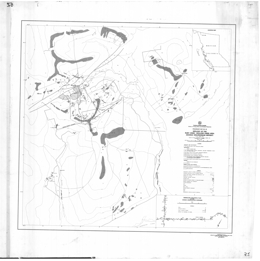
Preliminary Map 52 presents the geology of the Ruby Creek-Boulder Creek area (104N/11W) near Atlin in northern British Columbia. The area covered includes the Adanac molybdenum deposit. The 1:12 000 scale geology map includes a legend and a generalized geological plan of the Adanac underground workings. Ten pages of notes accompany the map. The bedrock geology of the Ruby Creek-Boulder Creek area is described in terms of 11 map units. The oldest rocks in the area are believed to be Permo-Pennsylvanian in age. They consist of crystalline limestone or skarn (unit 1) and undifferentiated metavolcanic or metasedimentary rocks (unit 2) of the Cache Creek Group, and serpentine or metaperidotite (unit 3) of the Atlin Intrusions. Metamorphic rocks generally strike northeasterly and dip westerly to the north of the Mount Leonard boss but have variable orientations southwest of it.
The Fourth of July batholith (unit 4) is a fairly uniform medium-grained biotite-hornblende diorite to granodiorite. This unit is generally fresh or weakly altered but contains minor quartz veining and aplitic dykelets near its contact with the Mount Leonard boss. The Atlin Ruffner silver-lead-zinc deposit, which is northwest of the map-area, is hosted by this unit. The multiphase Mount Leonard boss is divided into six main units that host the Adanac molybdenum deposit. A post-mineral equigranular granite phase encountered at a depth of 412 metres in drill hole 1W-1N has not been seen in outcrop.
The various units generally represent textural and mineralogical varieties of chemically similar units. K/Ar ages of the various units also suggest a nearly coeval emplacement of the phases. Field relationships indicate that either the mafic quartz monzonite or the coarse-grained quartz monzonite is the oldest unit and the aplitic phases or the equigranular granite is the youngest phase. Unit 5 (Mafic Sparse Aplite) is distinguished from other fine-grained quartz monzonite by higher biotite content and a mottled green colour. A sharp contact with unit 6 occurs just west of Molly Lake. Biotite appears to increase in this fine-grained phase near contacts with older metamorphic rocks.
Unit 6 (Fine-grained Quartz Monzonite) includes a variety of grey, aplitic, fine-grained equigranular and/or subporphyritic rocks. A gradation of equigranular to porphyritic varieties appears to occur. Crystallization of this rock type may have been controlled ~ fluid loss. Unit 7 (Crowded Quartz Monzonite Porphyry) has an average of 60 per cent subhedral to euhedral plagioclase, orthoclase (perthite), quartz, and biotite phenocrysts. The matrix is commonly aphanitic or aplitic, but locally becomes medium grained and the unit would be mapped as a hybrid coarse-grained phase. Unit 8 (Sparse Quartz Monzonite Porphyry) has similar mineralogy to crowded porphyry but carries between 10 to 30 per cent phenocrysts (2.0 to 6.0 millimetres). The matrix is brown aphanitic to fine grained or chilled.
Unit 9 (Mafic Quartz Monzonite Porphyry) is a distinctive grey rock characterized by disseminated fine biotite, chalky white plagioclase phenocrysts, and a seriate texture. The ragged feldspar and rare quartz phenocrysts (6.0 to 10.0 millimetres) lie in a finer (1.0 to 4.0-millimetre) quartz monzonite matrix. Nearly 5 per cent biotite is dusted through the matrix. The rock is significantly more biotite-rich than any of the other phases. It has been variously called granodiorite or quartz monzonite porphyry. Unit 10 (Coarse-grained Quartz Monzonite), previously mapped as coarse alaskite or coarse granite, is the most common rock type in both the Surprise Lake batholith and the Mount Leonard boss. It is weakly to moderately deformed and granulated and consists of pink to grey, equigranular, coarse-grained (0.5 to 3.0 centimetres) quartz monzonite. The rock consists of approximately equal amounts of perthitic potassium feldspar, intermediate plagioclase, and grey quartz. Much of the feldspar is seriate and there is commonly a small amount of fine-grained (2 to 4-millimetre) matrix. With increased abundance of matrix, the unit has been called 'transition' or 'hybrid.'
Olivine basalt (unit 11) of at least two ages occurs. The stratified mass that forms Ruby Mountain is considered to be older than columnar lava flows that wall Ruby Creek. The younger basalt may be related to the conelet mapped at the head of Cracker Creek. Altered late-stage mafic dykes exposed in the Adanac adit may also be related to this unit. Structure is important in the area. The Adera fault zone is bounded by the Molly Lake fault on the west and the Adera fault on the east. It has many connecting splays and forms the northern boundary of the Adanac deposit. Between Molly Lake and Ruby Creek the zone strikes north 65 degrees east and dips 80 degrees to the northwest. Geophysical surveys (EM and magnetic), diamond drilling for the proposed dam site, and mapping indicate a strike of north 45 degrees east for the eastern extension of the Adera fault. A dyke of crowded porphyry and the Black Diamond vein occupy structures that are subparallel to the Adera fault zone.
Four principal trends occur: 36 degrees/82 degrees southeast, 330 degrees to 345 degrees/70 degrees to 80 degrees southwest, 83 degrees/77 degrees northwest, and nearly horizontal. Molybdenum veins occur in the nearly horizontal and 36-degree structures. Trends of 265 veins measured in the underground workings confirm that many mineralized veins are nearly horizontal and that a lesser number strike northeastward. However, the workings also cut mineralized east-west structures with nearly vertical dips. Similarly, analysis of 171 barren fractures showed strong 25 degrees/75 degrees northwest, 355 degrees/nearly vertical, and east-west/near vertical trends. Both studies illuminate the key role that nearly horizontal fractures play in producing ore grade molybdenite mineralization.
Molybdenum mineralization occurs in all phases of the Mount Leonard boss, except the post-mineral equigranular granite. The 1 448-metre bench outline shows a doughnut-shaped mineralized body of greater than 0.06 per cent molybdenum that has been truncated by the Adera fault. The mineralized zone occurs mainly in coarse-grained quartz monzonite and fine-grained quartz monzonite that form a trough-like structure around a weakly mineralized sparse quartz monzonite porphyry core. An intrusive breccia body in the axis of the mineralized trough is well exposed in the underground workings.
Molybdenite occurs mainly as fracture coatings and in quartz veins. The modes of occurrence are as: rosettes in smoky quartz veins; fine-grained fracture coatings with quartz envelopes; quartz-pyrite-molybdenite-carbonate veins; molybdenite gouge on fault surfaces; molybdenite-bearing quartz veins with potassium feldspar and/or biotite envelopes; and quartz-molybdenite-fluorite-potassium feldspar-biotite veins.
Other vein and fracture types include: quartz veins; fracture coatings of pyrite with rare chalcopyrite and copper carbonates; pyrite-bearing quartz veins with rare chalcopyrite and copper carbonates; quartz, calcite, and chalcopyrite veins; potassium feldspar and/or biotite veins; quartz-wolframite, arsenopyrite, scheelite, and fluorite veins; fluorite, quartz, and pyrite veins; and carbonate veins.
Chalcopyrite is rare within the deposit; pyrite is less than 1 per cent and is restricted to veins and fractures. Examination of the adit area east of the deposit confirms the existence of pyrite. However, pyrite is equally abundant within the molybdenum deposit and no obvious pyrite halo was identified. The density of fluorite-bearing veins appears to increase in the fine-grained 'core' in the adit but regional rock geochemical studies show a fluorine halo around the deposit. Only one quartz-wolframite vein was identified in drill core from the northern margin of the deposit. However, quartz-wolframite-arsenopyrite veins and breccia zones are more common in the peripheral areas.
Information suggests a deposit with open pit mineable reserves of 151 971 000 tonnes of 0.063 per cent molybdenum with a 1.47 to 1 waste to ore stripping ratio.
The Adanac deposit lacks strong zonal alteration. The principal pervasive alteration consists of late chloritization of both biotite and feldspar, accompanied by minor sericite, clay, and carbonate alteration of feldspar. Locally, orthoclase develops peripheral to fractures, and silicification may extend a few centimetres beyond vein boundaries.
The YKR tungsten property is situated south and west of Adanac. It covers parts of the southerly contact between the Mount Leonard boss and Cache Creek metasedimentary rocks. The vein tungsten, contact skarn and porphyry potential of the property is presently being examined. Vein mineralization occurs mainly in the granitic rocks but has also been found in the contact zone.
The Black Diamond vein can be traced about 4 kilometres from near the Ruby Creek valley, where it strikes north 70 degrees east, to Boulder Creek where the strike is about north 50 degrees east. Veins consist of quartz, muscovite, arsenopyrite, and wolframite, with minor amounts of chalcopyrite, scheelite, molybdenite, cassiterite, fluorite, and gold. Diopside-tremolite-garnet skarn occurs in pendants in the stock and in contact metamorphosed Cache Creek rocks. The skarn carries pyrrhotite, pyrite, chalcopyrite, scheelite, wolframite, tetrahedrite, sphalerite, and fluorite. Bismuthinite (PbBi2S4) and possible tetradymite (BiTe2S) have been reported. Assays of up to 0.2 per cent tin have also been reported from the skarn occurrences.
Secondary uranium minerals, generally kasolite or zeunerite, occur in quartz veins or breccia zones with arsenopyrite, fluorite, tetrahedrite, chalcopyrite, and wolframite. Zeunerite has also been reported from the Black Diamond vein and the Purple Rose prospect.
More than 3 000 geochemical analyses of rocks from the Adanac deposit area indicate an average value of between 18 ppm and 20 ppm uranium. Values increased from about 13 ppm to 24 ppm as the phases evolved. No significant concentrations of uranium occur in the area of the Adanac deposit.
Eight holes were drilled by Cominco Ltd. to test for secondary uranium mineralization in paleostream sediments capped by olivine basalt flows on the Vol claim group between Boulder and Ruby Creeks. No significant uranium concentration was detected.
The Adanac molybdenum deposit occurs in the Mount Leonard boss, a composite quartz monzonite to granite stock, which is peripheral and probably related to the main body of the Surprise Lake batholith. The Mount Leonard boss and the Adanac deposit formed during a protracted Late Cretaceous (about 71 Ma by biotite K/Ar dating) intrusive and mineralizing event. Mineralization was localized in a trough-like structure that formed around the cupola of a quartz monzonite porphyry intrusive. Intersecting north-south, east-west, and northeast structures controlled the location.
The Adanac area differs from other parts of the Surprise Lake batholith in that there are finer grained phases that probably reflect rapid crystallization due to fluid loss. Release of pressure in the magma chamber resulted in reduced vertical pressure and horizontal fractures formed in the cupola area. Ore grade mineralization occurs where mineralized horizontal fractures coincide with mineralized north-south and east-west structures. Late movement along the Adera fault zone truncated the deposit on the northwest.
P. Schiarizza
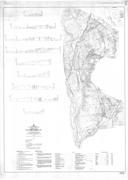
Preliminary Map 53 portrays the geology of the Barriere River-Clearwater area (82M/4, 5, 12; 92P/1, 8, 9) in south central British Columbia. The 1:50 000 scale geology map includes a legend, 8 geological cross sections, and a table of mineral occurrences.
The parautochthonous Eagle Bay Formation is Mississippian and perhaps older. Units within the Formation are: dominantly chloritic phyllite, schist, and schistose volcanic breccia with lesser carbonates, quartzite and phyllite and includes white crystalline limestone and white quartzite interlayers; quartz phyllite and muscovite-quartz schist with lesser dark grey phyllite, chloritic phyllite, and schistose volcanic breccia, and local feldspar porphyry, feldspathic schist, pyritic sericite-quartz schist, and metavolcanic breccia; feldspathic phyllite and phyllitic volcanic breccia with local ‘cherty quartzite (siliceous exhalites?); and dark grey slate and phyllite with interbedded siltstone, sandstone, and grit, and lesser conglomerate, limestone, metatuff and metavolcanic breccia. Rocks of the Devonian to Permian Fennel Formation comprise an allochthonous, internally imbricated oceanic terrane. The units of the ‘lower structural division’ are: intraformational conglomerate; limestone and marble; sandstone, siltstone, slate, phyllite and quartzite and local metatuff; quartz feldspar porphyry; gabbro, diorite and diabase; mainly chert, cherty argillite; and massive and pillowed metabasalt and local tuff. The ‘upper structural division’ contains a bedded chert unit, and a pillowed and massive metabasalt unit with local breccia, tuff, diabase, gabbro and chert. Younger rocks include granite and granodiorite of the Cretaceous Baldy batholith, rocks of the Eocene Kamloops Group and Miocene or younger olivine basalt flows. The Kamloops Group consists of the lower, Chu Chua Formation, which contains sandstone, shale, conglomerate and minor coal, and the Skull Hill Formation with vesicular and amygdaloidal andesite flows.
Major faults in the area underlie valleys that strike north east-northeast and southeast. Thrust faults with general northerly trends imbricate rocks of the allochthonous Fennel Formation. More than one generation of thrust faults occur and older thrust are folded. The folds they define have one limb with a low dip angle, and one that is upright or slightly overturned toward the west.
Mineral occurrences in the area include Cyprus massive sulphide Cu (Zn) deposits, like Chu Chua, and Noranda/Kuroko massive sulphide Cu-Pb-Zn deposits, like Homestake and Harper Creek. There are also polymetallic vein occurrences, volcanic hosted uranium deposits, like Rexspar, auriferous quartz veins, and potential for skarn and epithermal deposits.
T. Höy
The Purcell Supergroup comprises a thick accumulation of clastic and carbonate rocks that are interpreted to have been deposited in a large intracratonic basin. The northeastern margin of the basin is exposed in the northern part of the Fernie west-half sheet. It developed by growth faulting and is characterized by rapid and pronounced facies and thickness changes, in contrast with more subtle changes that occur elsewhere in the basin.
Moyie sills form an extensive suite of basaltic rocks that intruded the Aldridge and Fort Steele formations, the lower part of the Purcell Supergroup. Many of these sills were intruded at very shallow depths in unconsolidated, water-saturated sediments. Hence a Middle Proterozoic date of 1445 Ma from one of the sills defines the minimum age of deposition of lower and basal middle Aldridge, and of stratiform mineral deposits such as the Sullivan orebody.
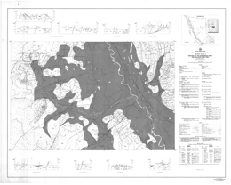
Preliminary Map 54 describes the geology of the Cranbrook map-sheet and the Sullivan Mine area (82G/12; 82F/9) in southeastern British Columbia. The 1:50 000 scale geology map includes a legend, geologic sections, a list of mineral deposits and references.
In the Kootenay Ranges, the oldest strata in the area are quartzite, siltstone and argillite of the Fort Steele Formation of the Helikian Purcell Supergroup. Overlying Aldridge Formation strata are subdivided into middle and upper units. Middle Aldridge strata include lower siltstone and argillite; silty dolomite, dolomitic siltstone and minor limestone; siltstone and argillite; thick bedded quartzite with minor conglomerate; siltstone and argillite; and upper quartzite and quartz wacke. Upper Aldridge strata are undivided. Moyie sills and minor dikes are present. Overlying Creston Formation lithologies are a green, grey and purple siltstone unit and a siltstone, quartzite, green and mauve siltstone and dolomitic siltstone unit. Kitchener Formation comprises dolomitic siltstone, siltstone and dolomitic quartzite. Other Purcell Supergroup formations present are the Van Creek, Nicol Creek and Gateway. Paleozoic strata include the Cambrian Cranbrook and Eager Formations, and the Devonian Burnais and Harrogate Formations of shaly limestone, dolomite and gypsum.
In the Purcell Mountains, the oldest strata Purcell Supergroup strata are lower Aldridge rusty weathering siltstone, quartzite or quartz wacke and silty argillite, middle Aldridge quartzite, quartz wacke, with mainly siltstone and rusty weathering argillite near the top, and upper Aldridge argillite and siltstone. Moyie sills and minor dikes are gabbro and diorite. Creston Formation comprises mainly green, grey and mauve siltstone and quartzite. Overlying Kitchener Formation strata are dolomite and limestone that are in part argillaceous and silty, argillite and siltite; Van Creek Formation consists of green and mauve siltstone, argillite and silty quartzite; Nicol Creek Formation is dominated by amygdaloidal and vesicular basalt, but includes volcaniclastic siltstone and sandstone intervals; Gateway Formation strata are green and mauve siltstone, argillite, quartzite, stromatolitic dolomite and silty dolomite; and gabbro or diorite sills. Cambrian rocks include the Cranbrook Formation, with quartzite, conglomerate, limestone and magnesite; and the Eager Formation with shale, siltstone, limestone and quartzite. Cretaceous quartz monzonite and granodiorite intrusions cut the older rocks.
Structurally, the area is divided by the north-northwest trending Rocky Mountain Trench fault. Northeast of the fault, in the Kootenay Ranges, east-northeast trending high angle faults and easterly-directed thrust faults dominate the structural fabric. Strata are deformed into overturned folds with axial surfaces that dip at low angles westerly. A broad area of alluvium marks the Trench. To the west, in the Purcell Mountains northeast to east trending high angle faults are cut by north-northeast trending high angle faults. Thrust and reverse faults are cut by the high angle faults. Thrust and reverse faults with easterly movement are cut by faults, like the St. Mary fault, with northeast to easterly trend and southerly-directed movement. Strata are deformed into gentle, upright folds to tight overturned folds.
In the Purcell Mountains, the oldest rocks exposed are components of the Helikian Aldridge Formation of the Purcell Supergroup. Lower Aldridge strata host the Sullivan deposit and are a prime exploration target in the area. They comprise rusty siltstone, quartzite and silty argillite. In the Kootenay Ranges, age equivalent rocks of the Fort Steele Formation are cross-bedded quartzites and mud-cracked siltstone and argillite.
Other components of the Purcell Supergroup are, from older to younger, the Creston, Kitchener, Van Creek, Nicol Creek, and Gateway formations. In the Purcell Mountains, the Creston Formation is dominantly varicoloured siltstone and quartzite; in the Kootenay Ranges, the Formation also contains an upper unit of coarse-grained siltstone and quartzite.
Cambrian rocks in the area comprise the Cranbrook and Eager formations. Magnesite occurs locally in the Cranbrook Formation in the Purcell Mountains. In the Kootenay Ranges, Devonian strata of the Burnais Formation consist of limestone, dolomite and gypsum.
Mesozoic quartz monzonite and granodiorite intrusions cut older rocks in the rocks in the Purcell Mountains, and Cenozoic glacial and alluvial deposits occur throughout the mapsheet.
Sullivan, a massive sulphide lead-zinc-silver deposit in Aldridge Formation turbidites, is the largest mineral deposit in the area. It has produced in excess of 125 million tonnes of ore from an original deposit of about 160 million tonnes. Other deposits in the Purcell Supergroup include lead-zinc replacement deposits in Upper Purcell carbonates and numerous lead-zinc-silver and copper veins. In the Paleozoic rocks, potential exists for the industrial mineral products magnesite and gypsum.
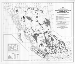
A. Ratel and J. Fontaine
Preliminary Map 55 is a 1:2 000 000-scale map which describes areas alienated or restricted from mining in British Columbia in 1983.
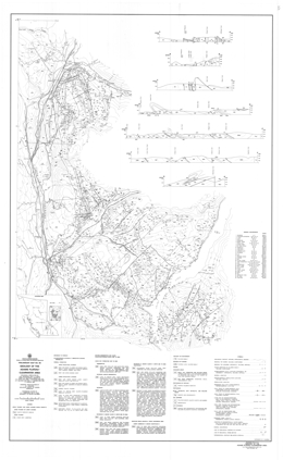
P. Schiarriza, V.A. Preto, G.P. McLaren, L.J. Diakow, D. Forster
Preliminary Map 56 portrays the geology of the Adams Plateau-Clearwater area. The map, which covers an area of approximately 3000 square kilometres, within the Shuswap Highland of south-central British Columbia. It is about 80 kilometres north-northeast of Kamloops and is bounded by latitudes 51o00' and 51o45' north, and longitudes
119o30' and 120o15' west. The topography is dominated by the North Thompson River valley in the north and west,
and the Adams Lake valley in the east. The map is accompanied by six cross-sections. It is the result of geological mapping by Ministry staff during the 1978 to 1981 field seasons. The map-area is largely underlain by Paleozoic metavolcanic and metasedimentary rocks of the Eagle Bay and Fennel Formations which host numerous mineral deposits. Note, for detailed descriptions, see Paper 1987-2.
The map area covers a belt of structurally complex low-grade metamorphic rocks that lies along the western margin of the Omineca Belt. It is flanked by high-grade metamorphic rocks of the Shuswap Complex to the east and by rocks of the Intermontane Belt to the west. The area is underlain mainly by Paleozoic metasedimentary and metavolcanic rocks of the Eagle Bay Assemblage and the Fennel Formation. Late Devonian granitic orthogneiss locally intrudes Eagle Bay rocks. The Paleozoic rocks are cut by mid-Cretaceous granodiorite and quartz monzonite of the Raft and Baldy batholiths, and by Early Tertiary quartz feldspar porphyry, basalt and lamprophyre dykes. They are locally overlain by Eocene sedimentary and volcanic rocks of the Kamloops Group and by Miocene plateau lavas.
The Paleozoic rocks occur in four structural slices separated by southwesterly-directed thrust faults. The upper three fault slices contain only Eagle Bay rocks, while the lowest slice comprises Eagle Bay strata structurally overlain by the Fennell Formation.
Rocks assigned to the Eagle Bay Assemblage range in age from Early Cambrian to Late Mississippian. They are in part correlative with Paleozoic successions in the Kootenay Arc and in the Barkerville-Cariboo River area. The oldest Eagle Bay rocks comprise quartzites and quartzose schists overlain by a unit of predominantly mafic metavolcanic rocks and limestone which, at one locality, contains Lower Cambrian archaeocyathids. An undated package of grit, phyllite, carbonate and metavolcanic rocks overlies the Early Cambrian succession. It is locally overlain by calcareous phyllite and associated calc-silicate schist and skarn or by mafic metavolcanic rocks. The upper part of the Eagle Bay Assemblage comprises a Devono-Mississippian succession consisting of felsic metavolcanic rocks overlain by intermediate, locally alkalic, metavolcanics and fine to coarse-grained clastic metasediments. These Devono-Mississippian rocks may be separated from older portions of the Eagle Bay Assemblage by a significant unconformity. Late Devonian orthogneiss that intrudes Eagle Bay rocks is probably related to the felsic metavolcanics.
The Fennell Formation comprises imbricated oceanic rocks of Slide Mountain terrane that were tectonically emplaced onto Mississippian clastic rocks of the Eagle Bay Assemblage prior to synmetamorphic southwesterly directed folding and thrusting. The formation comprises two major divisions. The lower structural division is a heterogeneous assemblage of bedded chert, gabbro, diabase, pillowed basalt, sandstone, quartz-feldspar-porphyry rhyolite and intraformational conglomerate. Conodonts extracted from bedded chert range in age from Early Mississippian to Middle Permian, while zircons extracted from quartz feldspar porphyry yield a Devonian uranium-lead age. The distribution of dated units indicates that the lower division is segmented into at least three and locally four imbricate thrust slices. The upper division consists almost entirely of pillowed and massive basalt, together with minor amounts of bedded chert and gabbro. Conodonts from two separate chert lenses within the division are respectively Early (?) Pennsylvanian and Middle Permian in age. The two divisions are therefore the same age, at least in part, and are inferred to be separated by a thrust fault.
Rocks of the Fennel Formation accumulated in a deep oceanic basin an unknown distance west of partially coeval rocks of the Eagle Bay Assemblage. Sandstone within the Fennell is very similar to Mississippian sandstone of the Early Bay Assemblage and may have been derived from it. Similarly, Devonian quartz-feldspar-porphyry rhyolite within the Fennell is like Devonian felsic volcanic rocks of the Eagle Bay Assemblage and may be an expression of the same igneous activity. The Fennell succession is inferred to comprise an imbricated marginal basin suite that was originally not far removed from the Eagle Bay terrane.
Deformation is predominantly Jura-Cretaceous and early Tertiary in age. The earliest macroscopic structures are the thrust faults that imbricate the Fennell Formation and separate it from Mississippian clastic rocks of the Eagle Bay Assemblage. East-verging, pre-metamorphic mesoscopic folds within the Fennell Formation probably also formed at this time. Tectonic emplacement of the Fennell Formation was followed by synmetamorphic southwesterly directed folding and associated thrust faulting, which gave rise to several large overturned folds, and also the thrust faults which define the structural/stratigraphic panels that dominate the map pattern. The associated synmetamorphic schistosity is the dominant mesoscopic fabric within the area. These early structures are cut by post-metamorphic northwest-trending mesoscopic folds with associated steeply dipping crenulation cleavage and axial crenulation lineation, and by later west trending macroscopic and mesoscopic folds which are synchronous with intrusion of the mid-Cretaceous Raft and Baldy batholiths. The youngest structures recognized are northeast-trending strike-slip faults and later northerly trending faults and associated folds that are Eocene in age.
Stratabound massive to semimassive sulphides containing mainly silver, lead and zinc occur on Adams Plateau where they are hosted by metasedimentary rocks within a succession of dominantly mafic metavolcanic Eagle Bay rocks of probable Early Cambrian age. Similar deposits occur within a correlative (?) interval near Mount McClennan.
Polymetallic precious and base metal massive sulphide occurrences are hosted by Devono-Mississippian felsic to intermediate metavolcanic rocks of the Eagle Bay Assemblage. They include the Homestake prospect and a number of other occurrences in the Sinmax Creek - Adams Lake area, as well as several showings along Birk Creek. Overlying alkalic rocks host similar mineralization at the recently discovered Rea deposit southwest of Johnson Lake.
Large-tonnage disseminated pyrite-pyrrhotite-chalcopyrite mineralization, such as that at the Harper Creek deposit, occurs within Eagle Bay rocks where they are intruded by Devonian orthogneiss. This spatial relationship suggests that the mineralization is Devonian in age and related to the orthogneiss, although it has been remobilized during later deformation and metamorphism.
Uranium-thorium-fluorite mineralization is hosted by a trachytic intrusive-extrusive complex within Devono-Mississippian Eagle Bay rocks along Foghorn and Lute creeks (Rexspar and Bullion showings).
The CC deposit is a cupriferous pyrite volcanogenic massive sulphide deposit hosted by oceanic basalts of the Fennel Formation east of Chu Chua Mountain.
The area also contains numerous vein deposits, as well as small pods of skarn mineralization near Cretaceous and Devonian granitic intrusions. The veins contain mainly silver-lead-zinc mineralization although gold was produced from the Sweet Home and Gold Hill veins within the Fennell Formation east of Dunn Lake.
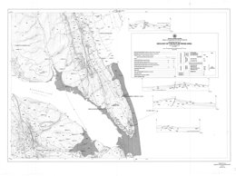
A. Legun, Revised 1988
Preliminary Map 57 presents the geology of the Butler Ridge area, which includes approximately 500 square kilometres of area north and south of Williston Lake near the W.A.C. Bennett dam site in northeastern British Columbia. The map shows borehole locations, geology, and structure. The accompanying notes describe the general stratigraphy, coal geology, the pre-Cadomin unconformity, and structural relationships. The area is underlain by rocks of the Monteith, Beatty Peaks, Monach, Cadomin, and Gething Formations.
Thinning and facies changes occur across the Carbon Creek fault. The Jurassic to Lower Cretaceous Monteith Formation of the Minnes Group consists of a 50-metre interval of quartz arenite in the area. Thickness of Minnes Group strata between the Monteith and Cadomin formations thins dramatically from about 990 metres in the Carbon Creek area southwest of the fault, to 145 metres in the Butler Ridge area. In Carbon Creek area, Minnes Group rocks above the Monteith Formation are the Beattie Peaks Formation shale, the Monach Formation arenite, and the Bickford Formation arenite and shale. In the Butler Ridge area, thinning prevents lithostratigraphic subdivision. The section consists of interbedded arenites and siltstones with no persistent markers.
The Cadomin Formation contact with the Minnes varies from gradational in the west to sharp in the east. The Cadomin is dominantly pebbly arenites and conglomerates. Gething Formation rocks overlie the Cadomin and are the main coal-bearing strata.
A major fault on Mount Gething dips 25 degrees near surface and steepens to near vertical at depth. Hangingwall strata form a box anticline with the west limb cut off by the fault.
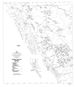
T. Schroeter
Preliminary Map 58 is a 1:100 000-scale map of the mineral and coal potential of northwestern British Columbia.
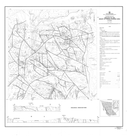
B.N. Church
Preliminary Map 59 and the accompanying 35 page report give the results of a geological investigation in the vicinity of the town of Greenwood in south central British Columbia. The 22 geological units distinguished in this 250-square kilometre area include a wide variety of Paleozoic to Tertiary rocks that have been affected by multiple episodes of deformation and igneous intrusion.
The Paleozoic (?) Knob Hill Group is the oldest unit in the area. Metacherts and quartz chlorite schists predominate. The Permo-Carboniferous Attwood Group is mainly black argillite with lesser clastic, metavolcanic and limestone components. The Triassic Brooklyn Group is characterized by thick basal conglomerates with interfingers of shale and carbonate, and an upper unit of volcanic breccias. Chlorite to amphibole grade metamorphism affected all these rocks. Deformation produced faults and locally tight folds.
The Eocene Princeton Group consists of the sedimentary Kettle River Formation and the volcanic Marron Formation. The volcanics are phonolites, trachytes and andesites. Block faulting related to uplift affected these rocks.
Triassic to Tertiary intrusive rocks occur in the area. Compositions range from mafic to granite and syenite.
Strongly serpentinized ultramafic rocks interpreted to be intrusions form sill and dyke-like bodies.
Mineralization in the area consists principally of copper bearing skarn deposits and to a lesser extent, gold and silver bearing quartz veins with minor lead and zinc values. Stratabound volcanogenic (?) gold-sulphide mineralization has been discovered in the area. Metallogenic evaluations indicate that the extensive fault and fracture patterns, which characterize the area, served as channelways for mineralizing solutions mobilized by the igneous intrusions. The combination of a long geological history and a wide range in types of deposits insures good potential for new mineral discoveries in this old mining camp.
The Greenwood Mining Camp flourished from 1900 to 1976 and produced 32 million tonnes of ore that yielded 38 276 kilograms of gold, 183 102 kilograms of silver, 270 945 tonnes of copper, 966 tonnes of lead, and 329 tonnes of zinc.
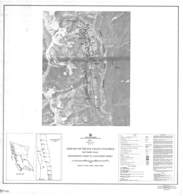
D.A. Grieve and J.M. Fraser
Preliminary Map 60 describes the geology of the southern half of the Elk Valley Coalfield.
L.J. Diakow, A. Panteleyev, T.G. Schroeter
Preliminary Map 61 describes the geology of the Toodoggone River area (94E) of north central British Columbia. The 1:50 000 scale geology map includes a legend.
The basement to the Early to perhaps Middle Jurassic ‘Toodoggone volcanics’ are the strata of the Permian Asitka Group (?), mainly limestone with minor marble and skarn, and the Late Triassic Takla Group, mainly augite phyric basalt flows and breccias. The Toodoggone volcanics have 8 major units. The lowermost Addoogatcho Creek Formation has 3 divisions: a lower quartz plagioclase porphyry, a middle unit of crystal ash tuff, lapilli tuff and rare agglomerate; and an upper unit of quartz, biotite and hornblende-bearing ash flows. The Moyez Creek volcanics comprise crystal tuffs in thin units with associated sandstone and mudstone; and conglomerate with some granite clasts, greywacke, crystal tuff and epiclastic rocks.
The Lawyers-Metsantan quartzose andesite consists mainly of flows and tuffs. The mafic flow and tuff unit contains pyroxene-biotite-hornblende phyric flows; lapilli, crystal and ash tuff with local sandstone and rare marl layers; porphyritic basalt; and pyroxene phyric basalt flows and tuffs. McClair Creek Formation includes an intrusive dome complex and mainly purple, lavender or grey crowded plagioclase phyric flows. Tuff Peak Formation strata include: flows with sparse orthoclase megacrysts; conglomerate or lahar with sandstone and mudstone interbeds, debris flows and lapilli and crystal tuffs; and biotite-augite-hornblende-plagioclase phyric flows. The Toodoggone crystal ash tuff and flow unit has lower epiclastic red arkosic sandstone, siltstone, conglomerate and slide debris, and an upper unit with mainly plagioclase crystal tuff, lapilli tuff and breccia. The upper ‘Grey Dacite’ unit consists of quartzose plagioclase-bearing ash flows of andesitic and rarely dacitic composition that are locally welded. The youngest strata exposed are Upper Cretaceous rocks of the Tango Formation of the Sustut Group comprise polymictic conglomerate, sandstone, shale, and carbonaceous mudstone.
Intrusive rocks in the area include Lower to Middle Jurassic feldspar and hornblende-feldspar porphyry dikes and plugs, granodiorite to quartz diorite, and quartz monzonite to granodiorite bodies that are partly megacrystic as well as minor syenite. Lower Jurassic dikes, sills and small plugs include pyroxene-plagioclase porphyry, diorite to gabbro, augite-hornblende porphyry, and basalt.
Faults in the area trend mainly northerly and northwesterly. The Jurassic volcanic rocks are within a fault-bounded graben.
Epithermal gold deposits, such as Lawyers and the Baker mine, characterize the Toodoggone camp but there is also potential for gold-bearing copper porphyry deposits.
S. Bennett
Preliminary Map 62 presents the geology of the Mount Forster map-area (82K/9, 10, 15) consists of a geological map at 1:25 000 scale covering approximately 500 square kilometres along and to the west of the Rocky Mountain Trench in southeastern British Columbia. The map sheet is bounded by Horsethief Creek to the south and Frances Creek to the north and includes exposures on Steamboat Mountain in the trench. A second sheet shows cross-sections, and accompanying notes briefly describe the geology.
The area is underlain by the Purcell Supergroup and unconformably overlying Windermere Group and lower Paleozoic strata. It is structurally complex, transected by the Mount Forster-Steamboat fault. Numerous silver-lead-zinc and copper showings occur throughout the area, including Grotto, Steamboat, Puzzle and others, and the Brisco barite mine is located in the northeast corner.
Rocks of the Belt-Purcell Supergroup are the oldest strata exposed in the area. The lowest unit consists of quartzites, shales, and laminated dolomites of the Dutch Creek Formation. Above are varicoloured quartzites, shales and dolomites of the Mount Nelson Formation. The Frances Creek Formation overlies the Mount Nelson with sharp discordance and locally with angular unconformity. The Frances Creek consists of thick-bedded white orthoquartzites, grey dolomites and thinly interbedded sandstone and shale. The basal member is a grey, thick-bedded algal dolomite with halite and gypsum pseudomorphs.
Windermere Supergroup components exposed are the Toby Formation and the Horsethief Creek Group. The Toby is a highly variable sequence of diamictites, conglomerates, sandstones, shales, dolomites, breccias, and volcanic rocks. It rests unconformably on the Belt-Purcell rocks. Volcanic rocks comprise the base of the Toby Formation. The base of the Horsethief Creek Group is marked by a black, detrital limestone. The Group comprises a series of interbedded grey shales, grits, quartzites, limestones and dolomites.
Paleozoic strata unconformably overlie the Windermere rocks. The basal Cranbrook Formation consists of mature quartzites and quartz grits. The Middle to Upper Cambrian Jubilee Formation is massive dolomite and unconformably overlies the Cranbrook strata. Base metal mineralization occurs in solution breccias beneath the Devonian and Ordovician unconformities. The Upper Cambrian to Middle Ordovician McKay Group conformably overlies the Jubilee Formation and is unconformably overlain by the Upper Ordovician Beaverfoot Formation. The McKay consists of recessive shales, sandstones and dolomitic biowackestones. The Beaverfoot has basal white quartzite overlain mainly by biowackestones and peloidal mudstones. The Middle Devonian Mount Forster Formation unconformably overlies the Beaverfoot and karsting and related features, including base metal mineralization, are developed adjacent to the unconformity. The Upper Devonian Starbird Formation, which consists mainly of fossiliferous dolomitic biowackestones, unconformably overlies the Mount Forster strata.
Syenitic sills and dykes intrude the Proterozoic sequence and were sheared during Mesozoic deformation. Narrow minette dykes also intrude the Proterozoic section. The Cretaceous Horsethief Creek batholith is largely coarse-grained quartz monzonite. The metamorphic aureole overprints the tectonic fabric in the country rocks.
The structural evolution of the area was episodic. Early basin formation and extension from Proterozoic through to Upper Paleozoic was followed by thrusting and folding in the Mesozoic Columbian-Laramide orogeny.
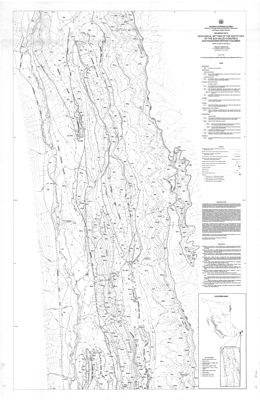
D.A. Grieve, R.A. Price
Preliminary Map 63 covers the geological setting of the south half of the Elk Valley coalfield in southeastern British Columbia. It is a 1:50 000-scale compilation that depicts the geology of the Lewis thrust sheet within NTS 82G/15 and 82J/2. The boundaries of the map are the traces of the Lewis thrust fault on the east, the Bourgeau thrust fault on the west, and latitudes 50 degrees, 15 minutes north and 49 degrees, 45 minutes north on the north and south. The Greenhills and Alexander Creek synclines underlie the south half of the Elk Valley Coalfield. The map area includes three operating coal mines in the Elk Valley Coalfield (Line Creek, Fording and Greenhills) and part of the Balmer mine in the Crowsnest Coalfield.
Geology has been derived from: published mapping by the British Columbia Geological Survey Branch; published and unpublished regional mapping by the Geological Survey of Canada; and unpublished mapping by coal mine and oil exploration company geologists.
The map area lies within the Front Ranges of the Rocky Mountains and is underlain by carbonate and clastic sedimentary rocks of Devonian to Cretaceous age. In addition to world-scale coal resources, the area contains phosphorite units and is currently being explored for its petroleum potential.
All southeastern British Columbia coal occurrences are within the Lewis thrust sheet. West-to-east horizontal displacement of the thrust sheet was at least 19 kilometres at the latitude of Fording Mountain. Folds in the surface of the Lewis thrust were mapped in outcrop in the Tornado Pass area and inferred in the subsurface from evidence acquired during drilling of the California Standard Fording Mountain well. Outcrop expressions of subsurface folds in the Lewis thrust include the Alexander Creek syncline in the east, and the combination of the Fording Mountain anticline and the anticline that passes through Wisukitsak Range and Erickson Ridge (82G/1 5) in the west. The west-dipping Erickson normal fault, part of the Flathead fault system, can be traced over nearly the entire length of the map area. It separates coal occurrences on Harmer Ridge at the north end of the Crowsnest Coalfield and in the Greenhills syncline from occurrences throughout the length of the Alexander Creek syncline.
The oldest rocks exposed in the map-area are Devonian carbonates of the Palliser formation. These are overlain by carbonates and siltstones of the Mississippian Rundle group. Pennsylvanian and Permian calcareous sandstones of the Rocky Mountain Supergroup follow, then siltstones and shales of the Triassic Spray River Group. The Jurassic Fernie Formation comprises shales, sandstones, siltstones, limestones and phosphorites. The Jurassic to Cretaceous Kootenay Group rocks contain coal measures and are the prime economic target in the area. Lower Cretaceous Blairmore Group chert pebble conglomerates sandstones and mudstones are overlain by Upper Cretaceous Belly River Formation shales and sandstones. All the older rocks are locally covered by Quaternary deposits that vary from till to gravel to silt and alluvium.
Coal deposits in southeastern British Columbia occur in the Jurassic-Cretaceous Kootenay Group. Kootenay Group overlies the marine Fernie Formation of Jurassic age. The basal Kootenay sandstone, the Morrissey Formation, is a coastal deposit, which forms a consistent, easily mapped unit. The overlying Mist Mountain Formation has average total thickness of 500 metres; 8 to 12 percent consists of humic coal seams, which range in thickness to 12 metres or more. The overlying Elk Formation contains lenticular humic and sapropelic coal seams up to approximately 1 metre in thickness. No marine strata are known in either the Mist Mountain or Elk Formations. Overlying the Kootenay Group is the Cadomin Formation, the basal conglomerate of the Lower Cretaceous Blairmore Group.
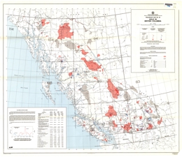
Compiled by T.G. Schroeter and A. Panteleyev
Preliminary Map 64 is a 1:2 000 000-scale map with accompanying table showing gold in British Columbia.
N.C. Carter and R.V. Kirkham
Preliminary Map 65 presents 1989 producers and potential producers, mineral and coal in British Columbia at a 1:2 500 000-scale.
T. Schroeter
Preliminary Map 66 presents discovery methods for metal mines producing in British Columbia between 1965 and 1986. This 1:2 000 000-scale map has an accompanying table attached.
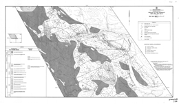
D.G. Bailey
Preliminary Map 67 displays generalized geology and outcrop distribution in the central volcanic axis of the Quesnel terrane in the Quesnel Lake and Quesnel River areas near the village of Likely (NTS 93A/12) at 1:50 000 scale.
Mapping covers about 600-square kilometres and extends from south of latitude 52 degrees, 30 minutes to about latitude 52 degrees, 45 minutes and between longitudes 121 degrees, 30 minutes and 122 degrees, 0 minutes, small portions of adjoining map sheets 93A/5, 6, 11 and 92B/9 are also included.
The mapping updates and extends Preliminary Map 20, 1976, Geology of the Morehead Lake Area. It emphasizes the continuity of Triassic-Jurassic and some younger stratigraphic units in the volcanic arc axis, outlines volcanic-intrusive centres, and identifies faults that are southern extensions of the Pinchi fault system.
Mesozoic volcanic rocks in the map-area exhibit a bi-symmetric, generally regular distribution. Norian fine-grained epiclastic sediments comprise the basal strata of the Mesozoic assemblage. Upward. Mafic volcanism produced variably pillowed basalt flows and polylithic breccias, then mafic siltstone and limestone; local alkalic units occur. Above these are Sinemurian polylithic breccias, latite tuff and breccia, feldspathic sandstones and analcite-bearing alkalic basalts. These rocks in turn are overlain by Pleinsbachian interbedded sandstone and siltstone and chert-bearing polylithic conglomerate with sandstone and shale interlayers.
Areas of Pliocene olivine plateau basalt occur locally.
Intrusive rocks include Pleinsbachian syenite to monzodiorite and Cretaceous nepheline syenite and quartz monzonite to granodiorite.
Alkalic stocks elsewhere in the belt host porphyry copper-gold deposits and are highly prospective. This mapping, which is north of Quesnel River, covers the main area of current exploration interest near the Quesnel River (QR) propylitic basalt-hosted gold deposit. Calc-alkalic intrusions have potential to host copper-molybdenum porphyry deposits.
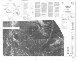
R.J. Morris, D.A. Grieve
Preliminary Map 68 describes the geology of the north half of the Elk Valley coalfield in southeastern British Columbia. The Preliminary Map consists of 8 sheets with geology presented at 1:10 000 scale on orthophoto bases. The Preliminary Map includes legends on each sheet, explanatory notes, plots of structural measurements and columnar sections through the coal measures.
Preliminary Map 68 is a contribution to the Canada/British Columbia Mineral Development Agreement 1985-1990. This MDA funded project extends and completes the 1:10 000-scale geological mapping carried out by the Geological Survey Branch in the East Kootenay coalfields of southeastern British Columbia. It covers an area immediately north of Preliminary Map 51 (Greenhills Range) and Preliminary Map 63 (south half of the Elk Valley coalfield).
Mapping, based on outcrops, roadcut exposures and trenches, defines the locations of formational contacts, coal seams, sandstone units and major structural features. Stratigraphic sections were measured at six locations. Vitrinite reflectance data and extensive descriptive notes are included.
The study area extends from Henrietta and Britt creeks in the south to the British Columbia - Alberta boundary in the north. Jurassic-Cretaceous Kootenay Group exposures throughout were mapped.
Most of the area is Crown land and includes all or part of three separate coal properties. The most southerly of these comprises the north end of the Fording Coal Ltd. Fording River property. The northern boundary of the Fording River property is in the vicinity of U.T.M. gridline 5 580 000 metres north, which is just north of Aldridge Creek.
Adjacent to the north is the Elk River property in which Fording Coal held a 50 per cent interest at the time of writing (June 1989). The northern boundary of the Elk River property is in the vicinity of U.T.M. gridline 5 590 000 metres north, close to Cadorna Creek. Coal rights in the area north of Cadorna Creek, formerly known as the Vincent option, were reserved to the Crown at the time of writing.
Data presented are based on examination of surface outcrops, roadcuts and trenches, and are supplemented by air-photograph interpretation. In many cases poor exposure has limited the amount of data and has restricted the ability to correlate seams. Seams less than 1 metre thick have generally not been plotted. Exposure on Map Sheet 2 is quite variable, with Mount Tuxford on the east side of the Elk River valley having good exposure, while the west side is virtually devoid of outcrop. Coal seam traces have been interpreted only on Mount Tuxford.
Stratigraphic sections were measured on Mount Veits and Tuxford, Henretta Ridge, Weary Ridge and at Coal Creek", a tributary of Bleasdell Creek. Sections were measured using either pogo stick or compass and chain. They have been generalized for publication. Note that coal seams less than 1 metre thick are not indicated, nor are partings within seams that are less than 1 metre in thickness.
The basal unit of the Kootenay Group is the Morrissey Formation. The Morrissey is a resistant sandstone unit consisting of two members and ranging in thickness from 20 to 80 metres (Gibson, 1985). The upper member, the Moose Mountain member, is a distinctive marker unit consisting of medium-grained sandstone, which is utilized in all surface and subsurface studies of the Kootenay to demarcate the base of coal occurrences. Within the study area the Moose Mountain member was observed to be more variable than normal. For example, it includes one or more carbonaceous partings in the area between Weary Ridge and Mount Tuxford, and at two localities south of Aldridge Creek it was observed to include an unusual light grey to white weathering, quartzose facies. The trace of the Morrissey Formation on the east limb of the Alexander Creek syncline is plotted with moderate confidence on Sheet 2.
The Mist Mountain Formation contains essentially all the coals of economic interest in southeastern British Columbia. Its thickness in the study area ranges between 450 and 550 metres. Coal forms between 8 and 12 per cent of the total thickness of the formation at most locations. Individual seams in the study area range from less than 1 to greater than 10 metres in thickness. In the area covered by Map Sheet 2, a section 550.0 metres thick comprising the complete Mist Mountain Formation was measured along the north ridge of Mount Tuxford. It hosts 39.5 metres of coal, representing only 7.2 per cent of the total thickness of the formation. However, some 50.6 metres of the section are covered, a portion of which could contain coal.
The precise identification of the contact of the Mist Mountain Formation with the overlying Elk Formation in southeastern British Columbia is generally difficult. The Elk is a coarser grained facies than the Mist Mountain and it generally lacks thick coal seams and contains unusual sapropelic coals known as "needle coals". The thickness of the Elk Formation in the study area is inferred to range between 350 and 450 metres. The Elk - Mist Mountain contact on Sheet 2 is located just below the peak of Mount Tuxford. It overlies a 2-metre-thick coal seam and is at the base of a thick sandstone sequence. This position also corresponds with a change in colour; the Elk Formation sandstones weather to a distinctive yellow or orange-brown colour compared with the predominantly grey weathering colour of the Mist Mountain Formation sandstones. A section of Elk Formation comprising the lowest 178 metres was measured. The lower two-thirds of the section consists of several stacked channel - sandstone units separated by thin, recessive, finer grained intervals, including a 1.0- metre thick coal seam. The upper third is a recessive interval including coal seams 1.0 and 1.6 metres thick. The section is overlain by a prominent cliff-forming sandstone that marks the base of another sequence of stacked sandstone units.
The Kootenay Group is unconformably (?) overlain by the Lower Cretaceous Blairmore Group. The basal unit of the Blairmore Group is the Cadomin Formation, a distinctive cliff-forming conglomerate unit.
The study area lies in the Front Ranges of the Rocky Mountains and is part of the Lewis thrust sheet. The major structure in the coalfield is the Alexander Creek syncline, which extends throughout its entire 100-kilometre length. The northern extension of the Greenhills syncline, which is west of the Alexander Creek syncline, also influences the extreme southern end of the study area.
The Alexander Creek syncline is overturned in the central part of the study area, and open elsewhere. It generally plunges to the north.
The Bourgeau thrust fault, which marks the western boundary of the surface exposures of the Lewis thrust sheet, forms the western boundary of the Mist Mountain Formation the Elk valley coalfield in the study area. The relative footwall stratigraphic position of the fault varies along its trace from the Fernie Formation to uppermost Kootenay. At the north end of the study area it is offset 2 kilometres to the northeast by a transverse fault.
Minor structures associated with the Bourgeau thrust are not generally observable because of poor exposure. The area known as "Coal Creek" on the west limb of the Alexander Creek syncline is one exception. See Sheet 3 for more detail. The complex folding in the northern part of Map Sheet 2 is interpreted to be caused by the Bourgeau thrust ramping to the east at this point.
Small-scale folds affect the Mist Mountain Formation strata in three general areas: the extreme south end of the study area (see Sheet 1), the lower west-facing slopes of Mount Tuxford (see Sheet 2), and the small eastward-flowing creeks north of Cadorna Creek (see Sheets 6 and 7). These are mainly interpreted as minor folds associated with the Alexander Creek syncline, and, with few exceptions, are not attributed directly to thrusting.
In contrast with the south half of the coalfield (see Grieve and Fraser, 1985), thrust faults within the Kootenay Group are not a major feature of the study area. On Henrietta Ridge at the extreme south end of the study area, however, two thrust faults are observed (see Sheet 1). One causes a repeat of the Morrissey Formation and lowermost part of the Mist Mountain Formation; the other occurs higher in the Mist Mountain Formation and is exposed on the south-facing slope of the ridge. A third thrust fault is inferred to occur in the east limb through part of the north end of the study area, based on sporadic occurrences of deformed strata (see Sheet 6 for example).
Late-stage, crosscutting normal faults are present in the Mount Tuxford and Mount Veits areas. These appear to follow prominent joint orientations and have resulted in mass wasting of the Morrissey Formation, forming both topographic steps and landslide blocks. A large landslide block of Morrissey Formation occurs on Weary Ridge (see Sheet 4). A set of two normal faults is shown at the north end of Mount Tuxford on Map Sheet 2. A combined 16 metres of normal displacement is estimated. A system of three faults, striking to the north and dipping steeply east, occurs approximately 400 metres due east of the peak of Mount Tuxford. The faults show a combined 8 metres of reverse displacement.
The rank of the coals has been determined petrographically by measuring the mean maximum vitrinite reflectance on grab samples. These values are plotted on the map. To convert reflectance values to ASTM rank equivalents use 1.12 per cent as the boundary between high-volatile and medium-volatile coals and 1.51 per cent as the boundary between medium-volatile and low-volatile rank. Coals of the Mist Mountain Formation vary in rank from low-volatile to high- volatile bituminous. The highest rank Mist Mountain Formation coals are found in the lower part of the formation on the east limb of the Alexander Creek syncline near Weary Creek. The lowest rank coals are exposed on the west limb of the Alexander Creek syncline near Bleasdell Creek, and on both limbs at the north end of the study area. Elk Formation coals are all of high-volatile bituminous rank in the study area. On Map Sheet 2 reflectance values in the Mist Mountain Formation vary from 1.57 to 1.02 per cent.

