B.C. Highway Flood Recovery Projects - Highway 8
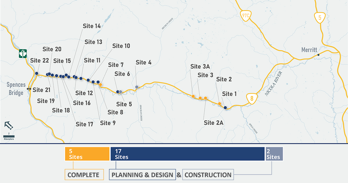
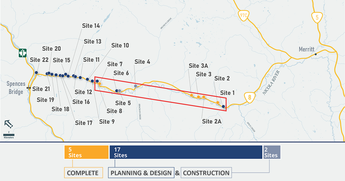
The November 2021 Atmospheric River damaged 24 sites along Highway 8 between Spences Bridge and Merritt. Work continues on permanent repairs to the damaged sites to restore them to full capacity and make them more resilient to extreme weather.
Overview
Permanent repairs are complete at 5 sites and are in progress at 19 sites.
Traffic impacts
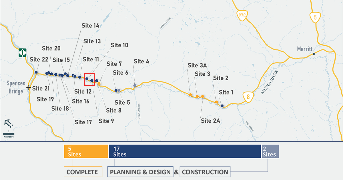
Several sections of Highway 8 still have gravel surfaces with reduced speed zones. At sites 9 and 10 (between 14 to 15.3 km east of Spences Bridge) there are two single lane alternating bridges. Be prepared for potential traffic delays and watch for signs that identify sites under active construction.
Drivers are asked to use caution, obey speed limits and follow directions of traffic-control personnel.
For the latest information on road conditions, visit DriveBC.
Highway maintenance
Yellowhead Road & Bridge Ltd. regularly monitors the area and applies traction control (salt and sand) on the roads during winter conditions. Cobra Electric Interior Services LP is the electrical maintenance contractor for the region and maintains traffic signals and lights.
If you notice any hazards or issues on Highway 8 (such as potholes and faulty lights), please call: 1-888-899-9854
Closure protocol
Should Highway 1 or Highway 5 close in the future, Highway 8 will not be used as a detour as it is an active construction zone. Protocol to redirect traffic away from Highway 8 will prevent secondary closures and impacts on local residents.
Messaging on available detour routes will be made available via message signs, www.DriveBC.ca and social media.
Check TranBC's Current Road Advisories for detailed information about highway travel disruptions during emergency situations.
Environmental enhancements
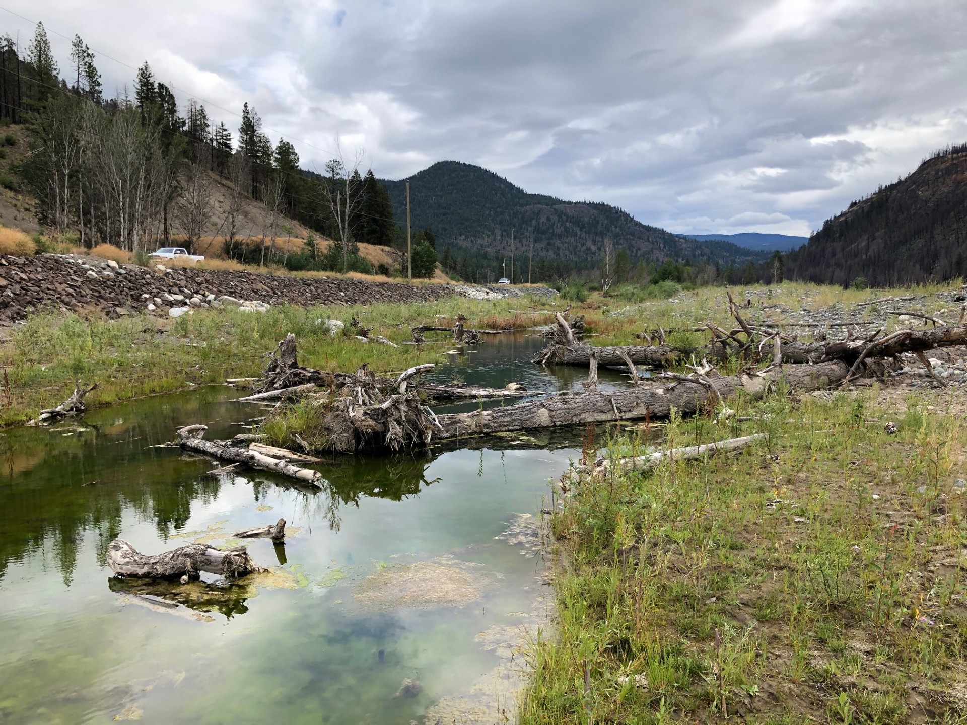
Reducing environmental impact is a top priority for the projects. Highway 8’s environmental team regularly monitors fish habitats to minimize the effects of repair work happening along the Nicola River.
Fish habitat assessments
The Highway 8 Team has completed fish habitat assessments at 15 sites where in-stream work is scheduled to take place.
These assessments include:
- Recording what fish species are present at the site
- Habitat conditions
- Potential impacts on habitats during construction
This information allows the Ministry to plan enhancements and schedule work in a way that reduces impacts on the ecosystem. For example, work in streams will be scheduled for the spring and summer, when water levels are higher and fish are less impacted by construction.
This is just one of several assessments that are part of the regulatory and permitting requirements for permanent repairs.
Environmental enhancements
Environmental enhancements will improve ecosystems and help support local fisheries, by providing habitat for young fish during periods of low water. Five priority sites have been identified in collaboration with Indigenous leadership and technical staff.
The enhancements include:
- Rock clusters and boulders to create pools with calmer water for fish to rest
- Large woody debris, which creates shade and attracts insects for feeding fish
- Streamside plants
Similar work was done in 2022, during the emergency repairs to Highway 8. Early monitoring has shown that streamside plants have begun to grow and young fish have started populating the side channels along the river.
Sites
Sites 1 to 8
Sites 1 to 8 are located between 17.3 km west of Mamit Junction and 16 km east of Spences Bridge.
- In design Site 1
- In construction Sites 4, 5, 6 and 8
- Complete Sites 2, 2A, 3, 3A, 7
Sites 9 to 10
Sites 9 to 10 are located between 14 to 15.3 km east of Spences Bridge.
- In construction Sites 9 and 10
Sites 11 to 15
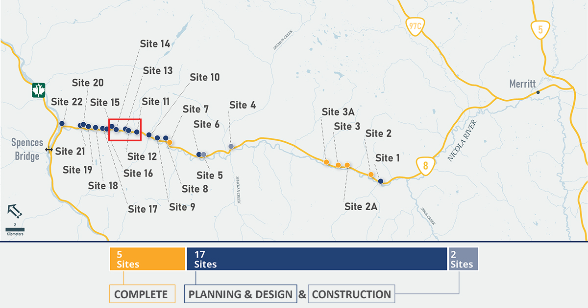
Sites 11 to 15 are located between 9.1 to 12 km east of Spences Bridge.
- In design Sites 12 to 15
- In construction Site 11
Sites 16 to 19
Sites 16 to 19 are located between 6.6 to 8.7 km east of Spences Bridge.
- In design Sites 16 to 19
Sites 20 to 22
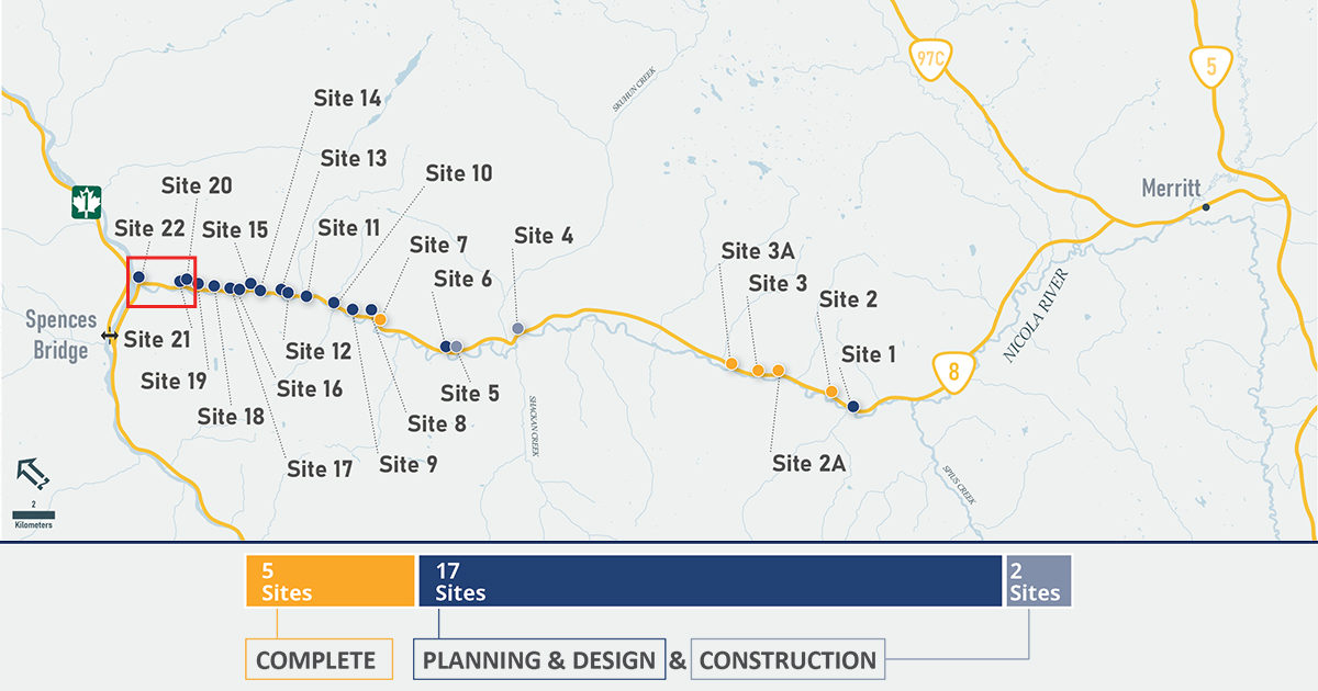
Sites 20 to 22 are located at 3 Mile Bridge, Rattlesnake Bridge and Curnow Bridge.
- In construction Site 22
- In design Sites 20 and 21 - construction will begin in 2025
News
- August 8, 2024: Permanent repairs to Highway 8 will begin soon
- March 19, 2024: Repairs to section of Highway 8 advance to next step
- November 9, 2022: Highway 8 reopens to public
Community newsletter
- March 2025
- February 2025
- January 2025
- August 2024
- July 2024
- March 2024
- November 2023
- August 2023
- June 2023
- February 2023
- January 2023
Photo gallery
Video
Contact information
Friendly Url for this Page:
gov.bc.ca/highway8recovery
For more information contact:
General Enquiries
Subscribe
Enter your email address to subscribe to updates of this page.

