South Okanagan - North Beach (Summerland) Rockslide
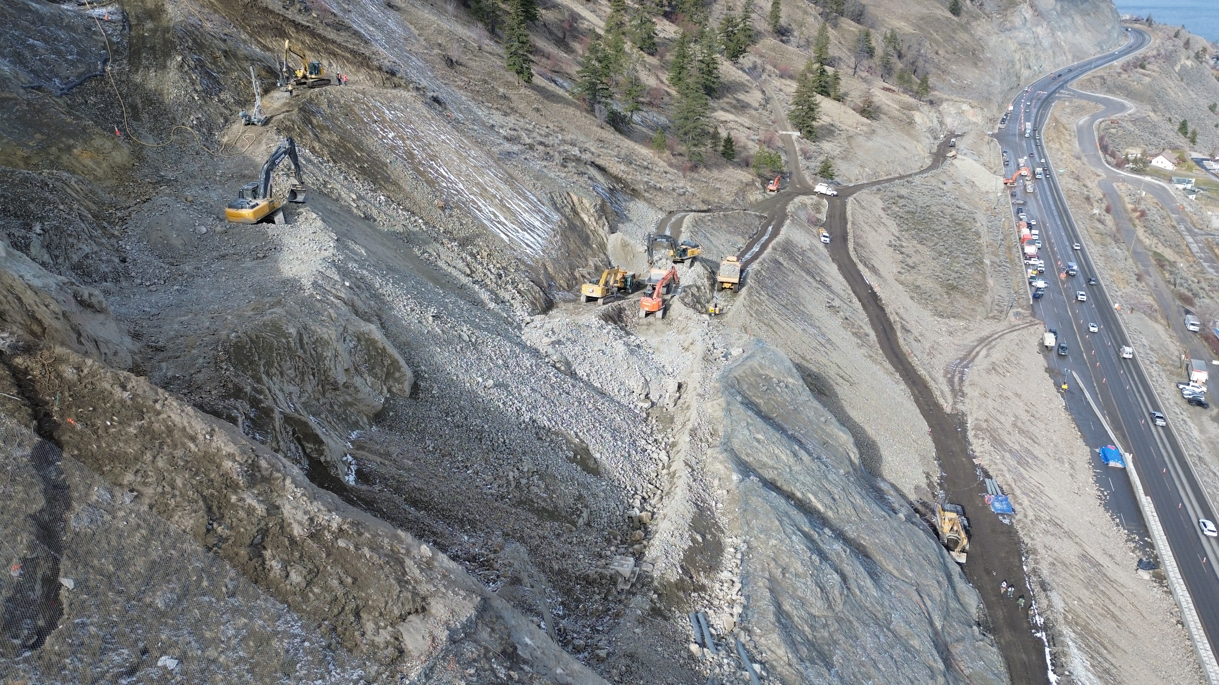
This section of Highway 97 was closed on Aug. 28, 2023 because of a rockslide that deposited approximately 3,000 cubic metres of material onto the highway surface.
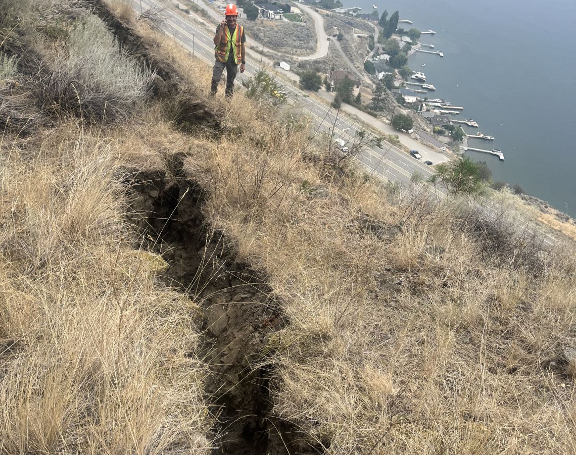
Further investigations revealed tension cracks above the source area of the rockfall, indicating the presence of a larger slide. Based on these findings, geotechnical engineers have determined that additional long-term stabilization measures are required in this area.
On this page
- Initial investigation
- Short term response – reopening Highway 97
- Slide material removal
- Stabilization
- Ongoing work
- Photo gallery
- Archive (News)
Oversize loads
You MUST contact Traffic Control 24 hours in advance prior to arrival on site to arrange for the applicable traffic control resourcing.
- Size: Oversized loads equal to or greater than 3.8 m are permitted through the site
- Days: Sunday, Monday, and Wednesday
- Time: Between 9 pm and 5 am
- Information required: Provide details of the width of the wide load for pre-planning purposes
Daily traffic control on site. Typical travel delays observed are 2-3 minutes or less.
Contacts
Traffic Control on site
Phone: 250-306-9483
If no response from Traffic Control on site contact
AIM Roads 24 hour
Phone: 1-866-222-4204
Initial investigation
After the rockfall event on August 28, Geotechnical engineers discovered tension cracks extending further upslope beyond the initial rockfall area.
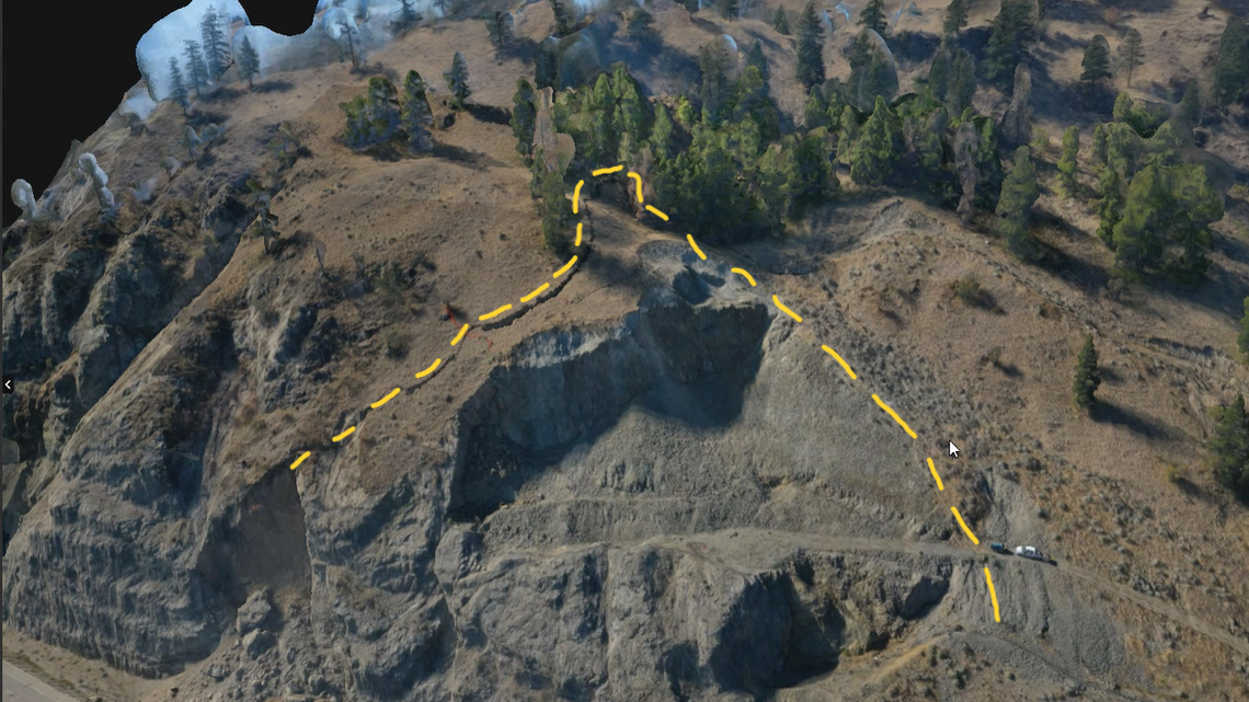
The tension cracks were up to 2 m wide and up to 20 m deep. These findings revealed that the initial rockfall event part a larger event that required mitigation to protect road users and the highway.
Short term response - reopening Highway 97
To manage the initial emergency, a 22 m high temporary soil and rock berm was constructed along the toe of the slide to resist further slope movement. This temporary berm acts as a buttress for holding back slide movement until long term stabilization measures can be implemented.
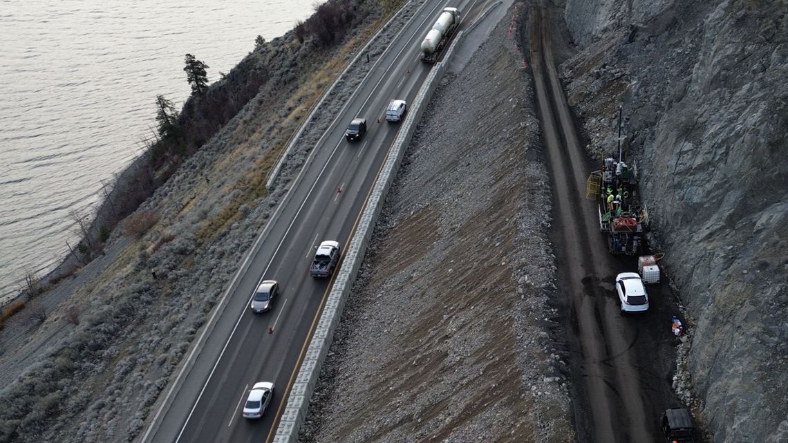
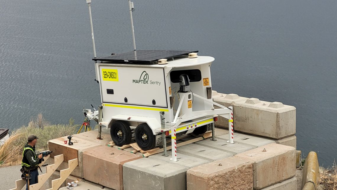
During the construction of the berm, a 24/7 slide monitoring program was established. Specialized survey equipment is used to continuously monitor the area for slide movement. If slide movement is detected, the highway can be closed on short notice to protect road users and site workers.
Slide material removal
From October 2023 to June 2024, blasting operations were conducted as part of the effort to unload a portion of the slide mass. This is to reduce the pressure on the hillside and protect the road from further rockfall. The unloaded material has been moved to off-site storage.
Blasting to remove unstable material above Highway 97 north of Summerland is now complete.
More than 46,500 m3 of material has been removed from the slope since the rockfall in August 2023.
Stabilization
To stabilize the rockslide, steel rock anchors (32mm to 75mm thick and up to approximately 30 m in length) will be installed in the slide zone.
After the rock anchors have been installed, the temporary berm will be removed, and will be replaced by a Mechanically Stabilized Earth (MSE) retaining wall, which will form a buttress to complement the anchors.
Ongoing work
- Highway 97 will continue to support two lanes of traffic
- The maintenance contractor will carry out regular maintenance to ensure these lanes remain open and safe to the travelling public
- Geotechnical engineers continue to monitor the slide site for changes in ground conditions
- Drivers are reminded that this portion of the road may need to be closed again with limited notice if deemed unsafe
- The site will be at greater likelihood of closure should heavy rainfall or snowfall occur
- Drivers are asked to use caution, obey speed limits and follow directions of traffic-control personnel
- Temporary stabilization work is nearly complete and the site will safely shut down for the winter months
- The long-term repair work will begin in spring 2025
Photo gallery
Archive
News
Territorial Acknowledgement
The Ministry of Transportation and Infrastructure acknowledges with respect and thanks that this endeavor is occurring within the traditional territories of the Syilx peoples represented by and with the assistance of the Okanagan Indian Band, Osoyoos Indian Band, Penticton Indian Band, Upper Nicola Band, Upper and Lower Similkameen Indian Bands, and Westbank First Nation.
lim’limpt (Thank you)
Subscribe
Enter your email address to subscribe to updates of this page.
Plan Your Trip
Contact information
For more information contact:
Maximilian Birkner, PMP
Project Manager
Phone: 778-220-4408
Samuel Baxter
Project Management Technician
Phone: 778-694-5767

